Embed Size (px)
Citation preview
LOCAL ROAD SAFETY PROGRAM NOVEMBER 2013 CHAPTER 4: BURLEIGH COUNTY SAFETY PROJECTS
TBG091013074136SEA 4-10 23 USC 409: NDDOT Reserves All Objections
Burleigh County
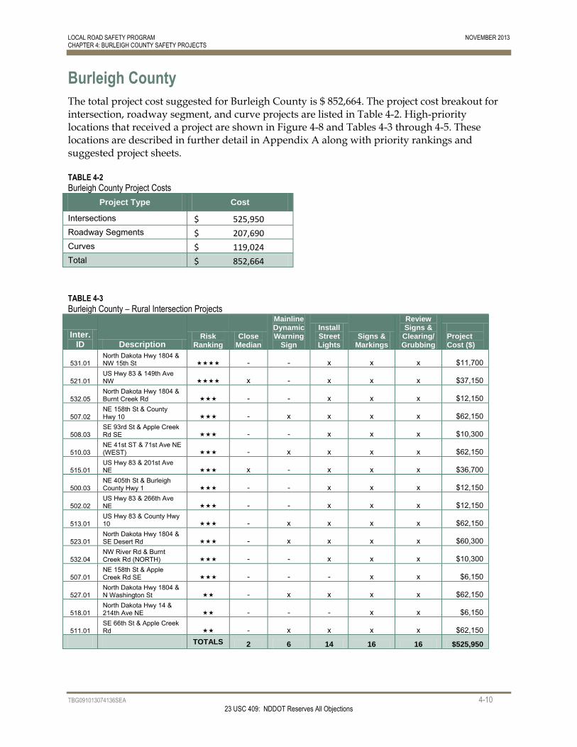
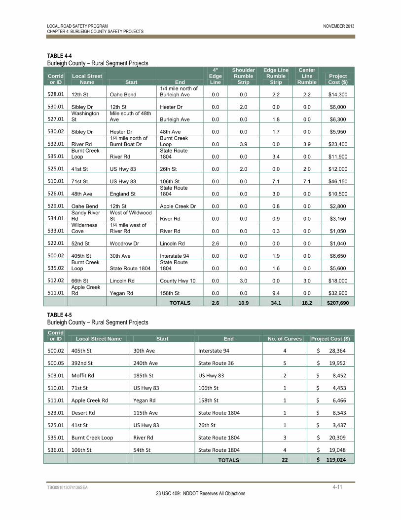
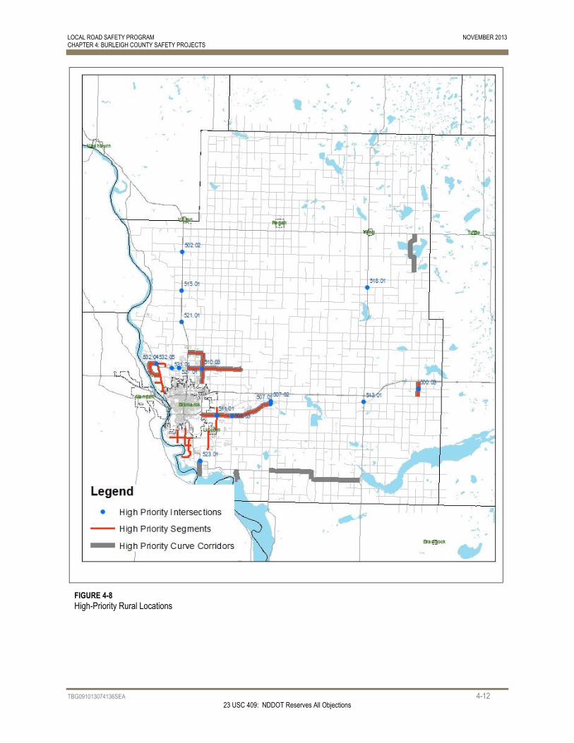
The total project cost suggested for Burleigh County is $ 852,664. The project cost breakout for intersection, roadway segment, and curve projects are listed in Table 4-2. High-priority locations that received a project are shown in Figure 4-8 and Tables 4-3 through 4-5. These locations are described in further detail in Appendix A along with priority rankings and suggested project sheets.
TABLE 4-2
Burleigh County Project Costs
Project Type Cost
Intersections $ 525,950
Roadway Segments $ 207,690
Curves $ 119,024
Total $ 852,664
TABLE 4-3
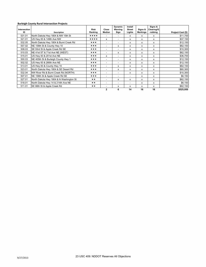
Burleigh County – Rural Intersection Projects
Inter. ID Description
Risk Ranking
Close Median
Mainline Dynamic Warning
Sign
Install Street Lights
Signs & Markings
Review Signs &
Clearing/ Grubbing
Project Cost ($)
531.01 North Dakota Hwy 1804 & NW 15th St - - x x x $11,700
521.01 US Hwy 83 & 149th Ave NW x - x x x $37,150
532.05 North Dakota Hwy 1804 & Burnt Creek Rd - - x x x $12,150
507.02 NE 158th St & County Hwy 10 - x x x x $62,150
508.03 SE 93rd St & Apple Creek Rd SE - - x x x $10,300
510.03 NE 41st ST & 71st Ave NE (WEST) - x x x x $62,150
515.01 US Hwy 83 & 201st Ave NE x - x x x $36,700
500.03 NE 405th St & Burleigh County Hwy 1 - - x x x $12,150
502.02 US Hwy 83 & 266th Ave NE - - x x x $12,150
513.01 US Hwy 83 & County Hwy 10 - x x x x $62,150
523.01 North Dakota Hwy 1804 & SE Desert Rd - x x x x $60,300
532.04 NW River Rd & Burnt Creek Rd (NORTH) - - x x x $10,300
507.01 NE 158th St & Apple Creek Rd SE - - - x x $6,150
527.01 North Dakota Hwy 1804 & N Washington St - x x x x $62,150
518.01 North Dakota Hwy 14 & 214th Ave NE - - - x x $6,150
511.01 SE 66th St & Apple Creek Rd - x x x x $62,150
TOTALS 2 6 14 16 16 $525,950
LOCAL ROAD SAFETY PROGRAM NOVEMBER 2013 CHAPTER 4: BURLEIGH COUNTY SAFETY PROJECTS
TBG091013074136SEA 4-11 23 USC 409: NDDOT Reserves All Objections
TABLE 4-4
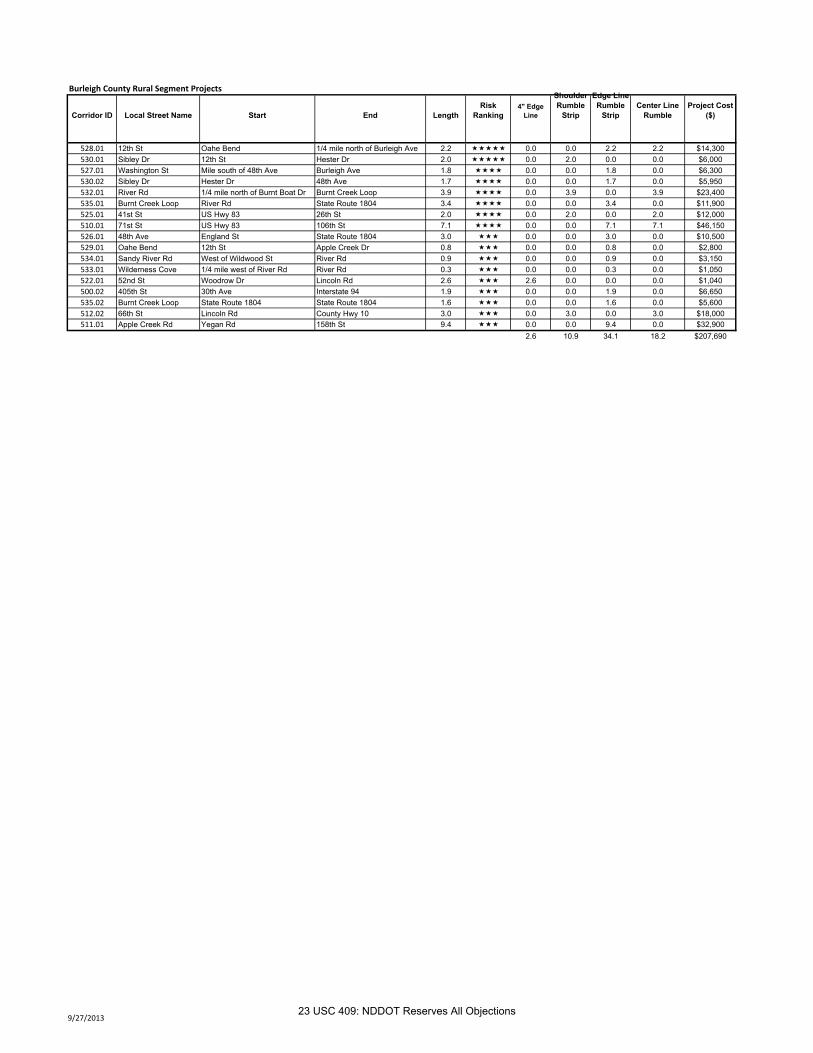
Burleigh County – Rural Segment Projects
Corridor ID
Local Street Name Start End
4" Edge Line
Shoulder Rumble
Strip
Edge Line Rumble
Strip
Center Line
Rumble Project Cost ($)
528.01 12th St Oahe Bend 1/4 mile north of Burleigh Ave 0.0 0.0 2.2 2.2 $14,300
530.01 Sibley Dr 12th St Hester Dr 0.0 2.0 0.0 0.0 $6,000
527.01 Washington St
Mile south of 48th Ave Burleigh Ave 0.0 0.0 1.8 0.0 $6,300
530.02 Sibley Dr Hester Dr 48th Ave 0.0 0.0 1.7 0.0 $5,950
532.01 River Rd 1/4 mile north of Burnt Boat Dr
Burnt Creek Loop 0.0 3.9 0.0 3.9 $23,400
535.01 Burnt Creek Loop River Rd
State Route 1804 0.0 0.0 3.4 0.0 $11,900
525.01 41st St US Hwy 83 26th St 0.0 2.0 0.0 2.0 $12,000
510.01 71st St US Hwy 83 106th St 0.0 0.0 7.1 7.1 $46,150
526.01 48th Ave England St State Route 1804 0.0 0.0 3.0 0.0 $10,500
529.01 Oahe Bend 12th St Apple Creek Dr 0.0 0.0 0.8 0.0 $2,800
534.01 Sandy River Rd
West of Wildwood St River Rd 0.0 0.0 0.9 0.0 $3,150
533.01 Wilderness Cove
1/4 mile west of River Rd River Rd 0.0 0.0 0.3 0.0 $1,050
522.01 52nd St Woodrow Dr Lincoln Rd 2.6 0.0 0.0 0.0 $1,040
500.02 405th St 30th Ave Interstate 94 0.0 0.0 1.9 0.0 $6,650
535.02 Burnt Creek Loop State Route 1804
State Route 1804 0.0 0.0 1.6 0.0 $5,600
512.02 66th St Lincoln Rd County Hwy 10 0.0 3.0 0.0 3.0 $18,000
511.01 Apple Creek Rd Yegan Rd 158th St 0.0 0.0 9.4 0.0 $32,900
TOTALS 2.6 10.9 34.1 18.2 $207,690
TABLE 4-5
Burleigh County – Rural Segment Projects
Corridor ID Local Street Name Start End No. of Curves Project Cost ($)
500.02 405th St 30th Ave Interstate 94 4 $ 28,364
500.05 392nd St 240th Ave State Route 36 5 $ 19,952
503.01 Moffit Rd 185th St US Hwy 83 2 $ 8,452
510.01 71st St US Hwy 83 106th St 1 $ 4,453
511.01 Apple Creek Rd Yegan Rd 158th St 1 $ 6,466
523.01 Desert Rd 115th Ave State Route 1804 1 $ 8,543
525.01 41st St US Hwy 83 26th St 1 $ 3,437
535.01 Burnt Creek Loop River Rd State Route 1804 3 $ 20,309
536.01 106th St 54th St State Route 1804 4 $ 19,048
TOTALS 22 $ 119,024
LOCAL ROAD SAFETY PROGRAM NOVEMBER 2013 CHAPTER 4: BURLEIGH COUNTY SAFETY PROJECTS
TBG091013074136SEA 4-12 23 USC 409: NDDOT Reserves All Objections
FIGURE 4-8
High-Priority Rural Locations
LOCAL ROAD SAFETY PROGRAM OCTOBER 2013 APPENDIX - CHAPTER 4: BURLEIGH COUNTY SAFETY PROJECTS
APPENDIX
Burleigh County
23 USC 409
NDDOT Reserves All Objections
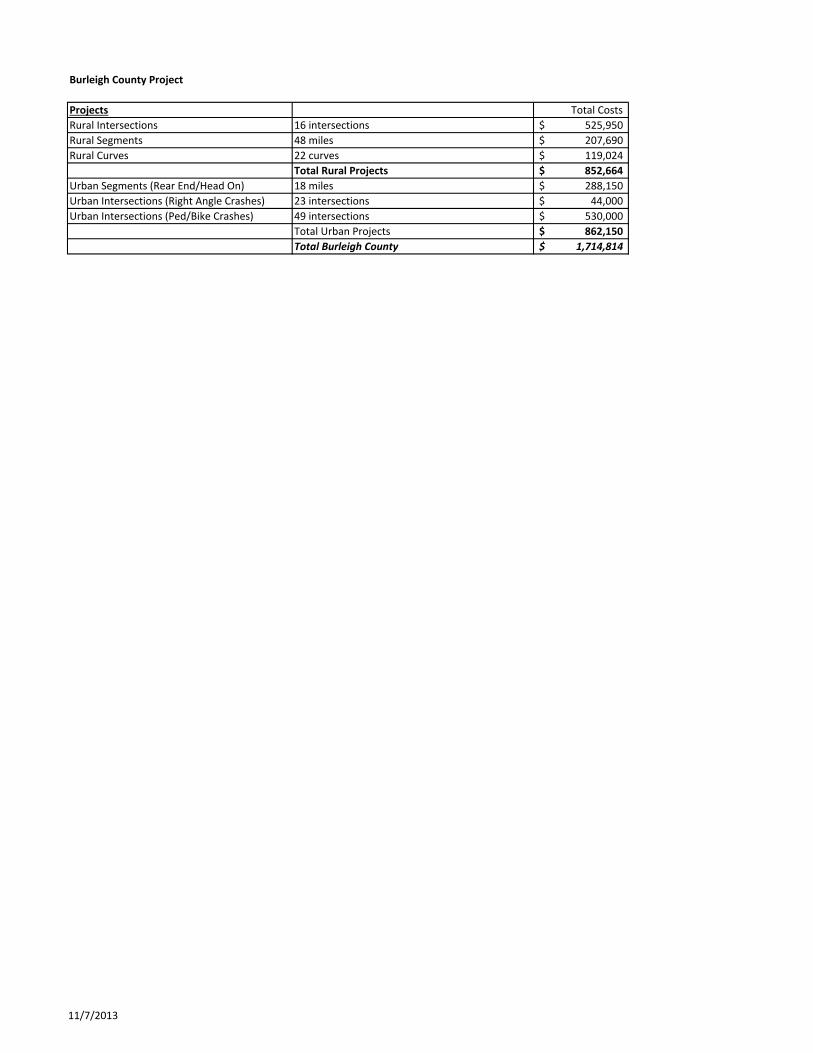
Burleigh County Project
Projects Total Costs
Rural Intersections 16 intersections 525,950$
Rural Segments 48 miles 207,690$
Rural Curves 22 curves 119,024$
Total Rural Projects 852,664$
Urban Segments (Rear End/Head On) 18 miles 288,150$
Urban Intersections (Right Angle Crashes) 23 intersections 44,000$
Urban Intersections (Ped/Bike Crashes) 49 intersections 530,000$
Total Urban Projects 862,150$
Total Burleigh County 1,714,814$
11/7/2013
Burleigh County Rural Intersection Projects
Intersection ID Description
Risk Ranking
Close Median
Dynamic Warning
Sign
Install Street Lights
Signs & Markings
Signs & Clearing/G
rubbing Project Cost ($)
531.01 North Dakota Hwy 1804 & NW 15th St - - x x x $11,700521.01 US Hwy 83 & 149th Ave NW x - x x x $37,150532.05 North Dakota Hwy 1804 & Burnt Creek Rd - - x x x $12,150507.02 NE 158th St & County Hwy 10 - x x x x $62,150508.03 SE 93rd St & Apple Creek Rd SE - - x x x $10,300510.03 NE 41st ST & 71st Ave NE (WEST) - x x x x $62,150515.01 US Hwy 83 & 201st Ave NE x - x x x $36,700500.03 NE 405th St & Burleigh County Hwy 1 - - x x x $12,150502.02 US Hwy 83 & 266th Ave NE - - x x x $12,150513.01 US Hwy 83 & County Hwy 10 - x x x x $62,150523.01 North Dakota Hwy 1804 & SE Desert Rd - x x x x $60,300532.04 NW River Rd & Burnt Creek Rd (NORTH) - - x x x $10,300507.01 NE 158th St & Apple Creek Rd SE - - - x x $6,150527.01 North Dakota Hwy 1804 & N Washington St - x x x x $62,150518.01 North Dakota Hwy 14 & 214th Ave NE - - - x x $6,150511.01 SE 66th St & Apple Creek Rd - x x x x $62,150
2 6 14 16 16 $525,950
9/27/201323 USC 409: NDDOT Reserves All Objections
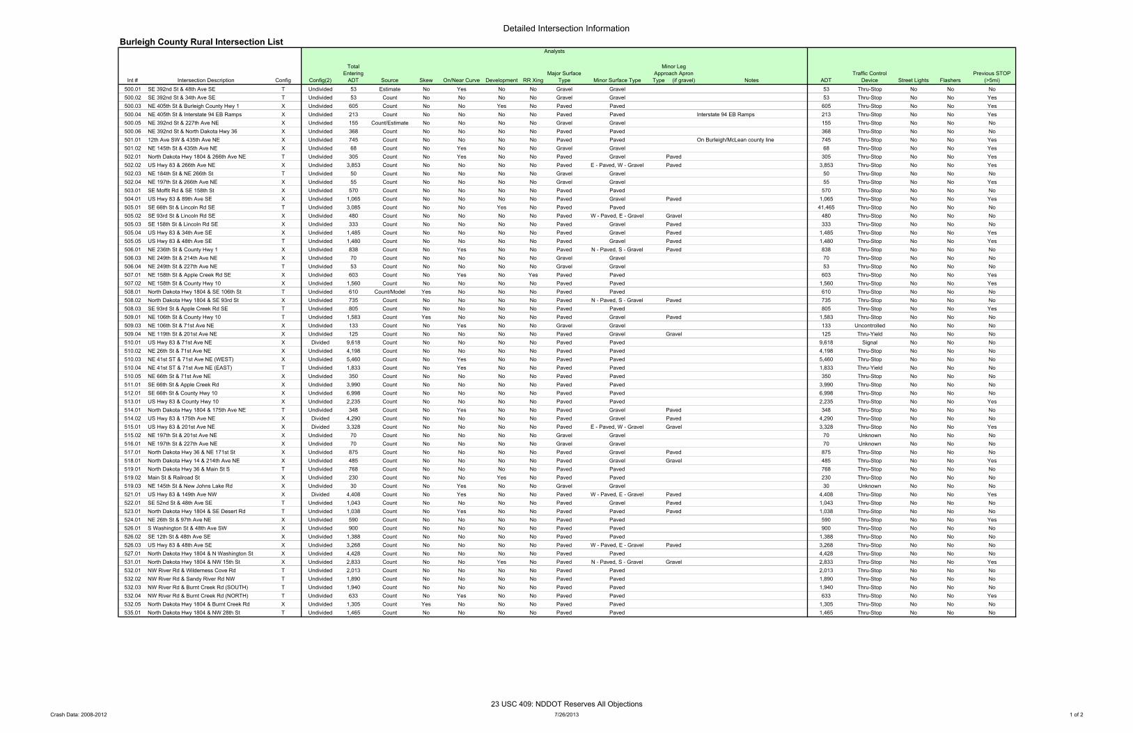
Detailed Intersection InformationBurleigh County Rural Intersection List
Int # Intersection Description Config Config(2)
Total Entering
ADT Source Skew On/Near Curve Development RR XingMajor Surface
Type Minor Surface Type
Minor Leg Approach Apron Type (if gravel) Notes ADT
Traffic Control Device Street Lights Flashers
Previous STOP (>5mi)
500.01 SE 392nd St & 48th Ave SE T Undivided 53 Estimate No Yes No No Gravel Gravel 53 Thru-Stop No No No500.02 SE 392nd St & 34th Ave SE T Undivided 53 Count No No No No Gravel Gravel 53 Thru-Stop No No Yes500.03 NE 405th St & Burleigh County Hwy 1 X Undivided 605 Count No No Yes No Paved Paved 605 Thru-Stop No No Yes500.04 NE 405th St & Interstate 94 EB Ramps X Undivided 213 Count No No No No Paved Paved Interstate 94 EB Ramps 213 Thru-Stop No No Yes500.05 NE 392nd St & 227th Ave NE X Undivided 155 Count/Estimate No No No No Gravel Gravel 155 Thru-Stop No No No500.06 NE 392nd St & North Dakota Hwy 36 X Undivided 368 Count No No No No Paved Paved 368 Thru-Stop No No No501.01 12th Ave SW & 435th Ave NE X Undivided 745 Count No No No No Paved Paved On Burleigh/McLean county line 745 Thru-Stop No No Yes501.02 NE 145th St & 435th Ave NE X Undivided 68 Count No Yes No No Gravel Gravel 68 Thru-Stop No No Yes502.01 North Dakota Hwy 1804 & 266th Ave NE T Undivided 305 Count No Yes No No Paved Gravel Paved 305 Thru-Stop No No Yes502.02 US Hwy 83 & 266th Ave NE X Undivided 3,853 Count No No No No Paved E - Paved, W - Gravel Paved 3,853 Thru-Stop No No Yes502.03 NE 184th St & NE 266th St T Undivided 50 Count No No No No Gravel Gravel 50 Thru-Stop No No No502.04 NE 197th St & 266th Ave NE X Undivided 55 Count No No No No Gravel Gravel 55 Thru-Stop No No Yes503.01 SE Moffit Rd & SE 158th St X Undivided 570 Count No No No No Paved Paved 570 Thru-Stop No No No504.01 US Hwy 83 & 89th Ave SE X Undivided 1,065 Count No No No No Paved Gravel Paved 1,065 Thru-Stop No No Yes505.01 SE 66th St & Lincoln Rd SE T Undivided 3,085 Count No No Yes No Paved Paved 41,465 Thru-Stop No No No505.02 SE 93rd St & Lincoln Rd SE X Undivided 480 Count No No No No Paved W - Paved, E - Gravel Gravel 480 Thru-Stop No No No505.03 SE 158th St & Lincoln Rd SE X Undivided 333 Count No No No No Paved Gravel Paved 333 Thru-Stop No No No505.04 US Hwy 83 & 34th Ave SE X Undivided 1,485 Count No No No No Paved Gravel Paved 1,485 Thru-Stop No No Yes505.05 US Hwy 83 & 48th Ave SE T Undivided 1,480 Count No No No No Paved Gravel Paved 1,480 Thru-Stop No No Yes506.01 NE 236th St & County Hwy 1 X Undivided 838 Count No Yes No No Paved N - Paved, S - Gravel Paved 838 Thru-Stop No No No506.03 NE 249th St & 214th Ave NE X Undivided 70 Count No No No No Gravel Gravel 70 Thru-Stop No No No506.04 NE 249th St & 227th Ave NE T Undivided 53 Count No No No No Gravel Gravel 53 Thru-Stop No No No507.01 NE 158th St & Apple Creek Rd SE X Undivided 603 Count No Yes No Yes Paved Paved 603 Thru-Stop No No Yes507.02 NE 158th St & County Hwy 10 X Undivided 1,560 Count No No No No Paved Paved 1,560 Thru-Stop No No Yes508.01 North Dakota Hwy 1804 & SE 106th St T Undivided 610 Count/Model Yes No No No Paved Paved 610 Thru-Stop No No No508.02 North Dakota Hwy 1804 & SE 93rd St X Undivided 735 Count No No No No Paved N - Paved, S - Gravel Paved 735 Thru-Stop No No No508.03 SE 93rd St & Apple Creek Rd SE T Undivided 805 Count No No No No Paved Paved 805 Thru-Stop No No Yes509.01 NE 106th St & County Hwy 10 T Undivided 1,583 Count Yes No No No Paved Gravel Paved 1,583 Thru-Stop No No No509.03 NE 106th St & 71st Ave NE X Undivided 133 Count No Yes No No Gravel Gravel 133 Uncontrolled No No No509.04 NE 119th St & 201st Ave NE X Undivided 125 Count No No No No Paved Gravel Gravel 125 Thru-Yield No No No510.01 US Hwy 83 & 71st Ave NE X Divided 9,618 Count No No No No Paved Paved 9,618 Signal No No No510.02 NE 26th St & 71st Ave NE X Undivided 4,198 Count No No No No Paved Paved 4,198 Thru-Stop No No No510.03 NE 41st ST & 71st Ave NE (WEST) X Undivided 5,460 Count No Yes No No Paved Paved 5,460 Thru-Stop No No No510.04 NE 41st ST & 71st Ave NE (EAST) T Undivided 1,833 Count No Yes No No Paved Paved 1,833 Thru-Yield No No No510.05 NE 66th St & 71st Ave NE X Undivided 350 Count No No No No Paved Paved 350 Thru-Stop No No No511.01 SE 66th St & Apple Creek Rd X Undivided 3,990 Count No No No No Paved Paved 3,990 Thru-Stop No No No512.01 SE 66th St & County Hwy 10 X Undivided 6,998 Count No No No No Paved Paved 6,998 Thru-Stop No No No513.01 US Hwy 83 & County Hwy 10 X Undivided 2,235 Count No No No No Paved Paved 2,235 Thru-Stop No No Yes514.01 North Dakota Hwy 1804 & 175th Ave NE T Undivided 348 Count No Yes No No Paved Gravel Paved 348 Thru-Stop No No No514.02 US Hwy 83 & 175th Ave NE X Divided 4,290 Count No No No No Paved Gravel Paved 4,290 Thru-Stop No No No515.01 US Hwy 83 & 201st Ave NE X Divided 3,328 Count No No No No Paved E - Paved, W - Gravel Gravel 3,328 Thru-Stop No No Yes515.02 NE 197th St & 201st Ave NE X Undivided 70 Count No No No No Gravel Gravel 70 Unknown No No No516.01 NE 197th St & 227th Ave NE X Undivided 70 Count No No No No Gravel Gravel 70 Unknown No No No517.01 North Dakota Hwy 36 & NE 171st St X Undivided 875 Count No No No No Paved Gravel Paved 875 Thru-Stop No No No518.01 North Dakota Hwy 14 & 214th Ave NE X Undivided 485 Count No No No No Paved Gravel Gravel 485 Thru-Stop No No Yes519.01 North Dakota Hwy 36 & Main St S T Undivided 768 Count No No No No Paved Paved 768 Thru-Stop No No No519.02 Main St & Railroad St X Undivided 230 Count No No Yes No Paved Paved 230 Thru-Stop No No No519.03 NE 145th St & New Johns Lake Rd X Undivided 30 Count No Yes No No Gravel Gravel 30 Unknown No No No521.01 US Hwy 83 & 149th Ave NW X Divided 4,408 Count No Yes No No Paved W - Paved, E - Gravel Paved 4,408 Thru-Stop No No Yes522.01 SE 52nd St & 48th Ave SE T Undivided 1,043 Count No No No No Paved Gravel Paved 1,043 Thru-Stop No No No523.01 North Dakota Hwy 1804 & SE Desert Rd T Undivided 1,038 Count No Yes No No Paved Paved Paved 1,038 Thru-Stop No No No524.01 NE 26th St & 97th Ave NE X Undivided 590 Count No No No No Paved Paved 590 Thru-Stop No No Yes526.01 S Washington St & 48th Ave SW X Undivided 900 Count No No No No Paved Paved 900 Thru-Stop No No No526.02 SE 12th St & 48th Ave SE X Undivided 1,388 Count No No No No Paved Paved 1,388 Thru-Stop No No No526.03 US Hwy 83 & 48th Ave SE X Undivided 3,268 Count No No No No Paved W - Paved, E - Gravel Paved 3,268 Thru-Stop No No No527.01 North Dakota Hwy 1804 & N Washington St X Undivided 4,428 Count No No No No Paved Paved 4,428 Thru-Stop No No No531.01 North Dakota Hwy 1804 & NW 15th St X Undivided 2,833 Count No No Yes No Paved N - Paved, S - Gravel Gravel 2,833 Thru-Stop No No Yes532.01 NW River Rd & Wilderness Cove Rd T Undivided 2,013 Count No No No No Paved Paved 2,013 Thru-Stop No No No532.02 NW River Rd & Sandy River Rd NW T Undivided 1,890 Count No No No No Paved Paved 1,890 Thru-Stop No No No532.03 NW River Rd & Burnt Creek Rd (SOUTH) T Undivided 1,940 Count No No No No Paved Paved 1,940 Thru-Stop No No No532.04 NW River Rd & Burnt Creek Rd (NORTH) T Undivided 633 Count No Yes No No Paved Paved 633 Thru-Stop No No Yes532.05 North Dakota Hwy 1804 & Burnt Creek Rd X Undivided 1,305 Count Yes No No No Paved Paved 1,305 Thru-Stop No No No535.01 North Dakota Hwy 1804 & NW 28th St T Undivided 1,465 Count No No No No Paved Paved 1,465 Thru-Stop No No No
Analysts
Crash Data: 2008-2012 7/26/2013 1 of 2
23 USC 409: NDDOT Reserves All Objections
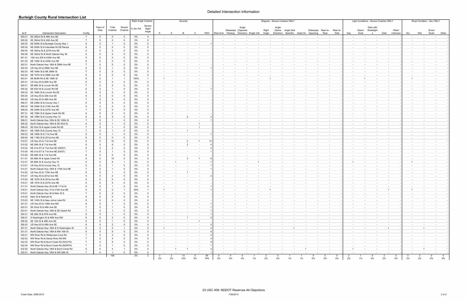
Detailed Intersection InformationBurleigh County Rural Intersection List
Int # Intersection Description Config500.01 SE 392nd St & 48th Ave SE T500.02 SE 392nd St & 34th Ave SE T500.03 NE 405th St & Burleigh County Hwy 1 X500.04 NE 405th St & Interstate 94 EB Ramps X500.05 NE 392nd St & 227th Ave NE X500.06 NE 392nd St & North Dakota Hwy 36 X501.01 12th Ave SW & 435th Ave NE X501.02 NE 145th St & 435th Ave NE X502.01 North Dakota Hwy 1804 & 266th Ave NE T502.02 US Hwy 83 & 266th Ave NE X502.03 NE 184th St & NE 266th St T502.04 NE 197th St & 266th Ave NE X503.01 SE Moffit Rd & SE 158th St X504.01 US Hwy 83 & 89th Ave SE X505.01 SE 66th St & Lincoln Rd SE T505.02 SE 93rd St & Lincoln Rd SE X505.03 SE 158th St & Lincoln Rd SE X505.04 US Hwy 83 & 34th Ave SE X505.05 US Hwy 83 & 48th Ave SE T506.01 NE 236th St & County Hwy 1 X506.03 NE 249th St & 214th Ave NE X506.04 NE 249th St & 227th Ave NE T507.01 NE 158th St & Apple Creek Rd SE X507.02 NE 158th St & County Hwy 10 X508.01 North Dakota Hwy 1804 & SE 106th St T508.02 North Dakota Hwy 1804 & SE 93rd St X508.03 SE 93rd St & Apple Creek Rd SE T509.01 NE 106th St & County Hwy 10 T509.03 NE 106th St & 71st Ave NE X509.04 NE 119th St & 201st Ave NE X510.01 US Hwy 83 & 71st Ave NE X510.02 NE 26th St & 71st Ave NE X510.03 NE 41st ST & 71st Ave NE (WEST) X510.04 NE 41st ST & 71st Ave NE (EAST) T510.05 NE 66th St & 71st Ave NE X511.01 SE 66th St & Apple Creek Rd X512.01 SE 66th St & County Hwy 10 X513.01 US Hwy 83 & County Hwy 10 X514.01 North Dakota Hwy 1804 & 175th Ave NE T514.02 US Hwy 83 & 175th Ave NE X515.01 US Hwy 83 & 201st Ave NE X515.02 NE 197th St & 201st Ave NE X516.01 NE 197th St & 227th Ave NE X517.01 North Dakota Hwy 36 & NE 171st St X518.01 North Dakota Hwy 14 & 214th Ave NE X519.01 North Dakota Hwy 36 & Main St S T519.02 Main St & Railroad St X519.03 NE 145th St & New Johns Lake Rd X521.01 US Hwy 83 & 149th Ave NW X522.01 SE 52nd St & 48th Ave SE T523.01 North Dakota Hwy 1804 & SE Desert Rd T524.01 NE 26th St & 97th Ave NE X526.01 S Washington St & 48th Ave SW X526.02 SE 12th St & 48th Ave SE X526.03 US Hwy 83 & 48th Ave SE X527.01 North Dakota Hwy 1804 & N Washington St X531.01 North Dakota Hwy 1804 & NW 15th St X532.01 NW River Rd & Wilderness Cove Rd T532.02 NW River Rd & Sandy River Rd NW T532.03 NW River Rd & Burnt Creek Rd (SOUTH) T532.04 NW River Rd & Burnt Creek Rd (NORTH) T532.05 North Dakota Hwy 1804 & Burnt Creek Rd X535.01 North Dakota Hwy 1804 & NW 28th St T
Years of Data
Total Crashes
Severe Crashes % Sev RA
Severe Right Angle
K A B C PDO Rear EndSideswipe Passing
Angle (Opposite Direction) Single Veh
Right Angle
Angle (Same
Direction)Angle (Not Specific) Head On
Sideswipe Opposing
Rear-to-Rear
Rear-to-Side Day
Dawn/ Dusk
Dark with Streetlight
s DarkOther/
Unknown Dry WetSnow/ Slush Other
5 0 0 0% 0 - - - - - - - - - - - - - - - - - - - - - - - - - 5 0 0 0% 0 - - - - - - - - - - - - - - - - - - - - - - - - - 5 1 0 0% 0 - - - - 1 - - - - - - - - - - - - - - - - - - - - 5 0 0 0% 0 - - - - - - - - - - - - - - - - - - - - - - - - - 5 0 0 0% 0 - - - - - - - - - - - - - - - - - - - - - - - - - 5 0 0 0% 0 - - - - - - - - - - - - - - - - - - - - - - - - - 5 0 0 0% 0 - - - - - - - - - - - - - - - - - - - - - - - - - 5 0 0 0% 0 - - - - - - - - - - - - - - - - - - - - - - - - - 5 0 0 0% 0 - - - - - - - - - - - - - - - - - - - - - - - - - 5 1 0 0% 0 - - - - 1 - - - - - - - - - - - - - - - - - - - - 5 0 0 0% 0 - - - - - - - - - - - - - - - - - - - - - - - - - 5 0 0 0% 0 - - - - - - - - - - - - - - - - - - - - - - - - - 5 1 1 100% 1 1 - - - - - - - - 1 - - - - - - - 1 - - - 1 - - - 5 0 0 0% 0 - - - - - - - - - - - - - - - - - - - - - - - - - 5 0 0 0% 0 - - - - - - - - - - - - - - - - - - - - - - - - - 5 1 0 0% 0 - - - - 1 - - - - - - - - - - - - - - - - - - - - 5 0 0 0% 0 - - - - - - - - - - - - - - - - - - - - - - - - - 5 0 0 0% 0 - - - - - - - - - - - - - - - - - - - - - - - - - 5 0 0 0% 0 - - - - - - - - - - - - - - - - - - - - - - - - - 5 0 0 0% 0 - - - - - - - - - - - - - - - - - - - - - - - - - 5 0 0 0% 0 - - - - - - - - - - - - - - - - - - - - - - - - - 5 0 0 0% 0 - - - - - - - - - - - - - - - - - - - - - - - - - 5 0 0 0% 0 - - - - - - - - - - - - - - - - - - - - - - - - - 5 5 0 0% 0 - - 2 - 3 - - - - - - - - - - - - - - - - - - - - 5 1 0 0% 0 - - - - 1 - - - - - - - - - - - - - - - - - - - - 5 1 0 0% 0 - - - 1 - - - - - - - - - - - - - - - - - - - - - 5 1 0 0% 0 - - - 1 - - - - - - - - - - - - - - - - - - - - - 5 1 0 0% 0 - - 1 - - - - - - - - - - - - - - - - - - - - - - 5 1 0 0% 0 - - - - 1 - - - - - - - - - - - - - - - - - - - - 5 0 0 0% 0 - - - - - - - - - - - - - - - - - - - - - - - - - 5 16 0 0% 0 - - 2 1 13 - - - - - - - - - - - - - - - - - - - - 5 6 0 0% 0 - - 2 - 4 - - - - - - - - - - - - - - - - - - - - 5 2 0 0% 0 - - - - 2 - - - - - - - - - - - - - - - - - - - - 5 1 0 0% 0 - - - - 1 - - - - - - - - - - - - - - - - - - - - 5 0 0 0% 0 - - - - - - - - - - - - - - - - - - - - - - - - - 5 10 0 0% 0 - - 3 1 6 - - - - - - - - - - - - - - - - - - - - 5 8 1 0% 0 - 1 - - 7 - - - 1 - - - - - - - 1 - - - - 1 - - - 5 1 0 0% 0 - - - - 1 - - - - - - - - - - - - - - - - - - - - 5 1 0 0% 0 - - - - 1 - - - - - - - - - - - - - - - - - - - - 5 1 0 0% 0 - - 1 - - - - - - - - - - - - - - - - - - - - - - 5 2 0 0% 0 - - - - 2 - - - - - - - - - - - - - - - - - - - - 5 0 0 0% 0 - - - - - - - - - - - - - - - - - - - - - - - - - 5 0 0 0% 0 - - - - - - - - - - - - - - - - - - - - - - - - - 5 1 0 0% 0 - - - - 1 - - - - - - - - - - - - - - - - - - - - 5 2 1 50% 1 1 - - - 1 - - - - 1 - - - - - - - - - 1 - 1 - - - 5 0 0 0% 0 - - - - - - - - - - - - - - - - - - - - - - - - - 5 0 0 0% 0 - - - - - - - - - - - - - - - - - - - - - - - - - 5 0 0 0% 0 - - - - - - - - - - - - - - - - - - - - - - - - - 5 1 0 0% 0 - - - - 1 - - - - - - - - - - - - - - - - - - - - 5 1 0 0% 0 - - - - 1 - - - - - - - - - - - - - - - - - - - - 5 1 0 0% 0 - - - - 1 - - - - - - - - - - - - - - - - - - - - 5 1 0 0% 0 - - - - 1 - - - - - - - - - - - - - - - - - - - - 5 3 0 0% 0 - - 1 - 2 - - - - - - - - - - - - - - - - - - - - 5 1 0 0% 0 - - - 1 - - - - - - - - - - - - - - - - - - - - - 5 2 0 0% 0 - - - - 2 - - - - - - - - - - - - - - - - - - - - 5 5 1 0% 0 1 - - - 4 - - - - - - 1 - - - - - - - 1 - - 1 - - 5 6 0 0% 0 - - - - 6 - - - - - - - - - - - - - - - - - - - - 5 3 0 0% 0 - - - - 3 - - - - - - - - - - - - - - - - - - - - 5 4 0 0% 0 - - - - 4 - - - - - - - - - - - - - - - - - - - - 5 9 0 0% 0 - - - - 9 - - - - - - - - - - - - - - - - - - - - 5 1 0 0% 0 - - - - 1 - - - - - - - - - - - - - - - - - - - - 5 4 1 0% 0 - 1 1 - 2 - - - - - - - 1 - - - 1 - - - - - 1 - - 5 1 0 0% 0 - - - - 1 - - - - - - - - - - - - - - - - - - - -
108 2% 2 3 2 13 5 85 0 0 0 1 2 0 1 1 0 0 0 2 1 0 2 0 3 2 0 03% 2% 12% 5% 79% 0% 0% 0% 1% 2% 0% 1% 1% 0% 0% 0% 2% 1% 0% 2% 0% 3% 2% 0% 0%
Right Angle Crashes Road Condition - Sev ONLYLight Conditions - Severe Crashes ONLYSeverity Diagram - Severe Crashes ONLY
Crash Data: 2008-2012 7/26/2013 2 of 2
23 USC 409: NDDOT Reserves All Objections
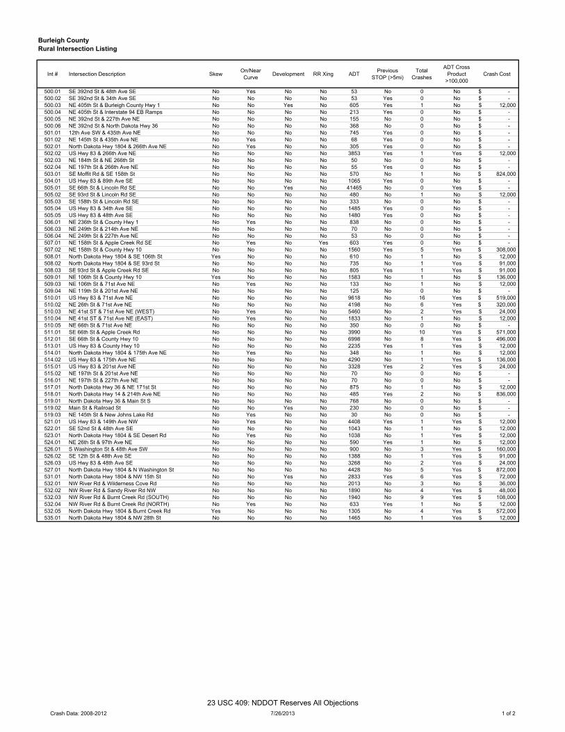
Burleigh CountyRural Intersection Listing
Int # Intersection Description Skew On/NearCurve Development RR Xing ADT Previous
STOP (>5mi)Total
Crashes
ADT Cross Product
>100,000Crash Cost
500.01 SE 392nd St & 48th Ave SE No Yes No No 53 No 0 No -$ 500.02 SE 392nd St & 34th Ave SE No No No No 53 Yes 0 No -$ 500.03 NE 405th St & Burleigh County Hwy 1 No No Yes No 605 Yes 1 No 12,000$ 500.04 NE 405th St & Interstate 94 EB Ramps No No No No 213 Yes 0 No -$ 500.05 NE 392nd St & 227th Ave NE No No No No 155 No 0 No -$ 500.06 NE 392nd St & North Dakota Hwy 36 No No No No 368 No 0 No -$ 501.01 12th Ave SW & 435th Ave NE No No No No 745 Yes 0 No -$ 501.02 NE 145th St & 435th Ave NE No Yes No No 68 Yes 0 No -$ 502.01 North Dakota Hwy 1804 & 266th Ave NE No Yes No No 305 Yes 0 No -$ 502.02 US Hwy 83 & 266th Ave NE No No No No 3853 Yes 1 Yes 12,000$ 502.03 NE 184th St & NE 266th St No No No No 50 No 0 No -$ 502.04 NE 197th St & 266th Ave NE No No No No 55 Yes 0 No -$ 503.01 SE Moffit Rd & SE 158th St No No No No 570 No 1 No 824,000$ 504.01 US Hwy 83 & 89th Ave SE No No No No 1065 Yes 0 No -$ 505.01 SE 66th St & Lincoln Rd SE No No Yes No 41465 No 0 Yes -$ 505.02 SE 93rd St & Lincoln Rd SE No No No No 480 No 1 No 12,000$ 505.03 SE 158th St & Lincoln Rd SE No No No No 333 No 0 No -$ 505.04 US Hwy 83 & 34th Ave SE No No No No 1485 Yes 0 No -$ 505.05 US Hwy 83 & 48th Ave SE No No No No 1480 Yes 0 No -$ 506.01 NE 236th St & County Hwy 1 No Yes No No 838 No 0 No -$ 506.03 NE 249th St & 214th Ave NE No No No No 70 No 0 No -$ 506.04 NE 249th St & 227th Ave NE No No No No 53 No 0 No -$ 507.01 NE 158th St & Apple Creek Rd SE No Yes No Yes 603 Yes 0 No -$ 507.02 NE 158th St & County Hwy 10 No No No No 1560 Yes 5 Yes 308,000$ 508.01 North Dakota Hwy 1804 & SE 106th St Yes No No No 610 No 1 No 12,000$ 508.02 North Dakota Hwy 1804 & SE 93rd St No No No No 735 No 1 Yes 91,000$ 508.03 SE 93rd St & Apple Creek Rd SE No No No No 805 Yes 1 Yes 91,000$ 509.01 NE 106th St & County Hwy 10 Yes No No No 1583 No 1 No 136,000$ 509.03 NE 106th St & 71st Ave NE No Yes No No 133 No 1 No 12,000$ 509.04 NE 119th St & 201st Ave NE No No No No 125 No 0 No -$ 510.01 US Hwy 83 & 71st Ave NE No No No No 9618 No 16 Yes 519,000$ 510.02 NE 26th St & 71st Ave NE No No No No 4198 No 6 Yes 320,000$ 510.03 NE 41st ST & 71st Ave NE (WEST) No Yes No No 5460 No 2 Yes 24,000$ 510.04 NE 41st ST & 71st Ave NE (EAST) No Yes No No 1833 No 1 No 12,000$ 510.05 NE 66th St & 71st Ave NE No No No No 350 No 0 No -$ 511.01 SE 66th St & Apple Creek Rd No No No No 3990 No 10 Yes 571,000$ 512.01 SE 66th St & County Hwy 10 No No No No 6998 No 8 Yes 496,000$ 513.01 US Hwy 83 & County Hwy 10 No No No No 2235 Yes 1 Yes 12,000$ 514.01 North Dakota Hwy 1804 & 175th Ave NE No Yes No No 348 No 1 No 12,000$ 514.02 US Hwy 83 & 175th Ave NE No No No No 4290 No 1 Yes 136,000$ 515.01 US Hwy 83 & 201st Ave NE No No No No 3328 Yes 2 Yes 24,000$ 515.02 NE 197th St & 201st Ave NE No No No No 70 No 0 No -$ 516.01 NE 197th St & 227th Ave NE No No No No 70 No 0 No -$ 517.01 North Dakota Hwy 36 & NE 171st St No No No No 875 No 1 No 12,000$ 518.01 North Dakota Hwy 14 & 214th Ave NE No No No No 485 Yes 2 No 836,000$ 519.01 North Dakota Hwy 36 & Main St S No No No No 768 No 0 No -$ 519.02 Main St & Railroad St No No Yes No 230 No 0 No -$ 519.03 NE 145th St & New Johns Lake Rd No Yes No No 30 No 0 No -$ 521.01 US Hwy 83 & 149th Ave NW No Yes No No 4408 Yes 1 Yes 12,000$ 522.01 SE 52nd St & 48th Ave SE No No No No 1043 No 1 No 12,000$ 523.01 North Dakota Hwy 1804 & SE Desert Rd No Yes No No 1038 No 1 Yes 12,000$ 524.01 NE 26th St & 97th Ave NE No No No No 590 Yes 1 No 12,000$ 526.01 S Washington St & 48th Ave SW No No No No 900 No 3 Yes 160,000$ 526.02 SE 12th St & 48th Ave SE No No No No 1388 No 1 Yes 91,000$ 526.03 US Hwy 83 & 48th Ave SE No No No No 3268 No 2 Yes 24,000$ 527.01 North Dakota Hwy 1804 & N Washington St No No No No 4428 No 5 Yes 872,000$ 531.01 North Dakota Hwy 1804 & NW 15th St No No Yes No 2833 Yes 6 Yes 72,000$ 532.01 NW River Rd & Wilderness Cove Rd No No No No 2013 No 3 No 36,000$ 532.02 NW River Rd & Sandy River Rd NW No No No No 1890 No 4 Yes 48,000$ 532.03 NW River Rd & Burnt Creek Rd (SOUTH) No No No No 1940 No 9 Yes 108,000$ 532.04 NW River Rd & Burnt Creek Rd (NORTH) No Yes No No 633 Yes 1 No 12,000$ 532.05 North Dakota Hwy 1804 & Burnt Creek Rd Yes No No No 1305 No 4 Yes 572,000$ 535.01 North Dakota Hwy 1804 & NW 28th St No No No No 1465 No 1 Yes 12,000$
Crash Data: 2008-2012 7/26/2013 1 of 2
23 USC 409: NDDOT Reserves All Objections
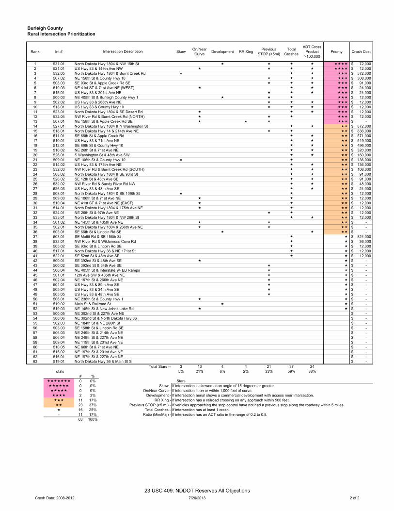
Burleigh CountyRural Intersection Prioritization
Rank Int # Skew On/NearCurve Development RR Xing Previous
STOP (>5mi)Total
Crashes
ADT Cross Product
>100,000Priority Crash Cost
1 531.01 North Dakota Hwy 1804 & NW 15th St 72,000$ 2 521.01 US Hwy 83 & 149th Ave NW 12,000$ 3 532.05 North Dakota Hwy 1804 & Burnt Creek Rd 572,000$ 4 507.02 NE 158th St & County Hwy 10 308,000$ 5 508.03 SE 93rd St & Apple Creek Rd SE 91,000$ 6 510.03 NE 41st ST & 71st Ave NE (WEST) 24,000$ 7 515.01 US Hwy 83 & 201st Ave NE 24,000$ 8 500.03 NE 405th St & Burleigh County Hwy 1 12,000$ 9 502.02 US Hwy 83 & 266th Ave NE 12,000$ 10 513.01 US Hwy 83 & County Hwy 10 12,000$ 11 523.01 North Dakota Hwy 1804 & SE Desert Rd 12,000$ 12 532.04 NW River Rd & Burnt Creek Rd (NORTH) 12,000$ 13 507.01 NE 158th St & Apple Creek Rd SE -$ 14 527.01 North Dakota Hwy 1804 & N Washington St 872,000$ 15 518.01 North Dakota Hwy 14 & 214th Ave NE 836,000$ 16 511.01 SE 66th St & Apple Creek Rd 571,000$ 17 510.01 US Hwy 83 & 71st Ave NE 519,000$ 18 512.01 SE 66th St & County Hwy 10 496,000$ 19 510.02 NE 26th St & 71st Ave NE 320,000$ 20 526.01 S Washington St & 48th Ave SW 160,000$ 21 509.01 NE 106th St & County Hwy 10 136,000$ 22 514.02 US Hwy 83 & 175th Ave NE 136,000$ 23 532.03 NW River Rd & Burnt Creek Rd (SOUTH) 108,000$ 24 508.02 North Dakota Hwy 1804 & SE 93rd St 91,000$ 25 526.02 SE 12th St & 48th Ave SE 91,000$ 26 532.02 NW River Rd & Sandy River Rd NW 48,000$ 27 526.03 US Hwy 83 & 48th Ave SE 24,000$ 28 508.01 North Dakota Hwy 1804 & SE 106th St 12,000$ 29 509.03 NE 106th St & 71st Ave NE 12,000$ 30 510.04 NE 41st ST & 71st Ave NE (EAST) 12,000$ 31 514.01 North Dakota Hwy 1804 & 175th Ave NE 12,000$ 32 524.01 NE 26th St & 97th Ave NE 12,000$ 33 535.01 North Dakota Hwy 1804 & NW 28th St 12,000$ 34 501.02 NE 145th St & 435th Ave NE -$ 35 502.01 North Dakota Hwy 1804 & 266th Ave NE -$ 36 505.01 SE 66th St & Lincoln Rd SE -$ 37 503.01 SE Moffit Rd & SE 158th St 824,000$ 38 532.01 NW River Rd & Wilderness Cove Rd 36,000$ 39 505.02 SE 93rd St & Lincoln Rd SE 12,000$ 40 517.01 North Dakota Hwy 36 & NE 171st St 12,000$ 41 522.01 SE 52nd St & 48th Ave SE 12,000$ 42 500.01 SE 392nd St & 48th Ave SE -$ 43 500.02 SE 392nd St & 34th Ave SE -$ 44 500.04 NE 405th St & Interstate 94 EB Ramps -$ 45 501.01 12th Ave SW & 435th Ave NE -$ 46 502.04 NE 197th St & 266th Ave NE -$ 47 504.01 US Hwy 83 & 89th Ave SE -$ 48 505.04 US Hwy 83 & 34th Ave SE -$ 49 505.05 US Hwy 83 & 48th Ave SE -$ 50 506.01 NE 236th St & County Hwy 1 -$ 51 519.02 Main St & Railroad St -$ 52 519.03 NE 145th St & New Johns Lake Rd -$ 53 500.05 NE 392nd St & 227th Ave NE -$ 54 500.06 NE 392nd St & North Dakota Hwy 36 -$ 55 502.03 NE 184th St & NE 266th St -$ 56 505.03 SE 158th St & Lincoln Rd SE -$ 57 506.03 NE 249th St & 214th Ave NE -$ 58 506.04 NE 249th St & 227th Ave NE -$ 59 509.04 NE 119th St & 201st Ave NE -$ 60 510.05 NE 66th St & 71st Ave NE -$ 61 515.02 NE 197th St & 201st Ave NE -$ 62 516.01 NE 197th St & 227th Ave NE -$ 63 519.01 North Dakota Hwy 36 & Main St S -$
Total Stars -- 3 13 4 1 21 37 24Totals 5% 21% 6% 2% 33% 59% 38%
# % 0 0% Stars 0 0% Skew - If intersection is skewed at an angle of 15 degrees or greater. 0 0% On/Near Curve - If intersection is on or within 1,000 feet of curve. 2 3% Development - If intersection aerial shows a commercial development with access near intersection. 11 17% RR Xing - If intersection has a railroad crossing on any approach within 500 feet. 23 37% Previous STOP (>5 mi) - If vehicles approaching the stop control have not had a previous stop along the roadway within 5 miles 16 25% Total Crashes - If intersection has at least 1 crash.- 11 17% Ratio (Min/Maj) - If intersection has an ADT ratio in the range of 0.2 to 0.8.
63 100%
Intersection Description
Crash Data: 2008-2012 7/26/2013 2 of 2
23 USC 409: NDDOT Reserves All Objections
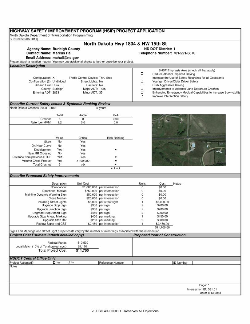
HIGHWAY SAFETY IMPROVEMENT PROGRAM (HSIP) PROJECT APPLICATIONNorth Dakota Department of Transportation ProgrammingSFN 59959 (06-2011)
Agency Name: Burleigh County ND DOT District: 1Contact Name: Marcus Hall Telephone Number: 701-221-6870
Email Address: [email protected] attach a location map(s). You may use additional sheets to further describe your project.
Location Description
Configuration: X Traffic Control Device: Thru-Stop
Configuration (2): Undivided Street Lights: No
Urban/Rural: Rural Flashers: No
County: Burleigh Major ADT: 1435
Entering ADT: 2833 Minor ADT: 35
Describe Current Safety Issues & Systemic Ranking ReviewNorth Dakota Crashes, 2008 - 2012 5 years
Total Angle K+A
Crashes 6 0 0.00Rate (per MVM) 1.2 0.0 0.0
Value Critical Risk Ranking
Skew No Yes
On/Near Curve No Yes
Development Yes Yes �
Near RR Crossing No Yes
Distance from previous STOP Yes Yes �
Volume Cross Product Yes ≥ 100,000 �
Total Crashes 6 >0 �
����
Describe Proposed Safety Improvements
Description Unit Cost Units Cost
Roundabout $1,000,000 per intersection 0 $0.00
Directional Median $750,000 per intersection 0 $0.00
Mainline Dynamic Warning Sign $50,000 per intersection 0 $0.00
Close Median $25,000 per intersection 0 $0.00
Installing Street Lights $6,000 per street light 1 $6,000.00Upgrade Stop Sign $350 per sign 2 $700.00
Upgrade Junction Sign $350 per sign 2 $700.00
Upgrade Stop Ahead Sign $450 per sign 2 $900.00Upgrade Stop Ahead Marking $450 per marking 1 $450.00
Upgrade Stop Bar $250 per marking 2 $500.00
Review Signs and CST $2,450 per intersection 1 $2,450.00
$11,700.00
Signs and Markings and Street Light project costs vary by the number of minor legs associated with the intersection.
Project Cost Estimate (attach detailed copy) Proposed Year of Construction
Federal Funds $10,530
Local Match (10% of Total project cost) $1,170
Total Project Cost $11,700
NDDOT Central Office OnlyProject Accepted? Reference Number ID Number
Notes
Page: 1
Intersection ID: 531.01Date: 8/13/2013
Improvements to Address Lane Departure Crashes
Enhancing Emergency Medical Capabilities to Increase Survivability
Improve Intersection Safety
Notes -
SHSP Emphasis Area (check all that apply)Reduce Alcohol Impaired Driving
Increase the Use of Safety Restraints for all Occupants
Younger Driver/Older Driver Safety
Curb Aggressive Driving
North Dakota Hwy 1804 & NW 15th St
Yes No
23 USC 409: NDDOT Reserves All Objections
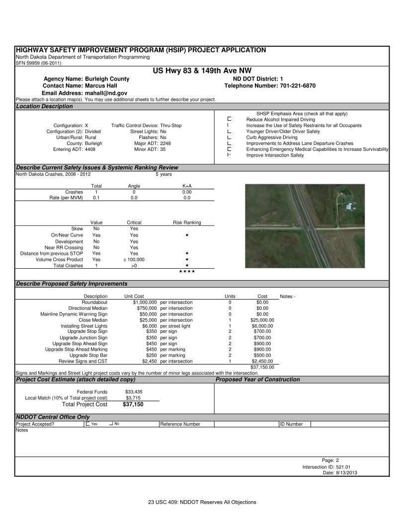
HIGHWAY SAFETY IMPROVEMENT PROGRAM (HSIP) PROJECT APPLICATIONNorth Dakota Department of Transportation ProgrammingSFN 59959 (06-2011)
Agency Name: Burleigh County ND DOT District: 1Contact Name: Marcus Hall Telephone Number: 701-221-6870
Email Address: [email protected] attach a location map(s). You may use additional sheets to further describe your project.
Location Description
Configuration: X Traffic Control Device: Thru-Stop
Configuration (2): Divided Street Lights: No
Urban/Rural: Rural Flashers: No
County: Burleigh Major ADT: 2248
Entering ADT: 4408 Minor ADT: 35
Describe Current Safety Issues & Systemic Ranking ReviewNorth Dakota Crashes, 2008 - 2012 5 years
Total Angle K+A
Crashes 1 0 0.00Rate (per MVM) 0.1 0.0 0.0
Value Critical Risk Ranking
Skew No Yes
On/Near Curve Yes Yes �
Development No Yes
Near RR Crossing No Yes
Distance from previous STOP Yes Yes �
Volume Cross Product Yes ≥ 100,000 �
Total Crashes 1 >0 �
����
Describe Proposed Safety Improvements
Description Unit Cost Units Cost
Roundabout $1,000,000 per intersection 0 $0.00
Directional Median $750,000 per intersection 0 $0.00
Mainline Dynamic Warning Sign $50,000 per intersection 0 $0.00
Close Median $25,000 per intersection 1 $25,000.00
Installing Street Lights $6,000 per street light 1 $6,000.00Upgrade Stop Sign $350 per sign 2 $700.00
Upgrade Junction Sign $350 per sign 2 $700.00
Upgrade Stop Ahead Sign $450 per sign 2 $900.00Upgrade Stop Ahead Marking $450 per marking 2 $900.00
Upgrade Stop Bar $250 per marking 2 $500.00
Review Signs and CST $2,450 per intersection 1 $2,450.00
$37,150.00
Signs and Markings and Street Light project costs vary by the number of minor legs associated with the intersection.
Project Cost Estimate (attach detailed copy) Proposed Year of Construction
Federal Funds $33,435
Local Match (10% of Total project cost) $3,715
Total Project Cost $37,150
NDDOT Central Office OnlyProject Accepted? Reference Number ID Number
Notes
Page: 2
Intersection ID: 521.01Date: 8/13/2013
Improvements to Address Lane Departure Crashes
Enhancing Emergency Medical Capabilities to Increase Survivability
Improve Intersection Safety
Notes -
SHSP Emphasis Area (check all that apply)Reduce Alcohol Impaired Driving
Increase the Use of Safety Restraints for all Occupants
Younger Driver/Older Driver Safety
Curb Aggressive Driving
US Hwy 83 & 149th Ave NW
Yes No
23 USC 409: NDDOT Reserves All Objections
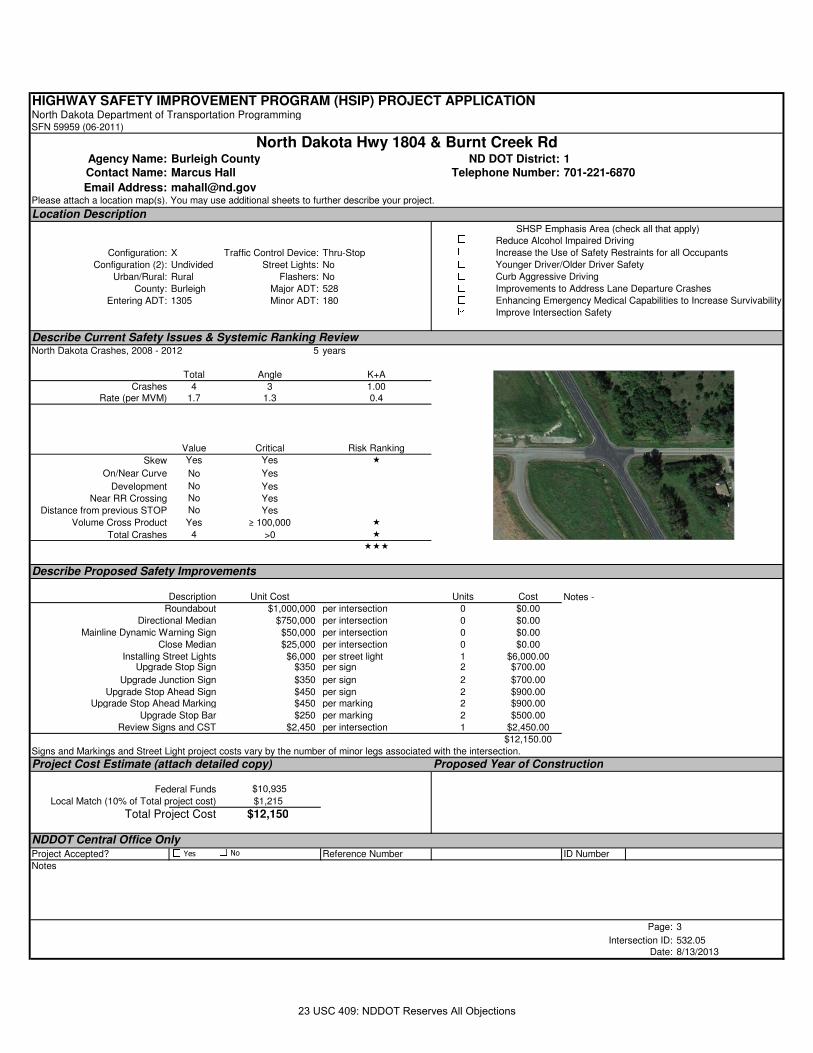
HIGHWAY SAFETY IMPROVEMENT PROGRAM (HSIP) PROJECT APPLICATIONNorth Dakota Department of Transportation ProgrammingSFN 59959 (06-2011)
Agency Name: Burleigh County ND DOT District: 1Contact Name: Marcus Hall Telephone Number: 701-221-6870
Email Address: [email protected] attach a location map(s). You may use additional sheets to further describe your project.
Location Description
Configuration: X Traffic Control Device: Thru-Stop
Configuration (2): Undivided Street Lights: No
Urban/Rural: Rural Flashers: No
County: Burleigh Major ADT: 528
Entering ADT: 1305 Minor ADT: 180
Describe Current Safety Issues & Systemic Ranking ReviewNorth Dakota Crashes, 2008 - 2012 5 years
Total Angle K+A
Crashes 4 3 1.00Rate (per MVM) 1.7 1.3 0.4
Value Critical Risk Ranking
Skew Yes Yes �
On/Near Curve No Yes
Development No Yes
Near RR Crossing No Yes
Distance from previous STOP No Yes
Volume Cross Product Yes ≥ 100,000 �
Total Crashes 4 >0 �
���
Describe Proposed Safety Improvements
Description Unit Cost Units Cost
Roundabout $1,000,000 per intersection 0 $0.00
Directional Median $750,000 per intersection 0 $0.00
Mainline Dynamic Warning Sign $50,000 per intersection 0 $0.00
Close Median $25,000 per intersection 0 $0.00
Installing Street Lights $6,000 per street light 1 $6,000.00Upgrade Stop Sign $350 per sign 2 $700.00
Upgrade Junction Sign $350 per sign 2 $700.00
Upgrade Stop Ahead Sign $450 per sign 2 $900.00Upgrade Stop Ahead Marking $450 per marking 2 $900.00
Upgrade Stop Bar $250 per marking 2 $500.00
Review Signs and CST $2,450 per intersection 1 $2,450.00
$12,150.00
Signs and Markings and Street Light project costs vary by the number of minor legs associated with the intersection.
Project Cost Estimate (attach detailed copy) Proposed Year of Construction
Federal Funds $10,935
Local Match (10% of Total project cost) $1,215
Total Project Cost $12,150
NDDOT Central Office OnlyProject Accepted? Reference Number ID Number
Notes
Page: 3
Intersection ID: 532.05Date: 8/13/2013
Improvements to Address Lane Departure Crashes
Enhancing Emergency Medical Capabilities to Increase Survivability
Improve Intersection Safety
Notes -
SHSP Emphasis Area (check all that apply)Reduce Alcohol Impaired Driving
Increase the Use of Safety Restraints for all Occupants
Younger Driver/Older Driver Safety
Curb Aggressive Driving
North Dakota Hwy 1804 & Burnt Creek Rd
Yes No
23 USC 409: NDDOT Reserves All Objections
HIGHWAY SAFETY IMPROVEMENT PROGRAM (HSIP) PROJECT APPLICATIONNorth Dakota Department of Transportation ProgrammingSFN 59959 (06-2011)
Agency Name: Burleigh County ND DOT District: 1Contact Name: Marcus Hall Telephone Number: 701-221-6870
Email Address: [email protected] attach a location map(s). You may use additional sheets to further describe your project.
Location Description
Configuration: X Traffic Control Device: Thru-Stop
Configuration (2): Undivided Street Lights: No
Urban/Rural: Rural Flashers: No
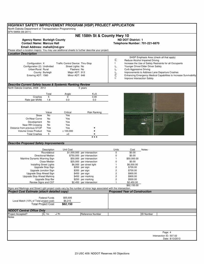
County: Burleigh Major ADT: 913
Entering ADT: 1560 Minor ADT: 648
Describe Current Safety Issues & Systemic Ranking ReviewNorth Dakota Crashes, 2008 - 2012 5 years
Total Angle K+A
Crashes 5 0 0.00Rate (per MVM) 1.8 0.0 0.0
Value Critical Risk Ranking
Skew No Yes
On/Near Curve No Yes
Development No Yes
Near RR Crossing No Yes
Distance from previous STOP Yes Yes �
Volume Cross Product Yes ≥ 100,000 �
Total Crashes 5 >0 �
���
Describe Proposed Safety Improvements
Description Unit Cost Units Cost
Roundabout $1,000,000 per intersection 0 $0.00
Directional Median $750,000 per intersection 0 $0.00
Mainline Dynamic Warning Sign $50,000 per intersection 1 $50,000.00
Close Median $25,000 per intersection 0 $0.00
Installing Street Lights $6,000 per street light 1 $6,000.00Upgrade Stop Sign $350 per sign 2 $700.00
Upgrade Junction Sign $350 per sign 2 $700.00
Upgrade Stop Ahead Sign $450 per sign 2 $900.00Upgrade Stop Ahead Marking $450 per marking 2 $900.00
Upgrade Stop Bar $250 per marking 2 $500.00
Review Signs and CST $2,450 per intersection 1 $2,450.00
$62,150.00
Signs and Markings and Street Light project costs vary by the number of minor legs associated with the intersection.
Project Cost Estimate (attach detailed copy) Proposed Year of Construction
Federal Funds $55,935
Local Match (10% of Total project cost) $6,215
Total Project Cost $62,150
NDDOT Central Office OnlyProject Accepted? Reference Number ID Number
Notes
Page: 4
Intersection ID: 507.02Date: 8/13/2013
Improvements to Address Lane Departure Crashes
Enhancing Emergency Medical Capabilities to Increase Survivability
Improve Intersection Safety
Notes -
SHSP Emphasis Area (check all that apply)Reduce Alcohol Impaired Driving
Increase the Use of Safety Restraints for all Occupants
Younger Driver/Older Driver Safety
Curb Aggressive Driving
NE 158th St & County Hwy 10
Yes No
23 USC 409: NDDOT Reserves All Objections
HIGHWAY SAFETY IMPROVEMENT PROGRAM (HSIP) PROJECT APPLICATIONNorth Dakota Department of Transportation ProgrammingSFN 59959 (06-2011)
Agency Name: Burleigh County ND DOT District: 1Contact Name: Marcus Hall Telephone Number: 701-221-6870
Email Address: [email protected] attach a location map(s). You may use additional sheets to further describe your project.
Location Description
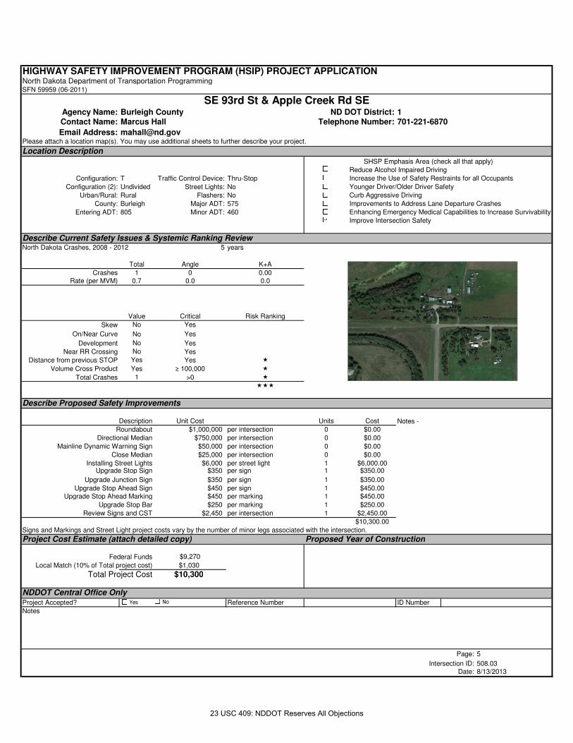
Configuration: T Traffic Control Device: Thru-Stop
Configuration (2): Undivided Street Lights: No
Urban/Rural: Rural Flashers: No
County: Burleigh Major ADT: 575
Entering ADT: 805 Minor ADT: 460
Describe Current Safety Issues & Systemic Ranking ReviewNorth Dakota Crashes, 2008 - 2012 5 years
Total Angle K+A
Crashes 1 0 0.00Rate (per MVM) 0.7 0.0 0.0
Value Critical Risk Ranking
Skew No Yes
On/Near Curve No Yes
Development No Yes
Near RR Crossing No Yes
Distance from previous STOP Yes Yes �
Volume Cross Product Yes ≥ 100,000 �
Total Crashes 1 >0 �
���
Describe Proposed Safety Improvements
Description Unit Cost Units Cost
Roundabout $1,000,000 per intersection 0 $0.00
Directional Median $750,000 per intersection 0 $0.00
Mainline Dynamic Warning Sign $50,000 per intersection 0 $0.00
Close Median $25,000 per intersection 0 $0.00
Installing Street Lights $6,000 per street light 1 $6,000.00Upgrade Stop Sign $350 per sign 1 $350.00
Upgrade Junction Sign $350 per sign 1 $350.00
Upgrade Stop Ahead Sign $450 per sign 1 $450.00Upgrade Stop Ahead Marking $450 per marking 1 $450.00
Upgrade Stop Bar $250 per marking 1 $250.00
Review Signs and CST $2,450 per intersection 1 $2,450.00
$10,300.00
Signs and Markings and Street Light project costs vary by the number of minor legs associated with the intersection.
Project Cost Estimate (attach detailed copy) Proposed Year of Construction
Federal Funds $9,270
Local Match (10% of Total project cost) $1,030
Total Project Cost $10,300
NDDOT Central Office OnlyProject Accepted? Reference Number ID Number
Notes
Page: 5
Intersection ID: 508.03Date: 8/13/2013
Improvements to Address Lane Departure Crashes
Enhancing Emergency Medical Capabilities to Increase Survivability
Improve Intersection Safety
Notes -
SHSP Emphasis Area (check all that apply)Reduce Alcohol Impaired Driving
Increase the Use of Safety Restraints for all Occupants
Younger Driver/Older Driver Safety
Curb Aggressive Driving
SE 93rd St & Apple Creek Rd SE
Yes No
23 USC 409: NDDOT Reserves All Objections

HIGHWAY SAFETY IMPROVEMENT PROGRAM (HSIP) PROJECT APPLICATIONNorth Dakota Department of Transportation ProgrammingSFN 59959 (06-2011)
Agency Name: Burleigh County ND DOT District: 1Contact Name: Marcus Hall Telephone Number: 701-221-6870
Email Address: [email protected] attach a location map(s). You may use additional sheets to further describe your project.
Location Description
Configuration: X Traffic Control Device: Thru-Stop
Configuration (2): Undivided Street Lights: No
Urban/Rural: Rural Flashers: No
County: Burleigh Major ADT: 4535
Entering ADT: 5460 Minor ADT: 925
Describe Current Safety Issues & Systemic Ranking ReviewNorth Dakota Crashes, 2008 - 2012 5 years
Total Angle K+A
Crashes 2 0 0.00Rate (per MVM) 0.2 0.0 0.0
Value Critical Risk Ranking
Skew No Yes
On/Near Curve Yes Yes �
Development No Yes
Near RR Crossing No Yes
Distance from previous STOP No Yes
Volume Cross Product Yes ≥ 100,000 �
Total Crashes 2 >0 �
���
Describe Proposed Safety Improvements
Description Unit Cost Units Cost
Roundabout $1,000,000 per intersection 0 $0.00
Directional Median $750,000 per intersection 0 $0.00
Mainline Dynamic Warning Sign $50,000 per intersection 1 $50,000.00
Close Median $25,000 per intersection 0 $0.00
Installing Street Lights $6,000 per street light 1 $6,000.00Upgrade Stop Sign $350 per sign 2 $700.00
Upgrade Junction Sign $350 per sign 2 $700.00
Upgrade Stop Ahead Sign $450 per sign 2 $900.00Upgrade Stop Ahead Marking $450 per marking 2 $900.00
Upgrade Stop Bar $250 per marking 2 $500.00
Review Signs and CST $2,450 per intersection 1 $2,450.00
$62,150.00
Signs and Markings and Street Light project costs vary by the number of minor legs associated with the intersection.
Project Cost Estimate (attach detailed copy) Proposed Year of Construction
Federal Funds $55,935
Local Match (10% of Total project cost) $6,215
Total Project Cost $62,150
NDDOT Central Office OnlyProject Accepted? Reference Number ID Number
Notes
Page: 6
Intersection ID: 510.03Date: 8/13/2013
Improvements to Address Lane Departure Crashes
Enhancing Emergency Medical Capabilities to Increase Survivability
Improve Intersection Safety
Notes -
SHSP Emphasis Area (check all that apply)Reduce Alcohol Impaired Driving
Increase the Use of Safety Restraints for all Occupants
Younger Driver/Older Driver Safety
Curb Aggressive Driving
NE 41st ST & 71st Ave NE (WEST)
Yes No
23 USC 409: NDDOT Reserves All Objections
HIGHWAY SAFETY IMPROVEMENT PROGRAM (HSIP) PROJECT APPLICATIONNorth Dakota Department of Transportation ProgrammingSFN 59959 (06-2011)
Agency Name: Burleigh County ND DOT District: 1Contact Name: Marcus Hall Telephone Number: 701-221-6870
Email Address: [email protected] attach a location map(s). You may use additional sheets to further describe your project.
Location Description
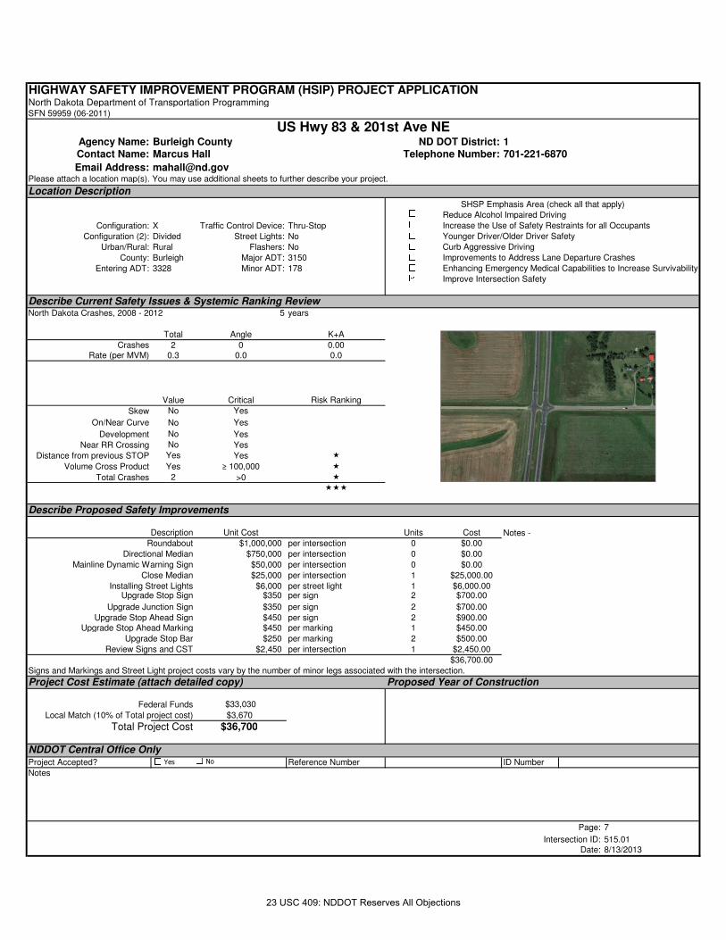
Configuration: X Traffic Control Device: Thru-Stop
Configuration (2): Divided Street Lights: No
Urban/Rural: Rural Flashers: No
County: Burleigh Major ADT: 3150
Entering ADT: 3328 Minor ADT: 178
Describe Current Safety Issues & Systemic Ranking ReviewNorth Dakota Crashes, 2008 - 2012 5 years
Total Angle K+A
Crashes 2 0 0.00Rate (per MVM) 0.3 0.0 0.0
Value Critical Risk Ranking
Skew No Yes
On/Near Curve No Yes
Development No Yes
Near RR Crossing No Yes
Distance from previous STOP Yes Yes �
Volume Cross Product Yes ≥ 100,000 �
Total Crashes 2 >0 �
���
Describe Proposed Safety Improvements
Description Unit Cost Units Cost
Roundabout $1,000,000 per intersection 0 $0.00
Directional Median $750,000 per intersection 0 $0.00
Mainline Dynamic Warning Sign $50,000 per intersection 0 $0.00
Close Median $25,000 per intersection 1 $25,000.00
Installing Street Lights $6,000 per street light 1 $6,000.00Upgrade Stop Sign $350 per sign 2 $700.00
Upgrade Junction Sign $350 per sign 2 $700.00
Upgrade Stop Ahead Sign $450 per sign 2 $900.00Upgrade Stop Ahead Marking $450 per marking 1 $450.00
Upgrade Stop Bar $250 per marking 2 $500.00
Review Signs and CST $2,450 per intersection 1 $2,450.00
$36,700.00
Signs and Markings and Street Light project costs vary by the number of minor legs associated with the intersection.
Project Cost Estimate (attach detailed copy) Proposed Year of Construction
Federal Funds $33,030
Local Match (10% of Total project cost) $3,670
Total Project Cost $36,700
NDDOT Central Office OnlyProject Accepted? Reference Number ID Number
Notes
Page: 7
Intersection ID: 515.01Date: 8/13/2013
Improvements to Address Lane Departure Crashes
Enhancing Emergency Medical Capabilities to Increase Survivability
Improve Intersection Safety
Notes -
SHSP Emphasis Area (check all that apply)Reduce Alcohol Impaired Driving
Increase the Use of Safety Restraints for all Occupants
Younger Driver/Older Driver Safety
Curb Aggressive Driving
US Hwy 83 & 201st Ave NE
Yes No
23 USC 409: NDDOT Reserves All Objections
HIGHWAY SAFETY IMPROVEMENT PROGRAM (HSIP) PROJECT APPLICATIONNorth Dakota Department of Transportation ProgrammingSFN 59959 (06-2011)
Agency Name: Burleigh County ND DOT District: 1Contact Name: Marcus Hall Telephone Number: 701-221-6870
Email Address: [email protected] attach a location map(s). You may use additional sheets to further describe your project.
Location Description
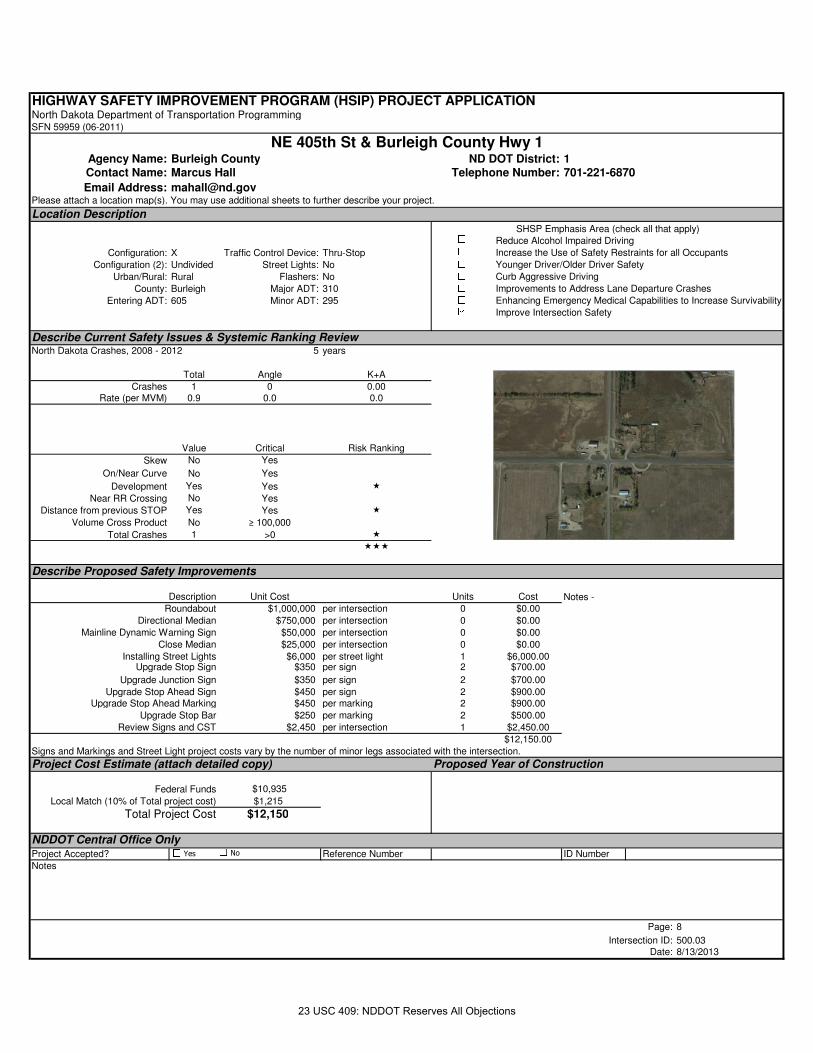
Configuration: X Traffic Control Device: Thru-Stop
Configuration (2): Undivided Street Lights: No
Urban/Rural: Rural Flashers: No
County: Burleigh Major ADT: 310
Entering ADT: 605 Minor ADT: 295
Describe Current Safety Issues & Systemic Ranking ReviewNorth Dakota Crashes, 2008 - 2012 5 years
Total Angle K+A
Crashes 1 0 0.00Rate (per MVM) 0.9 0.0 0.0
Value Critical Risk Ranking
Skew No Yes
On/Near Curve No Yes
Development Yes Yes �
Near RR Crossing No Yes
Distance from previous STOP Yes Yes �
Volume Cross Product No ≥ 100,000
Total Crashes 1 >0 �
���
Describe Proposed Safety Improvements
Description Unit Cost Units Cost
Roundabout $1,000,000 per intersection 0 $0.00
Directional Median $750,000 per intersection 0 $0.00
Mainline Dynamic Warning Sign $50,000 per intersection 0 $0.00
Close Median $25,000 per intersection 0 $0.00
Installing Street Lights $6,000 per street light 1 $6,000.00Upgrade Stop Sign $350 per sign 2 $700.00
Upgrade Junction Sign $350 per sign 2 $700.00
Upgrade Stop Ahead Sign $450 per sign 2 $900.00Upgrade Stop Ahead Marking $450 per marking 2 $900.00
Upgrade Stop Bar $250 per marking 2 $500.00
Review Signs and CST $2,450 per intersection 1 $2,450.00
$12,150.00
Signs and Markings and Street Light project costs vary by the number of minor legs associated with the intersection.
Project Cost Estimate (attach detailed copy) Proposed Year of Construction
Federal Funds $10,935
Local Match (10% of Total project cost) $1,215
Total Project Cost $12,150
NDDOT Central Office OnlyProject Accepted? Reference Number ID Number
Notes
Page: 8
Intersection ID: 500.03Date: 8/13/2013
Improvements to Address Lane Departure Crashes
Enhancing Emergency Medical Capabilities to Increase Survivability
Improve Intersection Safety
Notes -
SHSP Emphasis Area (check all that apply)Reduce Alcohol Impaired Driving
Increase the Use of Safety Restraints for all Occupants
Younger Driver/Older Driver Safety
Curb Aggressive Driving
NE 405th St & Burleigh County Hwy 1
Yes No
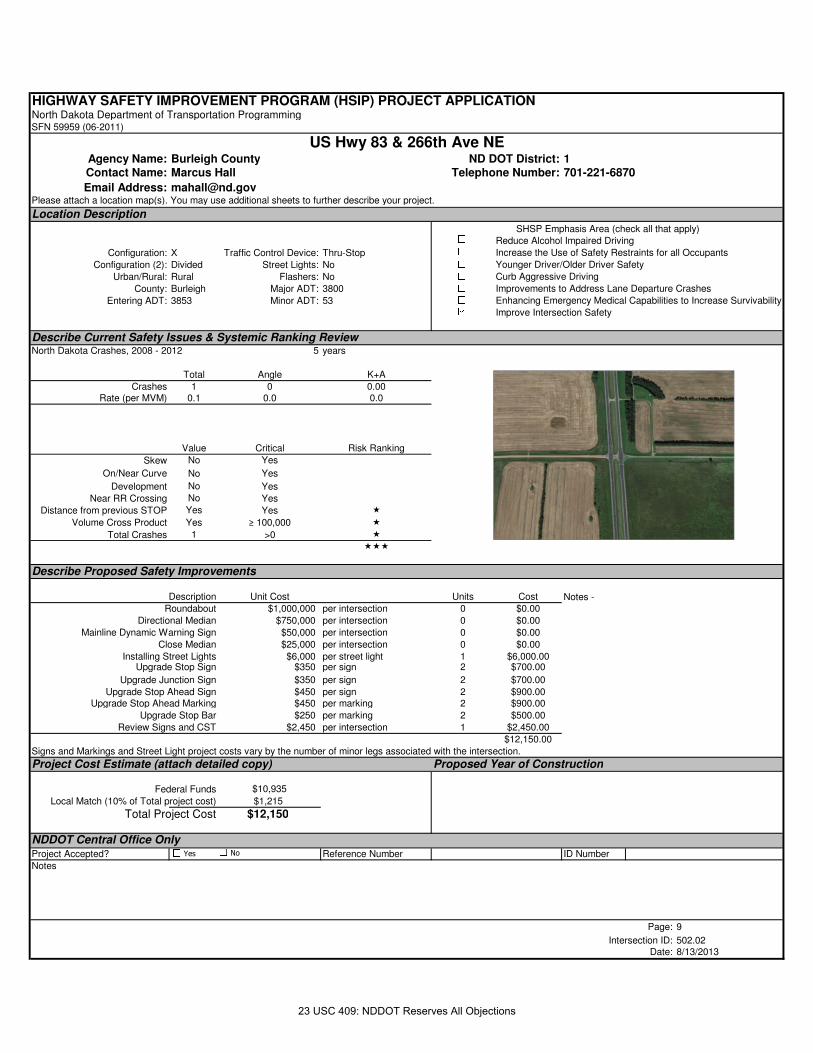
23 USC 409: NDDOT Reserves All Objections
HIGHWAY SAFETY IMPROVEMENT PROGRAM (HSIP) PROJECT APPLICATIONNorth Dakota Department of Transportation ProgrammingSFN 59959 (06-2011)
Agency Name: Burleigh County ND DOT District: 1Contact Name: Marcus Hall Telephone Number: 701-221-6870
Email Address: [email protected] attach a location map(s). You may use additional sheets to further describe your project.
Location Description
Configuration: X Traffic Control Device: Thru-Stop
Configuration (2): Divided Street Lights: No
Urban/Rural: Rural Flashers: No
County: Burleigh Major ADT: 3800
Entering ADT: 3853 Minor ADT: 53
Describe Current Safety Issues & Systemic Ranking ReviewNorth Dakota Crashes, 2008 - 2012 5 years
Total Angle K+A
Crashes 1 0 0.00Rate (per MVM) 0.1 0.0 0.0
Value Critical Risk Ranking
Skew No Yes
On/Near Curve No Yes
Development No Yes
Near RR Crossing No Yes
Distance from previous STOP Yes Yes �
Volume Cross Product Yes ≥ 100,000 �
Total Crashes 1 >0 �
���
Describe Proposed Safety Improvements
Description Unit Cost Units Cost
Roundabout $1,000,000 per intersection 0 $0.00
Directional Median $750,000 per intersection 0 $0.00
Mainline Dynamic Warning Sign $50,000 per intersection 0 $0.00
Close Median $25,000 per intersection 0 $0.00
Installing Street Lights $6,000 per street light 1 $6,000.00Upgrade Stop Sign $350 per sign 2 $700.00
Upgrade Junction Sign $350 per sign 2 $700.00
Upgrade Stop Ahead Sign $450 per sign 2 $900.00Upgrade Stop Ahead Marking $450 per marking 2 $900.00
Upgrade Stop Bar $250 per marking 2 $500.00
Review Signs and CST $2,450 per intersection 1 $2,450.00
$12,150.00
Signs and Markings and Street Light project costs vary by the number of minor legs associated with the intersection.
Project Cost Estimate (attach detailed copy) Proposed Year of Construction
Federal Funds $10,935
Local Match (10% of Total project cost) $1,215
Total Project Cost $12,150
NDDOT Central Office OnlyProject Accepted? Reference Number ID Number
Notes
Page: 9
Intersection ID: 502.02Date: 8/13/2013
Improvements to Address Lane Departure Crashes
Enhancing Emergency Medical Capabilities to Increase Survivability
Improve Intersection Safety
Notes -
SHSP Emphasis Area (check all that apply)Reduce Alcohol Impaired Driving
Increase the Use of Safety Restraints for all Occupants
Younger Driver/Older Driver Safety
Curb Aggressive Driving
US Hwy 83 & 266th Ave NE
Yes No
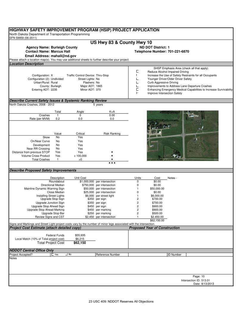
23 USC 409: NDDOT Reserves All Objections
HIGHWAY SAFETY IMPROVEMENT PROGRAM (HSIP) PROJECT APPLICATIONNorth Dakota Department of Transportation ProgrammingSFN 59959 (06-2011)
Agency Name: Burleigh County ND DOT District: 1Contact Name: Marcus Hall Telephone Number: 701-221-6870
Email Address: [email protected] attach a location map(s). You may use additional sheets to further describe your project.
Location Description
Configuration: X Traffic Control Device: Thru-Stop
Configuration (2): Undivided Street Lights: No
Urban/Rural: Rural Flashers: No
County: Burleigh Major ADT: 1865
Entering ADT: 2235 Minor ADT: 370
Describe Current Safety Issues & Systemic Ranking ReviewNorth Dakota Crashes, 2008 - 2012 5 years
Total Angle K+A
Crashes 1 0 0.00Rate (per MVM) 0.2 0.0 0.0
Value Critical Risk Ranking
Skew No Yes
On/Near Curve No Yes
Development No Yes
Near RR Crossing No Yes
Distance from previous STOP Yes Yes �
Volume Cross Product Yes ≥ 100,000 �
Total Crashes 1 >0 �
���
Describe Proposed Safety Improvements
Description Unit Cost Units Cost
Roundabout $1,000,000 per intersection 0 $0.00
Directional Median $750,000 per intersection 0 $0.00
Mainline Dynamic Warning Sign $50,000 per intersection 1 $50,000.00
Close Median $25,000 per intersection 0 $0.00
Installing Street Lights $6,000 per street light 1 $6,000.00Upgrade Stop Sign $350 per sign 2 $700.00
Upgrade Junction Sign $350 per sign 2 $700.00
Upgrade Stop Ahead Sign $450 per sign 2 $900.00Upgrade Stop Ahead Marking $450 per marking 2 $900.00
Upgrade Stop Bar $250 per marking 2 $500.00
Review Signs and CST $2,450 per intersection 1 $2,450.00
$62,150.00
Signs and Markings and Street Light project costs vary by the number of minor legs associated with the intersection.
Project Cost Estimate (attach detailed copy) Proposed Year of Construction
Federal Funds $55,935
Local Match (10% of Total project cost) $6,215
Total Project Cost $62,150
NDDOT Central Office OnlyProject Accepted? Reference Number ID Number
Notes
Page: 10
Intersection ID: 513.01Date: 8/13/2013
Improvements to Address Lane Departure Crashes
Enhancing Emergency Medical Capabilities to Increase Survivability
Improve Intersection Safety
Notes -
SHSP Emphasis Area (check all that apply)Reduce Alcohol Impaired Driving
Increase the Use of Safety Restraints for all Occupants
Younger Driver/Older Driver Safety
Curb Aggressive Driving
US Hwy 83 & County Hwy 10
Yes No
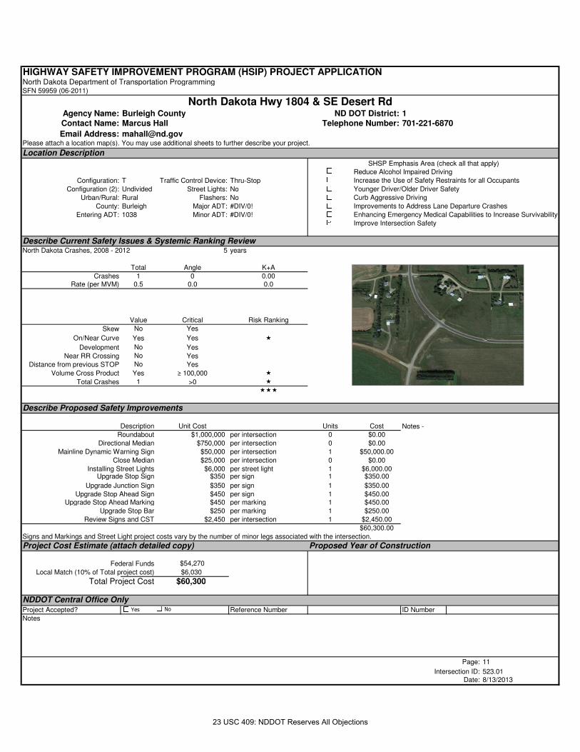
23 USC 409: NDDOT Reserves All Objections
HIGHWAY SAFETY IMPROVEMENT PROGRAM (HSIP) PROJECT APPLICATIONNorth Dakota Department of Transportation ProgrammingSFN 59959 (06-2011)
Agency Name: Burleigh County ND DOT District: 1Contact Name: Marcus Hall Telephone Number: 701-221-6870
Email Address: [email protected] attach a location map(s). You may use additional sheets to further describe your project.
Location Description
Configuration: T Traffic Control Device: Thru-Stop
Configuration (2): Undivided Street Lights: No
Urban/Rural: Rural Flashers: No
County: Burleigh Major ADT: #DIV/0!
Entering ADT: 1038 Minor ADT: #DIV/0!
Describe Current Safety Issues & Systemic Ranking ReviewNorth Dakota Crashes, 2008 - 2012 5 years
Total Angle K+A
Crashes 1 0 0.00Rate (per MVM) 0.5 0.0 0.0
Value Critical Risk Ranking
Skew No Yes
On/Near Curve Yes Yes �
Development No Yes
Near RR Crossing No Yes
Distance from previous STOP No Yes
Volume Cross Product Yes ≥ 100,000 �
Total Crashes 1 >0 �
���
Describe Proposed Safety Improvements
Description Unit Cost Units Cost
Roundabout $1,000,000 per intersection 0 $0.00
Directional Median $750,000 per intersection 0 $0.00
Mainline Dynamic Warning Sign $50,000 per intersection 1 $50,000.00
Close Median $25,000 per intersection 0 $0.00
Installing Street Lights $6,000 per street light 1 $6,000.00Upgrade Stop Sign $350 per sign 1 $350.00
Upgrade Junction Sign $350 per sign 1 $350.00
Upgrade Stop Ahead Sign $450 per sign 1 $450.00Upgrade Stop Ahead Marking $450 per marking 1 $450.00
Upgrade Stop Bar $250 per marking 1 $250.00
Review Signs and CST $2,450 per intersection 1 $2,450.00
$60,300.00
Signs and Markings and Street Light project costs vary by the number of minor legs associated with the intersection.
Project Cost Estimate (attach detailed copy) Proposed Year of Construction
Federal Funds $54,270
Local Match (10% of Total project cost) $6,030
Total Project Cost $60,300
NDDOT Central Office OnlyProject Accepted? Reference Number ID Number
Notes
Page: 11
Intersection ID: 523.01Date: 8/13/2013
Improvements to Address Lane Departure Crashes
Enhancing Emergency Medical Capabilities to Increase Survivability
Improve Intersection Safety
Notes -
SHSP Emphasis Area (check all that apply)Reduce Alcohol Impaired Driving
Increase the Use of Safety Restraints for all Occupants
Younger Driver/Older Driver Safety
Curb Aggressive Driving
North Dakota Hwy 1804 & SE Desert Rd
Yes No
23 USC 409: NDDOT Reserves All Objections
HIGHWAY SAFETY IMPROVEMENT PROGRAM (HSIP) PROJECT APPLICATIONNorth Dakota Department of Transportation ProgrammingSFN 59959 (06-2011)
Agency Name: Burleigh County ND DOT District: 1Contact Name: Marcus Hall Telephone Number: 701-221-6870
Email Address: [email protected] attach a location map(s). You may use additional sheets to further describe your project.
Location Description
Configuration: T Traffic Control Device: Thru-Stop
Configuration (2): Undivided Street Lights: No
Urban/Rural: Rural Flashers: No
County: Burleigh Major ADT: 180
Entering ADT: 633 Minor ADT: 180
Describe Current Safety Issues & Systemic Ranking ReviewNorth Dakota Crashes, 2008 - 2012 5 years
Total Angle K+A
Crashes 1 0 0.00Rate (per MVM) 0.9 0.0 0.0
Value Critical Risk Ranking
Skew No Yes
On/Near Curve Yes Yes �
Development No Yes
Near RR Crossing No Yes
Distance from previous STOP Yes Yes �
Volume Cross Product No ≥ 100,000
Total Crashes 1 >0 �
���
Describe Proposed Safety Improvements
Description Unit Cost Units Cost
Roundabout $1,000,000 per intersection 0 $0.00
Directional Median $750,000 per intersection 0 $0.00
Mainline Dynamic Warning Sign $50,000 per intersection 0 $0.00
Close Median $25,000 per intersection 0 $0.00
Installing Street Lights $6,000 per street light 1 $6,000.00Upgrade Stop Sign $350 per sign 1 $350.00
Upgrade Junction Sign $350 per sign 1 $350.00
Upgrade Stop Ahead Sign $450 per sign 1 $450.00Upgrade Stop Ahead Marking $450 per marking 1 $450.00
Upgrade Stop Bar $250 per marking 1 $250.00
Review Signs and CST $2,450 per intersection 1 $2,450.00
$10,300.00
Signs and Markings and Street Light project costs vary by the number of minor legs associated with the intersection.
Project Cost Estimate (attach detailed copy) Proposed Year of Construction
Federal Funds $9,270
Local Match (10% of Total project cost) $1,030
Total Project Cost $10,300
NDDOT Central Office OnlyProject Accepted? Reference Number ID Number
Notes
Page: 12
Intersection ID: 532.04Date: 8/13/2013
Improvements to Address Lane Departure Crashes
Enhancing Emergency Medical Capabilities to Increase Survivability
Improve Intersection Safety
Notes -
SHSP Emphasis Area (check all that apply)Reduce Alcohol Impaired Driving
Increase the Use of Safety Restraints for all Occupants
Younger Driver/Older Driver Safety
Curb Aggressive Driving
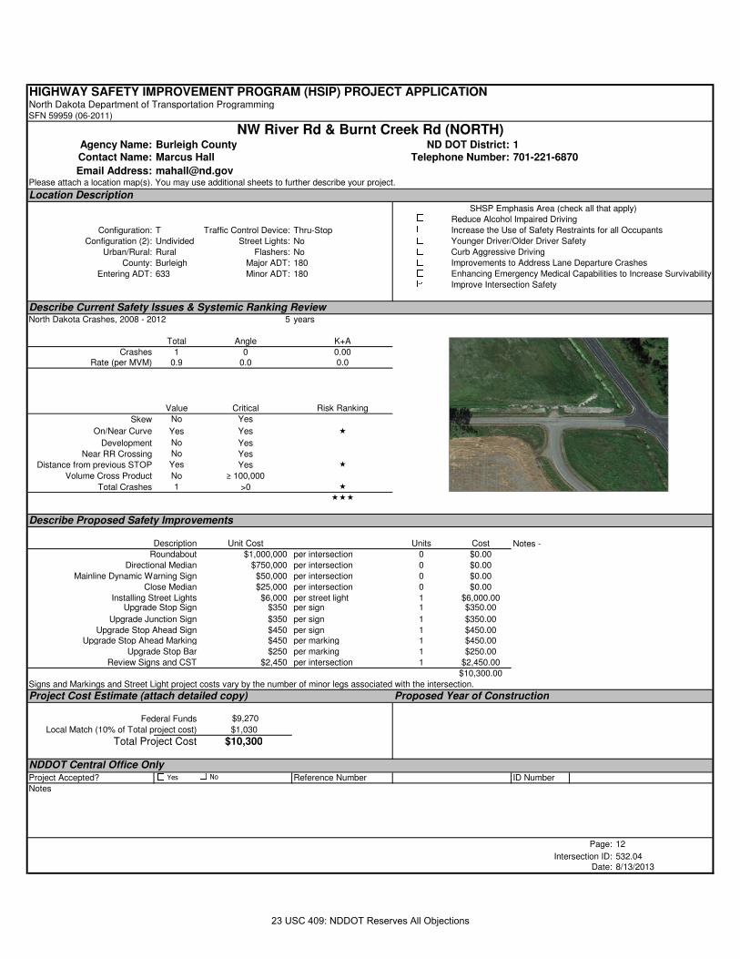
NW River Rd & Burnt Creek Rd (NORTH)
Yes No
23 USC 409: NDDOT Reserves All Objections
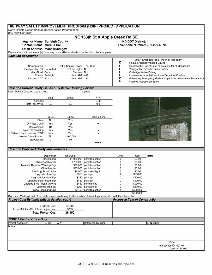
HIGHWAY SAFETY IMPROVEMENT PROGRAM (HSIP) PROJECT APPLICATIONNorth Dakota Department of Transportation ProgrammingSFN 59959 (06-2011)
Agency Name: Burleigh County ND DOT District: 1Contact Name: Marcus Hall Telephone Number: 701-221-6870
Email Address: [email protected] attach a location map(s). You may use additional sheets to further describe your project.
Location Description
Configuration: X Traffic Control Device: Thru-Stop
Configuration (2): Undivided Street Lights: No
Urban/Rural: Rural Flashers: No
County: Burleigh Major ADT: 468
Entering ADT: 603 Minor ADT: 135
Describe Current Safety Issues & Systemic Ranking ReviewNorth Dakota Crashes, 2008 - 2012 5 years
Total Angle K+A
Crashes 0 0 0.00Rate (per MVM) 0.0 0.0 0.0
Value Critical Risk Ranking
Skew No Yes
On/Near Curve Yes Yes �
Development No Yes
Near RR Crossing Yes Yes �
Distance from previous STOP Yes Yes �
Volume Cross Product No ≥ 100,000
Total Crashes 0 >0���
Describe Proposed Safety Improvements
Description Unit Cost Units Cost
Roundabout $1,000,000 per intersection 0 $0.00
Directional Median $750,000 per intersection 0 $0.00
Mainline Dynamic Warning Sign $50,000 per intersection 0 $0.00
Close Median $25,000 per intersection 0 $0.00
Installing Street Lights $6,000 per street light 0 $0.00Upgrade Stop Sign $350 per sign 2 $700.00
Upgrade Junction Sign $350 per sign 2 $700.00
Upgrade Stop Ahead Sign $450 per sign 2 $900.00Upgrade Stop Ahead Marking $450 per marking 2 $900.00
Upgrade Stop Bar $250 per marking 2 $500.00
Review Signs and CST $2,450 per intersection 1 $2,450.00
$6,150.00
Signs and Markings and Street Light project costs vary by the number of minor legs associated with the intersection.
Project Cost Estimate (attach detailed copy) Proposed Year of Construction
Federal Funds $5,535
Local Match (10% of Total project cost) $615
Total Project Cost $6,150
NDDOT Central Office OnlyProject Accepted? Reference Number ID Number
Notes
Page: 13
Intersection ID: 507.01Date: 8/13/2013
Improvements to Address Lane Departure Crashes
Enhancing Emergency Medical Capabilities to Increase Survivability
Improve Intersection Safety
Notes - .
SHSP Emphasis Area (check all that apply)Reduce Alcohol Impaired Driving
Increase the Use of Safety Restraints for all Occupants
Younger Driver/Older Driver Safety
Curb Aggressive Driving
NE 158th St & Apple Creek Rd SE
Yes No
23 USC 409: NDDOT Reserves All Objections
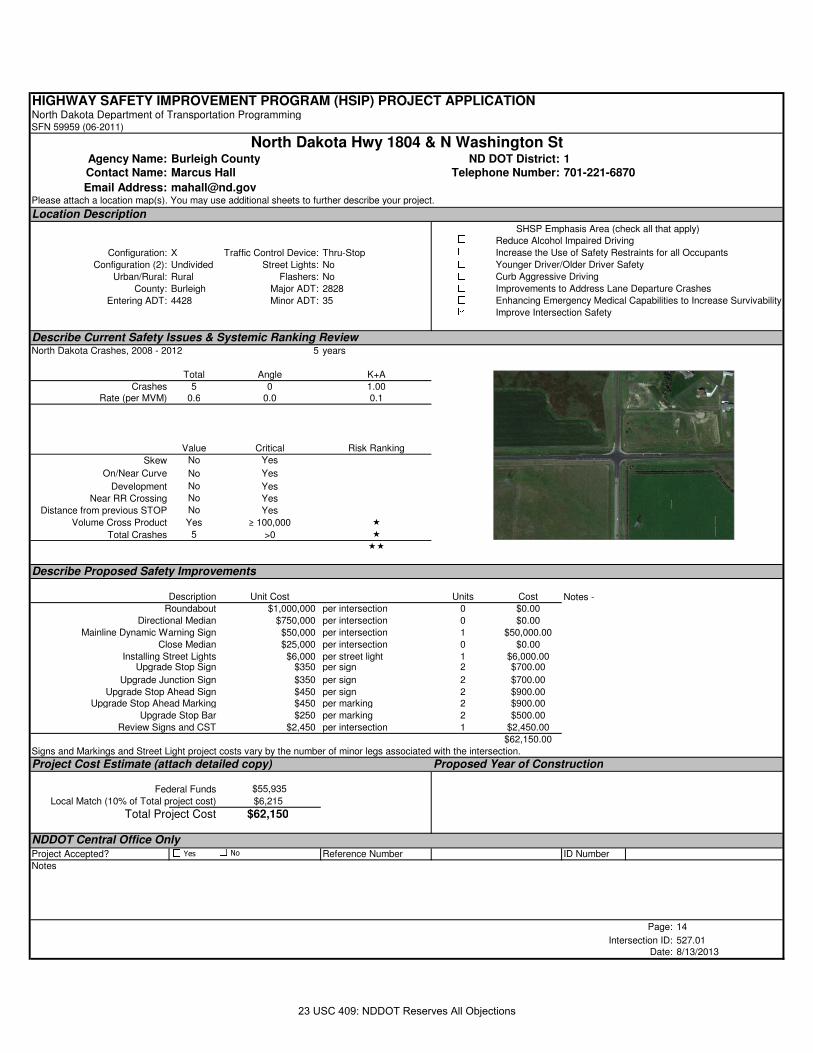
HIGHWAY SAFETY IMPROVEMENT PROGRAM (HSIP) PROJECT APPLICATIONNorth Dakota Department of Transportation ProgrammingSFN 59959 (06-2011)
Agency Name: Burleigh County ND DOT District: 1Contact Name: Marcus Hall Telephone Number: 701-221-6870
Email Address: [email protected] attach a location map(s). You may use additional sheets to further describe your project.
Location Description
Configuration: X Traffic Control Device: Thru-Stop
Configuration (2): Undivided Street Lights: No
Urban/Rural: Rural Flashers: No
County: Burleigh Major ADT: 2828
Entering ADT: 4428 Minor ADT: 35
Describe Current Safety Issues & Systemic Ranking ReviewNorth Dakota Crashes, 2008 - 2012 5 years
Total Angle K+A
Crashes 5 0 1.00Rate (per MVM) 0.6 0.0 0.1
Value Critical Risk Ranking
Skew No Yes
On/Near Curve No Yes
Development No Yes
Near RR Crossing No Yes
Distance from previous STOP No Yes
Volume Cross Product Yes ≥ 100,000 �
Total Crashes 5 >0 �
��
Describe Proposed Safety Improvements
Description Unit Cost Units Cost
Roundabout $1,000,000 per intersection 0 $0.00
Directional Median $750,000 per intersection 0 $0.00
Mainline Dynamic Warning Sign $50,000 per intersection 1 $50,000.00
Close Median $25,000 per intersection 0 $0.00
Installing Street Lights $6,000 per street light 1 $6,000.00Upgrade Stop Sign $350 per sign 2 $700.00
Upgrade Junction Sign $350 per sign 2 $700.00
Upgrade Stop Ahead Sign $450 per sign 2 $900.00Upgrade Stop Ahead Marking $450 per marking 2 $900.00
Upgrade Stop Bar $250 per marking 2 $500.00
Review Signs and CST $2,450 per intersection 1 $2,450.00
$62,150.00
Signs and Markings and Street Light project costs vary by the number of minor legs associated with the intersection.
Project Cost Estimate (attach detailed copy) Proposed Year of Construction
Federal Funds $55,935
Local Match (10% of Total project cost) $6,215
Total Project Cost $62,150
NDDOT Central Office OnlyProject Accepted? Reference Number ID Number
Notes
Page: 14
Intersection ID: 527.01Date: 8/13/2013
Improvements to Address Lane Departure Crashes
Enhancing Emergency Medical Capabilities to Increase Survivability
Improve Intersection Safety
Notes -
SHSP Emphasis Area (check all that apply)Reduce Alcohol Impaired Driving
Increase the Use of Safety Restraints for all Occupants
Younger Driver/Older Driver Safety
Curb Aggressive Driving
North Dakota Hwy 1804 & N Washington St
Yes No
23 USC 409: NDDOT Reserves All Objections
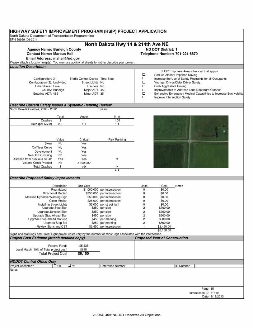
HIGHWAY SAFETY IMPROVEMENT PROGRAM (HSIP) PROJECT APPLICATIONNorth Dakota Department of Transportation ProgrammingSFN 59959 (06-2011)
Agency Name: Burleigh County ND DOT District: 1Contact Name: Marcus Hall Telephone Number: 701-221-6870
Email Address: [email protected] attach a location map(s). You may use additional sheets to further describe your project.
Location Description
Configuration: X Traffic Control Device: Thru-Stop
Configuration (2): Undivided Street Lights: No
Urban/Rural: Rural Flashers: No
County: Burleigh Major ADT: 450
Entering ADT: 485 Minor ADT: 35
Describe Current Safety Issues & Systemic Ranking ReviewNorth Dakota Crashes, 2008 - 2012 5 years
Total Angle K+A
Crashes 2 1 1.00Rate (per MVM) 2.3 1.1 1.1
Value Critical Risk Ranking
Skew No Yes
On/Near Curve No Yes
Development No Yes
Near RR Crossing No Yes
Distance from previous STOP Yes Yes �
Volume Cross Product No ≥ 100,000
Total Crashes 2 >0 �
��
Describe Proposed Safety Improvements
Description Unit Cost Units Cost
Roundabout $1,000,000 per intersection 0 $0.00
Directional Median $750,000 per intersection 0 $0.00
Mainline Dynamic Warning Sign $50,000 per intersection 0 $0.00
Close Median $25,000 per intersection 0 $0.00
Installing Street Lights $6,000 per street light 0 $0.00Upgrade Stop Sign $350 per sign 2 $700.00
Upgrade Junction Sign $350 per sign 2 $700.00
Upgrade Stop Ahead Sign $450 per sign 2 $900.00Upgrade Stop Ahead Marking $450 per marking 2 $900.00
Upgrade Stop Bar $250 per marking 2 $500.00
Review Signs and CST $2,450 per intersection 1 $2,450.00
$6,150.00
Signs and Markings and Street Light project costs vary by the number of minor legs associated with the intersection.
Project Cost Estimate (attach detailed copy) Proposed Year of Construction
Federal Funds $5,535
Local Match (10% of Total project cost) $615
Total Project Cost $6,150
NDDOT Central Office OnlyProject Accepted? Reference Number ID Number
Notes
Page: 15
Intersection ID: 518.01Date: 8/13/2013
Improvements to Address Lane Departure Crashes
Enhancing Emergency Medical Capabilities to Increase Survivability
Improve Intersection Safety
Notes -
SHSP Emphasis Area (check all that apply)Reduce Alcohol Impaired Driving
Increase the Use of Safety Restraints for all Occupants
Younger Driver/Older Driver Safety
Curb Aggressive Driving
North Dakota Hwy 14 & 214th Ave NE
Yes No
23 USC 409: NDDOT Reserves All Objections
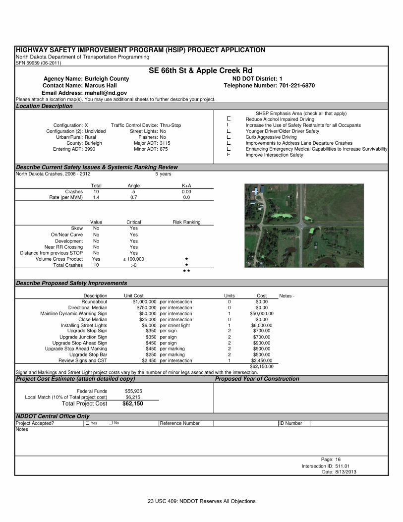
HIGHWAY SAFETY IMPROVEMENT PROGRAM (HSIP) PROJECT APPLICATIONNorth Dakota Department of Transportation ProgrammingSFN 59959 (06-2011)
Agency Name: Burleigh County ND DOT District: 1Contact Name: Marcus Hall Telephone Number: 701-221-6870
Email Address: [email protected] attach a location map(s). You may use additional sheets to further describe your project.
Location Description
Configuration: X Traffic Control Device: Thru-Stop
Configuration (2): Undivided Street Lights: No
Urban/Rural: Rural Flashers: No
County: Burleigh Major ADT: 3115
Entering ADT: 3990 Minor ADT: 875
Describe Current Safety Issues & Systemic Ranking ReviewNorth Dakota Crashes, 2008 - 2012 5 years
Total Angle K+A
Crashes 10 5 0.00Rate (per MVM) 1.4 0.7 0.0
Value Critical Risk Ranking
Skew No Yes
On/Near Curve No Yes
Development No Yes
Near RR Crossing No Yes
Distance from previous STOP No Yes
Volume Cross Product Yes ≥ 100,000 �
Total Crashes 10 >0 �
��
Describe Proposed Safety Improvements
Description Unit Cost Units Cost
Roundabout $1,000,000 per intersection 0 $0.00
Directional Median $750,000 per intersection 0 $0.00
Mainline Dynamic Warning Sign $50,000 per intersection 1 $50,000.00
Close Median $25,000 per intersection 0 $0.00
Installing Street Lights $6,000 per street light 1 $6,000.00Upgrade Stop Sign $350 per sign 2 $700.00
Upgrade Junction Sign $350 per sign 2 $700.00
Upgrade Stop Ahead Sign $450 per sign 2 $900.00Upgrade Stop Ahead Marking $450 per marking 2 $900.00
Upgrade Stop Bar $250 per marking 2 $500.00
Review Signs and CST $2,450 per intersection 1 $2,450.00
$62,150.00
Signs and Markings and Street Light project costs vary by the number of minor legs associated with the intersection.
Project Cost Estimate (attach detailed copy) Proposed Year of Construction
Federal Funds $55,935
Local Match (10% of Total project cost) $6,215
Total Project Cost $62,150
NDDOT Central Office OnlyProject Accepted? Reference Number ID Number
Notes
Page: 16
Intersection ID: 511.01Date: 8/13/2013
Improvements to Address Lane Departure Crashes
Enhancing Emergency Medical Capabilities to Increase Survivability
Improve Intersection Safety
Notes -
SHSP Emphasis Area (check all that apply)Reduce Alcohol Impaired Driving
Increase the Use of Safety Restraints for all Occupants
Younger Driver/Older Driver Safety
Curb Aggressive Driving
SE 66th St & Apple Creek Rd
Yes No
23 USC 409: NDDOT Reserves All Objections
Burleigh County Rural Segment Projects
528.01 12th St Oahe Bend 1/4 mile north of Burleigh Ave 2.2 0.0 0.0 2.2 2.2 $14,300530.01 Sibley Dr 12th St Hester Dr 2.0 0.0 2.0 0.0 0.0 $6,000527.01 Washington St Mile south of 48th Ave Burleigh Ave 1.8 0.0 0.0 1.8 0.0 $6,300530.02 Sibley Dr Hester Dr 48th Ave 1.7 0.0 0.0 1.7 0.0 $5,950532.01 River Rd 1/4 mile north of Burnt Boat Dr Burnt Creek Loop 3.9 0.0 3.9 0.0 3.9 $23,400535.01 Burnt Creek Loop River Rd State Route 1804 3.4 0.0 0.0 3.4 0.0 $11,900525.01 41st St US Hwy 83 26th St 2.0 0.0 2.0 0.0 2.0 $12,000510.01 71st St US Hwy 83 106th St 7.1 0.0 0.0 7.1 7.1 $46,150526.01 48th Ave England St State Route 1804 3.0 0.0 0.0 3.0 0.0 $10,500529.01 Oahe Bend 12th St Apple Creek Dr 0.8 0.0 0.0 0.8 0.0 $2,800534.01 Sandy River Rd West of Wildwood St River Rd 0.9 0.0 0.0 0.9 0.0 $3,150533.01 Wilderness Cove 1/4 mile west of River Rd River Rd 0.3 0.0 0.0 0.3 0.0 $1,050522.01 52nd St Woodrow Dr Lincoln Rd 2.6 2.6 0.0 0.0 0.0 $1,040500.02 405th St 30th Ave Interstate 94 1.9 0.0 0.0 1.9 0.0 $6,650535.02 Burnt Creek Loop State Route 1804 State Route 1804 1.6 0.0 0.0 1.6 0.0 $5,600512.02 66th St Lincoln Rd County Hwy 10 3.0 0.0 3.0 0.0 3.0 $18,000511.01 Apple Creek Rd Yegan Rd 158th St 9.4 0.0 0.0 9.4 0.0 $32,900
2.6 10.9 34.1 18.2 $207,690
Edge Line Rumble
StripCorridor ID Start End LengthRisk
Ranking4" Edge
Line
Shoulder Rumble
StripLocal Street NameCenter Line
RumbleProject Cost
($)
9/27/201323 USC 409: NDDOT Reserves All Objections
Detailed Corridor Information
Burleigh County Corridors ≥ 45 MPH OR ≤ 40 MPH
Corridor Local Name Start End Road Type Speed Limit Length Edge Risk Assesment ERA 2 Lane
Width
Paved Shoulder
Width
Gravel Shoulder
Width
Curb & Gutter? Shoulder Type Total Access/
MileWeighted
ADT
500.01 392nd St Intersection with 48th Ave Intersection with 30th Ave Rural CMC Gravel 6.78 no photo None 36 5.3 130500.02 405th St Intersection with 30th Ave Intersection with Interstate 94 Rural Paved Low 1.90 2 Reasonable clearzone, no useable shoulder 12 0 0 No None 41 21.5 375500.03 405th St Intersection with Interstate 94 Intersection with 110th Ave Rural Paved High 4.12 2 Reasonable clearzone, no useable shoulder 12 0 0 No None 28 6.8 145500.04 392nd St Intersection with 110th Ave Intersection with 240th Ave Rural CMC Gravel 11.08 no photo None 38 3.4 140500.05 392nd St Intersection with 240th Ave Intersection with state route 36 Rural Paved High 5.70 1 12 4 0 No Paved 30 5.3 155500.06 392nd St Intersection with state route 36 About a mile north of state route 36 Rural Paved High 1.00 1 12 2 0 No Paved 8 8.0 190500.07 392nd St About a mile north of state route 36 Intersection with 20th Ave Rural CMC Gravel 13.62 no photo None 48 3.5 133501.01 435th Ave Intersection with state route 9 Intersection with 145th St Rural CMC Gravel 7.96 no photo None 49 6.2 40502.01 266th Ave Intersection with state route 1804 Intersection with US Hwy 83 Rural CMC Gravel 5.15 no photo None 29 5.6 190502.02 266th Ave Intersection with US Hwy 83 Intersection with 26th St Rural Paved High 2.01 2 Reasonable clearzone, no useable shoulder 12 0 0 No None 15 7.5 160502.03 266th Ave Intersection with 26th St Intersection with 197th St Rural CMC Gravel 12.98 no photo None 73 5.6 125503.01 Moffit Rd Intersection with 185th St Intersection with US Hwy 83 Rural Paved High 12.55 1 12 6 0 No Paved 61 4.9 140504.01 102nd Ave Intersection with US Hwy 83 Border of Burleigh about a mile east of 353rd St Rural CMC Gravel 10.88 no photo None 36 3.3 170505.01 Lincoln Rd Intersection with 6th St Intersection with 93rd St Rural Paved 1.99 no photo None 23 11.5 413505.02 Lincoln Rd Intersection with 93rd St Intersection with 236th St Rural CMC Gravel 10.83 no photo None 10 0.9 69505.03 34th Ave Intersection with 236th St Intersection with US Hwy 83 Rural CMC Gravel 5.98 no photo None 20 3.3 170505.04 48th Ave Intersection with US Hwy 83 Intersection with 392nd St Rural CMC Gravel 5.92 no photo None 23 3.9 200505.05 34th Ave Intersection with 392nd St Intersection with 18th Ave Rural CMC Gravel 3.98 no photo None 12 3.0 35506.01 236th St Intersection with County Hwy 10 Intersection with Interstate 94 Rural Paved High 0.95 2 Reasonable clearzone, no useable shoulder 12 0 0 No None 15 15.8 270506.02 294th St Intersection with Interstate 94 Intersection with 227th Ave Rural CMC Gravel 16.06 no photo None 80 5.0 140507.01 158th St Intersection with Moffit Rd Intersection with Lincoln Rd Rural Paved High 4.99 2 Reasonable clearzone, no useable shoulder 12 0 0 No None 17 3.4 320507.02 158th St Intersection with Lincoln Rd Intersection with Interstate 94 Rural Paved High 4.87 1 12 2 0 No Paved 43 8.8 461507.03 158th St Intersection with Interstate 94 Intersection with 57th Ave Rural Paved High 1.97 1 12 2 1 No Composite 15 7.6 160508.01 93rd St Intersection with state route 1804 Intersection with Lincoln Rd Rural Paved High 4.93 1 12 2 1 No Composite 34 6.9 205508.02 93rd St Intersection with Lincoln Rd Intersection with Apple Creek Rd Rural Paved High 2.00 1 12 2 0 No Paved 24 12.0 460509.02 106th St Intersection with Interstate 94 Intersection with 123rd Ave Rural CMC Gravel 6.99 no photo None 33 4.7 130509.03 119th St Intersection with 123rd Ave Intersection with 201st Ave Rural CMC Gravel 6.94 no photo None 33 4.8 130510.01 71st St Intersection with US Hwy 83 Intersection with 106th St Rural Paved High 7.06 1 12 2 1 No Composite 80 11.3 1850511.01 Apple Creek Rd Intersection with Yegan Rd Intersection with 158th St Rural Paved High 9.40 1 12 2 0 No Paved 53 5.6 697512.01 66th St Intersection with 48th Ave About a quarter of a mile south of Humbert Dr Rural CMC Gravel 0.50 no photo None 20 40.0 1025512.02 66th St Intersection with Lincoln Rd Intersection with County Hwy 10 Rural Paved High 3.00 1 12 4 1 No Composite 31 10.3 2421512.03 66th St About a mile South of 43rd Ave Intersection with 43rd Ave Rural CMC Gravel 0.85 no photo None 5 5.9 120512.04 66th St About a quarter of a mile south of Rocky Rd About a mile South of 71st Ave Rural CMC Gravel 0.74 no photo None 10 13.6 120513.01 County Hwy 10 Intersection with Lincoln Rd Intersection with 158th St Rural Paved High 7.20 1 12 8 1 No Composite 54 7.5 1611513.02 County Hwy 10 Intersection with 158th St Intersection with 236th St Rural Paved High 6.00 1 12 8 0 No Paved 25 4.2 800513.03 County Hwy 10 Intersection with 236th St Intersection with Interstate 94 Rural Paved High 5.99 1 12 8 0 No Paved 44 7.3 715513.04 County Hwy 10 Intersection with Interstate 94 Intersection with 18th Ave Rural Paved High 10.54 1 12 8 0 No Paved 56 5.3 185514.01 175th Ave Intersection with state route 1804 Intersection with US Hwy 83 Rural CMC Gravel 4.29 no photo None 20 4.7 150515.01 201st Ave Intersection with US Hwy 83 Intersection with 119th St Rural Paved High 9.00 1 12 3 1 No Composite 60 6.7 212515.02 201st Ave Intersection with 119th St Intersection with 197th St Rural CMC Gravel 5.98 no photo None 22 3.7 120516.01 197th St Intersection with 201st Ave Intersection with 266th Ave Rural CMC Gravel 5.01 no photo None 17 3.4 120517.01 184th St Intersection with 266th Ave Intersection with state route 36 Rural CMC Gravel 3.02 no photo None 13 4.3 190518.01 227th Ave Intersection with 197th St Intersection with 249th St Rural CMC Gravel 4.01 no photo None 16 4.0 120518.02 214th Ave Intersection with 249th St Intersection with state route 14 Rural CMC Gravel 4.99 no photo None 23 4.6 120518.03 214th Ave Intersection with state route 14 Intersection with 392nd St Rural CMC Gravel 6.99 no photo None 28 4.0 120519.01 Main St Intersection with state route 36 Intersection with Charles St Rural Paved High 1.08 2 Reasonable clearzone, no useable shoulder 12 0 0 No None 10 9.2 190519.02 145th St Intersection with Charles St Intersection with 435th Ave Rural CMC Gravel 10.27 no photo None 43 4.2 30519.03 145th St Intersection with 435th Ave Intersection with 5th St Rural CMC Gravel 2.87 no photo None 18 6.3 15520.01 461st Ave Intersection with 145th St Intersection with 6th Ave Rural CMC Gravel 7.48 no photo None 32 4.3 140521.01 149th Ave Intersection with 34th St Intersection with US Hwy 83 Rural Paved High 2.46 1 12 3 0 No Paved 24 9.8 155522.01 52nd St Intersection with Woodrow Dr Intersection with Lincoln Rd Rural Paved Low 2.57 3 12 0 0 No None 26 10.1 120523.01 Desert Rd Intersection with 115th Ave Intersection with state route 1804 Rural Paved High 2.06 3 12 0 0 No None 14 6.8 140524.01 26th St Intersection with 71st St Intersection with 123rd Ave Rural Paved High 4.01 1 12 4 1 No Composite 47 11.7 339525.01 41st St Intersection with US Hwy 83 Intersection with 26th St Rural Paved High 1.99 1 12 8 0 No Paved 20 10.1 5283526.01 48th Ave Intersection with England St Intersection with state route 1804 Rural Paved Low 2.99 3 12 0 0 No None 51 17.0 659526.02 48th Ave Intersection with 552nd St Intersection with Pinewood Loop Rural CMC Gravel 0.50 no photo None 11 22.0 120527.01 Washington St About a mile south of 48th Ave Intersection with Burleigh Ave Rural Paved Low 1.75 3 12 0 0 No None 23 13.1 765527.02 Washington St About a half a mile south of 57th Ave Intersection with state route 1804 Rural Paved High 1.36 1 12 4 0 No Paved 13 9.6 2895528.01 12th St Intersection with Oahe Bend A quarter of a mile north of Burleigh Ave Rural Paved Low 2.25 3 12 0 0 No None 29 12.9 1298529.01 Oahe Bend Intersection with 12th St Intersection with Apple Creek Dr Rural Paved Low 0.84 3 12 0 0 No None 11 13.0 450530.01 Sibley Dr Intersection with 12th St Intersection with Hester Dr Rural Paved Low 2.04 2 Useable shoulder, no reasonable clear zone 12 0 2 No Gravel 35 17.1 725530.02 Sibley Dr Intersection with Hester Dr Intersection with 48th Ave Rural Paved Low 1.73 3 12 0 0 No None 22 12.7 663531.01 15th St Intersection with state route 1804 Intersection with Welle Loop Rural Paved High 1.33 1 12 4 0 No Paved 12 9.0 125532.01 River Rd About a quarter mile north of Burnt Boat Dr Intersection with Burnt Creek Loop Rural Paved Low 3.94 2 Useable shoulder, no reasonable clear zone 12 2 0 No Paved 24 6.1 1516533.01 Wilderness Cove About a quarter mile west of River Rd Intersection with River Rd Rural Paved Low 0.34 3 14 0 0 No None 7 20.7 160534.01 Sandy River Rd Just west of Wildwood St Intersection with River Rd Rural Paved Low 0.95 3 12 0 0 No None 19 20.1 350535.01 Burnt Creek Loop Intersection with River Rd Intersection with state route 1804 Rural Paved Low 3.43 2 Reasonable clearzone, no useable shoulder 12 0 0 No None 38 11.1 315535.02 Burnt Creek Loop Intersection with state route 1804 Intersection with state route 1804 Rural Paved High 1.59 2 Reasonable clearzone, no useable shoulder 12 0 0 No None 16 10.0 130536.01 106th St Intersection with54th St Intersection with state route 1804 Rural Paved High 1.75 1 12 2 0 No Paved 8 4.6 150
334.3
Access
Crash Data: 2008-2012 7/26/2013 1 of 3
23 USC 409: NDDOT Reserves All Objections
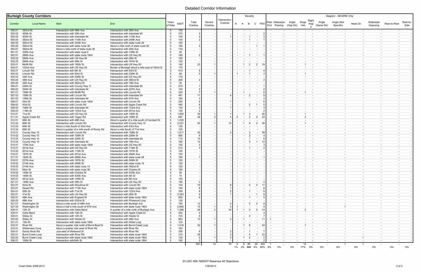
Detailed Corridor Information
Burleigh County Corridors
Corridor Local Name Start End
500.01 392nd St Intersection with 48th Ave Intersection with 30th Ave500.02 405th St Intersection with 30th Ave Intersection with Interstate 94500.03 405th St Intersection with Interstate 94 Intersection with 110th Ave500.04 392nd St Intersection with 110th Ave Intersection with 240th Ave500.05 392nd St Intersection with 240th Ave Intersection with state route 36500.06 392nd St Intersection with state route 36 About a mile north of state route 36500.07 392nd St About a mile north of state route 36 Intersection with 20th Ave501.01 435th Ave Intersection with state route 9 Intersection with 145th St502.01 266th Ave Intersection with state route 1804 Intersection with US Hwy 83502.02 266th Ave Intersection with US Hwy 83 Intersection with 26th St502.03 266th Ave Intersection with 26th St Intersection with 197th St503.01 Moffit Rd Intersection with 185th St Intersection with US Hwy 83504.01 102nd Ave Intersection with US Hwy 83 Border of Burleigh about a mile east of 353rd St505.01 Lincoln Rd Intersection with 6th St Intersection with 93rd St505.02 Lincoln Rd Intersection with 93rd St Intersection with 236th St505.03 34th Ave Intersection with 236th St Intersection with US Hwy 83505.04 48th Ave Intersection with US Hwy 83 Intersection with 392nd St505.05 34th Ave Intersection with 392nd St Intersection with 18th Ave506.01 236th St Intersection with County Hwy 10 Intersection with Interstate 94506.02 294th St Intersection with Interstate 94 Intersection with 227th Ave507.01 158th St Intersection with Moffit Rd Intersection with Lincoln Rd507.02 158th St Intersection with Lincoln Rd Intersection with Interstate 94507.03 158th St Intersection with Interstate 94 Intersection with 57th Ave508.01 93rd St Intersection with state route 1804 Intersection with Lincoln Rd508.02 93rd St Intersection with Lincoln Rd Intersection with Apple Creek Rd509.02 106th St Intersection with Interstate 94 Intersection with 123rd Ave509.03 119th St Intersection with 123rd Ave Intersection with 201st Ave510.01 71st St Intersection with US Hwy 83 Intersection with 106th St511.01 Apple Creek Rd Intersection with Yegan Rd Intersection with 158th St512.01 66th St Intersection with 48th Ave About a quarter of a mile south of Humbert Dr512.02 66th St Intersection with Lincoln Rd Intersection with County Hwy 10512.03 66th St About a mile South of 43rd Ave Intersection with 43rd Ave512.04 66th St About a quarter of a mile south of Rocky Rd About a mile South of 71st Ave513.01 County Hwy 10 Intersection with Lincoln Rd Intersection with 158th St513.02 County Hwy 10 Intersection with 158th St Intersection with 236th St513.03 County Hwy 10 Intersection with 236th St Intersection with Interstate 94513.04 County Hwy 10 Intersection with Interstate 94 Intersection with 18th Ave514.01 175th Ave Intersection with state route 1804 Intersection with US Hwy 83515.01 201st Ave Intersection with US Hwy 83 Intersection with 119th St515.02 201st Ave Intersection with 119th St Intersection with 197th St516.01 197th St Intersection with 201st Ave Intersection with 266th Ave517.01 184th St Intersection with 266th Ave Intersection with state route 36518.01 227th Ave Intersection with 197th St Intersection with 249th St518.02 214th Ave Intersection with 249th St Intersection with state route 14518.03 214th Ave Intersection with state route 14 Intersection with 392nd St519.01 Main St Intersection with state route 36 Intersection with Charles St519.02 145th St Intersection with Charles St Intersection with 435th Ave519.03 145th St Intersection with 435th Ave Intersection with 5th St520.01 461st Ave Intersection with 145th St Intersection with 6th Ave521.01 149th Ave Intersection with 34th St Intersection with US Hwy 83522.01 52nd St Intersection with Woodrow Dr Intersection with Lincoln Rd523.01 Desert Rd Intersection with 115th Ave Intersection with state route 1804524.01 26th St Intersection with 71st St Intersection with 123rd Ave525.01 41st St Intersection with US Hwy 83 Intersection with 26th St526.01 48th Ave Intersection with England St Intersection with state route 1804526.02 48th Ave Intersection with 552nd St Intersection with Pinewood Loop527.01 Washington St About a mile south of 48th Ave Intersection with Burleigh Ave527.02 Washington St About a half a mile south of 57th Ave Intersection with state route 1804528.01 12th St Intersection with Oahe Bend A quarter of a mile north of Burleigh Ave529.01 Oahe Bend Intersection with 12th St Intersection with Apple Creek Dr530.01 Sibley Dr Intersection with 12th St Intersection with Hester Dr530.02 Sibley Dr Intersection with Hester Dr Intersection with 48th Ave531.01 15th St Intersection with state route 1804 Intersection with Welle Loop532.01 River Rd About a quarter mile north of Burnt Boat Dr Intersection with Burnt Creek Loop533.01 Wilderness Cove About a quarter mile west of River Rd Intersection with River Rd534.01 Sandy River Rd Just west of Wildwood St Intersection with River Rd535.01 Burnt Creek Loop Intersection with River Rd Intersection with state route 1804535.02 Burnt Creek Loop Intersection with state route 1804 Intersection with state route 1804536.01 106th St Intersection with54th St Intersection with state route 1804
Years of Data AADT Total
CrashesSevere Crashes K A B C PDO Rear
EndSideswipe Passing
Angle (Opp Dir)
Singe Veh
Right Angl
e
Angle (Same Dir)
Angle (Not Specific) Head On Sideswipe
Opposing Rear-to-Rear Rear-to-Side
5 130 - - - - - - - - - - - - - - - - - - - 5 375 2 - - - - - - 2 - - - - - - - - - - - 5 145 4 - 1 - - 1 - 3 - - - - - - - - - - - 5 140 2 - - - - 1 - 1 - - - - - - - - - - - 5 155 - - - - - - - - - - - - - - - - - - - 5 190 2 - - - - - 1 1 - - - - - - - - - - - 5 133 - - - - - - - - - - - - - - - - - - - 5 40 - - - - - - - - - - - - - - - - - - - 5 190 2 - - - - 1 - 1 - - - - - - - - - - - 5 160 - - - - - - - - - - - - - - - - - - - 5 125 - - - - - - - - - - - - - - - - - - - 5 140 23 1 - - 1 2 2 18 - - - 1 - - - - - - - 5 170 - - - - - - - - - - - - - - - - - - - 5 413 5 - - - - 1 - 4 - - - - - - - - - - - 5 69 5 1 - 1 - 1 - 3 - - - 1 - - - - - - - 5 170 - - - - - - - - - - - - - - - - - - - 5 200 2 - - - - - - 2 - - - - - - - - - - - 5 35 - - - - - - - - - - - - - - - - - - - 5 270 1 - - - - - - 1 - - - - - - - - - - - 5 140 2 - - - - - - 2 - - - - - - - - - - - 5 320 7 1 - - 1 - - 6 - - - 1 - - - - - - - 5 461 11 - 4 - - 2 - 9 - - - - - - - - - - - 5 160 3 - - - - - - 3 - - - - - - - - - - - 5 205 6 - 1 - - - - 6 - - - - - - - - - - - 5 460 8 - - - - 2 1 5 - - - - - - - - - - - 5 130 3 - 1 - - - - 3 - - - - - - - - - - - 5 130 2 - - - - - - 2 - - - - - - - - - - - 5 1,850 30 1 1 - 1 3 - 26 - - - 1 - - - - - - - 5 697 29 2 4 2 - 2 2 23 - - - 2 - - - - - - - 5 1,025 - - - - - - - - - - - - - - - - - - - 5 2,421 50 1 15 - 1 9 2 38 - - - 1 - - - - - - - 5 120 - - - - - - - - - - - - - - - - - - - 5 120 - - - - - - - - - - - - - - - - - - - 5 1,611 42 - 2 - - 3 - 39 - - - - - - - - - - - 5 800 6 - - - - 2 - 4 - - - - - - - - - - - 5 715 10 - - - - 1 - 9 - - - - - - - - - - - 5 185 14 - - - - 3 1 10 - - - - - - - - - - - 5 150 3 - - - - - - 3 - - - - - - - - - - - 5 212 3 - - - - 1 - 2 - - - - - - - - - - - 5 120 - - - - - - - - - - - - - - - - - - - 5 120 - - - - - - - - - - - - - - - - - - - 5 190 1 - - - - - - 1 - - - - - - - - - - - 5 120 - - - - - - - - - - - - - - - - - - - 5 120 - - - - - - - - - - - - - - - - - - - 5 120 - - - - - - - - - - - - - - - - - - - 5 190 - - - - - - - - - - - - - - - - - - - 5 30 - - - - - - - - - - - - - - - - - - - 5 15 - - - - - - - - - - - - - - - - - - - 5 140 - - - - - - - - - - - - - - - - - - - 5 155 2 - - - - - - 2 - - - - - - - - - - - 5 120 15 - 8 - - 2 2 11 - - - - - - - - - - - 5 140 8 - 1 - - - - 8 - - - - - - - - - - - 5 339 9 - 2 - - 1 - 8 - - - - - - - - - - - 5 5,283 9 - 1 - - - 1 8 - - - - - - - - - - - 5 659 6 - - - - 1 - 5 - - - - - - - - - - - 5 120 - - - - - - - - - - - - - - - - - - - 5 765 12 - 5 - - 2 2 8 - - - - - - - - - - - 5 2,895 10 1 3 1 - - - 9 - - - - - - 1 - - - - 5 1,298 26 2 16 1 1 5 5 14 - - - 2 - - - - - - - 5 450 4 - - - - - - 4 - - - - - - - - - - - 5 725 9 - - - - 2 - 7 - - - - - - - - - - - 5 663 12 1 2 - 1 - - 11 1 - - - - - - - - - - 5 125 - - - - - - - - - - - - - - - - - - - 5 1,516 52 1 - - 1 8 - 43 - - - 1 - - - - - - - 5 160 - - - - - - - - - - - - - - - - - - - 5 350 8 - 2 - - 1 - 7 - - - - - - - - - - - 5 315 28 - 3 - - 4 1 23 - - - - - - - - - - - 5 130 5 1 3 - 1 2 - 2 - - - - - - - 1 - - - 5 150 2 - - - - - - 2 - - - - - - - - - - -
501 13 75 5 8 65 20 403 1 - - 10 - - 1 1 - - - 1% 2% ### 4% 80% 8% 0% 0% 77% 0% 0% 8% 8% 0% 0% 0%
Intersection Crashes
Severity Diagram - SEVERE Only
Crash Data: 2008-2012 7/26/2013 2 of 3
23 USC 409: NDDOT Reserves All Objections
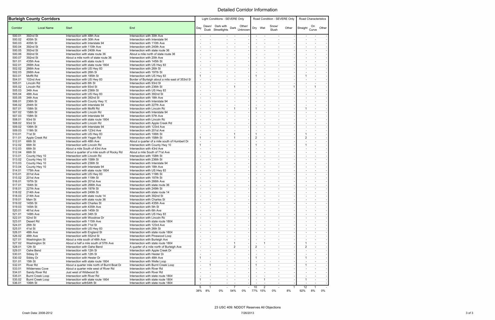
Detailed Corridor Information
Burleigh County Corridors
Corridor Local Name Start End
500.01 392nd St Intersection with 48th Ave Intersection with 30th Ave500.02 405th St Intersection with 30th Ave Intersection with Interstate 94500.03 405th St Intersection with Interstate 94 Intersection with 110th Ave500.04 392nd St Intersection with 110th Ave Intersection with 240th Ave500.05 392nd St Intersection with 240th Ave Intersection with state route 36500.06 392nd St Intersection with state route 36 About a mile north of state route 36500.07 392nd St About a mile north of state route 36 Intersection with 20th Ave501.01 435th Ave Intersection with state route 9 Intersection with 145th St502.01 266th Ave Intersection with state route 1804 Intersection with US Hwy 83502.02 266th Ave Intersection with US Hwy 83 Intersection with 26th St502.03 266th Ave Intersection with 26th St Intersection with 197th St503.01 Moffit Rd Intersection with 185th St Intersection with US Hwy 83504.01 102nd Ave Intersection with US Hwy 83 Border of Burleigh about a mile east of 353rd St505.01 Lincoln Rd Intersection with 6th St Intersection with 93rd St505.02 Lincoln Rd Intersection with 93rd St Intersection with 236th St505.03 34th Ave Intersection with 236th St Intersection with US Hwy 83505.04 48th Ave Intersection with US Hwy 83 Intersection with 392nd St505.05 34th Ave Intersection with 392nd St Intersection with 18th Ave506.01 236th St Intersection with County Hwy 10 Intersection with Interstate 94506.02 294th St Intersection with Interstate 94 Intersection with 227th Ave507.01 158th St Intersection with Moffit Rd Intersection with Lincoln Rd507.02 158th St Intersection with Lincoln Rd Intersection with Interstate 94507.03 158th St Intersection with Interstate 94 Intersection with 57th Ave508.01 93rd St Intersection with state route 1804 Intersection with Lincoln Rd508.02 93rd St Intersection with Lincoln Rd Intersection with Apple Creek Rd509.02 106th St Intersection with Interstate 94 Intersection with 123rd Ave509.03 119th St Intersection with 123rd Ave Intersection with 201st Ave510.01 71st St Intersection with US Hwy 83 Intersection with 106th St511.01 Apple Creek Rd Intersection with Yegan Rd Intersection with 158th St512.01 66th St Intersection with 48th Ave About a quarter of a mile south of Humbert Dr512.02 66th St Intersection with Lincoln Rd Intersection with County Hwy 10512.03 66th St About a mile South of 43rd Ave Intersection with 43rd Ave512.04 66th St About a quarter of a mile south of Rocky Rd About a mile South of 71st Ave513.01 County Hwy 10 Intersection with Lincoln Rd Intersection with 158th St513.02 County Hwy 10 Intersection with 158th St Intersection with 236th St513.03 County Hwy 10 Intersection with 236th St Intersection with Interstate 94513.04 County Hwy 10 Intersection with Interstate 94 Intersection with 18th Ave514.01 175th Ave Intersection with state route 1804 Intersection with US Hwy 83515.01 201st Ave Intersection with US Hwy 83 Intersection with 119th St515.02 201st Ave Intersection with 119th St Intersection with 197th St516.01 197th St Intersection with 201st Ave Intersection with 266th Ave517.01 184th St Intersection with 266th Ave Intersection with state route 36518.01 227th Ave Intersection with 197th St Intersection with 249th St518.02 214th Ave Intersection with 249th St Intersection with state route 14518.03 214th Ave Intersection with state route 14 Intersection with 392nd St519.01 Main St Intersection with state route 36 Intersection with Charles St519.02 145th St Intersection with Charles St Intersection with 435th Ave519.03 145th St Intersection with 435th Ave Intersection with 5th St520.01 461st Ave Intersection with 145th St Intersection with 6th Ave521.01 149th Ave Intersection with 34th St Intersection with US Hwy 83522.01 52nd St Intersection with Woodrow Dr Intersection with Lincoln Rd523.01 Desert Rd Intersection with 115th Ave Intersection with state route 1804524.01 26th St Intersection with 71st St Intersection with 123rd Ave525.01 41st St Intersection with US Hwy 83 Intersection with 26th St526.01 48th Ave Intersection with England St Intersection with state route 1804526.02 48th Ave Intersection with 552nd St Intersection with Pinewood Loop527.01 Washington St About a mile south of 48th Ave Intersection with Burleigh Ave527.02 Washington St About a half a mile south of 57th Ave Intersection with state route 1804528.01 12th St Intersection with Oahe Bend A quarter of a mile north of Burleigh Ave529.01 Oahe Bend Intersection with 12th St Intersection with Apple Creek Dr530.01 Sibley Dr Intersection with 12th St Intersection with Hester Dr530.02 Sibley Dr Intersection with Hester Dr Intersection with 48th Ave531.01 15th St Intersection with state route 1804 Intersection with Welle Loop532.01 River Rd About a quarter mile north of Burnt Boat Dr Intersection with Burnt Creek Loop533.01 Wilderness Cove About a quarter mile west of River Rd Intersection with River Rd534.01 Sandy River Rd Just west of Wildwood St Intersection with River Rd535.01 Burnt Creek Loop Intersection with River Rd Intersection with state route 1804535.02 Burnt Creek Loop Intersection with state route 1804 Intersection with state route 1804536.01 106th St Intersection with54th St Intersection with state route 1804
Day Dawn/ Dusk
Dark with Streetlights Dark Other/
Unknown Dry Wet Snow/ Slush Other Straight On
Curve Other
- - - - - - - - - - - - - - - - - - - - - - - - - - - - - - - - - - - - - - - - - - - - - - - - - - - - - - - - - - - - - - - - - - - - - - - - - - - - - - - - - - - - - - - - - - - - - - - - - - - - - - - - - - - - - - - - - - - - - - - - - - - - - - - - - - - - 1 - - - - 1 - - - 1 - - - - - - - - - - - - - - - - - - - - - - - - - - - - - 1 - - - - 1 - 1 - - - - - - - - - - - - - - - - - - - - - - - - - - - - - - - - - - - - - - - - - - - - - - - - - - - - - - - - - - - - - - - - 1 - 1 - - - 1 - - - - - - - - - - - - - - - - - - - - - - - - - - - - - - - - - - - - - - - - - - - - - - - - - - - - - - - - - - - - - - - - - - - - - - - - - - - - - 1 - 1 - - - 1 - - 1 - - 1 - 2 - - - 2 - - - - - - - - - - - - - - 1 - - - - 1 - - - 1 - - - - - - - - - - - - - - - - - - - - - - - - - - - - - - - - - - - - - - - - - - - - - - - - - - - - - - - - - - - - - - - - - - - - - - - - - - - - - - - - - - - - - - - - - - - - - - - - - - - - - - - - - - - - - - - - - - - - - - - - - - - - - - - - - - - - - - - - - - - - - - - - - - - - - - - - - - - - - - - - - - - - - - - - - - - - - - - - - - - - - - - - - - - - - - - - - - - - - - - - - - - - - - - - - - - - - - - - - - - - - - - - - - - - - - - - - - - - - - - - - - - - - - - - - - - - - - - - - - - - - - - - - - - - - - - - - - - - - - - - - - - - - - - - - - - - - - - - - - - - - - - - - - - - - - - - - - - - - 1 - - 1 - - 1 - - - - - 2 - 2 - - - 2 - - - - - - - - - - - - - - - - - - - - - - - - - - 1 - - - - 1 - - - 1 - - - - - - - - - - - - - - - 1 - - - 1 - - - 1 - - - - - - - - - - - - - - - - - - - - - - - - - - - - - - - - - - - - - - 1 - - - - - 1 - - 1 - - - - - - - - - - - - - - 5 1 - 7 - 10 2 - 1 12 1 -
38% 8% 0% 54% 0% 77% 15% 0% 8% 92% 8% 0%
Road Condition - SEVERE Only Road CharacteristicsLight Conditions - SEVERE Only
Crash Data: 2008-2012 7/26/2013 3 of 3
23 USC 409: NDDOT Reserves All Objections
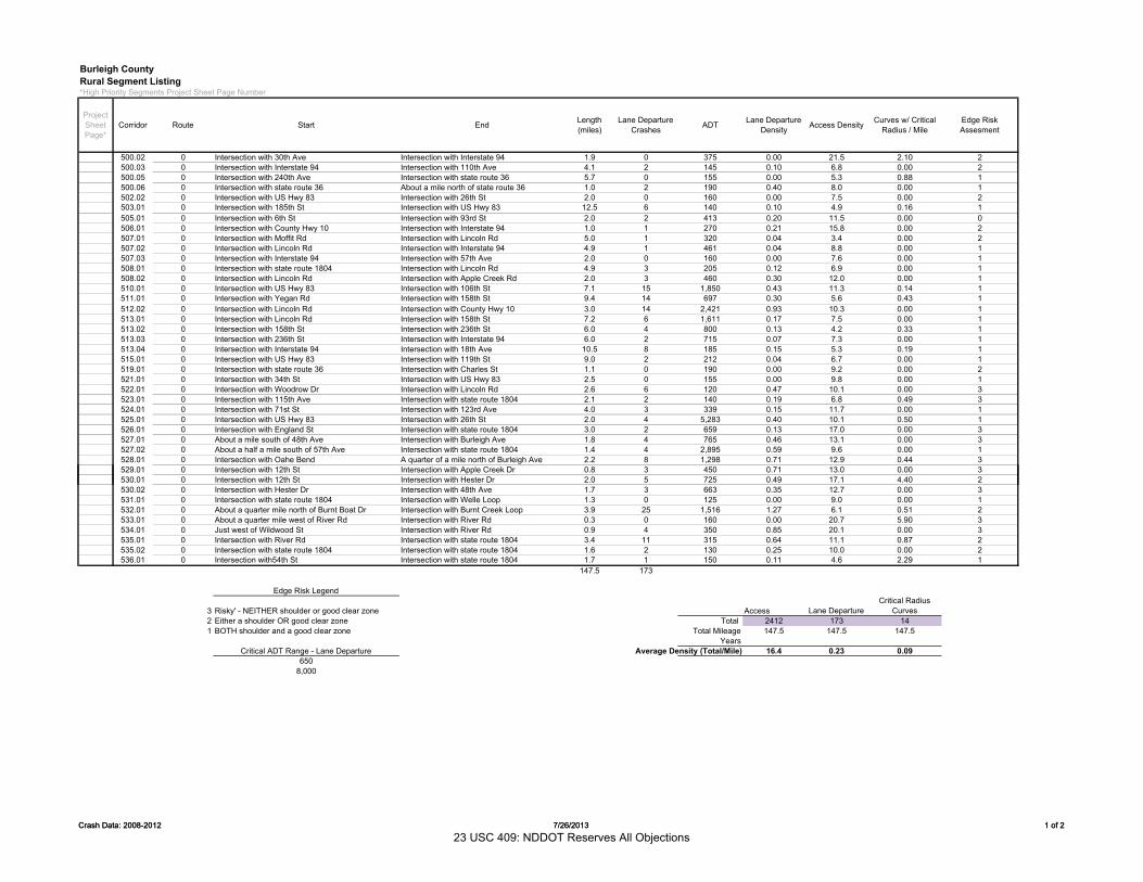
Burleigh CountyRural Segment Listing*High Priority Segments Project Sheet Page Number
500.02 0 Intersection with 30th Ave Intersection with Interstate 94 1.9 0 375 0.00 21.5 2.10 2500.03 0 Intersection with Interstate 94 Intersection with 110th Ave 4.1 2 145 0.10 6.8 0.00 2500.05 0 Intersection with 240th Ave Intersection with state route 36 5.7 0 155 0.00 5.3 0.88 1500.06 0 Intersection with state route 36 About a mile north of state route 36 1.0 2 190 0.40 8.0 0.00 1502.02 0 Intersection with US Hwy 83 Intersection with 26th St 2.0 0 160 0.00 7.5 0.00 2503.01 0 Intersection with 185th St Intersection with US Hwy 83 12.5 6 140 0.10 4.9 0.16 1505.01 0 Intersection with 6th St Intersection with 93rd St 2.0 2 413 0.20 11.5 0.00 0506.01 0 Intersection with County Hwy 10 Intersection with Interstate 94 1.0 1 270 0.21 15.8 0.00 2507.01 0 Intersection with Moffit Rd Intersection with Lincoln Rd 5.0 1 320 0.04 3.4 0.00 2507.02 0 Intersection with Lincoln Rd Intersection with Interstate 94 4.9 1 461 0.04 8.8 0.00 1507.03 0 Intersection with Interstate 94 Intersection with 57th Ave 2.0 0 160 0.00 7.6 0.00 1508.01 0 Intersection with state route 1804 Intersection with Lincoln Rd 4.9 3 205 0.12 6.9 0.00 1508.02 0 Intersection with Lincoln Rd Intersection with Apple Creek Rd 2.0 3 460 0.30 12.0 0.00 1510.01 0 Intersection with US Hwy 83 Intersection with 106th St 7.1 15 1,850 0.43 11.3 0.14 1511.01 0 Intersection with Yegan Rd Intersection with 158th St 9.4 14 697 0.30 5.6 0.43 1512.02 0 Intersection with Lincoln Rd Intersection with County Hwy 10 3.0 14 2,421 0.93 10.3 0.00 1513.01 0 Intersection with Lincoln Rd Intersection with 158th St 7.2 6 1,611 0.17 7.5 0.00 1513.02 0 Intersection with 158th St Intersection with 236th St 6.0 4 800 0.13 4.2 0.33 1513.03 0 Intersection with 236th St Intersection with Interstate 94 6.0 2 715 0.07 7.3 0.00 1513.04 0 Intersection with Interstate 94 Intersection with 18th Ave 10.5 8 185 0.15 5.3 0.19 1515.01 0 Intersection with US Hwy 83 Intersection with 119th St 9.0 2 212 0.04 6.7 0.00 1519.01 0 Intersection with state route 36 Intersection with Charles St 1.1 0 190 0.00 9.2 0.00 2521.01 0 Intersection with 34th St Intersection with US Hwy 83 2.5 0 155 0.00 9.8 0.00 1522.01 0 Intersection with Woodrow Dr Intersection with Lincoln Rd 2.6 6 120 0.47 10.1 0.00 3523.01 0 Intersection with 115th Ave Intersection with state route 1804 2.1 2 140 0.19 6.8 0.49 3524.01 0 Intersection with 71st St Intersection with 123rd Ave 4.0 3 339 0.15 11.7 0.00 1525.01 0 Intersection with US Hwy 83 Intersection with 26th St 2.0 4 5,283 0.40 10.1 0.50 1526.01 0 Intersection with England St Intersection with state route 1804 3.0 2 659 0.13 17.0 0.00 3527.01 0 About a mile south of 48th Ave Intersection with Burleigh Ave 1.8 4 765 0.46 13.1 0.00 3527.02 0 About a half a mile south of 57th Ave Intersection with state route 1804 1.4 4 2,895 0.59 9.6 0.00 1528.01 0 Intersection with Oahe Bend A quarter of a mile north of Burleigh Ave 2.2 8 1,298 0.71 12.9 0.44 3529.01 0 Intersection with 12th St Intersection with Apple Creek Dr 0.8 3 450 0.71 13.0 0.00 3
Project Sheet Page*
Edge Risk Assesment
Length (miles)
Lane Departure CrashesCorridor Curves w/ Critical
Radius / MileEndStartRoute Access DensityADT Lane Departure Density
Crash Data: 2008-2012 7/26/2013 1 of 2
530.01 0 Intersection with 12th St Intersection with Hester Dr 2.0 5 725 0.49 17.1 4.40 2530.02 0 Intersection with Hester Dr Intersection with 48th Ave 1.7 3 663 0.35 12.7 0.00 3531.01 0 Intersection with state route 1804 Intersection with Welle Loop 1.3 0 125 0.00 9.0 0.00 1532.01 0 About a quarter mile north of Burnt Boat Dr Intersection with Burnt Creek Loop 3.9 25 1,516 1.27 6.1 0.51 2533.01 0 About a quarter mile west of River Rd Intersection with River Rd 0.3 0 160 0.00 20.7 5.90 3534.01 0 Just west of Wildwood St Intersection with River Rd 0.9 4 350 0.85 20.1 0.00 3535.01 0 Intersection with River Rd Intersection with state route 1804 3.4 11 315 0.64 11.1 0.87 2535.02 0 Intersection with state route 1804 Intersection with state route 1804 1.6 2 130 0.25 10.0 0.00 2536.01 0 Intersection with54th St Intersection with state route 1804 1.7 1 150 0.11 4.6 2.29 1
147.5 173
Edge Risk Legend
3 Risky' - NEITHER shoulder or good clear zone Access Lane DepartureCritical Radius
Curves2 Either a shoulder OR good clear zone Total 2412 173 141 BOTH shoulder and a good clear zone Total Mileage 147.5 147.5 147.5
YearsCritical ADT Range - Lane Departure Average Density (Total/Mile) 16.4 0.23 0.09
6508,000
Crash Data: 2008-2012 7/26/2013 1 of 2
23 USC 409: NDDOT Reserves All Objections
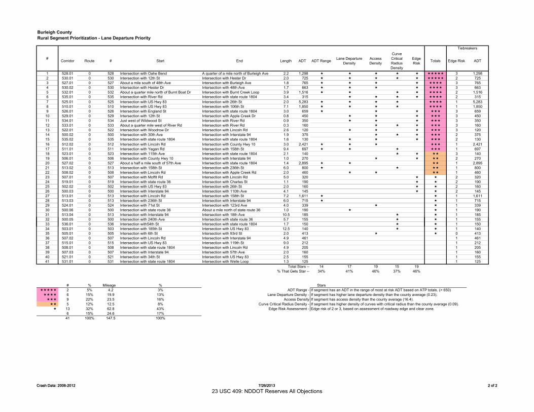
Burleigh CountyRural Segment Prioritization - Lane Departure Priority
Corridor Route # Start End Length ADT ADT Range Lane Departure Density
Access Density
Curve CriticalRadius Density
Edge Risk Totals Edge Risk ADT
1 528.01 0 528 Intersection with Oahe Bend A quarter of a mile north of Burleigh Ave 2.2 1,298 3 1,2982 530.01 0 530 Intersection with 12th St Intersection with Hester Dr 2.0 725 2 7253 527.01 0 527 About a mile south of 48th Ave Intersection with Burleigh Ave 1.8 765 3 7654 530.02 0 530 Intersection with Hester Dr Intersection with 48th Ave 1.7 663 3 6635 532.01 0 532 About a quarter mile north of Burnt Boat Dr Intersection with Burnt Creek Loop 3.9 1,516 2 1,5166 535.01 0 535 Intersection with River Rd Intersection with state route 1804 3.4 315 2 3157 525.01 0 525 Intersection with US Hwy 83 Intersection with 26th St 2.0 5,283 1 5,2838 510.01 0 510 Intersection with US Hwy 83 Intersection with 106th St 7.1 1,850 1 1,8509 526.01 0 526 Intersection with England St Intersection with state route 1804 3.0 659 3 659
10 529.01 0 529 Intersection with 12th St Intersection with Apple Creek Dr 0.8 450 3 45011 534.01 0 534 Just west of Wildwood St Intersection with River Rd 0.9 350 3 35012 533.01 0 533 About a quarter mile west of River Rd Intersection with River Rd 0.3 160 3 16013 522.01 0 522 Intersection with Woodrow Dr Intersection with Lincoln Rd 2.6 120 3 12014 500.02 0 500 Intersection with 30th Ave Intersection with Interstate 94 1.9 375 2 37515 535.02 0 535 Intersection with state route 1804 Intersection with state route 1804 1.6 130 2 13016 512.02 0 512 Intersection with Lincoln Rd Intersection with County Hwy 10 3.0 2,421 1 2,42117 511.01 0 511 Intersection with Yegan Rd Intersection with 158th St 9.4 697 1 69718 523.01 0 523 Intersection with 115th Ave Intersection with state route 1804 2.1 140 3 14019 506.01 0 506 Intersection with County Hwy 10 Intersection with Interstate 94 1.0 270 2 27020 527.02 0 527 About a half a mile south of 57th Ave Intersection with state route 1804 1.4 2,895 1 2,89521 513.02 0 513 Intersection with 158th St Intersection with 236th St 6.0 800 1 80022 508.02 0 508 Intersection with Lincoln Rd Intersection with Apple Creek Rd 2.0 460 1 46023 507.01 0 507 Intersection with Moffit Rd Intersection with Lincoln Rd 5.0 320 2 32024 519.01 0 519 Intersection with state route 36 Intersection with Charles St 1.1 190 2 19025 502.02 0 502 Intersection with US Hwy 83 Intersection with 26th St 2.0 160 2 16026 500.03 0 500 Intersection with Interstate 94 Intersection with 110th Ave 4.1 145 2 14527 513.01 0 513 Intersection with Lincoln Rd Intersection with 158th St 7.2 1,611 1 1,61128 513.03 0 513 Intersection with 236th St Intersection with Interstate 94 6.0 715 1 71529 524.01 0 524 Intersection with 71st St Intersection with 123rd Ave 4.0 339 1 33930 500.06 0 500 Intersection with state route 36 About a mile north of state route 36 1.0 190 1 19031 513.04 0 513 Intersection with Interstate 94 Intersection with 18th Ave 10.5 185 1 18532 500.05 0 500 Intersection with 240th Ave Intersection with state route 36 5.7 155 1 155
#
Tiebreakers
Crash Data: 2008-2012 7/26/2013 2 of 2
33 536.01 0 536 Intersection with54th St Intersection with state route 1804 1.7 150 1 15034 503.01 0 503 Intersection with 185th St Intersection with US Hwy 83 12.5 140 1 14035 505.01 0 505 Intersection with 6th St Intersection with 93rd St 2.0 413 0 41336 507.02 0 507 Intersection with Lincoln Rd Intersection with Interstate 94 4.9 461 1 46137 515.01 0 515 Intersection with US Hwy 83 Intersection with 119th St 9.0 212 1 21238 508.01 0 508 Intersection with state route 1804 Intersection with Lincoln Rd 4.9 205 1 20539 507.03 0 507 Intersection with Interstate 94 Intersection with 57th Ave 2.0 160 1 16040 521.01 0 521 Intersection with 34th St Intersection with US Hwy 83 2.5 155 1 15541 531.01 0 531 Intersection with state route 1804 Intersection with Welle Loop 1.3 125 1 125
Total Stars -- 14 17 19 15 19% That Gets Star -- 34% 41% 46% 37% 46%
# % Mileage % Stars 2 5% 4.2 3% ADT Range - If segment has an ADT in the range of most at risk ADT based on ATP totals. (> 650) 6 15% 19.9 13% Lane Departure Density - If segment has higher lane departure density than the county average (0.23). 9 22% 23.5 16% Access Density If segment has access density than the county average (16.4). 5 12% 12.5 8% Curve Critical Radius Density - If segment has higher density of curves with critical radius than the county average (0.09). 13 32% 62.8 43% Edge Risk Assessment - Edge risk of 2 or 3, based on assessment of roadway edge and clear zone.
6 15% 24.6 17%41 100% 147.5 100%
Crash Data: 2008-2012 7/26/2013 2 of 2
23 USC 409: NDDOT Reserves All Objections
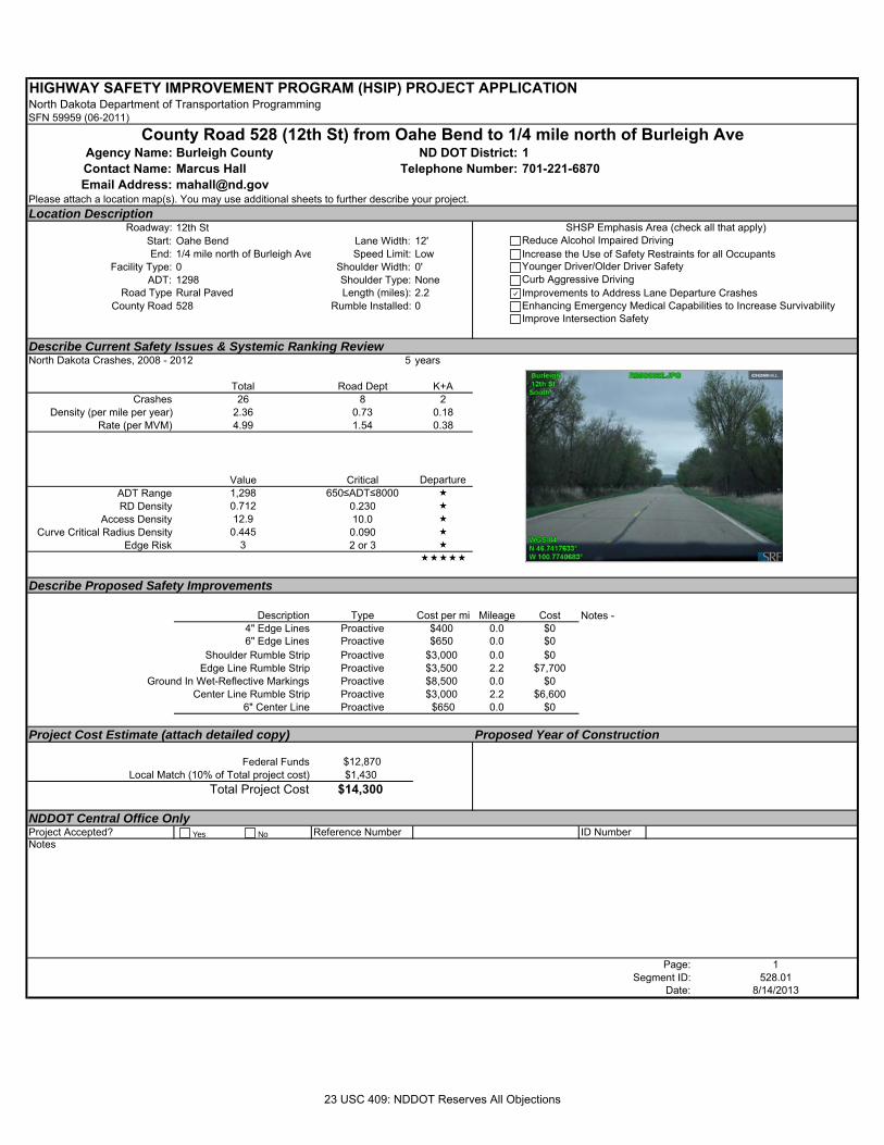
HIGHWAY SAFETY IMPROVEMENT PROGRAM (HSIP) PROJECT APPLICATIONNorth Dakota Department of Transportation ProgrammingSFN 59959 (06-2011)
Agency Name: Burleigh County 1Contact Name: Marcus Hall 701-221-6870Email Address: [email protected]
Please attach a location map(s). You may use additional sheets to further describe your project.Location Description
Roadway: 12th StStart: Oahe Bend Lane Width: 12'End: 1/4 mile north of Burleigh Ave Speed Limit: Low
Facility Type: 0 Shoulder Width: 0'ADT: 1298 Shoulder Type: None
Road Type Rural Paved Length (miles): 2.2County Road 528 Rumble Installed: 0
Describe Current Safety Issues & Systemic Ranking ReviewNorth Dakota Crashes, 2008 - 2012 5 years
Total Road Dept K+ACrashes 26 8 2
Density (per mile per year) 2.36 0.73 0.18Rate (per MVM) 4.99 1.54 0.38
Value Critical Departure ADT Range 1,298 650≤ADT≤8000 RD Density 0.712 0.230
Access Density 12.9 10.0 Curve Critical Radius Density 0.445 0.090
Edge Risk 3 2 or 3
Describe Proposed Safety Improvements
Description Type Cost per mi Mileage Cost4" Edge Lines Proactive $400 0.0 $06" Edge Lines Proactive $650 0.0 $0
Shoulder Rumble Strip Proactive $3,000 0.0 $0Edge Line Rumble Strip Proactive $3,500 2.2 $7,700
Ground In Wet-Reflective Markings Proactive $8,500 0.0 $0Center Line Rumble Strip Proactive $3,000 2.2 $6,600
6" Center Line Proactive $650 0.0 $0
Project Cost Estimate (attach detailed copy) Proposed Year of Construction
Federal Funds $12,870 Local Match (10% of Total project cost) $1,430
Total Project Cost $14,300
NDDOT Central Office OnlyProject Accepted? Reference Number ID NumberNotes
Page: 1Segment ID: 528.01
Date: 8/14/2013
Notes -
County Road 528 (12th St) from Oahe Bend to 1/4 mile north of Burleigh AveND DOT District:
Telephone Number:
SHSP Emphasis Area (check all that apply)Reduce Alcohol Impaired DrivingIncrease the Use of Safety Restraints for all OccupantsYounger Driver/Older Driver SafetyCurb Aggressive DrivingImprovements to Address Lane Departure CrashesEnhancing Emergency Medical Capabilities to Increase SurvivabilityImprove Intersection Safety
Yes No
23 USC 409: NDDOT Reserves All Objections
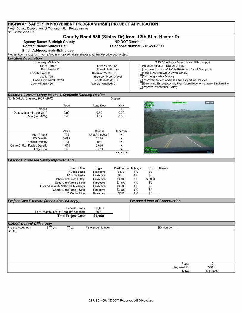
HIGHWAY SAFETY IMPROVEMENT PROGRAM (HSIP) PROJECT APPLICATIONNorth Dakota Department of Transportation ProgrammingSFN 59959 (06-2011)
Agency Name: Burleigh County 1Contact Name: Marcus Hall 701-221-6870Email Address: [email protected]
Please attach a location map(s). You may use additional sheets to further describe your project.Location Description
Roadway: Sibley DrStart: 12th St Lane Width: 12'End: Hester Dr Speed Limit: Low
Facility Type: 0 Shoulder Width: 2'ADT: 725 Shoulder Type: Gravel
Road Type Rural Paved Length (miles): 2.0County Road 530 Rumble Installed: 0
Describe Current Safety Issues & Systemic Ranking ReviewNorth Dakota Crashes, 2008 - 2012 5 years
Total Road Dept K+ACrashes 9 5 0
Density (per mile per year) 0.90 0.50 0.00Rate (per MVM) 3.40 1.89 0.00
Value Critical Departure ADT Range 725 650≤ADT≤8000 RD Density 0.489 0.230
Access Density 17.1 10.0 Curve Critical Radius Density 4.403 0.090
Edge Risk 2 2 or 3
Describe Proposed Safety Improvements
Description Type Cost per mi Mileage Cost4" Edge Lines Proactive $400 0.0 $06" Edge Lines Proactive $650 0.0 $0
Shoulder Rumble Strip Proactive $3,000 2.0 $6,000Edge Line Rumble Strip Proactive $3,500 0.0 $0
Ground In Wet-Reflective Markings Proactive $8,500 0.0 $0Center Line Rumble Strip Proactive $3,000 0.0 $0
6" Center Line Proactive $650 0.0 $0
Project Cost Estimate (attach detailed copy) Proposed Year of Construction
Federal Funds $5,400 Local Match (10% of Total project cost) $600
Total Project Cost $6,000
NDDOT Central Office OnlyProject Accepted? Reference Number ID NumberNotes
Page: 2Segment ID: 530.01
Date: 8/14/2013
Notes -
County Road 530 (Sibley Dr) from 12th St to Hester DrND DOT District:
Telephone Number:
SHSP Emphasis Area (check all that apply)Reduce Alcohol Impaired DrivingIncrease the Use of Safety Restraints for all OccupantsYounger Driver/Older Driver SafetyCurb Aggressive DrivingImprovements to Address Lane Departure CrashesEnhancing Emergency Medical Capabilities to Increase SurvivabilityImprove Intersection Safety
Yes No
23 USC 409: NDDOT Reserves All Objections
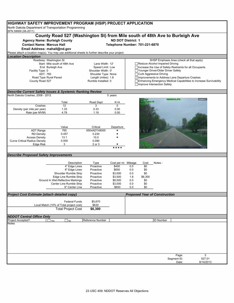
HIGHWAY SAFETY IMPROVEMENT PROGRAM (HSIP) PROJECT APPLICATIONNorth Dakota Department of Transportation ProgrammingSFN 59959 (06-2011)
Agency Name: Burleigh County 1Contact Name: Marcus Hall 701-221-6870Email Address: [email protected]
Please attach a location map(s). You may use additional sheets to further describe your project.Location Description
Roadway: Washington StStart: Mile south of 48th Ave Lane Width: 12'End: Burleigh Ave Speed Limit: Low
Facility Type: 0 Shoulder Width: 0'ADT: 765 Shoulder Type: None
Road Type Rural Paved Length (miles): 1.8County Road 527 Rumble Installed: 0
Describe Current Safety Issues & Systemic Ranking ReviewNorth Dakota Crashes, 2008 - 2012 5 years
Total Road Dept K+ACrashes 12 3 0
Density (per mile per year) 1.33 0.33 0.00Rate (per MVM) 4.78 1.19 0.00
Value Critical Departure ADT Range 765 650≤ADT≤8000 RD Density 0.457 0.230
Access Density 13.1 10.0 Curve Critical Radius Density 0.000 0.090
Edge Risk 3 2 or 3
Describe Proposed Safety Improvements
Description Type Cost per mi Mileage Cost4" Edge Lines Proactive $400 0.0 $06" Edge Lines Proactive $650 0.0 $0
Shoulder Rumble Strip Proactive $3,000 0.0 $0Edge Line Rumble Strip Proactive $3,500 1.8 $6,300
Ground In Wet-Reflective Markings Proactive $8,500 0.0 $0Center Line Rumble Strip Proactive $3,000 0.0 $0
6" Center Line Proactive $650 0.0 $0
Project Cost Estimate (attach detailed copy) Proposed Year of Construction
Federal Funds $5,670 Local Match (10% of Total project cost) $630
Total Project Cost $6,300
NDDOT Central Office OnlyProject Accepted? Reference Number ID NumberNotes
Page: 3Segment ID: 527.01
Date: 8/14/2013
Notes -
County Road 527 (Washington St) from Mile south of 48th Ave to Burleigh AveND DOT District:
Telephone Number:
SHSP Emphasis Area (check all that apply)Reduce Alcohol Impaired DrivingIncrease the Use of Safety Restraints for all OccupantsYounger Driver/Older Driver SafetyCurb Aggressive DrivingImprovements to Address Lane Departure CrashesEnhancing Emergency Medical Capabilities to Increase SurvivabilityImprove Intersection Safety
Yes No
23 USC 409: NDDOT Reserves All Objections
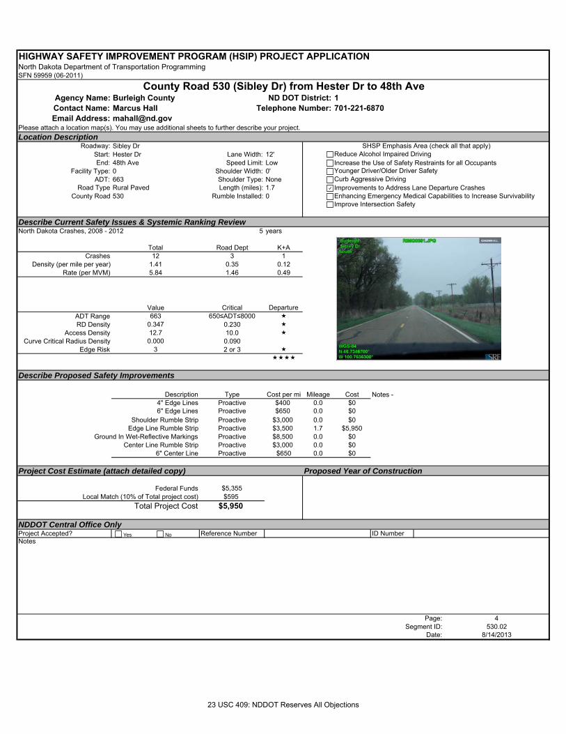
HIGHWAY SAFETY IMPROVEMENT PROGRAM (HSIP) PROJECT APPLICATIONNorth Dakota Department of Transportation ProgrammingSFN 59959 (06-2011)
Agency Name: Burleigh County 1Contact Name: Marcus Hall 701-221-6870Email Address: [email protected]
Please attach a location map(s). You may use additional sheets to further describe your project.Location Description
Roadway: Sibley DrStart: Hester Dr Lane Width: 12'End: 48th Ave Speed Limit: Low
Facility Type: 0 Shoulder Width: 0'ADT: 663 Shoulder Type: None
Road Type Rural Paved Length (miles): 1.7County Road 530 Rumble Installed: 0
Describe Current Safety Issues & Systemic Ranking ReviewNorth Dakota Crashes, 2008 - 2012 5 years
Total Road Dept K+ACrashes 12 3 1
Density (per mile per year) 1.41 0.35 0.12Rate (per MVM) 5.84 1.46 0.49
Value Critical Departure ADT Range 663 650≤ADT≤8000 RD Density 0.347 0.230
Access Density 12.7 10.0 Curve Critical Radius Density 0.000 0.090
Edge Risk 3 2 or 3
Describe Proposed Safety Improvements
Description Type Cost per mi Mileage Cost4" Edge Lines Proactive $400 0.0 $06" Edge Lines Proactive $650 0.0 $0
Shoulder Rumble Strip Proactive $3,000 0.0 $0Edge Line Rumble Strip Proactive $3,500 1.7 $5,950
Ground In Wet-Reflective Markings Proactive $8,500 0.0 $0Center Line Rumble Strip Proactive $3,000 0.0 $0
6" Center Line Proactive $650 0.0 $0
Project Cost Estimate (attach detailed copy) Proposed Year of Construction
Federal Funds $5,355 Local Match (10% of Total project cost) $595
Total Project Cost $5,950
NDDOT Central Office OnlyProject Accepted? Reference Number ID NumberNotes
Page: 4Segment ID: 530.02
Date: 8/14/2013
Notes -
County Road 530 (Sibley Dr) from Hester Dr to 48th AveND DOT District:
Telephone Number:
SHSP Emphasis Area (check all that apply)Reduce Alcohol Impaired DrivingIncrease the Use of Safety Restraints for all OccupantsYounger Driver/Older Driver SafetyCurb Aggressive DrivingImprovements to Address Lane Departure CrashesEnhancing Emergency Medical Capabilities to Increase SurvivabilityImprove Intersection Safety
Yes No
23 USC 409: NDDOT Reserves All Objections
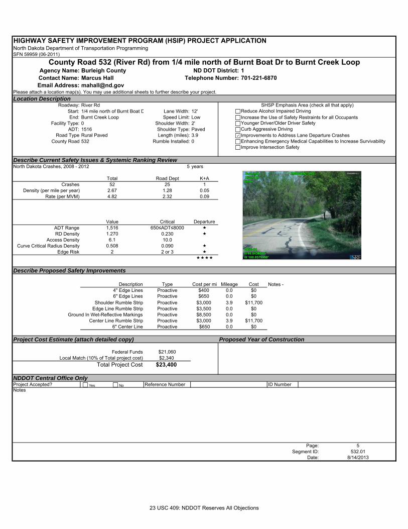
HIGHWAY SAFETY IMPROVEMENT PROGRAM (HSIP) PROJECT APPLICATIONNorth Dakota Department of Transportation ProgrammingSFN 59959 (06-2011)
Agency Name: Burleigh County 1Contact Name: Marcus Hall 701-221-6870Email Address: [email protected]
Please attach a location map(s). You may use additional sheets to further describe your project.Location Description
Roadway: River RdStart: 1/4 mile north of Burnt Boat D Lane Width: 12'End: Burnt Creek Loop Speed Limit: Low
Facility Type: 0 Shoulder Width: 2'ADT: 1516 Shoulder Type: Paved
Road Type Rural Paved Length (miles): 3.9County Road 532 Rumble Installed: 0
Describe Current Safety Issues & Systemic Ranking ReviewNorth Dakota Crashes, 2008 - 2012 5 years
Total Road Dept K+ACrashes 52 25 1
Density (per mile per year) 2.67 1.28 0.05Rate (per MVM) 4.82 2.32 0.09
Value Critical Departure ADT Range 1,516 650≤ADT≤8000 RD Density 1.270 0.230
Access Density 6.1 10.0Curve Critical Radius Density 0.508 0.090
Edge Risk 2 2 or 3
Describe Proposed Safety Improvements
Description Type Cost per mi Mileage Cost4" Edge Lines Proactive $400 0.0 $06" Edge Lines Proactive $650 0.0 $0
Shoulder Rumble Strip Proactive $3,000 3.9 $11,700Edge Line Rumble Strip Proactive $3,500 0.0 $0
Ground In Wet-Reflective Markings Proactive $8,500 0.0 $0Center Line Rumble Strip Proactive $3,000 3.9 $11,700
6" Center Line Proactive $650 0.0 $0
Project Cost Estimate (attach detailed copy) Proposed Year of Construction
Federal Funds $21,060 Local Match (10% of Total project cost) $2,340
Total Project Cost $23,400
NDDOT Central Office OnlyProject Accepted? Reference Number ID NumberNotes
Page: 5Segment ID: 532.01
Date: 8/14/2013
Notes -
County Road 532 (River Rd) from 1/4 mile north of Burnt Boat Dr to Burnt Creek LoopND DOT District:
Telephone Number:
SHSP Emphasis Area (check all that apply)Reduce Alcohol Impaired DrivingIncrease the Use of Safety Restraints for all OccupantsYounger Driver/Older Driver SafetyCurb Aggressive DrivingImprovements to Address Lane Departure CrashesEnhancing Emergency Medical Capabilities to Increase SurvivabilityImprove Intersection Safety
Yes No
23 USC 409: NDDOT Reserves All Objections
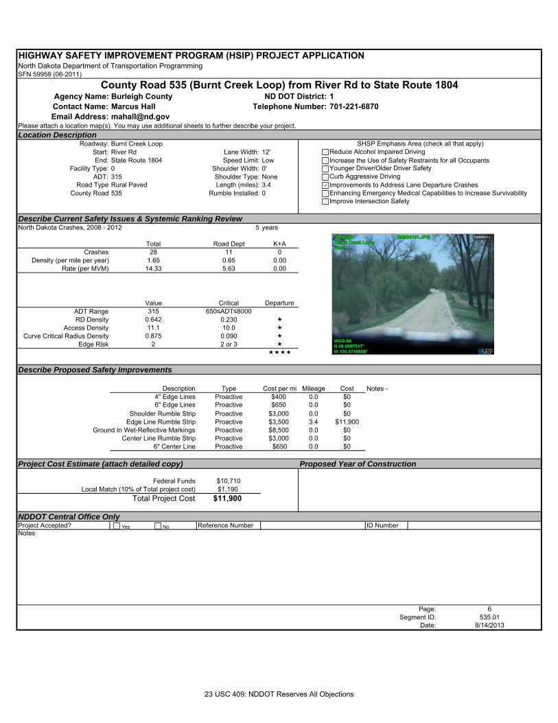
HIGHWAY SAFETY IMPROVEMENT PROGRAM (HSIP) PROJECT APPLICATIONNorth Dakota Department of Transportation ProgrammingSFN 59959 (06-2011)
Agency Name: Burleigh County 1Contact Name: Marcus Hall 701-221-6870Email Address: [email protected]
Please attach a location map(s). You may use additional sheets to further describe your project.Location Description
Roadway: Burnt Creek LoopStart: River Rd Lane Width: 12'End: State Route 1804 Speed Limit: Low
Facility Type: 0 Shoulder Width: 0'ADT: 315 Shoulder Type: None
Road Type Rural Paved Length (miles): 3.4County Road 535 Rumble Installed: 0
Describe Current Safety Issues & Systemic Ranking ReviewNorth Dakota Crashes, 2008 - 2012 5 years
Total Road Dept K+ACrashes 28 11 0
Density (per mile per year) 1.65 0.65 0.00Rate (per MVM) 14.33 5.63 0.00
Value Critical Departure ADT Range 315 650≤ADT≤8000RD Density 0.642 0.230
Access Density 11.1 10.0 Curve Critical Radius Density 0.875 0.090
Edge Risk 2 2 or 3
Describe Proposed Safety Improvements
Description Type Cost per mi Mileage Cost4" Edge Lines Proactive $400 0.0 $06" Edge Lines Proactive $650 0.0 $0
Shoulder Rumble Strip Proactive $3,000 0.0 $0Edge Line Rumble Strip Proactive $3,500 3.4 $11,900
Ground In Wet-Reflective Markings Proactive $8,500 0.0 $0Center Line Rumble Strip Proactive $3,000 0.0 $0
6" Center Line Proactive $650 0.0 $0
Project Cost Estimate (attach detailed copy) Proposed Year of Construction
Federal Funds $10,710 Local Match (10% of Total project cost) $1,190
Total Project Cost $11,900
NDDOT Central Office OnlyProject Accepted? Reference Number ID NumberNotes
Page: 6Segment ID: 535.01
Date: 8/14/2013
Notes -
County Road 535 (Burnt Creek Loop) from River Rd to State Route 1804ND DOT District:
Telephone Number:
SHSP Emphasis Area (check all that apply)Reduce Alcohol Impaired DrivingIncrease the Use of Safety Restraints for all OccupantsYounger Driver/Older Driver SafetyCurb Aggressive DrivingImprovements to Address Lane Departure CrashesEnhancing Emergency Medical Capabilities to Increase SurvivabilityImprove Intersection Safety
Yes No
23 USC 409: NDDOT Reserves All Objections
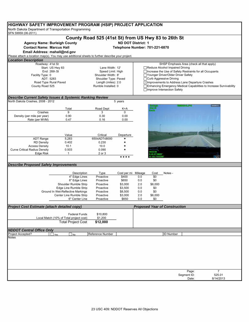
HIGHWAY SAFETY IMPROVEMENT PROGRAM (HSIP) PROJECT APPLICATIONNorth Dakota Department of Transportation ProgrammingSFN 59959 (06-2011)
Agency Name: Burleigh County 1Contact Name: Marcus Hall 701-221-6870Email Address: [email protected]
Please attach a location map(s). You may use additional sheets to further describe your project.Location Description
Roadway: 41st StStart: US Hwy 83 Lane Width: 12'End: 26th St Speed Limit: High
Facility Type: 0 Shoulder Width: 8'ADT: 5283 Shoulder Type: Paved
Road Type Rural Paved Length (miles): 2.0County Road 525 Rumble Installed: 0
Describe Current Safety Issues & Systemic Ranking ReviewNorth Dakota Crashes, 2008 - 2012 5 years
Total Road Dept K+ACrashes 9 3 0
Density (per mile per year) 0.90 0.30 0.00Rate (per MVM) 0.47 0.16 0.00
Value Critical Departure ADT Range 5,283 650≤ADT≤8000 RD Density 0.402 0.230
Access Density 10.1 10.0 Curve Critical Radius Density 0.503 0.090
Edge Risk 1 2 or 3
Describe Proposed Safety Improvements
Description Type Cost per mi Mileage Cost4" Edge Lines Proactive $400 0.0 $06" Edge Lines Proactive $650 0.0 $0
Shoulder Rumble Strip Proactive $3,000 2.0 $6,000Edge Line Rumble Strip Proactive $3,500 0.0 $0
Ground In Wet-Reflective Markings Proactive $8,500 0.0 $0Center Line Rumble Strip Proactive $3,000 2.0 $6,000
6" Center Line Proactive $650 0.0 $0
Project Cost Estimate (attach detailed copy) Proposed Year of Construction
Federal Funds $10,800 Local Match (10% of Total project cost) $1,200
Total Project Cost $12,000
NDDOT Central Office OnlyProject Accepted? Reference Number ID NumberNotes
Page: 7Segment ID: 525.01
Date: 8/14/2013
Notes -
County Road 525 (41st St) from US Hwy 83 to 26th StND DOT District:
Telephone Number:
SHSP Emphasis Area (check all that apply)Reduce Alcohol Impaired DrivingIncrease the Use of Safety Restraints for all OccupantsYounger Driver/Older Driver SafetyCurb Aggressive DrivingImprovements to Address Lane Departure CrashesEnhancing Emergency Medical Capabilities to Increase SurvivabilityImprove Intersection Safety
Yes No
23 USC 409: NDDOT Reserves All Objections
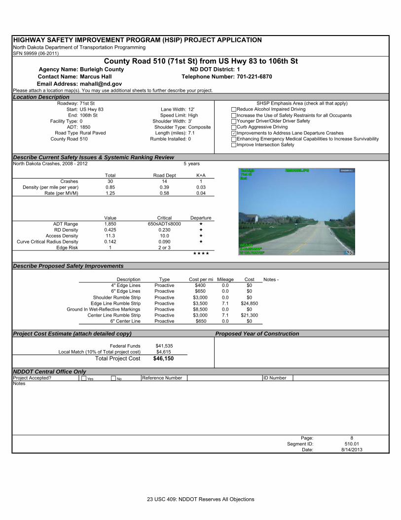
HIGHWAY SAFETY IMPROVEMENT PROGRAM (HSIP) PROJECT APPLICATIONNorth Dakota Department of Transportation ProgrammingSFN 59959 (06-2011)
Agency Name: Burleigh County 1Contact Name: Marcus Hall 701-221-6870Email Address: [email protected]
Please attach a location map(s). You may use additional sheets to further describe your project.Location Description
Roadway: 71st StStart: US Hwy 83 Lane Width: 12'End: 106th St Speed Limit: High
Facility Type: 0 Shoulder Width: 3'ADT: 1850 Shoulder Type: Composite
Road Type Rural Paved Length (miles): 7.1County Road 510 Rumble Installed: 0
Describe Current Safety Issues & Systemic Ranking ReviewNorth Dakota Crashes, 2008 - 2012 5 years
Total Road Dept K+ACrashes 30 14 1
Density (per mile per year) 0.85 0.39 0.03Rate (per MVM) 1.25 0.58 0.04
Value Critical Departure ADT Range 1,850 650≤ADT≤8000 RD Density 0.425 0.230
Access Density 11.3 10.0 Curve Critical Radius Density 0.142 0.090
Edge Risk 1 2 or 3
Describe Proposed Safety Improvements
Description Type Cost per mi Mileage Cost4" Edge Lines Proactive $400 0.0 $06" Edge Lines Proactive $650 0.0 $0
Shoulder Rumble Strip Proactive $3,000 0.0 $0Edge Line Rumble Strip Proactive $3,500 7.1 $24,850
Ground In Wet-Reflective Markings Proactive $8,500 0.0 $0Center Line Rumble Strip Proactive $3,000 7.1 $21,300
6" Center Line Proactive $650 0.0 $0
Project Cost Estimate (attach detailed copy) Proposed Year of Construction
Federal Funds $41,535 Local Match (10% of Total project cost) $4,615
Total Project Cost $46,150
NDDOT Central Office OnlyProject Accepted? Reference Number ID NumberNotes
Page: 8Segment ID: 510.01
Date: 8/14/2013
Notes -
County Road 510 (71st St) from US Hwy 83 to 106th StND DOT District:
Telephone Number:
SHSP Emphasis Area (check all that apply)Reduce Alcohol Impaired DrivingIncrease the Use of Safety Restraints for all OccupantsYounger Driver/Older Driver SafetyCurb Aggressive DrivingImprovements to Address Lane Departure CrashesEnhancing Emergency Medical Capabilities to Increase SurvivabilityImprove Intersection Safety
Yes No
23 USC 409: NDDOT Reserves All Objections
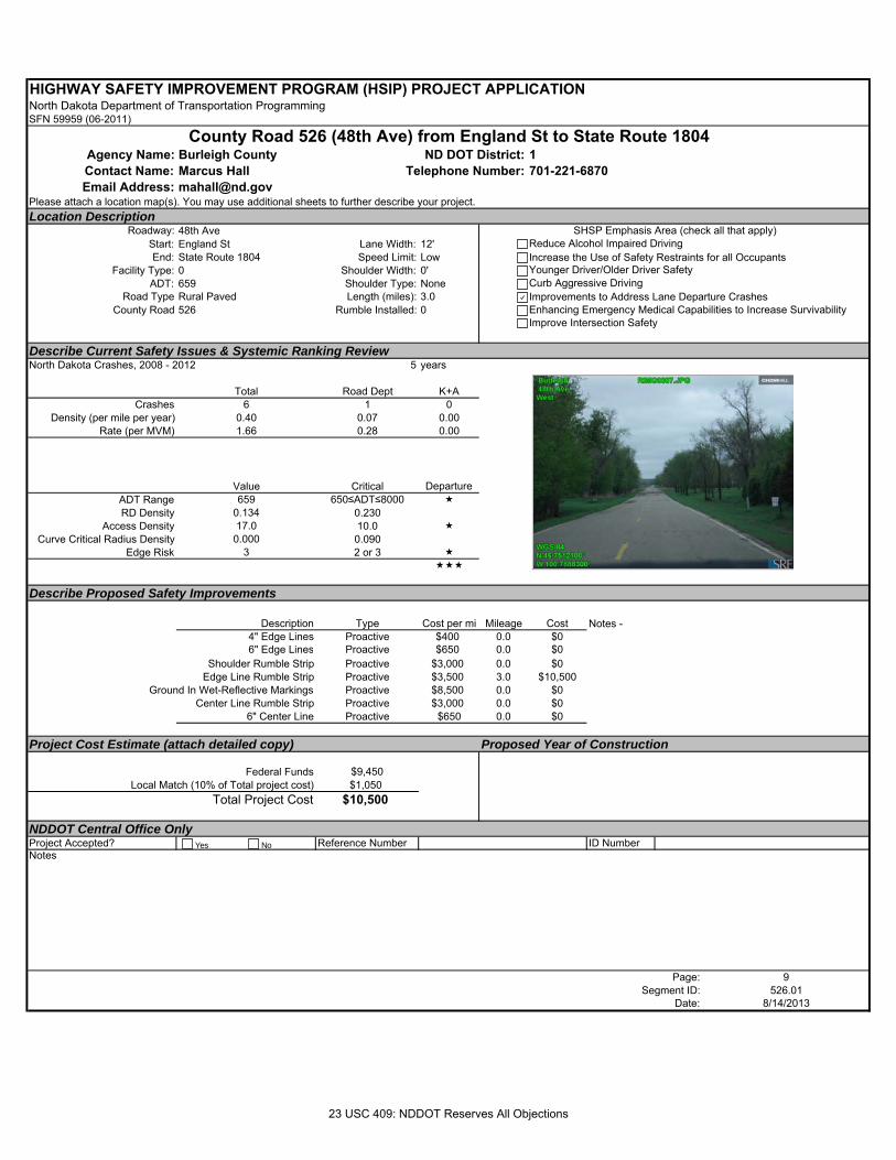
HIGHWAY SAFETY IMPROVEMENT PROGRAM (HSIP) PROJECT APPLICATIONNorth Dakota Department of Transportation ProgrammingSFN 59959 (06-2011)
Agency Name: Burleigh County 1Contact Name: Marcus Hall 701-221-6870Email Address: [email protected]
Please attach a location map(s). You may use additional sheets to further describe your project.Location Description
Roadway: 48th AveStart: England St Lane Width: 12'End: State Route 1804 Speed Limit: Low
Facility Type: 0 Shoulder Width: 0'ADT: 659 Shoulder Type: None
Road Type Rural Paved Length (miles): 3.0County Road 526 Rumble Installed: 0
Describe Current Safety Issues & Systemic Ranking ReviewNorth Dakota Crashes, 2008 - 2012 5 years
Total Road Dept K+ACrashes 6 1 0
Density (per mile per year) 0.40 0.07 0.00Rate (per MVM) 1.66 0.28 0.00
Value Critical Departure ADT Range 659 650≤ADT≤8000 RD Density 0.134 0.230
Access Density 17.0 10.0 Curve Critical Radius Density 0.000 0.090
Edge Risk 3 2 or 3
Describe Proposed Safety Improvements
Description Type Cost per mi Mileage Cost4" Edge Lines Proactive $400 0.0 $06" Edge Lines Proactive $650 0.0 $0
Shoulder Rumble Strip Proactive $3,000 0.0 $0Edge Line Rumble Strip Proactive $3,500 3.0 $10,500
Ground In Wet-Reflective Markings Proactive $8,500 0.0 $0Center Line Rumble Strip Proactive $3,000 0.0 $0
6" Center Line Proactive $650 0.0 $0
Project Cost Estimate (attach detailed copy) Proposed Year of Construction
Federal Funds $9,450 Local Match (10% of Total project cost) $1,050
Total Project Cost $10,500
NDDOT Central Office OnlyProject Accepted? Reference Number ID NumberNotes
Page: 9Segment ID: 526.01
Date: 8/14/2013
Notes -
County Road 526 (48th Ave) from England St to State Route 1804ND DOT District:
Telephone Number:
SHSP Emphasis Area (check all that apply)Reduce Alcohol Impaired DrivingIncrease the Use of Safety Restraints for all OccupantsYounger Driver/Older Driver SafetyCurb Aggressive DrivingImprovements to Address Lane Departure CrashesEnhancing Emergency Medical Capabilities to Increase SurvivabilityImprove Intersection Safety
Yes No
23 USC 409: NDDOT Reserves All Objections
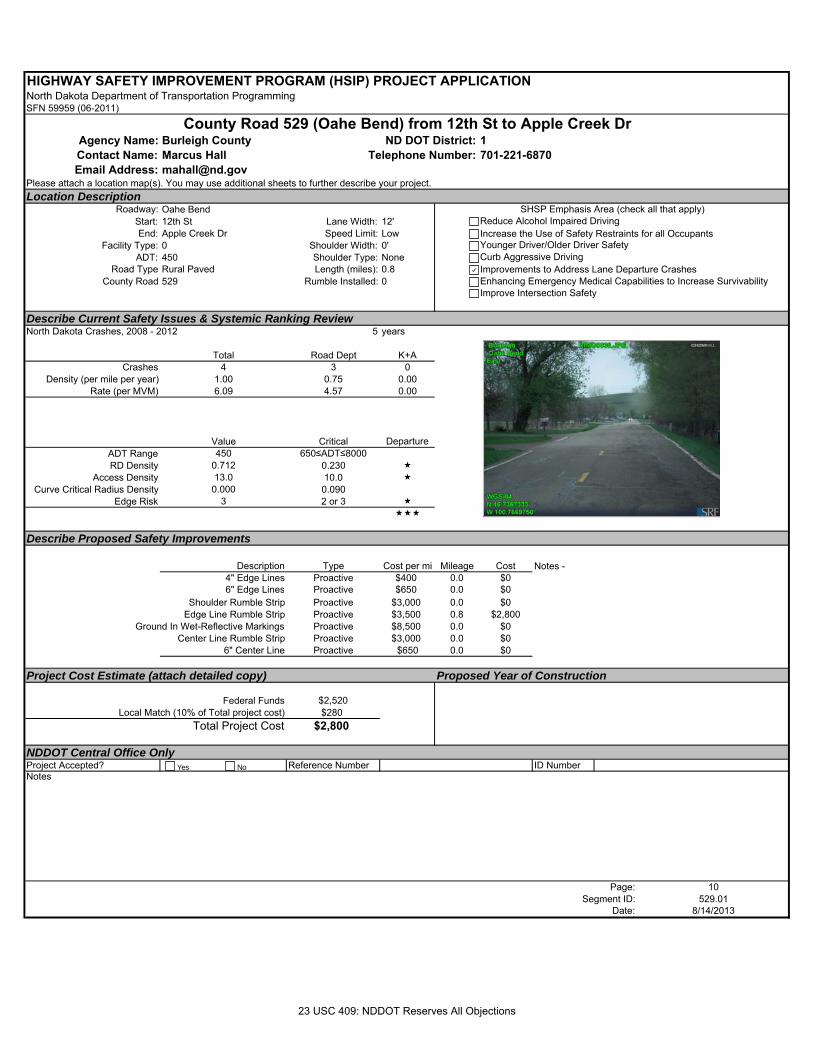
HIGHWAY SAFETY IMPROVEMENT PROGRAM (HSIP) PROJECT APPLICATIONNorth Dakota Department of Transportation ProgrammingSFN 59959 (06-2011)
Agency Name: Burleigh County 1Contact Name: Marcus Hall 701-221-6870Email Address: [email protected]
Please attach a location map(s). You may use additional sheets to further describe your project.Location Description
Roadway: Oahe BendStart: 12th St Lane Width: 12'End: Apple Creek Dr Speed Limit: Low
Facility Type: 0 Shoulder Width: 0'ADT: 450 Shoulder Type: None
Road Type Rural Paved Length (miles): 0.8County Road 529 Rumble Installed: 0
Describe Current Safety Issues & Systemic Ranking ReviewNorth Dakota Crashes, 2008 - 2012 5 years
Total Road Dept K+ACrashes 4 3 0
Density (per mile per year) 1.00 0.75 0.00Rate (per MVM) 6.09 4.57 0.00
Value Critical Departure ADT Range 450 650≤ADT≤8000RD Density 0.712 0.230
Access Density 13.0 10.0 Curve Critical Radius Density 0.000 0.090
Edge Risk 3 2 or 3
Describe Proposed Safety Improvements
Description Type Cost per mi Mileage Cost4" Edge Lines Proactive $400 0.0 $06" Edge Lines Proactive $650 0.0 $0
Shoulder Rumble Strip Proactive $3,000 0.0 $0Edge Line Rumble Strip Proactive $3,500 0.8 $2,800
Ground In Wet-Reflective Markings Proactive $8,500 0.0 $0Center Line Rumble Strip Proactive $3,000 0.0 $0
6" Center Line Proactive $650 0.0 $0
Project Cost Estimate (attach detailed copy) Proposed Year of Construction
Federal Funds $2,520 Local Match (10% of Total project cost) $280
Total Project Cost $2,800
NDDOT Central Office OnlyProject Accepted? Reference Number ID NumberNotes
Page: 10Segment ID: 529.01
Date: 8/14/2013
Notes -
County Road 529 (Oahe Bend) from 12th St to Apple Creek DrND DOT District:
Telephone Number:
SHSP Emphasis Area (check all that apply)Reduce Alcohol Impaired DrivingIncrease the Use of Safety Restraints for all OccupantsYounger Driver/Older Driver SafetyCurb Aggressive DrivingImprovements to Address Lane Departure CrashesEnhancing Emergency Medical Capabilities to Increase SurvivabilityImprove Intersection Safety
Yes No
23 USC 409: NDDOT Reserves All Objections
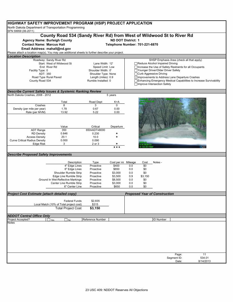
HIGHWAY SAFETY IMPROVEMENT PROGRAM (HSIP) PROJECT APPLICATIONNorth Dakota Department of Transportation ProgrammingSFN 59959 (06-2011)
Agency Name: Burleigh County 1Contact Name: Marcus Hall 701-221-6870Email Address: [email protected]
Please attach a location map(s). You may use additional sheets to further describe your project.Location Description
Roadway: Sandy River RdStart: West of Wildwood St Lane Width: 12'End: River Rd Speed Limit: Low
Facility Type: 0 Shoulder Width: 0'ADT: 350 Shoulder Type: None
Road Type Rural Paved Length (miles): 0.9County Road 534 Rumble Installed: 0
Describe Current Safety Issues & Systemic Ranking ReviewNorth Dakota Crashes, 2008 - 2012 5 years
Total Road Dept K+ACrashes 8 3 0
Density (per mile per year) 1.78 0.67 0.00Rate (per MVM) 13.92 5.22 0.00
Value Critical Departure ADT Range 350 650≤ADT≤8000RD Density 0.846 0.230
Access Density 20.1 10.0 Curve Critical Radius Density 0.000 0.090
Edge Risk 3 2 or 3
Describe Proposed Safety Improvements
Description Type Cost per mi Mileage Cost4" Edge Lines Proactive $400 0.0 $06" Edge Lines Proactive $650 0.0 $0
Shoulder Rumble Strip Proactive $3,000 0.0 $0Edge Line Rumble Strip Proactive $3,500 0.9 $3,150
Ground In Wet-Reflective Markings Proactive $8,500 0.0 $0Center Line Rumble Strip Proactive $3,000 0.0 $0
6" Center Line Proactive $650 0.0 $0
Project Cost Estimate (attach detailed copy) Proposed Year of Construction
Federal Funds $2,835 Local Match (10% of Total project cost) $315
Total Project Cost $3,150
NDDOT Central Office OnlyProject Accepted? Reference Number ID NumberNotes
Page: 11Segment ID: 534.01
Date: 8/14/2013
Notes -
County Road 534 (Sandy River Rd) from West of Wildwood St to River RdND DOT District:
Telephone Number:
SHSP Emphasis Area (check all that apply)Reduce Alcohol Impaired DrivingIncrease the Use of Safety Restraints for all OccupantsYounger Driver/Older Driver SafetyCurb Aggressive DrivingImprovements to Address Lane Departure CrashesEnhancing Emergency Medical Capabilities to Increase SurvivabilityImprove Intersection Safety
Yes No
23 USC 409: NDDOT Reserves All Objections
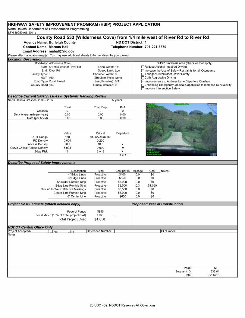
HIGHWAY SAFETY IMPROVEMENT PROGRAM (HSIP) PROJECT APPLICATIONNorth Dakota Department of Transportation ProgrammingSFN 59959 (06-2011)
Agency Name: Burleigh County 1Contact Name: Marcus Hall 701-221-6870Email Address: [email protected]
Please attach a location map(s). You may use additional sheets to further describe your project.Location Description
Roadway: Wilderness CoveStart: 1/4 mile west of River Rd Lane Width: 14'End: River Rd Speed Limit: Low
Facility Type: 0 Shoulder Width: 0'ADT: 160 Shoulder Type: None
Road Type Rural Paved Length (miles): 0.3County Road 533 Rumble Installed: 0
Describe Current Safety Issues & Systemic Ranking ReviewNorth Dakota Crashes, 2008 - 2012 5 years
Total Road Dept K+ACrashes 0 0 0
Density (per mile per year) 0.00 0.00 0.00Rate (per MVM) 0.00 0.00 0.00
Value Critical Departure ADT Range 160 650≤ADT≤8000RD Density 0.000 0.230
Access Density 20.7 10.0 Curve Critical Radius Density 5.903 0.090
Edge Risk 3 2 or 3
Describe Proposed Safety Improvements
Description Type Cost per mi Mileage Cost4" Edge Lines Proactive $400 0.0 $06" Edge Lines Proactive $650 0.0 $0
Shoulder Rumble Strip Proactive $3,000 0.0 $0Edge Line Rumble Strip Proactive $3,500 0.3 $1,050
Ground In Wet-Reflective Markings Proactive $8,500 0.0 $0Center Line Rumble Strip Proactive $3,000 0.0 $0
6" Center Line Proactive $650 0.0 $0
Project Cost Estimate (attach detailed copy) Proposed Year of Construction
Federal Funds $945 Local Match (10% of Total project cost) $105
Total Project Cost $1,050
NDDOT Central Office OnlyProject Accepted? Reference Number ID NumberNotes
Page: 12Segment ID: 533.01
Date: 8/14/2013
Notes -
County Road 533 (Wilderness Cove) from 1/4 mile west of River Rd to River RdND DOT District:
Telephone Number:
SHSP Emphasis Area (check all that apply)Reduce Alcohol Impaired DrivingIncrease the Use of Safety Restraints for all OccupantsYounger Driver/Older Driver SafetyCurb Aggressive DrivingImprovements to Address Lane Departure CrashesEnhancing Emergency Medical Capabilities to Increase SurvivabilityImprove Intersection Safety
Yes No
23 USC 409: NDDOT Reserves All Objections
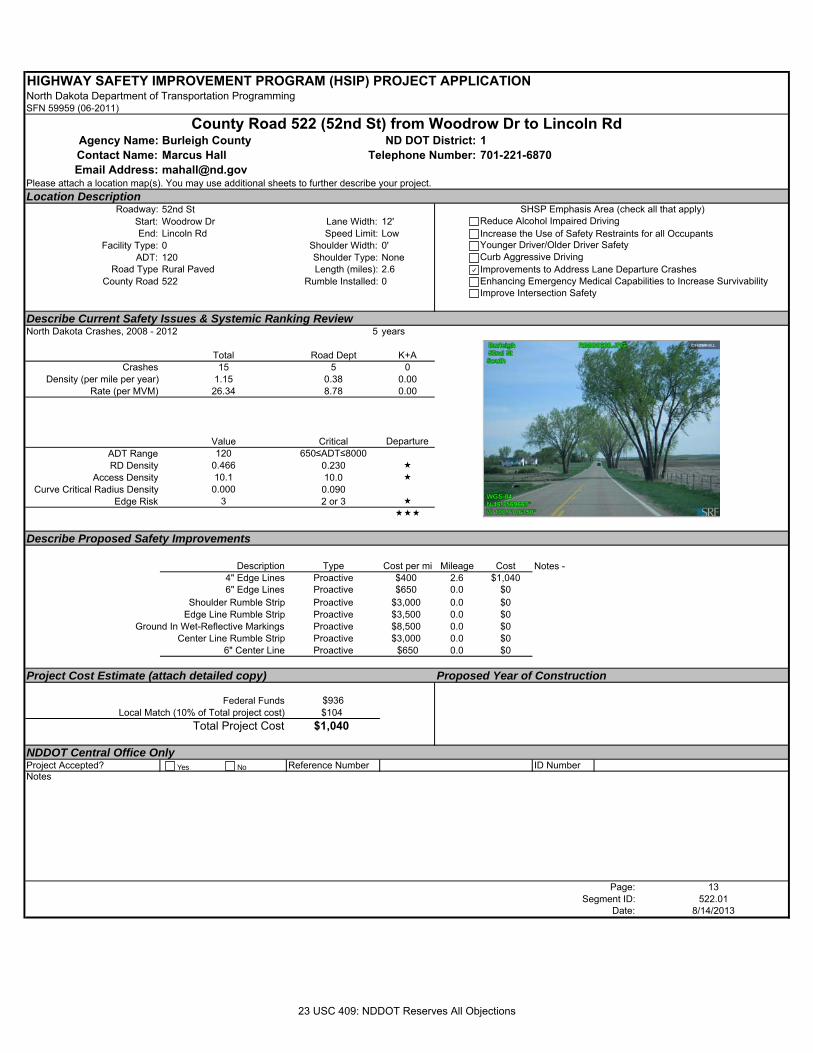
HIGHWAY SAFETY IMPROVEMENT PROGRAM (HSIP) PROJECT APPLICATIONNorth Dakota Department of Transportation ProgrammingSFN 59959 (06-2011)
Agency Name: Burleigh County 1Contact Name: Marcus Hall 701-221-6870Email Address: [email protected]
Please attach a location map(s). You may use additional sheets to further describe your project.Location Description
Roadway: 52nd StStart: Woodrow Dr Lane Width: 12'End: Lincoln Rd Speed Limit: Low
Facility Type: 0 Shoulder Width: 0'ADT: 120 Shoulder Type: None
Road Type Rural Paved Length (miles): 2.6County Road 522 Rumble Installed: 0
Describe Current Safety Issues & Systemic Ranking ReviewNorth Dakota Crashes, 2008 - 2012 5 years
Total Road Dept K+ACrashes 15 5 0
Density (per mile per year) 1.15 0.38 0.00Rate (per MVM) 26.34 8.78 0.00
Value Critical Departure ADT Range 120 650≤ADT≤8000RD Density 0.466 0.230
Access Density 10.1 10.0 Curve Critical Radius Density 0.000 0.090
Edge Risk 3 2 or 3
Describe Proposed Safety Improvements
Description Type Cost per mi Mileage Cost4" Edge Lines Proactive $400 2.6 $1,0406" Edge Lines Proactive $650 0.0 $0
Shoulder Rumble Strip Proactive $3,000 0.0 $0Edge Line Rumble Strip Proactive $3,500 0.0 $0
Ground In Wet-Reflective Markings Proactive $8,500 0.0 $0Center Line Rumble Strip Proactive $3,000 0.0 $0
6" Center Line Proactive $650 0.0 $0
Project Cost Estimate (attach detailed copy) Proposed Year of Construction
Federal Funds $936 Local Match (10% of Total project cost) $104
Total Project Cost $1,040
NDDOT Central Office OnlyProject Accepted? Reference Number ID NumberNotes
Page: 13Segment ID: 522.01
Date: 8/14/2013
Notes -
County Road 522 (52nd St) from Woodrow Dr to Lincoln RdND DOT District:
Telephone Number:
SHSP Emphasis Area (check all that apply)Reduce Alcohol Impaired DrivingIncrease the Use of Safety Restraints for all OccupantsYounger Driver/Older Driver SafetyCurb Aggressive DrivingImprovements to Address Lane Departure CrashesEnhancing Emergency Medical Capabilities to Increase SurvivabilityImprove Intersection Safety
Yes No
23 USC 409: NDDOT Reserves All Objections
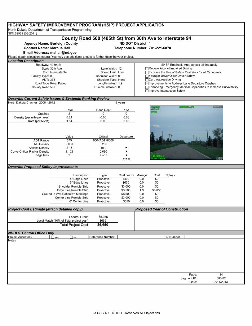
HIGHWAY SAFETY IMPROVEMENT PROGRAM (HSIP) PROJECT APPLICATIONNorth Dakota Department of Transportation ProgrammingSFN 59959 (06-2011)
Agency Name: Burleigh County 1Contact Name: Marcus Hall 701-221-6870Email Address: [email protected]
Please attach a location map(s). You may use additional sheets to further describe your project.Location Description
Roadway: 405th StStart: 30th Ave Lane Width: 12'End: Interstate 94 Speed Limit: Low
Facility Type: 0 Shoulder Width: 0'ADT: 375 Shoulder Type: None
Road Type Rural Paved Length (miles): 1.9County Road 500 Rumble Installed: 0
Describe Current Safety Issues & Systemic Ranking ReviewNorth Dakota Crashes, 2008 - 2012 5 years
Total Road Dept K+ACrashes 2 0 0
Density (per mile per year) 0.21 0.00 0.00Rate (per MVM) 1.54 0.00 0.00
Value Critical Departure ADT Range 375 650≤ADT≤8000RD Density 0.000 0.230
Access Density 21.5 10.0 Curve Critical Radius Density 2.102 0.090
Edge Risk 2 2 or 3
Describe Proposed Safety Improvements
Description Type Cost per mi Mileage Cost4" Edge Lines Proactive $400 0.0 $06" Edge Lines Proactive $650 0.0 $0
Shoulder Rumble Strip Proactive $3,000 0.0 $0Edge Line Rumble Strip Proactive $3,500 1.9 $6,650
Ground In Wet-Reflective Markings Proactive $8,500 0.0 $0Center Line Rumble Strip Proactive $3,000 0.0 $0
6" Center Line Proactive $650 0.0 $0
Project Cost Estimate (attach detailed copy) Proposed Year of Construction
Federal Funds $5,985 Local Match (10% of Total project cost) $665
Total Project Cost $6,650
NDDOT Central Office OnlyProject Accepted? Reference Number ID NumberNotes
Page: 14Segment ID: 500.02
Date: 8/14/2013
Notes -
County Road 500 (405th St) from 30th Ave to Interstate 94ND DOT District:
Telephone Number:
SHSP Emphasis Area (check all that apply)Reduce Alcohol Impaired DrivingIncrease the Use of Safety Restraints for all OccupantsYounger Driver/Older Driver SafetyCurb Aggressive DrivingImprovements to Address Lane Departure CrashesEnhancing Emergency Medical Capabilities to Increase SurvivabilityImprove Intersection Safety
Yes No
23 USC 409: NDDOT Reserves All Objections
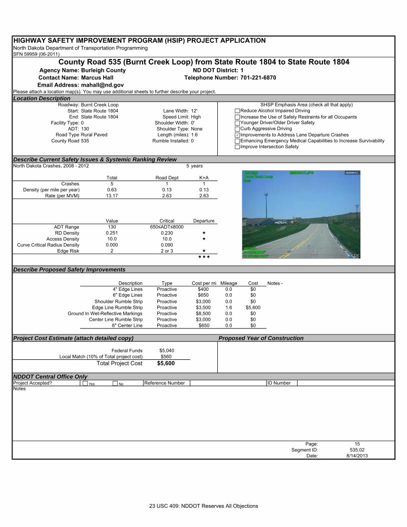
HIGHWAY SAFETY IMPROVEMENT PROGRAM (HSIP) PROJECT APPLICATIONNorth Dakota Department of Transportation ProgrammingSFN 59959 (06-2011)
Agency Name: Burleigh County 1Contact Name: Marcus Hall 701-221-6870Email Address: [email protected]
Please attach a location map(s). You may use additional sheets to further describe your project.Location Description
Roadway: Burnt Creek LoopStart: State Route 1804 Lane Width: 12'End: State Route 1804 Speed Limit: High
Facility Type: 0 Shoulder Width: 0'ADT: 130 Shoulder Type: None
Road Type Rural Paved Length (miles): 1.6County Road 535 Rumble Installed: 0
Describe Current Safety Issues & Systemic Ranking ReviewNorth Dakota Crashes, 2008 - 2012 5 years
Total Road Dept K+ACrashes 5 1 1
Density (per mile per year) 0.63 0.13 0.13Rate (per MVM) 13.17 2.63 2.63
Value Critical Departure ADT Range 130 650≤ADT≤8000RD Density 0.251 0.230
Access Density 10.0 10.0 Curve Critical Radius Density 0.000 0.090
Edge Risk 2 2 or 3
Describe Proposed Safety Improvements
Description Type Cost per mi Mileage Cost4" Edge Lines Proactive $400 0.0 $06" Edge Lines Proactive $650 0.0 $0
Shoulder Rumble Strip Proactive $3,000 0.0 $0Edge Line Rumble Strip Proactive $3,500 1.6 $5,600
Ground In Wet-Reflective Markings Proactive $8,500 0.0 $0Center Line Rumble Strip Proactive $3,000 0.0 $0
6" Center Line Proactive $650 0.0 $0
Project Cost Estimate (attach detailed copy) Proposed Year of Construction
Federal Funds $5,040 Local Match (10% of Total project cost) $560
Total Project Cost $5,600
NDDOT Central Office OnlyProject Accepted? Reference Number ID NumberNotes
Page: 15Segment ID: 535.02
Date: 8/14/2013
Notes -
County Road 535 (Burnt Creek Loop) from State Route 1804 to State Route 1804ND DOT District:
Telephone Number:
SHSP Emphasis Area (check all that apply)Reduce Alcohol Impaired DrivingIncrease the Use of Safety Restraints for all OccupantsYounger Driver/Older Driver SafetyCurb Aggressive DrivingImprovements to Address Lane Departure CrashesEnhancing Emergency Medical Capabilities to Increase SurvivabilityImprove Intersection Safety
Yes No
23 USC 409: NDDOT Reserves All Objections
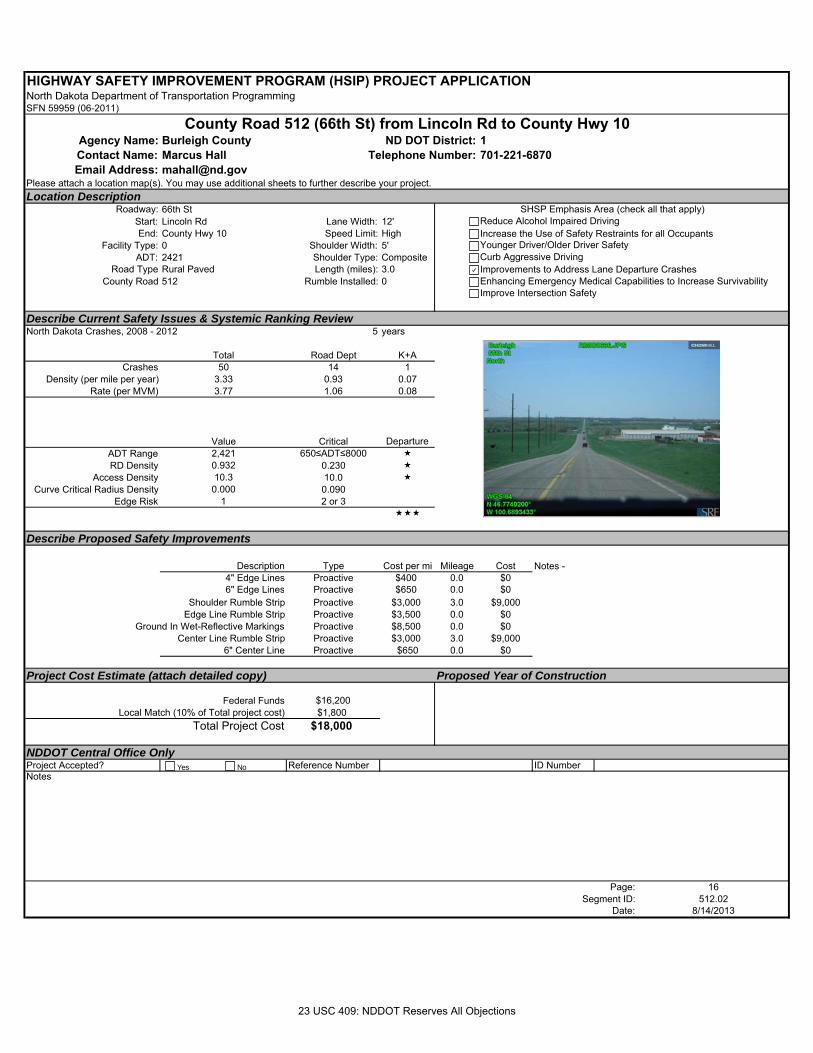
HIGHWAY SAFETY IMPROVEMENT PROGRAM (HSIP) PROJECT APPLICATIONNorth Dakota Department of Transportation ProgrammingSFN 59959 (06-2011)
Agency Name: Burleigh County 1Contact Name: Marcus Hall 701-221-6870Email Address: [email protected]
Please attach a location map(s). You may use additional sheets to further describe your project.Location Description
Roadway: 66th StStart: Lincoln Rd Lane Width: 12'End: County Hwy 10 Speed Limit: High
Facility Type: 0 Shoulder Width: 5'ADT: 2421 Shoulder Type: Composite
Road Type Rural Paved Length (miles): 3.0County Road 512 Rumble Installed: 0
Describe Current Safety Issues & Systemic Ranking ReviewNorth Dakota Crashes, 2008 - 2012 5 years
Total Road Dept K+ACrashes 50 14 1
Density (per mile per year) 3.33 0.93 0.07Rate (per MVM) 3.77 1.06 0.08
Value Critical Departure ADT Range 2,421 650≤ADT≤8000 RD Density 0.932 0.230
Access Density 10.3 10.0 Curve Critical Radius Density 0.000 0.090
Edge Risk 1 2 or 3
Describe Proposed Safety Improvements
Description Type Cost per mi Mileage Cost4" Edge Lines Proactive $400 0.0 $06" Edge Lines Proactive $650 0.0 $0
Shoulder Rumble Strip Proactive $3,000 3.0 $9,000Edge Line Rumble Strip Proactive $3,500 0.0 $0
Ground In Wet-Reflective Markings Proactive $8,500 0.0 $0Center Line Rumble Strip Proactive $3,000 3.0 $9,000
6" Center Line Proactive $650 0.0 $0
Project Cost Estimate (attach detailed copy) Proposed Year of Construction
Federal Funds $16,200 Local Match (10% of Total project cost) $1,800
Total Project Cost $18,000
NDDOT Central Office OnlyProject Accepted? Reference Number ID NumberNotes
Page: 16Segment ID: 512.02
Date: 8/14/2013
Notes -
County Road 512 (66th St) from Lincoln Rd to County Hwy 10ND DOT District:
Telephone Number:
SHSP Emphasis Area (check all that apply)Reduce Alcohol Impaired DrivingIncrease the Use of Safety Restraints for all OccupantsYounger Driver/Older Driver SafetyCurb Aggressive DrivingImprovements to Address Lane Departure CrashesEnhancing Emergency Medical Capabilities to Increase SurvivabilityImprove Intersection Safety
Yes No
23 USC 409: NDDOT Reserves All Objections
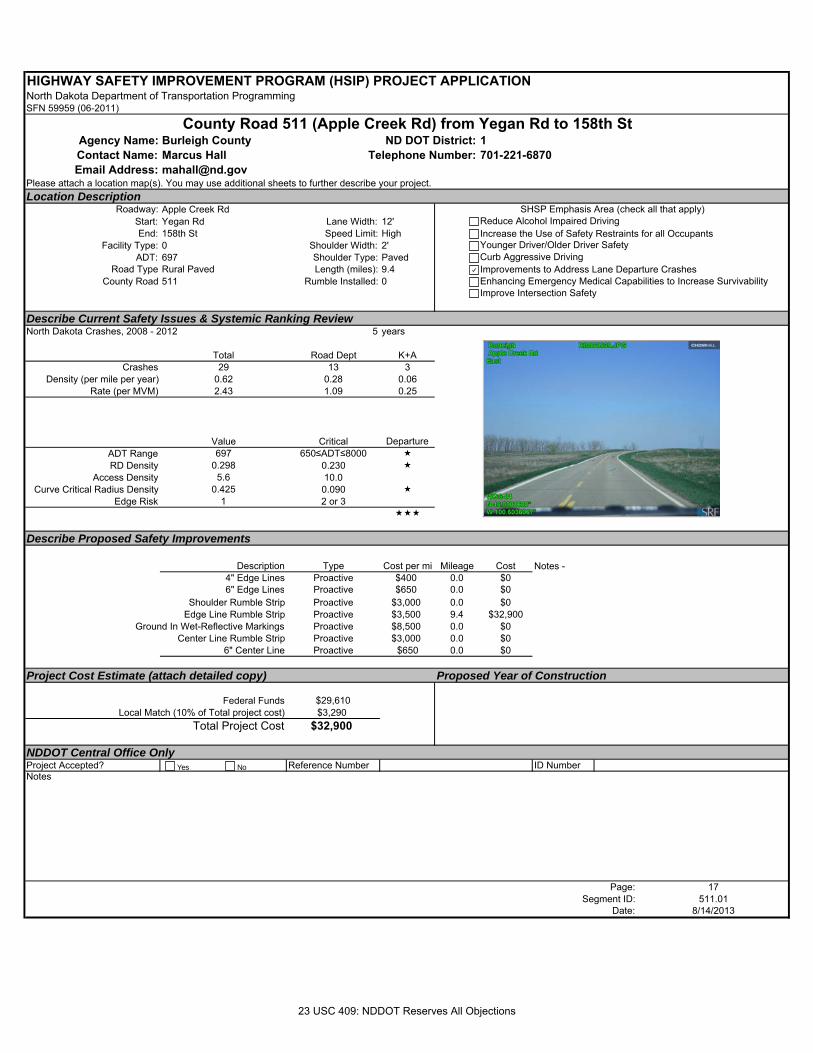
HIGHWAY SAFETY IMPROVEMENT PROGRAM (HSIP) PROJECT APPLICATIONNorth Dakota Department of Transportation ProgrammingSFN 59959 (06-2011)
Agency Name: Burleigh County 1Contact Name: Marcus Hall 701-221-6870Email Address: [email protected]
Please attach a location map(s). You may use additional sheets to further describe your project.Location Description
Roadway: Apple Creek RdStart: Yegan Rd Lane Width: 12'End: 158th St Speed Limit: High
Facility Type: 0 Shoulder Width: 2'ADT: 697 Shoulder Type: Paved
Road Type Rural Paved Length (miles): 9.4County Road 511 Rumble Installed: 0
Describe Current Safety Issues & Systemic Ranking ReviewNorth Dakota Crashes, 2008 - 2012 5 years
Total Road Dept K+ACrashes 29 13 3
Density (per mile per year) 0.62 0.28 0.06Rate (per MVM) 2.43 1.09 0.25
Value Critical Departure ADT Range 697 650≤ADT≤8000 RD Density 0.298 0.230
Access Density 5.6 10.0Curve Critical Radius Density 0.425 0.090
Edge Risk 1 2 or 3
Describe Proposed Safety Improvements
Description Type Cost per mi Mileage Cost4" Edge Lines Proactive $400 0.0 $06" Edge Lines Proactive $650 0.0 $0
Shoulder Rumble Strip Proactive $3,000 0.0 $0Edge Line Rumble Strip Proactive $3,500 9.4 $32,900
Ground In Wet-Reflective Markings Proactive $8,500 0.0 $0Center Line Rumble Strip Proactive $3,000 0.0 $0
6" Center Line Proactive $650 0.0 $0
Project Cost Estimate (attach detailed copy) Proposed Year of Construction
Federal Funds $29,610 Local Match (10% of Total project cost) $3,290
Total Project Cost $32,900
NDDOT Central Office OnlyProject Accepted? Reference Number ID NumberNotes
Page: 17Segment ID: 511.01
Date: 8/14/2013
Notes -
County Road 511 (Apple Creek Rd) from Yegan Rd to 158th StND DOT District:
Telephone Number:
SHSP Emphasis Area (check all that apply)Reduce Alcohol Impaired DrivingIncrease the Use of Safety Restraints for all OccupantsYounger Driver/Older Driver SafetyCurb Aggressive DrivingImprovements to Address Lane Departure CrashesEnhancing Emergency Medical Capabilities to Increase SurvivabilityImprove Intersection Safety
Yes No
23 USC 409: NDDOT Reserves All Objections
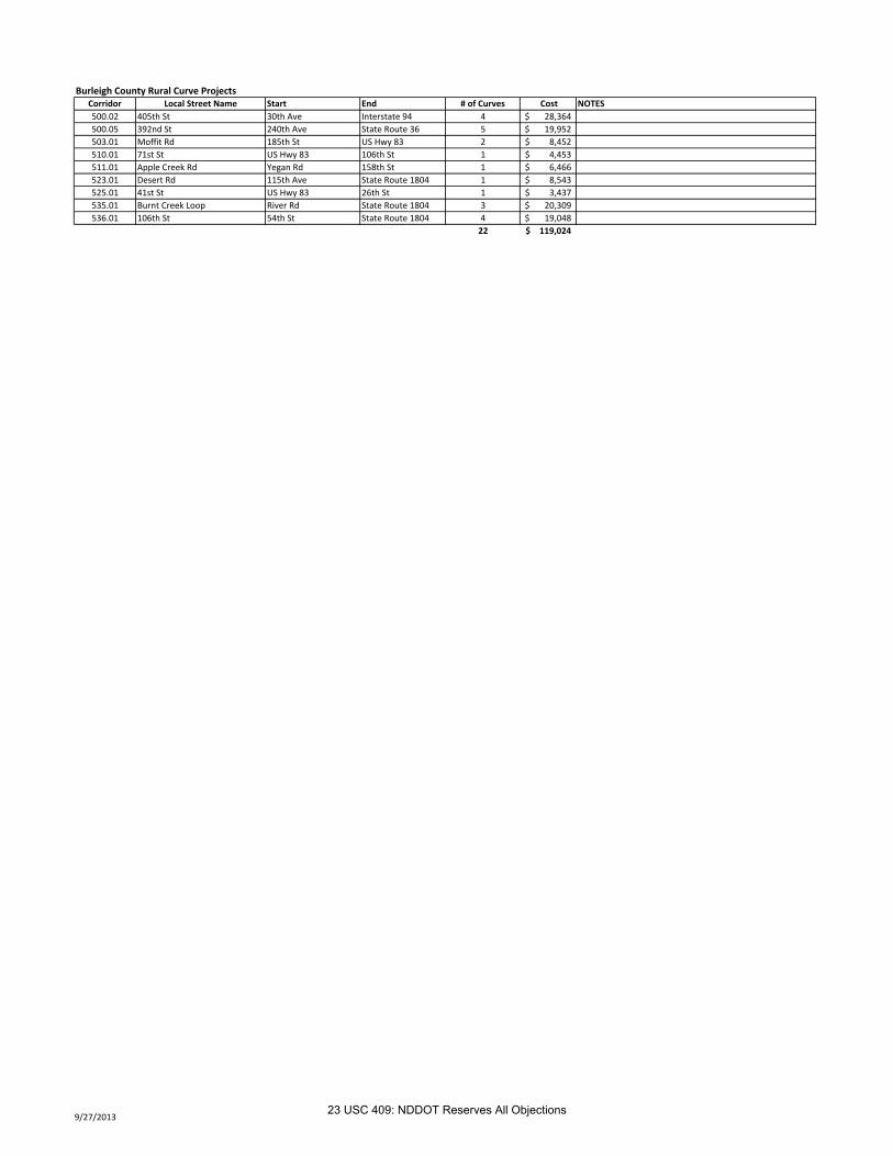
Burleigh County Rural Curve ProjectsCorridor Local Street Name Start End # of Curves Cost NOTES
500.02 405th St 30th Ave Interstate 94 4 28,364$
500.05 392nd St 240th Ave State Route 36 5 19,952$
503.01 Moffit Rd 185th St US Hwy 83 2 8,452$
510.01 71st St US Hwy 83 106th St 1 4,453$
511.01 Apple Creek Rd Yegan Rd 158th St 1 6,466$
523.01 Desert Rd 115th Ave State Route 1804 1 8,543$
525.01 41st St US Hwy 83 26th St 1 3,437$
535.01 Burnt Creek Loop River Rd State Route 1804 3 20,309$
536.01 106th St 54th St State Route 1804 4 19,048$
22 119,024$
9/27/201323 USC 409: NDDOT Reserves All Objections
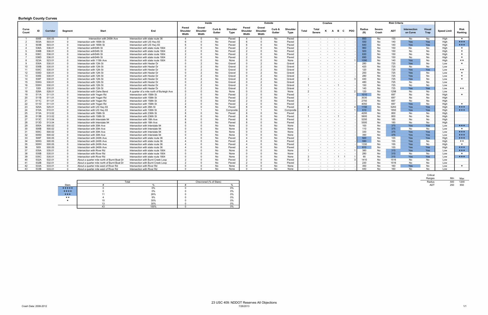
Burleigh County Curves 1 4
CurveCount ID Corridor Segment Start End
Paved Shoulder
Width
Gravel Shoulder
Width
Curb & Gutter
Shoulder Type
Paved Shoulder
Width
Gravel Shoulder
Width
Curb & Gutter
Shoulder Type Total Total
Severe K A B C PDO Radius(ft)
Severe Crash ADT Intersection
on CurveVisualTrap Speed Limit Risk
Ranking
1 500E 500.05 0 Intersection with 240th Ave Intersection with state route 36 4 0 No Paved 4 0 No Paved - - - - - - - 850 No 155 No No High 2 503A 503.01 0 Intersection with 185th St Intersection with US Hwy 83 6 0 No Paved 6 0 No Paved - - - - - - - 550 No 140 Yes Yes High 3 503B 503.01 0 Intersection with 185th St Intersection with US Hwy 83 6 0 No Paved 6 0 No Paved - - - - - - - 640 No 140 Yes Yes High 4 536A 536.01 0 Intersection with54th St Intersection with state route 1804 2 0 No Paved 2 0 No Paved - - - - - - - 960 No 150 No No High 5 536B 536.01 0 Intersection with54th St Intersection with state route 1804 2 0 No Paved 2 0 No Paved - - - - - - - 500 No 150 No No High 6 536C 536.01 0 Intersection with54th St Intersection with state route 1804 2 0 No Paved 2 0 No Paved - - - - - - - 630 No 150 No No High 7 536D 536.01 0 Intersection with54th St Intersection with state route 1804 2 0 No Paved 2 0 No Paved - - - - - - - 690 No 150 No No High 8 523A 523.01 0 Intersection with 115th Ave Intersection with state route 1804 0 0 No None 0 0 No None 1 - - - - - 1 1090 No 140 Yes No High 9 530A 530.01 0 Intersection with 12th St Intersection with Hester Dr 0 2 No Gravel 0 2 No Gravel - - - - - - - 280 No 725 Yes No Low 10 530B 530.01 0 Intersection with 12th St Intersection with Hester Dr 0 2 No Gravel 0 2 No Gravel - - - - - - - 420 No 725 No No Low11 530C 530.01 0 Intersection with 12th St Intersection with Hester Dr 0 2 No Gravel 0 2 No Gravel - - - - - - - 120 No 725 Yes Yes Low 12 530D 530.01 0 Intersection with 12th St Intersection with Hester Dr 0 2 No Gravel 0 2 No Gravel - - - - - - - 250 No 725 Yes No Low 13 530E 530.01 0 Intersection with 12th St Intersection with Hester Dr 0 2 No Gravel 0 2 No Gravel - - - - - - - 280 No 725 Yes No Low 14 530F 530.01 0 Intersection with 12th St Intersection with Hester Dr 0 2 No Gravel 0 2 No Gravel 3 - - - - - 3 440 No 725 Yes No Low 15 530G 530.01 0 Intersection with 12th St Intersection with Hester Dr 0 2 No Gravel 0 2 No Gravel - - - - - - - 480 No 725 No No Low16 530H 530.01 0 Intersection with 12th St Intersection with Hester Dr 0 2 No Gravel 0 2 No Gravel 1 - - - 1 - - 150 No 725 No No Low17 530I 530 01 0 Intersection with 12th St Intersection with Hester Dr 0 2 No Gravel 0 2 No Gravel 140 No 725 Yes Yes Low
Inside Outside Crashes Risk Criteria
17 530I 530.01 0 Intersection with 12th St Intersection with Hester Dr 0 2 No Gravel 0 2 No Gravel - - - - - - - 140 No 725 Yes Yes Low 18 528A 528.01 0 Intersection with Oahe Bend A quarter of a mile north of Burleigh Ave 0 0 No None 0 0 No None 2 - - - - - 2 120 No 1298 No No Low19 511A 511.01 0 Intersection with Yegan Rd Intersection with 158th St 2 0 No Paved 2 0 No Paved - - - - - - - 1010 No 697 No No High 20 511B 511.01 0 Intersection with Yegan Rd Intersection with 158th St 2 0 No Paved 2 0 No Paved - - - - - - - 3030 No 697 No No High21 511C 511.01 0 Intersection with Yegan Rd Intersection with 158th St 2 0 No Paved 2 0 No Paved - - - - - - - 2750 No 697 No No High22 511D 511.01 0 Intersection with Yegan Rd Intersection with 158th St 2 0 No Paved 2 0 No Paved - - - - - - - 4050 No 697 Yes No High 23 525A 525.01 0 Intersection with US Hwy 83 Intersection with 26th St 8 0 No Paved 8 0 No Paved 4 - - - - - 4 1150 No 5283 Yes Yes High 24 510A 510.01 0 Intersection with US Hwy 83 Intersection with 106th St 2 1 No Composite 2 1 No Composite 1 - - - - - 1 610 No 1850 Yes Yes High 25 513A 513.02 0 Intersection with 158th St Intersection with 236th St 8 0 No Paved 8 0 No Paved - - - - - - - 4200 No 800 No No High26 513B 513.02 0 Intersection with 158th St Intersection with 236th St 8 0 No Paved 8 0 No Paved 1 - - - 1 - - 5600 No 800 No No High27 513C 513.04 0 Intersection with Interstate 94 Intersection with 18th Ave 8 0 No Paved 8 0 No Paved - - - - - - - 5200 No 185 No No High28 513D 513.04 0 Intersection with Interstate 94 Intersection with 18th Ave 8 0 No Paved 8 0 No Paved - - - - - - - 5500 No 185 No No High29 500A 500.02 0 Intersection with 30th Ave Intersection with Interstate 94 0 0 No None 0 0 No None - - - - - - - 100 No 375 Yes Yes Low 30 500B 500.02 0 Intersection with 30th Ave Intersection with Interstate 94 0 0 No None 0 0 No None - - - - - - - 110 No 375 No No Low 31 500C 500.02 0 Intersection with 30th Ave Intersection with Interstate 94 0 0 No None 0 0 No None - - - - - - - 330 No 375 Yes Yes Low 32 500D 500.02 0 Intersection with 30th Ave Intersection with Interstate 94 0 0 No None 0 0 No None - - - - - - - 390 No 375 Yes Yes Low 33 500F 500.05 0 Intersection with 240th Ave Intersection with state route 36 4 0 No Paved 4 0 No Paved - - - - - - - 920 No 155 Yes Yes High 34 500G 500.05 0 Intersection with 240th Ave Intersection with state route 36 4 0 No Paved 4 0 No Paved - - - - - - - 590 No 155 Yes No High 35 500H 500.05 0 Intersection with 240th Ave Intersection with state route 36 4 0 No Paved 4 0 No Paved - - - - - - - 1330 No 155 Yes No High 36 500I 500.05 0 Intersection with 240th Ave Intersection with state route 36 4 0 No Paved 4 0 No Paved - - - - - - - 610 No 155 Yes Yes High 37 535A 535.01 0 Intersection with River Rd Intersection with state route 1804 0 0 No None 0 0 No None 1 - - - - - 1 380 No 315 Yes Yes Low 38 535B 535.01 0 Intersection with River Rd Intersection with state route 1804 0 0 No None 0 0 No None - - - - - - - 280 No 315 No No Low 39 535C 535.01 0 Intersection with River Rd Intersection with state route 1804 0 0 No None 0 0 No None 3 - - - 1 1 1 90 No 315 Yes Yes Low 40 532A 532.01 0 About a quarter mile north of Burnt Boat Dr Intersection with Burnt Creek Loop 2 0 No Paved 2 0 No Paved 3 - - - - - 3 1410 No 1516 No No Low41 532B 532.01 0 About a quarter mile north of Burnt Boat Dr Intersection with Burnt Creek Loop 2 0 No Paved 2 0 No Paved - - - - - - - 230 No 1516 No No Low42 533A 533.01 0 About a quarter mile west of River Rd Intersection with River Rd 0 0 No None 0 0 No None - - - - - - - 350 No 160 Yes No Low 43 533B 533.01 0 About a quarter mile west of River Rd Intersection with River Rd 0 0 No None 0 0 No None - - - - - - - 440 No 160 No No Low
20 - - - 3 1 16 14 7 11Critical
Ranges Min MaxTotal (ft) Radius 500 1200
Stars # % # % Total (mi) ADT 250 650 0 0% 0 0% Average (ft) 0 0% 0 0% 11 26% 0 0% 4 9% 0 0% 15 35% 0 0%
13 30% 0 0%43 100% 0 0%
Total Chevroned (% of Stars)
Crash Data: 2008-2012 7/26/2013 1/123 USC 409: NDDOT Reserves All Objections
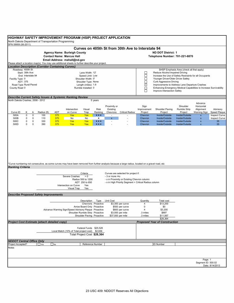
HIGHWAY SAFETY IMPROVEMENT PROGRAM (HSIP) PROJECT APPLICATIONNorth Dakota Department of Transportation ProgrammingSFN 59959 (06-2011)
Burleigh County 1Marcus Hall [email protected]
Please attach a location map(s). You may use additional sheets to further describe your project.Location Description (Corridor Containing Curves)
Roadway:Start: Lane Width:End: Speed Limit:
Facility Type: Shoulder Width:ADT: Shoulder Type:
Road Type Length (miles):County Road Rumble Installed:
Describe Current Safety Issues & Systemic Ranking ReviewNorth Dakota Crashes, 2008 - 2012 5 years
Curve ID K A Radius (ft) ADTIntersectionon Curve
Visual Trap
Risk Ranking
Proximity or Existing
Chevrons Critical Radius
Sign Improvement
ProjectShoulder Paving
Project
Shoulder Rumble Strip
Project
Advance Horizontal Alignment
Warning SignAdvisory
Speed Plaque500A 0 0 100 375 Yes Yes - - Chevron Inside/Outside Inside/Outside x Inspect Curve500B 0 0 110 375 No No x - Chevron Inside/Outside Inside/Outside x Inspect Curve500C 0 0 330 375 Yes Yes - - Chevron Inside/Outside Inside/Outside x 35500D 0 0 390 375 Yes Yes - - Chevron Inside/Outside Inside/Outside x 35
Email Address:
Curves on 405th St from 30th Ave to Interstate 94Agency Name: ND DOT District:Contact Name: Telephone Number:
SHSP Emphasis Area (check all that apply)30th Ave 12' Reduce Alcohol Impaired DrivingInterstate 94 Low Increase the Use of Safety Restraints for all Occupants
405th St
0 0' Younger Driver/Older Driver Safety375 None Curb Aggressive DrivingRural Paved 1.9 Improvements to Address Lane Departure Crashes0 0 Enhancing Emergency Medical Capabilities to Increase Survivability
Improve Intersection Safety
*Curve numbering not consecutive, as some curves may have been removed from further analysis because a large radius, located on a gravel road, etcRanking Criteria
Criteria Curves are selected for project if:Severe Crashes > 0 - 3 or more s
Radius 500 to 1200 - x in Proximity or Existing Chevron columnADT 250 to 650 - x in High Priority Segment + Critical Radius column
Intersection on Curve YesVisual Trap Yes
Describe Proposed Safety Improvements
Description Type Unit Cost Quantity Total costChevrons Proactive $3,300 per curve 4 $13,200
Arrow Board Only Proactive $500 per curve 0 $0Advance Warning Sign/Speed Advisory Plaque Proactive $800 per curve 4 $3,200
Shoulder Rumble Strip Proactive $3,000 per mile .3 miles $897Shoulder Paving Proactive $37,000 per mile .3 miles $11,067
$28,364Project Cost Estimate (attach detailed copy) Proposed Year of Construction
Federal Funds $25,528Local Match (10% of Total project cost) $2,836
Total Project Cost $28,364
NDDOT Central Office OnlyID Number
Notes
Page: 1Segment ID: 500.02
Date: 8/14/2013
Project Accepted? Reference NumberYes No
23 USC 409: NDDOT Reserves All Objections
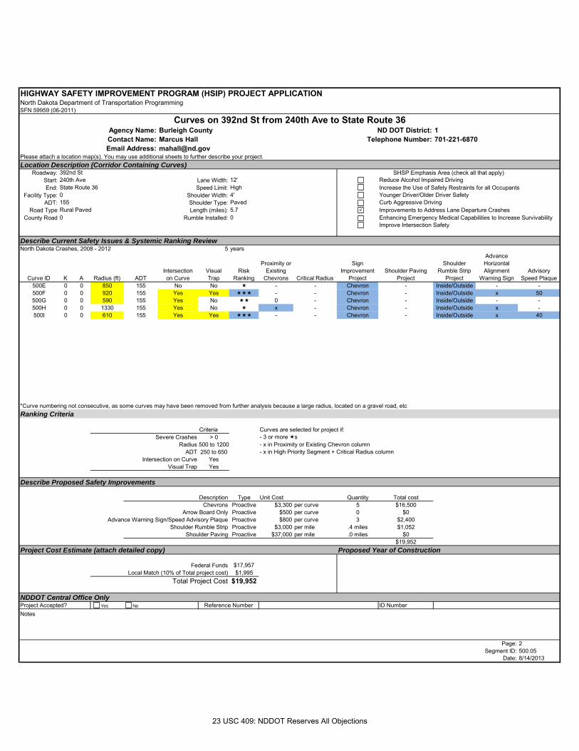
HIGHWAY SAFETY IMPROVEMENT PROGRAM (HSIP) PROJECT APPLICATIONNorth Dakota Department of Transportation ProgrammingSFN 59959 (06-2011)
Burleigh County 1Marcus Hall [email protected]
Please attach a location map(s). You may use additional sheets to further describe your project.Location Description (Corridor Containing Curves)
Roadway:Start: Lane Width:End: Speed Limit:
Facility Type: Shoulder Width:ADT: Shoulder Type:
Road Type Length (miles):County Road Rumble Installed:
Describe Current Safety Issues & Systemic Ranking ReviewNorth Dakota Crashes, 2008 - 2012 5 years
Curve ID K A Radius (ft) ADTIntersectionon Curve
Visual Trap
Risk Ranking
Proximity or Existing
Chevrons Critical Radius
Sign Improvement
ProjectShoulder Paving
Project
Shoulder Rumble Strip
Project
Advance Horizontal Alignment
Warning SignAdvisory
Speed Plaque500E 0 0 850 155 No No - - Chevron - Inside/Outside - -500F 0 0 920 155 Yes Yes - - Chevron - Inside/Outside x 50500G 0 0 590 155 Yes No 0 - Chevron - Inside/Outside - -500H 0 0 1330 155 Yes No x - Chevron - Inside/Outside x -500I 0 0 610 155 Yes Yes - - Chevron - Inside/Outside x 40
Email Address:
Curves on 392nd St from 240th Ave to State Route 36Agency Name: ND DOT District:Contact Name: Telephone Number:
SHSP Emphasis Area (check all that apply)240th Ave 12' Reduce Alcohol Impaired DrivingState Route 36 High Increase the Use of Safety Restraints for all Occupants
392nd St
0 4' Younger Driver/Older Driver Safety155 Paved Curb Aggressive DrivingRural Paved 5.7 Improvements to Address Lane Departure Crashes0 0 Enhancing Emergency Medical Capabilities to Increase Survivability
Improve Intersection Safety
*Curve numbering not consecutive, as some curves may have been removed from further analysis because a large radius, located on a gravel road, etcRanking Criteria
Criteria Curves are selected for project if:Severe Crashes > 0 - 3 or more s
Radius 500 to 1200 - x in Proximity or Existing Chevron columnADT 250 to 650 - x in High Priority Segment + Critical Radius column
Intersection on Curve YesVisual Trap Yes
Describe Proposed Safety Improvements
Description Type Unit Cost Quantity Total costChevrons Proactive $3,300 per curve 5 $16,500
Arrow Board Only Proactive $500 per curve 0 $0Advance Warning Sign/Speed Advisory Plaque Proactive $800 per curve 3 $2,400
Shoulder Rumble Strip Proactive $3,000 per mile .4 miles $1,052Shoulder Paving Proactive $37,000 per mile .0 miles $0
$19,952Project Cost Estimate (attach detailed copy) Proposed Year of Construction
Federal Funds $17,957Local Match (10% of Total project cost) $1,995
Total Project Cost $19,952
NDDOT Central Office OnlyID Number
Notes
Page: 2Segment ID: 500.05
Date: 8/14/2013
Project Accepted? Reference NumberYes No
23 USC 409: NDDOT Reserves All Objections
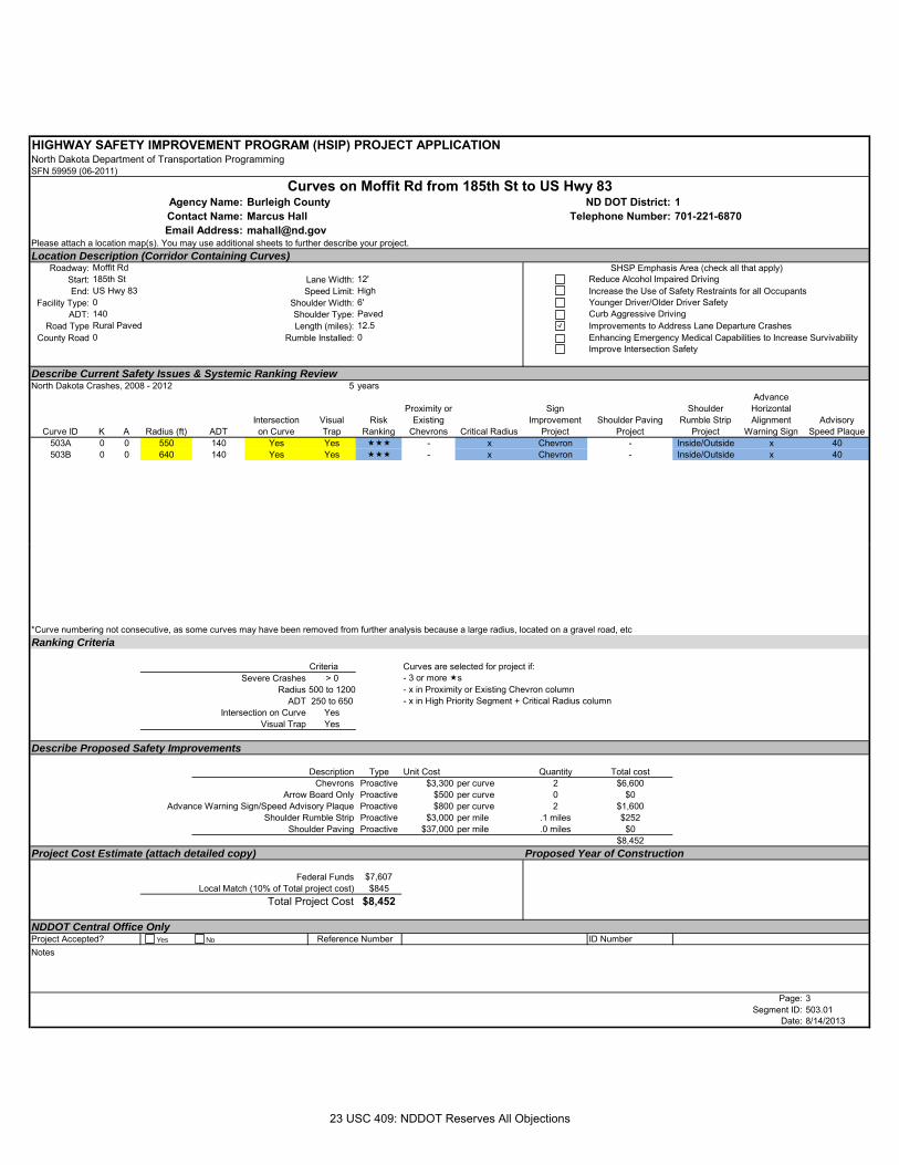
HIGHWAY SAFETY IMPROVEMENT PROGRAM (HSIP) PROJECT APPLICATIONNorth Dakota Department of Transportation ProgrammingSFN 59959 (06-2011)
Burleigh County 1Marcus Hall [email protected]
Please attach a location map(s). You may use additional sheets to further describe your project.Location Description (Corridor Containing Curves)
Roadway:Start: Lane Width:End: Speed Limit:
Facility Type: Shoulder Width:ADT: Shoulder Type:
Road Type Length (miles):County Road Rumble Installed:
Describe Current Safety Issues & Systemic Ranking ReviewNorth Dakota Crashes, 2008 - 2012 5 years
Curve ID K A Radius (ft) ADTIntersectionon Curve
Visual Trap
Risk Ranking
Proximity or Existing
Chevrons Critical Radius
Sign Improvement
ProjectShoulder Paving
Project
Shoulder Rumble Strip
Project
Advance Horizontal Alignment
Warning SignAdvisory
Speed Plaque503A 0 0 550 140 Yes Yes - x Chevron - Inside/Outside x 40503B 0 0 640 140 Yes Yes - x Chevron - Inside/Outside x 40
Email Address:
Curves on Moffit Rd from 185th St to US Hwy 83Agency Name: ND DOT District:Contact Name: Telephone Number:
SHSP Emphasis Area (check all that apply)185th St 12' Reduce Alcohol Impaired DrivingUS Hwy 83 High Increase the Use of Safety Restraints for all Occupants
Moffit Rd
0 6' Younger Driver/Older Driver Safety140 Paved Curb Aggressive DrivingRural Paved 12.5 Improvements to Address Lane Departure Crashes0 0 Enhancing Emergency Medical Capabilities to Increase Survivability
Improve Intersection Safety
*Curve numbering not consecutive, as some curves may have been removed from further analysis because a large radius, located on a gravel road, etcRanking Criteria
Criteria Curves are selected for project if:Severe Crashes > 0 - 3 or more s
Radius 500 to 1200 - x in Proximity or Existing Chevron columnADT 250 to 650 - x in High Priority Segment + Critical Radius column
Intersection on Curve YesVisual Trap Yes
Describe Proposed Safety Improvements
Description Type Unit Cost Quantity Total costChevrons Proactive $3,300 per curve 2 $6,600
Arrow Board Only Proactive $500 per curve 0 $0Advance Warning Sign/Speed Advisory Plaque Proactive $800 per curve 2 $1,600
Shoulder Rumble Strip Proactive $3,000 per mile .1 miles $252Shoulder Paving Proactive $37,000 per mile .0 miles $0
$8,452Project Cost Estimate (attach detailed copy) Proposed Year of Construction
Federal Funds $7,607Local Match (10% of Total project cost) $845
Total Project Cost $8,452
NDDOT Central Office OnlyID Number
Notes
Page: 3Segment ID: 503.01
Date: 8/14/2013
Project Accepted? Reference NumberYes No
23 USC 409: NDDOT Reserves All Objections
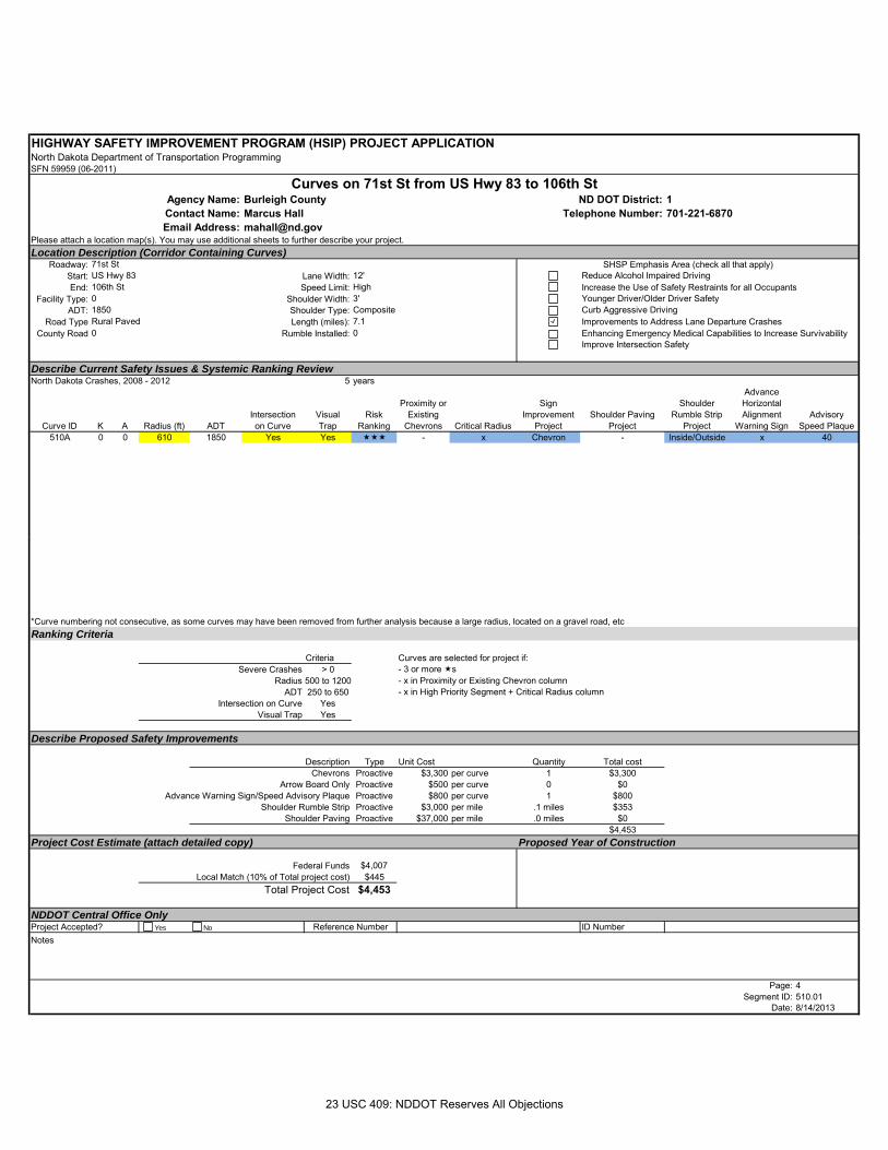
HIGHWAY SAFETY IMPROVEMENT PROGRAM (HSIP) PROJECT APPLICATIONNorth Dakota Department of Transportation ProgrammingSFN 59959 (06-2011)
Burleigh County 1Marcus Hall [email protected]
Please attach a location map(s). You may use additional sheets to further describe your project.Location Description (Corridor Containing Curves)
Roadway:Start: Lane Width:End: Speed Limit:
Facility Type: Shoulder Width:ADT: Shoulder Type:
Road Type Length (miles):County Road Rumble Installed:
Describe Current Safety Issues & Systemic Ranking ReviewNorth Dakota Crashes, 2008 - 2012 5 years
Curve ID K A Radius (ft) ADTIntersectionon Curve
Visual Trap
Risk Ranking
Proximity or Existing
Chevrons Critical Radius
Sign Improvement
ProjectShoulder Paving
Project
Shoulder Rumble Strip
Project
Advance Horizontal Alignment
Warning SignAdvisory
Speed Plaque510A 0 0 610 1850 Yes Yes - x Chevron - Inside/Outside x 40
Email Address:
Curves on 71st St from US Hwy 83 to 106th StAgency Name: ND DOT District:Contact Name: Telephone Number:
SHSP Emphasis Area (check all that apply)US Hwy 83 12' Reduce Alcohol Impaired Driving106th St High Increase the Use of Safety Restraints for all Occupants
71st St
0 3' Younger Driver/Older Driver Safety1850 Composite Curb Aggressive DrivingRural Paved 7.1 Improvements to Address Lane Departure Crashes0 0 Enhancing Emergency Medical Capabilities to Increase Survivability
Improve Intersection Safety
*Curve numbering not consecutive, as some curves may have been removed from further analysis because a large radius, located on a gravel road, etcRanking Criteria
Criteria Curves are selected for project if:Severe Crashes > 0 - 3 or more s
Radius 500 to 1200 - x in Proximity or Existing Chevron columnADT 250 to 650 - x in High Priority Segment + Critical Radius column
Intersection on Curve YesVisual Trap Yes
Describe Proposed Safety Improvements
Description Type Unit Cost Quantity Total costChevrons Proactive $3,300 per curve 1 $3,300
Arrow Board Only Proactive $500 per curve 0 $0Advance Warning Sign/Speed Advisory Plaque Proactive $800 per curve 1 $800
Shoulder Rumble Strip Proactive $3,000 per mile .1 miles $353Shoulder Paving Proactive $37,000 per mile .0 miles $0
$4,453Project Cost Estimate (attach detailed copy) Proposed Year of Construction
Federal Funds $4,007Local Match (10% of Total project cost) $445
Total Project Cost $4,453
NDDOT Central Office OnlyID Number
Notes
Page: 4Segment ID: 510.01
Date: 8/14/2013
Project Accepted? Reference NumberYes No
23 USC 409: NDDOT Reserves All Objections
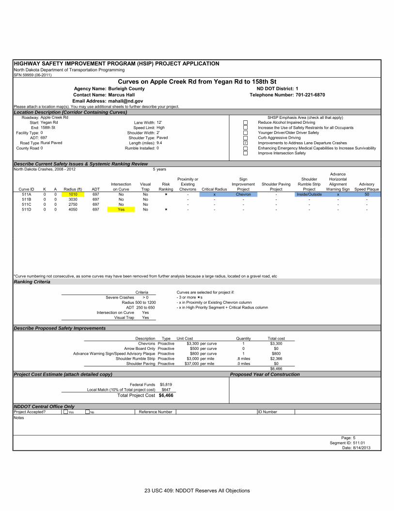
HIGHWAY SAFETY IMPROVEMENT PROGRAM (HSIP) PROJECT APPLICATIONNorth Dakota Department of Transportation ProgrammingSFN 59959 (06-2011)
Burleigh County 1Marcus Hall [email protected]
Please attach a location map(s). You may use additional sheets to further describe your project.Location Description (Corridor Containing Curves)
Roadway:Start: Lane Width:End: Speed Limit:
Facility Type: Shoulder Width:ADT: Shoulder Type:
Road Type Length (miles):County Road Rumble Installed:
Describe Current Safety Issues & Systemic Ranking ReviewNorth Dakota Crashes, 2008 - 2012 5 years
Curve ID K A Radius (ft) ADTIntersectionon Curve
Visual Trap
Risk Ranking
Proximity or Existing
Chevrons Critical Radius
Sign Improvement
ProjectShoulder Paving
Project
Shoulder Rumble Strip
Project
Advance Horizontal Alignment
Warning SignAdvisory
Speed Plaque511A 0 0 1010 697 No No - x Chevron - Inside/Outside x 50511B 0 0 3030 697 No No - - - - - - -511C 0 0 2750 697 No No - - - - - - -511D 0 0 4050 697 Yes No - - - - - - -
Email Address:
Curves on Apple Creek Rd from Yegan Rd to 158th StAgency Name: ND DOT District:Contact Name: Telephone Number:
SHSP Emphasis Area (check all that apply)Yegan Rd 12' Reduce Alcohol Impaired Driving158th St High Increase the Use of Safety Restraints for all Occupants
Apple Creek Rd
0 2' Younger Driver/Older Driver Safety697 Paved Curb Aggressive DrivingRural Paved 9.4 Improvements to Address Lane Departure Crashes0 0 Enhancing Emergency Medical Capabilities to Increase Survivability
Improve Intersection Safety
*Curve numbering not consecutive, as some curves may have been removed from further analysis because a large radius, located on a gravel road, etcRanking Criteria
Criteria Curves are selected for project if:Severe Crashes > 0 - 3 or more s
Radius 500 to 1200 - x in Proximity or Existing Chevron columnADT 250 to 650 - x in High Priority Segment + Critical Radius column
Intersection on Curve YesVisual Trap Yes
Describe Proposed Safety Improvements
Description Type Unit Cost Quantity Total costChevrons Proactive $3,300 per curve 1 $3,300
Arrow Board Only Proactive $500 per curve 0 $0Advance Warning Sign/Speed Advisory Plaque Proactive $800 per curve 1 $800
Shoulder Rumble Strip Proactive $3,000 per mile .8 miles $2,366Shoulder Paving Proactive $37,000 per mile .0 miles $0
$6,466Project Cost Estimate (attach detailed copy) Proposed Year of Construction
Federal Funds $5,819Local Match (10% of Total project cost) $647
Total Project Cost $6,466
NDDOT Central Office OnlyID Number
Notes
Page: 5Segment ID: 511.01
Date: 8/14/2013
Project Accepted? Reference NumberYes No
23 USC 409: NDDOT Reserves All Objections
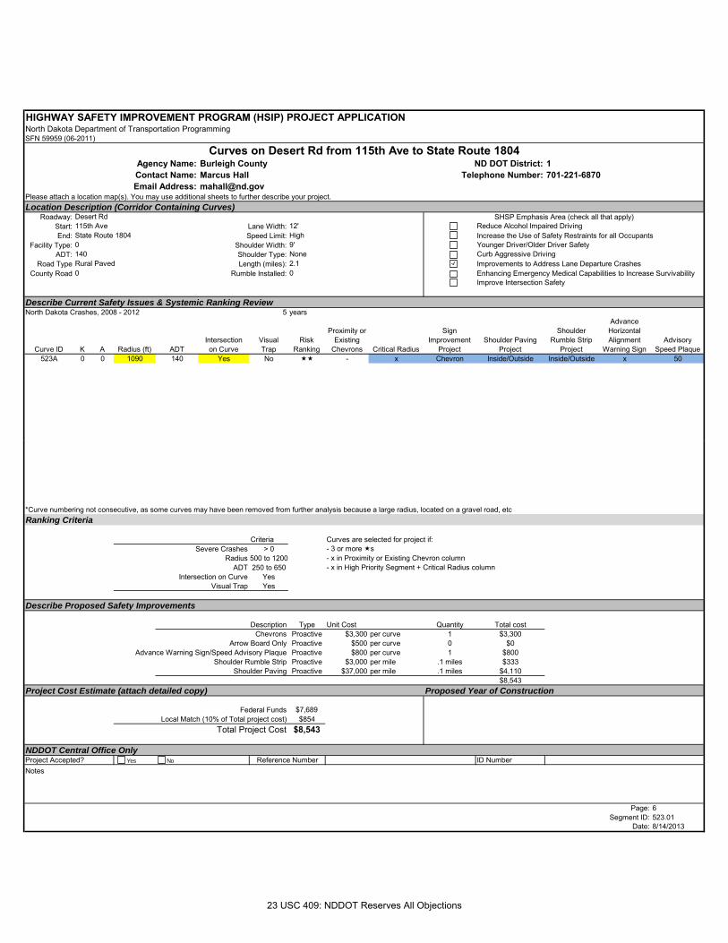
HIGHWAY SAFETY IMPROVEMENT PROGRAM (HSIP) PROJECT APPLICATIONNorth Dakota Department of Transportation ProgrammingSFN 59959 (06-2011)
Burleigh County 1Marcus Hall [email protected]
Please attach a location map(s). You may use additional sheets to further describe your project.Location Description (Corridor Containing Curves)
Roadway:Start: Lane Width:End: Speed Limit:
Facility Type: Shoulder Width:ADT: Shoulder Type:
Road Type Length (miles):County Road Rumble Installed:
Describe Current Safety Issues & Systemic Ranking ReviewNorth Dakota Crashes, 2008 - 2012 5 years
Curve ID K A Radius (ft) ADTIntersectionon Curve
Visual Trap
Risk Ranking
Proximity or Existing
Chevrons Critical Radius
Sign Improvement
ProjectShoulder Paving
Project
Shoulder Rumble Strip
Project
Advance Horizontal Alignment
Warning SignAdvisory
Speed Plaque523A 0 0 1090 140 Yes No - x Chevron Inside/Outside Inside/Outside x 50
Email Address:
Curves on Desert Rd from 115th Ave to State Route 1804Agency Name: ND DOT District:Contact Name: Telephone Number:
SHSP Emphasis Area (check all that apply)115th Ave 12' Reduce Alcohol Impaired DrivingState Route 1804 High Increase the Use of Safety Restraints for all Occupants
Desert Rd
0 9' Younger Driver/Older Driver Safety140 None Curb Aggressive DrivingRural Paved 2.1 Improvements to Address Lane Departure Crashes0 0 Enhancing Emergency Medical Capabilities to Increase Survivability
Improve Intersection Safety
*Curve numbering not consecutive, as some curves may have been removed from further analysis because a large radius, located on a gravel road, etcRanking Criteria
Criteria Curves are selected for project if:Severe Crashes > 0 - 3 or more s
Radius 500 to 1200 - x in Proximity or Existing Chevron columnADT 250 to 650 - x in High Priority Segment + Critical Radius column
Intersection on Curve YesVisual Trap Yes
Describe Proposed Safety Improvements
Description Type Unit Cost Quantity Total costChevrons Proactive $3,300 per curve 1 $3,300
Arrow Board Only Proactive $500 per curve 0 $0Advance Warning Sign/Speed Advisory Plaque Proactive $800 per curve 1 $800
Shoulder Rumble Strip Proactive $3,000 per mile .1 miles $333Shoulder Paving Proactive $37,000 per mile .1 miles $4,110
$8,543Project Cost Estimate (attach detailed copy) Proposed Year of Construction
Federal Funds $7,689Local Match (10% of Total project cost) $854
Total Project Cost $8,543
NDDOT Central Office OnlyID Number
Notes
Page: 6Segment ID: 523.01
Date: 8/14/2013
Project Accepted? Reference NumberYes No
23 USC 409: NDDOT Reserves All Objections
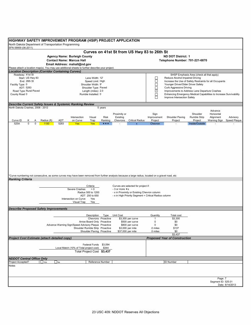
HIGHWAY SAFETY IMPROVEMENT PROGRAM (HSIP) PROJECT APPLICATIONNorth Dakota Department of Transportation ProgrammingSFN 59959 (06-2011)
Burleigh County 1Marcus Hall [email protected]
Please attach a location map(s). You may use additional sheets to further describe your project.Location Description (Corridor Containing Curves)
Roadway:Start: Lane Width:End: Speed Limit:
Facility Type: Shoulder Width:ADT: Shoulder Type:
Road Type Length (miles):County Road Rumble Installed:
Describe Current Safety Issues & Systemic Ranking ReviewNorth Dakota Crashes, 2008 - 2012 5 years
Curve ID K A Radius (ft) ADTIntersectionon Curve
Visual Trap
Risk Ranking
Proximity or Existing
Chevrons Critical Radius
Sign Improvement
ProjectShoulder Paving
Project
Shoulder Rumble Strip
Project
Advance Horizontal Alignment
Warning SignAdvisory
Speed Plaque525A 0 0 1150 5283 Yes Yes - x Chevron - Inside/Outside - -
Email Address:
Curves on 41st St from US Hwy 83 to 26th StAgency Name: ND DOT District:Contact Name: Telephone Number:
SHSP Emphasis Area (check all that apply)US Hwy 83 12' Reduce Alcohol Impaired Driving26th St High Increase the Use of Safety Restraints for all Occupants
41st St
0 9' Younger Driver/Older Driver Safety5283 Paved Curb Aggressive DrivingRural Paved 2.0 Improvements to Address Lane Departure Crashes0 0 Enhancing Emergency Medical Capabilities to Increase Survivability
Improve Intersection Safety
*Curve numbering not consecutive, as some curves may have been removed from further analysis because a large radius, located on a gravel road, etcRanking Criteria
Criteria Curves are selected for project if:Severe Crashes > 0 - 3 or more s
Radius 500 to 1200 - x in Proximity or Existing Chevron columnADT 250 to 650 - x in High Priority Segment + Critical Radius column
Intersection on Curve YesVisual Trap Yes
Describe Proposed Safety Improvements
Description Type Unit Cost Quantity Total costChevrons Proactive $3,300 per curve 1 $3,300
Arrow Board Only Proactive $500 per curve 0 $0Advance Warning Sign/Speed Advisory Plaque Proactive $800 per curve 0 $0
Shoulder Rumble Strip Proactive $3,000 per mile .0 miles $137Shoulder Paving Proactive $37,000 per mile .0 miles $0
$3,437Project Cost Estimate (attach detailed copy) Proposed Year of Construction
Federal Funds $3,094Local Match (10% of Total project cost) $344
Total Project Cost $3,437
NDDOT Central Office OnlyID Number
Notes
Page: 7Segment ID: 525.01
Date: 8/14/2013
Project Accepted? Reference NumberYes No
23 USC 409: NDDOT Reserves All Objections
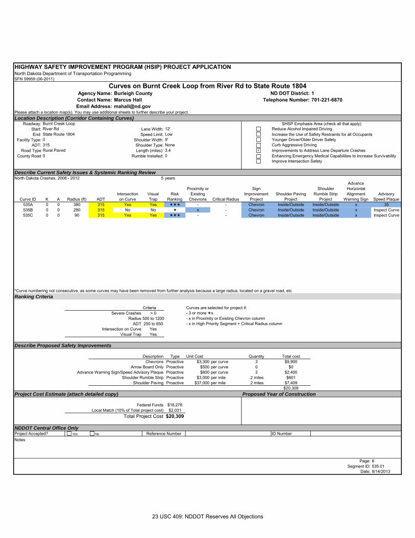
HIGHWAY SAFETY IMPROVEMENT PROGRAM (HSIP) PROJECT APPLICATIONNorth Dakota Department of Transportation ProgrammingSFN 59959 (06-2011)
Burleigh County 1Marcus Hall [email protected]
Please attach a location map(s). You may use additional sheets to further describe your project.Location Description (Corridor Containing Curves)
Roadway:Start: Lane Width:End: Speed Limit:
Facility Type: Shoulder Width:ADT: Shoulder Type:
Road Type Length (miles):County Road Rumble Installed:
Describe Current Safety Issues & Systemic Ranking ReviewNorth Dakota Crashes, 2008 - 2012 5 years
Curve ID K A Radius (ft) ADTIntersectionon Curve
Visual Trap
Risk Ranking
Proximity or Existing
Chevrons Critical Radius
Sign Improvement
ProjectShoulder Paving
Project
Shoulder Rumble Strip
Project
Advance Horizontal Alignment
Warning SignAdvisory
Speed Plaque535A 0 0 380 315 Yes Yes - - Chevron Inside/Outside Inside/Outside x 35535B 0 0 280 315 No No x - Chevron Inside/Outside Inside/Outside x Inspect Curve535C 0 0 90 315 Yes Yes - - Chevron Inside/Outside Inside/Outside x Inspect Curve
Email Address:
Curves on Burnt Creek Loop from River Rd to State Route 1804Agency Name: ND DOT District:Contact Name: Telephone Number:
SHSP Emphasis Area (check all that apply)River Rd 12' Reduce Alcohol Impaired DrivingState Route 1804 Low Increase the Use of Safety Restraints for all Occupants
Burnt Creek Loop
0 9' Younger Driver/Older Driver Safety315 None Curb Aggressive DrivingRural Paved 3.4 Improvements to Address Lane Departure Crashes0 0 Enhancing Emergency Medical Capabilities to Increase Survivability
Improve Intersection Safety
*Curve numbering not consecutive, as some curves may have been removed from further analysis because a large radius, located on a gravel road, etcRanking Criteria
Criteria Curves are selected for project if:Severe Crashes > 0 - 3 or more s
Radius 500 to 1200 - x in Proximity or Existing Chevron columnADT 250 to 650 - x in High Priority Segment + Critical Radius column
Intersection on Curve YesVisual Trap Yes
Describe Proposed Safety Improvements
Description Type Unit Cost Quantity Total costChevrons Proactive $3,300 per curve 3 $9,900
Arrow Board Only Proactive $500 per curve 0 $0Advance Warning Sign/Speed Advisory Plaque Proactive $800 per curve 3 $2,400
Shoulder Rumble Strip Proactive $3,000 per mile .2 miles $601Shoulder Paving Proactive $37,000 per mile .2 miles $7,409
$20,309Project Cost Estimate (attach detailed copy) Proposed Year of Construction
Federal Funds $18,278Local Match (10% of Total project cost) $2,031
Total Project Cost $20,309
NDDOT Central Office OnlyID Number
Notes
Page: 8Segment ID: 535.01
Date: 8/14/2013
Project Accepted? Reference NumberYes No
23 USC 409: NDDOT Reserves All Objections
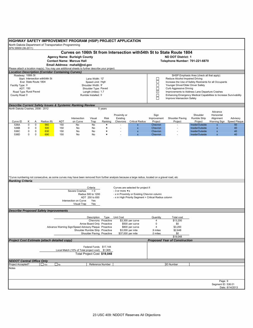
HIGHWAY SAFETY IMPROVEMENT PROGRAM (HSIP) PROJECT APPLICATIONNorth Dakota Department of Transportation ProgrammingSFN 59959 (06-2011)
Burleigh County 1Marcus Hall [email protected]
Please attach a location map(s). You may use additional sheets to further describe your project.Location Description (Corridor Containing Curves)
Roadway:Start: Lane Width:End: Speed Limit:
Facility Type: Shoulder Width:ADT: Shoulder Type:
Road Type Length (miles):County Road Rumble Installed:
Describe Current Safety Issues & Systemic Ranking ReviewNorth Dakota Crashes, 2008 - 2012 5 years
Curve ID K A Radius (ft) ADTIntersectionon Curve
Visual Trap
Risk Ranking
Proximity or Existing
Chevrons Critical Radius
Sign Improvement
ProjectShoulder Paving
Project
Shoulder Rumble Strip
Project
Advance Horizontal Alignment
Warning SignAdvisory
Speed Plaque536A 0 0 960 150 No No - x Chevron - Inside/Outside x 50536B 0 0 500 150 No No - x Chevron - Inside/Outside x 40536C 0 0 630 150 No No - x Chevron - Inside/Outside x 40536D 0 0 690 150 No No - x Chevron - Inside/Outside x 40
Email Address:
Curves on 106th St from Intersection with54th St to State Route 1804Agency Name: ND DOT District:Contact Name: Telephone Number:
SHSP Emphasis Area (check all that apply)Intersection with54th St 12' Reduce Alcohol Impaired DrivingState Route 1804 High Increase the Use of Safety Restraints for all Occupants
106th St
0 9' Younger Driver/Older Driver Safety150 Paved Curb Aggressive DrivingRural Paved 1.7 Improvements to Address Lane Departure Crashes0 0 Enhancing Emergency Medical Capabilities to Increase Survivability
Improve Intersection Safety
*Curve numbering not consecutive, as some curves may have been removed from further analysis because a large radius, located on a gravel road, etcRanking Criteria
Criteria Curves are selected for project if:Severe Crashes > 0 - 3 or more s
Radius 500 to 1200 - x in Proximity or Existing Chevron columnADT 250 to 650 - x in High Priority Segment + Critical Radius column
Intersection on Curve YesVisual Trap Yes
Describe Proposed Safety Improvements
Description Type Unit Cost Quantity Total costChevrons Proactive $3,300 per curve 4 $13,200
Arrow Board Only Proactive $500 per curve 0 $0Advance Warning Sign/Speed Advisory Plaque Proactive $800 per curve 4 $3,200
Shoulder Rumble Strip Proactive $3,000 per mile .9 miles $2,648Shoulder Paving Proactive $37,000 per mile .0 miles $0
$19,048Project Cost Estimate (attach detailed copy) Proposed Year of Construction
Federal Funds $17,144Local Match (10% of Total project cost) $1,905
Total Project Cost $19,048
NDDOT Central Office OnlyID Number
Notes
Page: 9Segment ID: 536.01
Date: 8/14/2013
Project Accepted? Reference NumberYes No
23 USC 409: NDDOT Reserves All Objections