Embed Size (px)
Citation preview
-10
-30
-10
-30
-20
-10
-30
-20
-30
-10
-30
-50
-60
-70-80
-110
-10
-50
-30
-20
-20
-40
CR 3
CR 2
CR 1
CR 4
CR 5CR 6
CR 7
CR 8CR 9
CR 15
CR 14
CR 10CR 11
CR 13
CR 12
0 2,000 4,0001,000Feet
Produced by WPP GIS (LML), February 2018
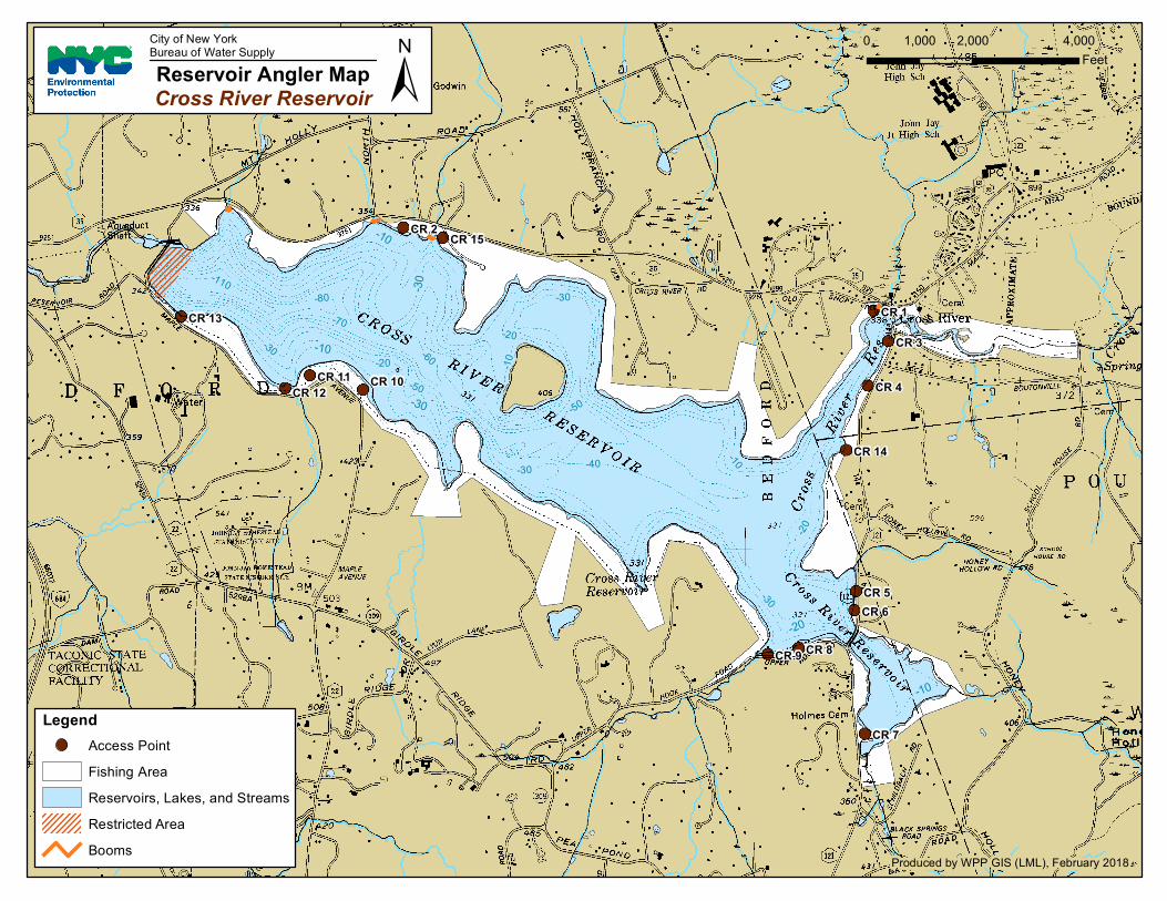
LegendAccess PointFishing AreaReservoirs, Lakes, and StreamsRestricted AreaBooms
±Reservoir Angler MapCross River Reservoir
City of New YorkBureau of Water Supply

General Restrictions:
Please stay back 500’ from all buildings and water supply structures
No floating booms or structure shall be crossed, and if present, shall serve as a marker for restricted areas.
No trespassing on islands
CROSS RIVER
Dam and Spillway area:
Located on the western end of the reservoir, boaters must stay back 500 feet from the dam and spillway. The
restricted area extends from shoreline to shoreline. Visual landmarks include rock outcroppings on both
shorelines.