Embed Size (px)
Citation preview
Mole Valley Local Development Framework
Built Up Areas Character AppraisalAshtead
Supplementary Planning Document
Adopted 23 February 2010

Mole Valley Local Development Framework Supplementary Planning Document Adopted February 2010
Built up Areas Character Appraisal – Ashtead
22
Contents
1.0 Background ................................................................................................3
2.0 Methodology ...............................................................................................3
3.0 Policy Context .............................................................................................4
4.0 Ashtead Overview .......................................................................................5
5.0 Landscape Setting ......................................................................................6
6.0 The Village...................................................................................................6
7.0 Woodfield ....................................................................................................8
8.0 Oakfield Road to The Marld ........................................................................9
9.0 South Ashtead ............................................................................................9
10.0 West Ashtead ...........................................................................................11
11.0 West North Ashtead ..................................................................................12
12.0 The Lanes .................................................................................................13
13.0 North East Ashtead ...................................................................................14
14.0 Links Road ................................................................................................14
15.0 Berg Estate ...............................................................................................15
Mole Valley Local Development Framework Supplementary Planning Document Adopted February 2010
Built up Areas Character Appraisal – Ashtead
3
1.0 Background1.1 This is one of four Supplementary Planning
Documents which together provide a Character Appraisal of the five main built up areas in Mole Valley: Dorking, Leatherhead, Ashtead, Bookham and Fetcham. Bookham and Fetcham are contained in a single document.
1.2 The environmental quality of Mole Valley is highly valued by both local people and visitors. There is wide diversity in built character across the District, from historic rural villages to tight knit, historic town centres and leafy suburban areas. There are several Conservation Areas, but also many other areas where the built up area has its own, distinctive character. There are also areas where improvements could be made.
1.3 Protection of the distinctive character of the District has been a recurring theme during preparation of the Core Strategy at the heart of the Mole Valley Local Development Framework. The purpose of these Character Appraisals is to set out the key characteristics of Dorking, Leatherhead, Ashtead, Bookham and Fetcham. They identify features that should be respected and preserved, the landscape setting of each settlement, opportunities for enhancement and vulnerability to change.
1.4 The Council is also producing a Landscape Character Assessment, which acts as a companion document, focussing on the wider landscape, outside the built up areas. A Character Appraisal of the six Larger Rural Villages identified in the Core Strategy is also being prepared Taken together, these Assessments will provide an overview of the character of the District’s environment - both built-up and rural.
1.5 ‘Character’ can be defined as a distinct, recognisable and consistent pattern of elements that make each landscape or townscape distinctive. Character is influenced by particular combinations of visual, ecological, historical, built components and other intangible aspects. The character of an area and its surroundings plays an important role in quality of life.
1.6 The five built up areas covered by the Character Appraisal are the locations to which the majority of development will be directed during the life of the Core Strategy. It is important to ensure that such development contributes to the established character of these locations and is integrated into
its setting, rather than appearing as an isolated infill plot or an after thought.
1.7 This need to relate new development to its context and setting is clearly recognised in National Planning Guidance, for example PPS1, paragraph 34: “Design which is inappropriate in its context, or which fails to take the opportunities available for improving the character and quality of an area and the way it functions, should not be accepted.”.
1.8 The Built Up Areas Character Appraisal covers the whole of each built up area, recognising that every area has its own distinctive character. Some locations have obvious townscape qualities, perhaps as a result of their historic origins or particularly high standards of urban design. Others may be less distinctive. Nevertheless, every area has its own character, which forms part of the mosaic that creates a distinctive built environment within each settlement.
1.9 The analysis in this document will inform the preparation of Local Development Documents, including the Land Allocations Development Plan Document (DPD), and the determination of planning applications. By those means, it will help to ensure that the local distinctiveness of the various parts of the District’s built up areas is recognised and reflected in development proposals or land management.
2.0 Methodology2.1 The Built Up Areas Character Appraisal has been
prepared by the Council in partnership with local organisations. Each area was visited and extensive use made of aerial photography and published material relating to local history and townscape character. Early drafts were made available to the main Residents’ Association for each settlement in the north of the District, as well as the Dorking and District Preservation Society, in order to incorporate their local perspective.
2.2 The Character Appraisals were published for public consultation between 30th October and 27th November 2009. A number of amendments were made in light of comments raised.
2.3 The completed Built Up Areas Character Appraisals were adopted as a Supplementary Planning Document by the Council at its meeting of 23 February 2010.
Mole Valley Local Development Framework Supplementary Planning Document Adopted February 2010
Built up Areas Character Appraisal – Ashtead
4
3.0 Policy ContextNational Guidance
3.1 Planning Policy Statement 1, Delivering Sustainable Development emphasises “good design” as an intrinsic element of good planning. It states: Good design ensures attractive usable, durable and adaptable places and is a key element in achieving sustainable development. Good design is indivisible from good planning. (PPs1 para 33)
3.2 The guidance goes on to place the notion of “good design” firmly in the context of an understanding of the existing character and appearance of the locality in which new development takes place. PPS1 para 34 states: Design which is inappropriate in its context, or which fails to take the opportunities available for improving the character and quality of an area and the way it functions, should not be accepted.
3.3 In paragraph 36, Planning Authorities are encouraged to prepare robust policies on design and access, which should be based on an understanding and evaluation of its present defining characteristics. And para 38 recognises that it is proper to seek to promote or reinforce local distinctiveness particularly where this is supported by clear plan policies or supplementary planning documents on design.
3.4 This Supplementary Planning Document expresses the Council’s understanding of the distinctive characteristics of each of its main built up areas, taking into account the views of local residents and other interested bodies. The SPD will, in turn, form a basis for policies on design and access, and act as a tool for assessing development proposals.
Local Policy Context3.5 The need to balance new development against its
impact on the character of the built environment
is at the heart of Mole Valley’s Core Strategy. The Council’s spatial vision for Mole Valley, as set out in the Core Strategy 2006-2026, is as follows: Mole Valley will make provision for its share of the Region’s growth of homes and jobs and provide for the needs of its communities but in a way that is sustainable, minimises significant harmful change to its distinctive character, environment and feel, and mitigates its impact on the causes of climate change. The District’s natural, built and historic environment will be safeguarded and enhanced and communities will have safe, convenient and sustainable access to the services and facilities they require.
3.6 This, in turn, reflects the Vision of the Community Strategy 2006-2016 which is that The needs of those who live and work in the District are met, the environment, prosperity and distinctive character of Mole Valley are sustained and problems that reduce the quality of life are tackled.’
3.7 The high priority placed on protecting character is reflected in Goal 1 of the Core Strategy, which is To safeguard and enhance the highly attractive and diverse natural, built and historic environment of the District.
3.8 This applies most especially to areas covered by specific policy designations, but the Core Strategy goes on to highlight that all areas have their own distinctive character, which needs to be understood in order to be safeguarded and/or enhanced. The Strategic Objectives to achieve Goal 1 include
To safeguard and enhance the built and •historic environment of the District, including the many listed buildings, conservation areas, archaeological sites and historic landscapes/parks and gardens and the overall distinctive character of Mole Valley’s towns and villages.
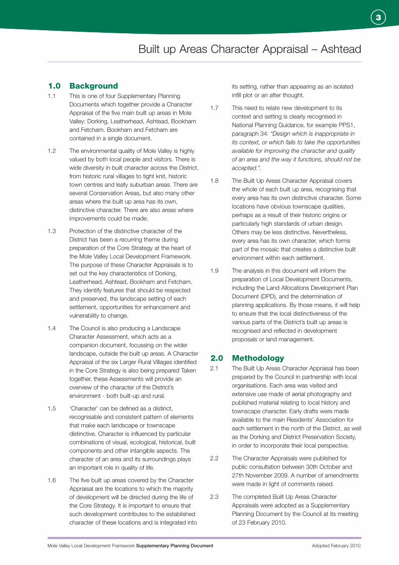
The Street, Ashtead Ashtead Common
4.0
5.0
Mole Valley Local Development Framework Supplementary Planning Document Adopted February 2010
Built up Areas Character Appraisal – Ashtead
5
“To ensure that all development makes a •positive contribution to the built and historic environment and respects local distinctiveness.
3.9 Core Strategy Policy CS14 sets out how these objectives are to be achieved in policy terms:
Policy CS14 Townscape, Urban Design and the Historic Environment
1. All new development must respect and enhance the character of the area in which it is proposed whilst making the best possible use of the land available. This will be assisted through the work on Urban Area Character Appraisals.
2. The Council will resist development of a poor quality of design and will expect to see sufficient detail set out in Design and Access Statements, where required, to enable planning applications to be properly determined.
3. Development must incorporate appropriate landscaping with particular attention to the use of trees and hedges native to the locality.
4. Areas and sites of historic or architectural importance will be protected and, where appropriate, enhanced in accordance with the legislation, national and regional guidance.
3.10 This document fulfils the commitment in the Core Strategy to prepare Character Appraisals for the Built Up Areas. It will be used to support and assist the implementation of Core Strategy Policy CS14., to ensure that future development contributes to the character of these locations and is integrated into its location rather than appearing as an isolated infill plot or an after thought.
4.0 Ashtead Overview4.1 The settlement of Ashtead has grown up around
the village centre which grew up on the ‘spring line’ where the chalk to the south meets the lowland clay to the north. It has a population of approximately 13,500, according to the 2001 Census.
4.2 The village centre lies towards the southern end of the modern settlement, focussed around The Street (part of the A24 between Leatherhead and Epsom). Local residents continue to refer to this
part of Ashtead as The Village and it is readily identifiable as both the historic focus and a hub for modern community life.
4.3 East of The Village is Ashtead Park - an historic estate which includes the campus of the City of London Freemen’s School and St Giles Parish Church. The church is Grade II* and includes construction from the early 12th century. The school building was originally built in 1790 as a replacement for the manor house. It is also Grade II*. Ashtead Park also includes publicly owned land with important wildlife habitats.
4.4 North of The Village is Lower Ashtead - an extensive residential area of varying period and character. It includes an important secondary local shopping centre on Craddocks Parade and a smaller parade of shops on Barnett Wood Lane.
4.5 The settlement is permeated by a strong network of public footpaths which take some pressure of the road network and are a particular asset in terms of providing access to The Village from adjacent residential areas. Two of the longer footpaths connect Agates Lane and Ottways Lane with the village centre, providing more convenient access than is available by road. Others, in the north of the settlement, provide welcome connections across the railway line and into the surrounding countryside.
4.6 Ten Character Areas can be identified within the settlement. None of these is entirely homogenous and there are pockets of contrasting character within each one, but they are sufficiently coherent to allow some general conclusions to be drawn about existing features of importance and the constraints over future development.
The Village•Woodfield •Oakfield Road to The Marld•South Ashtead •West Ashtead•West North Ashtead•The Lanes•North East Ashtead•Links Road•Berg Estate•
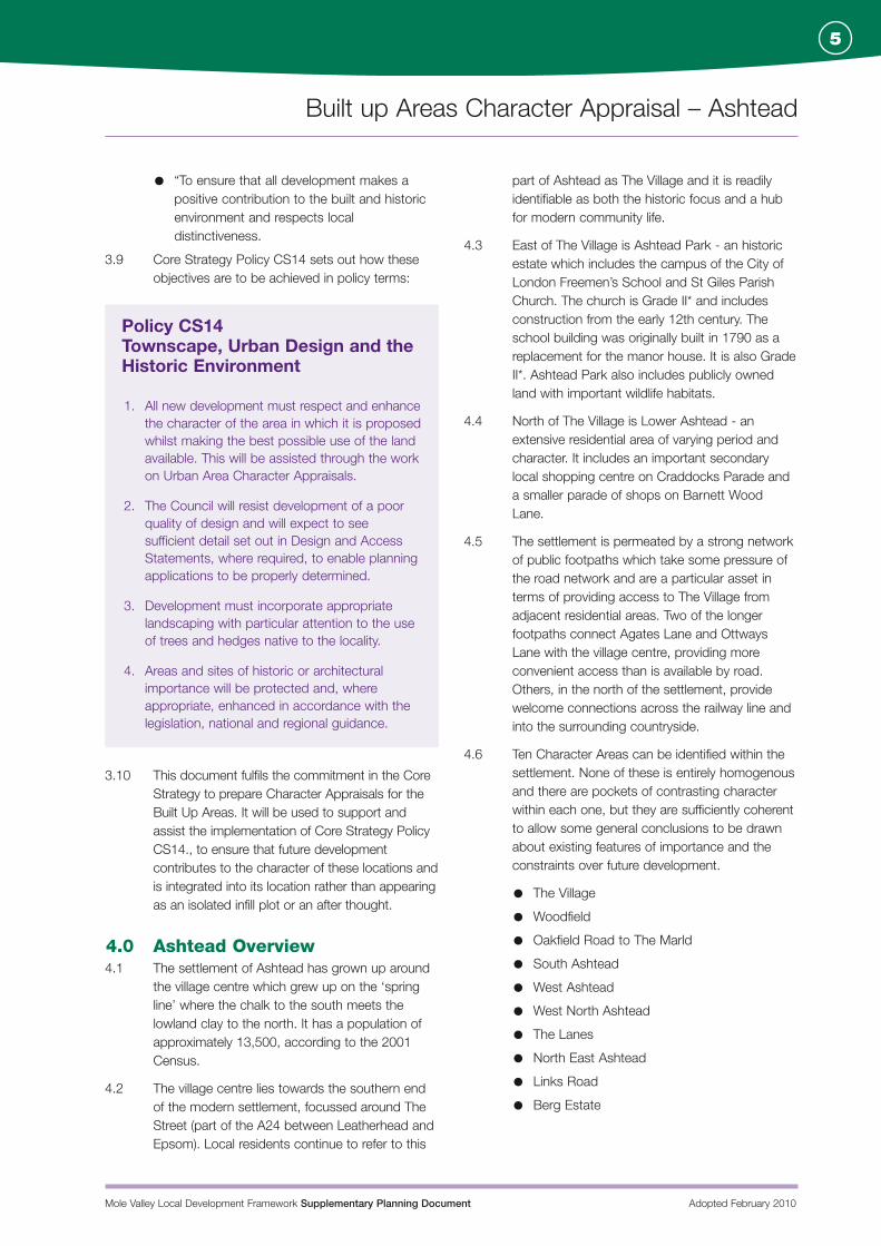
Brick Wall Parkers Lane Chimneys in the Street Larger Houses, Dene Road
Mole Valley Local Development Framework Supplementary Planning Document Adopted February 2010
Built up Areas Character Appraisal – Ashtead
6
6.0
5.0 Landscape Setting5.1 Ashtead is one of a chain of small settlements
reaching south west from Epsom through the
northern part of Mole Valley. It is separated from
Epsom by a belt of woodland, where Ashtead
and Epsom Commons meet, to either side of
the A24.
5.2 Ashtead Common itself provides a strong
landscape setting for the northern part of the
settlement. This National Nature Reserve
comprises some 200 hectares of ancient
woodland common, owned and managed by the
City of London. The Common is part of the
Epsom and Ashtead Commons SSSI and also
contains two scheduled Ancient Monuments. It
provides important and well-used public open
space for both local residents and visitors.
5.3 Towards the north west of the settlement, the
woodland continues into Leatherhead Common.
However the land between Leatherhead and
Ashtead is more open, comprising a narrow belt
of grazing land, incorporating the embankments
of the M25 motorway. This narrow corridor of
open land serves the important function of
separating the two settlements and helping them
to retain their own identity and character.
5.4 South of Ashtead, a rolling landscape of pasture,
hedgerow and woodland rises up into the Epsom
Downs. The edge of the settlement is well
defined and the landscape is remarkably open
and undeveloped. Narrow rural lanes and rights
of way lead out of the built up area, providing
good access for recreation and a strong
landscape setting for the lower density housing
on the southern fringe of the village.
6.0 The Village6.1 The Village is the original location of Ashtead
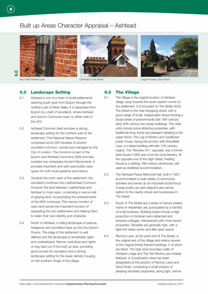
village, lying towards the south eastern corner of the settlement. It is focussed on The Street (A24). The Street is the main shopping street, with a good range of small, independent shops fronting a broad street of predominantly late 19th century/early 20th century two storey buildings. The older units include some attractive properties, with traditional shop fronts and pleasant detailing to the upper floors. The Leg of Mutton and Cauliflower public house, facing the junction with Woodfield Lane, is a listed building with late 17th century origins. The “Brewery Inn”, opposite, was a former beer-house c1800 and once the local brewery. At the opposite end of the High Street, Fielding House is a striking 18th century almshouse, still used as sheltered accommodation.
6.2 The Ashtead Peace Memorial Hall, built in 1927, accommodates a wide variety of community activities and serves as an important social focus. A large public car park adjacent also serves visitors to the nearby shops and businesses in The Street.
6.3 South of The Street are a series of narrow streets, mainly in residential use, punctuated by a handful of small business. Building styles include a high proportion of Victorian semi-detached and terraced cottages, interspersed with more recent properties. Densities are generally high, with a tight knit street scene and little open space.
6.4 Rectory Lane, at the west end of The Street, is the original axis of the village and retains several of the original timber-framed buildings, 3 of which are listed. The high brick boundary walls of Ashtead Lodge and The Old Rectory are notable features. A Conservation Area has been designated at the junction of Rectory Lane and Dene Road, comprising a small enclave of pleasing domestic properties, along tight, narrow
Mole Valley Local Development Framework Supplementary Planning Document Adopted February 2010
Built up Areas Character Appraisal – Ashtead
7
Shops on The Street Housing near Village Centre 18 Rectory Lane
streets, reinforced by strong garden boundaries. The line of lime trees along the southern side of Dene Road is of particular value. The village’s first school building is situated at the rear of one of the cottages on Rectory Lane.
6.5 Towards the south and east of The Village, building densities decrease, with a higher proportion of detached houses in more generous gardens. There is an historic focal point at the junction of Dene Road and Park Lane. Grouped around this junction are the entrance to Ashtead Park, with its Grade II listed gate piers, the wooded drive leading to St Giles Parish Church and the attractive Victorian buildings of St Giles Infant School.
6.6 The lower density, detached housing along Dene Road and Park Lane creates a gradual transition into the more spacious residential area of South Ashtead.
6.7 There are few identifiable development sites within The Village, as there has already been a significant amount of infill development within the historic street pattern. One exception is the former Esso garage on The Street, in the centre of the main retail centre, which is vacant and subject to a planning application for a supermarket development at the time of writing. The variety of building styles, and the preponderance of small, independent shops, means that sensitive redevelopment of small sites is more capable of being absorbed than larger-scale redevelopment.
6.8 The narrow streets are frequently congested by on-street parking and more intensive new development is likely to raise concerns about accommodating additional traffic. In this context, the extensive network of public rights of way, both within the Village and connecting it to adjacent residential areas, are an important asset which is worthy of protection and enhancement.
The Village: Key Characteristics
Good range of independent shops and local services, creating a vibrant village centre with a strong community focus.
Several nicely-detailed shop fronts, coupled with attractive upper floors to many of the retail buildings on The Street.
Tight-knit residential environment, with varied and interesting street scenes, including many historic and/or traditional older buildings. Several stretches of well-detailed Victorian cottages and 1930s houses - also some distinctive 1970s housing at Westfield.
Strong historic focus at the junction of Dene Road and Park Lane - featuring mature trees, the substantial stone gateposts to The Park and St Giles Church and the pleasant Victorian buildings of St Giles School.
Strong use of soft, red brick for buildings and boundary walls. Brick boundary walls are a distinctive feature in parts of the Village, particularly in the vicinity of Rectory Lane, creating a strong sense of enclosure.
Occasional pockets of mature trees, including lime trees on southern side of Dene Road, belt of trees on embankment at southern end of Woodfield Lane and extensive tree cover within grounds of Ashtead Park and St Giles Church and neighbouring lanes. Trees add relief to an otherwise tight-knit, building-dominated environment.
Narrow streets congested by parked cars - access difficulties in places.
Extensive network of public rights of way, both within The Village and connecting it to adjacent residential area. Worthy of protection and enhancement as a means of taking pressure off highway network.
6.0
Mole Valley Local Development Framework Supplementary Planning Document Adopted February 2010
Built up Areas Character Appraisal – Ashtead
8
Housing on edge of Woodfield St George’s Christian Centre from Woodfield Craddocks Parade from pond
7.0
Currently vacant site at former filling station on north side of The Street.
Through traffic along The Street makes the shopping area noisy.
Some rather nondescript late 20th century commercial buildings at the outer edges of the shopping area, which detract from the settings of some of the older buildings.
Indifferent floorscape and other streetscape elements reflecting minimal
investment in the public realm.
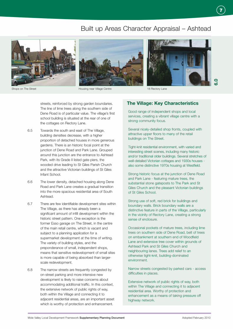
7.0 Woodfield7.1 The Woodfield is 6.3 Hectares of open space,
about 0.75km north of The Village, at the northern end of Woodfield Lane. Here lies the second main focal point of the settlement.
7.2 There are relatively few buildings in the Woodfield Character Area. It’s main characteristic is the expanse of continuous open space, comprising the Woodfield, the adjacent village pond and the recreation ground. It provides the only children’s playground in the village. The open space is interrupted by the railway line, but then continues north into the edge of Ashtead Common. The Woodfield itself is criss-crossed by paths, some through belts of mature trees, linking this part of the village with the woodland of Ashtead Common itself, beyond the confines of the built up area.
7.3 The Woodfield itself is Common Land and as such enjoys legal protection against built development.
7.4 Around the periphery of the open space is a cluster of local amenities. Parades of shops on Barnett Wood Lane and Craddocks Parade provide a range of local retail uses. Around the
south west corner of the Woodfield lies a group of public buildings, including St George’s Church and Christian Centre, Barnett Wood Lane Infant School, Ashtead Youth Centre, the Pelham Scout Hut and the Woodman public house. The nature of the uses means that building is more sporadic, with contrasting styles and sizes of buildings held together by the way that they front onto the open space.
7.5 There are few individual buildings of note; the main exception being St George’s Church and Christian Centre - an imposing red brick church building, dating from 1906, with a modern extension dating from 2001.
7.6 The scale of existing buildings is generally modest - predominantly one or two storeys. The variety of styles creates a harmonious and varied environment, with the buildings generally being subservient to the green space around which they are grouped. It is anticipated that any new development will need to be similarly modest in scale and allow the open space to remain as the dominant characteristic of this Character Area.
Woodfield: Key Characteristics
The Pond: a strong landscape feature, adding visual interest and biodiversity, as well as being popular with residents.
Mature tree belts around and through the Woodfield, giving the area maturity and a strong landscape setting.
Open space: an asset to the village as a whole. Development around the periphery widely visible, maintaining an attractive balance of modest buildings in varied styles, with no individual building or style being over-dominant.
Good access to alternative transport modes and excellent range of local shops and community facilities.
Mole Valley Local Development Framework Supplementary Planning Document Adopted February 2010
Built up Areas Character Appraisal – Ashtead
9
Conservation Area, Woodfield Lane Low Densitsy Housing, Greville Park Road
The junction of Barnett Wood Lane, Craddocks Avenue and Woodfield Lane has a large expanse of tarmac and hard landscaping compared to the extensive green space nearby. Coupled with the concentration of traffic and parked cars, this is a less visually appealing part of the area.
Poor environmental setting to Barnett Wood Lane parade of shops and rather cluttered streetscape around the parades of shops at Craddocks Parade. Parked cars and pavement clutter contrast with the otherwise spacious and tidy environment around the edges of the Woodfield.
Nondescript environment within the railway station and station car park, contrasting unfavourably with the open space within which it sits.
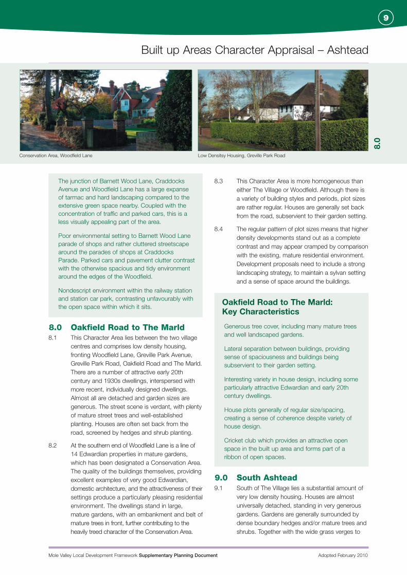
8.0 Oakfield Road to The Marld8.1 This Character Area lies between the two village
centres and comprises low density housing, fronting Woodfield Lane, Greville Park Avenue, Greville Park Road, Oakfield Road and The Marld. There are a number of attractive early 20th century and 1930s dwellings, interspersed with more recent, individually designed dwellings. Almost all are detached and garden sizes are generous. The street scene is verdant, with plenty of mature street trees and well-established planting. Houses are often set back from the road, screened by hedges and shrub planting.
8.2 At the southern end of Woodfield Lane is a line of 14 Edwardian properties in mature gardens, which has been designated a Conservation Area. The quality of the buildings themselves, providing excellent examples of very good Edwardian, domestic architecture, and the attractiveness of their settings produce a particularly pleasing residential environment. The dwellings stand in large, mature gardens, with an embankment and belt of mature trees in front, further contributing to the heavily treed character of the Conservation Area.
8.3 This Character Area is more homogeneous than either The Village or Woodfield. Although there is a variety of building styles and periods, plot sizes are rather regular. Houses are generally set back from the road, subservient to their garden setting.
8.4 The regular pattern of plot sizes means that higher density developments stand out as a complete contrast and may appear cramped by comparison with the existing, mature residential environment. Development proposals need to include a strong landscaping strategy, to maintain a sylvan setting and a sense of space around the buildings.
Oakfield Road to The Marld: Key Characteristics
Generous tree cover, including many mature trees and well landscaped gardens.
Lateral separation between buildings, providing sense of spaciousness and buildings being subservient to their garden setting.
Interesting variety in house design, including some particularly attractive Edwardian and early 20th century dwellings.
House plots generally of regular size/spacing, creating a sense of coherence despite variety of house design.
Cricket club which provides an attractive open space in the built up area and forms part of a ribbon of open spaces.
9.0 South Ashtead9.1 South of The Village lies a substantial amount of
very low density housing. Houses are almost universally detached, standing in very generous gardens. Gardens are generally surrounded by dense boundary hedges and/or mature trees and shrubs. Together with the wide grass verges to
8.0
Mole Valley Local Development Framework Supplementary Planning Document Adopted February 2010
Built up Areas Character Appraisal – Ashtead
10
The Warren Chalk Lane View beyond village, from Grays Lane
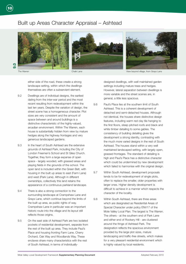
9.0
either side of the road, these create a strong landscape setting, within which the dwellings themselves are often a subservient element.
9.2 Dwellings are of individual designs, the earliest dating from the inter-war period and the most recent resulting from redevelopment within the last ten years. Despite the variation of design, the street scene has a homogeneous character. Plot sizes are very consistent and the amount of space between and around buildings is a distinctive characteristic of the highly-valued, arcadian environment. Within The Warren, each house is substantially hidden from view by mature hedges along the highway frontages and very generous landscaped gardens.
9.3 In the heart of South Ashtead are the extensive grounds of Ashtead Park, including the City of London Freemen’s School and St Giles Church. Together, they form a large expanse of open space - largely wooded, with grassed areas and playing fields in the grounds of the school. The open land is included within the Green Belt, with housing in the built up areas to east (Farm Lane) and west (Park Lane). Although in different ownerships, collectively this land retains the appearance of a continuous parkland landscape.
9.4 There is also a strong connection to the surrounding landscape at Crampshaw Lane and Grays Lane, which continue beyond the limits of the built up area, as public rights of way. Crampshaw Lane in particular was an important historic route into the village and its layout still reflects those origins.
9.5 On the east side of Ashtead Park are two isolated pockets of residential development, separate from the rest of the built up area. They include Paul’s Place and housing fronting Farm Lane, Cherry Orchard, Oak Way and Woodlands Way. These enclaves share many characteristics with the rest of South Ashtead, in terms of individually-
designed dwellings, with well maintained garden settings including mature trees and hedges. However, lateral separation between dwellings is more variable and the street scenes are, in general, a little less spacious.
9.6 Paul’s Place lies at the southern limit of South Ashtead. This is a coherent development of detached and semi-detached houses. Although not identical, the houses share distinctive design features, including warm red clay tile hanging to the first floors, steep pitched roofs and black and white timber detailing to some gables. The consistency of building detailing gives the development a strong identity, contrasting with the much more varied designs in the rest of South Ashtead. The houses stand within a very well maintained landscaped setting, with largely open, grassed frontages. The standard of detailing is high and Paul’s Place has a distinctive character which could be undermined by new development which failed to harmonise with the original design.
9.7 Within South Ashtead, development proposals tends to be for redevelopment of single plots, often to replace the smaller, older properties with larger ones. Higher density development is difficult to achieve in a manner which respects the character of the locality.
9.8 Within South Ashtead, there are three areas which are designated as Residential Areas of Special Character under policy ENV17 of the Mole Valley Local Plan. The largest is The Warren. The others - at the southern end of Park Lane and either end of Rookery Hill - are clustered around the fringe of Ashtead Park. The designation reflects the spacious environment provided by the large plot sizes, mature landscaping and traffic-free streets, which makes for a very pleasant residential environment which is highly valued by local residents.
Mole Valley Local Development Framework Supplementary Planning Document Adopted February 2010
Built up Areas Character Appraisal – Ashtead
11
Tree-lined Epsom Road Taleworth Road Stag Leys
South Ashtead: Key Characteristics
Very generous plot sizes and good lateral separation between buildings.
Very strong sense of openness, particularly in the Grays Lane area - wide, straight roads, wide, manicured grass verges, houses set well back, some behind open frontages, which add to sense of space.
Mature garden settings, with extensive hedges, shrubs and large trees. Many mature trees and vestiges of a former woodland in the Ashtead Hospital grounds.
Within The Warren: long, continuous evergreen hedges screen houses, creating a very strong, mature garden setting with buildings being subservient to their parkland setting.
Strong rural setting, which belies area’s proximity to the village centre. For example, views out to open countryside to the south of Grays Lane and parallel streets. Also stretches of native woodland along Park Lane and Farm Lane, enclosing the enclaves at the east end of the village.
Highways relatively free of traffic, with little visible car parking.
Some attractive and well detailed houses - mainly 1930s, some more modern.
Ashtead Park is a mature open area, with grassed verges and tree belts helping to preserve the character of a rural estate despite the proximity to the built up area. Strong landscape character of approaches and through routes should be preserved. Some areas are ecologically significant and is part designated as a LNR. The area forms part of the attractive Thames Downs long distance path, linking the open spaces of the London clay to the more open chalk downland of the North Downs.
Paul’s Place: strong and consistent building detailing and a clearly-defined, well maintained, landscape setting to the houses.
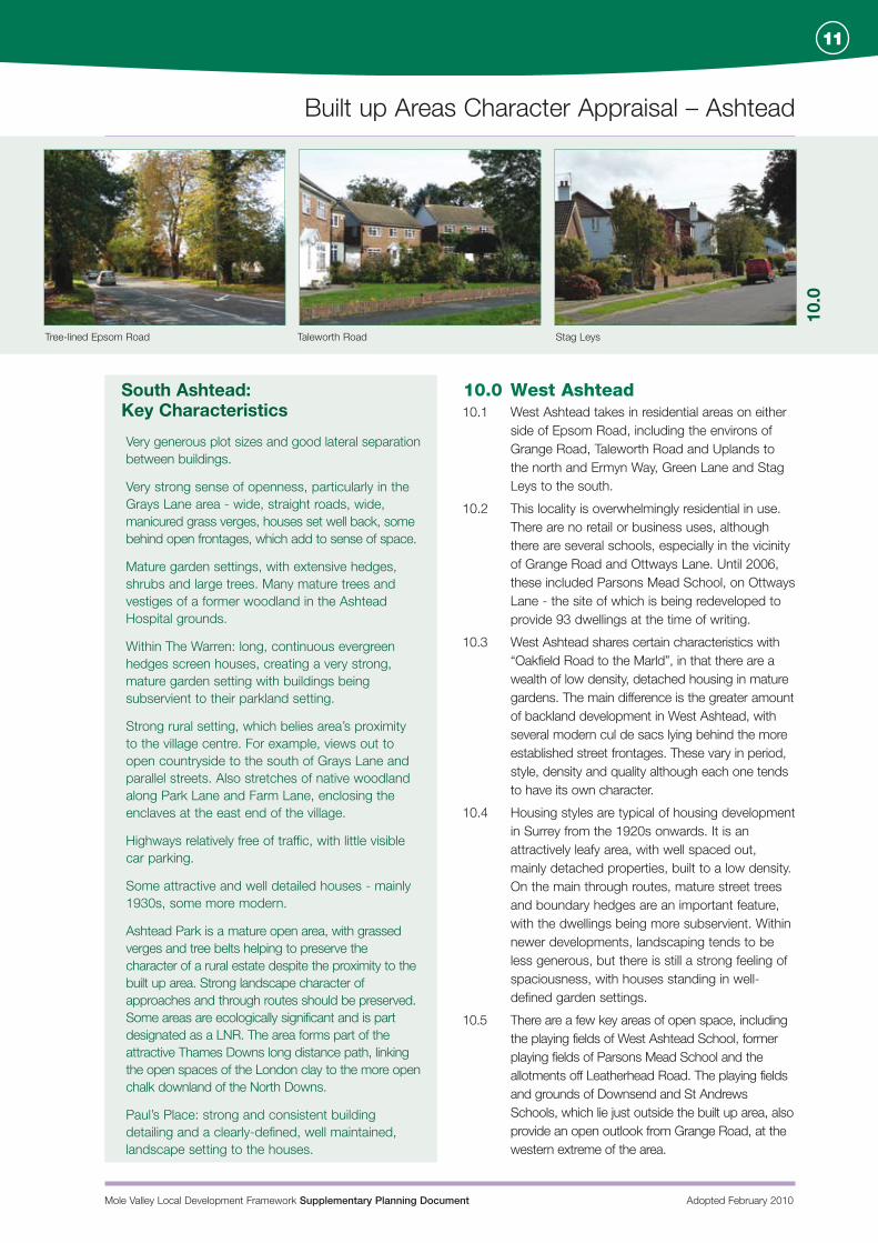
10.0 West Ashtead10.1 West Ashtead takes in residential areas on either
side of Epsom Road, including the environs of Grange Road, Taleworth Road and Uplands to the north and Ermyn Way, Green Lane and Stag Leys to the south.
10.2 This locality is overwhelmingly residential in use. There are no retail or business uses, although there are several schools, especially in the vicinity of Grange Road and Ottways Lane. Until 2006, these included Parsons Mead School, on Ottways Lane - the site of which is being redeveloped to provide 93 dwellings at the time of writing.
10.3 West Ashtead shares certain characteristics with “Oakfield Road to the Marld”, in that there are a wealth of low density, detached housing in mature gardens. The main difference is the greater amount of backland development in West Ashtead, with several modern cul de sacs lying behind the more established street frontages. These vary in period, style, density and quality although each one tends to have its own character.
10.4 Housing styles are typical of housing development in Surrey from the 1920s onwards. It is an attractively leafy area, with well spaced out, mainly detached properties, built to a low density. On the main through routes, mature street trees and boundary hedges are an important feature, with the dwellings being more subservient. Within newer developments, landscaping tends to be less generous, but there is still a strong feeling of spaciousness, with houses standing in well-defined garden settings.
10.5 There are a few key areas of open space, including the playing fields of West Ashtead School, former playing fields of Parsons Mead School and the allotments off Leatherhead Road. The playing fields and grounds of Downsend and St Andrews Schools, which lie just outside the built up area, also provide an open outlook from Grange Road, at the western extreme of the area.
10.0
Mole Valley Local Development Framework Supplementary Planning Document Adopted February 2010
Built up Areas Character Appraisal – Ashtead
12
Oakhill Road Flats at Flower Court Caen Wood Road
11.0
0
10.6 Developments behind established street frontages have been a feature of this locality. However, it is becoming more difficult to address issues of good neighbourliness as the size of development sites decreases. There is a precedent for various styles of building to co-exist, provided there is some coherence of design within an individual development. On the main through routes, the established character is of individual dwellings on regular plots and higher-density development is more difficult to accommodate.
10.7 At the very southern tip of the built up area stands the Headquarters offices of Exxon, a major local employer and contributor to many community projects in the northern part of Mole Valley. This part of West Ashtead also provides residents with excellent access to the network of public rights of way in the countryside south of the village.
West Ashtead: Key Characteristics
Dwellings set back from main through routes, with front gardens and large street trees creating sense of space and maturity.
Several large 1930s houses with strong detailing of the period.
Strong garden setting - many mature trees and good sized gardens in relation to dwelling sizes.
Varied housing design in the area as a whole, but strong consistency within each street/cul-de-sac, giving each its own visual identity.
Major employment site at Exxon Headquarters, on southern edge of village.
Direct access to open countryside with a good footpath network off Green Lane & Ermyn Way.
Some parts remote from local services, with limited access to sustainable transport options.
Congestion associated with school traffic in vicinity of Grange Road/Ottways Lane, and on Epsom Road.
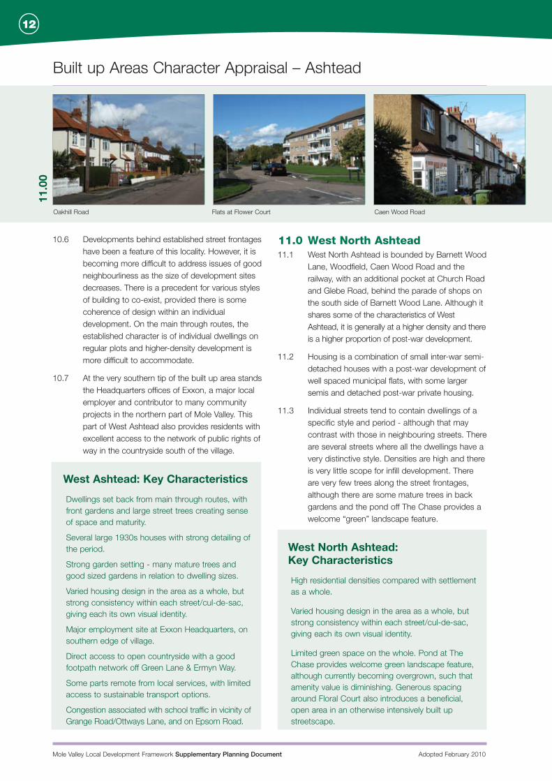
11.0 West North Ashtead11.1 West North Ashtead is bounded by Barnett Wood
Lane, Woodfield, Caen Wood Road and the railway, with an additional pocket at Church Road and Glebe Road, behind the parade of shops on the south side of Barnett Wood Lane. Although it shares some of the characteristics of West Ashtead, it is generally at a higher density and there is a higher proportion of post-war development.
11.2 Housing is a combination of small inter-war semi-detached houses with a post-war development of well spaced municipal flats, with some larger semis and detached post-war private housing.
11.3 Individual streets tend to contain dwellings of a specific style and period - although that may contrast with those in neighbouring streets. There are several streets where all the dwellings have a very distinctive style. Densities are high and there is very little scope for infill development. There are very few trees along the street frontages, although there are some mature trees in back gardens and the pond off The Chase provides a welcome “green” landscape feature.
West North Ashtead: Key Characteristics
High residential densities compared with settlement as a whole.
Varied housing design in the area as a whole, but strong consistency within each street/cul-de-sac, giving each its own visual identity.
Limited green space on the whole. Pond at The Chase provides welcome green landscape feature, although currently becoming overgrown, such that amenity value is diminishing. Generous spacing around Floral Court also introduces a beneficial, open area in an otherwise intensively built up streetscape.
Mole Valley Local Development Framework Supplementary Planning Document Adopted February 2010
Built up Areas Character Appraisal – Ashtead
13
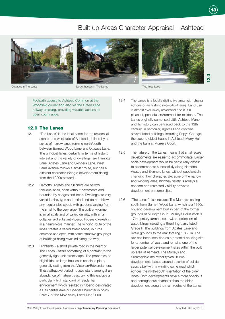
Cottages in The Lanes Larger houses in The Lanes Tree-lined Lane
Footpath access to Ashtead Common at the Woodfield corner and also via the Green Lane railway crossing, providing valuable access to open countryside.
12.0 The Lanes12.1 “The Lanes” is the local name for the residential
area on the west side of Ashtead, defined by a series of narrow lanes running north/south between Barnett Wood Lane and Ottways Lane. The principal lanes, certainly in terms of historic interest and the variety of dwellings, are Harriotts Lane, Agates Lane and Skinners Lane. West Farm Avenue follows a similar route, but has a different character, being a development dating from the 1920s onwards.
12.2 Harriotts, Agates and Skinners are narrow, tortuous lanes, often without pavements and bounded by hedges and trees. Dwellings are very varied in size, type and period and do not follow any regular plot layout, with gardens varying from the small to the very large. The built environment is small scale and of varied density, with small cottages and substantial period houses co-existing in a harmonious manner. The winding route of the lanes creates a varied street scene, in turns enclosed and open, with some attractive groupings of buildings being revealed along the way.
12.3 Highfields - a short private road in the heart of The Lanes - offers something of a contrast to the generally tight knit streetscape. The properties on Highfields are large houses in spacious plots, generally dating from the Victorian/Edwardian era. These attractive period houses stand amongst an abundance of mature trees, giving this enclave a particularly high standard of residential environment which resulted in it being designated a Residential Area of Special Character in policy ENV17 of the Mole Valley Local Plan 2000.
12.4 The Lanes is a locally distinctive area, with strong echoes of an historic network of lanes. Land use is almost exclusively residential and it is a pleasant, peaceful environment for residents. The Lanes originally comprised Little Ashtead Manor and its history can be traced back to the 13th century. In particular, Agates Lane contains several listed buildings, including Pepys Cottage, the second oldest house in Ashtead, Merry Hall and the barn at Murreys Court.
12.5 The nature of The Lanes means that small-scale developments are easier to accommodate. Larger scale development would be particularly difficult to accommodate successfully along Harriotts, Agates and Skinners lanes, without substantially changing their character. Because of the narrow and winding lanes, highway safety is always a concern and restricted visibility prevents development on some sites.
12.6 “The Lanes” also includes The Murreys, leading south from Barnett Wood Lane, which is a 1980s housing development built in part of the former grounds of Murreys Court. Murreys Court itself is 17th century farmhouse, , with a collection of outbuildings including a threshing barn, listed Grade II. The buildings front Agates Lane and retain grounds to the rear totalling 1.85 Ha. The site has been identified as a potential housing site for a number of years and remains one of the larger potential development sites within the built up area of Ashtead. The Murreys and Summerfield are rather typical 1980s developments based around a series of cul de sacs, albeit with a winding spine road which echoes the north-south orientation of the older lanes. Both developments have a more spacious and homogenous character than the older development along the main routes of the Lanes.
12.0
Mole Valley Local Development Framework Supplementary Planning Document Adopted February 2010
Built up Areas Character Appraisal – Ashtead
14
Mixed house designs, Hillside 1950’s housing, Berry Meade
13.0
The Lanes: Key Characteristics Narrow, enclosed lanes with extensive planting,
creating an almost rural feel that belies location within built up area. Some stretches with high, hedgerow-style mixed planting to either side, giving strong sense of enclosure.
Tortuous lanes, irregular plot sizes and an informal, almost jumbled, layout makes for a visually interesting, varied street scene with new views opening up around every corner.
Building styles varied in scale, period and materials, adding to the visual interest of the area. No particular style dominating.
Several listed buildings and other interesting and well detailed dwellings providing visual interest and maturity in the built environment.
A concentration of larger, period properties on Highfields, offering a more spacious environment than is typical of The Lanes as a whole.
Plenty of trees, including some large garden and street trees adding to the semi-rural feel.
Poor visibility on the highway and lack of pavements can create highway safety concerns.
Parts of the area are relatively remote from local services and have limited access by means other than the car, although there is a useful bus route along Barnett Wood Lane.
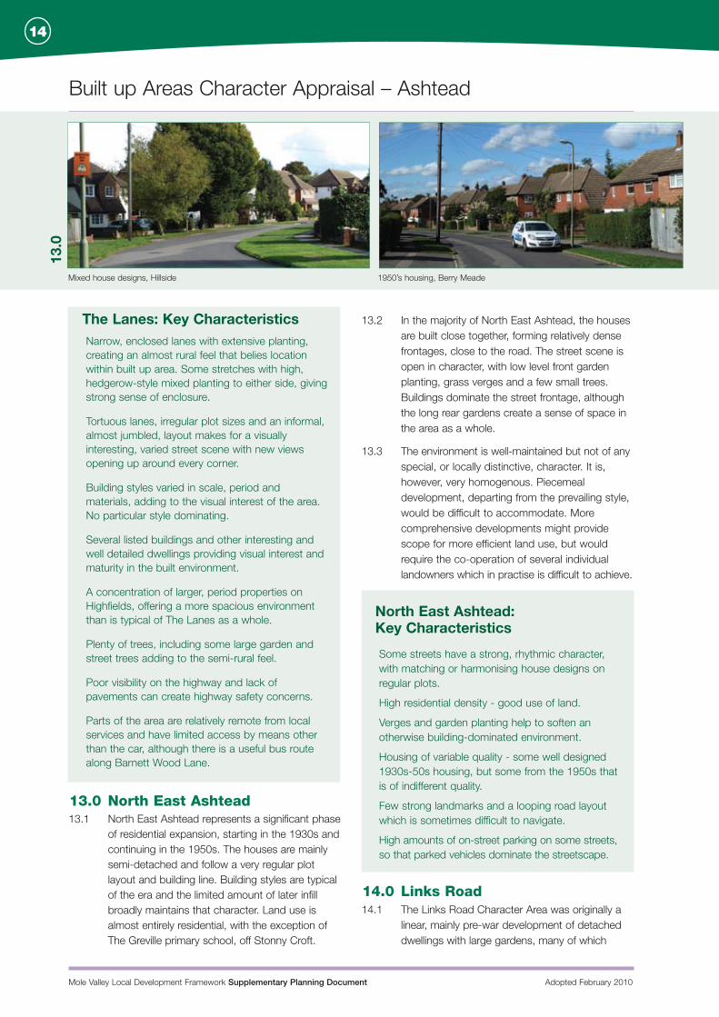
13.0 North East Ashtead13.1 North East Ashtead represents a significant phase
of residential expansion, starting in the 1930s and continuing in the 1950s. The houses are mainly semi-detached and follow a very regular plot layout and building line. Building styles are typical of the era and the limited amount of later infill broadly maintains that character. Land use is almost entirely residential, with the exception of The Greville primary school, off Stonny Croft.
13.2 In the majority of North East Ashtead, the houses are built close together, forming relatively dense frontages, close to the road. The street scene is open in character, with low level front garden planting, grass verges and a few small trees. Buildings dominate the street frontage, although the long rear gardens create a sense of space in the area as a whole.
13.3 The environment is well-maintained but not of any special, or locally distinctive, character. It is, however, very homogenous. Piecemeal development, departing from the prevailing style, would be difficult to accommodate. More comprehensive developments might provide scope for more efficient land use, but would require the co-operation of several individual landowners which in practise is difficult to achieve.
North East Ashtead: Key Characteristics
Some streets have a strong, rhythmic character, with matching or harmonising house designs on regular plots.
High residential density - good use of land.
Verges and garden planting help to soften an otherwise building-dominated environment.
Housing of variable quality - some well designed 1930s-50s housing, but some from the 1950s that is of indifferent quality.
Few strong landmarks and a looping road layout which is sometimes difficult to navigate.
High amounts of on-street parking on some streets, so that parked vehicles dominate the streetscape.
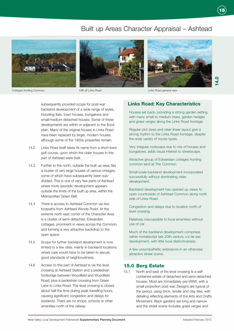
14.0 Links Road14.1 The Links Road Character Area was originally a
linear, mainly pre-war development of detached dwellings with large gardens, many of which
Mole Valley Local Development Framework Supplementary Planning Document Adopted February 2010
Built up Areas Character Appraisal – Ashtead
15
Cottages fronting Common Infill off Links Road Links Road general view
14.0
subsequently provided scope for post-war backland development of a wide range of styles, including flats, town houses, bungalows and small/medium detached houses. Some of these developments are within or adjacent to the flood plain. Many of the original houses in Links Road have been replaced by larger, modern houses, although some of the 1930s properties remain.
14.2 Links Road itself takes its name from a short-lived golf course, upon which the older houses in this part of Ashtead were built.
14.3 Further to the north, outside the built up area, lies a cluster of very large houses of various vintages, some of which have subsequently been sub-divided. This is one of very few parts of Ashtead where more sporadic development appears outside the limits of the built up area, within the Metropolitan Green Belt.
14.4 There is access to Ashtead Common via two footpaths from Ashtead Woods Road. At the extreme north east corner of the Character Area is a cluster of semi-detached, Edwardian cottages, prominent in views across the Common and forming a very attractive backdrop to the open space.
14.5 Scope for further backland development is now limited to a few sites, mainly in backland locations where care would have to be taken to secure good standards of neighbourliness.
14.6 Access to this part of Ashtead is via the level crossing at Ashtead Station and a pedestrian footbridge between Woodfield and Woodfield Road, plus a pedestrian crossing from Green Lane to Links Road. The level crossing is closed about half the time during peak travelling hours, causing significant congestion and delays for residents. There are no shops, schools or other amenities north of the railway.
Links Road: Key Characteristics
Houses set back, providing a strong garden setting with many small to medium trees, garden hedges and grass verges along the Links Road frontage.
Regular plot sizes and clear linear layout give a strong rhythm to the Links Road frontage, despite the wide variety of house types.
Very irregular roofscape due to mix of houses and bungalows, adds visual interest to streetscape.
Attractive group of Edwardian cottages fronting common land at The Common.
Small-scale backland development incorporated successfully without dominating older development.
Backland development has opened up views to open countryside of Ashtead Common along north side of Links Road.
Congestion and delays due to location north of level crossing.
Relatively inaccessible to local amenities without use of car.
Much of the backland development comprises rather nondescript late 20th century cul de sac development, with little local distinctiveness.
A few unsympathetic extensions in an otherwise attractive street scene.
15.0 Berg Estate15.1 North and east of the level crossing is a self-
contained estate of detached and semi-detached houses. Most are immediately pre-WWII, with a small proportion post war. Designs are typical of the period, using brick, render and clay tiles, with detailing reflecting elements of the Arts and Crafts Movement. Back gardens are long and narrow and the street scene includes grass verges and
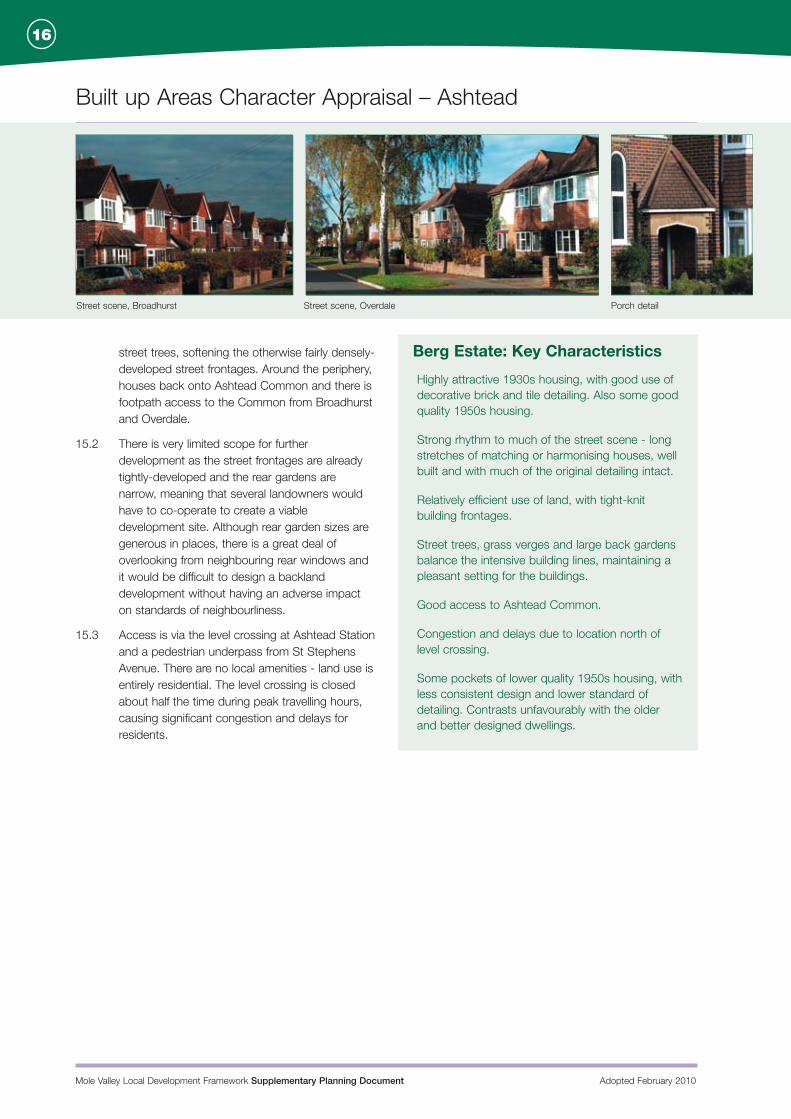
Street scene, Broadhurst Street scene, Overdale Porch detail
Mole Valley Local Development Framework Supplementary Planning Document Adopted February 2010
Built up Areas Character Appraisal – Ashtead
16
street trees, softening the otherwise fairly densely-developed street frontages. Around the periphery, houses back onto Ashtead Common and there is footpath access to the Common from Broadhurst and Overdale.
15.2 There is very limited scope for further development as the street frontages are already tightly-developed and the rear gardens are narrow, meaning that several landowners would have to co-operate to create a viable development site. Although rear garden sizes are generous in places, there is a great deal of overlooking from neighbouring rear windows and it would be difficult to design a backland development without having an adverse impact on standards of neighbourliness.
15.3 Access is via the level crossing at Ashtead Station and a pedestrian underpass from St Stephens Avenue. There are no local amenities - land use is entirely residential. The level crossing is closed about half the time during peak travelling hours, causing significant congestion and delays for residents.
Berg Estate: Key Characteristics
Highly attractive 1930s housing, with good use of decorative brick and tile detailing. Also some good quality 1950s housing.
Strong rhythm to much of the street scene - long stretches of matching or harmonising houses, well built and with much of the original detailing intact.
Relatively efficient use of land, with tight-knit building frontages.
Street trees, grass verges and large back gardens balance the intensive building lines, maintaining a pleasant setting for the buildings.
Good access to Ashtead Common.
Congestion and delays due to location north of level crossing.
Some pockets of lower quality 1950s housing, with less consistent design and lower standard of detailing. Contrasts unfavourably with the older and better designed dwellings.
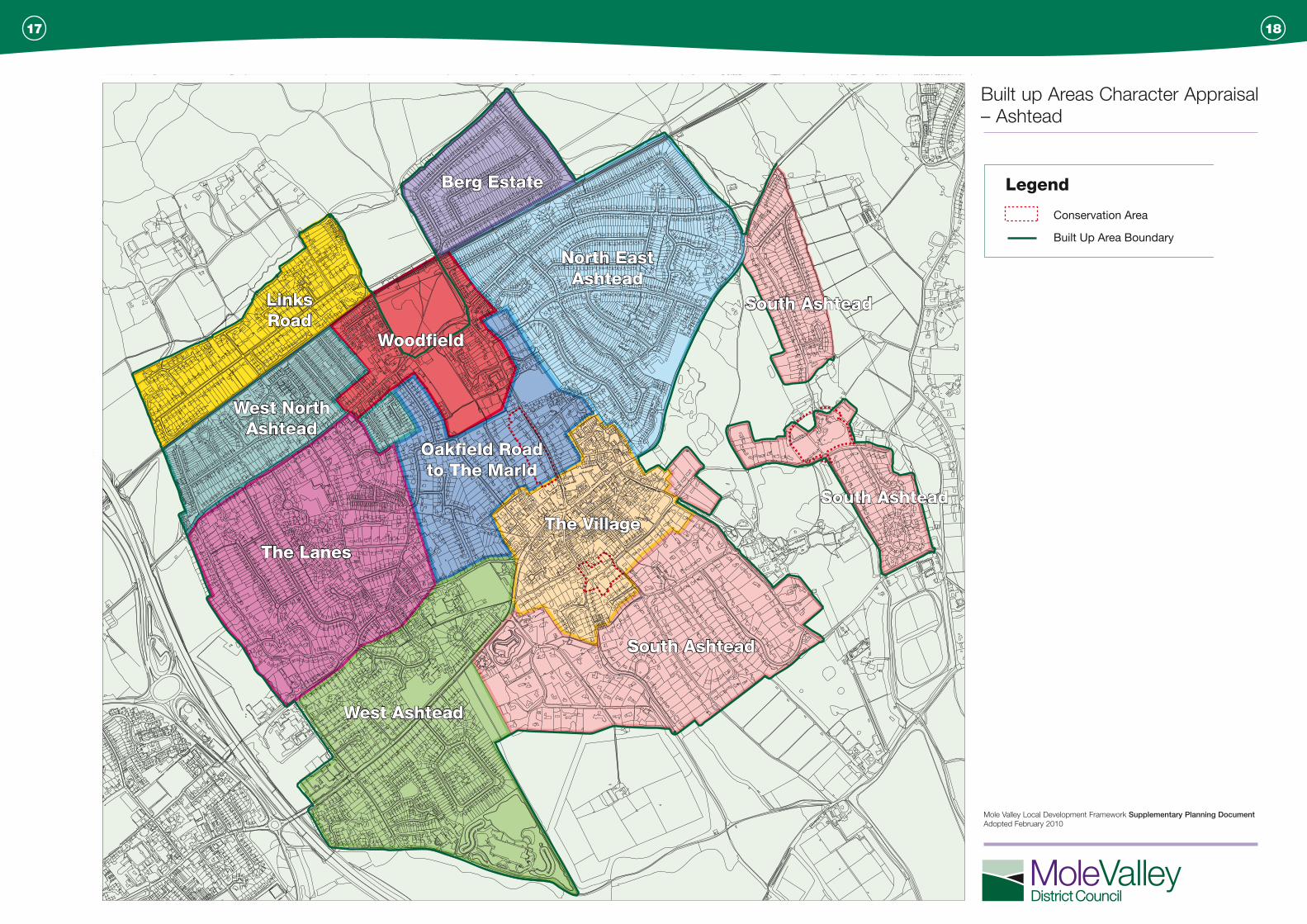
Berg Estate
North EastAshtead
South Ashtead
South Ashtead
South Ashtead
The Village
West Ashtead
Oakfield Roadto The Marld
The Lanes
West NorthAshtead
LinksRoad
Legend
Woodfield
Conservation Area
Built Up Area Boundary
Built up Areas Character Appraisal – Ashtead
Mole Valley Local Development Framework Supplementary Planning Document Adopted February 2010
1817

Mole Valley Local Development Framework
Mole Valley Local Development FrameworkAlternative formatsIf you would like this document in another format or language please visit the Council’s main reception in Dorking or the Leatherhead HelpShop. Alternatively you can contact us by:
Fax: 01306 876821 E-mail: [email protected] Website: www.molevalley.gov.uk
Si usted quisiera este documento en otro formato o idioma, por favor visite el Consejo principal de recepción en Dorking o la Leatherhead HelpShop. También puede contactar con nosotros
Fax: 01306 876821 E-mail: [email protected] Website: www.molevalley.gov.uk
Mole Valley District Council Pippbrook Dorking RH4 1SJ
Tel: 01306 885001 Fax: 01306 876821 E-mail: [email protected]
www.molevalley.gov.uk
November 2010
Published by Mole Valley Local Development Framework