Embed Size (px)
Citation preview
Brooten Area Water Use
June 19, 2008
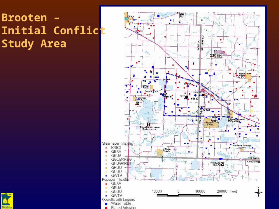
Brooten – Initial Conflict Study Area


A
A’
Brooten – Geologic Cross-Section
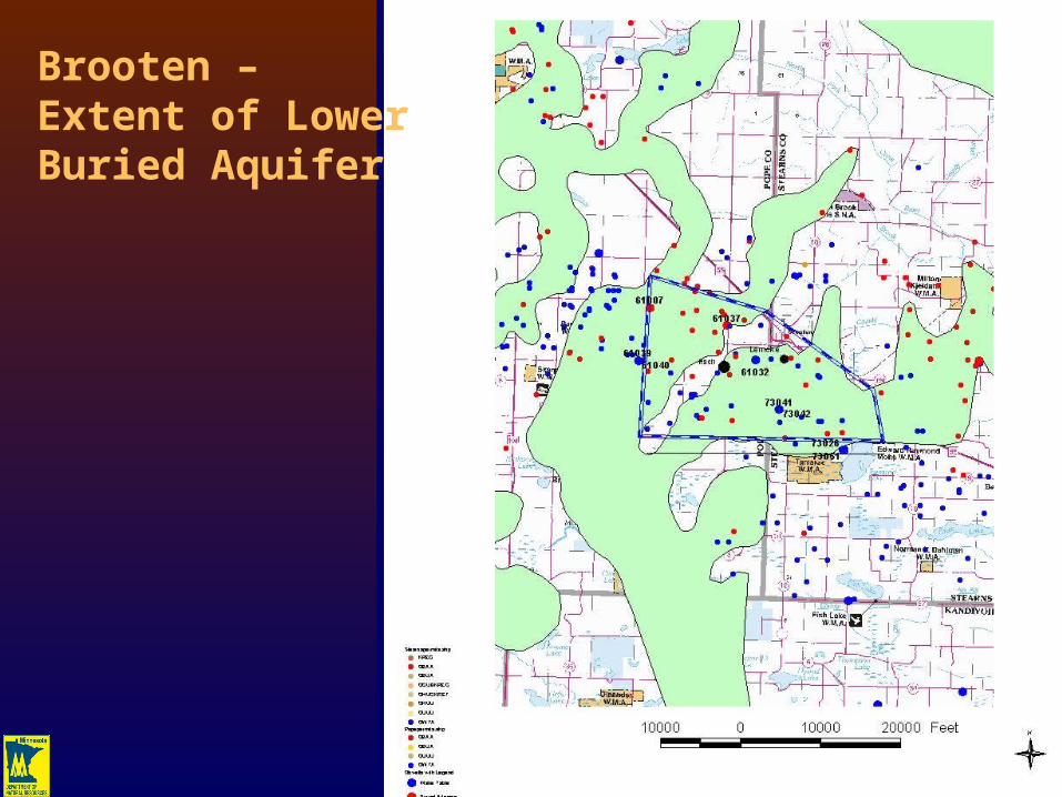
Brooten – Extent of LowerBuried Aquifer
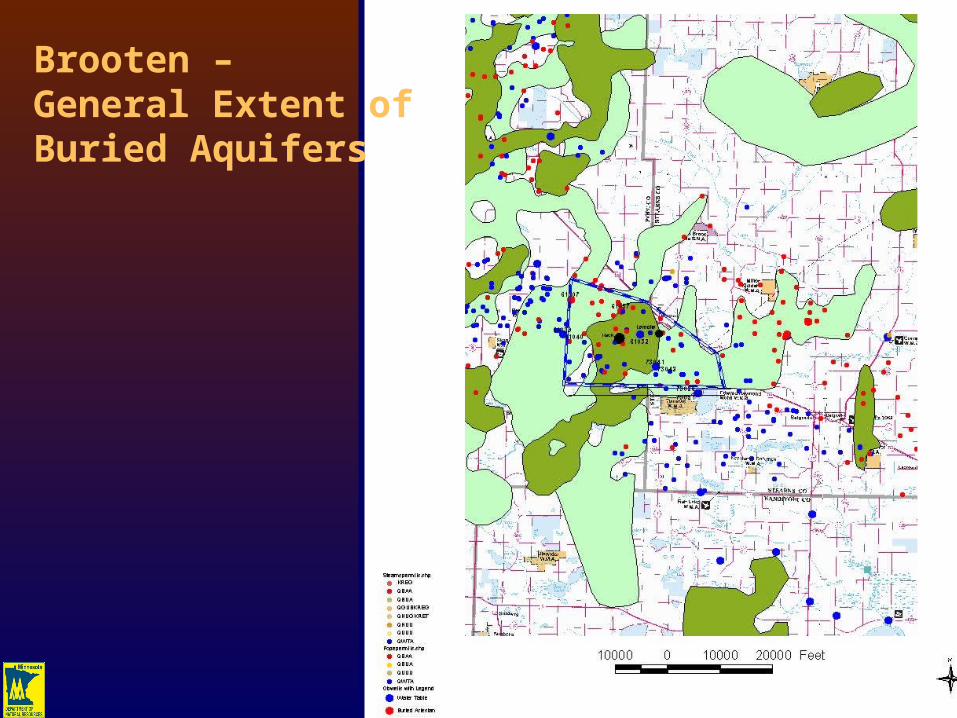
Brooten – General Extent ofBuried Aquifers
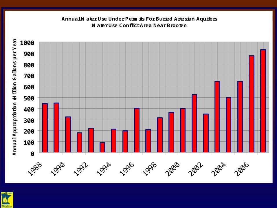
Annual Water Use Under Permits For Buried Artesian Aquifers Water Use Conflict Area Near Brooten
0
100
200
300
400
500
600
700
800
900
1000
An
nu
al A
pp
rop
riat
ion
(M
illi
on
Gal
lon
s p
er Y
ear)
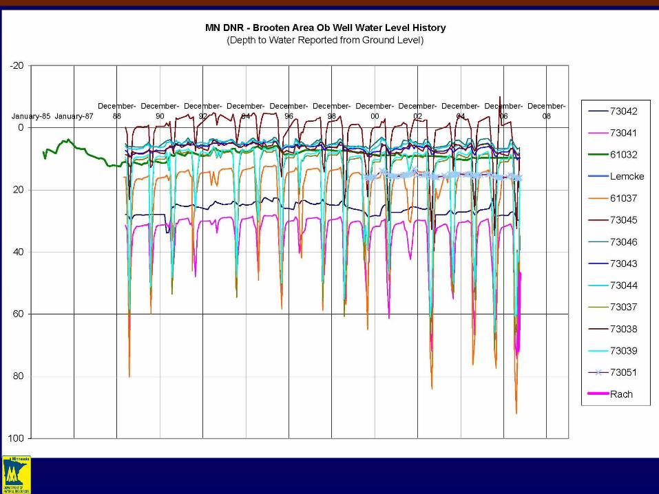
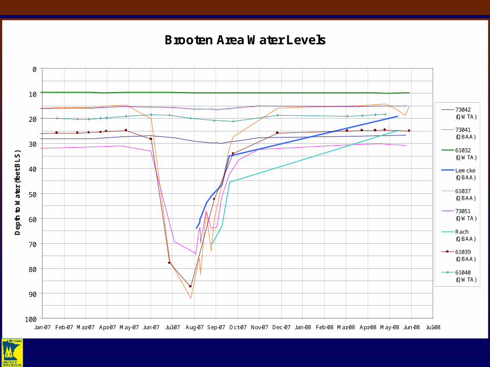
Brooten Area Water Levels
0
10
20
30
40
50
60
70
80
90
100Jan-07 Feb-07 Mar-07 Apr-07 May-07 Jun-07 Jul-07 Aug-07 Sep-07 Oct-07 Nov-07 Dec-07 Jan-08 Feb-08 Mar-08 Apr-08 May-08 Jun-08 Jul-08
De
pth
to
Wa
ter
(fe
et
BL
S)
73042(QWTA)
73041(QBAA)
61032(QWTA)
Lemcke(QBAA)
61037(QBAA)
73051(QWTA)
Rach(QBAA)
61039(QBAA)
61040(QWTA)
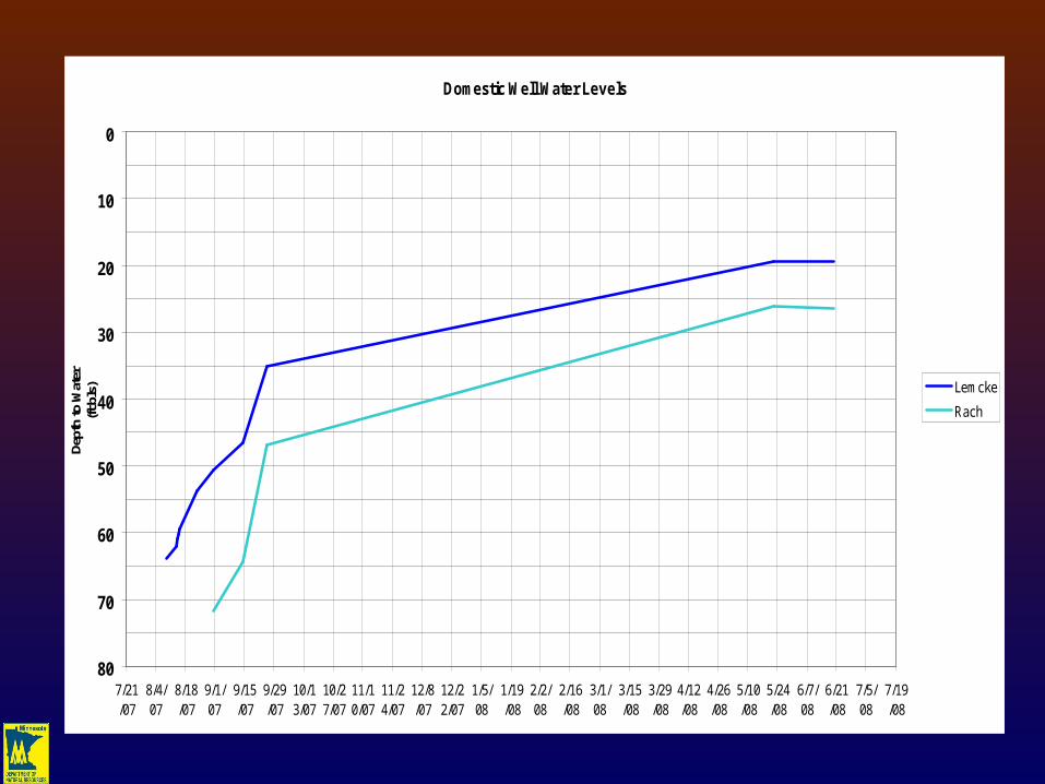
Domestic Well Water Levels
0
10
20
30
40
50
60
70
807/21/07
8/4/07
8/18/07
9/1/07
9/15/07
9/29/07
10/13/07
10/27/07
11/10/07
11/24/07
12/8/07
12/22/07
1/5/08
1/19/08
2/2/08
2/16/08
3/1/08
3/15/08
3/29/08
4/12/08
4/26/08
5/10/08
5/24/08
6/7/08
6/21/08
7/5/08
7/19/08
Dept
h to
Wat
er
(ft b
ls) Lemcke
Rach
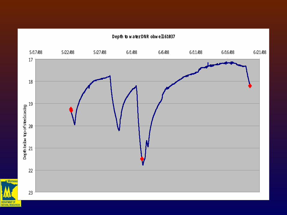
Depth to water DNR obwell 61037
17
18
19
20
21
22
23
5/17/08 5/22/08 5/27/08 6/1/08 6/6/08 6/11/08 6/16/08 6/21/08
Dept
h be
low
top
of s
teel
cas
ing
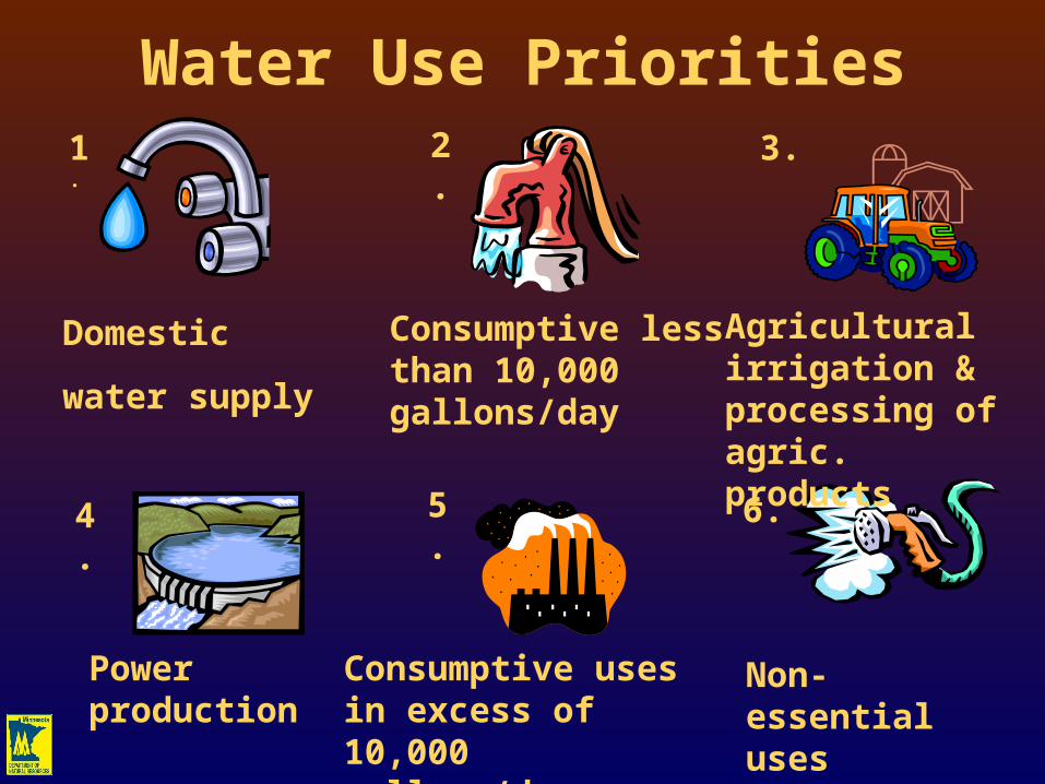
Water Use Priorities
1. 2.
3.
4. 5.
6.
Non-essential uses
Domestic
water supply
Consumptive less than 10,000 gallons/day
Agricultural irrigation & processing of agric. products
Power production
Consumptive uses in excess of 10,000 gallons/day
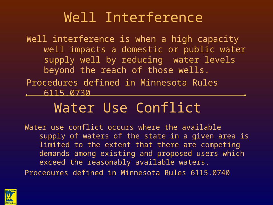
Well Interference
Well interference is when a high capacity well impacts a domestic or public water supply well by reducing water levels beyond the reach of those wells.
Procedures defined in Minnesota Rules 6115.0730
Water Use ConflictWater use conflict occurs where the available supply of
waters of the state in a given area is limited to the extent that there are competing demands among existing and proposed users which exceed the reasonably available waters.
Procedures defined in Minnesota Rules 6115.0740
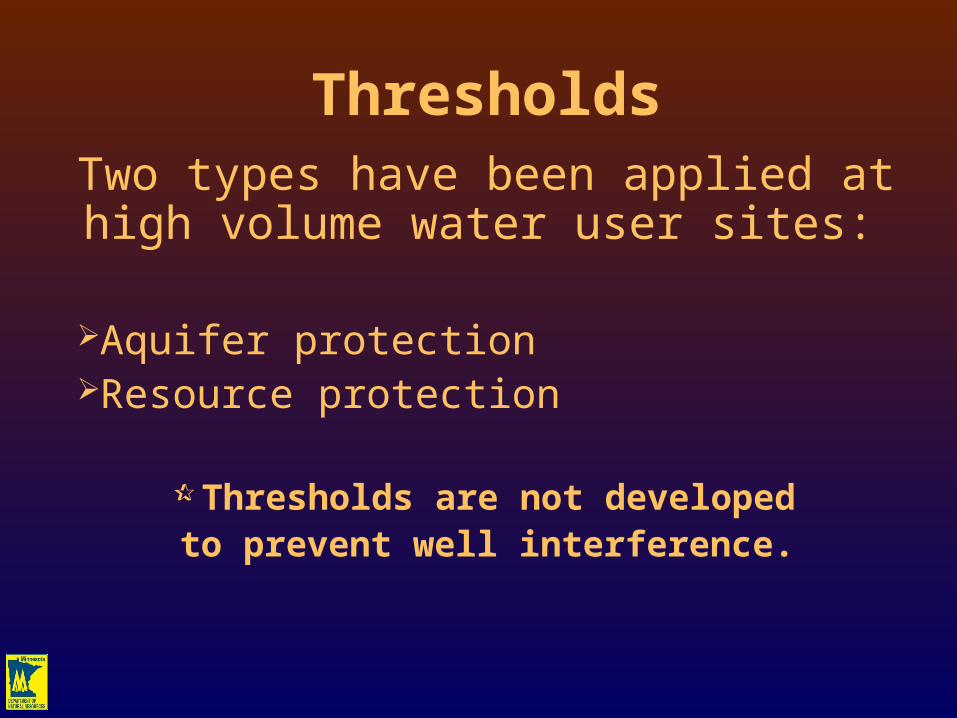
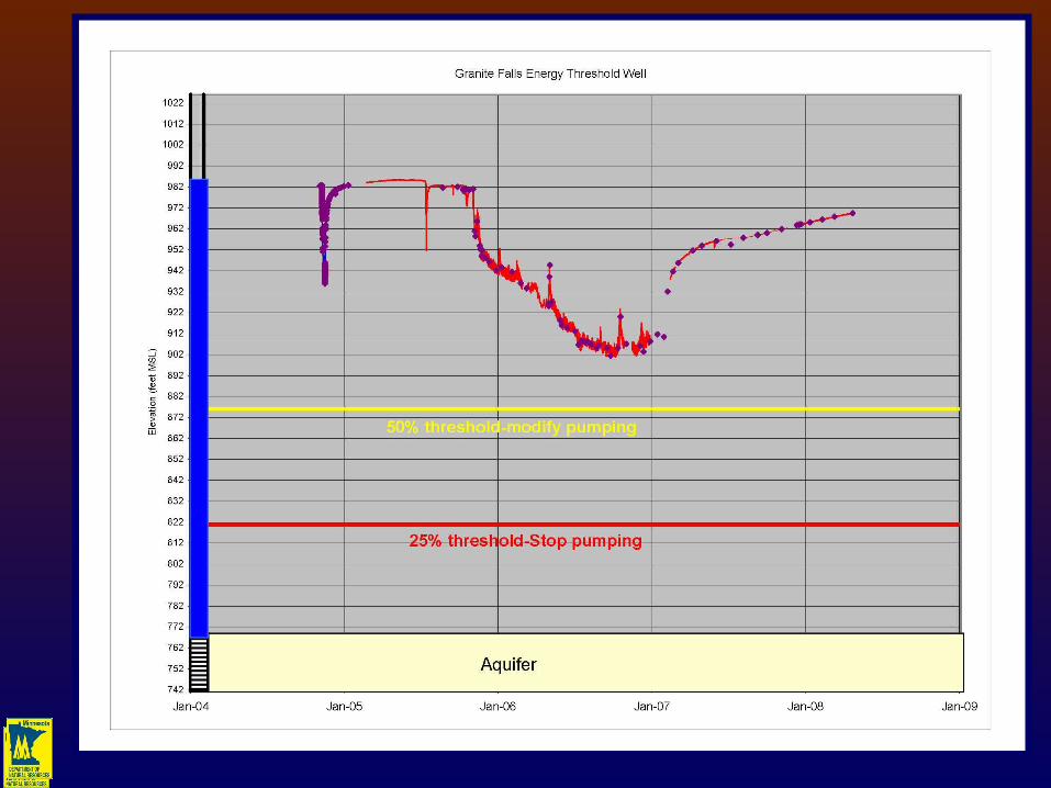
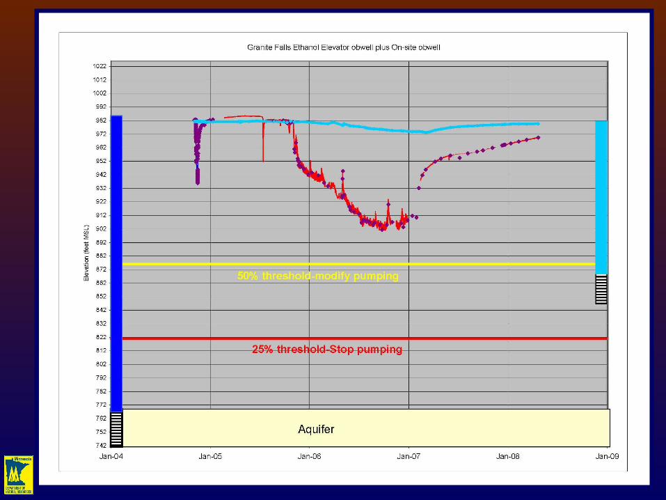
ThresholdsTwo types have been applied at high volume water user sites:
Aquifer protectionResource protection
Thresholds are not developed to prevent well interference.
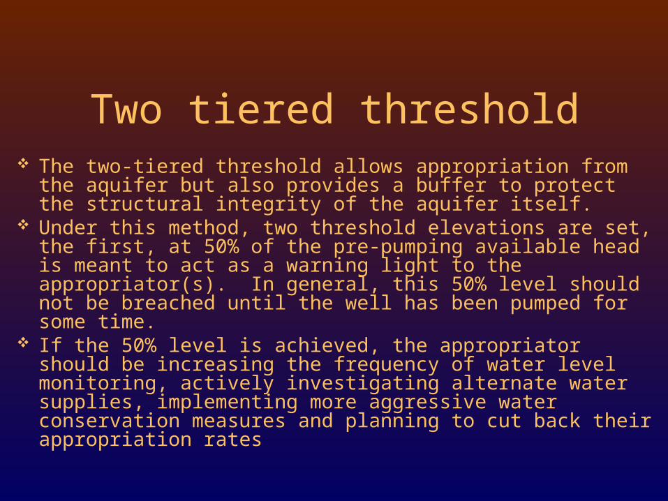
The two-tiered threshold allows appropriation from the aquifer but also provides a buffer to protect the structural integrity of the aquifer itself.
Under this method, two threshold elevations are set, the first, at 50% of the pre-pumping available head is meant to act as a warning light to the appropriator(s). In general, this 50% level should not be breached until the well has been pumped for some time.
If the 50% level is achieved, the appropriator should be increasing the frequency of water level monitoring, actively investigating alternate water supplies, implementing more aggressive water conservation measures and planning to cut back their appropriation rates
Two tiered threshold
Land surface
0
20
40
60
80
100
120
140
160
180
200
Dept
h be
low la
ndsu
rface
(fee
t)
sand 180-199
swl=68 feet
50%=124 feet
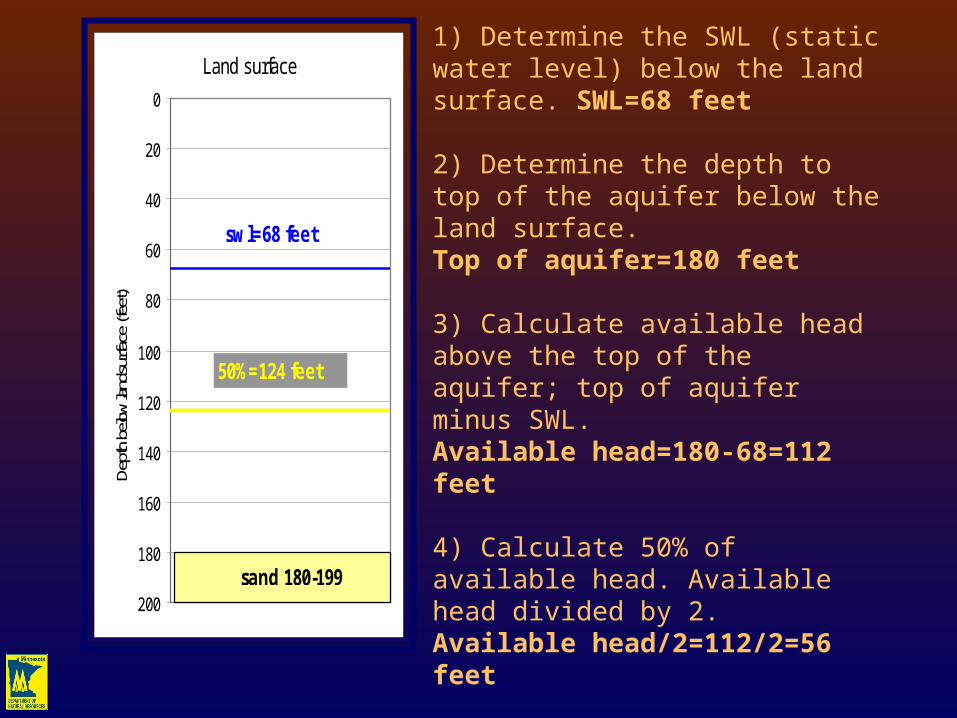
1) Determine the SWL (static water level) below the land surface. SWL=68 feet
2) Determine the depth to top of the aquifer below the land surface.Top of aquifer=180 feet
3) Calculate available head above the top of the aquifer; top of aquifer minus SWL.Available head=180-68=112 feet
4) Calculate 50% of available head. Available head divided by 2.Available head/2=112/2=56 feet
5) Calculate threshold by subtracting 50% of available head from the depth to the top of the aquifer.Threshold=180-56=124 feet
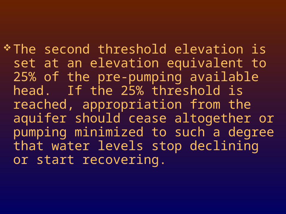
The second threshold elevation is set at an elevation equivalent to 25% of the pre-pumping available head. If the 25% threshold is reached, appropriation from the aquifer should cease altogether or pumping minimized to such a degree that water levels stop declining or start recovering.
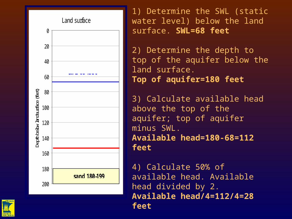
Land surface
0
20
40
60
80
100
120
140
160
180
200
Dept
h be
low la
ndsu
rface
(fee
t)
sand 180-199
swl=68 feet
25%=156 feet
1) Determine the SWL (static water level) below the land surface. SWL=68 feet
2) Determine the depth to top of the aquifer below the land surface.Top of aquifer=180 feet
3) Calculate available head above the top of the aquifer; top of aquifer minus SWL.Available head=180-68=112 feet
4) Calculate 50% of available head. Available head divided by 2.Available head/4=112/4=28 feet
5) Calculate threshold by subtracting 50% of available head from the depth to the top of the aquifer.Threshold=180-28=156 feet