Embed Size (px)
Citation preview

Bronze Age Sailors in the Libyan Sea: Reconsidering the Capacity for Northward
Voyages between Crete and North Africa
Master’s Thesis
Presented to
The Faculty of the Graduate School of Arts and Sciences
Brandeis University
Graduate Program in Ancient Greek and Roman Studies
Andrew Koh, Advisor
In Partial Fulfillment
of the Requirements for the Degree
Master of Arts
in
Ancient Greek and Roman Studies
by
Michelle Creisher
May 2015

Copyright by
Michelle Creisher
© 2015

iii
Acknowledgements
I would like to expressly thank my advisor, Professor Andrew Koh, who, through his
own passion for and knowledge of the field, continually guided and encouraged me during my
time at Brandeis University; moreover, for the generous opportunities that he made available and
without which, this thesis would not have been a possibility. I would also like to extend my
thanks to my reader, Professor Cheryl Walker, whose dedication and attention to detail in her
work with me has been inestimable. Thank you to Professor Koloski-Ostrow for her support and
constant availability, and Professor Meullner for the hours spent drinking tea and translating the
ancient authors in his office and reminding me why I first fell in love with the field of Classical
Studies. The respect and appreciation that I hold for each and every faculty member of the
Ancient Greek and Roman Studies Master’s Program at Brandeis University can never fully be
expressed; their wisdom, advice, and kindness over the years has been invaluable.
A special thanks goes out to my fellow graduate students, I cannot even begin to imagine
the last two years without you. I am honored to have known and worked with such amazing,
intelligent people each of whom I hope to call friend for many years to come.
Finally, thank you to my family and friends for all of the love and support that you have
given me during my years at Brandeis. I could never have accomplished this much without you.
iv
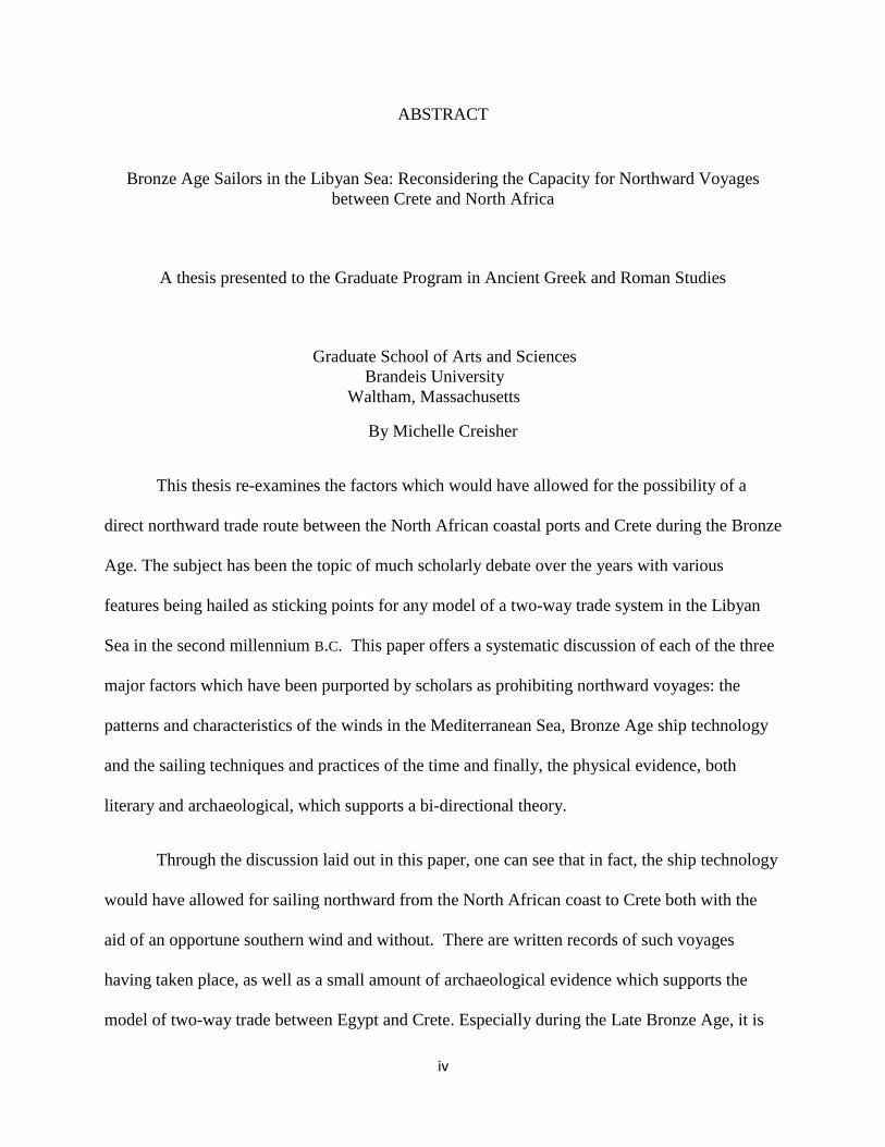
ABSTRACT
Bronze Age Sailors in the Libyan Sea: Reconsidering the Capacity for Northward Voyages
between Crete and North Africa
A thesis presented to the Graduate Program in Ancient Greek and Roman Studies
Graduate School of Arts and Sciences
Brandeis University
Waltham, Massachusetts
By Michelle Creisher
This thesis re-examines the factors which would have allowed for the possibility of a
direct northward trade route between the North African coastal ports and Crete during the Bronze
Age. The subject has been the topic of much scholarly debate over the years with various
features being hailed as sticking points for any model of a two-way trade system in the Libyan
Sea in the second millennium B.C. This paper offers a systematic discussion of each of the three
major factors which have been purported by scholars as prohibiting northward voyages: the
patterns and characteristics of the winds in the Mediterranean Sea, Bronze Age ship technology
and the sailing techniques and practices of the time and finally, the physical evidence, both
literary and archaeological, which supports a bi-directional theory.
Through the discussion laid out in this paper, one can see that in fact, the ship technology
would have allowed for sailing northward from the North African coast to Crete both with the
aid of an opportune southern wind and without. There are written records of such voyages
having taken place, as well as a small amount of archaeological evidence which supports the
model of two-way trade between Egypt and Crete. Especially during the Late Bronze Age, it is

v
clear that certain ships would have opted for the shorter, more direct route of sailing northward
in the Libyan Sea towards Crete rather than taking the longer route up along the Levantine coast
towards Syria-Palestine and around.

vi
Table of Contents
Acknowledgements............................................................................................................. page iii
Abstract............................................................................................................................... page iv
Introduction…………………………………………………………….…………….….. page 1
Chapter I: Examining the Winds………………………………...…….……..…..…...…. page 5
Chapter II: Ship Technology…………………………………………………….….….... page 13
Chapter III: Literary and Archaeological Evidence for Northward Voyages…………... page 21
Conclusion……………………………………………………………………………..... page 29
Illustrations…………………………………………………………………………….... page 34
Bibliography………………………………………………………………………….…. page 38

vii
List of Illustrations
Figure 1: Aristotle’s Wind Compass.................................................................................... page 34
Figure 2: Reconstruction of a Theran Boom-footed Rig...................................................... page 35
Figure 3: A Reefed Boom-footed Rig.................................................................................. page 36
Figure 4: Square-sail Rigged Vessel Tacking to Windward................................................ page 36
Figure 5: Map Showing the Location of Kommos............................................................... page 37
Figure 6: Visibility of the Land from the Sea...................................................................... page 37

1
Introduction
For centuries it has been the accepted view that maritime trade in the ancient world was
carried out in a counterclockwise direction around the coast of the eastern Mediterranean.
According to the common views on the trade routes, sailors would set out from their home port
and sail along the Mediterranean coastline in a counterclockwise direction and eventually, due to
the circular nature of the eastern portion of the sea, arrive back at their home port; e.g. from the
Aegean, ships would sail southward to Crete, down along the coast of North Africa to Egypt,
then up along the Syrian coast, through the Cyclades, and ultimately back to Greek ports. Thus,
for the most part, maritime trade routes in the Bronze Age Mediterranean are thought to resemble
a modern traffic rotary. This view is supported, to a large extent, by archaeological material from
both coastal sites and ancient shipwrecks around the Mediterranean. While it is well known that
the Egyptians and Cretans maintained strong communications during these times and even
earlier, as witnessed by the quantity of Minoan artifacts found in Egypt, the many references
made to the Keftiu in Egyptian records, and the iconographic evidence of Minoan/Egyptian
contact seen in the Theban tomb paintings, most of the evidence has seemed to point towards
one-directional (southward) communications. Recent excavations, however, at the site of
Kommos in southern Crete have unearthed numerous Near Eastern, specifically Egyptian,
pottery fragments which, by their sheer numbers, would seem to suggest possible two-directional
trade between the two regions in the Late Bronze Age. Thus, it appears as though the small

2
section of the trade rotary known as the Libyan Sea might actually have been an area of two-
way, rather than one-way, traffic.
This possibility has been rejected by a group of scholars who argue that the strong north-
northwest winds in that part of the Mediterranean and the ship technology of the time would
have prevented Bronze Age seafarers from accomplishing any such journey northward from
North Africa to Crete. Shelley Waschmann,1 in addition to many others, believes that the only
route which could and would have been sailed is the southward course from Crete to Egypt,
claiming that a lack of sufficient south-southeast winds and the inability of ancient ships to travel
against the wind would have prevented a return trip via the same route. According to
Waschmann, in order to return home, the sailors would have had to complete the entire circuit of
the Mediterranean and arrive back at Crete from the north. While the majority of trade and
merchant ships would have pursued such a course, following the circular route which enabled
them to access the major trade centers lining the Mediterranean coast in a grander version of
coastal tramping,2 it should not be regarded as impossible for ancient mariners to have made the
trip from the Libyan coast northward to Crete and thence the Aegean, had they so chosen. As
Arnaud points out, an alternative view on ancient sailing and trade patterns states that not all
merchantmen would have participated in the multi-stop pattern of trade, claiming that certain
voyages were undertaken with a specific trade destination as the goal, and with the a direct return
to the starting point upon completion.3 With this in mind, it is not impractical to imagine such
1 Waschmann, Shelley. 1998. Seagoing Ships and Seamanship in the Bronze Age Levant. Texas A&M University
Press; p.106 2 For an explanation of coastal ‘tramping’ in the ancient world, see Z. Archibald et al. 2001. Hellenistic Economies.
Routledge. New York, NY; p.220 3 Pascal Arnaud. 2011. “Ancient Sailing-Routes and Trade Patterns: the Impact of Human Factors” in Damian
Robinson and Andrew Wilson (eds.) Maritime Archaeology and Ancient Trade in the Mediterranean. Oxford Centre
for Maritime Archaeology: Monographs 6; p.61

3
destination-bound voyages taking place between Crete and North Africa and therefore
necessitating northward travel.
The purpose of this paper offers the possibility that Bronze Age ships would have been
capable of sailing northward to and from Crete as a viable alternate view to the argument that all
trade was carried out in a counter-clockwise route. This objective is brought about through a
careful examination of the ancient literary sources and their depiction of the winds, weather and
trade routes in and around the Libyan Sea; the ship technology known to have been used during
the Bronze Age and its potential for sailing against the wind; and the numerous Egyptian objects
recovered from the southern harbor site of Kommos. Beginning with the identification of those
winds essential for such two-way traffic, we shall then explore the recorded characteristics of
those winds; how the sail technology of the time would have dealt with such winds; whether it
has ever been recorded that such a northerly route was undertaken; and finally, the significance
of such a large quantity of Egyptian-ware being present at Kommos.
It is necessary at this point to mention that, when studying the topic of winds, the
common practice appears to be to examine the modern pilot charts and wind roses which show
the monthly averages of the winds according to the past two hundred years of recorded wind
directions and strength. This practice, however, is based on the assumption that the winds and
weather of today’s Mediterranean Sea are an accurate source upon which one may base all
decisions and beliefs concerning the sailing patterns and trade routes of the Bronze Age. Strabo,
writing in the late first century B.C. states, “For we ought not to form conjectures respecting the
ancient from the present state of things, for each has undergone contrary changes.”4 Therefore,
4 Strabo Geography (10.IV:17). Translated by H.C. Hamilton and W. Falconer, M.A. London; G. Bell and Sons,
LTD (1916)

4
while there are no recordings of the winds and weather in and around the Libyan Sea from the
Bronze Age which have survived for our research, texts such as Aristotle’s Meteorologica, the
De Mundo, Theophrastus’ De Ventis, Strabo’s Geographia, and finally, Pliny’s Naturalis
Historia, have survived; and as these texts are much closer in time to the period of interest than
the modern pilot charts, this paper’s main focus will be to examine the writings of the ancients in
order to discover what was known of the winds as early as the fourth century B.C.E. and later.
What cannot be discovered through these texts, however, must be supplemented by the modern
records; then, where information is lacking in the ancient records, we will turn to the modern
ones.

5
Chapter I: Examining the Winds
Beginning with identifying the winds necessary for a ship to undertake a northerly route
from the coast of Libya to Crete, we will turn first to Aristotle’s Meteorologica 2.VI, wherein the
description of a wind compass, which reveals the names and directions of the eight primary
winds, can be found:
Let the point A be the equinoctial sunset and the point B its opposite… let another
diameter cut this at right angles, and let the point H on this be the north and its
diametrical opposite Θ be the south. Let the point Ζ be the summer sunrise, the
point E the summer sunset, the point Δ the winter sunrise, the point Γ the winter
sunset. And from Z let the diameter be drawn to Γ, from Δ to E… The names of
the winds corresponding to these positions are as follows: Zephyros blows from
A… Apeliotes blows from B… Boreas or Aparctias blows from H… Notos blows
from Θ… From Z blows Caecias… Γ, Lips… From Δ blows Eurus… the wind
from E is called sometimes Argestes, sometimes Olympias, sometimes Sciron.5
According to Aristotle then (See Figure 1), on a circle where points A and B are diametrically
opposed and represent the West and East respectively, the wind Zephyros blows from the West
and Apeliotes blows from the East. If line H, Θ lies perpendicular to line A,B, so that point H
represents North and Θ, South, we find that the wind Boreas blows from the North and Notos
from the South. Now if a third line Z, Γ lies 30˚ (this is the angle from which the sunrise and
sunset of the summer and winter solstices would appear to an observer in Athens from a line
drawn East to West)6 to the northwest of line A,B; where Z represents the summer sunrise
(E.N.E.) and Γ represent the winter sunset (W.S.W.), then the wind Caecias blows from the
5 Aristotle Meteorologica (2.VI:363a). Translated by H.D.P. Lee. Cambridge, Massachusetts; Harvard University
Press. Loeb Classical Library (1952) 6 For 30˚, see Thompson, D’Arcy Wentworth. 1918. “The Greek Winds” in The Classical Review. Vol. 32; No. 3/4
(May & June) pp.49-56. For 29˚, see Appendix I, in Theophrastus. On Winds and On Weather Signs. Translated by
Jas. G. Wood; Edited by G.J. Symons; Published by Edward Stanford. London (1894): p.81
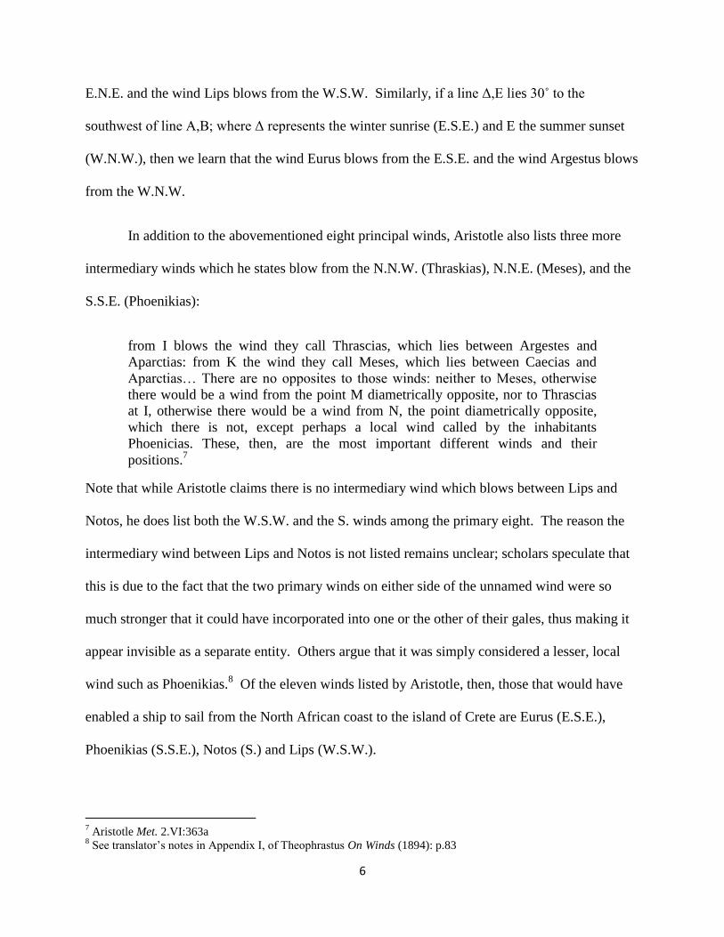
6
E.N.E. and the wind Lips blows from the W.S.W. Similarly, if a line Δ,E lies 30˚ to the
southwest of line A,B; where Δ represents the winter sunrise (E.S.E.) and E the summer sunset
(W.N.W.), then we learn that the wind Eurus blows from the E.S.E. and the wind Argestus blows
from the W.N.W.
In addition to the abovementioned eight principal winds, Aristotle also lists three more
intermediary winds which he states blow from the N.N.W. (Thraskias), N.N.E. (Meses), and the
S.S.E. (Phoenikias):
from I blows the wind they call Thrascias, which lies between Argestes and
Aparctias: from K the wind they call Meses, which lies between Caecias and
Aparctias… There are no opposites to those winds: neither to Meses, otherwise
there would be a wind from the point M diametrically opposite, nor to Thrascias
at I, otherwise there would be a wind from N, the point diametrically opposite,
which there is not, except perhaps a local wind called by the inhabitants
Phoenicias. These, then, are the most important different winds and their
positions.7
Note that while Aristotle claims there is no intermediary wind which blows between Lips and
Notos, he does list both the W.S.W. and the S. winds among the primary eight. The reason the
intermediary wind between Lips and Notos is not listed remains unclear; scholars speculate that
this is due to the fact that the two primary winds on either side of the unnamed wind were so
much stronger that it could have incorporated into one or the other of their gales, thus making it
appear invisible as a separate entity. Others argue that it was simply considered a lesser, local
wind such as Phoenikias.8 Of the eleven winds listed by Aristotle, then, those that would have
enabled a ship to sail from the North African coast to the island of Crete are Eurus (E.S.E.),
Phoenikias (S.S.E.), Notos (S.) and Lips (W.S.W.).
7 Aristotle Met. 2.VI:363a
8 See translator’s notes in Appendix I, of Theophrastus On Winds (1894): p.83

7
The final wind, that which would blow from point M and lie opposite to point K, which
Aristotle does not name, is found in other contemporary works such as the pseudo-Aristotelian
work De Mundo, as well as the work of Theophrastus of Eresus. The De Mundo states that:
Of the south winds, that which comes from the invisible pole and immediately
faces Aparctias is called Notus; that between Notus and Eurus is called
Euronotos. The wind on the other side between Lips and Notus is called by some
Libonotos, by other Libophoenix.9
The wind entitled Phoenikias by Aristotle is here named Euronotos, as it lies between Eurus and
Notos; likewise, the winds which lies between the winds Lips and Notos is named as Libonotos
or Libophoenix.10
Theophrastus, Aristotle’s successor, also identifies the S.S.W. wind when he
writes:
For the S. winds of the Spring (which they call “white S. winds” from their being
usually accompanied by clear weather) are, as it were, monsoons; but at the same
time, by reason of their being so far off from us, they have not been recognized as
such.11
The Greek word here translated as the “white S. winds” is Leuconotos, which is yet another
name for the abovementioned Libonotos. Why this wind in particular was left out of Aristotle’s
wind compass, yet fully acknowledged in the pseudo-Aristotelian work De Mundo, as well as the
work of Aristotle’s successor, Theophrastus of Eresus, is perplexing to say the least. The overall
conclusion, however, is that by the fourth century BC, the standard twelve winds known today
had been fully identified and named. Therefore, it can clearly be seen that, by at least the fourth
century, the five winds which would have been used by Bronze Age sailors making a northward
journey on the Libyan Sea, were commonly known and recognized.
9 De Mundo IV.394b:30. Translated by E.S. Forster in The Works of Aristotle. Volume III. Edited by W.D. Ross.
Oxford University Press, London (1931) 10
For the sake of consistency, and as this is the only time that the name Libophoenix is given for this wind, it will
referred to as Libonotos for the remainder of the disussion. 11
Theophrastus. On Winds (11th
section)
8
Having successfully identified the twelve winds, the names by which those winds were
called, and more specifically, those five southerly winds which would have been used to sail
northward from the North African coast to Crete (i.e., Eurus, Phoenikias, Notos, Libonotos, and
Lips), we will move on to the second topic under consideration, that of the characteristics of the
southern winds. According to the ancient authors, the south winds were known to bring with
them clear weather, to blow more frequently during the spring, autumn, and winter months, to
blow consistently in and around Egypt, and to be good for sailing. Theophrastus above mentions
two of these aspects when he writes “the S. winds of the Spring (which they call “white S.
winds” from their being usually accompanied by clear weather)…” Not only does he mention
the season with which these particular south winds were known to have been associated, but he
also comments on the reason the wind is called by that title. The statement reveals that the wind
Libonotos (here Leuconotos) was commonly known to have been associated with clearing skies
and nice weather. This is again mentioned further on in the passage when he writes:
for the S. wind is always accompanied by clear weather in the place of its origin;
but the N. wind, whenever there is a great storm, produces cloud in the parts near
[its place of origin], but clear weather beyond.12
Aristotle supports this claim:
For the south wind is the warmest of winds (both in size and strength) and blows
from regions that are dry and warm, and so it contains little moist exhalation,
which is the reason why it is so hot… The north wind, on the other hand, carries
moist vapour because it comes from damp places. So it is also cold. And it brings
fine weather here because it drives the clouds away; but in the south it brings rain.
Similarly the south wind brings fine weather in Libya.13
The fact that the south winds were known to bring fair weather especially to the region of Libya
is worth noting, as this would have been important particularly for those ships sailing in and
12
Ibid. (6th
section) 13
Aristotle Met. 2.III:358b
9
around this area. He also mentions above that the south winds are the warmest as they blow from
the warmer climes and bring little moisture. Later in the text, Aristotle again refers to the south
winds as being associated with fine weather, when he writes that the “fair weather winds do blow
from the south at the corresponding time in winter”;14
however, while still acknowledging that
the south winds bring nice weather, he here asserts that it is the south winds of winter which do
so, rather than those of the spring, as Theophrastus wrote.
In addition to describing the association between the south winds and good weather, the
above passages also mention these winds in conjunction with two separate seasons: spring and
winter. A common assumption pertaining to the weather patterns in the Mediterranean, which is
based on modern wind records, is that the south winds are predominant in the winter and the
north winds in the summer. While in general the north winds do in fact blow more frequently in
the summer, while the south winds are more frequent in the winter, this pattern is not strictly
exclusive. In his argument for Egypto-Cretan contact in the second millennium, Watrous states
rather bluntly that the north wind is not the only wind to blow during the Aegean sailing
season.15
This fact, however, is lost in the broader assumptions of wind patterns in the
Mediterranean, which leads to obvious consequences on the views concerning the direction of
travel in the ancient world. Another passage in Theophrastus’ On Wind specifically addresses
the issue of seasons and describes when each wind was known customarily to have blown by
300BC:
The N. winds blow both in Winter and Summer, and in the late Autumn until just
before the close. Southerly winds blow in Winter and at the commencement of
Spring, and the end of the late Autumn… For, whatever amount of air may have
been expelled [by N. winds] during the Winter (and the N. winds generally blow
14
Ibid 2.V:361b 15
Watrous, Vance L. 1992. Kommos III: The Late Bronze Age Pottery. Princeton University Press; Princeton, New
Jersey; p.177

10
then more frequently than the S. winds) and again before Summer by the
monsoons and succeeding winds, it is given back to these parts [by the S. winds]
in the Spring and at the close of the late Autumn, and about the setting of the
Pleiades in due course.16
The segment reveals that both the north and south winds were known to blow in the winter, but
that the north blew more frequently than the south during this season. During the spring the south
winds were recognized as being more common, but in the summer the north winds again became
more frequent. By late autumn, however, the roles had again reversed and the south winds were
once more predominant.
Connie Lambrou-Phillipson, in her article on the limitations of sailing in the Bronze Age
Mediterranean, bases her claim that a northward journey upon the Libyan Sea would have been
completely unfeasible in the Bronze Age upon three reasons. 17
Her first reason is the most
common in regards to the argument against north-bound sea voyages, that the predominant
north-northwest winds blow for at least half of the days of summer and would have hindered any
ship’s reliability on a steady southern wind for a northward journey. This argument, however, is
founded strictly on the assumption that any Bronze Age sailing would have been restricted to the
summer months (May through October) alone.18
But this argument can easily be refuted by the
very information given in the passage above, and by broadening the scope of available sailing
seasons to include spring and autumn in addition to just the summer. By recognizing the fact
that Bronze Age sailors would have been fully capable of sailing during the spring and autumn
months, the possibility of a ship’s encountering a southerly wind is increased, and the odds of
making a northward journey are greatly improved. The Mediterranean Pilot reports that the
16
Theophrastus. On Wind (10th
section) 17
Lambrou-Phillipson, Connie. 1991. Seafaring in the Bronze Age Mediterranean: The Parameters Involved in
Maritime Travel. Aegaeum. Vol. 7; p.13 18
This period is considered to be the optimal sailing season in the Mediterranean, as storms are known to
customarily arise during the winter.

11
south and north winds alternate during the months of March and April; during the month of June,
the weather is serene; while the south winds prevail in September. Indeed, the south wind from
Libya, known as Livas, today commonly blows during the summer.19
In light of these facts, it is
clear that the commonly accepted general view of the wind patterns in the Mediterranean have
greatly affected the beliefs concerning the limitations of Bronze Age trade routes.
The second reason that Lambrou-Phillipson gives is that the south-southeastern winds are
weak during the summer months and therefore unusable. Due to the information given in the
quotation above, however, Theophrastus makes it clear that the south winds are not common
during these months, and therefore cannot be expected to be strong. Had the spring and autumn
months been added to the equation the argument would not have held, as it is during these
seasons that the south winds prevail. On the topic of strength, Theophrastus lists another
characteristic of the south winds: “It is from the same cause that the N. wind is strong
immediately it begins to blow; while the S. wind is strong as it is leaving off; on which facts is
founded the proverbial advice about sailing.” 20
The proverb that is being referred to here is one
found in Aristotle’s Problemata and may be translated as follows: “’Tis well to sail, when the
South winds begin to blow, and when the North winds fail.”21
Obviously this characteristic is
pertinent information to those in the maritime communities, as it reveals the best times for setting
out to sea, in addition to being generally helpful information regarding the weather patterns in
the Mediterranean.
Lambrou-Phillipson’s final argument lies in the claim that south-southeastern winds
represent over two and a half days per month, but that there is no guarantee of consistency as the
19
See note in Watrous. 1992. Kommos III. p.177 20
Theophrastus. On Winds (5th
section) 21
See Aristotle. Problemata (XXVI.21). Translated by W.S. Hett, M.A. Cambridge, Massachusetts; Harvard
University Press. Loeb Classical Library (1937)

12
statistical averages are not the number of days in a sequence in which the winds blow, but rather
estimates. Before discussing the lack of reliability found in the south winds, it seems appropriate
to mention a second proverb discussed in Theophrastus’ work. While Lambrou-Phillips may
claim that the south winds are inconsistent, the fourth-century philosopher explains that: “N.
winds arising in the night blow themselves out at the third day; whence the proverb runs – ‘A
North-wind rising in the night/Never sees the third day’s light;’.”22
But as concerns the claim
against the south winds, he writes:
In like manner, with them [North Africans], the S. wind particularly exhibits the
characteristics of recurrence, steadiness, continuousness and regularity, for such is
always the character of each wind among those who are near its place [of origin];
but when it reaches those who are afar, it is irregular and disorganized.23
According to the De Ventis, while the south winds might be inconsistent further to the north, it is
known and acknowledged to be consistent, steady, and reliable around North Africa and Egypt.
This characteristic is specifically pertinent to the discussion, as it reveals the south wind is much
more reliable the closer one gets to the North African coast. Thus when sailing a northward
journey, the possibility of a north wind hindering a ship’s progress would be less likely in the
Libyan Sea than in the Aegean.
22
Theophrastus. On Winds (48th
-49th
sections) 23
Ibid. (6th
section)

13
Chapter II: Ship Technology
The next topic to be discussed is that of ship technology and the sails used during the
Bronze Age. In her book on the topic, H.S. Georgiou states that one must remember that ship
technology was not something to be taken lightly in the ancient world, but an issue of skill and
precision:
Given the absolute need for efficient communication by sea, one cannot assume
that boat design evolved haphazardly over the centuries. The development of
designs allowing for more predictable handling of ships was undoubtedly given
considerable attention.24
With this quotation as the foundation for our study of the subject, we will begin by recalling two
essential facts: first, that the style of rigging being used both in the Aegean and on Crete was the
single-masted, boom-footed, square-sail;25
second, that while the majority of seafaring in the
Bronze Age Mediterranean still consisted of coastal sailing, open-water voyages were also
occurring at this time. Both of these methods of sailing required a significant amount of skill
regarding stability and maneuverability as the routes which followed the coastline led ships
along a twisted path in and out of various harbors, inlets, and outcroppings; and those in the open
waters could unexpectedly be subject to the rougher weather and sea conditions found out in the
open. In both situations, the ships would have had to account for the various and sometimes
sudden changes in wind direction. Sailing in such contexts requires that a ship be able to travel
in both unfavorable and favorable conditions. Due to this fact, it would have been entirely
24
Georgiou, H. 1991. “Bronze Age Ships and Rigging” in Thalassa: L’Egée préhistorique et la mer. Aegaeum 7:
p.68 25
Waschmann. 1998. Seagoing Ships. pp.251, 254, and 330

14
unreasonable for an ancient mariner to have gone to sea without the ability to travel, even
slightly, to windward,26
as a vessel must maintain its balance as well as its course in the event of
a change in the wind’s direction.
In the broader scope of second millennium maritime technology, there was a supplement
to sails to be found in the use of oars for added maneuverability, and in fact depictions of ships in
the iconographic record portray both being broadly used; but they were more typically those
smaller watercraft used in and around harbors or on shorter day journeys such as those between
Crete and the Mainland or the Cyclades. The archetypal merchant ship of the Bronze Age
Mediterranean tended to use wind propulsion over oars as sails require less space and crew, both
important features when dealing with cargo vessels. Georgiou wrote that oared cargo vessels
would have been impractical due to the amount of space both the crew and equipment space
would have required; the hulls being designed for maximum storage capacity rather than
accommodating rowers.27
In contrast, the war galleys, requiring the maximum amount of
flexibility for naval battles, used oars to achieve the much-needed maneuverability in tight
places, as cargo space would not have been a concern. Although sails were present on the
warships, according to the iconographic record, Campbell claims that these were not the main
form of propulsion:
It did not become the main means of shifting the war galleys because it could not
compete with the speed and maneuverability of oars in battle conditions, useful
though it was as an auxiliary power source.28
26
Tilley, Alec. 1994. “Sailing to Windward in the Ancient Mediterranean” in International Journal of Nautical
Archaeology. Vol. 23, No.4, p.310 27
Georgiou. 1991. Bronze Age Ships. p.62 28
Campbell, I.C. 1955. “The Lateen Sail in World History” in Journal of World History. University of Hawaii
Press; Vol.6, No.1, p.20

15
From the few details that can be discerned from Late Minoan seals and sealings which, in
addition to a few crude and fragmentary models, comprise the extent of Bronze Age Cretan ship
iconography, it is understood that the Cretan and Cycladic crafts were similar in style. Thus, the
discovery of the Miniature Frieze at Akrotiri on Thera has added greatly to our knowledge
concerning the ship technology of those vessels navigating the Libyan Sea. 29
Between the
depictions in the frieze and the seals and sealings, a general picture of the type of rigging used on
Late Bronze Age Aegean ships has been pieced together, allowing for the potential sailing
performances to be determined. When sailing with the wind blowing in from directly behind the
ship, the square-sail is ideal for sailing as its shape allows for the wind-pressure to be evenly
dispersed both vertically, along the mast, and horizontally, along the yardarms. Casson calls the
square-sail “the best there is for sailing with a favorable wind.”30
According to modern replicas
of the ancient vessel,31
it is known that the square-sail has the ability to sail up to 12+ knots when
running directly before the wind.32
According to Waschmann and Morgan, before the wind was
the only manner in which a square-sail ship could be sailed in the ancient world,33
claiming that a
square-sail rig could have been rotated slightly on the mast in order to accommodate for minor
changes in wind direction, but that it would have been incapable of rotating far enough in order
to be used efficiently when traveling against the wind. As a result, Late Bronze Age ships would
have been able to sail exclusively southwards from Crete to North Africa, but would have been
incapable of sailing against the predominantly north-northwestern winds, therefore necessitating
29
Wachsmann. 1998. Seagoing Ships. p.83 30
Casson, Lionel. 1971. Ships and Seamanship in the Ancient World. Princeton, New Jersey: Princeton University
Press; p. 337 31
Whitewright, Julian. 2008. “Maritime Technological Change in the Ancient Mediterranean: the Invention of the
Lateen Sail” PhD. dissertation, University of Southampton. p.127 32
Whitewright. 2008. Maritime Technological Change. p.138 33
See Waschmann. 1998. Seagoing Ships; and Morgan, Lyvia. 1988. The Miniature Wall Paintings of Thera.
Cambridge: Cambridge University Press

16
the well-known counter-clockwise route.34
There is much debate concerning this argument,
however, as there is no evidence for such inhibition, either archaeological or iconographical;
moreover, as members of coastal and island communities, the sailors of the Late Bronze Age
Aegean would have had access to thousands of years of seafaring knowledge, understanding and
technique. Thus, there is no reason not to allow for the possibility that the sails could have been
rotated sufficiently to permit for tacking.
While some scholars claim that a boom-footed square-sail cannot be reefed, but only
rotated to a position before the wind,35
Georgiou’s reconstruction of the rigging of the Theran
ship allows for reefing, highlighting the boat’s ability to sail at a closer angle to the wind than
previously acknowledged and, consequently, enable the technique of tacking rather than merely
going before the wind (See Figures 2 and 3). According to the iconographic record and
Georgiou’s extensive work, the boom-footed square-sail rigs of the ancient Aegean had lifts
attached at intervals to the boom which ran up and over the yardarms before falling to the deck to
be secured. These lifts allowed the crew to raise and lower the boom, thereby adjusting the size
and shape of the sail either in its entirety or just on a single side. Through a process called
reefing sailors would haul up a portion of the sail by pulling on the ropes attached to the boom
and so allow for less of the sail’s area to be available to the wind on one side of the ship. 36
By
the end of the fifteenth century B.C., the technique of reefing was greatly improved by the
invention of brails. (Brail-rings are small rings which are attached to the sail at intervals in
vertical rows through which lifts, called brail-lines, are run up through the rings, over the yard,
and back to the deck.) These lifts are controlled much as the abovementioned lifts that are
34
Berg, Ina. 2007. “Aegean Bronze Age Seascapes – A Case Study in Maritime Movement, Contact and Interaction”
in Conference Proceedings, ed. S. Antoniadou and S. Pace. p.394 35
Roberts, O.T.P. 1991. “The Development of the Brail into a Viable Sail Control for Aegean Boats of the Bronze
Age” in Aegaeum 7: 55 36
Whitewright. 2008. Maritime Technological Change. p.109
17
attached straight to the boom to ‘brail up’ the sail. This allowed the crew to adjust the fabric
itself rather than just the boom, and with the advent of this new technology, the boom essentially
became superfluous. Without a boom, the sail was easier to manipulate and the entire rigging
much lighter.
In the situation of a contrary wind, the process of reefing is beneficial to mariners as it
aids in controlling how and where the majority of the wind’s force hits the sail and thus the angle
at which the ship is propelled. By reefing only one side of the sail and leaving the other side
open to the wind, the portion that is reefed would receive proportionally less wind force than the
open portion, creating an unequalled amount of pressure on the sail, with the greater amount of
wind-force being caught by the open section of sail. Just as a rowboat, where more force is used
on one oar than the other, the ship would be propelled more on one side than the other, resulting
in its moving at an angle rather than in a straight line. When the process of reefing is used in
conjunction with rotating the sail, the capacity to sail against the wind suddenly becomes
feasible. After a sail has been reefed on one side, the entire thing can then be rotated in order to
regulate where the majority of the wind hits the sail, therefore manipulating the angle at which
the wind propels the ship. If the sail is positioned so that the reefed portion of the sail points
toward the front of the ship and the open portion points toward the stern, then the majority of the
wind is forced to hit the open sail at the rear of the craft.37
Thus, the sails can be manipulated in
such a way as to catch a wind coming from before or beside the ship at an angle so that the craft
is still propelled forward. Pliny describes how “vessels by means of slacking the sheets can sail
37
Campbell. 1955. The Lateen Sail. p.2

18
in contrary direction with the same winds;”38
and the entire practice is described by Aristotle in
the Mechanica,
Why is it that [sailors], when the wind in unfavorable and they wish to run before
it, they reef the sail in the direction of the helmsman, and slacken the part of the
sheet towards the bows? Is it because the rudder cannot act against the wind when
it is stormy, but can when the wind is slight and so they shorten the sail? In this
way the wind carries the ship forward, but the rudder turns it into the wind, acting
against the sea as a lever.39
As it is impossible for a ship to sail directly into an oncoming wind without the use of a
motor, it is necessary to set out on a course at an angle less than 90˚ from the direction of the
wind then, after a certain distance, to turn and again sail at the same angle into the wind, a
technique known as tacking (See Figure 4). Thus, when covering long stretches between two
points in an oncoming wind, a ship must go back and forth repeatedly; as Casson describes,
When his destination lay well to the windward he resorted, as ships willy-nilly did
until the age of steam, to tacking, i.e., he pursued a zigzag course with the ship
taking the wind first on one bow and then being swung about to take it on the
other.40
One of the difficulties of tacking is that it requires a ship to be able to perform a turn in order to
accomplish such a zigzag course. Tacking is a time-consuming process as, at the end of every
long stretch, the bow of the ship must be turned to face the direction of the wind, and as the ship
begins to lose its forward momentum in the face of the oncoming wind, the sail must quickly be
swung around to the other side of the mast in order to again catch the wind and regain its
38
Pliny the Elder. Natural History: Books III-VII. Translated by H. Rackham. Cambridge, Massachusetts; Harvard
University Press. Loeb Classical Library (1942), 2:48 39
“Aristotle: Mechanical Problems, 851b.7” Translated by E. Thayer, Last modified November 19, 2012.
http://penelope.uchicago.edu/Thayer/E/Roman/Texts/Aristotle/Mechanica*.html 40
Casson. 1971. Ships and Seamanship. p.274

19
momentum in the new direction.41
While the square-sail has the advantage of being able to
regain its speed quickly during the long stretches of a tack, its disadvantage is in the degree of
angle at which it is capable of sailing into the wind. Through the trial voyages of modern
replicas, we have been able to ascertain that the maximum angle that a square-sail is able to sail
to windward is approximately 60˚.42
Therefore, according to the facts above, not only was it
possible for a Bronze Age ship to have sailed directly before the wind, but it was also capable of
sailing against a contrary wind through the processes of reefing and tacking.
When it comes to the question of speed, Whitewright’s extensive work on the potential
performance of ancient sailing crafts has shown us that the single-masted square-sail rigged
vessel is capable of traveling against the wind at a rate of up to two knots using his system of
“velocity made good.”43
Velocity made good (Vmg) is the absolute speed of a vessel over a
direct course between two points.44
This means that for a ship traveling against the wind, the
actual speed is much faster than two knots, but when the overall distance covered by having to
tack is calculated in, the result is an absolute speed which is much slower than what the ship
actually achieved. By examining the results of the sailing trials of replica vessels, we know that
those using the same rigging types as the Bronze Age Aegean ships are capable of achieving
speeds of up to two knots Vmg when sailing in both favorable and unfavorable conditions. Thus,
despite the fact that it would have taken a considerably longer time to sail on a windward, or
close-hauled course, the square-sailed vessels are proven to be capable of accomplishing
journeys which would have required the ability to sail close-hauled.
41
Whitewright. 2008. Maritime Technological Change. p.95 42
Ibid. p.138 43
Whitewright, Julian. 2011a. "The Potential Performance of Ancient Mediterranean Sailing Rigs" in International
Journal of Nautical Archaeology. Vol.40, No.1, p.9 44
For further explanation on “Velocity made good (Vmg)” see Figure 4

20
This implies that an Aegean ship, setting out on its return journey home from the North
African coast, could have successfully sailed northward by either sailing directly before the wind
in the case of a south wind or by reefing in the case of east or west winds, and tacking in a north
wind. As a result, Bronze Age ships would not have been subject to the influence of the wind
nearly as much as has previously been believed, ultimately using the wind to its advantage rather
than being limited by it. Neither the selection of routes nor destinations would have been
determined by environmental factors. Ina Berg, in her work on maritime contacts and
interactions, sums it up perfectly when she writes:
Without doubt, prehistoric sailors took geographical conditions, predominant
current and seasonal wind patterns into consideration in order to sail under the
best possible conditions – we should not expect anything else – but available ship
technology and navigation skills meant that sailors could be much more flexible if
they wished to; ultimately, wind and current could be used to the sailor’s
advantage but neither their route nor their destination was predetermined by these
environmental factors.45
45
Berg. 2007. Aegean Bronze Age Seascapes. p.397

21
Chapter III: Literary and Archaeological Evidence for Northward Voyages
At this point in the discussion, we have identified the south winds which are ideal for
undertaking a northward journey; examined the different characteristics of those winds and the
seasons they blow; and lastly we have determined how Bronze Age ship technology would have
allowed and enabled travel in unfavorable and even contrary winds. As a final point, we will
examine the evidence, both literary and archaeological, for any record of north-bound voyages
ever having being accomplished between the coasts of North Africa and Crete. While the
evidence for such journeys remains sparse, relatively speaking, what does exist is incredibly
compelling. In Pliny’s Naturalis Historia there is a brief passage which suggests that a
northward route had been taken; he writes: “The distance of the island [Crete] at its promontory
called the Ram’s Forehead from the promontory of Cyrene named Phycus [Ras el-Sem] is stated
by Agrippa to be 125 miles.”46
Due to the wording, the lines seem to imply that at least by the
time of Agrippa in the first century BC, the voyage from North Africa to Crete had been
successfully undertaken at least once, if not more, in order for the distance between the two
geographic points to have been known to the extent where they would be recorded.
Strabo, writing slightly earlier than Pliny, also reports the distance between Cyrene and
Crete in his work Geography, when he writes that: “According to Eratosthenes , the distance
from Cyrenaïca to Criu-Metopan [Cape Krio, Crete] is 2000 stadia, and thence to Peloponnesus
46
Pliny. Natural History (4.XII:59); emphasis added.

22
less than [1000].”47
This text also gives the distance between the two locations in such a way
that suggests the journey had been accomplished at least once. Due to the casual way in which
the added trip north to the Peloponnese is mentioned, it could easily be assumed that this route
was commonly known and used by sailors in the first century BC. The reference to the author
Eratosthenes of Cyrene, however, proves that this route was being sailed by the end of the
third/beginning of the second century at the latest. Along this same vein, Strabo also wrote:
“The harbour of Cyrene is situated opposite to Criu-Metapon, the western cape of Crete, distant
2000 stadia. The passage is made with a south-south-west wind.”48
This segment of the work
supports the previous argument perfectly. Not only does it reiterate and prove the earlier
information concerning the presence and nature of the southern winds, it also proves that the
Libyan Sea portion of the Mediterranean trade circuit was indeed an area where the standard of
strictly counter-clockwise trade routes was not always practiced and that two-directional
seafaring was in fact carried out between North Africa and Crete.
The final piece of literary evidence for northward sailing is found in Book Four of
Thucydides’ History of the Peloponnesian War, where the fifth-century author states that the
island of Kythera was given special attention by the Spartans as it was “There the merchant
vessels coming from Egypt and Libya commonly put in.”49
This passage implies that ships were
capable of sailing northward to the Aegean since it specifically says that the vessels were coming
from Egypt and Libya. While there is no mention of the direction from which the ships arrived at
Kythera and thus no way of knowing whether the author was simply referring here to their ports
of origin, the wording seems to suggest that these specific merchant vessels were coming directly
47
Strabo, Geo. (10.IV:5); emphasis added. The number 1000 is conjecture as it is wanting in the text (see
translators’ note). 48
Ibid. (17.XXI:1) 49
Thucydides. History of the Peloponnesian War (4.53.2-3). Translated by Benjamin Jowett. Oxford; Clarendon
Press (1881)

23
from Egypt and Libya and, therefore, indicates the possibility of a northward route through the
Libyan Sea. Additionally, the use of the word ‘commonly’ intimates that ships arriving in the
Aegean from a southerly direction was not an exceptional thing, but rather a customary and
familiar occurrence. Trade between North Africa and the Aegean, by all appearances, was an
active and successful enterprise, to the point that a Kytherian port of arrival for those vessels
making such a trip was given particular consideration.
Concerning the archaeological evidence for northbound seafaring as seen in light of the
possibility for direct two-way trade between Egypt and Crete, we will begin by determining the
number of the published Egyptian artifacts discovered in Late Minoan contexts on Crete.
According to Cline’s research, the total number of Orientalia found in the Late Minoan I contexts
on the island is 119, of which 76 are Egyptian; from the Late Minoan II contexts, 21 of the total
24 are Egyptian (an additional 7 Orientalia are dated from the generic Late Minoan I-II contexts,
of which all are Egyptian). Out of the Orientalia from Late Minoan IIIA-B contexts, there are 18
objects dated to the timeframe in general, and only 7 from the Late Minoan IIIB period, leaving
the majority of the objects (134) from the Late Minoan IIIA contexts and a total of 159, of which
53 are from Egyptian objects. 50
What is most notable about this data is that the number of
Egyptian artifacts found on Crete seems much greater that one would expect if the island’s
position is considered the end point of the counter-clockwise trade rotary, as has previously been
believed. Why are the majority of artifacts not Syro-Palestinian or Cypriote? According to the
commonly accepted view of trade, both of these locations would have been the last stopping
points for any merchants or trade ships before arriving at Crete and both regions were firmly
50
Cline, Eric. 1999. “The Nature of the Economic Relations of Crete with Egypt and the Near East during the Late
Bronze Age” in Angelos Chaniotis (ed) From Minoan Farmers to Roman Traders: Sidelights on the Economy of
Ancient Crete. Franz Steiner Verlag; Stuttgart, Germany. p.117

24
incorporated into the team of international players by this point. With the quantity of Egyptian
objects in nearly every period comprising more than half of all Orientalia occurring across all of
Crete, there seems no reason at least to consider direct trade between the two locations as a
possibility. Cline wrote:
During the earlier LH/LMI-II periods in the Aegean, Egyptian objects comprise
the vast majority of the Orientalia found in the Aegean. Most are on Crete, in
LMIB contexts. These data suggest that Egypt dominated trade with the Aegean
during this time and that Minoan Crete was the partner with whom Egypt was
trading during these early centuries. We may thus hypothesize that a direct route
between Egypt and Crete was utilized and that the mariners sailing this route were
predominantly of Egyptian and Minoan nationality. In the early LH/LMIIIA
period, virtually all of the Egyptian imports, and the Orientalia in general,
continue to be found on Crete rather than on the Greek Mainland. This argues for
a continuance of directional trade between Crete and Egypt at this time...51
While the number of Orientalia found in and around the palatial centers (such as Knossos
with the second highest amount, at 79) during the Late Minoan I-IIIA contexts is not surprising,
the extraordinarily large quantity of imported ceramic goods found at Kommos from the same
period (109, or 38% of all Orientalia found on the island) is definitely noteworthy. In the words
of the excavators, “The collection of international pottery from the Kommos site is greater than
that recovered from any other Aegean site.”52
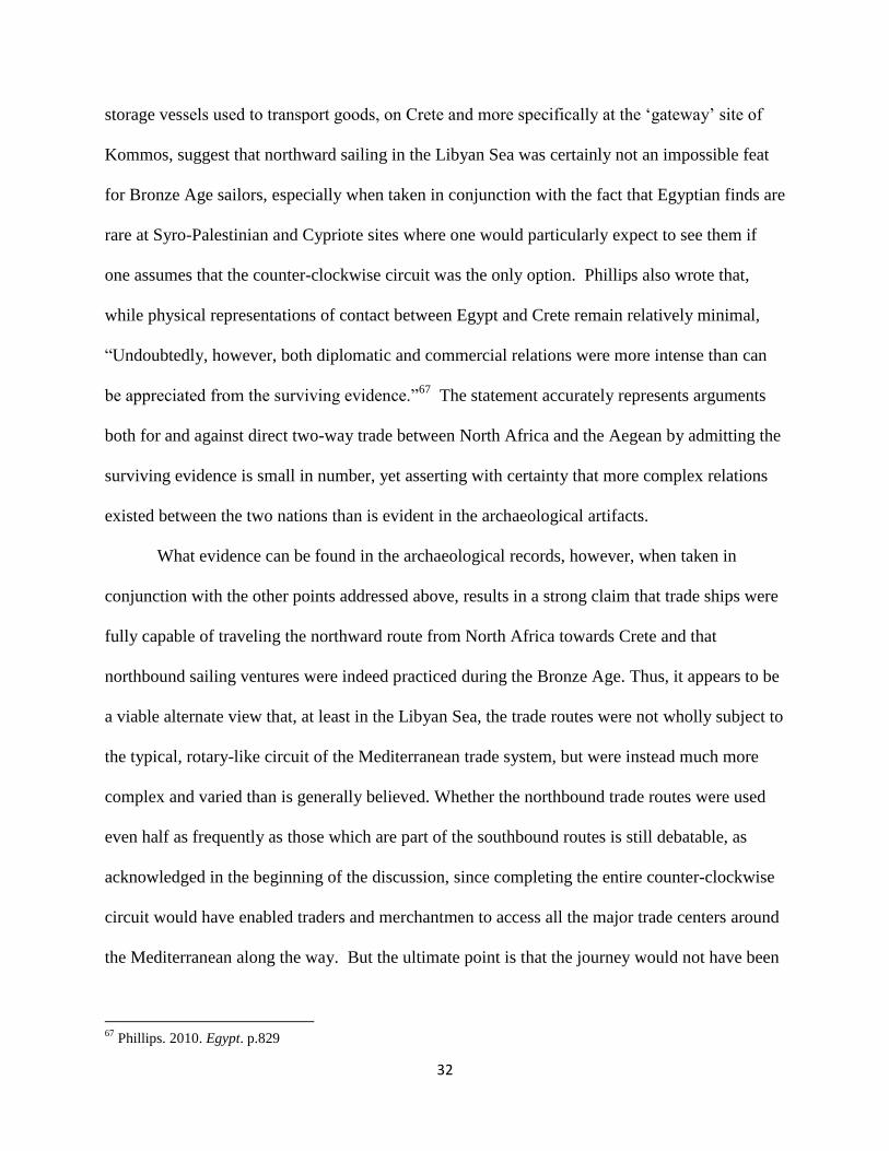
Kommos lies in south-central Crete facing the
Libyan Sea, on the edge of the Mesara Plain, south of Agia Triada and southeast of the palatial
site of Phaistos (See Figure 5). According to the Shaws, the town was first settled in the Late
Neolithic/Early Minoan period and grew up through the Middle Minoan period, when habitation
reached a plateau; the site was then only ‘casually used’ until the end of the Late Minoan IIIB
51
Cline, Eric. 2009. “Contact and Trade or Colonization?: Egypt and the Aegean in the 14th-13th Centuries BC” in
Minos: Revista de Filología Egea 25. p.30 52
Shaw, Joseph and Maria C. Shaw. 1993. “Excavations at Kommos (Crete) during 1986-1992” in Hesperia: The
Journal of the American School of Classical Studies at Athens. Vol. 62, No. 2 (Apr. - Jun.) p.550

25
period, when it was finally abandoned.53
In regards to the role the site played in international
trade, the port was situated so as to enable both local and international trade, with Cyprus and
Syria-Palestine to the east, Egypt to the southeast and Italy to the west, and the finds uncovered
at Kommos ascertain that exchange networks flourished in all three directions. The site has been
described by many as a ‘gateway community’ into the Aegean.54
These ‘gateway communities’
are sites where imported goods came straight from a specific major trade center and were then
redistributed under the authority of the local administrator; they are characterized by long-
distance trade connections and are usually located on sites of transportational significance.55
As pertains to the evidence for a possible, or rather probable, southern trade route from
Egypt to Crete in addition to the northern route from Syria-Palestine and Cyprus, it should be
noted that all the Egyptian vases found at Kommos were large to medium-sized jars, with the
exception of two flasks. Large storage jars and amphorae such as those discovered at the site
were commonly used in Eighteenth Dynasty Egypt as containers for a variety of goods such as
wines, oils, cereals or pitch. 56
These jars also would have served as transport containers for the
trade of these same products in a manner identical to that of the Canaanite storage jars which
have been excavated in great quantities from the Uluburun and other shipwrecks. While the
majority of these jars at Kommos are from the Late Minoan IIIA period, some have been dated
as early as the Late Minoan I period, and Watrous seems to feel as though a more detailed
examination of the Middle Minoan deposits at the site would lead to even earlier examples.57
53
Shaw, Joseph. 2006. Kommos: A Minoan Harbor Town and Greek Sanctuary in Southern Crete. American School
of Classical Studies, Italy; p.11 54
Shaw, Joseph and Maria Shaw. 2010. “Kommos” in Eric Cline (ed.) The Oxford Handbook of the Aegean Bronze
Age. Oxford University Press; New York, NY. p.549 55
Cline, Eric. 2009. Contact and Trade or Colonization? p.19-21; and Cline. 1999. The Nature of the Economic
Relations. p.119-120 56
Watrous. 1992. Kommos III. p.175 57
Ibid. p.172

26
What is most striking about the presence and number of the Egyptian vessels at Kommos is that
almost no Egyptian pottery has been discovered at fourteenth century Syro-Palestinian or
Cypriote sites, where Egyptian objects in general are surprisingly rare.58
If trade ships were only
capable of traveling the counter-clockwise rotary route from Egypt up the Levant to Anatolia and
Cyprus, would there not be more Egyptian artifacts to be found at the trade centers and stopping
points along this path? The same can be said of the Southern Canaanite jars found at Kommos;
the amount of jars categorized as ‘Southern Canaanite jars’ outnumber those labeled as
‘Northern’ by a ratio of 8:1.59
Due to Crete’s position in the eastern Mediterranean, the exact
reverse would be expected if a southern trade route had never existed.
The evidence seen in the large amount of Egyptian artifacts on Crete in general and
especially at the site of Kommos, therefore, appears to encourage the theory of a two-directional
trade route between these two regions during the Late Bronze Age. This theory is further
justified when one considers the expediency with which direct a route would enable trade
between the two regions to be carried out. While a direct journey from Alexandria to Kommos is
around 350 nmi (nautical miles), the circular route up along the eastern coast of the
Mediterranean to the northern port of Amnisos is approximately 1610 nmi depending on the
whether the ship traveled the Anatolian coast as well, as the Uluburun ship did, or instead went
straight to Crete from Cyprus in which case the voyage is roughly 1315 nmi.
By the end of the Late Minoan period, vessels from both Crete and Egypt occupied the
site of Marsa Matruh60
on the North African coast,150 miles west of Alexandria and only about
58
Weinstein, James M. 1981. "The Egyptian Empire in Palestine: A Reassessment." In Bulletin of the American
Schools of Oriental Research. p.14-20 59
Watrous. 1992. Kommos III. p.176 60
Bates, Oric. 1927. Excavations at Marsa Matṛūḥ. Reprinted from the Harvard African Studies, Vol. VIII.
Cambridge

27
250 nmi from Kommos, confirming the belief that the site was a stopping-point for ships on their
between the two locations. As there are a number of finds from both Crete to the north and
Egypt to the east, it is reasonable to assume that these artifacts suggest traffic from both
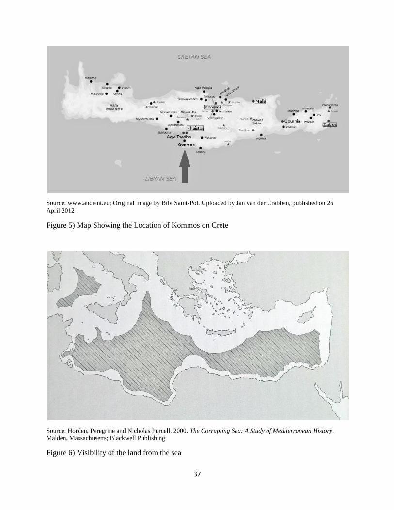
directions used the site as a watering-hole. The use of the site as a stopping-point also would
have permitted Bronze Age sailors to remain within sight of land for a longer portion of the
voyage and made navigation of the open-water part of the trip far easier (See Figure 6).
Including Marsa Martruh into the itinerary would also have adjusted the direction from which
ships would have sailed towards Crete – rather than traveling in a north-western direction
straight from Egypt, departing from Marsa Martruh would have enabled sailors to travel in a
more northern direction and, therefore, increase the possibility of catching a favorable wind. The
same is true of the site of Cyrene further to the west, roughly 190 nmi from Kommos, where
vessels could have made the trip west from Egypt along the coast and then set out in a north,
north-eastern direction towards Crete with far more chances of a fair wind. Evidence for direct
trade between the site of Cyrene and Crete in the specific products of silphium and murex shells
has also recently come to light, which supports the theory of frequent two-way contact between
the two areas during the Late Bronze Age.61
The large number of Egyptian objects found at Mycenae, which imitates Kommos by
being the location of the largest percentage of Egyptian-ware on the mainland during the Late
Helladic/Minoan IIIA-B periods, 62
further corroborates the argument for bi-directional trade in
the Libyan Sea. Whether the goods had arrived at Mycenae by way of Crete and were passed on
to the Mycenaean elite on the mainland as exotica or they went straight to the Mycenaeans as the
new ruling civilization via same course the previously ruling Minoans had employed is unclear.
61
Dr. Andrew Koh, personal communication 62
Cline. 2009. Contact and Trade or Colonization? p.19-21

28
Either way, the objects most likely verify a southern route coming directly from North Africa
rather than via Syria-Palestine and Anatolia. Watrous reinforces the argument for a model of
northward as well as southward trade when he states,
Scholars have also minimalized the importance of Egyptian objects and influence
in the Aegean. Signs of Egyptian influence, visible in Aegean burial customs and
art, have been discounted as indicators or possible direct Aegean-Egyptian
contact. Until recently, such a view seemed reasonable, since all Egyptian objects
in the Aegean were believed to have come via Syria-Palestine and Cyprus, where
Egyptian finds are scarce prior to Tutmosis III’s victory at Megiddo in 1482 B.C.
The record of Egyptian pottery at Kommos, however, makes it more likely that
Egyptian objects and ideas came to the Aegean by a more direct route via Crete.63
63
Watrous. 1992. Kommos III. p.172-3

29
Conclusion
The two greatest arguments against any sort of northward sailing, and therefore against
two-way maritime travel between North Africa and the Aegean in the Bronze Age, are that the
northwestern winds are predominant during the summer sailing months (May-August) and that
ship technology was sufficiently lacking in the second millennium that mariners were unable to
practice the techniques of reefing and tacking, and therefore incapable of sailing to windward.
As the discussion has shown, however, neither of these circumstances prohibits the possibility of
northward sailing in the Libyan Sea when examined in detail.
In the case of the predominant northwest winds, the records of the ancient authors
Aristotle and Theophrastus of the fourth century B.C. informed us that of the twelve winds
which were recognized by at least that era and which would have enabled a northward journey
are the winds Eurus (E.S.E.), Euronotos or Phoenikias (S.S.E.), Notos (S.), Libonotos (S.S.W.)
and Lips (W.S.W.). These winds were characterized in the first millennium B.C. to have been
warm and always accompanied by clear weather, as well as being steady and reliable, especially
near the Libyan coast. Despite claims that the south winds only blow in the winter and thus
could not have been utilized by Bronze Age sailors, records from the fourth century B.C. through
modern ones state that the south winds regularly blow both in the spring and autumn seasons and
in fact are known to alternate occasionally with northern winds during the summer. While it is
possible that the wind patterns have changed slightly between the second millennium B.C. and
today, it is much less likely that those patterns and characteristics recorded by scholars in the
30
fourth, third and second centuries B.C. would be any different from what Bronze Age sailors
would have experienced. Thus, Theophrastus’ claim that it is best to sail when the south winds
blow may be taken to have been true for those Cretans desiring to return home from Egypt by a
direct southern route.
In combination with the surprising presence and frequency of the south winds in the
Mediterranean, the various winds could and would have been exploited in order to accomplish a
windward voyage. Hara Georgiou, herself a sailor, has very strong views concerning the current
lack of appreciation given to the accomplishments of prehistoric ships and seamen. She once
wrote that,
It is especially important to establish the ability of BA boats to sail to windward… A
major misconception about square sails is that they can only be used for running before
the wind. The concept of ancient navigators running south with the aetesian winds in the
summer and north with the southerlies in the winter is both simplistic and unpractical.
Unfortunately, it has influenced theories about communication and trading systems in the
Aegean.64
The main reason it has been considered impossible for Bronze Age ships to have traveled against
the wind is on account of the boom at the foot of the sail. There exists, however, no iconographic
or physical indications that the boom-footed square-sail rigging could not have been reefed.
Concerning the technology of brails, the first indication of the use of brails is in the Late Bronze
Age relief of the Sea Peoples at Medinet Habu, where both the Egyptian and Sea People ships
are depicted with brails. In Aegean iconography, brails first begin to appear in the Late Minoan
IIIB period, and by the Late Helladic IIIC period all decipherable portrayals of ships show
brailed rigs.65
Undoubtedly, experimentation with this type of rigging would have begun and
64
Georgiou. 1991. Bronze Age Ships and Rigging. p. 62 65
Wachsmann. 1998. Seagoing Ships and Seamanship. p.251

31
continued throughout the preceding century. Even before brail-lifts and rings became
widespread, however, the technique of reefing would not have been unfamiliar to mariners.
Once the ability to reef has been established, it is a logical and simple enough step to
envision the technique of tacking as also being employed by Bronze Age sailors. As Alec Tilley
once stated, “Any theory that ancient mariners were stupid must be countered.”66
Both practices
would surely have been managed long before we could even imagine. As the majority of Bronze
Age sailors must have come from coastal, seafaring communities where centuries’ worth of
knowledge and traditions concerning sailing and nautical matters would have been taught and
improved upon, there is little reason to believe that reefing and tacking remained untried until the
very end of the Late Bronze Age.
Having determined that a Bronze Age sailing vessel could very well have been capable of
successfully undertaking the northward journey from North Africa to Crete, either with the aid of
a southerly wind, or by reefing the sail and tacking against a northerly wind, we arrive at the
ultimate question: was it actually ever done? According to our literary evidence, the first century
B.C. authors Pliny and Strabo (who in fact refers to the fourth century scholar Eratosthenes)
knew and acknowledged as fact the distances from the North African coast to Crete, implying
that someone had completed the northward journey in order to report the distance. The even
earlier author Thucydides declared that merchant vessels coming from Egypt and Libya
habitually put in at the port of Kythera, implying that ships arrived on a regular basis from these
locations directly and, therefore, leading us to infer that they came from the south along a
northward route rather than from the north.
In addition to the written records, the archaeological records reveal strong evidence for
north-bound trade ventures. The relatively large numbers of Egyptian objects, especially large
66
Tilley. 1994. Sailing to Windward. p.311
32
storage vessels used to transport goods, on Crete and more specifically at the ‘gateway’ site of
Kommos, suggest that northward sailing in the Libyan Sea was certainly not an impossible feat
for Bronze Age sailors, especially when taken in conjunction with the fact that Egyptian finds are
rare at Syro-Palestinian and Cypriote sites where one would particularly expect to see them if
one assumes that the counter-clockwise circuit was the only option. Phillips also wrote that,
while physical representations of contact between Egypt and Crete remain relatively minimal,
“Undoubtedly, however, both diplomatic and commercial relations were more intense than can
be appreciated from the surviving evidence.”67
The statement accurately represents arguments
both for and against direct two-way trade between North Africa and the Aegean by admitting the
surviving evidence is small in number, yet asserting with certainty that more complex relations
existed between the two nations than is evident in the archaeological artifacts.
What evidence can be found in the archaeological records, however, when taken in
conjunction with the other points addressed above, results in a strong claim that trade ships were
fully capable of traveling the northward route from North Africa towards Crete and that
northbound sailing ventures were indeed practiced during the Bronze Age. Thus, it appears to be
a viable alternate view that, at least in the Libyan Sea, the trade routes were not wholly subject to
the typical, rotary-like circuit of the Mediterranean trade system, but were instead much more
complex and varied than is generally believed. Whether the northbound trade routes were used
even half as frequently as those which are part of the southbound routes is still debatable, as
acknowledged in the beginning of the discussion, since completing the entire counter-clockwise
circuit would have enabled traders and merchantmen to access all the major trade centers around
the Mediterranean along the way. But the ultimate point is that the journey would not have been
67
Phillips. 2010. Egypt. p.829

33
impossible, and active northbound trade routes certainly did exist between Bronze Age Egypt
and Crete.
In closing, one final matter ought to be addressed, namely that mentioned by Frost when
he wrote:
The sea is the great culture bearer. The civilization that originated in the eastern
Mediterranean was not transmitted by hordes in search of new pasture lands or by
armies on the march, but by seafarers…it is astonishing how little has, as yet,
been found out about this aspect of history.68
Despite the nearly forty years of coastal and maritime archaeology that has increasingly taken
place since this passage was written and the great advantages in understanding that we have
gained on account of them – the excavations of and findings from the Uluburun, Gelidonya, and
Antikythera shipwrecks have proven extremely beneficial to our knowledge in a number of
archaeological fields pertaining to seafaring cultures, ships and trade, to list only a few – the
statement above remains as true today as it did then. There is still a large amount of work that
still needs to be done in the scholarly world of the ancient Mediterranean, but with the
improvements in modern technology and the founding of the field of Nautical Archaeology,
there is hope that academics in the discipline will soon flourish. Until such time, however, care
must be taken that our lack of sufficient knowledge concerning a variety of subjects relating to
the Mediterranean including, but certainly not limited to, the multitude of exchange networks
that were formed across its surfaces, does not cause us to become content with restricted views
regarding prehistoric matters.
68
Frost, Honor. 1970. "Some Cypriot Stone Anchors from Land Sites and from the Sea" in Report of the
Department of Antiquities Cyprus. p.55

34
Illustrations:
Source: Meteorologica. Translated by H.D.P. Lee. Cambridge, Massachusetts; Harvard University Press. Loeb
Classical Library (1952)
Figure 1) Aristotle’s Wind Compass, with lines M’ and N’ lacking the titles which were
identified in later years as Libonotos and Euronotos, respectively.

35
Figure 2) Reconstruction of a Theran boom-footed rig
Source: Georgiou, Hara. 1991. “Bronze Age Ships and Rigging” in Thalassa: L’Egée préhistorique et la mer.
Aegaeum 7
Figure 3) A reefed boom-footed rig

36
Source: Whitewright, Julian. 2011a. "The Potential Performance of Ancient Mediterranean Sailing Rigs" in
International Journal of Nautical Archaeology. Vol. 40, No. 1
Figure 4) Square-sail Rigged Vessel Tacking to Windward (not to scale)
37
Source: www.ancient.eu; Original image by Bibi Saint-Pol. Uploaded by Jan van der Crabben, published on 26
April 2012
Figure 5) Map Showing the Location of Kommos on Crete
Source: Horden, Peregrine and Nicholas Purcell. 2000. The Corrupting Sea: A Study of Mediterranean History.
Malden, Massachusetts; Blackwell Publishing
Figure 6) Visibility of the land from the sea

38
Bibliography
Archibald, Zofia, John Davies, Vincent Gabrielsen and G.J. Oliver (eds.). 2001. Hellenistic Economies.
Routledge; New York, NY
Aristotle. De Mundo. Translated by E.S. Forster in The Works of Aristotle. Volume III. Edited by W.D.
Ross. Oxford University Press, London (1931)
Problems: Vol II. Translated by W.S. Hett, M.A. Cambridge, Massachusetts; Harvard University
Press. Loeb Classical Library (1937)
Meteorologica. Translated by H.D.P. Lee. Cambridge, Massachusetts; Harvard University Press.
Loeb Classical Library (1952)
Mechanical Problems. Translated by E. Thayer, Last modified November 19, 2012.
http://penelope.uchicago.edu/Thayer/E/Roman/Texts/Aristotle/Mechanica*.html
Arnaud, Pascal. 2011. “Ancient Sailing-Routes and Trade Patterns: the Impact of Human Factors” in
Damian Robinson and Andrew Wilson (eds.) Maritime Archaeology and Ancient Trade in the
Mediterranean. Oxford Centre for Maritime Archaeology: Monographs 6; pp. 61-80
2014. “Maritime Infrastructure: Between Public and Private Initiative” in A. Kolbe (ed)
Infrastruktur und Herrschaftsorganisation im Imperium Romanum; 161-77
Bates, Oric. 1927. Excavations at Marsa Matṛūḥ. Reprinted from the Harvard African Studies, Vol. VIII.
Cambridge
Berg, Ina. 2006. “The ‘Western String’: A Reassessment” in Pepragmena 9th Diethnous Kritologikou
Synedriou. Etairia Kritikou Istorikon Meleton. Herakeio, pp.135-150
2007. “Aegean Bronze Age Seascapes – A Case Study in Maritime Movement, Contact and
Interaction” in S. Antoniadou and S. Pace (eds.) Mediterranean Crossroads. Athens. Pierides
Foundation, pp. 387-415
2010. “Re-capturing the Sea: The Past and Future of ‘Island Archaeology’ in Greece” in Shima:
The International Journal of Research into Island Cultures. Vol. 4, Num. 1, pp. 16-26
Branigan, Keith. 1981. “Minoan Colonialism” in The Annual of the British School at Athens.76:23-33
1991. “Mochlos: An Early Aegean Gateway Community” In R. Laffineur and L. Basch (eds.),
Thalassa. L’Egéen Prehistorique et la Mer. Actes de la troisième Rencontre égéenne
internationale de l’Université de Liège, Station de recherches sous-marines et océanographiques
(StaReSO), Calvi, Corse (23-25 avril 1990). Aegaeum 7: 97-105. Liège: Université de Liège.
Broodbank, Cyprian. 2006. “The Origins and Early Development of Mediterranean Maritime Activity” in
Journal of Mediterranean Archaeology. Vol. 19, No. 2, pp. 199-230
2013. The Making of the Middle Sea: A History of the Mediterranean from the Beginning to the
Emergence of the Classical World. Oxford University Press

39
Broodbank, Cyprian and Evangelia Kiriatzi. 2007. “The First ‘Minoans’ of Kythera Revisited:
Technology, Demography, and Landscape in the Prepalatial Aegean” in American Journal of
Archaeology. Vol. 111, No. 2 (April), pp. 241-274
Buck, Robert. 1962. “The Minoan Thalassocracy Re-Examined” in Historia: Zeitschrift für Alte
Geshichte. Bd. 11, H. 2 (April) pp.129-137
Buraselis, Kostas, Mary Stefanou and Dorothy J. Thompson (eds.) 2013. The Ptolemies, the Sea and the
Nile: Studies in Waterborne Power. Cambridge University Press; Cambridge, U.K.
Campbell, I.C. 1955. “The Lateen Sail in World History” in Journal of World History. vol. 6, no. 1,
University of Hawai’i Press. pp.1-23
Casson, Lionel. 1954. “The Sails of the Ancient Mariners” in Archaeology, vol. 7, no. 4; p. 214-219
1964. Illustrated History of Ships and Boats. Garden City, New York: Doubleday & Company,
Inc.
1971. Ships and Seamanship in the Ancient World. Princeton, New Jersey: Princeton
University Press
Castleden, Rodney. 1993. Minoans: Life in Bronze Age Crete. Routledge; New York, NY
Castro, F. 2008. “A Quantitative Look at Mediterranean Lateen- and Square-Rigged Ships (Part 1)” in
The International Journal of Nautical Archaeology. vol. 37, no. 2: pp. 347-359
Cline, Eric. 1998. “Amenhotep III, the Aegean, and Anatolia” in David O’Connor and Eric Cline (eds)
Amenhotep III: Perspectives on his Reign. The University Of Michigan Press, Ann Arbor
1999. “The Nature of the Economic Relations of Crete with Egypt and the Near East during the
Late Bronze Age” in Angelos Chaniotis (ed) From Minoan Farmers to Roman Traders:
Sidelights on the Economy of Ancient Crete. Franz Steiner Verlag; Stuttgart, Germany
2009. “Contact and Trade or Colonization?: Egypt and the Aegean in the 14th-13th Centuries
BC” in Minos: Revista de Filología Egea 25
2010. “Bronze Age Interactions between the Aegean and the Eastern Mediterranean:
Revisited” in William A. Parkinson and Michael L. Galaty (eds.) Archaic State Interaction: the
Eastern Mediterranean in the Bronze Age. SAR Press. pp. 161-181
Cline, Martin and Eric Cline. 1991. “Of Shoes and Ships and Sealing Wax: International Trade and the
Late Bronze Age Aegean” in the University of Pennsylvania Museum of Archaeology and
Anthropology’s Expedition. Vol. 33: No. 3: pp. 46-54
Cline, Eric and Steve Stannish. 2011. “Sailing the Great Green Sea? Amenhotep III’s ‘Aegean List’ from
Kom el-Hetan, Once More” in the Journal of Ancient Egyptian Interconnections; Vol. 3, No.2,
pp. 6-16

40
Cotterell, Arthur. 1980. The Minoan World. Charles Scribner’s Sons; New York, NY
Csapo, E. 1991. “An International Community of Traders in Late 8th-7th c. B.C. Kommos in Southern
Crete,” ZPE 88: 211-16.
Davis, Jack L., Elizabeth Schofield, Robin Torrence and David F. Williams. 1983. “Keos and the Eastern
Aegean: the Cretan Connection” in The Journal of the American School of Classical Studies at
Athens. Vol. 52, No. 4 (Oct.-Dec.) pp.361-366
De Graeve, Marie-Christine. 1981. The Ships of the Ancient Near East (c.2000-500B.C.). Leuven,
Belgium: Orientaliste
Finamore, Daniel. 2004. Maritime History as World History. Peabody Essex Museum; Salem,
Massachusetts; and University Press of Florida
Frost, Honor. 1970. "Some Cypriot Stone Anchors from Land Sites and from the Sea" in Report of the
Department of Antiquities Cyprus. pp.14-24.
Galili, Ehud and Baruck Rosen. 2011. “Ancient Underwater and Coastal Settlements of Israel: An
Endangered Cultural Resource” in Hakan Oniz and Erdogan Aslan (eds.) SOMA 2009,
Proceedings of the XIII Symposium on Mediterranean Archaeology, Selcuk University of Konya,
Turkey. 23-24 April 2009. BAR International Series 2200
Galili, Ehud, Uzi Dahari and Jacob Sharvit. 1993. “Underwater Surveys and Rescue Excavations along
the Israeli Coast” in The International Journal of Nautical Archaeology. Vol. 22, No. 1, pp. 61-77
Georgiou, Hara. 1991. “Bronze Age Ships and Rigging” In R. Laffineur and L. Basch (eds.), Thalassa.
L’Egéen Prehistorique et la Mer. Actes de la troisième Rencontre égéenne internationale de
l’Université de Liège, Station de recherches sous-marines et océanographiques (StaReSO),Calvi,
Corse (23-25 avril 1990). Aegaeum 7: 67-74. Liège: Université de Liège.
Gillis, Carole, Christina Risberg, and Birgitta Sjöberg Leppänen. 1995. "Trade and Production in
Premonetary Greece: Aspects of Trade” Proceedings of the Third International Workshop,
Athens 1993; pp.61-86
Greene, Elizabeth S., Justin Leidwanger and Harun Özdaş. 2013. “Expanding Contacts and Collapsing
Distances in Early Cypro-Archaic Trade: Three Case Studies in Shipwrecks off the Turkish
Coast” in Lawall and Lund (eds.) The Transport Amphorae and Trade of Cyprus. Aarhus
University Press, Denmark. pp. 21-34
Horden, Peregrine and Nicholas Purcell. 2000. The Corrupting Sea: A Study of Mediterranean History.
Malden, Massachusetts; Blackwell Publishing
Hourani, George F. 1951. Arab Seafaring in the Indian Ocean in Ancient and Early Medieval Times.
Princeton, New Jersey: Princeton University Press
Kaniewski, David; Elise Van Campo, Christopher Morhange, Joël Guiat, dov Zviely, Idan Shaked,
Thierry Otto and Michal Artzy. 2013. “Early Urban Impact on Mediterranean Coastal
Environments” in Scientific Reports. Vol. 3, No. 3540 (June) pp. 1-5

41
Knapp, A. Bernard. 1989. “Independence, Imperialism and the Egyptian Factor” in Bulletin of the
American Schools of Oriental Research. No 275, August: pp.64-68
1990. “Ethnicity, Entrepreneurship and Exchange: Mediterranean Inter-Island Relations in the
Late Bronze Age” in The Annual of the British School at Athens. Vol 85: 115-153
1992. “Bronze Age Mediterranean Island Cultures and the Ancient Near East” in The Biblical
Archaeologist. Vol. 55, No. 2 (June) pp. 52-72
1993. “Thalassocracies in Bronze Age Eastern Mediterranean Trade: Making and Breaking a
Myth” in World Archaeology. Vol. 24, No. 3 (Feb.) pp. 332-347
Knappett, Carl, Time Evans, and Ray Rivers. 2008. “Modelling Maritime Interaction in the Aegean
Bronze Age” in Antiquity 82:1009-1024
Knappett, Carl and Irene Nikolakopoulou. 2005. “Exchange and Affiliation Networks in the MBA
Southern Aegean: Crete, Akrotiri and Miletus” in Aegaeum 25 Proceedings of the 10th
International Aegean Conference. University of Texas at Austin; pp.175-184
Lambrou-Phillipson, Connie. 1991. “Seafaring in the Bronze Age Mediterranean: The Parameters
Involved in Maritime Travel” In R. Laffineur and L. Basch (eds.), Thalassa. L’Egéen
Prehistorique et la Mer. Actes de la troisième Rencontre égéenne internationale de l’Université
de Liège, Station de recherches sous-marines et océanographiques (StaReSO), Calvi, Corse (23
25 avril 1990). Aegaeum 7: 11-21. Liège: Université de Liège.
Marketou, T. 1987. “Marine Style Pottery from the Seraglio in Kos” in The Annual of the British School
at Athens. Vol. 82, pp.165-169
Marriner, Nick, Christopher Morhange and Claude Dourmet-Serhal. 2006. “Geoarchaeology of Sidon’s
Ancient Harbours, Phoenicia” in Journal of Archaeological Science. Vol. 33, pp. 1514-1535
Marriner, Nick, Christopher Morhange, Claude Dourmet-Serhal and Pierre Carbonel. 2006. “Geoscience
Rediscovers Phoenicia’s Buried Harbors” in Geology. Vol. 34, No. 1 (Jan.) pp. 1-4
McGrail, Seán. 2006. Boats of the World: from the Stone Age to Medieval Times. Oxford, New York:
Oxford University Press
Morgan, Lyvia. 1988. The Miniature Wall Paintings of Thera. Cambridge: Cambridge University Press
Morhange, Christopher and Nick Marriner. 2010. “Mind the (Stratigraphic) Gap: Roman Dredging in
Ancient Mediterranean Harbours” in Bollettino Di Archeologia On Line. Volume Special
Morhange, Christopher, Nick Marriner, and Nicolas Carayon. 2014. “The Geoarchaeology of Ancient
Mediterranean Harbours” in La Geoarcheologie Francaise au XXI Seicle
Mountjoy, P.A. and M.J. Ponting. 2000. “The Minoan Thalassocracy Reconsidered: Provenance Studies
of LH II A/LM I B Pottery from Phylakopi, Ay. Irini and Athens” in The Annual of the British
School at Athens. Vol. 95, pp.141-184

42
Niemeier, Wolf-Dietrich. 2004. “When Minos ruled the Waves: Knossian Power Overseas” in British
School at Athens Studies. Vol. 12:393-398
Oka, Rahul and Chapurukha M. Kusimba. 2008. “The Archaeology of Trading Systems, Part 1: Towards
a New Trade Synthesis” in Journal of Archaeological Research. Vol. 16, No. 4; pp.339-395
Palmer, Colin. 2009. “Windward Sailing Capabilities of Ancient Vessels” in International Journal of
Nautical Archaeology. Vol. 38, Issue 2, pp.314-330
Phillips, Jacke. 2010. “Egypt” in Eric Cline (ed.) The Oxford Handbook of the Aegean Bronze Age.
Oxford University Press; New York, NY
Phillips, Jacke and Eric Cline. 2005. “Amenhotep III and Mycenae: New Evidence” in Anastasia
Dakouri-Hild and Sue Sharrett (eds.) Autochthon. BAR International Series 1432
Pliny the Elder. Natural History: Books III-VII. Translated by H. Rackham. Cambridge, Massachusetts;
Harvard University Press. Loeb Classical Library (1942)
Renfrew, Colin. 2010. “Contrasting Trajectories: Crete and the Cyclades during the Aegean Early Bronze
Age” in British School at Athens Studies; Vol. 18:285-291
Roberts, Owain T.P. 1991. "The Development of the Brail into a Viable Sail Control for Aegean Boats of
the Bronze Age." Thalassa. L'Égée préhistorique et la mer. Actes de la troisième rencontre
égéenne internationale de l'Université de Liège, Station de recherches sous-marines et
océanographiques (StaReSo), Calvi, Corse, 23-25 avril 1990. Aegaeum 7. pp.55-60.
1995. “An Explanation of Ancient Windward Sailing – Some Other Considerations” in The
International Journal of Nautical Archaeology. Vol. 24, No. 4, pp. 307-315
Schäfer, Jörg. 1991. “Amnisos: Harbour-Town of Minos?” In R. Laffineur and L. Basch (eds.), Thalassa.
L’Egéen Prehistorique et la Mer. Actes de la troisième Rencontre égéenne internationale de
l’Université de Liège, Station de recherches sous-marines et océanographiques (StaReSO), Calvi,
Corse (23-25 avril 1990). Aegaeum 7: 111-119. Liège: Université de Liège.
Shaw, J.W. 1977. “Excavations at Kommos (Crete) during 1976” in Hesperia: The Journal of the
American School of Classical Studies at Athens. Vol. 46, No. 3 (Jul. - Sep., 1977). pp. 199-240
1978a. “Kommos: A Major Prehistoric Town in Crete” in Archaeology. Vol. 31, No. 2
(March/April) pp. 50-52
1978b. “Excavations at Kommos, Crete, 1977” in Current Anthropology. Vol. 19, No. 2 (June)
pp. 388-389
1979. “Excavations at Kommos (Crete) during 1978” in Hesperia: The Journal of the American
School of Classical Studies at Athens. Vol. 48, No. 2 (April-June) pp. 145-173
1980. “Excavations at Kommos (Crete) during 1979” in Hesperia: The Journal of the American
School of Classical Studies at Athens. Vol. 49, No. 3 (Jul. - Sep.) pp. 207-250
43
1981. “Excavations at Kommos (Crete) during 1980” in Hesperia: The Journal of the American
School of Classical Studies at Athens. Vol. 50, No. 3 (Jul. - Sep.) pp. 211-251
1982. “Excavations at Kommos (Crete) during 1981” in Hesperia: The Journal of the American
School of Classical Studies at Athens. Vol. 51, No. 2 (Apr. - Jun.) pp. 164-195
1984. “Excavations at Kommos (Crete) during 1982-1983” in Hesperia: The Journal of the
American School of Classical Studies at Athens. Vol. 53, No. 2 (Apr. - Jun.) pp. 251-287
1986. “Excavations at Kommos (Crete) during 1984-1985” in Hesperia: The Journal of the
American School of Classical Studies at Athens. Vol. 55, No. 3 (Jul. - Sep.) pp. 219-269
2006. Kommos:A Minoan Harbor Town and Greek Sanctuary in Southern Crete. The American
School of Classical Studies, Italy
Shaw, Joseph and Maria C. Shaw. 1993. “Excavations at Kommos (Crete) during 1986-1992” in
Hesperia: The Journal of the American School of Classical Studies at Athens. Vol. 62, No. 2
(Apr. - Jun.) pp. 129-190
2010. “Kommos” in Eric Cline (ed.) The Oxford Handbook of the Aegean Bronze Age. Oxford
University Press; New York, NY.
Shaw, J.W., Philip P. Betancourt and L. Vance Watrous. 1978. “Excavations at Kommos (Crete) during
1977” in Hesperia: The Journal of the American School of Classical Studies at Athens. Vol. 47,
No. 2 (Apr. - Jun.) pp. 111-170
Sherratt, Susan. 2009. “The Aegean and the Wider World: Some Thoughts on a World-Systems
Perspective” in William A. Parkinson and Michael L. Galaty (eds.) Archaic State Interaction: The
Eastern Mediterranean in the Bronze Age. School for Advanced Research Advanced Seminar
Series. SAR Press, Santa Fe
Sherratt, Susan and Andrew. 1991. “From Luxuries to Commodities: The Nature of Mediterranean
Bronze Age Trading Systems” in N.H. Gale (ed.) Bronze Age Trade in the Mediterranean. SIMA
90; Jonsered: Paul Astroms Forlag. pp.351-386
Sowada, Karin. 2009. Egypt in the Eastern Mediterranean during the Old Kingdom: An Archaeological
Perspective. Academic Press Fribourg; Fribourg, Switzerland
Strabo. Geography: Volume III. Translated by H.C. Hamilton and W. Falconer, M.A. London; G. Bell
and Sons, LTD (1916)
Theophrastus of Eresus. On Winds and on Weather Signs. Translated by Jas.G. Wood; Edited by G.J.
Symons; Published by Edward Stanford. London (1894)
Thompson, D’Arcy Wentworth. 1918. “The Greek Winds” The Classical Review. Vol. 32; No. 3/4 (May
June) pp.49-56
Thucydides. History of the Peloponnesian War. Volume 1. Translated by Benjamin Jowett. Oxford;
Clarendon Press (1881)

44
Tilley, Alec. 1994. “Sailing to Windward in the Ancient Mediterranean” in The International Journal of
Nautical Archaeology. Vol. 23, No. 4, pp. 309-313
Vavouranakis, Giorgos. 2011. “Funerary Customs and Maritime Activity in Early Bronze Age Crete” in
G. Vavouranakis, ed. The Seascape in Aegean Prehistory. The Danish Institute at Athens; Athens
Wachsmann, Shelley. 2008. Seagoing Ships and Seamanship in the Bronze Age Levant. Texas A&M
University Press
Watrous, L. Vance. 1992. Kommos III: The Late Bronze Age Pottery. Princeton University Press;
Princeton, New Jersey
1997. "Egypt and Crete in the Early Middle Bronze Age: A case of trade and cultural diffusion."
In The Aegean and the Orient in the Second Millennium, Proceedings of the 50th Anniversary
Symposium, Cincinnati, pp. 18-20
1998. “Crete and Egypt in the Seventh Century BC: Temple A at Prinias”. British School at
Athens Studies. Vol. 2 Post-Minoan Crete: Proceedings of the First Colloquium on Post Minoan
Crete held by the British School at Athens and the Institute of Archaeology, University College
London, November 10-11, 1995. pp. 75-79
Weinstein, James M. 1981. "The Egyptian Empire in Palestine: A Reassessment." In Bulletin of the
American Schools of Oriental Research. pp. 1-28.
Whitewright, R. Julian. 2006. “Tracing Technology: the Material Culture of Maritime Technology in the
Ancient Mediterranean and Contemporary Indian Ocean.” In Between the Seas: Transfer and
Exchange in Nautical Technology; Proceedings of the Eleventh International Symposium on Boat
and Ship Archaeology. Edited by Ronald Bockius. Mainz, Germany: Verlag des Römisch
Germanischen Zentralmuseums, pp. 489-497
2008. “Maritime Technological Change in the Ancient Mediterranean: the Invention of the
Lateen Sail” PhD. dissertation, University of Southampton
2011a. "The Potential Performance of Ancient Mediterranean Sailing Rigs" in International
Journal of Nautical Archaeology. Vol. 40, No. 1, pp. 2-17.
2011b. “Efficiency or Economics? Sail Development in the Ancient Mediterranean.” in Maritime
Technology in the Ancient Economy: Ship-Design and Navigation. Vol. 84. Edited by W.V.
Harris and K. Iara. Portsmouth, Rhode Island: Journal of Roman Archaeology, pp.89- 102
Wiener, Malcolm 1991a. “The Nature and Control of Minoan Foreign Trade” in N.H. Gale (ed.) Bronze
Age Trade in the Mediterranean. SIMA 90; Jonsered: Paul Astroms Forlag. pp.325-341
1991b. “The Isles of Crete? The Minoan Thalassocracy Revisited” in NESTOR 18:8 (Nov.)
pp.127-155
Wilson, Andrew. 2006. “New Light on a Greek City: Archaeology and History at Euesperides”. In
Emanuela Fabbricotti and Olivia Menozzi (eds.) Cirenaica: Studi, Scavi e Scoperte. British
Archaeological Reports. International Series, Oxford. pp. 141-152