Embed Size (px)
Citation preview
PEBBLE PROJECT ENVIRONMENTAL BASELINE DOCUMENT
2004 through 2008
CHAPTER 5. SOILS
Bristol Bay Drainages
PPRREEPPAARREEDD BBYY:: TTHHRREEEE PPAARRAAMMEETTEERRSS PPLLUUSS,, IINNCC..
SOILS—BRISTOL BAY DRAINAGES
5-i 12/9/2011
TABLE OF CONTENTS
LIST OF TABLES .................................................................................................................................... 5-ii
LIST OF FIGURES .................................................................................................................................. 5-ii
APPENDICES ........................................................................................................................................... 5-ii
ACRONYMS AND ABBREVIATIONS .................................................................................................5-iii
5. SOILS .................................................................................................................................................. 5-1
5.1. Soils—Bristol Bay Region ........................................................................................................ 5-1 5.1.1. Introduction .................................................................................................................. 5-1 5.1.2. Study Objectives ........................................................................................................... 5-1 5.1.3. Study Areas .................................................................................................................. 5-1 5.1.4. Previous Studies ........................................................................................................... 5-1 5.1.5. Scope of Work .............................................................................................................. 5-2 5.1.6. Methods .................................................................................................................... 5-3
5.2. Soil Map Units in the Mine Study Area .................................................................................... 5-3 5.3. Soil Map Units in the Transportation Corridor .......................................................................... 5-4 5.4. Results and Discussion .............................................................................................................. 5-5 5.5. Summary .................................................................................................................................... 5-5 5.6. References ................................................................................................................................. 5-6 5.7. Glossary ..................................................................................................................................... 5-6
PEBBLE PROJECT, ENVIRONMENTAL BASELINE DOCUMENT, 2004 THROUGH 2008
5-ii 12/9/2011
LIST OF TABLES
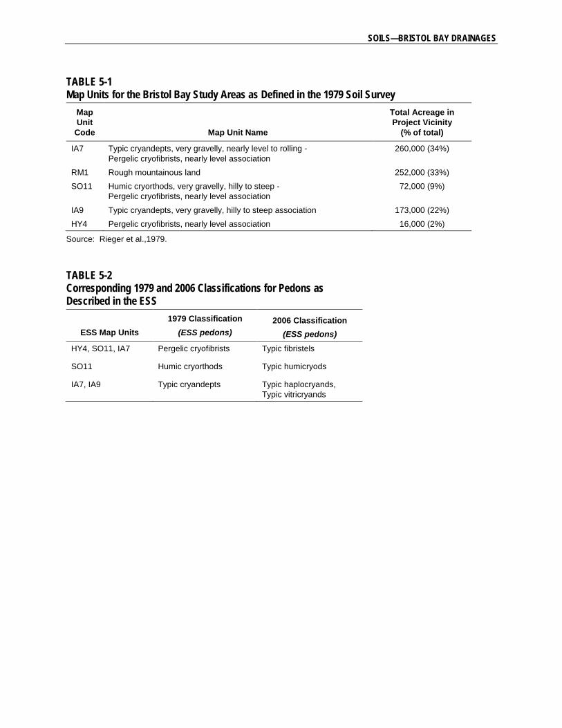
Table 5-1, Map Units for the Bristol Bay Study Areas as Defined in the 1979 Soil Survey
Table 5-2, Corresponding 1979 and 2006 Soil Classifications for Pedons as Described in the ESS
LIST OF FIGURES
Figure 5-1, Bristol Bay and Cook Inlet Drainages, Exploratory Soil Survey
Figure 5-2, ESS Map Units, Mine Study Area
Figure 5-3, ESS Map Units, Transportation Corridor
APPENDICES Appendix 5A, Required Characteristics for Andic Soil Properties
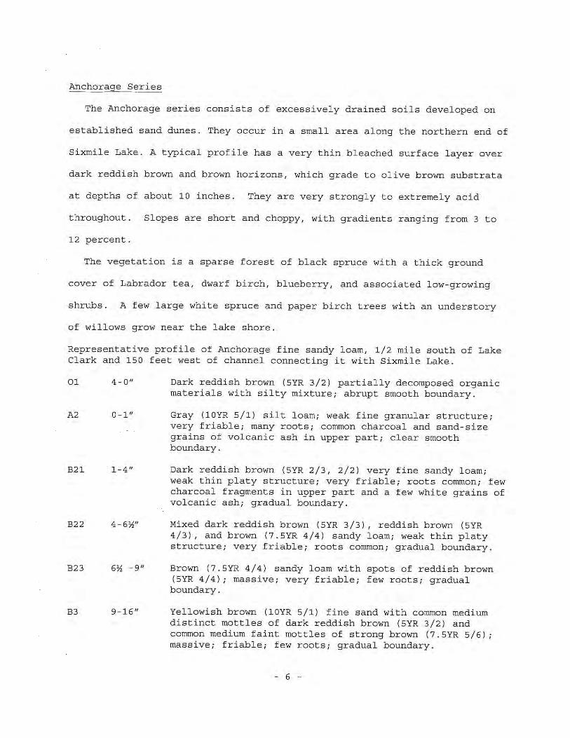
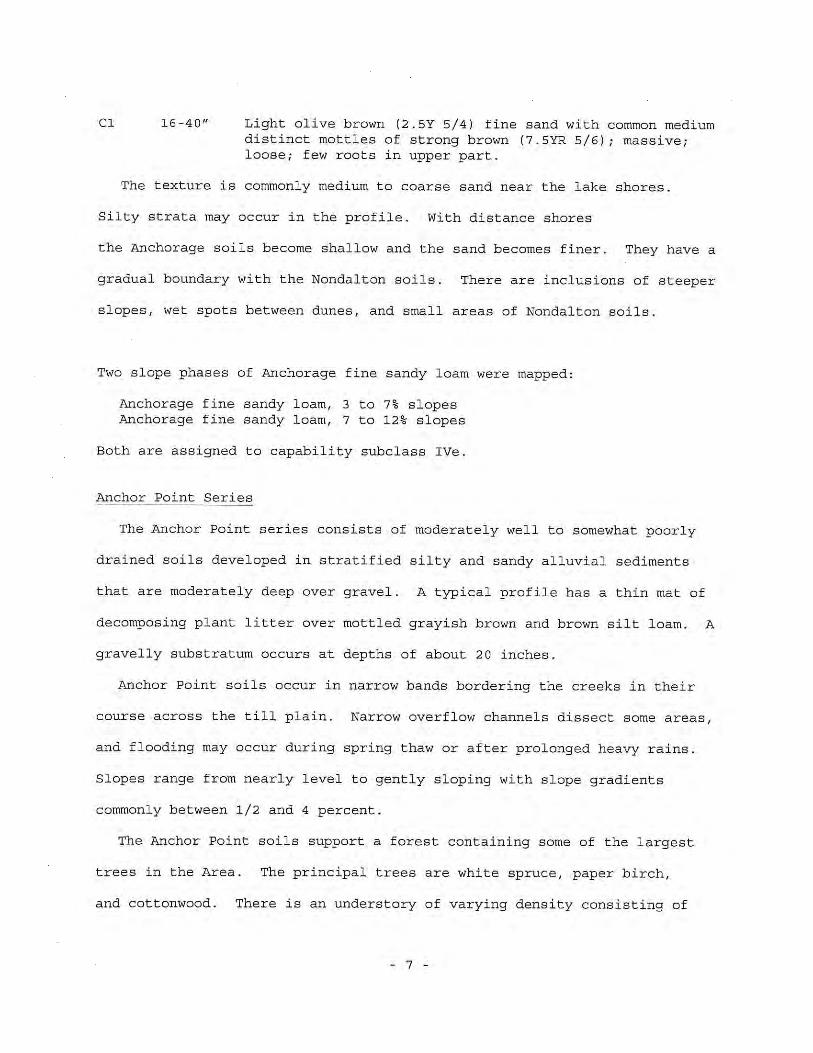
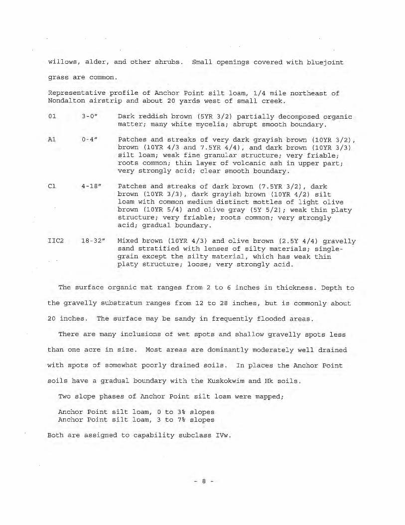
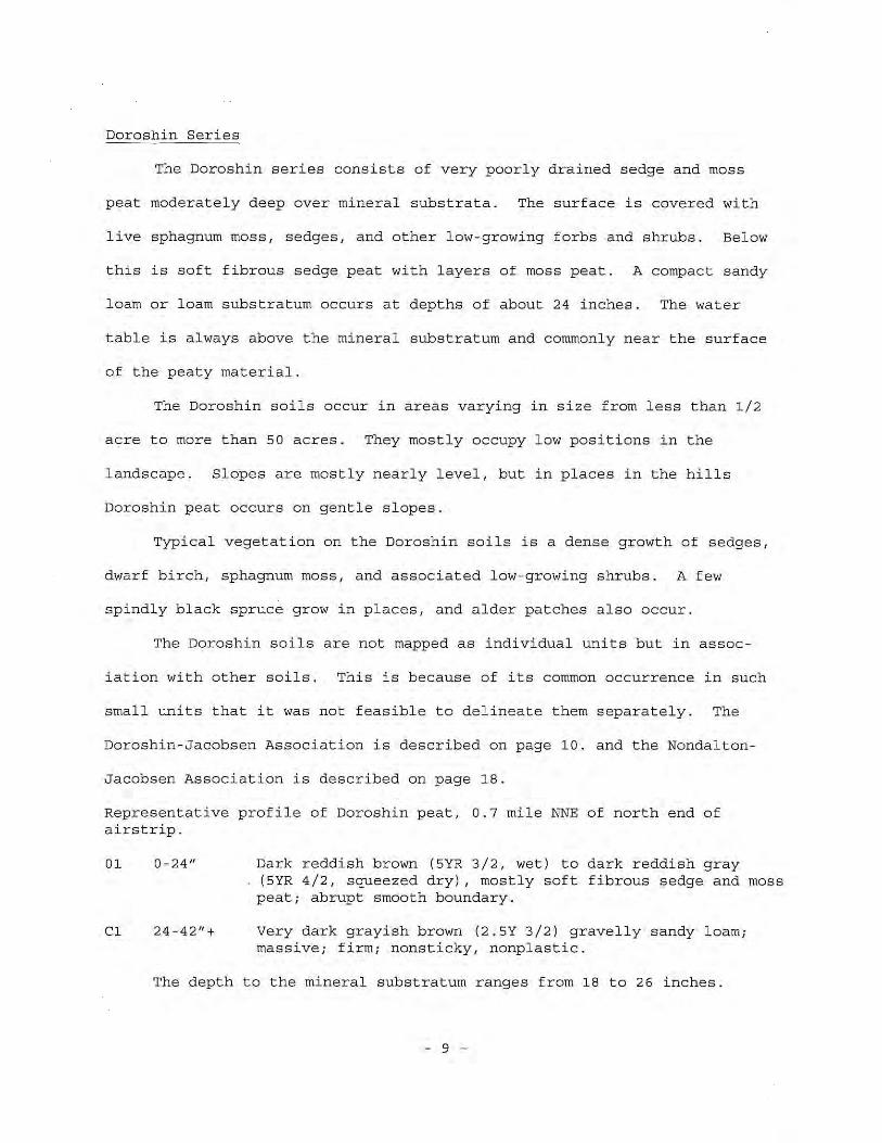
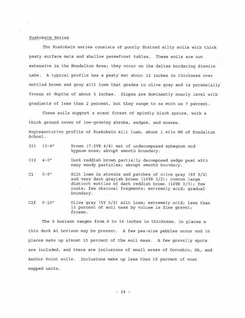
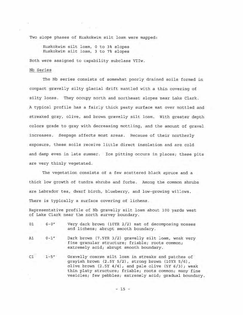
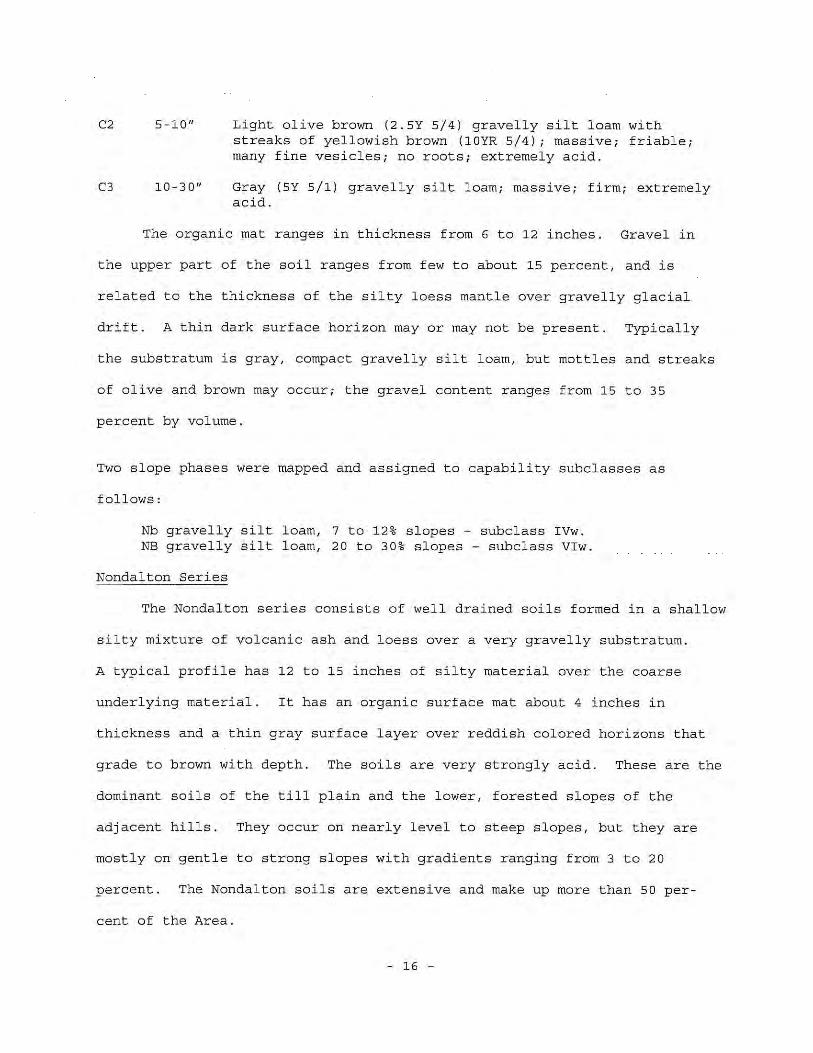
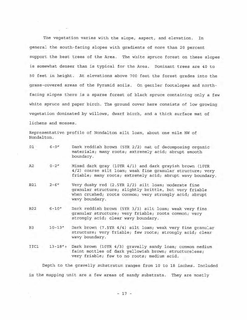
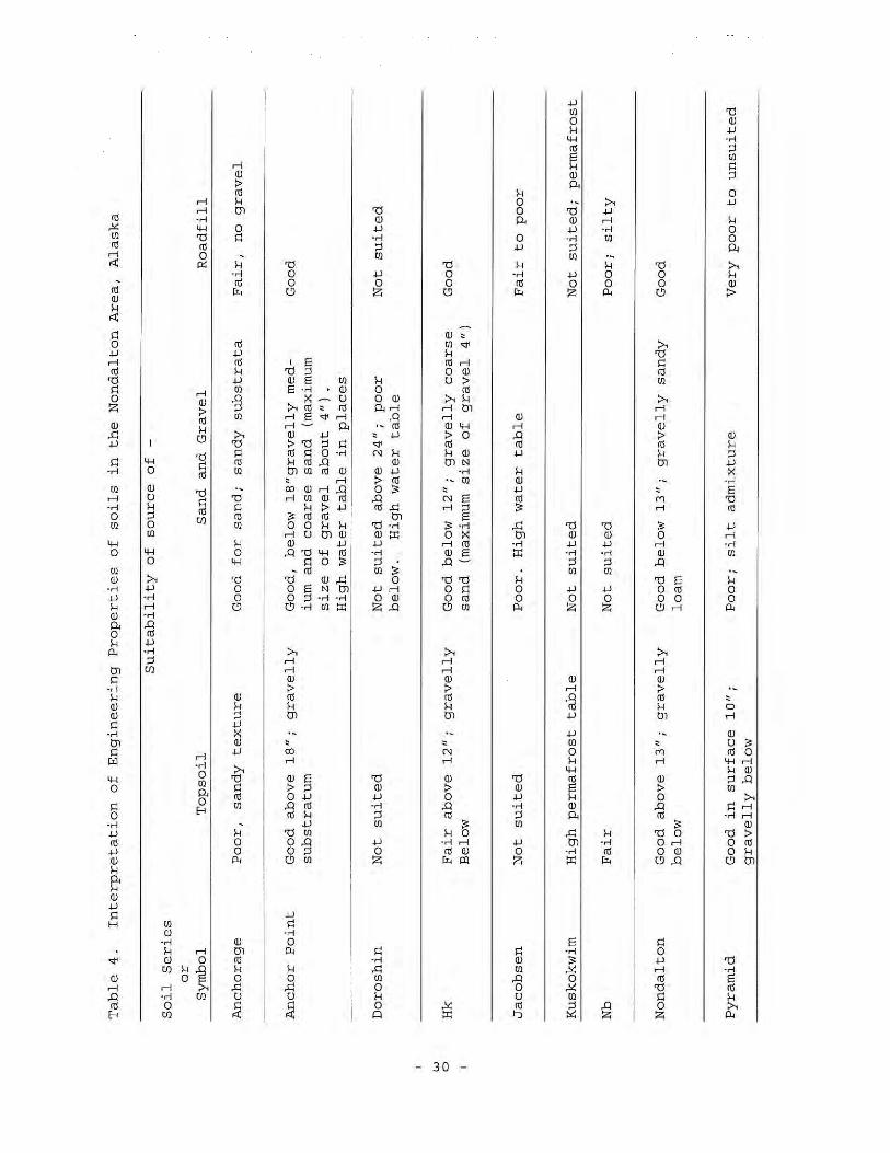
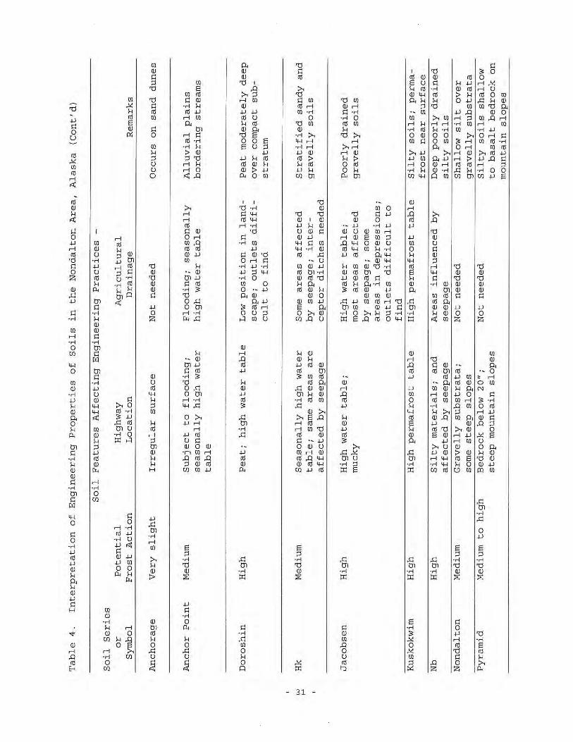
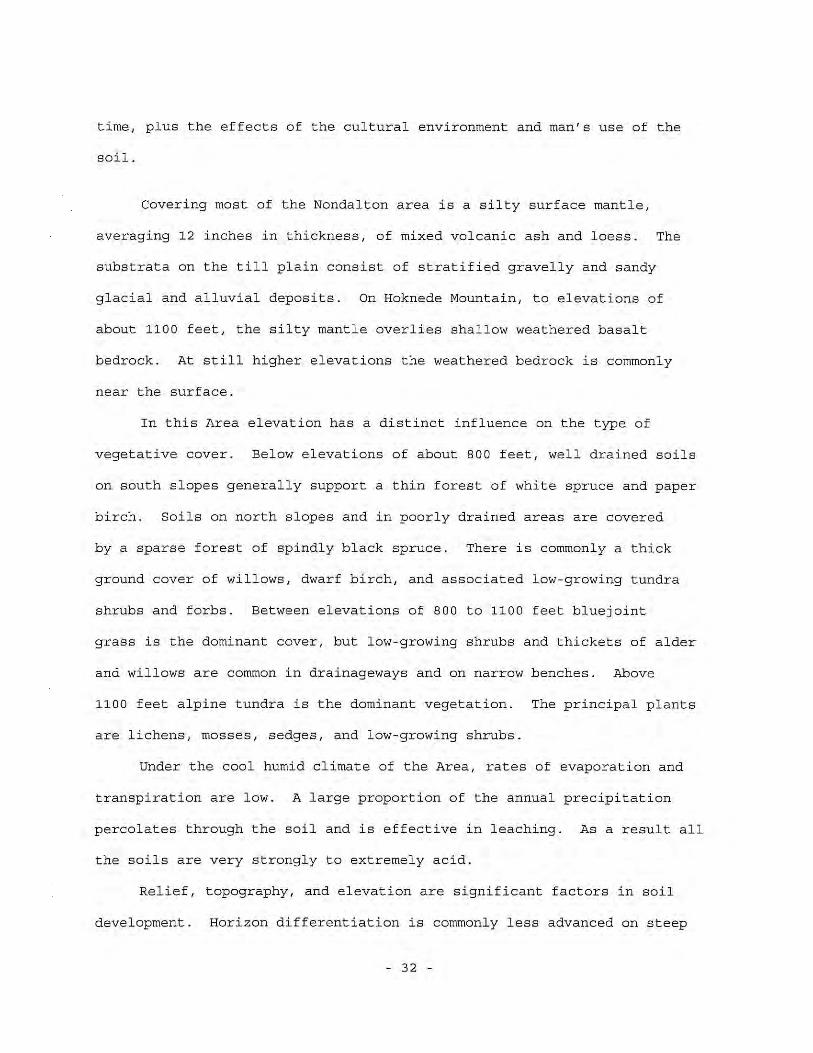
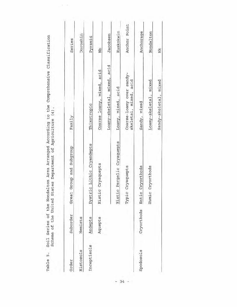
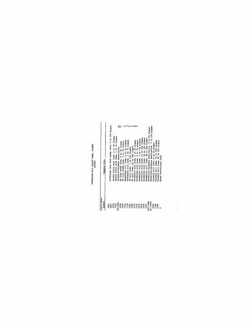
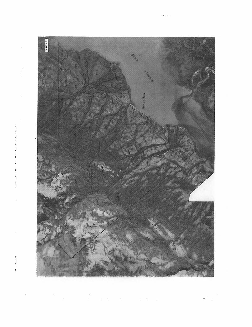
Appendix 5B, Soils of the Nondalton Area, Alaska
SOILS—BRISTOL BAY DRAINAGES
5-iii 12/9/2011
ACRONYMS AND ABBREVIATIONS
cm centimeter(s) ESS Exploratory Soil Survey of Alaska g/cm3 grams per cubic centimeter mm millimeter(s) NRCS Natural Resources Conservation Service USDA United States Department of Agriculture
SOILS—BRISTOL BAY DRAINAGES
5-1 12/9/2011
5. SOILS
5.1. Soils—Bristol Bay Region
5.1.1. Introduction
The overall Pebble Project study area is divided into the Bristol Bay region, which comprises 84 percent of the project study area, and the Cook Inlet region. A literature review and previous studies for the Bristol Bay region are discussed in this document. Review of existing data for the Cook Inlet region drainage is discussed in Chapter 29.
The Exploratory Soil Survey of Alaska (ESS) was completed by the U.S. Department of Agriculture (USDA) Soil Conservation Service (now the USDA Natural Resources Conservation Service [NRCS]) about 40 years ago (Rieger et al., 1979). The ESS covers the entire Pebble Project area and is the only direct coverage available. Soil investigations had also been completed for the village of Nondalton (Hinton and Neubauer, 1965) (Appendix 5B) and for Chisik Island (Clark and Ping, 1995). Both of these areas are near or within the Pebble Project study area.
5.1.2. Study Objectives
The goal of the soil studies for the Bristol Bay region of the Pebble Project was to gain an understanding of the general types of soils that occur in the region. The objective of the soils program was to review historical soils data from the region to determine the typical and common soil types occurring in the study area.
5.1.3. Study Areas
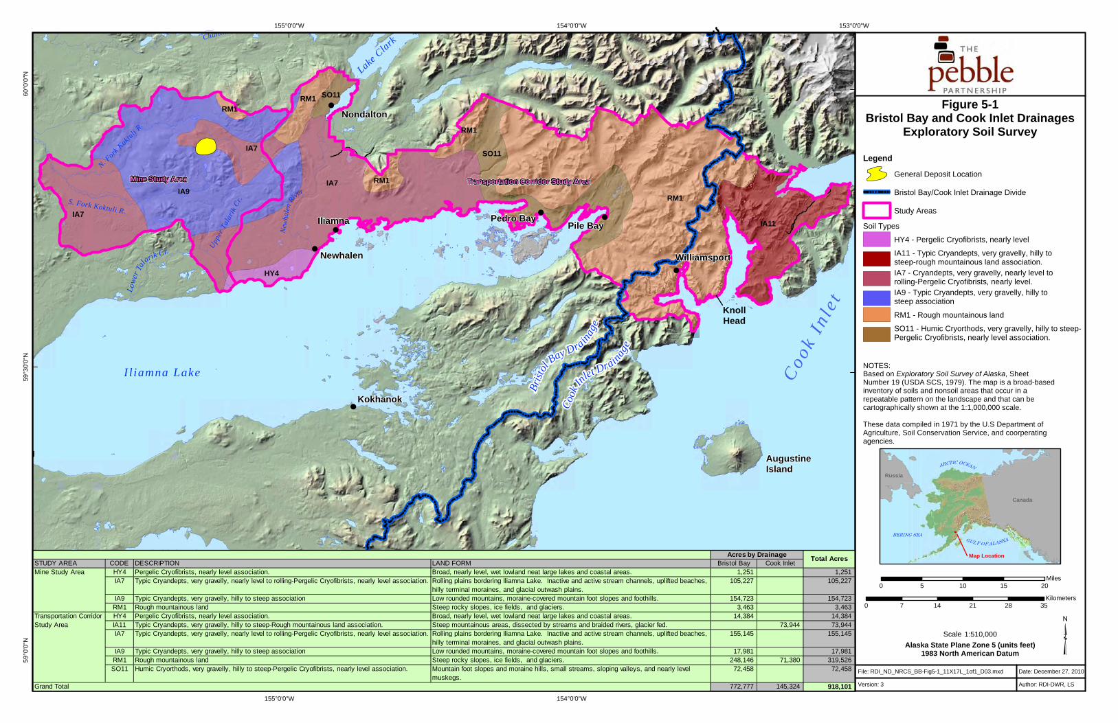
The soil study areas within the Bristol Bay region total approximately 773,000 acres in size. The study areas are north of Iliamna Lake and include part of the north shore of the lake. They extend from a large outwash plain in the west to steep mountains in the east. The study areas encompass parts of the North and South Forks of the Koktuli River, the Upper and Lower Talarik Creeks, and Nondalton River drainages. Figure 5-1 shows the extent of both the mine study area and transportation corridor within the region.
The study areas were glaciated during the Pleistocene and are in relatively close proximity to several active volcanoes in the Alaska Range. The fine textured soil layers that cover some of the landscapes is thought to be an admixture of glacial loess and volcanic ash. The nearest source of ash, Augustine Volcano, is an active stratovolcano on Augustine Island about 70 miles southeast of the study areas.
5.1.4. Previous Studies
The entire Pebble Project study area is included in the ESS. The ESS is a product of the National Cooperative Soil Survey, an interagency program responsible for classifying and mapping the soils of the
PEBBLE PROJECT, ENVIRONMENTAL BASELINE DOCUMENT, 2004 THROUGH 2008
5-2 12/9/2011
entire United States. The ESS is useful as a general soils map but is not intended to be used for site-specific interpretations. The mapping scale used was necessarily very small (1:1,000,000, i.e., 1 inch is the equivalent of 15.8 miles). The small scale precludes the definition of soil details at the square-mile scale or smaller, but the mapping provides an introduction to the types of soils and their variability across the project study area. Figure 5-1 and Table 5-1 show the five ESS map unit delineations that occur within the Bristol Bay region study areas.
Soil map units can comprise areas of soils, soils and intermingled miscellaneous areas (non-soil, e.g., rock outcrop or ice), or miscellaneous areas alone. Small scale mapping commonly defines map units as associations that combine multiple associated soil types together. These associations may consist entirely of soil types or may be a grouping of soil types and associated miscellaneous areas. Miscellaneous areas may also stand alone as a map unit if the mapped area is almost entirely non-soil. Four of the five map units identified for the study area are soil associations; the remaining map unit is a miscellaneous area (Table 5-1).
The soil types within each of the soil association map units are classified to the subgroup level, which is an intermediate level of detail in Soil Taxonomy, the United States soil taxonomic system (USDA NRCS, 1999).
The field work for the ESS was completed between 1967 and 1973. At that time, Soil Taxonomy included 10 soil orders, which is the highest categorical level. Two additional soil orders, Andisols and Gelisols, were added later. This addition to Soil Taxonomy affects the classification of some soil types described in the ESS that occur in the Pebble Project study areas.
Andisols are defined by the presence of andic soil properties within the upper 24 inches of soil. Andic soil properties result from volcanic ash or the products of weathered volcanic ash. The criteria for andic soil properties are presented in Appendix 5A. It is likely that the Andisols of this region may classify as more than one of 18 subgroups defined in Keys to Soil Taxonomy, 10th edition (Soil Survey Staff, 2006). However, accurate classification to and within the Andisol order requires laboratory analyses.
Gelisols are soils that have permafrost within 40 inches of the soil surface and/or have gelic materials within 80 inches of the soil surface. The ESS mapped and described pergelic cryofibrists in the study areas as relatively undecomposed organic materials that remained frozen throughout the year. These soils would currently classify as Gelisols in the typic fibristel subgroup.
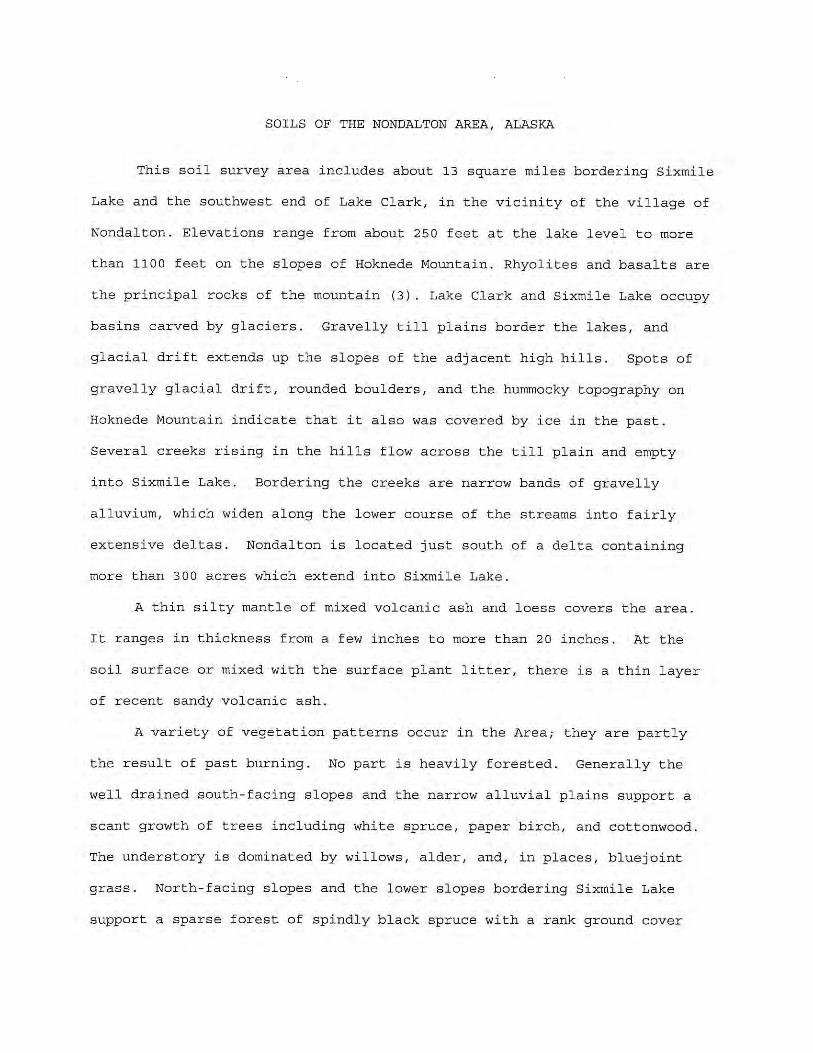
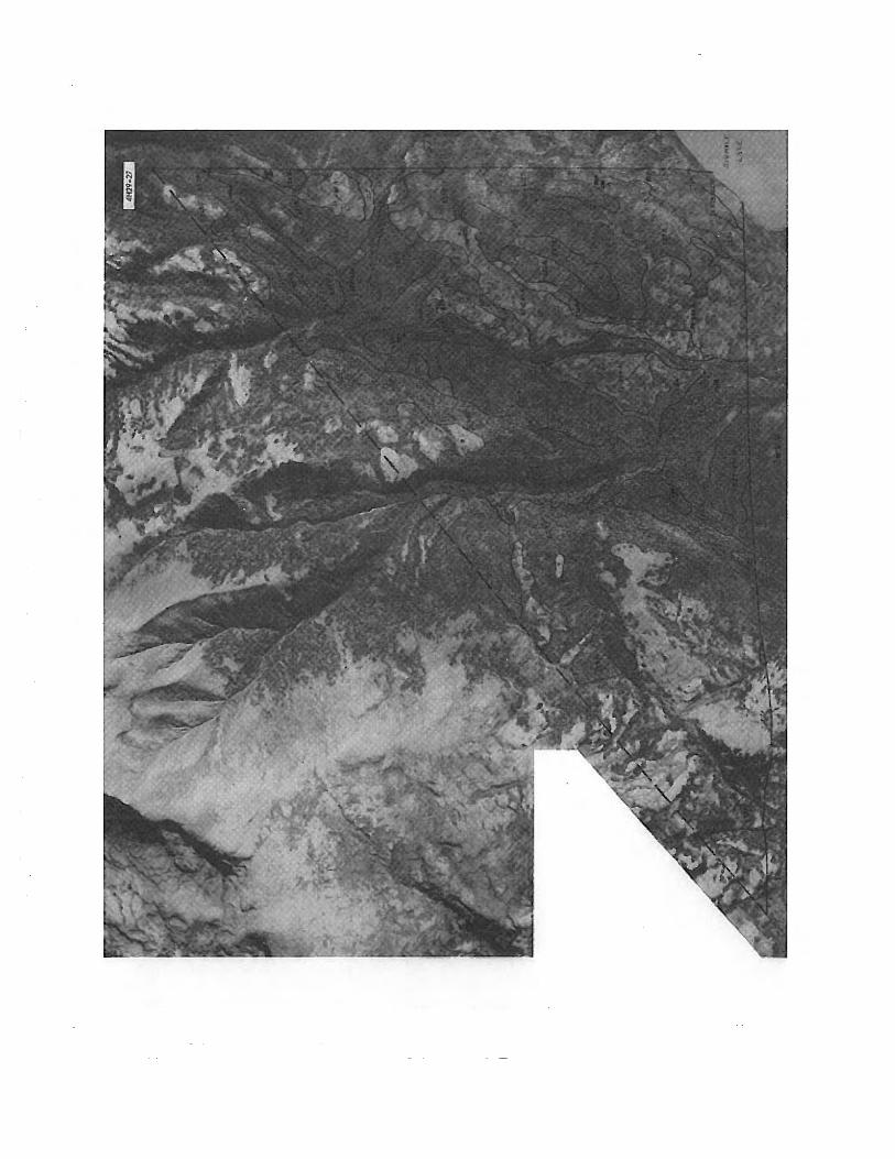
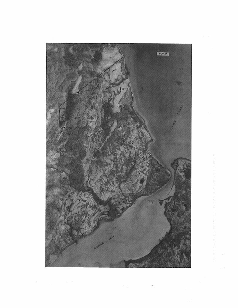
A detailed soils investigation is available for an area surrounding the village of Nondalton, located several miles north of the transportation corridor (Hinton and Neubauer, 1965). This report is available in electronic format only (Appendix 5B). Throughout Alaska, relatively small areas such as Nondalton were mapped in detail to provide baseline reference data for the broader ESS of Alaska.
A detailed soils investigation is also available for Chisik Island, an area about 30 miles northeast of the Bristol Bay region study areas (Clark and Ping, 1995).
5.1.5. Scope of Work
The scope of work for the Bristol Bay soil studies included the following:
SOILS—BRISTOL BAY DRAINAGES
5-3 12/9/2011
• A literature review, including scientific journals, soil survey reports, and online sources, for data related to the study area and region.
• A review and summary of the ESS map unit descriptions in the project area.
Three Parameters Plus, Inc. conducted this work.
5.1.6. Methods
A review of library reference and/or search systems was conducted using key words, including volcanic ash, tephra, Andisols, Alaska, and other terms. The literature search generated lists of documents with data pertinent to the study area and references were added to an in-house library.
5.2. Soil Map Units in the Mine Study Area The ESS recognized four soil map units in the mine study area (approximately 265,000 acres). The map units are delineated on Figure 5-1 and are described below in decreasing order by the percentage of the mine study area that they comprise (Figure 5-2):
• IA9: Typic cryandepts, very gravelly, hilly to steep association (approximately 155,000 acres, 58 percent). In the mine study area, this map unit includes the upper reaches of the north and south forks of the Koktuli River, as well as the upper reaches of Upper Talarik Creek. These soils formed in volcanic material, are well drained, are strongly acidic, and have a thin surface mat of partly decomposed plant litter mixed with volcanic ash. The vegetation is either alder and grasses or low shrubs and associated plants.
• IA7: Typic cryandepts, very gravelly, nearly level to rolling and pergelic cryofibrists, nearly level association (approximately 105,000 acres, 40 percent). This map unit includes the headwaters of Upper Talarik Creek, the lower part of the South Fork Koktuli River, and portions of the north shore of Iliamna Lake. These soils are composed of well-drained acidic soils developed in shallow volcanic ash over very gravelly glacial material. They occur on ground moraines, terminal moraines, outwash plains, and old beach ridges. The vegetation is dominantly low tundra species, but white spruce and paper birch also occur in the Iliamna Lake area.
• RM1: Rough mountainous land (approximately 3,500 acres, 1 percent). This map unit includes sparsely vegetated, steep rocky slopes on Groundhog Mountain. The sparsely vegetated soils are thin, overlying bedrock or stones/boulders.
• HY4: Pergelic cryofibrists, nearly level association (approximately 1,300 acres, less than 1 percent). This map unit includes a small portion of the north shore of Lake Iliamna, southwest of Newhalen. These soils are very poorly drained, perennially frozen peat soils located on broad, nearly level muskegs. In summer, water is perched above the permafrost table, and the thawed material is wet, soft, and spongy. Plants that grow on these soils are sedges, mosses, and low shrubs. The peat consists of dark brown, coarse sedge and moss fibers that are perennially frozen below a depth of 10 to 30 inches.
PEBBLE PROJECT, ENVIRONMENTAL BASELINE DOCUMENT, 2004 THROUGH 2008
5-4 12/9/2011
5.3. Soil Map Units in the Transportation Corridor The ESS recognized five soil map units in the transportation corridor study area within the Bristol Bay region (approximately 507,000 acres). The map units are delineated on Figure 5-1 and are described below in decreasing order by the percentage of the transportation corridor study area that they comprise (Figure 5-3):
• RM1: Rough mountainous land (approximately 248,000 acres, 49 percent). This unit consists of steep rocky slopes, primarily east of Lake Clark, sloping towards the divide with Groundhog Mountain. This unit dominates the eastern portion of the transportation corridor study area. The sparsely vegetated soils are thin, overlying bedrock or stones/boulders.
• IA7: Typic cryandepts, very gravelly, nearly level to rolling and pergelic cryofibrists, nearly level association (approximately 155,000 acres, 31 percent). This unit encompasses all of the Newhalen River drainage and portions of the north shore of Lake Iliamna, primarily to the east of Iliamna and Newhalen. These soils are composed of well-drained acidic soils developed in shallow volcanic ash over very gravelly glacial material. They occur on ground moraines, terminal moraines, outwash plains, and old beach ridges. The vegetation is dominantly low tundra species, but white spruce and paper birch also occur in the Iliamna Lake area.
• SO11: Humic cryorthods, very gravelly, hilly to steep and pergelic cryofibrists, nearly level association (approximately 72,000 acres, 14 percent). This association includes land west of Lake Clark as well as at the northeast end of Iliamna Lake. Humic cryorthods are well-drained soils on footslopes and moraines under forests dominated by white spruce and paper birch on steeper slopes and by black spruce on more gentle slopes. These soils developed in volcanic ash over gravelly glacial till. In areas that are nearly level, such as muskegs in valleys and depressions in moraines, pergelic cryofibrist soils develop. These soils are very poorly drained, perennially frozen peat. In summer, water is perched above the permafrost table, and the thawed material is wet, soft, and spongy. Plants that grow on these soils are sedges, mosses, and low shrubs. The peat consists of dark brown, coarse sedge and moss fibers that are perennially frozen below a depth of 10 to 30 inches.
• IA9: Typic cryandepts, very gravelly, hilly to steep association (approximately 18,000 acres, 4 percent). This soil association includes land in the Newhalen River drainage. These soils form in volcanic material, are well drained, are strongly acidic, and have a thin surface mat of partly decomposed plant litter mixed with volcanic ash. The vegetation is either alder and grasses or low shrubs and associated plants.
• HY4: Pergelic cryofibrists, nearly level association (approximately 14,000 acres, 3 percent). This association was mapped in a block along the north shore of Iliamna Lake, southwest of Newhalen. These soils are very poorly drained, perennially frozen peat soils located on broad, nearly level muskegs. In summer, water is perched above the permafrost table, and the thawed material is wet, soft, and spongy. Plants that grow on these soils are sedges, mosses, and low shrubs. The peat consists of dark brown, coarse sedge and moss fibers that are perennially frozen below a depth of 10 to 30 inches.
SOILS—BRISTOL BAY DRAINAGES
5-5 12/9/2011
5.4. Results and Discussion The 1979 ESS survey summarized three major soil types that occur in one or more of the five soil map units delineated over the Bristol Bay region study areas. These summaries are based on descriptions of representative pedons. The source pedons for the summaries were not necessarily located within the Pebble Project study area. The three soil types are described as follows:
• Pergelic cryofibrists are fibrous organic soils that have mean annual soil temperatures below freezing. The permafrost table is commonly less than 30 inches (75 centimeters [cm]) deep in these soils. The soils are composed dominantly of laminated sedge peat, but in many places the upper part of the soil consists of sphagnum moss peat. The thickness of the peat ranges from 16 inches (40 cm) to more than 10 feet (3 meters). The soils occupy shallow depressions in lowlands throughout interior, arctic, and western Alaska. The vegetation is dominantly sedge tussocks or, in the interior, black spruce forests.
• Typic cryandepts are soils in which less than half of the soil between depths of 10 and 40 inches (25 and 100 cm) exhibit thixotropic properties. They generally are dark reddish brown or dark brown. Some are made up mostly of ash grains of sand or cinder size. Others consist of fine thixotropic ashy material that is fairly thin over other material.
• Humic cryorthods have large accumulations of organic matter in at least the upper part of the spodic horizon. They are similar in appearance and thickness to the typic cryohumods, but have higher iron content. These soils dominate well drained forested uplands in Southeastern Alaska, areas along the north shore of the Gulf of Alaska, and areas with high precipitation rates west of the Alaska and Aleutian Ranges.
Soil Taxonomy is periodically updated and expanded; therefore, terminology used in 1979 may not still be in use in the current classification system. The soil descriptions and laboratory data presented in the ESS survey were used to determine how the 1979 soil classifications for the study areas would translate to the 2006 classification system (Soil Survey Staff, 2006). Table 5-2 matches the 1979 ESS taxonomic classification with a current equivalent.
5.5. Summary A thorough literature review revealed three existing soil studies that covered or were near the Pebble Project mine study area and transportation corridor study area in the Bristol Bay Region. These studies, the ESS and the soil investigations of the Nondalton Area and Chisik Island represent the only previously published soils information for the study areas.
The three existing publications indicate that many of the soils in the study areas are influenced to some degree by volcanic ash within the parent materials. The ESS classifies the dominant soils of the area as typic cryandepts and describes their ash-influenced, or andic, properties. The Nondalton and Chisik Island soil investigations describe similar soils, although the soil classifications reflect the version of Soil Taxonomy current at the time of each publication.
PEBBLE PROJECT, ENVIRONMENTAL BASELINE DOCUMENT, 2004 THROUGH 2008
5-6 12/9/2011
5.6. References American Geological Institute. 2008. Glossary of Geology. http://www.agiweb.org/pubs/glossary/
(November 23, 2010).
Clark, M. H., and C. L. Ping. 1995. Soil Survey Investigation. Chisik Island Tuxedni Wilderness Area Alaska.
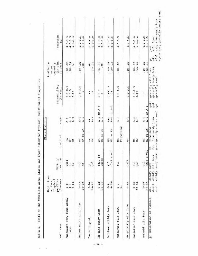
Hinton, R.B., and L.A. Neubauer. Undated [1965]. Soils of the Nondalton Area, Alaska. Unpublished report by Soil Conservation Service, U.S. Department of Agriculture, Palmer, Alaska.
Rieger, S., D.B. Schoephorster, and C. E. Furbush. 1979. Exploratory Soil Survey of Alaska. USDA-SCS. Washington, D.C.: U.S. Government Printing Office.
Soil Survey Staff. 2006. Keys to Soil Taxonomy,10th Edition. USDA-NRCS. Washington, D.C.: U.S. Government Printing Office.
______. 1993. Soil survey manual. USDA-NRCS. U.S. Department of Agriculture Handbook 18(rev.), Washington, D.C.: U.S. Government Printing Office.
USDA-Natural Resources Conservation Service. 1999. Soil Taxonomy. A Basic System of Soil Classification for Making and Interpreting Soil Surveys. 2nd ed. AH 436, Washington, D.C.
5.7. Glossary Andic soil properties—soil material of volcanic origin. These properties include organic carbon content,
bulk density, phosphate retention, and iron and aluminum extractable with ammonium oxalate; containing a significant content of volcanic glass in the fine-earth fraction (less than 2 mm).
Andisols—one of the 12 orders of soil taxonomy (the broadest level of soil classification). These include soils that are strongly influenced by volcanic ash. Andic soils have distinct properties including low organic carbon content, low bulk density, phosphate retention, ammonium oxalate extractable iron and aluminum, and significant content of volcanic glass in the fine-earth fraction (less than 2 mm).
Ash [volcanic]—fine material (under 2.0 mm diameter; under 0.063 mm diameter for fine ash) blown from a volcanic vent, usually referring to the unconsolidated material but sometimes also used to refer to its consolidated counterpart, tuff.
Gelic materials—mineral or organic soil materials that have evidence of cryoturbation (frost churning) and/or ice segregation in the active layer (seasonal thaw layer) and/or the upper part of the permafrost.
SOILS—BRISTOL BAY DRAINAGES
5-7 12/9/2011
Gelisols—one of the 12 orders of soil taxonomy (the broadest level of soil classification). The unique property of gelisols is the presence of permafrost and soil features and properties associated with freezing and thawing. These features include irregular or broken horizons and incorporation of organic materials in the lower horizons, especially along the top of the permafrost table. Freezing and thawing produce granular, platy, and vesicular structures in surface and subsurface horizons.
Horizons—a specific layer or stratum of soil or subsoil in a vertical cross section of land. Horizons are designated and subdivided on the basis of color, texture, structure, and the observation of soil-forming properties. Primary horizon designations are O, A, E, B, and C horizons:
• O horizon: layers dominated by organic material.
• A horizon: mineral soil layer at soil surface or below O horizon having an accumulation of organic matter.
• E horizon: mineral soil layer characterized by loss of clay, iron, and\or aluminum in some combination, leaving a combination of sand and silt particles.
• B horizon: mineral soil layer characterized by ay of the following: pedogenic structure; accumulation if iron, aluminum, or humus; reddish colors due to pedogenic processes.
• C horizon: subsurface layers showing little affect by pedogenic processes.
Humic cryothods—(obsolete) subgroup level of soil taxonomy, and belonging to the Spodosols soil order. Humic cryorthods are cold, well drained soils that have relatively high organic carbon content and may or may not have andic soil properties.
Inceptisols—one of the twelve orders of soil taxonomy (the broadest level of soil classification). These include soils that are moderately well developed and are transitioning toward other soil orders.
Loess—a widespread, homogeneous, commonly nonstratified, porous, friable, slightly coherent, fine-grained blanket deposit), consisting predominantly of silt with secondary grain sizes ranging from clay to fine sand.
Pedogenic—related to the formation and development of soil.
Pedon—a three-dimensional body of soil with lateral dimensions large enough to permit the study of horizon shapes and relations. Its area ranges from 1 to 10 square meters.
Pergelic cryofibrists—(obsolete) subgroup level of soil taxonomy, and belonging to the Histosols soil order. Pergelic cryofibrists are wet soils composed of minimally decomposed organic matter and that have a mean annual soil temperature of less than 0 degrees Celsius.
Pyroclastic—fragmented rock material formed by a volcanic explosion or ejection from a volcanic vent.
Spodic horizon—a B horizon consisting of an accumulation of black or reddish amorphous materials that have a high cation-exchange capacity.
PEBBLE PROJECT, ENVIRONMENTAL BASELINE DOCUMENT, 2004 THROUGH 2008
5-8 12/9/2011
Spodosols—one of the 12 orders of soil taxonomy (the broadest level of soil classification). These include highly leached soils in which a combination of environmental conditions (high precipitation, high soil acidity) lead to the removal of organic matter and aluminum from upper soil layers and deposition of these materials in lower soil layers.
Stratovolcano—a volcano that is constructed of alternating layers of lava and pyroclastic deposits, along with abundant dikes and sills. Viscous, acidic lava may flow from fissures radiating from a central vent, from which pyroclastics are ejected.
Tephra—materials of all types and sizes that are erupted from a crater or volcanic vent and deposited from the air.
Till—dominantly unsorted and unstratified drift, generally unconsolidated, deposited directly by and underneath a glacier without subsequent reworking by meltwater, and consisting of a heterogeneous mixture of clay, silt, sand, gravel, and boulders ranging widely in size and shape.
Thixotropic—subject to loss of structural support upon movement due to positive pore pressures.
Typic cryandepts— (obsolete) subgroup level of soil taxonomy, and belonging to the Inceptisols soil order. Typic cryandepts are cold, moderately well developed soils strongly influenced by volcanic ash.
Typic fibristels—subgroup level of soil taxonomy, belonging to the Gelisols soil order. Typic fibristels are very cold, wet soils comprised of slightly decomposed organic matter and have permafrost.
Sources for glossary: American Geological Institute, 2008; Soil Survey Staff, 1993; and USDA-NRCS, 1999.

SOILS—BRISTOL BAY DRAINAGES
TABLES
SOILS—BRISTOL BAY DRAINAGES
TABLE 5-1 Map Units for the Bristol Bay Study Areas as Defined in the 1979 Soil Survey
Map Unit
Code Map Unit Name
Total Acreage in Project Vicinity
(% of total)
IA7 Typic cryandepts, very gravelly, nearly level to rolling - Pergelic cryofibrists, nearly level association
260,000 (34%)
RM1 Rough mountainous land 252,000 (33%)
SO11 Humic cryorthods, very gravelly, hilly to steep - Pergelic cryofibrists, nearly level association
72,000 (9%)
IA9 Typic cryandepts, very gravelly, hilly to steep association 173,000 (22%)
HY4 Pergelic cryofibrists, nearly level association 16,000 (2%)
Source: Rieger et al.,1979.
TABLE 5-2 Corresponding 1979 and 2006 Classifications for Pedons as Described in the ESS
ESS Map Units 1979 Classification
(ESS pedons) 2006 Classification
(ESS pedons) HY4, SO11, IA7 Pergelic cryofibrists Typic fibristels
SO11 Humic cryorthods Typic humicryods
IA7, IA9 Typic cryandepts Typic haplocryands, Typic vitricryands
SOILS—BRISTOL BAY DRAINAGES
FIGURES
Alaska State Plane Zone 5 (units feet)1983 North American Datum
!
!
!
!
!!
!
Pedro Bay
Coo
k In
l et
N. Fork
Kokt
uli R.
Upp
er T
alar
ik C
r.S. Fork Koktuli R.
Low
er T
al
arik Cr.
New
hale
n Ri
ver
AugustineIsland
Bri
stol
Bay Drainag
e
Coo
k In
let Drainag
e
KnollHead
I l iamna Lake
Lake C
lark
Kamishak Bay
Nonvianuk L.
Kukaklek Lake
Chulitna
Iliamna
Kokhanok
Newhalen Williamsport
g
Nondalton
Pile Bay
Transportation Corridor Study AreaMine Study Area
RM1IA9
IA7
IA7IA11
SO11IA7
HY4
RM1
RM1
RM1
SO11
RM1
153°0'0"W
154°0'0"W
154°0'0"W
155°0'0"W
155°0'0"W60
°0'0
"N59
°30'
0"N
59°0
'0"N ³
0 5 10 15 20Miles
0 7 14 21 28 35Kilometers
Scale 1:510,000
Figure 5-1Bristol Bay and Cook Inlet Drainages
Exploratory Soil Survey
Legend
General Deposit Location
Bristol Bay/Cook Inlet Drainage Divide
Study Areas
Soil Types
HY4 - Pergelic Cryofibrists, nearly level
IA11 - Typic Cryandepts, very gravelly, hilly tosteep-rough mountainous land association.IA7 - Cryandepts, very gravelly, nearly level torolling-Pergelic Cryofibrists, nearly level.IA9 - Typic Cryandepts, very gravelly, hilly tosteep association
RM1 - Rough mountainous land
SO11 - Humic Cryorthods, very gravelly, hilly to steep-Pergelic Cryofibrists, nearly level association.
NOTES:Based on Exploratory Soil Survey of Alaska, Sheet Number 19 (USDA SCS, 1979). The map is a broad-basedinventory of soils and nonsoil areas that occur in a repeatable pattern on the landscape and that can becartographically shown at the 1:1,000,000 scale.
These data compiled in 1971 by the U.S Department ofAgriculture, Soil Conservation Service, and coorperatingagencies.
Canada
ARCTIC OCEAN
Map Location
Russia
BERING SEAGUL F OF ALASKA
Date: December 27, 2010
Author: RDI-DWR, LS
File: RDI_ND_NRCS_BB-Fig5-1_11X17L_1of1_D03.mxd
Version: 3
STUDY AREA CODE DESCRIPTION LAND FORM Bristol Bay Cook InletMine Study Area HY4 Pergelic Cryofibrists, nearly level association. Broad, nearly level, wet lowland neat large lakes and coastal areas. 1,251 1,251
IA7 Typic Cryandepts, very gravelly, nearly level to rolling-Pergelic Cryofibrists, nearly level association. Rolling plains bordering Iliamna Lake. Inactive and active stream channels, uplifted beaches, hilly terminal moraines, and glacial outwash plains.
105,227 105,227
IA9 Typic Cryandepts, very gravelly, hilly to steep association Low rounded mountains, moraine-covered mountain foot slopes and foothills. 154,723 154,723 RM1 Rough mountainous land Steep rocky slopes, ice fields, and glaciers. 3,463 3,463
Transportation Corridor HY4 Pergelic Cryofibrists, nearly level association. Broad, nearly level, wet lowland neat large lakes and coastal areas. 14,384 14,384 Study Area IA11 Typic Cryandepts, very gravelly, hilly to steep-Rough mountainous land association. Steep mountainous areas, dissected by streams and braided rivers, glacier fed. 73,944 73,944
IA7 Typic Cryandepts, very gravelly, nearly level to rolling-Pergelic Cryofibrists, nearly level association. Rolling plains bordering Iliamna Lake. Inactive and active stream channels, uplifted beaches, hilly terminal moraines, and glacial outwash plains.
155,145 155,145
IA9 Typic Cryandepts, very gravelly, hilly to steep association Low rounded mountains, moraine-covered mountain foot slopes and foothills. 17,981 17,981 RM1 Rough mountainous land Steep rocky slopes, ice fields, and glaciers. 248,146 71,380 319,526 SO11 Humic Cryorthods, very gravelly, hilly to steep-Pergelic Cryofibrists, nearly level association. Mountain foot slopes and moraine hills, small streams, sloping valleys, and nearly level
muskegs.72,458 72,458
Grand Total 772,777 145,324 918,101
Acres by Drainage Total Acres
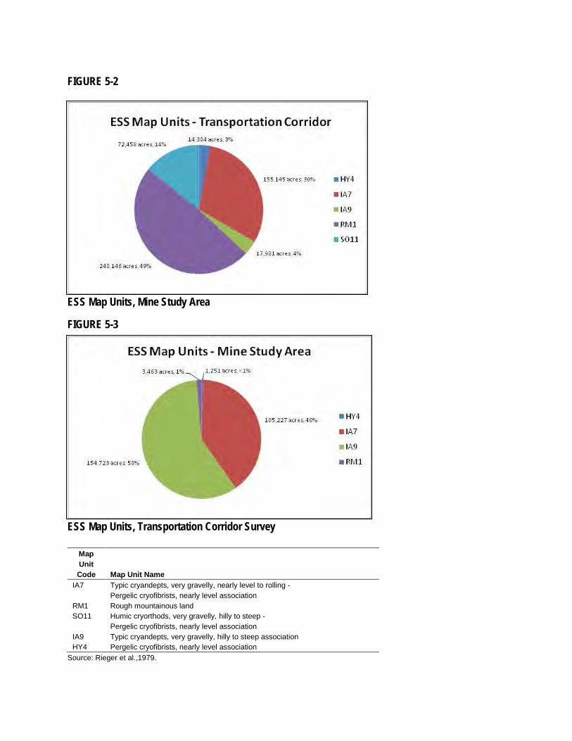
FIGURE 5-2
ESS Map Units, Mine Study Area
FIGURE 5-3
ESS Map Units, Transportation Corridor Survey
Map Unit Code Map Unit Name
IA7 Typic cryandepts, very gravelly, nearly level to rolling - Pergelic cryofibrists, nearly level association
RM1 Rough mountainous land SO11 Humic cryorthods, very gravelly, hilly to steep -
Pergelic cryofibrists, nearly level association IA9 Typic cryandepts, very gravelly, hilly to steep association HY4 Pergelic cryofibrists, nearly level association
Source: Rieger et al.,1979.
SOILS—BRISTOL BAY DRAINAGES
APPENDICES
SOILS—BRISTOL BAY DRAINAGES
APPENDIX 5A
Required Characteristics for Andic Soil Properties
APPENDIX 5A, SOILS—BRISTOL BAY DRAINAGES
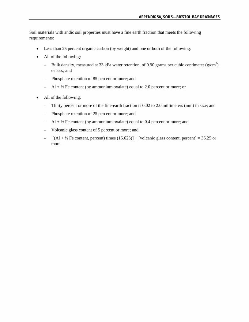
Soil materials with andic soil properties must have a fine earth fraction that meets the following requirements:
• Less than 25 percent organic carbon (by weight) and one or both of the following:
• All of the following:
– Bulk density, measured at 33 kPa water retention, of 0.90 grams per cubic centimeter (g/cm3) or less; and
– Phosphate retention of 85 percent or more; and
– Al + ½ Fe content (by ammonium oxalate) equal to 2.0 percent or more; or
• All of the following:
– Thirty percent or more of the fine-earth fraction is 0.02 to 2.0 millimeters (mm) in size; and
– Phosphate retention of 25 percent or more; and
– Al + ½ Fe content (by ammonium oxalate) equal to 0.4 percent or more; and
– Volcanic glass content of 5 percent or more; and
– [(Al + ½ Fe content, percent) times (15.625)] + [volcanic glass content, percent] = 36.25 or more.
SOILS—BRISTOL BAY DRAINAGES
APPENDIX 5B
Soils of the Nondalton Area, Alaska