Embed Size (px)
Citation preview


Brief History of Fisheries LawBackground Enforcement
Management of the new 200-mile U.S. fish-ery zone will, of necessity, have enforcementof regulations as an integral part if it is to ac-complish restoration and conservation of fishstocks and provide the domestic fishing in-dustry with the potential and incentive togrow, as mandated by the Fishery Conserva-tion and Management Act of 1976 (P.L.94-265).
Management plans to be drawn-up underprovisions of the Act will lay the groundworkfor the types of regulations which will be re-quired and which must be enforced. However,fish resources are already scarce enough andthe demand for fish products high enoughthat it is logical to conclude that foreign na-tions can justify the risk of violating theseregulations and the United States can justifythe effort and expense of enforcing them. Infact, the U.S. Coast Guard, the agency pri-marily charged with the enforcement task, hasconcluded in a report on its preparations forincreased fisheries duties that “the state of thefish stocks today is too critical to allow for anylapse in enforcement.”20
A discussion of enforcement problems andopportunities is offered first in this report fortwo reasons:
1) Clear and timely indication of U.S. inten-tions to strictly enforce fishery regula-tions within the 200-mile zone is impera-tive for gaining foreign cooperation.
2) Even the best of management plans can-not succeed without effective enforce-ment of its provisions.
Later sections of this report deal with theproblems and opportunities of managing the200-mile fishing zone and with the need formuch additional information as Federal agen-cies and Regional Councils seek to refine andimprove management techniques.
The United States began to exercise controlover its coastal fisheries soon after it became acountry. Until the passage of the Bartlett Act,in the middle 1960’s, however, enforcementwas essentially confined to the “territorialsea”, the area within 3-nautical miles offshore.
The early control activities were generallymild. It wasn’t until the late 1800’s and early1900’s, that strong legislation was passed toresolve fishery and marine mammal problemsin Alaska and the Pacific Northwest, In theearly 1900’s, foreign fishing vessels wereseized and brought to American ports, andfines were successfully levied against thecrews and vessels.
The Bartlett Act has been the primary fish-eries law. Foreign fishing is not onlyprohibited within the territorial sea, but alsois excluded within a contiguous 9-mile fish-eries zone beyond the 3-mile territorial sea. Inaddition, foreign fishermen cannot retaincreatures of the Continental Shelf (shellfishand crustacean). Violations of the Bartlett Actcould result in fines, imprisonment, and for-feiture of the vessel, gear, and catch.
There are a number of treaties and interna-tional agreements in which the United Statesand other countries have agreed to managefishery resources, outside the 12-mile zone.ICNAF (International Convention for theNorthwest Atlantic Fisheries) is an example ofone important treaty. Here, the 18 membergovernments prepare the regulations, whichfor the most part are concerned with quota
21
allocations. Inspectors may stop, board, andexamine member fishing vessels for violationsof the regulations, but prosecution andpunishment (if any) are carried out by the“flag state”, the home country of the particu-lar fishing vessel.
The United States was a member of ICNAFfor more than 25 years. However, it withdrewfrom the convention after Congress passed theFishery Management and Conservation Act of1976, unilaterally assuming jurisdiction overmost of the east coast waters in whichAmerican fishermen work.
The growth in breadth and strength of en-forcement of fisheries laws can be traced totwo primary interrelated occurrences:
● intense foreign fishing off our coasts, and
● depletion of many fish species due tooverfishing.
In 1975, there were 17 foreign nations fish-ing off our coasts.21 In June 1975, almost 1,000foreign fishing vessels were sighted; the year’smonthly average was more than 500.22 Theforeign vessels caught about three-quarters ofthe 3 million metric tons of fish caught in the200-mile zone that year.
From 1964 through September of 1976,nearly 100 foreign fishing vessels were citedfor violation of U.S. fishing laws. The mostfrequent offenders have been Japan, Canada,Cuba, and the U.S.S.R. Fishermen from thesenations account for more than 70 percent ofthe violations of U.S. law. In addition, approx-imately 100 treaty violations are documentedeach year.23
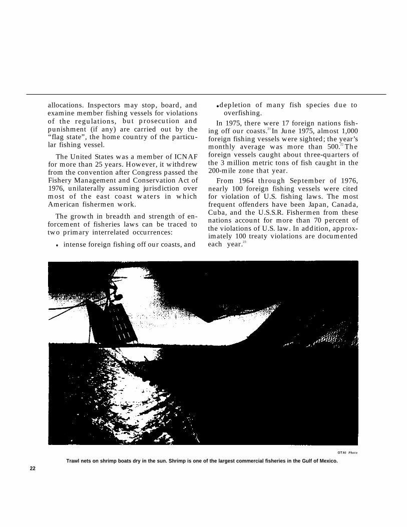
OTAI Photo
Trawl nets on shrimp boats dry in the sun. Shrimp is one of the largest commercial fisheries in the Gulf of Mexico.22
Requirements of the Law
Violations of U.S. law can be classified as:● geographical intrusion, that is entrance
into forbidden areas, such as territorialwaters or closed areas; and
● catch and illegal retention of creaturesfrom the continental shelf , such aslobsters and crabs.
Treaty violations take the form of:●
●
●
●
i m p r o p e r f i s h i n g g e a r , w h i c h i sprohibited in certain areas by regulation;
illegal retainment of bycatch, that is,catching and keeping prohibited species;
overfishing of quotas; and
violating administrative regulations,such as improper keeping of log books ornot reporting required scientific data.
In the past, fisheries enforcement respon-sibility has been vested primarily in the U.S.Coast Guard. The Coast Guard has providedthe ships and aircraft and much of the man-power to staff the vehicles, the sensing equip-ment and the command and control functionof operations. The National Marine FisheriesService, which is primarily concerned withgathering management and scientific data,assisted in enforcement. NMFS provided per-sonnel with expertise on fishing gear, fishingtechniques, and fish identification and catchrates. There was close cooperation betweenthe two groups, with personnel from bothagencies frequently onboard the same vessels,
The State Department has also played animportant role in fisheries law enforcement.The State Department negotiated the varioustreaties and international agreements, and inthe past, any foreign fishing vessel was seizedonly after coordination with the Secretary ofState. A close liaison between the StateDepartment and the Coast Guard was neededsince any interference with foreign shipping,warranted or not, could certainly affect U.S.relations with the foreign country.
I .1 I,, < ~ - 7 ‘ -
The purpose and policies set out in PublicLaw 94-265 have important effects on enforce-ment. The law vests the responsibility for en-forcement in the Secretary of Commerce(NMFS) and in the Secretary of Transporta-tion (Coast Guard). Authorization is given toarrest violators, to seize vessels and cargo, andto issue citations.
In addition a number of specific instruc-tions, which have a major effect on enforce-ment, are spelled out in the law:
1. No foreign fishing is permitted in thefishery conservation zone except:
a. under agreements or treaties (new andrenegotiated), and
b. with a permit.
2. In every international agreement:
a.
b.
c.
d.
e.
f.
g
The foreign country agrees to abide byall U.S. regulations.The foreign country allows a U.S.officer to:
(1) board the vessel,(2) make arrests and seizures, and(3) examine the permit,
The permit must be prominently dis-played.
Appropriate position-fixing and iden-tification equipment, such as transpon-ders, if required by the Coast Guard,are to be installed and maintained oneach vessel.
U.S. observers will be allowed to boardany vessel, the cost to be reimbursed tothe United States.
Foreign agents are to be sited in theUnited States to deal with any legalprocess.
The foreign nation acts in behalf of itsindividual vessels.
23
Present Plans for Near-TermEnforcement
3. An allocation of fishing level (fishquotas) will be made to specific foreigncountries.
4. If a foreign vessel, with a permit, violatesthe regulations:
a. The permit of that vessel could berevoked.
b. The permit could be suspended.c. Additional conditions could be im-
posed on the foreign nation and onany of its permits,
5. Civil penalties for violations could be asmuch as $25,000 per violation, where ev-ery day may be considered as an addi-tional violation.
6. Criminal penalties for violations could beas much as $100,000 and 10 years inprison.
7. Any vessel, its fishing gear and cargo,could be forfeited to the United States.
Since the passage of the Fishery Manage-ment and Conservation Act of 1976, someconcern has been voiced by Members of Con-gress, members of the Regional Councils, andothers, that foreign investments in U.S. fishingoperations and joint ventures between foreignand domestic fishing and processing com-panies may provide a means of circumventingcontrols on foreign fishing interests within the200-mile zone. Such investments mayguarantee foreign firms the almost unlimitedaccess to fish stocks which is intended fordomestic fishermen and allow them to operateoutside certain regulations-such as gearrestrictions—which may be in effect only forforeign fishermen. While such investmentsmay pose problems in enforcing the intent ofthe Act, they are not, strictly speaking, an en-forcement problem to be dealt with by theCoast Guard and NMFS operational divisions.
The problems and benefits of foreign in-vestments are discussed as management con-
24 cerns in other sections of this report.
Enforcement of regulations in the new 200-mile fishery zone is complicated by the size ofthe area and the fact that fishing is to be reg-ulated not prohibited. The area encompassedby the 200-mile-wide band surrounding theUnited States and its possessions adds up toalmost 21/Q-million square miles of ocean. Ac-cording to Coast Guard estimates, major fish-eries cover approximately one-fourth of thatarea. These prime fishing grounds will requireconcentrated enforcement efforts during cer-tain seasons, In addition, at least some level ofenforcement may be required in all parts ofthe zone at some time during the year. Adense mixture of marine traffic, includingmerchant vessels, warships, tankers, recrea-tional craft, and both domestic and foreignfishing vessels, is found within the 200-milezone. From this mix of vessels, foreign fishingcraft must be located and identified by nation.Further, in order to enforce any regulation inany fishing area at any given time, fishingvessels must be classified as fishing accordingto the provisions of their permits and existingregulations or in violation of these controls;violators must be apprehended; and someprosecutor action must be taken.
This detection, identification, and classifica-tion of foreign fishing activity must go onunder any sea conditions that permit fishingitself. Experienced fishermen have indicatedthat this means enforcement activities may be
necessary through at least sea state 7 (28- to40-knot winds and 22- to 40-foot waves).
In addition, for each enforcement step,different vehicles and equipment are useful.For example, an aircraft flying at 200 knots, at15,000 feet in clear weather will cover agreater area, using sight and radar, and detectmore fishing vessels than will a cutter at seadoing 15 knots. On the other hand, the aircraftcannot put a boarding party on fishingvessels, while a cutter can accomplish thismission.
It is not now possible to project explicitlywhat enforcement will be necessary to detectand deter violations because the RegionalCouncils, which are charged with creating theregulations for fishery management, have notyet formalized final plans which will includethe regulations which are to be enforced.Regulations which have been drawn-up bythe National Marine Fisheries Service for im-plementation as of March 1, 1977, are merelyinterim rules which will be supplanted oncethe councils formulate regulations specific to
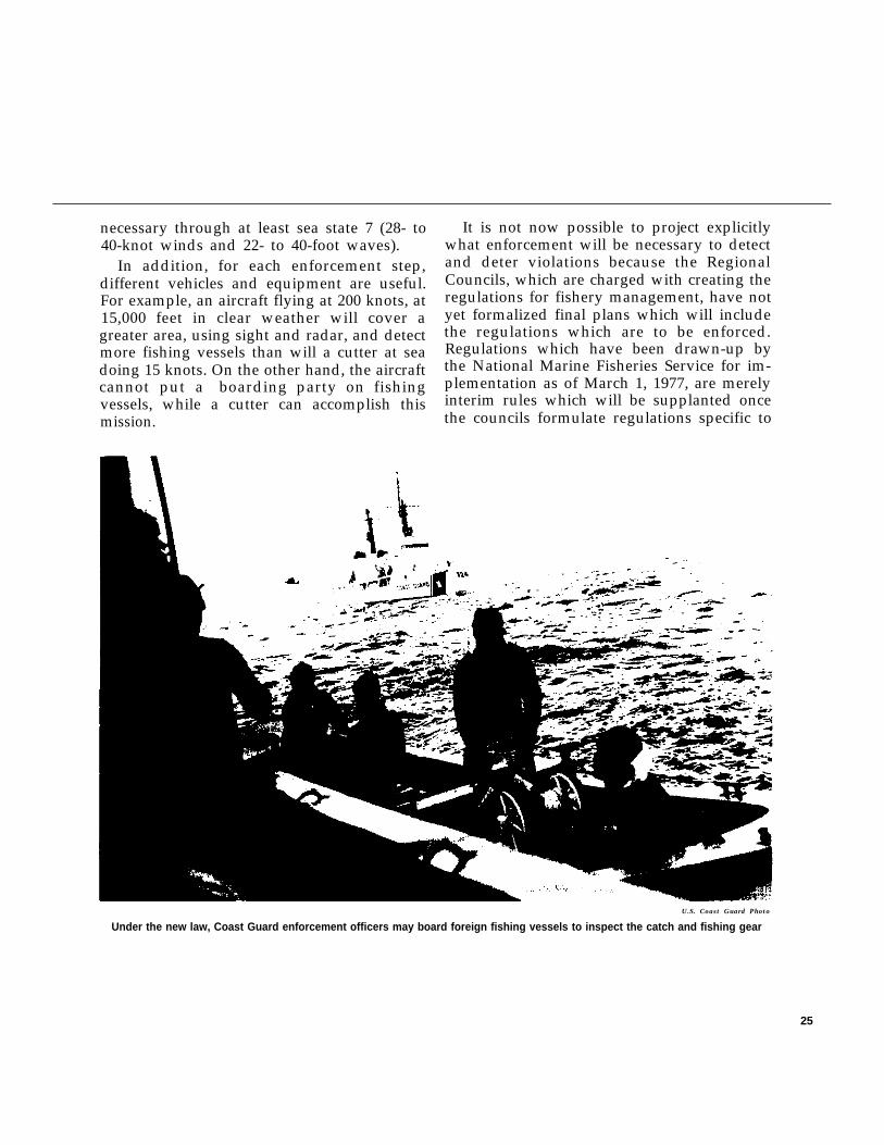
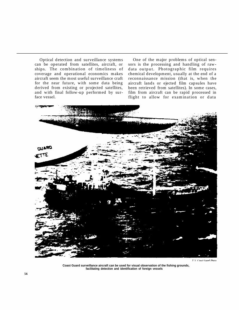
U.S. Coast Guard Photo
Under the new law, Coast Guard enforcement officers may board foreign fishing vessels to inspect the catch and fishing gear
25
their fisheries. The interim regulations are nottoo different from those contained in the in-ternational agreements which have, in thepast, been the only means of controlling fish-ing activity. The major immediate changeswill be that the United States has taken on theresponsibility for enforcement, will board andinspect foreign vessels for compliance withU.S. regulations, and will prosecute offendersitself instead of leaving that task to flag states.But as experience with the fishery zone grows,new types of regulations and enforcementtechniques will be needed and used.
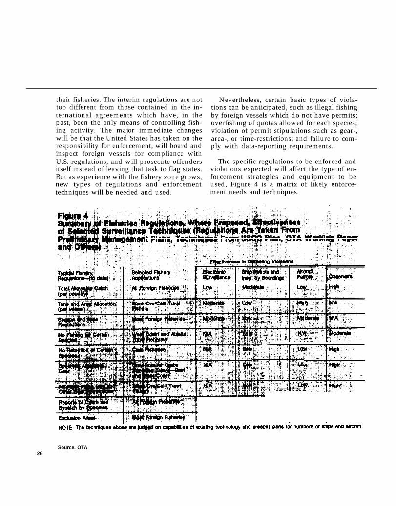
Nevertheless, certain basic types of viola-tions can be anticipated, such as illegal fishingby foreign vessels which do not have permits;overfishing of quotas allowed for each species;violation of permit stipulations such as gear-,area-, or time-restrictions; and failure to com-ply with data-reporting requirements.
The specific regulations to be enforced andviolations expected will affect the type of en-forcement strategies and equipment to beused, Figure 4 is a matrix of likely enforce-ment needs and techniques.
Source. OTA26
Level of Enforcement
Just as important in determining what en-forcement capabilities will be necessary isdetermination of the desired level of enforce-ment. In other words, should enforcementagencies mobilize to catch 50 percent of theviolators, 75 percent, or 100 percent—inwhich case the costs could prove to beastronomical. Without a quantified level ofenforcement, the allocation of enforcementresources becomes a matter of intuition ratherthan one of reasoned judgment.
Currently, the Coast Guard simulationmodel used for costing purposes indicates thatthe agency assumes it can catch or deter ap-proximately 95 percent of the 2,150 expectedannual violators within the budget appropria-tion level requested. 24 That percentage,however, does not appear to have been set asan enforcement goal based on any policy deci-sion as to what level of enforcement is desira-ble. In addition, the percentage shown may bemuch too high, depending on what types ofviolations (over quota, use of prohibited gear,fishing in closed areas) are being counted, Amiddle-ground approach is probably requiredand a specific definition of that approachwould be desirable. This should be followedby regular assessment of changing enforce-ment needs as well as the actual level of en-forcement compared to the desired level.Determination of the level of enforcementcould also be enhanced by asking RegionalCouncils to make a projection of desired en-forcement actions in their areas, possible com-pliance inducements for fisheries in theirareas, and potential domestic-enforcementplans.
A major shortcoming of the Coast Guard’sanalysis of the appropriate level of enforce-ment is the lack of an adequate method forassessing the benefits that can be expectedfrom various enforcement strategies. Sincesignificant resources may be required to oper-ate an effective enforcement system, the CoastGuard’s current inability to systematicallyestimate the expected value of enforcement isa serious flaw. However, since the determina-tion of appropriate enforcement strategies isonly one part of the broader process of fish-eries management, what is probably needed isa more general analytical system which couldprovide quantitative estimates of the impactsof alternative management techniques, includ-ing—but not limited to—the enforcementstrategies, on the catch and profits of commer-cial fishermen, the quantities and prices of fishavailable to the domestic consumer, the stateof recreational fishing, and other measures ofthe benefits of management.
One such general analytical system is cur-rently being developed for NOAA by theCenter for Technology Assessment andResource Policy at Stanford University. Thissystem is based on a generalized computersystems model which can integrate the bestavailable scientific information about any par-ticular fishery in order to assess the quantita-tive impacts of various management tech-niques on the fishery. Since even the initial ap-proach to enforcement is expected to costnearly $100 million per year, benefits shouldbe clearly identified and quantified to the ex-tent
●
●
●
useful. Some of the benefits may include:
A future increase in stocks and yields dueto tighter controls to prevent overfishing.
Less pressure on stocks caught as bycatchdue to better controls on gear and areasfished,
Less conflict among fishermen for certaingrounds and reduced gear conflict.
27
● Assurance of proper allocation of quotasamong foreign and U.S. fishermen.
An enforcement component is not presentlyplanned for the Stanford model. Such a com-ponent, which would translate various en-forcement strategies into impacts on foreignfishing activities, should be developed by theCoast Guard. The Coast Guard could then useits enforcement model in conjunction with theStanford model, or any similar one adoptedby NOAA, in order to determine the costs andbenefits of various levels or enforcement orspecific enforcement strategies.
The primary objective of the Coast Guardsimulation should be to evaluate the effective-ness and the cost of a mix of vehicles, sensors,and personnel as they enforce the regulationsapplicable to the 200-mile fishery zone.Among other factors, the model should in-clude:
● existing capabilities and possible futuresystems of sensors, vehicles, and person-nel;
● short- and long-range enforcementneeds;
● possible multipurpose use of systems andequipment by the Coast Guard for ac-complishment of several of its missions;
. likely levels of assistance from the Navy,NASA, the Air Force, and NMFS;
● relative importance of various compo-nents of enforcement, such as sur-veillance, boarding, etc.;
● the effects of various types and levels ofpenalties, such as fines and seizures;
. likely regulations of all types;
● explicit yardsticks of effectiveness, suchas percent of captured violators, amountof protection given to stocks, value offines collected, value of regulation on
foreign relations, comparability withother Coast Guard duties, etc.;
. behavior patterns of foreign anddomestic fishermen in reaction to regula-tions; and
● monetary cost of programs.
A model which does a more adequate job ofmaking cost-benefit estimates than the exist-ing Coast Guard model will be exceedinglydifficult to prepare since the efficiency of en-forcement involves intangible as well as tangi-ble costs and results. For example, how doesthe value of protecting and restoring adepleted stock compare with the value of im-proved international relations which mayresult in some specific sought-after agreementin another field? However, the model couldpresent possible scenarios, impacts, and trade-offs which may result from various levels ofenforcement or differing amounts of expend-itures.
Although the analytical models to be usedby NOAA and the Coast Guard in fisheriesmanagement and enforcement are an impor-tant tool, there is considerable feeling amongmembers of the Regional Councils and otherinterested parties that modeling techniqueshave already outstripped available data. Theresults of the OTA study also indicate that ex-isting models have already identified largeareas where there is insufficient information.Therefore, immediate emphasis should be ona program for long-term collection of consist-ent basic information. Models and modelingtechniques can be improved while this basicdata is being gathered.
28
Existing Capabilities
The existing capabilities for enforcingPublic Law 94-265 include three primarygroups, within the executive branch, whichwould or could be involved in the future:
1. The Coast Guard has the primary respon-sibility for enforcement and exercisesalmost complete jurisdiction over ac-tivities in the foreign fisheries.
2. The National Marine Fisheries Serviceshares the enforcement function with theCoast Guard by providing personnelwith scientific and biological expertise toaid in planning and carrying out enforce-ment strategies in the domestic fisheries.
3. The Department of Defense normally willhave no enforcement function at all, ex-cept in the unlikely event that foreignwarships should appear within the 200-mile zone to contest U.S. regulations. Inthat case, U.S. military forces would becalled upon under the terms of amemorandum of understanding betweenthe Coast Guard and the Department ofDefense. The memorandum and con-tingency plan for such a situation hasbeen worked out by the Joint Chiefs ofStaff and the highest levels of the CoastGuard and is classified information,
The Department of State, which has beeninvolved in enforcement of fishery agree-ments in the past because of their interna-tional nature, has been given a limited roleunder the new law.
The Department of State’s primary functionis to negotiate the Governing InternationalFisheries Agreement, by which, foreign na-
tions agree to accept the U.S. jurisdiction inthe 200-mile zone. The State Department isalso to exercise an advisory role, keeping theCoast Guard, the National Marine FisheriesService, and the Regional Councils informedon foreign policy implications of fisherymanagement.
Under the new law, as in the past, the State Department is consulted by the Coast Guardbefore any foreign fishing vessel is seized forviolation of U.S. regulations. There are un-doubtedly legitimate instances when theforeign policy or diplomatic implications ofsome action should take precedence over thefishery implications. However, the CoastGuard routinely allows the State Depart-ment’s desire to avoid unpleasant diplomaticincidents to influence enforcement actions.There appears to be no formal mechanism toassure that State Department decisions to in-tervene in a fishery action are made at an ap-propriate policy level and that the CoastGuard exercises its statutory responsiblitity tomake final enforcement decisions, with advicefrom the State Department being only one ofmany factors to be considered. There is ob-vious need for a clear and simple procedurewhich quickly leads to a decision-and reviewof that decision by the Chief Executive whennecessary--on whether or not to seize aforeign vessel which is violating U.S. law orregulations.
The following discussion of the work ofthese agencies in regard to enforcement is notintended as a specific description of theirplanned operations. Rather, it is an overviewand a critique of likely enforcement.
In its routine enforcement role, the CoastGuard provides personnel, vehicles, and sens-ing equipment. Its enforcement capabilityduring 1975 came from its fleet of 39 aircraft,39 ships, 94 helicopters, and various supportfacilities. These facilities were not dedicated
29
solely to fishery enforcement, but were usedalso for other Coast Guard duties such as in-vestigating oil spills, sea search and rescue,and general law enforcement. Approximately2,500 days of ship time and 6,000 hours ofaircraft time were devoted to enforcing fisherylaws, regulations, and treaties during 1975,about one-haIf million square miles werepatrolled, at a cost of $46 million for the year.The Coast Guard spent about 5 percent of its
total annual operational budget on fisheriesenforcement .25
The Coast Guard’s original plan for en-forcement under the new law called for in-creasing ship time by 951 days to provide2,616 patrol days inside active fishing areasand 823 patrol days in other areas; increasingaircraft time by 7,553 hours to provide 8,446hours of patrol in active fishing areas and3,068 hours of patrol in other areas.26
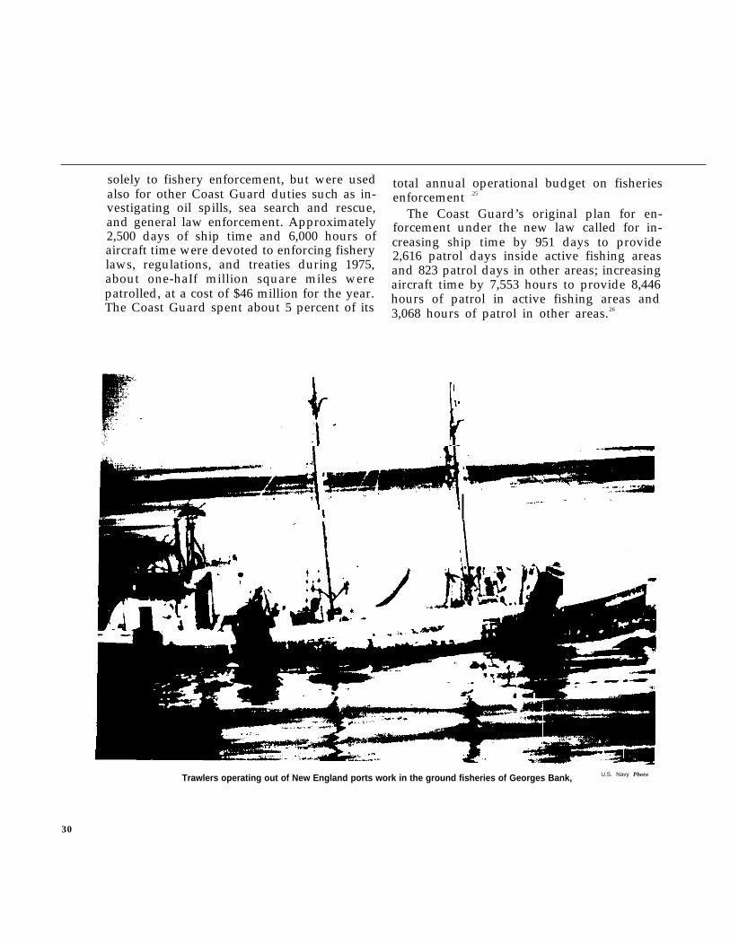
U.S. Navy PhotoTrawlers operating out of New England ports work in the ground fisheries of Georges Bank,
30
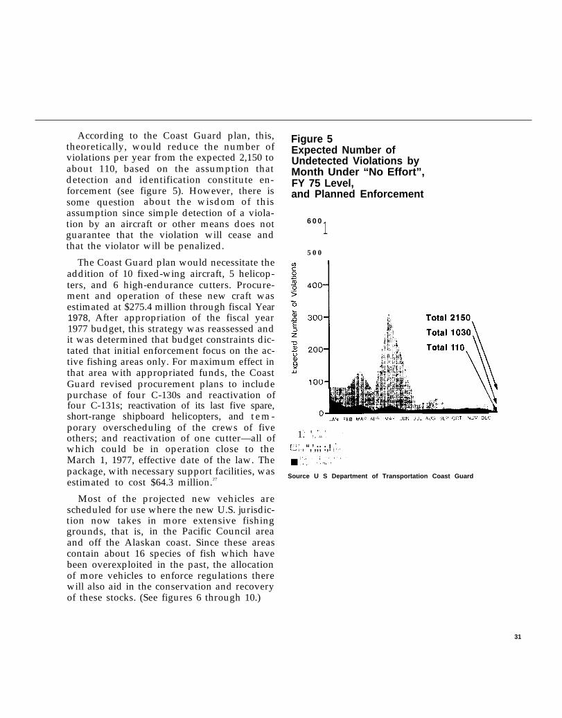
According to the Coast Guard plan, this,theoretically, would reduce the number ofviolations per year from the expected 2,150 toabout 110, based on the assumption thatdetection and identification constitute en-forcement (see figure 5). However, there issome question about the wisdom of thisassumption since simple detection of a viola-tion by an aircraft or other means does notguarantee that the violation will cease andthat the violator will be penalized.
The Coast Guard plan would necessitate theaddition of 10 fixed-wing aircraft, 5 helicop-ters, and 6 high-endurance cutters. Procure-ment and operation of these new craft wasestimated at $275.4 million through fiscal Year1978, After appropriation of the fiscal year1977 budget, this strategy was reassessed andit was determined that budget constraints dic-tated that initial enforcement focus on the ac-tive fishing areas only. For maximum effect inthat area with appropriated funds, the CoastGuard revised procurement plans to includepurchase of four C-130s and reactivation offour C-131s; reactivation of its last five spare,short-range shipboard helicopters, and tem-porary overscheduling of the crews of fiveothers; and reactivation of one cutter—all ofwhich could be in operation close to theMarch 1, 1977, effective date of the law. Thepackage, with necessary support facilities, wasestimated to cost $64.3 million.27
Most of the projected new vehicles arescheduled for use where the new U.S. jurisdic-tion now takes in more extensive fishinggrounds, that is, in the Pacific Council areaand off the Alaskan coast. Since these areascontain about 16 species of fish which havebeen overexploited in the past, the allocationof more vehicles to enforce regulations therewill also aid in the conservation and recoveryof these stocks. (See figures 6 through 10.)
Figure 5Expected Number ofUndetected Violations byMonth Under “No Effort”,FY 75 Level,and Planned Enforcement
6 0 015 0 0
‘4 t ‘!1 f t [ ! ,
[ 1. ! I , .1,1. ,
El; ;, “,’,;; :,! ,’,1 $
Source U S Department of Transportation Coast Guard
31

New England
●
✎
✎
✎
✎
✎
●
✎
✎
✎
✎
✎
✎
✎✎
✎. .. .. .. . .
“. .● . .
.
. . .. . .. .. ... .● ✎
✎ ✎✎ ✎✎☛✎ ✎
✎✎
✎ ✎ ☛ ☛✎
✎✎ ✎
✎ ✎✎
✎
✎ ✎ ✎✎
✎✎ ✎
✎ ✎
✎ ✎ ✎✎
✎ ✎ ✎ ✎ ✎✎ ✎ ✎ ✎ ✎
✎ ✎ ✎✎
✎
✎ ✎ ✎ ✎✎
✎ ✎ ✎✎
✎
✎ ✎ ✎ ✎✎
. .. .. .. .. .. .. .. .. .
. . ..... .. ..● .O . .
● ✎ ● “,● ,
. .
. ...O● ● .*. .
..
.. .
.. . . .
. . ●
✎ ✎ ✎
✎ ✎ ✎
✌ ✎ ✎
✎ ✎✎
✎✎
✎✎ ✎
✎✎ ✎
✎✎ ✎
✎✎ ✎
✎ ✎ ✎ ✎ ●✎ ✎
✎✎ ✌
✎
✎ ✎
✎ ✎✎ ✎
✎ ✎ ✎
.. .. .. .. . .*. . “. .. . .
.
●✌✎☛
✎
● ✎☛ “ .
. . . . . . ..
. . .●
. . ..
..
. . . . . . ..
..
.. ..*. ● .*. .
....● ✎ ✎
. . . .. . . .. . . .. . . . . . .● ✎ ✎ ✎ “.*. .
● . . . . . .
..........
.. .
. . . * ”
.. . .
. . . . . . ““” ” ” . . . . . . . . . . . .. . . . . .
. . . . . . . . . . . . . .. ..”. .. .. ● . ... .“. .. ..”
. ..
0 80& , .Miles
,
Source: U.S. Department of Transportation, Coast Guard
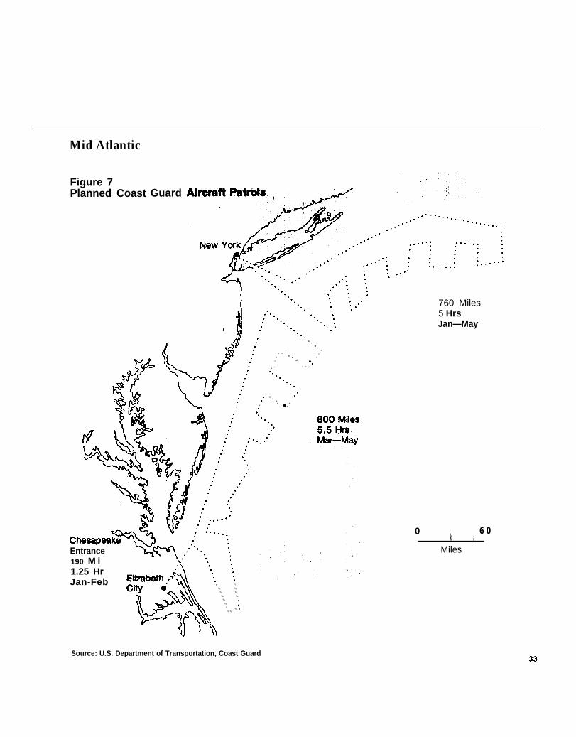
Mid Atlantic
Figure 7Planned Coast Guard
. .
“ .“ . .
. . . .. “ . .
. “. ●. . . .“.
..“ .. . ‘. .. . ● .
.
Entrance190 M i1.25 HrJan-Feb
....●
✎
✎ ✎
✎ ✎
✎ ✎
✎ ✎
✎ ✎
✎✎ ✎
✎ ✎
... .‘ .....
.
760 Miles5 HrsJan—May
o 6 0k a
Miles
Source: U.S. Department of Transportation, Coast Guard

Gulf of Mexico
\
Source: U.S. Department of Transportation, Coast Guard34
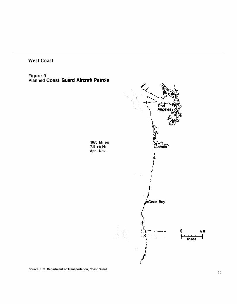
West Coast
Figure 9Pianned Coast
1070 Miles7.5 Flt HrApr—Nov
0 6 0
Source: U.S. Department of Transportation, Coast Guard
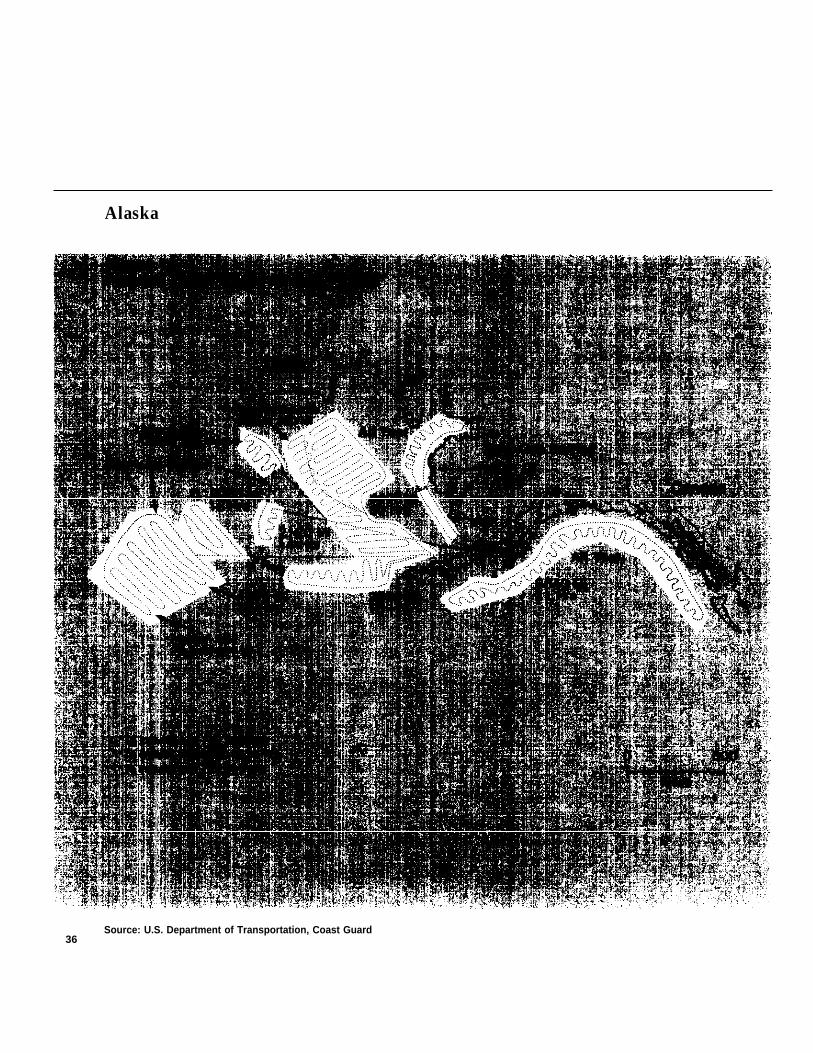
Alaska
Source: U.S. Department of Transportation, Coast Guard36
On the other hand, there are also manyspecies in danger in the east coast and gulffisheries. Three new aircraft have beenassigned to the New England area and one tothe Gulf of Mexico, but it seems reasonablethat additional vehicles may be desirable onthe east coast in the future even though fish-ery areas there are concentrated and notgreatly increased by the move to the 200-milejurisdiction.
As outlined by the Coast Guard, theplanned enforcement strategy of increasingpresent capabilities is a reasonable first step. Itis flexible in that enforcement resources willbe added over a period of time and at amoderate first cost. As experience is gained,additional resources can be curtailed or ac-celerated if original assumptions do not proveout.
The Coast Guard enforcement strategy is,however, limited to preventing violations byforeign fishermen. Presently, there is no plan-ning within the Coast Guard to deal withpossible at-sea violations of the domestic fish-ery regulations. Only two domestic manage-ment plans have been drawn-up so far, butother plans will be a major order-of-businessfacing the Regional Councils in the future.
In the past, enforcement in the domesticfishery has been carried out by NMFS fromshore, where officials observe offloading,weigh and inspect fish, and identify bycatch.NMFS will continue its enforcement ofdomestic fisheries from shore under the newlaw. If this dockside effort were to be com-bined with a program of boarding domesticvessels for inspections, it would probably besufficient in most situations.
However, if regulations for domestic fish-eries duplicate many of the gear and opera-tional controls used in foreign regulations,some at-sea capability will be needed.
In the event an at-sea capability is neededfor enforcement in domestic fisheries, theCoast Guard could use the same types ofequipment and techniques planned for foreignfisheries, but would need additional facilitiesin order to cover the different areas used bydomestic fishermen and the many additionalfishing vessels of a greater variety of sizes andtypes.
Available information indicates that about7,000 domestic vessels may spend most oftheir fishing time in the 3- to 200-mile zone.28
Although the domestic vessels catch far lessthan the foreign vessels, domestic fisheries en-forcement—in terms of fishing units to bedealt with—is on a larger scale than foreignenforcement. The cost of any deterrencegained by domestic enforcement will also behigher than for foreign enforcement.
The Coast Guard has rightly given prioritystatus to planning for enforcement in foreignfisheries. However, this OTA assessment indi-cates that at-sea enforcement will also benecessary in domestic fisheries in the nearfuture and planning for such a job should bestarted as soon as possible.” This will be a par-ticularly sensitive enforcement job becausefishermen, a politically powerful group, havetraditionally enjoyed a great deal of freedomin how they conduct their activities.
37
Other Possibilities forNear-Term Enforcement
The OTA study of enforcement strategiesseems to indicate that several fairly simpletechniques which could be activated almostimmediately have not been given favorableconsideration by the Coast Guard or the Na-tional Marine Fisheries Service.
Among these are:
1)
2)
3)
the establishment of an efficient report-ing system which would allow domesticfishermen to aid in observing foreignfishing vessels,
extensive use of observers onboardforeign fishing vessels, and
formulation of specific guidelines to befollowed in granting annual permitsand renewing the Governing Interna-tional Fisheries Agreements.
The lesser of these strategies is the reportingsystem, which could be simply a well-definedand published procedure, which domesticfishermen could follow in notifying the CoastGuard by radio with information on the loca-tion of foreign vessels or on suspected viola-tions of fisheries regulations.
The Coast Guard is not now planning areporting system because of concern that itwill increase the number of bogus complaintsof violations and tax the already limited man-power and facilities of Coast Guard in thearea. The Coast Guard argues that if fishermensuspect serious violations, they will-andalready do—report these to the nearest CoastGuard facility,
Extensive use of a reporting system may notbe likely because many domestic fishermenmaintain radio silence in order to protect thelocation of their fishing areas. Still, it is likelythat the lack of formal procedures for report-ing may, in the future, cause the same kind ofgap in coverage that was demonstrated whenfishermen testified to congressional commit-tees that some recent oil spills might havebeen prevented if fisherman had some systemfor reporting on the location of foreigntankers which are sited outside of establishedtraffic lanes.29
Another minor improvement in enforce-ment could probably be gained by formulat-ing a detailed list of specific criteria which willbe taken into account in renewal of theGoverning International Fisheries Agree-ments (GIFAs) with foreign governments andin annually granting fishery permits to thevessels.
The National Marine and Fisheries Serviceis now drafting civil procedure regulationswhich outline the sanctions, such as permitrevocation, suspension, or modification,which may be used against violators or
38
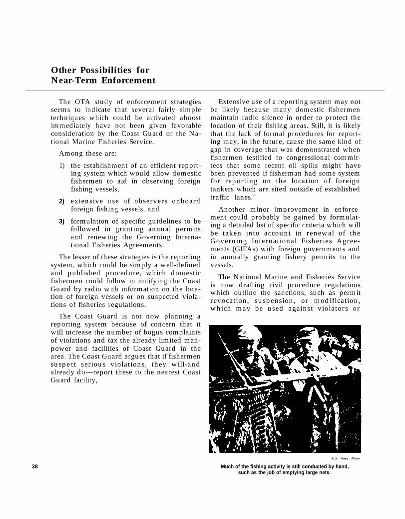
U.S. Navy Photo
Much of the fishing activity is still conducted by hand,such as the job of emptying large nets.
against those countries which have not paidfines and assessments. However, these pro-cedures are not expected to include specificnumbers or types of violations which wouldmandate nonrenewal of GIFAs or nonissuanceof permits.
The Coast Guard has indicated that record-ing violations on the permits of individualfishing vessels may constitute one of the mostpotent regulatory tools available.30 A systemwhich works much like the points systemused in revocation of drivers licenses and set-ting insurance rates is probably worth in-vestigating in connection with fisheries per-mits. Such a system could be used initially inforeign fisheries, but would be equally usefulin the domestic fisheries should some form oflimited entry be adopted.
Under the law, GIFAs are negotiated by theState Department. However, the State Depart-ment has been given no regulatory functions.Therefore, the law may have to be amended inorder to charge the State Department withpreparing such guidelines for its negotiationsor these guidelines could be prepared byNMFS along with guidelines to be consideredin granting permits. Without these specificguidelines as to what violations constitutegrounds for nonissuance of permits or GIFAs,it is likely that uneven and inefficient use ofthis potential tool will result.
It appears that the second strategy, the ex-tensive use of observers onboard foreign fish-ing vessels, could be vital to the success of en-forcement in the 200-mile zone.
Current plans call for placing observers on-board 10 to 20 percent of the foreign vesselsgranted permits to fish in U.S. waters. Theseobservers will be NMFS personnel who willhave no enforcement duties. They will beassigned randomly to vessels of foreign na-tions which in the past have been suspected ofgiving NMFS incomplete or inaccurate reportson their fishing activity.
!1- 172 ( I - 77 - J
The present plan is to place about 20 observ-ers on vessels in the Georges Bank area of theNortheast fisheries and slightly fewer in theNorthwest fisheries, primarily Alaska. TheNational Marine and Fisheries Service hasestimated the annual cost of the program atapproximately $750,000, The cost per ship,with an observer onboard, may be as high as$15,00031 for a cruise of several weeks. Underthe terms of Public Law 94-265, which re-quires that foreign fishing vessels payreasonable fees to compensate the UnitedStates for expenses incurred in the course offishery conservation, management, research,administration, and enforcement, costs for ob-servers will be billed to the individual shipcarrying the observers. 32
The cost will probably make little differenceto vessels from countries which subsidizetheir fishermen, However, such a charge maynot be taken lightly by fishermen who are in-dependent operators. Since the vessels to carryobservers will be chosen randomly within anyparticular country, levying the charge againstthe individual vessels may strain relations be-tween foreign fishermen and the observerwho must live onboard their vessel for ex-tended lengths of time and make it much moredifficult for the observer to gather accuratedata. In the interests of easing this relation-ship, OTA suggests that charges for observersbe spread evenly among all the ships in thefishing fleet of a particular nation. The law re-quires that the fee schedule which sets outcharges to foreign fishermen be determined bythe Secretary of Commerce in consultationwith the Secretary of State.ss Therefore, arevised billing procedure for observer costscould be recommended to Commerce by Statebased on its negotiations with foreign nations.
39
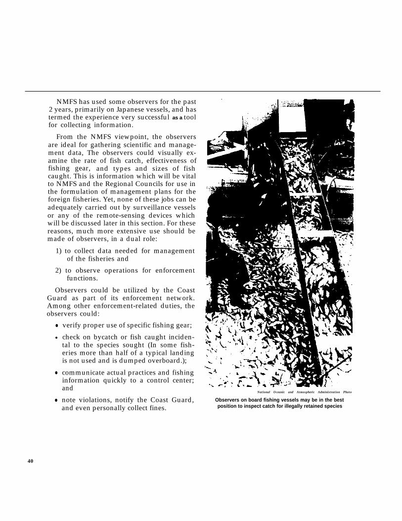
NMFS has used some observers for the past2 years, primarily on Japanese vessels, and hastermed the experience very successful as a toolfor collecting information.
From the NMFS viewpoint, the observersare ideal for gathering scientific and manage-ment data, The observers could visually ex-amine the rate of fish catch, effectiveness offishing gear, and types and sizes of fishcaught. This is information which will be vitalto NMFS and the Regional Councils for use inthe formulation of management plans for theforeign fisheries. Yet, none of these jobs can beadequately carried out by surveillance vesselsor any of the remote-sensing devices whichwill be discussed later in this section. For thesereasons, much more extensive use should bemade of observers, in a dual role:
1) to collect data needed for managementof the fisheries and
2) to observe operations for enforcementfunctions.
Observers could be utilized by the CoastGuard as part of its enforcement network.Among other enforcement-related duties, theobservers could:
●
●
●
●
verify proper use of specific fishing gear;
check on bycatch or fish caught inciden-tal to the species sought (In some fish-eries more than half of a typical landingis not used and is dumped overboard.);
communicate actual practices and fishinginformation quickly to a control center;and
note violations, notify the Coast Guard,and even personally collect fines.
National Oceanic and Atmospheric Administration Photo
Observers on board fishing vessels may be in the bestposition to inspect catch for illegally retained species
40
The Coast Guard has stressed the need foreasily enforceable regulations as an importantfactor in successful enforcement. Aimingtoward that goal, the Coast Guard favors aNMFS proposal to reduce most regulations tolimitations on the amount of effort expendedfishing or the number of days spent in a cer-tain area. Such limitations are next tomeaningless, however, because there is no de-pendable equation for measuring catch ratesbased on vessel time in an area. Past data usedin such calculations haven’t been verified. Inaddition, new technology and improvementsin fishing techniques make any equation sub-ject to constant change. Shipboard observerswould be in the best position to provideanalysis of the relationships between vesseltime, fishing effort, and catch rate.
Foreign fishermen will realize that fromtheir view the observer is primarily a police-man. The potential penalties for violationsnoted by the observer could be high, but thevalue of an illegal catch may be even higher.Therefore, foreign fishermen may attempt tobribe, harm, or deceive the observers, frustrat-ing their scientific and enforcement functions.
Present thinking at the Coast Guard is thatsuch drawbacks exceed the enforcement valueof onboard observers although the observerswould be very useful for collecting scientificand management data for NMFS.34
OTA research suggests otherwise: a near-blanket program of mandatory shipboard ob-servers may be the simplest way to obtain thedetailed information about fishing activitiesand response to fisheries regulations whichwill be necessary in developing a dependable,cost-effective enforcement program.
Councils the option of charging a fee for il-legal bycatch. Some council members feel thatsuch a fee, based on actual bycatch figuresprovided by observers, would be more suc-cessful than gear restrictions in reducing theactual amount of bycatch because it wouldforce fishermen to find their own means of notcatching fish which cut into their profit. 35
The observer program is an area in whichthere are a wide range of opinions among themany parties interested in enforcement offisheries regulations. However, the limited useof observers to date provides no basis forresolving these differences. A pilot projectwould offer actual experience on which toevaluate the costin a combinedgathering role.
and usefulness of observersenforcement - information
In addition, the Federal Government’sfailure to implement an extensive observerprogram will remove from the Regional
41
Recommended Pilot Project
The Office of Technology Assessment’sanalysis suggests that much could be learnedfrom a pilot project in which a foreign fisheryis nearly blanketed with shipboard observerswho have both management and enforcementduties,
The New England region would be mostsuitable for such a pilot project for the follow-ing reasons:
they should be Coast Guard personnel, in-stead of NMFS personnel. However, theyshould receive some training from NMFS inobserving, collecting, and reporting informa-tion of value. Some familiarity with the nationon whose vessel the observer serves wouldalso be helpful.
Based on NMFS estimates for their limited-observer program, the cost of a 100-man pilotprogram would be roughly $2 million plusfunds for an accurate evaluation of the pilot.36
●
●
●
●
●
The fishing grounds are concentrated Under the law, this cost is passed on to theand foreign fishing practices are well foreign vessels. However, other fees andknown. charges are also levied, under the law, to reim -
Many of the foreign vessels fish in burse the United States for management and
groups which could simplify the ar- enforcement activities in the 200-mile zone.Since the observer program would presuma-rangement of vessels with observers bly make some other expenditures covered byand control vessels without observers. these levies unnecessary, the gross tonnage-
The stocks in that region are generally fee or tax on ex-vessel valdepleted and information for use in be reduced accordingly.restoring stocks is badly needed.
Questions about bycatch are most sig-nificant in the area.
There are important problems withgear restrictions and gear conflicts inthe area.
About 150 foreign vessels, on the average,have traditionally fished within the 200-milezone off New England. At this writing, thenumber of permit applications which hadbeen received suggested that this number willprobably go down because of the 1977 catchallocations. Therefore, it appears that a total ofabout 100 shipboard observers would besuitable for the pilot project. These observersshould be selected on the basis of experiencein fishing practice and knowledge of fisherymatters. If they are given enforcement duties,
ue of the catch could
42
Possibilities for Long-Range Enforcement
It is likely that the proposed near-term en-forcement capabilities described earlier willnot be adequate for long-range demands. Fac-tors like the following may contribute to theneed for more sophisticated enforcementtools:
●
●
●
●
●
Individual Regional Fishery ManagementCouncils are likely to develop someunique regulations which demand moreknowledge of vessel locations;
Developments in technology may resultin more efficient and effective equipment,for instance, land-based electronicssystems could supplant some aircraftflights;
There may be pressures for increasedforeign fishing off our shores, such thatthe value of illegal fish could exceed thecost of being apprehended;
Scientific data might reveal a greaterdanger to fishery resources than is pres-ently realized or danger to resources innew areas not now covered;
The costs of traditional enforcement maygrow to a level that could not be easilyjustified in terms of resources conserved.
Such factors as these lead to the conclusionthat plans should be made for further im-provements in enforcement capabilities by useof remote-sensing devices and other advancedtechnology.
It is probably in the national interest to ac-tively plan and pursue interagency use ofsome of these new technologies, especiallythose in which there already has been signifi-cant investment in development. However, itis unlikely that military agencies which nowhave such advanced technology will volunteeror be receptive to suggestions that they sharetheir capabilities for use in enforcing fisheryregulations.
In addition to the fact that such equipmentis dedicated to military application and report-edly already heavily used, it would be neces-sary to develop a fas t and ef f ic ientclearinghouse for processing and distributinginformation from the sensors before joint useof sensing equipment would be possible. Themilitary has already developed specializedsystems for correlating information frommany sensors; however, these systems arecrowded and translation of fisheries datawould receive low-priority treatment.
It may be desirable to pursue the develop-ment of new facilities which could receivedata from many sources, including suchgroups as the military, Bureau of Customs,NMFS, Coast Guard, and State and Federallaw enforcement networks. This facility couldcorrelate data, protecting classified or priv-ileged information if necessary, and displayall maritime activity, including that of fishingvessels37 (see figure 11).
Such a data correlation and display centerfor coverage of the complete fishing zonewould be costly, but it could also provide in-formation on oil tankers, commercial cargocarriers, surveillance for search and rescuemissions, and other similar activities. TheOffice of Technology Assessment’s WorkingPaper No. 5, which discusses such a facility,estimates the initial set-up cost at $1.5 millionfor a correlation facility to receive the infor-mation. Computer time would cost at least$14,000 a month for operation of the facility.Expense to the Coast Guard for installation ofhardware compatible with the correlationfacility and operation of Coast Guard func-tions would be an additional cost which hasnot been determined.
Recommended Pilot Project
OTA proposes a pilot program utilizing oneof the existing military systems for the collec-
43
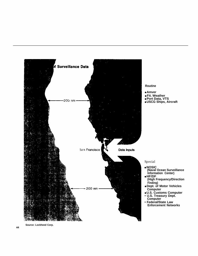
San
Routine
● Amver● Fit. Weather● Port Data, VTS● USCG Ships, Aircraft
Special
● NOSIC(Naval Ocean SurveillanceInformation Center)
● HF/DF(High Frequency/DirectionFinding)
● Dept. of Motor VehiclesComputer
● U.S. Customs Computer• U.S. Treasury Dept.
Computer• Federal/State Law
Enforcement Networks
Source: Lockheed Corp.44
New Technologies
tion and transfer of available surveillance datafor one specific region. Some precedent forsuch a project already exists at the NavalOcean Surveillance Information Center wherethe Coast Guard has recently detailed oneofficer to work on data which are of interest tothe Coast Guard and have not, in the past,been processed by Navy personnel.38
The Office of Technology Assessment hasnot investigated the feasibility of using aspecific system in any region, but it appearsthat the Navy’s west coast network could be alikely pilot region. Any pilot project shouldbegin with an indepth investigation of theNavy’s existing system and its ability to pro-vide information needed for fisheries enforce-ment.
Some funding would be necessary to addpersonnel who would coordinate the transferof fisheries-related data from the Navy to theCoast Guard district in charge of fisheries en-forcement in that zone.
After a period of operation, the pilot projectshould be evaluated with special attention todetermining the completeness of coverageprovided, the cost, the timeliness and useful-ness of data provided, and a comparison ofthis method with other methods of sur-veillance.
On one hand, there may be difficulties inworking with and protecting classified infor-mation and there may be a danger that this ex-tra task might not receive adequate attentionin a facility oriented to an existing militarymission. However, such an information-shar-ing program could ultimately cut costs sub-stantially by reducing duplication of effortand facilities. It could also provide cooperativeexperience which might lead to sharing ofother services and resources needed for en-forcement and the opportunity to evaluatenew technology which may be of use in fish-eries enforcement.
Use of new technology, particularlyremote-sensing devices, may make it possibleto improve enforcement of fisheries regula-tions in the future by better coverage, betterperformance, and a reduction of the need forexpanding conventional ship and aircraftpatrols. Although it may be possible forseveral agencies (such as the Coast Guard, themilitary, and NASA) to share the cost of newremote-sensing devices, these systems are ex-tremely expensive and their use should bethoroughly evaluated before any one systemis adopted. Any analysis of benefits and costsof remote-sensing systems should not ignorethe argument that national security could becompromised by making some of thesesystems available for other than military mis-sions. Most of the security risks and financialcosts of remote-sensing systems could be con-sidered now; however, a clear analysis of thebenefits or improvements that could resultfrom the use of such new technology is notpossible until overall strategies of enforce-ment and specific regulations are defined.When these strategies and regulations havebeen drawn up, it will be desirable to preparea long-range plan; for example, a 5- to 10-yearplan that would include specific analysis ofthe introduction of new technologies andtechniques into enforcement plans.
The Coast Guard is presently in the processof formulating a research and developmentprogram for future enforcement of fisherieslaws.39 Such a program could make good useof an improved version of the existing com-puter model or a new model such as the onesuggested in an earlier section for joint prepa-ration by NOAA and the Coast Guard. Theresearch program is expected to include plansfor studying hardware and procedures for im-proving monitoring and surveillance, com-munications, data integration and analysis,and general operations.
45
At present, the research and developmentprogram is directed toward bringing new en-forcement technology into use in 10 years ormore. It could be possible, however, to ac-celerate the applied development of new tech-nology for which most of the research hasalready been completed by others so that itcould meet some Coast Guard needs in about5 years.
Because the budget for fisheries enforce-ment is only a small part of the overall CoastGuard budget (about $50 million out of $1.2billion), the agency has determined thatresearch funds in support of such enforcementcan best be spent for technology transfer andfor additions to related research contracts inother agencies.40
The Coast Guard is also following develop-ments in the Department of Defense wheremuch of the work on technology which maybe applicable to long-term fisheries enforce-ment is classified.
If conservation and management of the 200-mile fisheries zone is judged to have value tothe United States beyond the present mone-tary value of fisheries-related products andemployment, support for increased researchat the Coast Guard level may be warranted.Further research should include determina-tion of the best methods of utilizing classifiedsystems for other than defense purposes.
It appears that a pilot project for coopera-tion and joint research could bring togetherthe Coast Guard, DOD, and NASA to developnew systems and find efficient ways of usingtechnology in a multimission context. Such apilot project could include joint preparation oflong-range plans for determining the most ap-propriate research and development strategyfor new technologies, identifying the needs ofall potential users of such technology, andanalyzing the costs and benefits of developingand utilizing new technology, especiallyremote-sensing devices.
46
Remote-Sensing Devices
Since it appears that remote sensing will bean important enforcement tool as fisheriesmanagement develops, OTA commissioned astudy of the technology of such systems. Thefollowing is a brief summary of the OTAstudy of remote-sensing devices and findingsrelative to the remote-sensing techniqueswhich were analyzed for potential usefulnessin fisheries enforcement. Figure 12 comparesthe various techniques for usefulness and cost.
Of the seven devices studied, microwaveradar appears to have the best potential foruse in fisheries enforcement. High-frequency,over-the-horizon radar was also judged tohave good potential, but is not as highlydeveloped for commercial application asmicrowave radar. Other remote-sensingsystems in this group appear to have onlylimited fisheries application at this time.
Because of the sensitive nature of much ofthe remote-sensing technology, OTA has alsoprepared a separate classified document onthese systems.
By definition, remote sensing includes anymethod of obtaining information about an ob-ject from a distance without any physical con-nection to the object. It must be rememberedthat remote sensing is a detection and iden-tification tool only; it is not useful in ap-prehension.
For purposes of this study, research person-nel with broad knowledge and experience inremote sensing have analyzed potential tech-niques for use in fishery enforcement andhave determined that some of these tech-niques can be applied to fishery enforcementwithout resorting to the kind of high-priority,high-cost research and development used indefense and space exploration programs.
Based on past experience and based onNavy and Coast Guard ocean surveillancefunctions, it is likely that a combination ofsensors may be required to maintain an ade-quate picture of activity. When properly cor-related and analyzed, information fromvisual, radio, and radar sensors can provide apicture that is much more complete and ofgreater validity than could be provided by anyone or a few sensor systems. Ultimately, theproblems of patrolling a 200-mile fishing zonemay require the acquisition, correlation, andanalysis of multisensory data.
The Department of Defense is the principaldeveloper and user of most of the remote-sensing technology which may be applicableto the fisheries enforcement problem. To alesser extent, the National Aeronautics andSpace Administration and the Federal Avia-tion Administration are also developers andusers of new sensing technology. The CoastGuard is now working with these other agen-cies to determine what technologies would besuitable and how they could be utilized infisheries enforcement.
Transponders
A transponder is an active beacon whichcan be used in conjunction with radar or otherelectronic transmission system to enhance thedetection and location of foreign fishingvessels. The transponder transmits energy onthe same frequency as the radar signal, but at alevel several times higher than that whichwould result from unaided reflection of thesignal.
Some transponders can be hooked intoLoran–C receivers. Loran–C is a navigationalaid by which the location of a vessel isautomatically pinpointed by triangulation,
using continuous signals from two shorebasedstations at known locations. After the locationis identified by Loran–C, the information ispassed to the transponder which retransmitsit, along with the vessel’s identification, to acontrol station. These systems have goodfuture potential for use in fisheries enforce-ment as an extension of patrols by cutters andaircraft.
Transponders can be built that emit a stand-ard, preset signal or that respond to interroga-tion by a remote-sensing device by transmit-ting a wide variety of identification and fish-ing status information. The sophistication oftransponders is limited primarily by cost con-siderations. However, the state-of-the-art intransponders is advancing rapidly, d u elargely to advances in digital storage andprocessing technology, so that improved per-formance at lower cost is possible in thefuture. From a fisheries enforcement stand-point, the major drawback of most transpon-ders is that cooperation on the part of thevessel fitted with the transponder is required.A transponder that simply enhances detectionor supplies a preprogrammed identification andlocation signal can operate independently onany input from the target, but to supply addi-tional information such as fishing status orcatch data the vessel must provide the infor-mation to be transmitted. Guaranteeing thatsuch input would be provided or that inputwould be accurate could prove to be a seriousproblem, In addition, since such transponderscould only be placed aboard vessels whichhad permits to fish, they would do nothing inidentifying vessels which had illegally enteredan area without permit status.
It has been suggested that in lieu of requir-ing transponders on foreign fishing vessels,such devices could be supplied to domesticfishing craft to emit a signal that would im-mediately identify them as ships with whichthe enforcement agency need not be con-cerned.
47
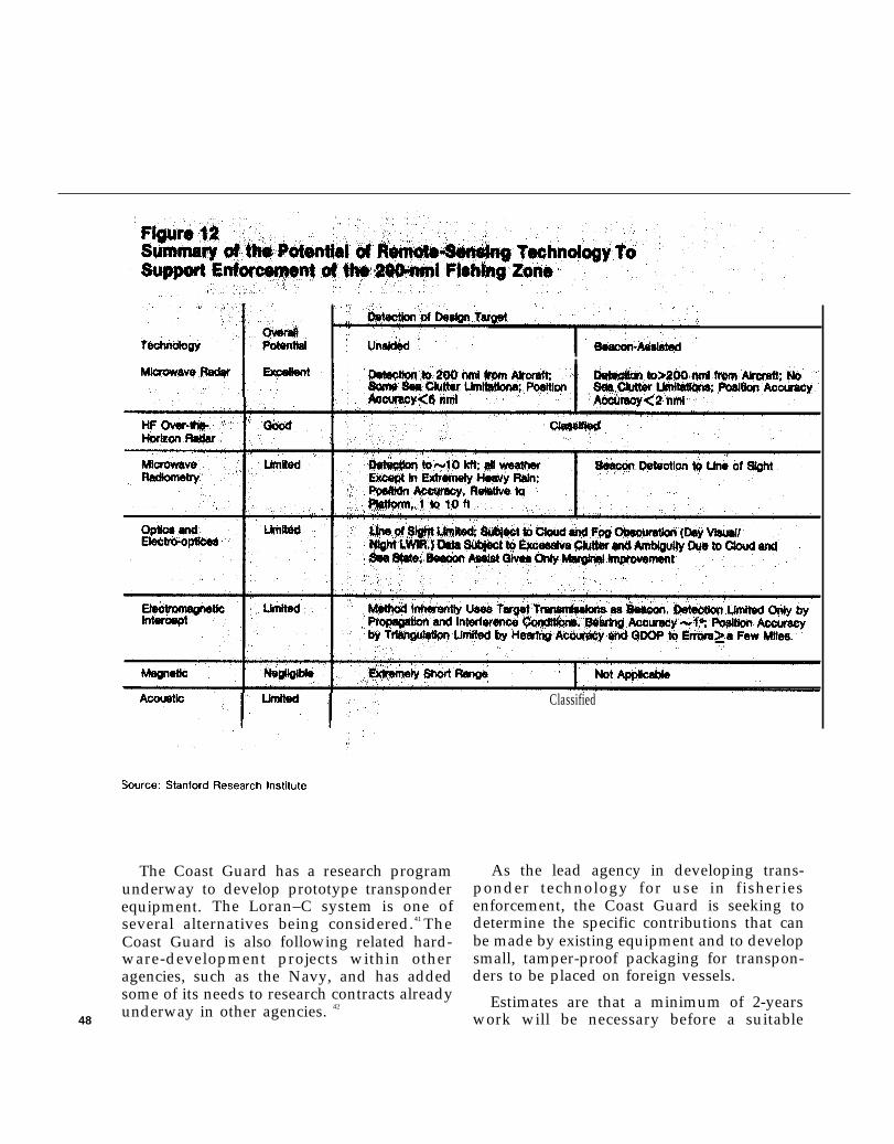
—
The Coast Guard has a research programunderway to develop prototype transponderequipment. The Loran–C system is one ofseveral alternatives being considered.41 TheCoast Guard is also following related hard-ware-development projects within otheragencies, such as the Navy, and has addedsome of its needs to research contracts already
48underway in other agencies. 42
Classified
As the lead agency in developing trans-ponder technology for use in fisheriesenforcement, the Coast Guard is seeking todetermine the specific contributions that canbe made by existing equipment and to developsmall, tamper-proof packaging for transpon-ders to be placed on foreign vessels.
Estimates are that a minimum of 2-yearswork will be necessary before a suitable

Figure 12 (continued)Summary of the Potentiai of Remote-sensing Technology ToSupport Enforcement of the 200 nmi Fishing Zone
Classification Capability
FishingVessel?
BeaconRequired
ForeignFishing Vessel’
Coded BeaconRequired
Beacon Coded BeaconRequired Required
Beacon Coded BeaconRequired Required
1
Good;Requires low-to Medium-AltitudeApproach
Limited;RequiresTargetCooperation
No Capability
BeaconRequired
Fair; RequiresVery Low-AltitudeApproach
Limited;RequiresTargetCooperation
No Capability
Coded BeaconRequired
I IFishing? I Permit? I Catch?
Cooperative Transponder Required
Cooperative Transponder Required
No Capability No Capability No Capability
I I
Good, with Cooperative Fair, if CatchDirect Tele- Transponder Visible onPhoto Required DeckInspection
Cooperative Transmission Required
No Capability No Capability No Capability
Cooperative Transmission Required
Rough Cost Estimates ($ thousands)
IInitial
IYearly Operating
250-500 Per Principality AircraftAircraft* Operating Costs
(1 ,000-1,600 per A/C)
48,000 forI
1,800 for CompleteComplete Coverage* Coverage
100-200 Per 10% of AircraftAircraft* Operating Costs
10-500 Per Aircraft 10% of AircraftOperating Costs
125 Per Station 110 Per Station
N/A N/A
Classified Classified
● NOTE: Beacons or transponders on each fishing vessel would be in addition to the above and cost $500 to $2,500 per vessel.
S o u r c e : O T A
system can be put onboard foreign vessels andthat as much- as 7 years may be requiredbefore an ideal system with the best long-termapplication is devised.43
Recommended Pilot Program. —The Office ofTechnology Assessment suggests early imple-mentation of a pilot program utilizing trans-ponders in two specific regions—the BeringSea off the coast of Alaska and Georges Bank
off the New England coast. Since each of theseareas is a traditional fishing ground, but withvery different prevailing conditions, theusefulness of transponders could be evaluatedfor a broad range of applications by this pilotprogram.
The pilot programs would require thedesign and manufacture of Loran–C trans-ponder equipment specifically for this pur- 49
pose. The Loran–C network is now plannedor in operation in the regions proposed. Alicensing arrangement and installation tech-nique for fitting transponders on each foreignfishing vessel entitled to fish in the regionwould need to be devised, Control stationsand receivers on patrol ships or aircraft wouldneed to be installed.
It is estimated that the transponder whichwould go onboard each foreign vessel wouldcost less than $2,500. Once the system wereinstalled, operational costs would be roughlyequivalent to the operational cost of theaircraft carrying each control station, $1million to $1.6 million annually. Funds forevaluating the pilot project would be in addi-tion to these costs.
The Georges Bank pilot program would re-quire about 150 transponder units and a con-trol station most likely at a Coast Guard shorebase in New England. Each vessel entering the200-mile zone at Georges Bank for fishingwould be required to activate its transponderwhich would automatically transmit iden-tification and location to the shore base. Theshore base would keep plots of all foreignfishing activity on the banks and give this topatrol craft. Regular patrols of the regionwould use this information to check on anyfishing activity that wasn’t reported by thissystem. At the end of one season, an evalua-tion of the usefulness of this system could bemade.
In the Bering Sea region a similar networkof transponders could be required aboardforeign fishing vessels, In this region it may bedesirable to combine the transponder networkwith microwave radar systems already usedaboard Coast Guard patrol aircraft and receiv-ing stations. In this way a specific region couldbe covered by regular overflight, all vessels
operating in the region located by radar, eachvessel interrogated to determine whether anapproved transponder is aboard stating IDand location, and any vessels without trans-ponders investigated.44 There are several ad-vantages to a system thus described, especiallyin Alaska where long distances and large areascan best be covered by aircraft and where fre-quent cloud cover makes visual observationdifficult or impossible. After a season ofoperations with such a system a comparativeevaluation of its usefulness would determinewhether it could be beneficial to expand use orcoverage.
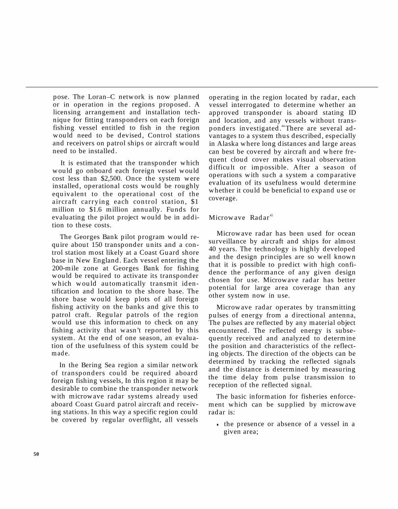
Microwave Radar45
Microwave radar has been used for oceansurveillance by aircraft and ships for almost40 years. The technology is highly developedand the design principles are so well knownthat it is possible to predict with high confi-dence the performance of any given designchosen for use. Microwave radar has betterpotential for large area coverage than anyother system now in use.
Microwave radar operates by transmittingpulses of energy from a directional antenna,The pulses are reflected by any material objectencountered. The reflected energy is subse-quently received and analyzed to determinethe position and characteristics of the reflect-ing objects. The direction of the objects can bedetermined by tracking the reflected signalsand the distance is determined by measuringthe time delay from pulse transmission toreception of the reflected signal.
The basic information for fisheries enforce-ment which can be supplied by microwaveradar is:
● the presence or absence of a vessel in agiven area;
50
● the position of a detected ship at a givenpoint in time;
● course and speed of a vessel when aseries of position updates are available;and
● estimates of gross shape and size.
However, microwave radar by itself hasalmost no potential to classify vessels by type,nationality, or operation. Some classificationmay be possible by continuous tracking toestablish movement patterns, but microwaveradar’s primary contribution to classificationis in guiding patrol ships or aircraft to a posi-tion where identification can be made byvisual means. Detection of fishing vessels byradar is enhanced, and identification andclassification made possible, by adding trans-ponders onboard permitted foreign fishingvessels.
Any modern commercial or military ship-board radar can easily detect fishing boats at adistance of up to 12- to 18-nautical miles(nmi), Existing ground-based, surface-searchradars, such as the sea surveillance radarsdeveloped for the Pacific Missile Test Centerby the Navy Electronics Laboratory Center,can detect fishing vessels at a distance of up to40 nmi from the land base. These systems arealready in use by the Coast Guard which hassome of the best available equipment.
The opportunities for improving the use ofmicrowave radar lay in the use of more ad-vanced radar systems from aircraft orsatellites and the addition of transponders on-board fishing vessels in order to exploit the in-formation-gathering potential of the combina-tion. It is estimated that a single aircraft withradar could patrol the west coast out to andbeyond the 200-mile fishing zone once every 4hours (see figure 13), For satellite sur-veillance, the National Aeronautics and SpaceAdministration (NASA) has estimated that
Figure 13Useful Surveillance Coverage by aState-of-the-Art Microwave Radaron a 70-kft Altitude Aircraft
/
<
ISource: Stanford Research Institute
twice daily imaging of thezone could be provided by
entire U.S. fisheryeight satellites.
Microwave radar technology operated fromsatellites is being developed by the Depart-ment of Defense and NASA and mav beavailable within 10 years, The system has thepotential to supplement or supplant airborne
51
radar, but the cost would be high and proba-bly would have to be shared by several agen-cies.
Over-the-Horizon Radar46
Use of over-the-horizon radar (OTHR)techniques would allow detection of fishingboats at much greater distances and wouldallow coverage of much larger areas thanthose covered by microwave radar.
This is because remote sensing using signalsin the microwave and other very high fre-quency ranges is constrained by the essen-tially line-of-sight nature of the signal. For allpractical purposes, this means that the sensorsmust be elevated in order to operate over sig-nificant distances.
The use of over-the-horizon radar reducesthis constraint by making use of signals in thehigh frequency range in which energy wavesare refracted by the atmosphere or ionosphereto follow the curvature of the earth.
High frequency energy has been used forcommunications since the earliest days ofradio. The technology for generation,transmission, and reception of high frequencyenergy is well developed and the effects of theatmosphere and ionosphere on the signals arewell understood. However, some aspects ofusing high frequency signals are not so wellunderstood. Among these are the reflectioncharacteristics of material objects at high fre-quency, Means of concentrating and codinghigh frequency transmissions to enhanceradar operation and the processing of radar
returns in order to extract more informationabout the object detected also are still beingdeveloped.
OTHR has been developed primarily formilitary use and several experimentalsystems, capable of performing a number ofuseful functions, have been built by the NavalResearch Laboratory, the National Oceanicand Atmospheric Administration, and othergroups.
Two types of OTHR might be usefulcries enforcement, a skywave modegroundwave mode:
Skywave OTHR takes advantage
in fish-and a
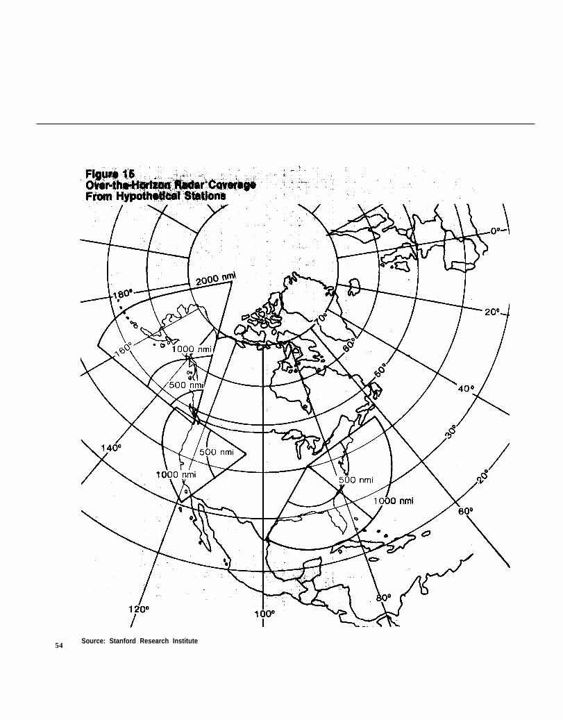
of therefractive property of the ionosphere, whichcauses the radar to curve back to earth at dis-tances ranging from 500 to 2,000 nmi (seefigure 14). Thus wide area coverage is possiblefrom a single site. For instance, a singleskywave OTHR located in Utah could providesurveillance coverage over the entire PacificCoast (see figure 15).
Groundwave OTHR, in which radio energytravels along the curved earth surface, pro-vides much more limited coverage, but may beuseful in specific regions. Groundwave OTHRhas an operational radius of a few hundredmiles. Thus, while ships out to and beyond the200-mile zone could be detected from a shorestation, many stations would be required tocover the entire coast.
Both systems can provide continuous sur-veillance of very large areas so that the generallocation of all fishing boats of at least a certainminimum size can be monitored on a full-timebasis. If transponders are installed on theboats, detection can be enhanced and otheruseful information can be obtained,
Because of their capability to cover greaterdistances and larger areas, OTHR techniqueshave good potential for use in fisheries en-forcement. However, due to both the classified
52
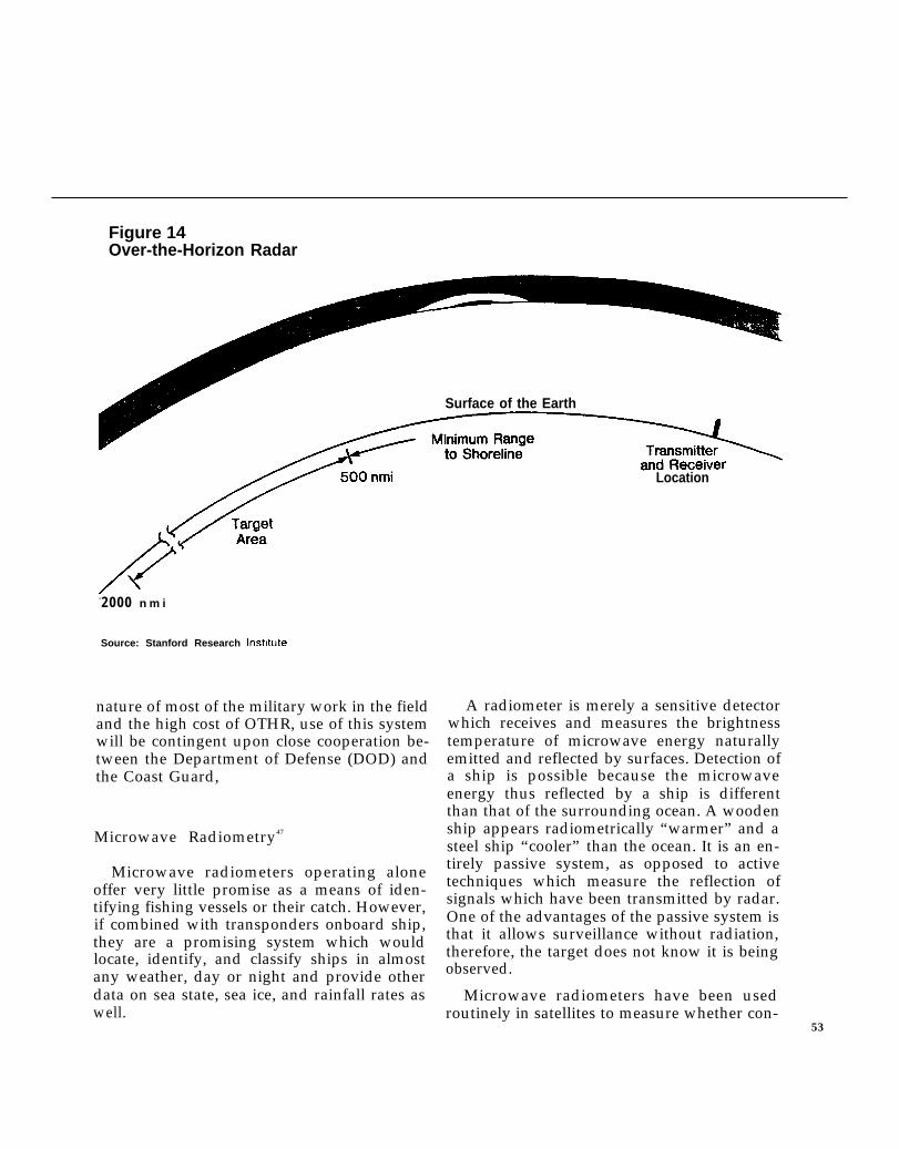
Figure 14Over-the-Horizon Radar
Surface of the Earth
-2000 n m i
Source: Stanford Research Inst!tute
nature of most of the military work in the fieldand the high cost of OTHR, use of this systemwill be contingent upon close cooperation be-tween the Department of Defense (DOD) andthe Coast Guard,
Microwave Radiometry47
Microwave radiometers operating aloneoffer very little promise as a means of iden-tifying fishing vessels or their catch. However,if combined with transponders onboard ship,they are a promising system which wouldlocate, identify, and classify ships in almostany weather, day or night and provide otherdata on sea state, sea ice, and rainfall rates aswell.
Location
A radiometer is merely a sensitive detectorwhich receives and measures the brightnesstemperature of microwave energy naturallyemitted and reflected by surfaces. Detection ofa ship is possible because the microwaveenergy thus reflected by a ship is differentthan that of the surrounding ocean. A woodenship appears radiometrically “warmer” and asteel ship “cooler” than the ocean. It is an en-tirely passive system, as opposed to activetechniques which measure the reflection ofsignals which have been transmitted by radar.One of the advantages of the passive system isthat it allows surveillance without radiation,therefore, the target does not know it is beingobserved.
Microwave radiometers have been usedroutinely in satellites to measure whether con-
53
54Source: Stanford Research Institute
ditions and airborne radiometers have been Figure 16successful in mapping weather fronts and sea Airborne Scanning Microwavestates. Radiometric measurement of oil spillshave been made with limited success and
Radiometerradiometers have been frequently suggestedfor use in missile terminal guidance systems.
Although there do not appear to be anyoperational systems at present that arespecifically designed for detection of ships,such systems have been studied and pro-totypes have been tested. The existing tech-nology is more than adequate for the detectionof fishing vessels.
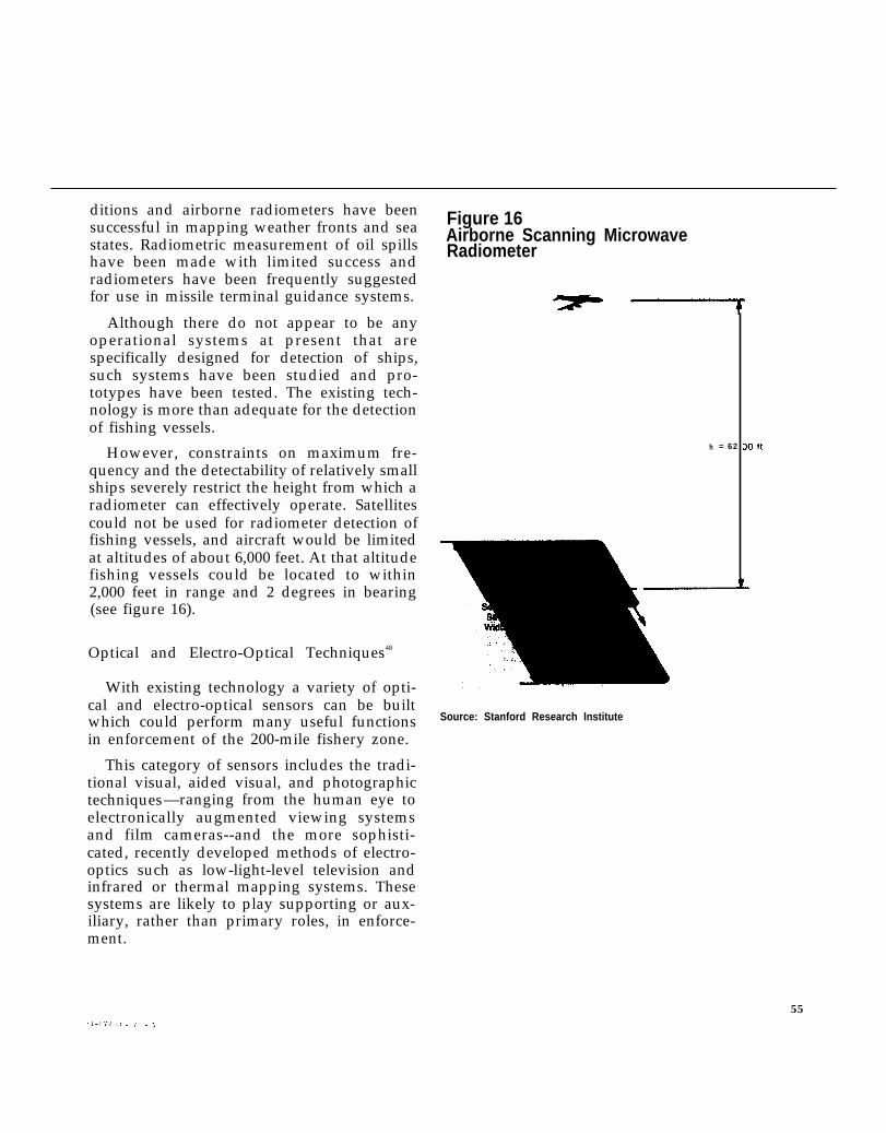
However, constraints on maximum fre- h = 62
quency and the detectability of relatively smallships severely restrict the height from which aradiometer can effectively operate. Satellitescould not be used for radiometer detection offishing vessels, and aircraft would be limitedat altitudes of about 6,000 feet. At that altitudefishing vessels could be located to within2,000 feet in range and 2 degrees in bearing(see figure 16).
Optical and Electro-Optical Techniques48
With existing technology a variety of opti-cal and electro-optical sensors can be builtwhich could perform many useful functionsin enforcement of the 200-mile fishery zone.
This category of sensors includes the tradi-tional visual, aided visual, and photographictechniques—ranging from the human eye toelectronically augmented viewing systemsand film cameras--and the more sophisti-cated, recently developed methods of electro-optics such as low-light-level television andinfrared or thermal mapping systems. Thesesystems are likely to play supporting or aux-iliary, rather than primary roles, in enforce-ment.
Source: Stanford Research Institute
55
Optical detection and surveillance systemscan be operated from satellites, aircraft, orships. The combination of timeliness ofcoverage and operational economics makesaircraft seem the most useful surveillance craftfor the near future, with some data beingderived from existing or projected satellites,and with final follow-up performed by sur-face vessel.
One of the major problems of optical sen-sors is the processing and handling of raw-data output. Photographic film requireschemical development, usually at the end of areconnaissance mission (that is, when theaircraft lands or ejected film capsules havebeen retrieved from satellites). In some cases,film from aircraft can be rapid processed inflight to allow for examination or data
Coast Guard surveillance aircraft can be used for visual observation of the fishing grounds,facilitating detection and identification of foreign vessels
56
transmission within minutes, for immediateinterpretation of close-up photography. Butimages from long-range, high-altitudesatellites need more extensive and detailed ex-amination, often requiring several hours oreven days by expert photo-interpreters beforeuseful, specific data are developed. Most of theelectro-optical systems can provide realtimeoutputs capable of immediate display and ex-amination in the form of electrical signalsreadily amenable to interpretation ortransmission to a shore-based facility.
Optical and electro-optical techniques varywidely and the choice of specific systemswould depend on the enforcement strategieschosen.
Electromagnetic Intercept Techniques49
Because all ocean-going vessels are alreadyequipped with radio equipment and mostwith navigational radar, it is possible to detectand classify foreign fishing vessels by inter-cepting and analyzing their radio or radaremissions.
Two techniques have potential in fisheriesenforcement activities: the use of directionfinding equipment to determine the positionof detected vessels and the use of informationfrom the intercepted transmissions to identifyand classify the vessel.
The technology for both direction-findingand communications interception andanalysis is highly developed and numeroussystems have been developed for both mili-tary and civilian use. These systems can beoperated from shore bases, ships, aircraft, orsatellites. At high frequencies intercept is notlimited to, but does work best, within line-of-sight of the detected vessel. An aircraft mov-ing at 300 knots could have line-of-sight ac-cess to 200,000 square miles of sea surface perhour.
In the past, direction-finding equipmentwas used primarily for location of aircraft andships in distress. Currently, however, it is inuse largely for monitoring and surveillance.The Federal Communications Commissionmaintains a network to locate illegal radiotransmitters and sources of radio interference;the Department of Defense operates severalnetworks for surveillance and intelligencedata collection.
It is possible that some signal intercept in-formation from DOD files can be made availa-ble to the Coast Guard for fishery enforce-ment, However, most of the DOD operationsare mission-oriented and are flown in areas ofmilitary interest, therefore it is unlikely muchtime is spent tracking fishing fleets. Thefeasibility of assigning military aircraft forfishery patrols would be expensive and wouldhave to be worked out with DOD.
The Coast Guard could supply personnel tosort out fishery information collected by DODor an entire direction-finding station could bededicated to Coast Guard fisheries work.Because of the security implications of muchof the data handled by DOD facilities, suchcoordination may prove difficult.
Magnetic Techniques50
Magnetic anomaly detector systems havebeen built and used for the detection of sub-marines and there is no reason why theywould not be equally successful in detectingfishing vessels. The systems operate by detect-ing local changes in the direction and strengthof the earth’s magnetic field caused by any ob-ject, such as a steel-hulled vessel, with mag-
57
+
netic properties. However, because detectionis possible only at a much shorter range thanwith radar or visual systems and because noclassification of vessels is possible, magnetictechniques presently have little potential foruse in fisheries enforcement.
Acoustic Techniques51
Detection and classification of fishingvessels by use of acoustic techniques is possi-ble because the technology for the generation,transmission, and reception of acoustic energyis well established and the factors that in-
fluence acoustics in the ocean and atmosphereare well known.
The use of acoustic techniques for the detec-tion of fishing vessels can be extrapolatedfrom the Navy’s experience in submarinedetection. However, new equipment and newmethods of use would have to be developed.Since most of the existing acoustic systems arehighly classified it is not possible to describethem, except to say the equipment is verycomplex and costly to operate. Much develop-ment would be needed to determine theusefulness of these systems for fisheries lawenforcement.
OTA Photo
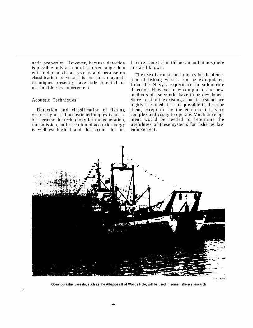
Oceanographic vessels, such as the Albatross II of Woods Hole, will be used in some fisheries research
58