Embed Size (px)
Citation preview
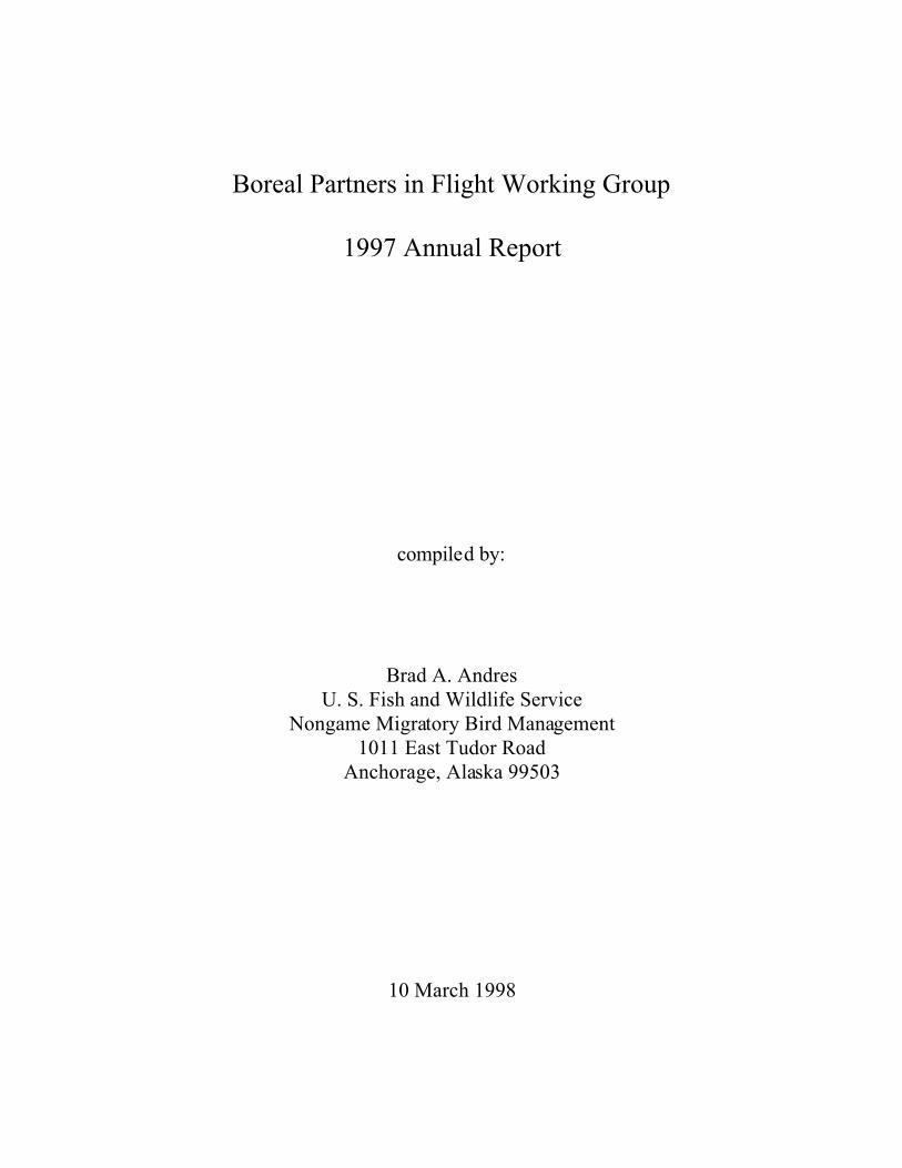
Boreal Partners in Flight Working Group
1997 Annual Report
compiled by:
Brad A. AndresU. S. Fish and Wildlife Service
Nongame Migratory Bird Management1011 East Tudor Road
Anchorage, Alaska 99503
10 March 1998
i
TABLE OF CONTENTS
BOREAL PARTNERS IN FLIGHT 1997 WORKSHOP AGENDA . . . . . . . . . . . . . . . . . . . . . . 1
INVENTORY, MONITORING, AND RESEARCH . . . . . . . . . . . . . . . . . . . . . . . . . . . . . . . . . . 4BREEDING BIRD INVENTORIES . . . . . . . . . . . . . . . . . . . . . . . . . . . . . . . . . . . . . . . . . 4BREEDING BIRD SURVEY ROUTES . . . . . . . . . . . . . . . . . . . . . . . . . . . . . . . . . . . . . . 5MIST-NETTING AND BANDING . . . . . . . . . . . . . . . . . . . . . . . . . . . . . . . . . . . . . . . . . 5OFF-ROAD POINT COUNT PROGRAM . . . . . . . . . . . . . . . . . . . . . . . . . . . . . . . . . . . 14OTHER LANDBIRD RESEARCH PROJECTS . . . . . . . . . . . . . . . . . . . . . . . . . . . . . . 15
INFORMATION AND EDUCATION . . . . . . . . . . . . . . . . . . . . . . . . . . . . . . . . . . . . . . . . . . . . 22RESOURCES . . . . . . . . . . . . . . . . . . . . . . . . . . . . . . . . . . . . . . . . . . . . . . . . . . . . . . . . . 22INTERNATIONAL MIGRATORY BIRD DAY AND THE NORTH AMERICAN
MIGRATION COUNT . . . . . . . . . . . . . . . . . . . . . . . . . . . . . . . . . . . . . . . . . . . . 23
CONSERVATION PLANNING - BIOGEOGRAPHIC REGION REPORTS . . . . . . . . . . . . . 28WESTERN BIOGEOGRAPHIC REGION . . . . . . . . . . . . . . . . . . . . . . . . . . . . . . . . . . . 28NORTHERN BIOGEOGRAPHIC REGION . . . . . . . . . . . . . . . . . . . . . . . . . . . . . . . . . 31CENTRAL BIOGEOGRAPHIC REGION . . . . . . . . . . . . . . . . . . . . . . . . . . . . . . . . . . . 33SOUTHCOASTAL BIOGEOGRAPHIC REGION . . . . . . . . . . . . . . . . . . . . . . . . . . . . 34SOUTHEASTERN BIOGEOGRAPHIC REGION . . . . . . . . . . . . . . . . . . . . . . . . . . . . 37
ADMINISTRATION . . . . . . . . . . . . . . . . . . . . . . . . . . . . . . . . . . . . . . . . . . . . . . . . . . . . . . . . . . 45

1
BOREAL PARTNERS IN FLIGHT WORKSHOP AGENDA
4 December 1997
Held in conjunction with the seventh Alaska Bird ConferenceAbstracts of papers germane to PIF members are given in the appropriate sections
U.S. Fish and Wildlife Service Regional Office
Gordon W. Watson Conference Room1011 East Tudor Road
Anchorage, Alaska
3 December
8:45 pm Presentation — Birds, conservation, and politics in the land of the Maya,Chandler S. Robbins, Patuxent Wildlife Research Center, USGS-BRD,Laurel, MD (given as banquet address at the Alaska Bird Conference)
4 December
8:00 am Welcome and introductions — Brad Andres, Chair, Boreal Partners inFlight
Inventory, Monitoring, Research
8:10 am Breeding Bird Survey in Alaska — Brad Andres, USFWS
8:25 am Discussion on mist-netting and banding efforts in Alaska — Brad Andres
8:45 am Off-road point count program — Colleen Handel, USGS-BRD
9:00 am Update on the effects of the Spruce Bark Beetle on breeding birds — SteveMatsuoka, USGS-BRD
9:15 am Breeding bird surveys on Research Natural Areas in the Tongass NationalForest — Brad Andres
Information and Education
9:30 am Update on "Teaming with Wildlife", the Fish and Wildlife DiversityFunding Initiative — John Wright, ADF&G

2
9:45 am North American Migration Count and International Migratory Bird Day1997 — Brad Andres
10:00 am Current outreach projects — Brad Andres
10:15 am Break
10:30 am Filemaker Pro® database for entering and summarizing banding data —Terry Doyle, Tetlin NWR
10:45 am Communication within Boreal Partners in Flight — Brad Andres
International Efforts
11:00 am Alvarado wetland project with Pronatura-Veracruz — Brad Andres
11:15 am Mapping neotropical migrants in Belize — Chandler Robbins, PatuxentWildlife Research Center, USGS-BRD, Laurel, MD
12:00 pm Lunch
The Conservation Plan
1:15 pm Species account reviews for the Alaska Landbird Conservation Plan —Paul Cotter, USFWS
1:30 pm The Important Bird Areas program — Jeff Price, American BirdConservancy, Washington, D. C.
2:30 pm Break out into biogeographic regional groups and identify specific,achievable action items that relate to habitat and species priorities and canbe accomplished in 1998.
Southeastern
Do we know enough about birds’ response to cutting?Do we have good information on densities of birds in deciduous forests?Can BPIF priorities mesh with Tongass monitoring efforts?Will there be a Hummingbird Festival in Ketchikan?

3
Southcoastal
Who can support increased monitoring efforts in coastal spruce forests?Can we pull together information in the health of the coastal spruce forest
and predict effects on bird populations?What plans are there for an IMBD celebration in Anchorage?
Central
Is there enough broadscale monitoring being done in Central?What habitats are being neglected and do they hold priority species?What is the current status of logging in the Tanana Valley?Are there plans for an IMBD celebration in Fairbanks?
Western
What is the current status of monitoring efforts?Are there other methods/techniques to try?Is a summary of existing information on abundance and habitat needed?What West-specific I&E projects could be undertaken (e.g., “Birds of the
Fish Camp”)
4:00 pm Report to the larger group
4:15 pm Technical committee break outs
Monitoring/Research
Now that MAPS has had a review and information is accumulating on ORPCs, what recommendations should be made?Where should we go with migration monitoring?Has any “hot” bird-habitat research issue emerged recently?
Information and Education
Are our current outreach products advertized well enough?What other statewide efforts should we undertake?
5:15 pm Report back to the group
5:30 pm Elections and officer responsibilities
5:45 pm Adjourn

4
INVENTORY, MONITORING, AND RESEARCH
BREEDING BIRD INVENTORIES
Brad Andres, U. S. Fish and Wildlife Service
In 1997, we continued to inventory local training areas (19 sites; Table 1) of the AlaskaArmy National Guard, primarily in southeastern, southcoastal, and southwestern Alaska. Wespent 669 person-hours on 64 days and recorded 163 species of birds across all training areas. We also continued our breeding bird atlas of Fort Richardson, Anchorage. To date, we havedocumented 113 species of summer birds on the installation; 103 species were considered asbreeders and 83% of these were confirmed as breeding on Fort Richardson.
Table 1. Locations of breeding bird inventories of Alaska National Guard training areassurveyed in 1997.
Angoon Kake Wrangell Manokotak
Craig Ketchikan Kenai New Stuyahok
Haines Petersburg Kodiak Togiak
Hoonah Sitka Valdez Stewart River (Nome)
Juneau St. James Bay Dillingham
AN AREA SEARCH METHOD FOR INVENTORYING BREEDING BIRDS (ABC ABSTRACT), Brad A.Andres and Diana L. Brann (Migratory Bird Management, USFWS, 1011 E. Tudor Road,Anchorage, AK, 99503).
Baseline information on the distribution and abundance of breeding birds is central to theconservation of natural biodiversity in any landscape. To meet this need in Alaska, wedeveloped a modified area search method to inventory breeding birds across a variety ofgeographic scales. Our method includes documenting the breeding status of all speciesencountered and assigning their abundance to one of several categories. Abundance estimatesare standardized by the number of person-hours of effort during a survey. Enumeration ofabundance by categories minimizes differences in estimates that are due to the abilities ofobservers. Our area search procedure generates a more complete list of bird species for an areathan point counts and has the potential to be used as a monitoring tool. This method is notuseful, however, for describing the abundance of large aggregated populations. Restrictingsurvey effort to specific landscape units would increase the utility of the method.

5
We also participated in cooperative project with U. S. Forest Service, Forest ScienceLaboratory, to conduct baseline surveys of seven Research Natural Areas on the TongassNational Forest. This project will continue in 1998. We conducted point counts (84 total) andarea searches on each RNA. We also determined the vegetation community at each point andmeasured vegetation structure at a subsample of points.
BREEDING BIRD SURVEY ROUTES
Because of the new recording technique, Patuxent is behind on processing ‘97 data and Ihave not yet received Alaska. A summary will be sent to participants in the next few months.
MONITORING BIRD POPULATIONS AND HABITAT CHANGES ON SOUTHEASTERN ALASKAN
BREEDING BIRD SURVEY ROUTES (ABC ABSTRACT), Paul A. Cotter and Brad A. Andres(Migratory Bird Management, USFWS, 1011 E. Tudor Road, Anchorage, AK, 99503).
Characterizing habitat and its trends is critical in developing landbird monitoring plansand evaluating their effectiveness. To better understand Breeding Bird Survey (BBS) data insoutheastern Alaska, we classified habitat at each stop along 12 BBS routes to ascertain habitat-use patterns of migratory and resident birds during the breeding season. Habitat was classifiedusing a 3-tiered scheme (adapted from Viereck et al. 1992) emphasizing the structural landscape.Using 4 years of BBS data (1993-1996), we developed habitat distribution patterns forSoutheastern Alaska landbirds. Stops comprising 60% or more of a single habitat were definedby that major cover type and percent occurrence distributions for each species were calculated.For example, Pacific-slope Flycatchers were present on 86% of all needleleaf forest stops.Further, needleleaf and shrub coverage was estimated with 10% resolution and plotted againstbird density to determine general habitat preference. Chestnut-backed Chickadee densities werepositively related to needleleaf cover and negatively related to shrub cover. Highest densities ofTownsend’s Warblers, however, occurred with moderate coverage of both trees and shrubs,suggesting they are associated with forest openings and edges rather than dense forest inSoutheastern Alaska. This Alaska BBS habitat database allows us to continue monitoringAlaska’s migrant and resident populations with concomitant changes in habitat and providesbackground for conducting more intensive bird-habitat studies. We are in the process ofproducing a statewide report on this work.
MIST-NETTING AND BANDING
Anna-Marie Barber, Alaska Bird Observatory
Following is a summary of banding activities in 1997 in Alaska.

13
SPECIES COMPOSITION AND ABUNDANCE OF FALL LANDBIRD MIGRANTS AT YAKUTAT, ALASKA
(ABC ABSTRACT), Brad A. Andres and Brian T. Browne (Migratory Bird Management, USFWS,1011 E. Tudor Road, Anchorage, AK, 99503).
The coastline of the eastern Gulf of Alaska is suspected of providing an importantpathway for birds migrating to and from Alaska. No intensive study of landbird migrationthrough this area, however, has been made. Therefore, we used mist nets to study the migrationof landbirds along the coast during August and September, 1994-1997. We netted for a total of211 days and 14,707 net-hours. We captured 7,729 individuals, at a rate of 52.6 birds/100 net-hours, and 48 species or forms. Five species constituted >62% of the total captures: the Orange-crowned Warbler, Hermit Thrush, Lincoln’s Sparrow, Ruby-crowned Kinglet, and YellowWarbler. Immature birds dominated the captures of common (>200 captures) species (77%; n =7,292) and most captures (90%) were of species that are long- or medium-distance migrants. Thehigh capture rate and high proportion of long- and medium-distance migrants indicates thatYakutat could be an acceptable location for establishing a long-term banding site to monitorpopulations of Neotropical migratory birds.
INTERANNUAL VARIATION IN RELATIVE ABUNDANCE, AGE STRUCTURE, AND TIMING OF FALL
MIGRATION OF LANDBIRDS IN FAIRBANKS, ALASKA, 1992-1997 (ABC ABSTRACT), Anna-MarieBarber, (Alaska Bird Observatory, P.O. Box 80505, Fairbanks, AK, 99708).
An array of mist nets was used to capture landbirds between 15 July and 30 September1992-1997. During 77,294 net-hours we banded 21,076 birds of 50 species. Capture ratesaveraged 28.6 ± 10.1 birds/100 net-hrs and ranged from 43.2 birds/100 net-hours in 1992 to 12.6 birds/100 net-hrs in 1993. The mean percentage of hatch year birds captured during six yearswas 86% ± 6%. The lowest percentage of hatch year birds captured occurred in 1993 (75%). More than 10 individuals of 17 species were caught each year. Of these 17 species, 10 specieshad their lowest capture rates of hatch year birds in 1993 suggesting a common factor influencedreproductive success. Mean capture rates (based on 5-day intervals) of hatch year birds werehighest between 19 and 28 August (44.9 birds/100 net-hrs) while mean capture rates of after-hatch year birds were highest between 13 and 17 September (8.9 birds/100 net-hrs). There waslittle variation among years in timing of captures in either age class. The northern location of themigration station allows us to examine the initial phase of autumn migration in nearctic-neotropical passerines. Our data indicate juveniles begin fall migration before adults.

14
OFF-ROAD POINT COUNT PROGRAM
MONITORING POPULATION TRENDS OF LANDBIRDS IN ALASKA — DO WE HAVE THE POWER?(ABC ABSTRACT), Colleen M. Handel (Alaska Biological Science Center, USGS-BRD, 1011 E.Tudor Rd., Anchorage, AK, 99503).
Under the auspices of Boreal Partners in Flight, biologists from Alaska and westernCanada have combined efforts to develop a Boreal Landbird Monitoring Program. Onecomponent of this program is the Boreal Breeding Bird Survey, through which population trendsare monitored over time through replicated surveys of miniroutes. Standard surveys consist oftwelve 5-min point counts separated by a minimum of 250 m in roadless areas. Since 1992,biologists have contributed data from about 200 routes as part of an experimental researchprogram to test different aspects of design for these surveys in Alaska. An intensive 4-year studyin the Anchorage area examined the detectability of birds in relation to time of day, season, year,location, and observer. Total numbers of detections declined significantly after 1030 hrs andseasonally remained most stable between 10 and 30 June. For most (82%) of the 28 speciescommonly detected, the most significant source of variability in counts was location of the route. Six species (21%) showed significant interannual variation in detections and only 5 (18%)showed significant differences in counts among observers. The national Partners in Flightmonitoring goal is to have a 90% probability of detecting a 50% change in population size over a25-year period. Power analyses of the statewide data are now underway to determine the numberof routes that will be required to meet this goal for landbird species within each biogeographicregion of Alaska.
MONITORING LANDBIRDS IN DENALI NATIONAL PARK UTILIZING ON-ROAD AND OFF-ROAD POINT
COUNTS (ABC ABSTRACT), Peter W. C. Paton (Department of Natural Resource Science,University of Rhode Island, Kingston, RI, 02881) and Stephen K. Springer (Alaska BirdObservatory, P.O. Box 80505, Fairbanks, AK, 99708).
Point count techniques were used to monitor breeding birds in Denali National Park andPreserve, Alaska, from 1993 to 1997. Birds were surveyed from 9 off-road routes in spruceforests, and from 4 on-road routes in a variety of habitats from 1993 to 1997. A total of 45species were detected during the off-road censuses, with species richness ranging from 26-32species annually. Relative abundance of most species was similar among years during theoff-road censuses. The cumulative number of species detected during the 4 on-road routes were69, 70, 61, and 74 respectively, from 1993 to 1997. The on-road routes that exhibited greaterspecies richness had a wider variety of habitat types. Inter-annual variation in population trendswas similar between on-road and off-road censuses. The abundance of rare species, whichoccurred at <2% of all counting stations, fluctuated among years. In contrast, populations ofspecies that were common exhibited little inter-annual variation.
15
BIRD DIVERSITY AND ABUNDANCE IN THE CENTRAL BROOKS RANGE (ABC ABSTRACT), Shelli A.Swanson and Donna L. DiFolco (National Park Service, 201 1st Ave., Fairbanks, AK, 99701).
Bird diversity and abundance has been surveyed annually along 3 off-road point counttransects in Gates of the Arctic National Park and Preserve since 1993. Transects of 12 pointcount stations each are located in tundra (Upper Noatak River and near Anaktuvuk Pass) andboreal forest (Middle Fork Koyukuk River) ecosystems. On the Anaktuvuk Pass transect,species diversity was highest in Dryas dwarf scrub habitat (19 species), and bird abundance washighest in wet graminoid herbaceous habitat. Species diversity in the Upper Noatak River washighest in mesic graminoid herbaceous habitat (22 species), and bird abundance was highest inopen tall shrub habitat. Dryas dwarf scrub habitat had the lowest bird abundance on both tundratransects. On the boreal forest transect, species diversity was highest in open broadleaf foresthabitat (24 species), and open mixed forest habitat had the highest bird abundance. Speciescomposition differed between the 3 transects, with only 7 species common to all areas surveyed. The 2 most abundant species on each transect were: Anaktuvuk Pass - American Tree Sparrow(20.6%) and Savannah Sparrow (18.6%); Noatak River - American Tree Sparrow (24.3 %) andWhite-crowned Sparrow (24.2%); and Middle Fork Koyukuk - Swainson's Thrush (22.3%) andSlate-colored Junco (9.8 %).
OTHER LANDBIRD RESEARCH PROJECTS
FOREST BIRD COMMUNITIES IN THE TANANA RIVER FLOODPLAIN (ABC ABSTRACT), Ann Johnson,(Institute of Arctic Biology, UAF, Fairbanks, AK, 99775).
To determine the relative influences of primary productivity, successional stage, andhabitat complexity on breeding bird communities, I measured bird territory density, speciesrichness, and species diversity in 3 forest habitats adjacent to the Tanana River in 1995 and 1996. I established 2 bird census plots (10.5 ha) in each of the following vegetation types: closed alderand willow shrubs, closed white spruce, and black spruce. Of the 12 successional stages found inthe Tanana River floodplain, these types corresponded to stages 4, 8, and 12 as described byViereck and were chosen because they represent habitats with high, moderate, and low levels ofprimary productivity. I used the spot mapping technique to generate territory maps for eachforest bird species. Vegetation structure and species composition were measured at 42 siteswithin each census plot to determine the influence these factors had on avian habitat use atspatial scales of individual territory and habitat type. Logistic regression analysis was used togenerate models of habitat use for 11 species of migrant songbirds.

16
VEGETATION AND BIRD SURVEYS AT FRYINGPAN CREEK IN CENTRAL ALASKA, BEFORE AND
AFTER A PLACER MINING OPERATION (ABC ABSTRACT), Cathryn S. Moitoret (Northern AlaskaEcological Services, USFWS, 101 12th Ave., Box 19, Fairbanks, AK, 99701) and Ruth M.Gronquist (Bureau of Land Management, 1150 University Ave., Fairbanks, AK, 99709)
Vegetation and bird survey data were collected at a study site on Fryingpan Creek inCentral Alaska as part of a multi-agency effort to document changes occurring as a result of aplacer mining operation which impacted the area in 1995. Fifteen habitat types were identifiedand mapped using aerial photography. Individual bird sightings from breeding bird surveysconducted in June 1995 and 1996 (before and after the mining operation) were plotted on thehabitat type map. Twenty-one bird species were recorded in the study area, with Gray-cheekedThrush, Redpoll spp., White-crowned Sparrow, Lincoln’s Sparrow, Yellow-rumped Warbler, andWilson’s Warbler being the most numerous. Highest densities of bird use occurred in thehabitats with the densest cover of tall, medium and low shrubs: Riparian Willow Scrub andWoodland Spruce/Closed Low Scrub, with densities of 10.6 and 7.3 birds/ha. The placer miningoperation eliminated approximately 3.2 ha of habitat, which supported approximately 14 birdsprior to the disturbance. In the year following placer mining no birds were observed in thedisturbed area, and there was an overall decline of 23 birds (37%) in the survey area. Reclamation which encourages revegetation with willow shrubs will likely provide the greatestbenefit in re-establishing breeding bird habitats.
WOODPECKERS AND FIRE — DO BLACK-BACKED WOODPECKERS REQUIRE RECENT BURNS? (ABCABSTRACT), Edward C. Murphy (Institute of Arctic Biology, UAF, Fairbanks AK, 99775-0180)and William A. Lehnhausen (Linnaea Associates, P.O. Box 82115, Fairbanks, AK, 99708).
Endemic population densities of Three-toed Woodpeckers are low (<0.1/ha) and theBlack-backed Woodpecker is extremely rare in mature spruce stands of interior Alaska. Following the Rosie Creek fire in June 1983, woodpecker densities increased markedly and wereas high as 0.9/ha in a 63-ha plot at the edge of the burn in the following two years. By December1986, densities had declined to about 0.1/ha. Black-backed Woodpeckers fed primarily oncharred portions of lightly to heavily burnt spruces and fed almost exclusively by excavatinglarval wood-boring beetles. Three-toed Woodpeckers fed on less-burnt spruces and foraged inand immediately under the bark; bark beetle larvae predominated in their diet. Followingemergence of cerambycid adults in 1985, numbers of Black-backed Woodpeckers declinedmarkedly. Our results suggest that in interior Alaska the Black-backed Woodpecker is extremelyspecialized in its foraging niche, exploiting outbreaks of wood-boring beetles for 2-3 years afterfires. Consequently, this species may be particularly vulnerable to local and regional extinctionas fire suppression intensifies and proposed programs of intensive salvage logging followingfires throughout the region are enacted.
17
ENZYMATIC CONTROL OF WINTER FATTENING IN THE BLACK-CAPPED CHICKADEE IN INTERIOR
ALASKA (ABC ABSTRACT), Susan M. Sharbaugh (Department of Biology and Wildlife, UAF,P.O. Box 756100, Fairbanks, AK, 99775), Pierre Deviche (Institute of Arctic Biology, UAF,P.O. Box 7000, Fairbanks, AK, 99775), and Marilyn Ramenofsky (Dept. of Zoology, NJ-15,University of Washington, WA, 98195)
Chronic exposure to extremely low temperatures and short photoperiods combine withsmall body mass (11-13 g) and relatively high mass-specific metabolic rate to constitute aphysiological challenge to Black-capped Chickadees overwintering in interior Alaska. Fatreserves play an important role in meeting this challenge. Free-living chickadees captured inFairbanks have larger fat reserves (determined by furcular fat volume) early in the day during thewinter than in the fall or spring. Lipid reserves progressively increase as a function of time aftermorning twilight. Rates of fattening vary systematically with season, being greatest in winter.The ability to rapidly deposit fat in winter may be facilitated by increased activity of the fatdeposition-promoting enzyme, adipose lipoprotein lipase. Seasonal lipase activity was measuredin furcular fat samples obtained through the winter from chickadees held in outdoor flightaviaries in Fairbanks. Lipase activity in these birds was 20-30x higher than lipase activitypreviously measured in passerine birds during pre-migratory fattening. Lipase activity washighest in December/January. In chickadees, unusually high lipase activity may facilitate rapiddeposition of large amounts of fat during short winter days.
STELLER’S SEA-EAGLES IN THE MAGADAN REGION OF RUSSIA IN 1997 (ABC ABSTRACT), M. J.McGrady (Raptor Research Technical Advisory Center, Boise State University, 1910 UniversityDr., Boise, ID, 23725), M. Thompson, R. Schrank, G. Bucaria, A. Jeffery (Chugach NationalForest, USFS, Suite 300, 33301 'C' Street, Anchorage, AK, 99786), I. Utekhina (MagadanskyState Reserve, Magadan, Russia), E. Potopov (Institute for Biological Problems of the North,Magadan, Russia), and P. Schempf (Migratory Bird Management, USFWS, 3000 Vintage Blvd.,Suite 240, Juneau, AK, 99801).
In the summer of 1997 an international team surveyed coastline and rivers of Magadanand Khabarovsk regions of Russia for Steller's Sea-Eagles. At least 1 adult was seen at 69 of the123 territories visited; 40 nests were productive. The average number of chicks per occupiednest was 1.24. We tagged 14 eagles with satellite received transmitters. The movement of theseand 3 other birds marked elsewhere (1 in Kamchatka, and 2 in Amur) are illustrated. Details oftiming of migration and movements are presented. This data is interim and is part of amulti-year, cooperative study involving U.S., Russian, and Japanese researchers.

18
MAPPING STELLER’S SEA-EAGLE NEST SITE IN THE MAGADAN REGION OF RUSSIA USING GLOBAL
POSITIONING SYSTEM APPLICATIONS (ABC ABSTRACT), Randy D. Schrank, Michael L.Thompson, David C. Hale, Anne Jeffery and Garvan P. Bucaria (Chugach National Forest,USFS, 3301 "C" Street, Suite 300, Anchorage, AK, 99503), Michael E. Shephard (TongassNational Forest, USFS, 204 Siginaka Way, Sitka, AK, 99835), Robert B. Benter (USFWS, 1011E. Tudor Road, Anchorage, AK, 99503), Michael J. McGrady (Raptor Research TechnicalAdvisory Center, Boise State University, 1910 University Dr., Boise, ID, 23725), Irina Utekhina(Magadansky State Reserve, Magadan, Russia), and Eugene Potopov (Institute for BiologicalProblems of the North, Magadan, Russia).
Forest Service staff from the Chugach and Tongass National Forests, under a SisterForest sponsored program, assisted scientists from the Magadansky Nature Reserve to map sitesof Steller's Sea-Eagles in the Magadan Region of Russia. Surveys were conducted by boat, foot,and ultralight aircraft along rivers draining the interior and coastal reaches adjacent to the Sea ofOkhotsk. Forest Surveyors mapped Steller’s Sea-Eagle nests and significant geographic featuresusing a Trimble Pathfinder Pro XL receiver with a Corvallis Micro Technology (CMT) MC-Vdata collector and/or a Trimble Ensign hand-held receiver. We down loaded data files from thePathfinder Pro XL receiver to a portable 486 computer with Trimble's PFINDER software, andportrayed the data on a map trace depicting eagle nests and other raptor sightings. Wecooperatively worked with an international team in capturing birds, attaching bands, tags and/orsatellite transmitters, and collected biological data. During summers from 1995 to 1997 ourteams mapped eagle locations on interior rivers (the Kava, Tauy, Chelomdzha, and Yma Rivers)and in coastal habitats from the Koni Peninsula near Magadan to 450 km southwest to the city ofOkhotsk. This project is scheduled to continue in 1998, but funds remain unsecured.
THIRTY YEAR POPULATION TREND OF ADULT BALD EAGLES IN SOUTHEAST ALASKA (ABCABSTRACT), Michael J. Jacobson and John I. Hodges (Migratory Bird Management, USFWS,3000 Vintage Boulevard, Suite 240, Juneau, AK, 99801).
Six aerial surveys to estimate the adult Bald Eagle population size in southeast Alaskawere conducted from 1967 to 1997. A stratified random sampling method was used with 166km2 size plots. All surveys were flown in late April and early May when many adults were nearnest sites. The estimated population size of adult Bald Eagles in southeast Alaska increased from7,230 (± 896) in 1967 to 12,026 (±3,108) in 1997 (95% confidence limit). The populationreached a peak of 13,341 (±2,348) in 1992. The increase of the adult Bald Eagle populationprobably represents a recovery from the effects of the 1917-1953 eagle bounty in Alaska when asmany as 150,000 Bald Eagles were killed. The later establishment of protection zones at eaglenest trees and other key waterfront habitat on national forest lands (80% of the land base) haslikely contributed to the rise in Bald Eagle numbers.

19
NAKNEK DRAINAGE BALD EAGLE PRODUCTIVITY DECLINES WITH SPRING RAIN (ABC ABSTRACT),Susan E. Savage (Alaska Peninsula/Becharof National Wildlife Refuge Complex, P.O. Box 277,King Salmon, AK, 99613).
Bald Eagle surveys were conducted in the Naknek drainage of Katmai National Parkfrom 1991 to 1997 using fixed-wing aircraft. May activity survey and July production surveydates were standardized from 1993 to 1997. Surveys resulted in the following information:number of empty nests, number of occupied nests, number of active nests (subset of occupied),number of successful nests, number of chicks produced, individual nest histories, nest substrateuse, and several calculations of Naknek drainage eagle nest productivity. Total chicks producedranged from 7 in 1994 and 1995 to 24 in 1991. Nest productivity (measured as chicks-per-occupied-nest) ranged from 0.44 chicks in 1994 and 1995 to 0.94 chicks in 1992. Nestproductivity was compared between years using non-parametric tests. No significant differencesin chicks-per-successful-nest, chicks-per-active-nest, or chicks-per-occupied-nest were found.Eagle productivity measures were correlated with King Salmon rain data. Significant negativecorrelations (P = 0.05, P = 0.01) were found when April rain, May rain, or the sum of April andMay rain were tested against productivity measures chicks-per-occupied-nest, chicks-per-active-nest, or total chicks. These data show that dry springs are associated with higher Bald Eaglechick production. Nest activity information was also used in an aircraft management policy thatmay have positively influenced individual nest production.
ALASKA BALD EAGLE ATLAS VIA THE INTERNET (ABC ABSTRACT), Schempf, Philip F.(Migratory Bird Management, USFWS, 3000 Vintage Blvd., Suite 240, Juneau, AK, 99801) andJohn Stroud (ESRI-Alaska, 2020 Abbott Rd., Anchorage, AK, 99507).
Since at least the 1960's, biologists have collected data on Bald Eagle nests acrossAlaska. These data have been stored in a wide variety of formats and locations. Undoubtedlyand unfortunately, some of these records have been lost due to changes in personnel, the lack of acentral repository for the information and inconsistent archiving efforts. Much of the data still inexistence is not available to the people who need access to it. Existing records on topographicmaps, data cards and field notes are widely scattered and often at least partially redundant ofsimilar data stored elsewhere. To resolve these problems and stimulate a statewide cooperativeeffort to collect and archive Bald Eagle nest data in a consistent manner, a relational database ofbald eagle nest attributes and a geographic information system of nest site locations was created. A single master data set will reside on a server accessible via the Internet, minimizing problemsnoted above. A draft version of the database and geographic information system will bedemonstrated.
20
THIRTY-FIVE YEAR BALD EAGLE NESTING POPULATION TREND ON THE KODIAK NATIONAL
WILDLIFE REFUGE (ABC ABSTRACT), Denny Zwiefelhofer (Kodiak National Wildlife Refuge,1390 Buskin River Road, Kodiak AK, 99615).
Aerial surveys for nesting Bald Eagles began on the Kodiak National Wildlife Refuge in1963. Since surveys started, Bald Eagle nesting activity has increased 190% while the number ofyoung Bald Eagles fledged increased approximately 150%. Kodak refuge personnel surveyedrefuge Bald Eagle nesting and productivity on all Kodiak refuge lands during May and July of1997. The last comprehensive Bald Eagle nesting surveys were conducted in 1992. A nestoccupancy rate of 52% in 1997 (n = 1,010 nests) was comparable to the 1992 (50%, n = 878nests) comprehensive survey results but down from the historic nest occupancy rate (60%). Production was verified for 518 nests found to be active or occupied in May. Of the 518 nests,280 were successful in producing 423 young. The 1997 nesting success rate of 54% was lowerthan 1992 (58%) and historic (65%) nest success rates. The 1997 nest productivity parameterswere somewhat lower (0.8 fledglings/May occupied nest; 1.5 fledglings/July successful nest)than 1992 and the historic averages (0.91 and 1.01 fledglings/May occupied nest; 1.56 and 1.55fledglings/July successful nest, respectively).
STATUS OF PEREGRINE FALCONS AND BALD EAGLES IN THE YUKON-TANANA UPLANDS OF EAST
CENTRAL ALASKA (ABC ABSTRACT), Robert J. Ritchie and John R. Rose (ABR, Inc.,Environmental Research and Services, P.O. Box 80410, Fairbanks, AK , 99708).
Since 1994, we have conducted annual aerial surveys, primarily by helicopter, for nestingraptors in the tributary drainages of the Yukon and Tanana rivers in east-central Alaska. Objectives included locating nests and monitoring their productivity for Peregrine Falcons andBald Eagles, as part of a cooperative study to measure the impacts of U. S. Air Force jet aircrafton raptors in Military Operating Areas within this region. Peregrine nests were most abundanton riparian cliffs and in upland areas on drainages south of the Yukon River (Birch Creek, SalchaRiver, Forty-Mile River, and Seventy-Mile River). More than 110 cliff sites with some historyof occupancy by peregrines were identified during the study. The Tanana-Yukon Uplandsappear to be a major area being reoccupied by the expanding Peregrine Falcon population ininterior Alaska, and the status of recovery of peregrines in this region is discussed. Bald Eaglesalso were more abundant south of the Yukon River. Bald Eagles were common north of theYukon only on the Black River, although nesting success (<30%) and, consequently,productivity of this population was low compared to eagles nesting on tributaries of the TananaRiver. Information on the distribution and abundance of other large raptors, notably Gyrfalcons,Golden Eagles, and Ospreys also is presented.
21
BREEDERS, MOVERS, AND FLOATERS — AMONG-YEAR MOVEMENTS OF NORTHERN GOSHAWKS ON
THE TONGASS NATIONAL FOREST AND IMPLICATIONS FOR MONITORING (ABC ABSTRACT), KimTitus, Richard E. Lowell (Wildlife Conservation, ADF&G, Box 240020, Douglas, AK, 99824),and Craig F. Flatten (ADF&G, 2030 Sea Level Drive, Suite 205, Ketchikan, AK, 99901).
We radiotagged 49 adult goshawks from 1992 to 97 and used extensive aircraft trackingto monitor among-year movements, pairing, and nest locations. Goshawks were captured atactive nests and produced young in their year of capture. We considered 5 outcomes whensummarizing among-year movements: 1) nesting in same forest stand, 2) not nesting but in sameuse area, 3) nesting in alternate forest stand but in same use area, 4) nesting in new stand in newuse area, and 5) floating. We used a bird-year as a sampling unit which represents the knownfate of a goshawk across 2 breeding seasons. For 10 adult males representing 15 bird-years, 2males moved a total of 3 times, all within their original use area. The maximum movement to anew nest by a male was 2.9 km. We could not locate active nests for 4 males whose matesmoved or died after the previous nesting season. For 13 adult females representing 24bird-years, 9 moved to different nesting areas and 3 moved to a different nest stand within theiroriginal use areas. The maximum movement between nests by a female was 150 km. Our datasuggest 4 instances of non-nesting and floating by adult females that previously produced young. Results suggest that long-term monitoring of nest stands for activity will only meet a limited setof objectives. Inferences about territory occupancy and population status requires a completestudy area search or some other sampling framework.

22
INFORMATION AND EDUCATION
Brad Andres, U. S. Fish and Wildlife Service
RESOURCES
Mark Schroeder and I finished up the BPIF slide show in July and mailed several copies to eachagency liaison. If you need to borrow a copy, I have some to lend.
Deb Dubec is still working on the migration poster. I hope to have a finished product this spring. However, I don’t think it will be printed by IMBD. The poster will depict the migration path of ayellow wagtail, Smith’s longspur, blackpoll warbler, Swainson’s thrush, and Pacific-slopeflycatcher. Tidbits of life history information will be added for each species.
Heather Johnson, U. S. Fish and Wildlife Service, Regional Office, answered my request for anI&E chair and is thus appointed.
Please check out Karen Murphy’s website on neotropical migrants:http://www.alaskana.com/birds/
We discussed producing a BPIF homepage at the December meeting and Collen Handel andSteve Matsuoka (USGS-BRD) are undertaking this task. We identified a few elements that itshould contain: information on monitoring programs, newsletters (International, WWG, BPIF), aBPIF project list, and links to other Alaska bird sites and birding events.
FIVE YEARS OF PARTNERS IN FLIGHT IN ALASKA (ABC ABSTRACT AND PRESENTED AT PIF-WWGMEETING IN VANCOUVER), Brad A. Andres (U. S. Fish and Wildlife Service, 1011 East TudorRoad, Anchorage, AK, 99503).
The main purpose of the Boreal Partners in Flight Working Group is to develop andcoordinate a network of integrated research, monitoring, and educational programs specific toNeotropical migratory landbirds that breed in Alaska and Yukon. Since its formation in March1992, the Partners in Flight initiative has greatly expanded research, monitoring, and educationalefforts for landbirds in Alaska and has demonstrated a willingness of agencies andnongovernmental organization to commit to establishing a viable landbird conservation program. We continue to maintain, or expand, monitoring programs such as the Breeding Bird Survey, off-road point counts, migration banding stations, and Monitoring Avian Productivity andSurvivorship (MAPS) stations. Our education efforts (including a bird song CD, a slide show,school presentations, a poster, and International Migratory Bird Day activities) has raised theawareness of the public, and professionals, about the conservation issues facing landbirds. In thenext few years, Boreal Partners in Flight is faced with the task of evaluating existing monitoringefforts and implementing an integrated, comprehensive, and well-designed plan for theconservation of migratory landbirds in Alaska.

23
INTERNATIONAL MIGRATORY BIRD DAY AND THE NORTH AMERICANMIGRATION COUNT
BPIF members continue to participate in International Migratory Bird Day in a number ofways: radio and TV spots, bird-banding demonstrations, and bird walks. The HummingbirdFestival in Ketchikan and both the Copper River Delta and Kachemak Bay shorebird festivalsconduct activities that share the IMBD theme. We encourage you to keep providing theseactivities to your communities.
A packet describing resources available for IMBD ‘98 will be sent shortly. Although IMBD isofficially May 9, 1998, we decided to celebrate IMBD between May 8 and May 17 in Alaska. Anchorage is planning to hold an event at Kincaid Municipal Park on Sunday, May 17th.
The second Alaska-wide North American Migration Count was held between May 3 and May11, 1997. During this period, 115 individuals, in 10 groups, conducted counts and recorded 169species. Following are a complete species list and a list of all count participants. As last year,the Kachemak Bay group lead the state with 119 species. On their count, they recorded a singleEurasian Wigeon and seven Upland Sandpipers. Observers at Cape Peirce recorded 13,000Black Brant on May 10th and Brian McCaffery recorded a Slaty-backed Gull at Cape Romanzof.
Please contact Brad Andres if you need NAMC forms for 1998. Otherwise, use those we had in1997. The official NAMC day is May 9th.

24
1997 International Migratory Bird Day — North American Migration Count (169 species)
Red-throated Loon Pacific Loon Common Loon Yellow-billed Loon Horned Grebe Red-necked Grebe Sooty Shearwater Double-crested Cormorant Pelagic Cormorant Red-faced Cormorant Tundra Swan Trumpeter Swan Greater White-fronted Goose Snow Goose Emperor Goose Brant Canada Goose Green-winged Teal Mallard Northern Pintail Northern Shoveler Gadwall Eurasian Wigeon American Wigeon Canvasback Ring-necked Duck Greater Scaup Lesser Scaup Common Eider King Eider Spectacled EiderSteller’s EiderHarlequin Duck Oldsquaw Black Scoter Surf Scoter White-winged Scoter Common Goldeneye Barrow's Goldeneye Bufflehead Common Merganser
Red-breasted Merganser OspreyBald Eagle Northern Harrier Sharp-shinned Hawk Red-tailed Hawk Rough-legged Hawk Golden Eagle American Kestrel Merlin Peregrine Falcon Ring-necked Pheasant Ruffed Grouse Spruce Grouse Willow Ptarmigan Rock Ptarmigan Sharp-tailed Grouse Sandhill Crane Black-bellied Plover American Golden-Plover Pacific Golden-Plover Semipalmated Plover Black Oystercatcher Greater Yellowlegs Lesser Yellowlegs Solitary Sandpiper Wandering Tattler Spotted Sandpiper Upland Sandpiper Whimbrel Hudsonian Godwit Marbled Godwit Ruddy Turnstone Black Turnstone Surfbird Red Knot Sanderling Semipalmated Sandpiper Western Sandpiper Least Sandpiper Baird's Sandpiper

25
Pectoral Sandpiper Rock Sandpiper Dunlin Short-billed Dowitcher Long-billed Dowitcher Common Snipe Red-necked Phalarope Pomarine Jaeger Parasitic Jaeger Long-tailed Jaeger Bonaparte's Gull Mew Gull Herring Gull Slaty-backed Gull Glaucous-winged Gull Glaucous Gull Black-legged Kittiwake Caspian Tern Arctic Tern Aleutian Tern Common Murre Pigeon Guillemot Marbled Murrelet Kittlitz's Murrelet Tufted Puffin Rock Dove Great Horned Owl Northern Hawk Owl Short-eared Owl Boreal Owl Northern Saw-whet Owl Rufous Hummingbird Belted Kingfisher Downy Woodpecker Hairy Woodpecker Three-toed Woodpecker Northern Flicker Hammond's Flycatcher Say's Phoebe Horned Lark Tree Swallow Violet-green Swallow Gray JaySteller's Jay
Black-billed Magpie Northwestern Crow Common Raven Black-capped Chickadee Chestnut-backed Chickadee Boreal Chickadee Red-breasted Nuthatch Brown Creeper Winter Wren American Dipper Golden-crowned Kinglet Ruby-crowned Kinglet Gray-cheeked Thrush Swainson's Thrush Hermit Thrush American Robin Varied Thrush American Pipit Bohemian Waxwing Northern Shrike Orange-crowned Warbler Yellow Warbler Yellow-rumped Warbler Townsend's Warbler Blackpoll Warbler Wilson's Warbler American Tree Sparrow Savannah Sparrow Fox Sparrow Song Sparrow Lincoln's Sparrow White-crowned Sparrow Golden-crowned Sparrow Dark-eyed Junco Lapland Longspur Snow Bunting Red-winged Blackbird Rusty Blackbird Pine Grosbeak White-winged CrossbillHoary Redpoll Common Redpoll Pine Siskin

26
1997 International Migratory Bird DayBird Count Participants
Bethel — 32 species; Chris Harwood and 37 Bethel community members
Cape Romanzof — 44 species; Brian McCaffery
Denali National Park — 48 species
Michelle AmbroseChip BarkerAndrea BrandRick BorettiSue DeyoeNan EaglesonCarol McIntyre (compiler)
Linda NorrisLynn PalmquistJan St. PetersMidori RaymoreDianna SwaimMichael SwainEd Vorisek
Dillingham — 83 species
Andy AdermanAaron ArchibequeKatherine CarscallenVern CarscallenRob DoyleEric HollandDenise Lisac
Mark LisacRob MacDonaldJohn MoranGeorge NelsonJoanne NelsonMichelle SmithCarol Wilson (compiler)
Galena — 33 species
Buddy Johnson (compiler)Heather JohnsonKarin Lehmkuhl
Lisa SapersteinMike Spindler
Glenallen Area — 64 species
Janissa BalcombKari BarnardLaurie DeWispelaere (compiler)Brad HenspeterMelissa HronkinAlthea Hughes
Kathy LiskaRuth McHenryTed McHenryVanessa JohnsonKenneth RobersonVicki Snitzler

27
Kachemak Bay — 119 species
Ed BaileyAmy BollenbachMarcus BradleyDale ChormanWilly Dunne (compiler)Nina Faust
Conrad FieldMossy KilcherRich KleinlederJack MorgomeAnne Wieland
Seward — 76 species; Brad Andres and Dana Bruden
Tok — 69 species
Terry Doyle (compiler)Kim FluetschRebecca JoyceKeith LarsonKathy O’Reilly-DoyleMark RutherfordBob Schulz
Hank TimmJacob TimmJeb TimmMary TimmMolly TimmRichard Voss
Yakutat — 68 species; Brad Andres, Brian Browne, Octavio Cruz, and Mike St. Germain

28
CONSERVATION PLANNING - BIOGEOGRAPHIC REGION REPORTS
WESTERN BIOGEOGRAPHIC REGION
Brian McCaffery, Yukon Delta NWR
Members of the western biogeographic BPIF working group (including biologists fromwestern and southwestern Alaska) addressed a number of topics at the most recent BPIF meeting. Most of the discussion focused on high priority species (ranks of 17-25 in the western bioregion)and how to most effectively monitor them. These discussions, as well as some subsequentconsiderations, are summarized here. For the purposes of this report, “western Alaska” refers tothe western and southwestern biogeographic regions combined.
Species Unique to Western Alaska
McKay’s Bunting
The McKay’s Bunting is the only species of passerine endemic to Alaska. The breedingrange is restricted to St. Matthew and Hall islands in the Bering Sea, and comprises only 300km2. The estimated breeding population size (based on average Snow Bunting densitieselsewhere in North America) is only 2,800 birds, and the most liberal estimate of population sizeis < 6,000 birds. The species is apparently most common in the coastal lowlands of the islands,and nests most commonly on shingle beaches.
Insular populations of birds are particularly vulnerable to extinction. The McKay’sBunting has a tiny range, a tiny population, and the low coastal habitats it prefers are mostvulnerable to disturbance from both oil spills and the potential threat of introduced predators(e.g., rats). The recent shipwreck on St. Matthew Island highlights the reality of both types ofthreats. The Fish and Wildlife Service should conduct a population inventory of the species. Inaddition, a more detailed analysis of habitat use (throughout the breeding season) would improveour ability to predict the effects of potential perturbations. Finally, a preliminary evaluation ofthe utility of providing rat-proof nesting boxes might provide the Service with a managementtool in case rats do accidentally reach the breeding islands.
Old World Passerines
Six species of migrants that winter in the Old World nest regularly in western Alaska,including Arctic Warbler, Bluethroat, Northern Wheatear, Yellow Wagtail, White Wagtail, andRed-throated Pipit. Among these, White Wagtail and Red-throated Pipit are probably too rareand localized to justify a concerted monitoring effort. Although the other four species areconsiderably more abundant and widespread, efforts to adequately monitor their populations willremain challenging in the foreseeable future. Nearly 20 BBS routes are currently active inwestern Alaska, but Bluethroats and Northern Wheatears have been detected on only 2 and 4
29
routes respectively. Even on the routes where they occur, they average < 1.00 bird/route. Investigations at Cape Romanzof suggest that 1) wheatears can become extremely cryptic onceincubation begins, and 2) bluethroats can be very cryptic throughout the breeding season, anddisplay behavior is surprisingly unpredictable. Without considerably more effort than currentlyenvisioned in western Alaska, we may not be able to monitor these species on a regional level.
Prospects for monitoring Arctic Warbler and Yellow Wagtail are considerably better. Although neither species is currently detected on more than 10 BBS routes (7 for Arctic Warbler,9 for Yellow Wagtail), detection frequencies on the routes where they occur are reasonably high(27 and 10 individuals/route, respectively). If researchers can refine the methodology forincorporating both BBS data and Off-Road Point Count (ORPC) data into a single trendestimate, the addition of relatively few routes of either kind in western Alaska might allow foreffective monitoring of Arctic Warblers and Yellow Wagtails.
Recent research at Cape Romanzof also indicates that dedicated site-specific inventoriesmay be feasible for tracking populations of Northern Wheatears and Yellow Wagtails. NorthernWheatears are particularly conspicuous during nest-building, and in 1997, 79% of all nestsdiscovered (11 of 14) were located during a 12-day period prior to incubation. Ten of these 11were located during a 10-day period prior to egg-laying (5/29 - 6/7). For Yellow Wagtails, 64%of all nests found (18 of 28) were discovered in a 2-week from egg-laying to early incubation(6/4 - 6/17), and 93% of nests (26 of 28) were located in the 3-week period between 6/4 and 6/24. A concerted 2-week effort at nest-finding might be sufficient to monitor local populations ofthese species.
Raptors
Four high-priority raptor species occur in western Alaska, including Golden Eagle,Gyrfalcon, Rough-legged Hawk, and Short-eared Owl. The three falconiforms are not well-represented on current BBS routes, occurring on only 3, 6, and 5 routes, respectively. Even onthe routes where they occur, none average >1.00 bird/route. A more feasible monitoring strategywould be to establish and annually survey a network of sites throughout western Alaska that areknown to support high nesting concentrations of these species. Although statistical inferenceprecludes extrapolating the results of these non-random sites to the entire western region,common sense indicates that this may be the only means to track these cliff-nesting raptorpopulations for management purposes.
Short-eared Owls average 1.05 birds/route on the 8 routes where they have been detected. Because their populations fluctuate so dramatically in response to small rodent numbers,however, our ability to monitor trends in western Alaska is severely restricted. No special effortshould be made to target this species for monitoring.

30
New World Passerines
Western Alaska supports breeding populations of five high-priority passerine species thatspend all of their lives in the New World, including Gray-cheeked Thrush, Northern Shrike,Blackpoll Warbler, Golden-crowned Sparrow, and Rusty Blackbird. With the exception ofNorthern Shrikes (which have been found on only 2 BBS routes, averaging 0.08 birds/route),these passerines can probably be effectively monitored at the regional level in western Alaska. Gray-cheeked Thrush, Blackpoll Warbler and Golden-crowned Sparrow occur on 16, 11, and 14current BBS routes, respectively, and average 28, 22, and 34 birds/route, respectively, on theroutes where they occur. With the inclusion of ORPC data, it seems likely that these 3 speciescan be monitored at the current level of sampling intensity. Rusty Blackbirds have been detectedon only 5 BBS routes (averaging 5 birds/route), but the addition of only a few more riparianroutes (BBS, modified BBS, or ORPC) might increase blackbird detections sufficiently tomonitor this species as well.
Plans and Recommendations for 1998
1. Maintain the currently active BBS routes. The addition of new routes where feasible remainsthe highest priority use for new funding/personnel directed at passerine monitoring
2. Maintain ORPCs, particularly those sampling medium and tall shrub thicket habitats. Consider re-allocating effort, or prioritizing routes, to ensure increased and then consistentcoverage of these thicket habitats.
3. Evaluate the magnitude of habitat change on the Alaska Peninsula. Recent findings suggestthat shrub habitat is expanding on the peninsula. Monitoring the change in habitat is importantfor 1) tracking changes in distribution and abundance of shrub-dwelling passerines, and 2)evaluating whether population trends are the result of increases within established habitats orsimply a function of birds occupying new habitats.
4. Identify and census swallow colonies that can be monitored readily on an annual basis.
5. The working group realized that the current sampling intensity might be adequate (or nearlyadequate) to monitor a number of common species in addition to the region’s high-priority targetspecies. Such an ability would allow BPIF to evaluate regional differences in population trends. To facilitate planning for such an effort, we request USGS-BRD to determine the number ofroutes (with detections) necessary to detect population trends in the following species, within a12-15 year period, with alpha = 0.15: Alder Flycatcher, Gray-cheeked Thrush, Yellow Wagtail,Orange-crowned Warbler, Yellow Warbler, Blackpoll Warbler, Northern Waterthrush, Wilson’sWarbler, American Tree Sparrow, Savannah Sparrow, Fox Sparrow, Golden-crowned Sparrow,White-crowned Sparrow, and Lapland Longspur.

31
NORTHERN BIOGEOGRAPHIC REGION
Proposal for the Colville River Bird Conservation Area
Dave Yokel, BLM Northern District Office
Bird Conservation Areas (BCA) are part of the overall strategy of Partners in Flight (PIF). ThePIF program was initiated in 1990 by the National Fish and Wildlife Foundation to promote theconservation of bird diversity in North America. Since many species that breed in Canada andthe United States spend the non-breeding season in Central and South America, this effort mustbe coordinated across many boundaries. PIF is not an organization, but a cooperative effortdedicated to the long-term well being of the birds of the western hemisphere. Participants in PIFinclude non-governmental organizations, state/provincial and federal agencies, academicians andprivate industry in several nations.
BCAs are large areas that sustain or are capable of sustaining healthy populations of birds. Typically they include multiple cooperating landowners who voluntarily coordinate theirmanagement practices to provide a constant base of habitat needed by birds. The nature of birdconservation efforts in these areas must be compatible with other social and economic priorities. The BCA program is coordinated in the U.S. by the American Bird Conservancy, a non-governmental organization.
Alaska can be divided into six biogeographic regions that are distinct from one another in thegeneral characteristics of their vegetation and avian communities (Kessel and Gibson, 1978). The northern region comprises all lands north of the Brooks Range crest (i.e. Alaska's NorthSlope). While tussock tundra and wetland communities are widespread across the North Slope,low (>30 cm but <1.5 m) shrub communities are largely, and tall (>1.5 m) shrub communities areentirely, limited to riparian systems, with the latter restricted to the larger rivers (Kessel andCade, 1958). The Colville is the largest river on the North Slope, rising in the central BrooksRange and draining into the Arctic Ocean near the village of Nuiqsut, and includes the greatestconcentration of riparian shrubs in the region.
As a result of the distribution of vegetation types throughout the North Slope, avian species thatare associated with tundra/wetland communities, such as waterfowl and shorebirds, are dispersedwidely. However, most North Slope passerine (songbird) species are associated with shrubcommunities, and are concentrated along stream drainages. Thus the Colville River provides thelargest expanse of passerine habitat on the North Slope, resulting in a passerine communityunsurpassed elsewhere in the region for both abundance and diversity. Thirteen shrub-dependentpasserine species are regular breeders here (Kessel and Cade, 1958).
Three of these species are North American migrants. They move south for the non-breedingseason, but spend that season primarily north of the U.S.-Mexican border. They are the northernshrike, American tree sparrow and redpoll. Seven species are neotropical migrants, meaning that
32
a significant proportion of each species spends the winter south of the U.S.-Mexican border inthe tropics of the "new world." These can be broken further into two groups. Among the firstgroup, a majority of each species' winter range is north of the U.S.-Mexican border, but asubstantial portion is nonetheless in Central and South America. These are the American robin,savannah sparrow, white-crowned sparrow and fox sparrow. For the second group, the majorityof each species' winter range is south of the U.S.-Mexican border. These are the gray-cheekedthrush, yellow warbler and Wilson's warbler. Finally, there are three species of paleotropicalmigrants; when the breeding season ends these birds migrate west into Siberia and then southinto the old world tropics of Asia, India and Africa. They are the bluethroat, arctic warbler andyellow wagtail.
The Colville River also provides the most extensive system of steep bluffs on the North Slope,providing nesting sites for cliff-nesting raptors and another passerine, the common raven. As aresult, a significant proportion of the North Slope's arctic peregrine falcon, gyrfalcon and rough-legged hawk populations nest along this river. The peregrine was recently delisted fromthreatened status; its population along the Colville River has been monitored since 1952providing an excellent long-term data base for population trends in this subspecies.
Because of its exceptional concentrations of tall shrub communities and passerine speciesrelative to the rest of the North Slope, its significant population of the recently delisted arcticperegrine falcon, and its major contribution to long-term avian monitoring on the North Slope,the Colville River is an excellent candidate for BCA status. Additional biological values of thearea that would be conserved under BCA status are the winter habitat that the riparian shrubsprovide for moose, snowshoe hare and willow ptarmigan, and habitat for the rare plant speciesPotentilla stipularis.
In its Draft Environmental Impact Statement for the Northeastern National Petroleum Reserve -Alaska (NPR-A), the Bureau of Land Management (BLM) has proposed BCA status for a sectionof the Colville River from the mouth of the Killik River to the mouth of the Kikiakrorak River, areach of about 110 miles. The area outlined totals 264,490 acres of which 81,909 acres arewithin NPR-A. The Arctic Slope Regional Corporation holds title to 46,338 acres within theproposed BCA and has selected an additional 93,795 acres. The State of Alaska holds title to41,168 acres and has selected 1,280 acres more.
The primary uses of the area at present are subsistence activities by North Slope residents andpetroleum exploration. There is also a secondary component of recreational use by non-localpeople. Possible threats to the riparian and cliff habitats are petroleum development, sand/gravelextraction, coal or other mining, and construction of transportation and utility corridors.
The BLM would propose that the three landowners voluntarily agree to manage their lands in thearea in a coordinated manner so if development occurs only some agreed upon proportion of thelow and tall shrub habitats would be lost to development during any period of time. Currentlywithin the 264,490 acres of the proposed BCA are 34,835 acres of low shrub and 28,915 acres of
33
tall shrub. Since none of the passerines except the common raven have large individual homerange sizes the distribution of development within each shrub type would not be an importantparameter. Much more important would be the distribution between shrub types and the totalarea of shrub habitat available at any time.
In addition to the biological values of the area are its cultural and social values. Subsistenceactivities, including hunting and fishing, are an integral part of the Inupiat Eskimo culture andhave much greater importance to that culture than just the provision of food items. The ColvilleRiver is used by hunters of Nuiqsut and Barrow as a travel corridor and for subsistence activities. There are Native Allotments and subsistence cabins along its shore today, and its use as a traderoute is assumed to extend back beyond recorded history. Although no extensive search of theColville River system for archaeological sites has been conducted, it is assumed due to thepresence of some known sites that many others exist dating back to 11,000 years ago.
Literature Cited:
Kessel, B., and D.D. Gibson. 1978. Status and distribution of Alaska birds. Studies Avian Biol.1:1-100.
Kessel, B., and T.J. Cade. 1958. Birds of the Colville River, northern Alaska. Biol. Papers Univ.Alaska. No. 2:1-83.
CENTRAL BIOGEOGRAPHIC REGION
Action Priorities for Calendar Year 1998
John Wright, Alaska Dept. of Fish and Game
A. Highest Priority — Effects of Logging on Birds in Mature Riparian White Spruce
1. Initiate preliminary studies to provide basis for future research.a. coordinate point count routes (John Wright, Merry Maxwell?).
- Fairbanks (ABO, Boreal Forest Council, FWS, ADFG).- Delta (ADFG).- Tok (FWS-Tetlin NWR).- Nenana (?)
b. identify funding sources.- Challenge cost/share grant (FWS, Kanuti NWR - Merry Maxwell).- DOD funds (Ft. Wainwright - Pam Bruce).
c. include early season coverage for resident and short-distance migrants.d. include winter surveys for resident species, especially spruce habitats known to
be important to many resident species.

34
2. Cooperate and support efforts by the Alaska Bird Observatory and Boreal ForestCouncil to initiate studies.
3. Correspond with Canadians to find out what work they have done on the effects oftimber harvesting on bird communities (Terry Doyle).
4. Conduct literature review (Boreal Forest Council?).5. Identify and incorporate partners (Ft Wainwright; ABO; Boreal Forest Council;
FWS-NWRs, -NAES; BLM-Steese/White Mtn; ADFG; UAF; ADNR-Div ofForestry; Native corporations).
6. Verify the quantity and harvest schedule of mature riparian white spruce to determineif this habitat is most vulnerable (ADNR-Forestry, John Wright).
B. Second Priority — Effects of placer mining and other impacts on riparian willow habitats.
1. Attempt to quantify the loss of riparian habitats within BLM Steese-White Mtn area - BLM, FWS-NAES, ADFG Habitat?
2. Encourage FWS-NAES, BLM and others to continue bird studies.
C. Another priority — Sample size and allocation of off-road point counts in central Alaska.
1. Determine the sample size needed to monitor landbird populations in the centralAlaska biogeographic region (Terry Doyle, Colleen Handel).
2. Design a sampling strategy to monitor landbird populations in the central Alaskabiogeographic region, including sample size and allocation (Terry Doyle, ColleenHandel).
3. Identify and suggest partners to contribute to this design.
SOUTHCOASTAL BIOGEOGRAPHIC REGION
Spring Owl Surveys on Fort Richardson in 1997.
Brian T. Browne and Brad A. Andres, U.S. Fish and Wildlife Service
We conducted owl surveys during Mar - Apr at 2 locations on Fort Richardson. Owlsurvey routes were established on parts of the existing BBS routes; each owl survey routeconsisted of 20 stops placed at 0.8 km intervals. We surveyed routes during 3 time periods: 15-31 Mar, 1-15 Apr, and 16-30 Apr. Routes weresurveyed on different nights, usually within 4 days of each other. Surveys were begun 1-1.5 hrafter sunset and took about 4 hr to complete. Cloud cover (%) and wind speed and directionwere noted at the beginning and end of each survey. Surveys were not conducted when windswere > 24 km/hr. At each stop, 2 observers recorded all owls heard during a 7-min listeningperiod. Approximate owl locations were mapped to eliminate double-counting and the training

35
area location of detection was determined. No playback tapes were used to stimulate owl callresponses. We completed 3 owl surveys on each route during Mar and Apr 1997. One survey of theAlpenglow route was shortened (16 stops) due to snow conditions. In Table 2, we present thetotal number of owls, by species, from both routes during each of the 3 time periods. We recorded 3 species of owls on both routes. We estimated the maximum number of owls,by species, detected during all surveys by excluding duplicate records of birds that occurred atthe same stop during different time periods. The boreal owl was the most common species with9 birds recorded at 8 different stops. Seven great-horned owls were recorded at 6 stops, and 6 northern saw-whet owls were recorded at 6 stops.
Table 6. Number of owls, by species, during the 3 survey periods, and the maximum number ofindependent birds and number of stops where they were recorded.
Number of birds Maximum
Species Period1
Period2
Period3
no. of birds No. of stops
Great Horned Owl 2 1 4 7 6
Northern Saw-whet Owl 1 3 3 6 6
Boreal Owl 4 2 4 9 8
All species 7 6 11 22 -
The greatest number of owls (11 individuals) were recorded during survey period 3(Table 6). Nine owls were detected on a 17 Apr survey of the Fort Richardson route andconstituted >35% of all owl detections; fewer owls were recorded during period 1 (7 owls) andperiod 2 (6 owls).
Owls were more abundant on the north side of the base than on the Arctic Valley side. Fifteen owls were recorded at 10 different stops on the Fort Richardson route compared to 9 owlsat 7 stops on the Alpenglow route. We recorded owls on 8 training areas, near Otter Lake, andby the Moose Run golf course (Table 7).
Training areas 6B and 11E had the most owls (6 each). Four owls were recorded in area6B on one survey (period 3) alone. Thirty-six of the 40 stops (from both routes) were surveyedin all 3 periods. Distribution of owls across the 36 stops was as follows: 0 owls (19 stops), 1 owl(13 stops), 2 owls (2 stops), 3 owls (1 stop), and 4 owls (1 stop). No owls were detected on the 4stops that were surveyed only twice.
36
Table 7. Number of owls, by location, recorded on Fort Richardson during March and April, 1997.
Number of owls
Training Area Great Horned Saw-whet Boreal All species
1A 1 1 2
1B 1 1
5 1 1
6B 2 4 6
9A 1 1
9B 1 1
11E 2 2 2 6
12A 1 1
Golf course 1 1 2
Otter Lake 1 2 3
We found an increase in owl detections on the Fort Richardson route from period 2 (3owls) to period 3 (9 owls). However, owl detections on the Alpenglow route remained constantover all 3 periods (2-4 owls). Furthermore, the Fort Richardson route was surveyed on acompletely clear night (0% clouds), whereas the Alpenglow route for period 3 was surveyed on acloudy night (50% cloud cover) and 10 days later. Owl activity might have decreased in the timeafter the Fort Richardson survey and could have lead to a lower number recorded on theAlpenglow survey. However, owl activity is thought to be related to cloud cover and it isdifficult to conclude that owl activity increased in period 3 due to temporal changes. We willattempt to reduce variability between routes by limiting all surveys to relatively clear nights(<50% cloud cover) in 1998. We will also compress the period of surveys to 1 month (16 Mar - 24 Apr), and increase the number of surveys from 3 to 5 (once a week). Surveys will beconducted on consecutive nights, weather permitting, to reduce temporal differences betweensites.
37
SOUTHEASTERN BIOGEOGRAPHIC REGION
Brad Andres, U. S. Fish and Wildlife Service
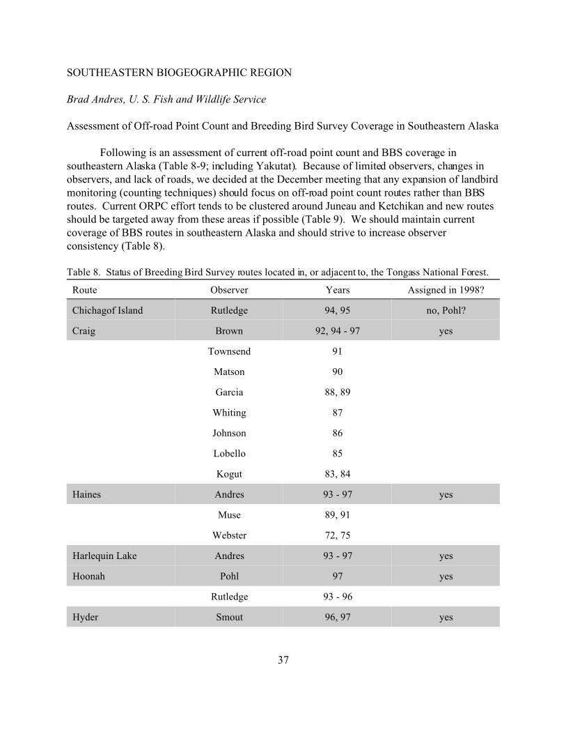
Assessment of Off-road Point Count and Breeding Bird Survey Coverage in Southeastern Alaska
Following is an assessment of current off-road point count and BBS coverage insoutheastern Alaska (Table 8-9; including Yakutat). Because of limited observers, changes inobservers, and lack of roads, we decided at the December meeting that any expansion of landbirdmonitoring (counting techniques) should focus on off-road point count routes rather than BBSroutes. Current ORPC effort tends to be clustered around Juneau and Ketchikan and new routesshould be targeted away from these areas if possible (Table 9). We should maintain currentcoverage of BBS routes in southeastern Alaska and should strive to increase observerconsistency (Table 8).
Table 8. Status of Breeding Bird Survey routes located in, or adjacent to, the Tongass National Forest.
Route Observer Years Assigned in 1998?
Chichagof Island Rutledge 94, 95 no, Pohl?
Craig Brown 92, 94 - 97 yes
Townsend 91
Matson 90
Garcia 88, 89
Whiting 87
Johnson 86
Lobello 85
Kogut 83, 84
Haines Andres 93 - 97 yes
Muse 89, 91
Webster 72, 75
Harlequin Lake Andres 93 - 97 yes
Hoonah Pohl 97 yes
Rutledge 93 - 96
Hyder Smout 96, 97 yes

Route Observer Years Assigned in 1998?
38
Canterbury 94, 95
Juneau Rudis 89 - 97 yes
Glass 83 - 86
Ketchikan Brown 93 - 97 yes
Burns 92
Canterbury 91
West 89 - 90
Lanse 73, 74
Vincent 71, 72
Mitkof Island Walsh 88 - 96 Edgington
Sitka Ward 93 - 96 Schank?
Skagway Andres 93 - 97 yes
Stikine River Robertsen 97 yes
Thorne Bay Russell 94 - 97 yes
Ford 92, 93
Townsend 91
Hollingsworth 89 - 90
Whale Pass Russell 97 yes
Yakutat Andres 93 - 97 yes
May 86
Zarembo Wise-Eagle 93 - 97 yes
Zimovia Strait Wise-Eagle 88 - 97 yes
Discontinued routes
Juneau II Gordon 84 - 86
Petersburg Krueper 84
Walsh 87
Sitka (30 stops) Ward 84 - 92

39
Table 9. Status of off-road point count transects in, or adjacent to, the Tongass National Forest.
Administrative unit Route Years Surveyed in 1998?
Juneau Ranger District Dan Moller Trail 93 - 95 yes?
Dredge Crystal 93 - 96 ?
Eaglecrest Road 93 - 96 yes?
Eaglecrest 2 93, 95 ?
Mendenhall Lake 93 - 96 ?
Moose Lake 93 - 96 yes?
Moraine Ecology 93 - 96 ?
Outer Point 93 ?
Treadwell Ditch 93 - 95 yes?
West Glacier 93 - 95 ?
East Glacier 93 - 95 yes?
Hoonah Ranger District Big Cut 94 - 95 ?
Cann Creek 93 ?
Game Creek 93 - 95 ?
Upper Game Creek 94 - 95 ?
Misty Fjords NM Checats 97 yes
Ella Bay 95 - 97 yes
Manzanita 97 yes
Winstanley 95 - 97 yes
Ketchikan Ranger District Perseverance 95 - 97 yes
Lower Thorne 95, 97 yes
Upper Thorne 95, 97 yes
Rio Roberts 95 - 97 yes
Sarkar 97 yes
Alaska Maritime NWR St. Lazaria Island 94 - 97 yes
Klondike Goldrush NHP Chilkoot Trail 95, 97 yes
40
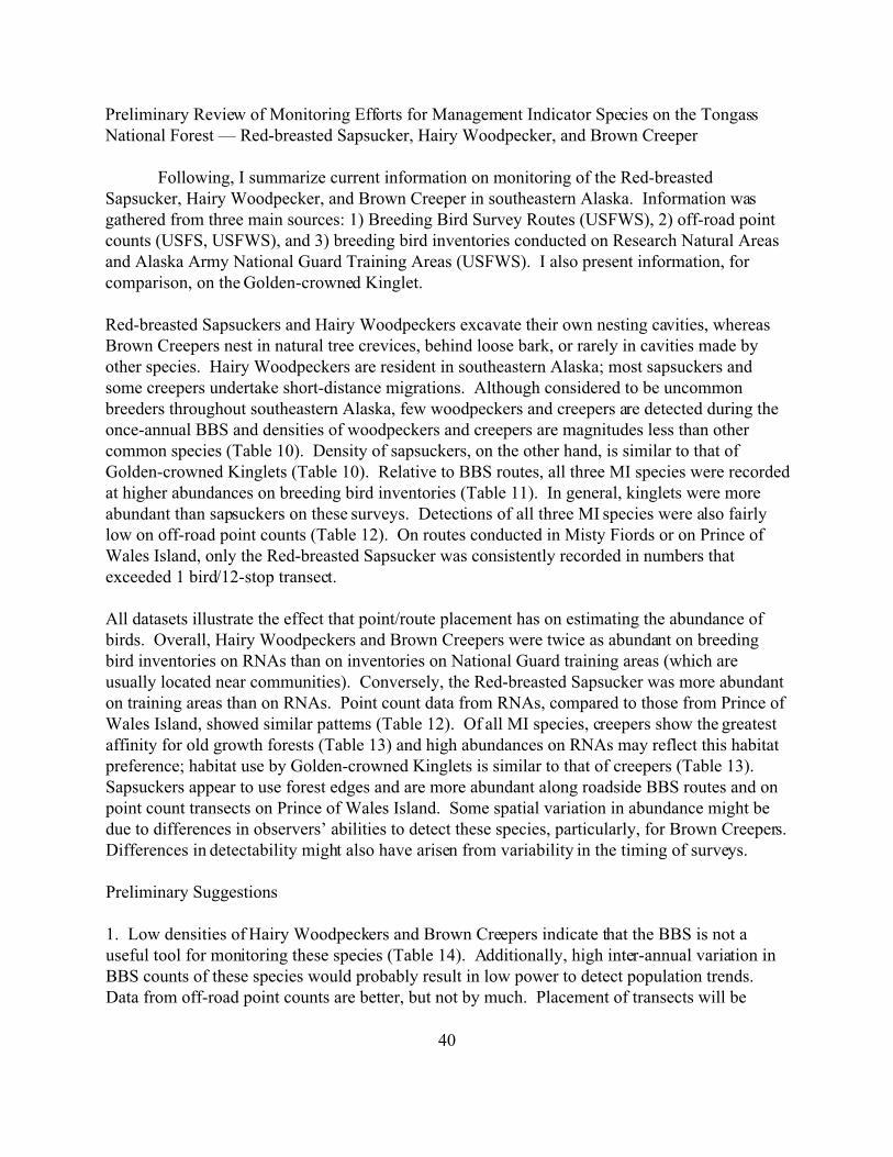
Preliminary Review of Monitoring Efforts for Management Indicator Species on the TongassNational Forest — Red-breasted Sapsucker, Hairy Woodpecker, and Brown Creeper
Following, I summarize current information on monitoring of the Red-breastedSapsucker, Hairy Woodpecker, and Brown Creeper in southeastern Alaska. Information wasgathered from three main sources: 1) Breeding Bird Survey Routes (USFWS), 2) off-road pointcounts (USFS, USFWS), and 3) breeding bird inventories conducted on Research Natural Areasand Alaska Army National Guard Training Areas (USFWS). I also present information, forcomparison, on the Golden-crowned Kinglet.
Red-breasted Sapsuckers and Hairy Woodpeckers excavate their own nesting cavities, whereasBrown Creepers nest in natural tree crevices, behind loose bark, or rarely in cavities made byother species. Hairy Woodpeckers are resident in southeastern Alaska; most sapsuckers andsome creepers undertake short-distance migrations. Although considered to be uncommonbreeders throughout southeastern Alaska, few woodpeckers and creepers are detected during theonce-annual BBS and densities of woodpeckers and creepers are magnitudes less than othercommon species (Table 10). Density of sapsuckers, on the other hand, is similar to that ofGolden-crowned Kinglets (Table 10). Relative to BBS routes, all three MI species were recordedat higher abundances on breeding bird inventories (Table 11). In general, kinglets were moreabundant than sapsuckers on these surveys. Detections of all three MI species were also fairlylow on off-road point counts (Table 12). On routes conducted in Misty Fiords or on Prince ofWales Island, only the Red-breasted Sapsucker was consistently recorded in numbers thatexceeded 1 bird/12-stop transect.
All datasets illustrate the effect that point/route placement has on estimating the abundance ofbirds. Overall, Hairy Woodpeckers and Brown Creepers were twice as abundant on breedingbird inventories on RNAs than on inventories on National Guard training areas (which areusually located near communities). Conversely, the Red-breasted Sapsucker was more abundanton training areas than on RNAs. Point count data from RNAs, compared to those from Prince ofWales Island, showed similar patterns (Table 12). Of all MI species, creepers show the greatestaffinity for old growth forests (Table 13) and high abundances on RNAs may reflect this habitatpreference; habitat use by Golden-crowned Kinglets is similar to that of creepers (Table 13). Sapsuckers appear to use forest edges and are more abundant along roadside BBS routes and onpoint count transects on Prince of Wales Island. Some spatial variation in abundance might bedue to differences in observers’ abilities to detect these species, particularly, for Brown Creepers. Differences in detectability might also have arisen from variability in the timing of surveys.
Preliminary Suggestions
1. Low densities of Hairy Woodpeckers and Brown Creepers indicate that the BBS is not auseful tool for monitoring these species (Table 14). Additionally, high inter-annual variation inBBS counts of these species would probably result in low power to detect population trends. Data from off-road point counts are better, but not by much. Placement of transects will be

41
critical to ensure a reasonable number of encounters. Point count methods appear to be a viablemethod to monitor Red-breasted Sapsuckers. Further power analysis of these methods fordetecting trends in sapsuckers should be conducted.
2. Area searches might provide the best method for monitoring creepers and woodpeckers. Ihope to work out power aspects of detecting differences for these procedures in the near future. Area search methods can be adapted to any spatial scale; abundance categories are based onbirds/person-hour. For all methods, clear objectives for the monitoring need to be established. Are trends/changes in populations needed for the entire forest, certain districts, or only alteredlandscape units? What is the monitoring time frame; are annual estimates needed or cansampling occur at a longer interval.
3. If rigorous monitoring of creepers and woodpeckers is cost-prohibitive, perhaps could asurrogate species be used (e.g., Golden-crowned Kinglet) to quantitatively track populationchanges and a more cursory method be used to ensure that woodpeckers and creepers still occurwithin landscape units. Certainly, the surrogate(s) would need to strongly overlap in habitatuse/preference with MI species.
4. A small research project could be initiated to determine seasonality of detectability in the MIspecies. Perhaps a survey conducted earlier in the season would substantially increase thenumber of individuals recorded on point count transects.
Table 10. Average abundance (birds/route) of selected species on BBS routes (n = 69 route-years) in, or adjacent to the Tongass National Forest.
Species Birds/route Species Birds/route
Varied Thrush 54.3 Red-breasted Sapsucker 8.8
Pacific-slope Flycatcher 16.4 Hairy Woodpecker 1.3
Townsend’s Warbler 13.2 Brown Creeper 0.7
Golden-crowned Kinglet 9.2

42
Table 11. Abundance of Management Indicator Species, and the Golden-crowned Kinglet, at sites inventories for
breeding birds in southeastern Alaska, 1997.
Abundance o f:
Area RBSA HAWO BRCR GCKI
Dog Island RNA rare - rare uncommon
Ketchikan NGTA rare uncommon occasional fairly common
Old Tom Creek RNA occasional uncommon fairly common common
Craig NGTA rare - rare common
Rio Roberts RNA - uncommon - abundant
Kadin Island RNA - fairly common common abundant
Wrangell NGTA uncommon rare - fairly common
Petersburg NGTA uncommon - occasional rare
Kake NGTA fairly common rare rare fairly common
Cape Fanshaw RNA uncommon common common abundant
West Gambier Bay RNA uncommon occasional fairly common common
Sitka NGTA uncommon - - uncommon
Angoon NGTA fairly common rare uncommon uncommon
Limestone Creek RNA uncommon uncommon uncommon common
Juneau NGTA uncommon - uncommon fairly common
Hoonah NGTA uncommon - rare fairly common
St. James Bay NGTA uncommon rare occasional common
Haines NGTA rare uncommon uncommon common

43
Table 12. Abundance (birds/point) of Management Indicator Species, and the Golden-crownedKinglet, on point counts in the Tongass National Forest.
Average number (birds/point)
RBSA HAWO BRCR GCKI
Research Natural Areas (n = 84 points) 0.02 0.07 0.32 1.05
Misty Fiords (n = 72 point-years) 0.05 0.00 0.01 -
Prince of Wales (n = 132 point-years) 0.14 0.05 0.05 -
Table 1 3. Occur rence of land bird M anageme nt Indicator S pecies in ma ture conifero us and succ essional stage forests
in the Ton gass Natio nal Forest.
Old-gro wth Successional Stage
Species tall closed1 medium open 2 20 yrs3 11-17 yrs4 9 yrs5 <5 yrs6
Red-breasted Sapsucker x7 x x x
Hairy Woodpecker x x x x r7
Brown Creeper x x
Golden-crowned Kinglet x x x r
1 closed canopy forest dominated by large diameter hemlock/spruce associations2 open forest, primarily muskeg hab itat, dominated by shore pine a nd mixed conifer assoc iations.3 hemlock-spruce associations, trees <55 cm DBH4 hemlock/spruce saplings <13 cm DBH, deciduous shrubs5 similar to above but trees <2.5 cm DBH6 dense hemlock/spruce seedlings; deciduous shrubs and forbs7 x = comm only presen t; r = present o nly rarely

44
Table 14. Average abundance (birds/route) and interannual variation (SE) of Management Indicator Species (and the Golden-crowned Kinglet) on BBSroutes on, or adjacent to, the Tongass National Forest.
Hairy Woodpecker Red-breasted Sapsucker
No. individuals No. stops present No. individuals No. stops present
Route Yrs ave SE cv ave SE cv Ave SE cv ave SE cv
Juneau 8 0.13 0.13 1.00 0.13 0.13 1.00 4.75 1.00 0.21 4.25 0.98 0.23
Craig 4 1.50 0.96 0.64 1.50 0.96 0.64 10.00 1.78 0.18 8.25 0.75 0.09
Ketchikan 4 - - - - - - 0.75 0.48 0.64 0.75 0.48 0.64
Haines 4 0.25 0.25 1.00 0.25 0.25 1.00 1.00 0.41 0.41 1.00 0.41 0.41
Sitka 4 2.50 0.65 0.26 1.75 0.48 0.27 4.75 0.85 0.18 4.75 0.85 0.18
Thorne Bay 3 2.67 1.67 0.63 2.67 1.67 0.63 5.67 1.86 0.33 5.33 1.76 0.33
Yakutat 4 0.25 0.25 1.00 0.25 0.25 1.00 - - - - - -
Mitkof Island 9 0.78 0.36 0.47 0.78 0.36 0.47 18.67 3.54 0.19 15.22 2.73 0.18
Zimovia Strait 9 1.56 0.63 0.40 1.50 0.50 0.34 5.33 1.71 0.32 4.75 1.12 0.24
Harlequin Lake 4 1.00 0.41 0.41 1.00 0.41 0.41 2.50 1.19 0.48 2.25 0.95 0.42
Hoonah 4 3.50 1.50 0.43 2.75 1.11 0.40 24.25 6.46 0.27 18.25 4.48 0.25
Skagway 4 - - - - - - 0.75 0.48 0.64 0.75 0.48 0.64
Zarembo 4 6.00 2.16 0.36 4.25 1.65 0.39 24.25 7.16 0.30 17.50 4.73 0.27
Chichagof Island 2 1.50 0.50 0.33 1.50 0.50 0.33 30.00 11.00 0.37 22.50 6.50 0.29
Hyder 2 - - - - - - 1.50 1.50 1.00 1.50 1.50 1.00
Brown Creeper Golden-crowned Kinglet
No. individuals No. stops present No. individuals No. stops present
Route Yrs Ave SE cv ave SE cv Ave SE cv ave SE cv
Juneau 8 - - - - - - 7.13 2.95 0.41 5.63 2.36 0.42
Craig 4 - - - - - - 3.25 0.63 0.19 2.50 0.50 0.20
Ketchikan 4 - - - - - - 3.25 0.63 0.19 3.00 0.71 0.24
Haines 4 0.25 0.25 1.00 0.25 0.25 1.00 6.00 1.68 0.28 5.25 1.60 0.30
Sitka 4 0.25 0.25 1.00 0.25 0.25 1.00 5.00 1.83 0.37 4.00 1.29 0.32
Thorne Bay 3 0.33 0.33 1.00 0.33 0.33 1.00 8.67 4.06 0.47 7.33 3.53 0.48
Yakutat 4 1.25 0.75 0.60 1.25 0.75 0.60 22.00 6.54 0.30 17.00 4.20 0.25
Mitkof Island 9 2.11 0.72 0.34 2.00 0.67 0.33 8.56 1.61 0.19 6.56 1.00 0.15
Zimovia Strait 9 - - - - - - 14.33 4.72 0.33 8.50 2.71 0.32
Harlequin Lake 4 1.75 0.85 0.49 1.75 0.85 0.49 17.25 2.50 0.14 14.75 2.50 0.17
Hoonah 4 3.25 1.25 0.38 2.00 0.71 0.35 9.00 3.49 0.39 6.00 1.96 0.33
Skagway 4 - - - - - - 2.75 1.25 0.45 2.50 1.04 0.42
Zarembo 4 - - - - - - 9.00 6.36 0.71 4.75 2.46 0.52
Chichagof Island 2 - - - - - - 7.00 6.00 0.86 4.00 3.00 0.75
Hyder 2 2.00 2.00 1.00 1.00 1.00 1.00 10.00 1.00 0.10 6.50 2.50 0.38

45
ADMINISTRATION
Brad Andres, U.S. Fish and Wildlife Service
Few nominations for Chair of BPIF were sent to Paul Cotter and those that were sent indicated thatI should remain Chair of BPIF for the next two years. I agreed to retain this responsibility for the next twoyears. As for committees, my suggestion of maintaining current chairs was not met with much oppositionmassive. Below are listed the current chairs with a brief outline of their duties over the next two years. Icontinue to make, albeit slow, headway on the Alaska Landbird Conservation Plan
Boreal Partners in Flight Working Group Chair - Brad Andres• distribute regional, national, and international materials in a timely manner (should be
easier after the homepage is functional [4/98])• represent BPIF at meetings of the Western Working Group• draft Alaska Landbird Conservation Plan• produce BPIF annual report, February - early March• organize and facilitate annual meeting• maintain BPIF mailing list
Biogeographic Region Chairs• summarize meeting topics, action items, and accomplishments for annual report• contribute sections for Conservation Plan and serve as reviewers for completed plan• ensure annual action items identified for each region are completed
Southeastern - Ellen CampbellSouthcoastal - Colleen HandelCentral - John WrightNorthern - Dave YokelWestern/Southwestern - Brian McCaffery
Monitoring/Research Committee Chairs• summarize meeting topics, action items, and accomplishments for annual report• ensure annual action items identified for each monitoring/research area are completed• distribute materials on new field techniques, data forms, or data analysis
Breeding Bird Survey - Brad AndresOff-road point counts - Colleen HandelMist-netting/banding - Anna-Marie Barber
Information and Education Chair - Heather Johnson• summarize meeting topics, action items, and accomplishments for annual report• coordinate the North American Migration Count and other IMBD activities• identify new educational projects that need to be developed