Embed Size (px)
Citation preview

Blueprint Denver Task Force Meeting #16 – February 22, 2018

• Welcome, Meeting Overview and Process Update• Change Categories• Small Group Recommendations Discussions:
– Land Use and Built Form – General– Land Use and Built Form – Design Quality– Mobility and Access– Quality of Life Infrastructure
• Questions and Comments• Next Steps2
Agenda
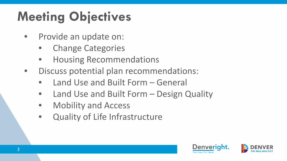
• Provide an update on:• Change Categories• Housing Recommendations
• Discuss potential plan recommendations:• Land Use and Built Form – General• Land Use and Built Form – Design Quality• Mobility and Access• Quality of Life Infrastructure
3
Meeting Objectives

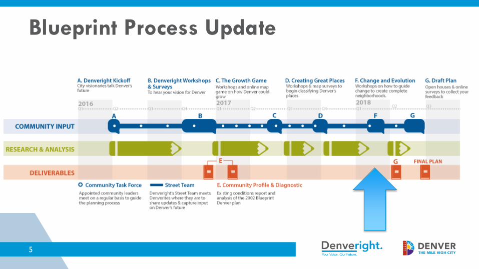
1. Blueprint Denver Process Update
4
5
Blueprint Process Update
2. Blueprint Denver Change Categories
6

Blueprint 2002: Change CategoriesTwo categories• Areas of Change
– Direct growth
• Areas of Stability– Maintain character
7
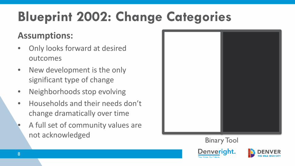
Assumptions:• Only looks forward at desired
outcomes• New development is the only
significant type of change• Neighborhoods stop evolving• Households and their needs don’t
change dramatically over time• A full set of community values are
not acknowledgedBinary Tool
Blueprint 2002: Change Categories
8

9
Transform Expected to experience
significant Character ChangeConnect Improve Access to Opportunity
Integrate Vulnerable to Displacement
Enrich Strengthen and be inclusive
Mor
e C
hang
eLe
ss C
hang
e
Transform
Connect Enrich
Integrate
NEIGHBORHOOD CHANGE
Blueprint 2018 Categories of Change
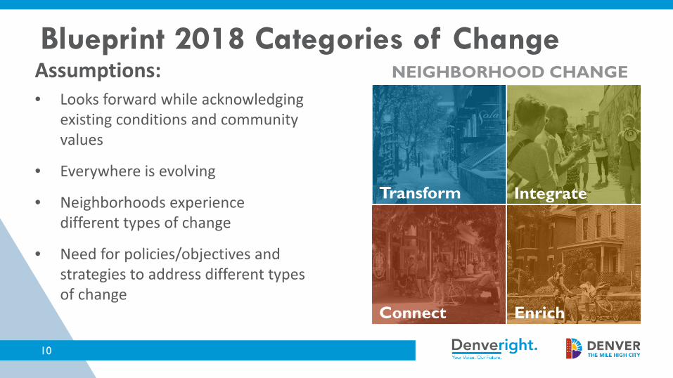
Assumptions:• Looks forward while acknowledging
existing conditions and community values
• Everywhere is evolving
• Neighborhoods experience different types of change
• Need for policies/objectives and strategies to address different types of change
Transform
Connect Enrich
Integrate
NEIGHBORHOOD CHANGE
10
Blueprint 2018 Categories of Change

11
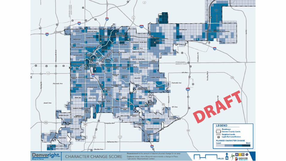
1. Character Change Measurement = the amount of
desired physical change for an area
Captures areas where Blueprint recommends a change in Place Type and/or Neighborhood Context Transform
Connect
Integrate
Enrich
Categories of Change – Four Inputs
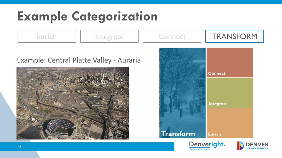
TRANSFORMEnrich Integrate Connect
Example: Central Platte Valley - Auraria
Transform
Connect
Integrate
Enrich
13
Example Categorization

14
2. Access to Opportunity Measurement = Physical access to
healthy food, education, parks, shopping, entertainment and jobs
Captures areas that currently do not have access to key elements of a complete neighborhood
Transform
Connect
Integrate
Enrich
Categories of Change – Four Inputs

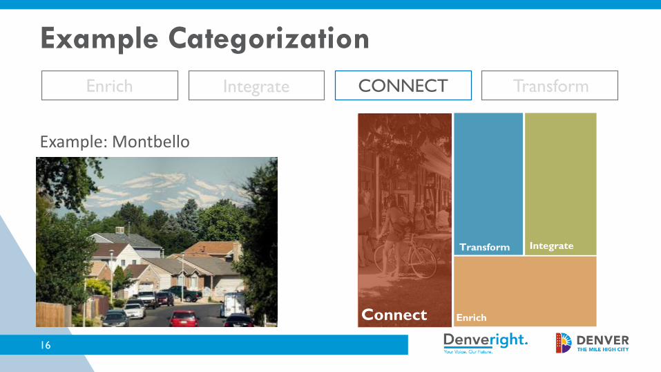
CONNECTEnrich TransformIntegrate
Example: Montbello
Transform
Connect
Integrate
Enrich
16
Example Categorization
17
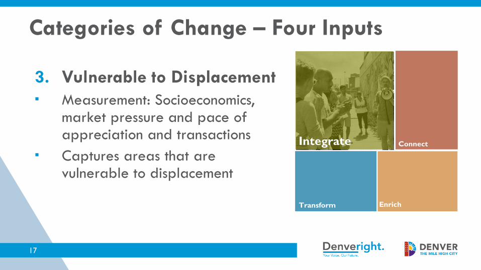
3. Vulnerable to Displacement Measurement: Socioeconomics,
market pressure and pace of appreciation and transactions
Captures areas that are vulnerable to displacement
Transform
ConnectIntegrate
Enrich
Categories of Change – Four Inputs
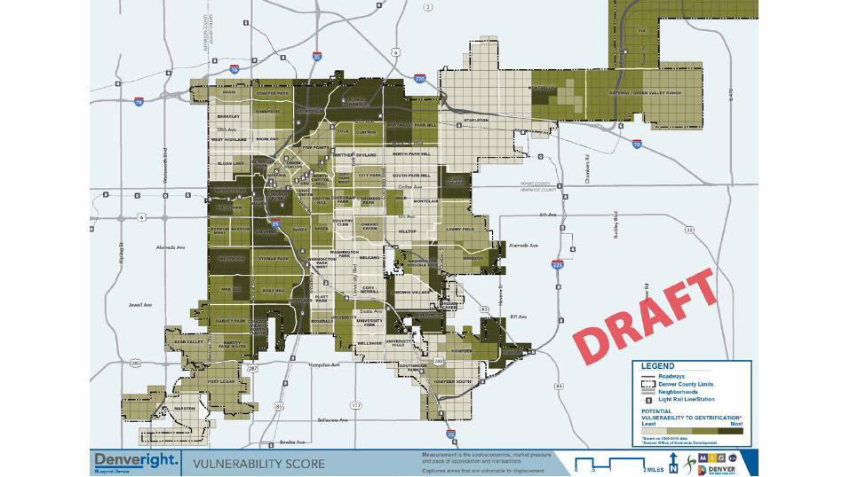
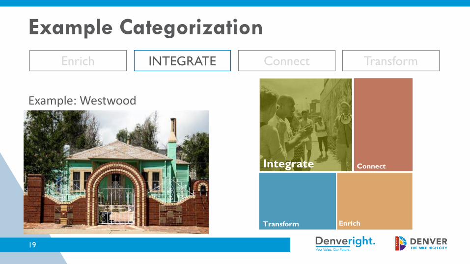
Enrich INTEGRATE Connect Transform
Example: Westwood
Transform
ConnectIntegrate
Enrich
19
Example Categorization
20
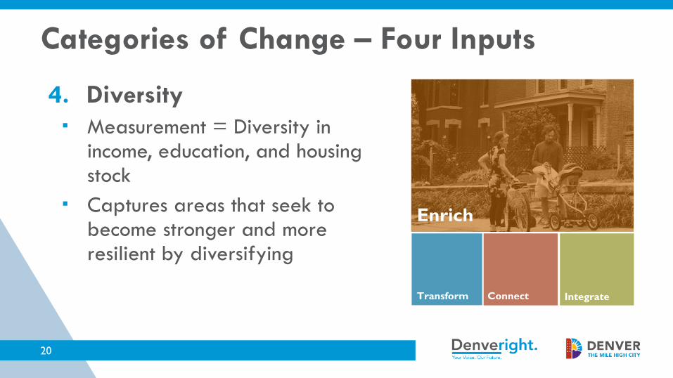
4. Diversity Measurement = Diversity in
income, education, and housing stock
Captures areas that seek to become stronger and more resilient by diversifying
Transform Connect Integrate
Enrich
Categories of Change – Four Inputs


ENRICH Integrate Connect Transform
Example: West Wash Park
Transform Connect Integrate
Enrich
22
Example Categorization


3. Draft Blueprint Denver Plan Recommendations
24

Seeking community input on initial ideas for four key topics:
1. Housing2. Design Quality3. Mobility and Access4. Quality of Life Infrastructure• The
Recommendations for Community Input
26
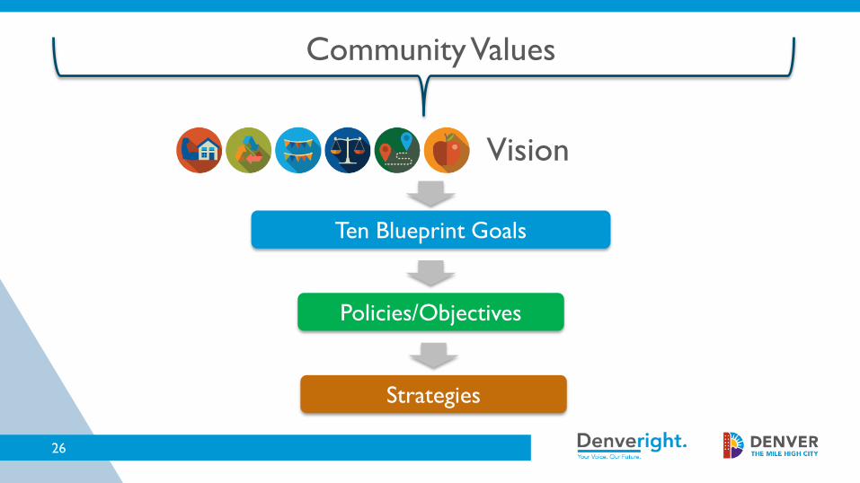
Community Values
Ten Blueprint Goals
Policies/Objectives
Strategies
Vision

To help achieve the goals outlined in Blueprint Denver, a series of policies, objectives and strategies have been identified.
Policies and Objectives:• Policies are statements that help to achieve the desired goals.• Objectives are at the same level as Policies, but are
measurable and include time-bound targets.
Strategies:• Strategies are actions and incremental steps that help achieve
the policies and objectives.
Organization of Recommendations
Land Use and Built Form: Housing
28

29
Housing

Recap of Task Force meeting with Housing Advisory Committee:• Overview of Housing an Inclusive Denver, Denver’s new
housing plan• Breakout discussion and feedback on initial ideas for
Blueprint recommendations on:– ADUs– Missing Middle Housing– Incentivizing affordable housing through zoning
30
Housing

PolicyExpand housing choice by allowing more accessory dwelling units (ADUs) – also called granny flats or carriage houses – throughout the city.
Example Strategies– Allow ADUs in all residential areas.
• Consider impacts for areas most vulnerable to displacement and look for tools – such as removing financial barriers – to promote ADUs as wealth-building tools for low- and moderate-income homeowners
– Revise ADU zoning standards to be sensitive to surrounding character, including height and building mass.
31
Housing – Draft Recommendations

• Strong consensus to recommend ADUs as a detached accessory use throughout all neighborhood contexts
• Do not require ADUs to be income restricted since we are trying to remove barriers and see more ADUs throughout the city– We could explore ways to incentivize income restricted ADUs
• At this time we probably don’t want to remove the restriction that the owner live on-site or enable selling of the ADU
32
Input from Task Force/HAC

PolicyDiversify housing options by integrating “missing middle housing” into low-and low-medium scale Residential Areas
Example Strategies– In single- and two-unit areas, allow two- to four-unit structures in
appropriate locations, such as corner lots along collector streets. This could include a requirement to provide income-restricted affordable units in exchange for the increased density.
– Incentivize the re-use of existing structures to add more units, rather than a complete redevelopment of the site.
33
Housing – Draft Recommendations

• Strong consensus to pursue this approach – some expressed desire to enable it to happen anywhere in a residential neighborhood, others think it makes sense to limit to strategic locations such as corners along a collector street
• General support to explore how to make this an incentive for income restricted units – will require a feasibility study
34
Input from Task Force/HAC

PolicyIncentivize the development of affordable and mixed-income housing.
Example Strategies– Study and implement zoning tools to incentivize affordable housing in
regional centers, community centers, and community corridors. Tools could include height bonuses.
– Study the feasibility of parking reductions and reduced building permit fees for projects that commit to a certain level of affordability
– Leverage publicly owned land for affordable housing development
35
Housing – Draft Recommendations

• Strong consensus to pursue this approach – definitely in corridors and centers served by transit
• Consider an incentive approach that could be scaled to different areas– Residential areas: slightly more units allowed if income restrictions
met– Corridors and centers: more stories allowed if income restrictions
met (similar to height incentive just implemented at 38th and Blake station area)
36
Input from Task Force/HAC
Building on Housing discussion, seeking Task Force input on initial ideas for four additional topics:
1. Land Use and Built Form – General2. Land Use and Built Form – Design Quality3. Mobility and Access4. Quality of Life Infrastructure• The
37
Additional Task Force Input Needed
Land Use & Built Form: General
38

• This is a category of recommendations that relate to Land Use and Built Form and are not captured in the Housing or Design Quality
• Two major topics to address today:– Explore minimum density/height requirements in centers
and corridors to encourage more efficient use of land– Street level uses in centers and corridors
39
Background

• In centers and corridors, especially at the regional and community scale, we need intensity to achieve:– Projected growth– Walkable, mixed use communities– Densities and land use that support transit
ridership
40
Efficient Use of Land

• Zoned for mixed use 20 stories
• Within three blocks of a major commuter rail station
41
Efficient Use of Land

PolicyPromote the efficient use of land, especially in centers and corridors with high transit connectivity
Example Strategy– In regional centers and community centers and corridors,
study the feasibility of requiring or incentivizing density. One example could be minimum heights
42
Efficient Use of Land
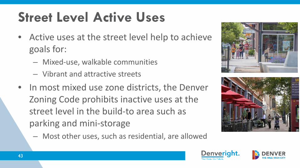
• Active uses at the street level help to achieve goals for:– Mixed-use, walkable communities– Vibrant and attractive streets
• In most mixed use zone districts, the Denver Zoning Code prohibits inactive uses at the street level in the build-to area such as parking and mini-storage– Most other uses, such as residential, are allowed
43
Street Level Active Uses

• Many new buildings in Denver are 100% residential with residential uses at the street level
• This is a particular concern for small local corridors, which are intended to provide neighborhoods with entertainment, service, and employment uses
• Examples along Tennyson, zoned for Mixed-use/Main Street, fully residential built
44
U-MX-3
U-MS-5
Street Level Active Uses

PolicyEnsure an active and pedestrian-friendly environment that provides a true mixed-use character where neighborhood services are desired.
Example Strategies– Require strong street level active use standards for local centers and
corridors. This may include a prohibition on residential units for a portion of the street level building.
– Study stronger street level active use requirements for other centers and corridors (community and regional scale)
45
Street Level Active Uses
Land Use & Built Form: General
46
- Small Group Recommendations Discussion

Land Use & Built Form: Design Quality
47

48
• Enhance the overall character and sense of place of neighborhoods through all stages of development and reinvestment.
• Foster great urban design and the creation of authentic places that thoughtfully integrate streets, public spaces and private property.
• Promote enduring and compatible design that responds to an evolving community while embracing character and cultural heritage.
Blueprint Goals That Support Design Quality
49
• Key Question: what should Blueprint Denver recommend to achieve high-quality design from private development?
• Remember:• Blueprint is policy – it does not have “teeth” to enforce
or change the rules of development• Implementation of Blueprint recommendations will rely
on regulatory tools such as zoning and design standards and guidelines
Design Quality

50
aaaaaaaaaaa
Residential Areas
51
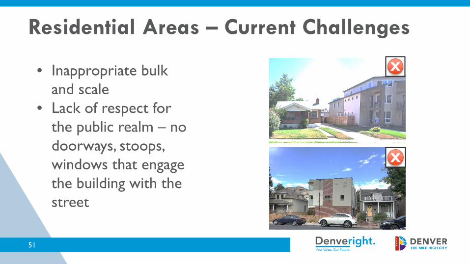
• Inappropriate bulk and scale
• Lack of respect for the public realm – no doorways, stoops, windows that engage the building with the street
X
X
Residential Areas – Current Challenges
52
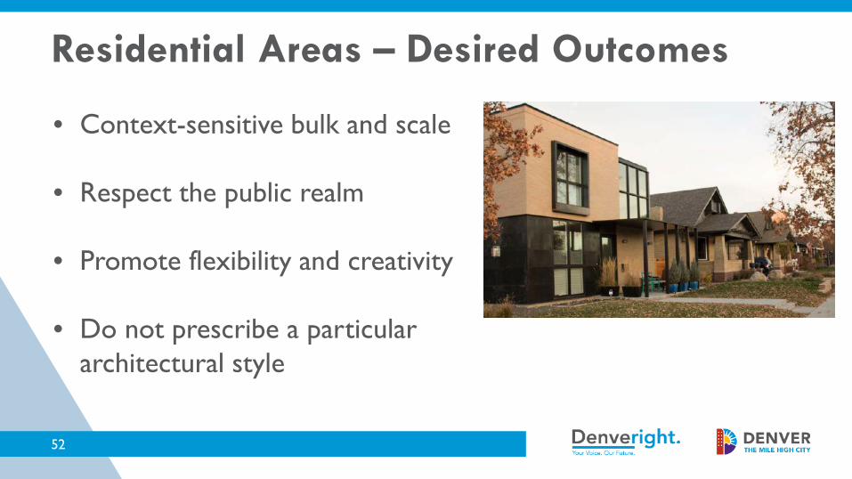
• Context-sensitive bulk and scale
• Respect the public realm
• Promote flexibility and creativity
• Do not prescribe a particular architectural style
Residential Areas – Desired Outcomes
53
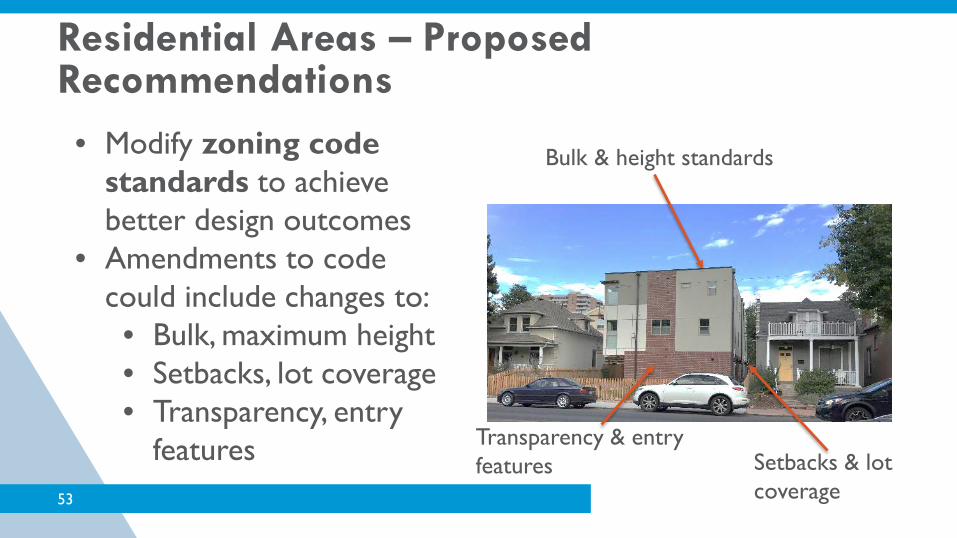
• Modify zoning code standards to achieve better design outcomes
• Amendments to code could include changes to:
• Bulk, maximum height• Setbacks, lot coverage• Transparency, entry
features
Bulk & height standards
Setbacks & lot coverage
Transparency & entry features Setbacks & lot
coverage
Residential Areas – Proposed Recommendations

54
Zoning code changes:• Would likely vary by neighborhood context• Can achieve significant improvements without requiring a new
design review system or new staff to administer• Could apply to all residential areas throughout the city• Could be paired with other regulations, such as new street design
guidelines, to improve landscaping in the public right-of-way
Neighborhood Contexts
Residential Areas – Proposed Recommendations
55
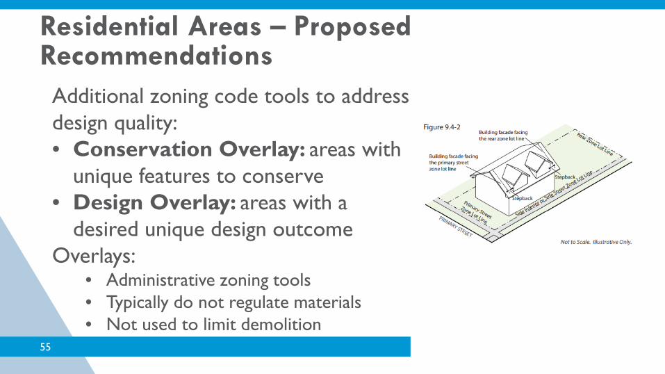
Additional zoning code tools to address design quality:• Conservation Overlay: areas with
unique features to conserve• Design Overlay: areas with a
desired unique design outcomeOverlays:
• Administrative zoning tools• Typically do not regulate materials • Not used to limit demolition
Residential Areas – Proposed Recommendations
56
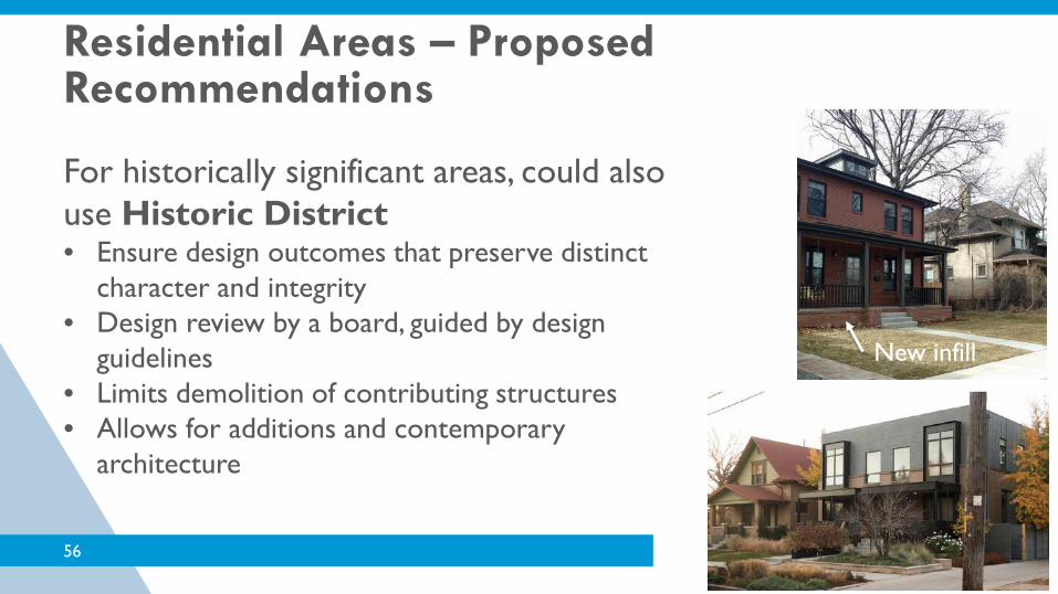
For historically significant areas, could also use Historic District• Ensure design outcomes that preserve distinct
character and integrity• Design review by a board, guided by design
guidelines• Limits demolition of contributing structures• Allows for additions and contemporary
architecture
New infill
Residential Areas – Proposed Recommendations

57
aaaaaaaaaaa
Centers and Corridors

58
• Inactive street level uses• In some locations, such as transitions
to residential areas, inappropriate bulk and scale
• Lack of façade articulation and little variation in materials
• Lack of respect for the public realm:• Large parking structures exposed to the
street• Inadequate landscaping, cafes, and other
features that engage the sidewalk
Centers and Corridors – Current Challenges

59
• Active and engaging street levels that support pedestrian activity
• Appropriate bulk and scale• Sensitive transitions to residential
areas• Human-scaled facades with
variation and interest• Respect and engage the public
realm
Centers and Corridors – Desired Outcomes

60
• Modify zoning code standards to achieve better design outcomes
• Amendments to code could include changes to:
• Street level active uses• Setbacks, stepbacks and
other tools to address bulk and transitions
• Transparency, entry features
Centers and Corridors – Recommendations

61
Zoning code changes:• Would likely vary by neighborhood context• Can vary by place type
• For example, local corridors may need different standards than community corridors
• Could apply to all/most centers and corridors throughout the city
Centers Corridors
Centers and Corridors – Recommendations
62
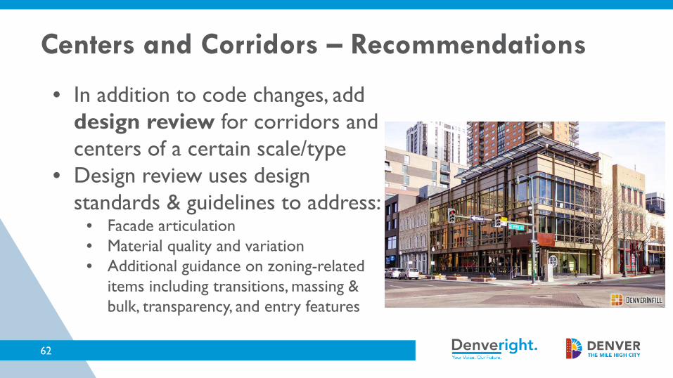
• In addition to code changes, add design review for corridors and centers of a certain scale/type
• Design review uses design standards & guidelines to address:
• Facade articulation• Material quality and variation• Additional guidance on zoning-related
items including transitions, massing & bulk, transparency, and entry features
Centers and Corridors – Recommendations

63
• Design review can be administrative (by staff) or through a design review board
• Design review with professional design review board recommended for:• Downtown: currently does not
exist for all of Downtown
• Cherry Creek North: already exists
Centers and Corridors – Recommendations
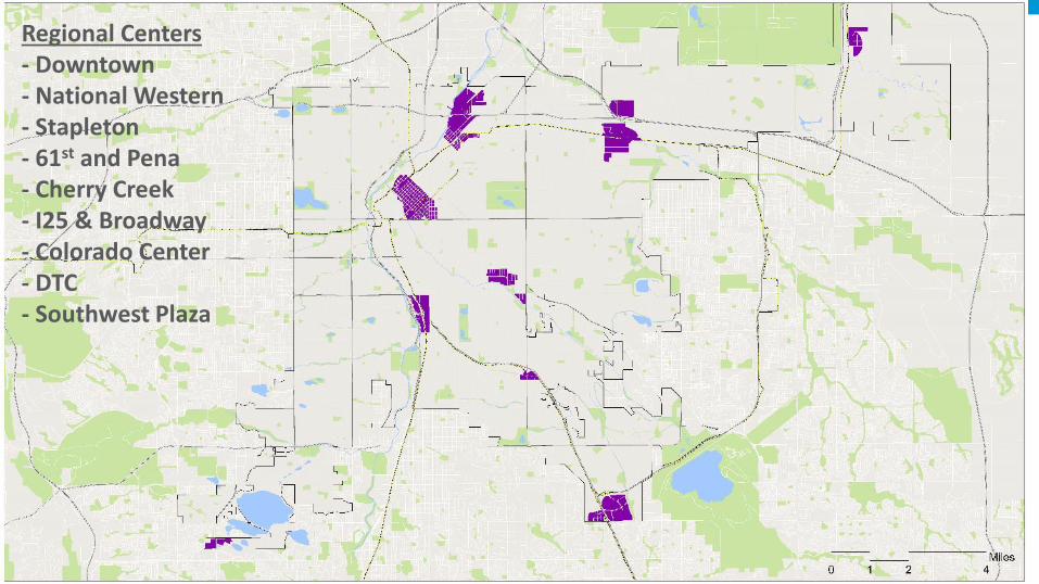
Regional Centers- Downtown- National Western- Stapleton- 61st and Pena- Cherry Creek- I25 & Broadway- Colorado Center- DTC- Southwest Plaza
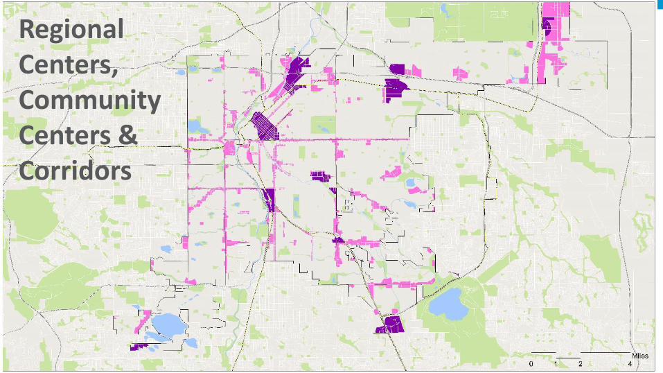
Regional Centers, Community Centers & Corridors

66
• Consider a two-track design review system for all regional & community centers and community corridors• Projects below threshold reviewed administratively by staff• Projects of a certain size or type could be triggered for review by a
professional design review board
• Similar approach used in peer cities like Portland• Requires significant increase in staff resources
Centers Corridors
Centers and Corridors – Recommendations

Land Use & Built Form: Design Quality
68
- Small Group Recommendations Discussion

Mobility and Access
69

70
• Streets can better serve the needs of everyone when the design of a street considers the needs surrounding character.
• When there are more amenities and services available near the places where people live, it reduces the distance needed to travel.
• As Denver grows, certain corridors will need to accommodate growth by providing more housing while also providing more transportation choices.
Why Integrate Land Use & Transportation in Blueprint?

71
Denver Moves: Transit will help Denver identify and create new transportation choices to move more people efficiently and safely on our existing street network.
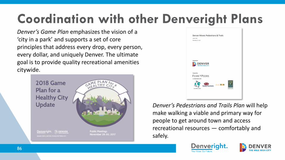
Denver’s Pedestrians and Trails Plan will help make walking a viable and primary way for people to get around town and access recreational resources — comfortably and safely.
Coordination with other Denveright Plans
72
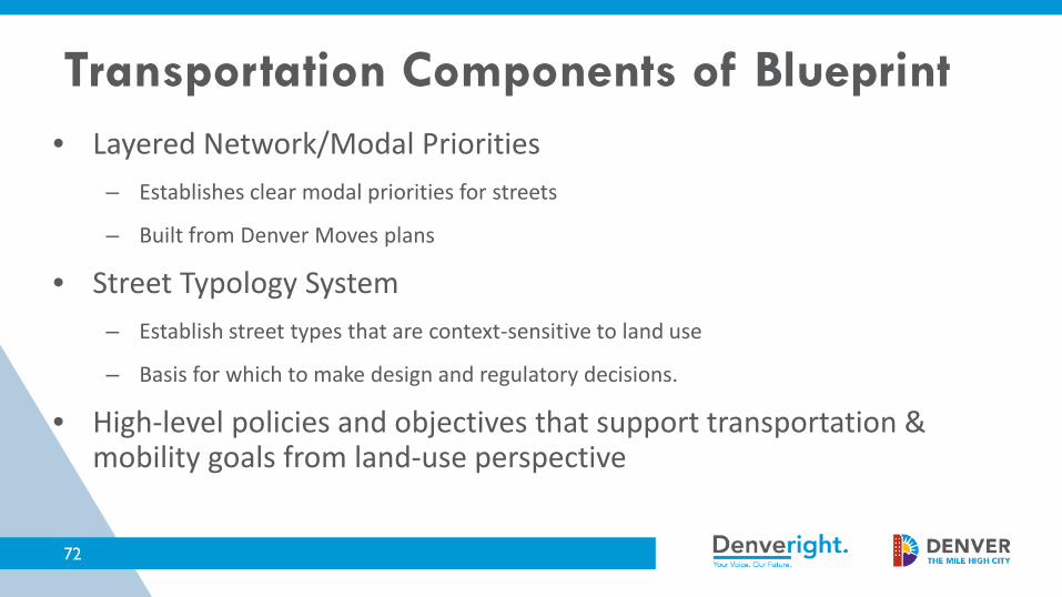
• Layered Network/Modal Priorities– Establishes clear modal priorities for streets
– Built from Denver Moves plans
• Street Typology System– Establish street types that are context-sensitive to land use
– Basis for which to make design and regulatory decisions.
• High-level policies and objectives that support transportation & mobility goals from land-use perspective
Transportation Components of Blueprint

• Streets that will be prioritized for a particular mode (or modes)– Design– Operations
• Each modal network should provide a reasonable degree of mobility and access
• Together, the modal networks should create a complete system that provides more options for how to travel
73
Modal Priority Networks

74
• Transit priority streets make transit a reliable and attractive travel choice
• Capital Investment and Speed and Reliability corridors from Denver Moves: Transit• Future bus-rapid transit or rail on
certain corridors• Station improvements
• Real-time passenger information• Improved shelters
Transit Priority Streets
75
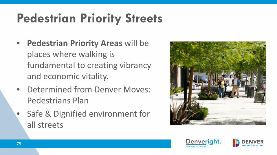
• Pedestrian Priority Areas will be places where walking is fundamental to creating vibrancy and economic vitality.
• Determined from Denver Moves: Pedestrians Plan
• Safe & Dignified environment for all streets
Pedestrian Priority Streets

76
• Bicycle Priority Streets make traveling by bicycle more comfortable and convenient.
• Low-stress (high ease-of-use) network from Denver Moves Bicycles.
Bicycle Priority Streets
77
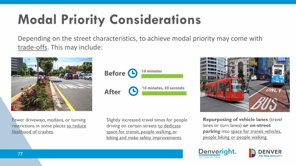
Depending on the street characteristics, to achieve modal priority may come with trade-offs. This may include:
Slightly increased travel times for people driving on certain streets to dedicate space for transit, people walking, or biking and make safety improvements.
Repurposing of vehicle lanes (travel lanes or turn lanes) or on-street parking into space for transit vehicles, people biking or people walking.
Fewer driveways, medians, or turning restrictions in some places to reduce likelihood of crashes.
10 minutes
10 minutes, 30 seconds
Before
After
Modal Priority Considerations

PolicyPromote a safe and dignified pedestrian environment citywide.
Example Strategy– Ensure that café seating in the public right-of-way
provides adequate space for pedestrians and streetscape, especially in areas with high pedestrian volumes.
78
Modal Priority
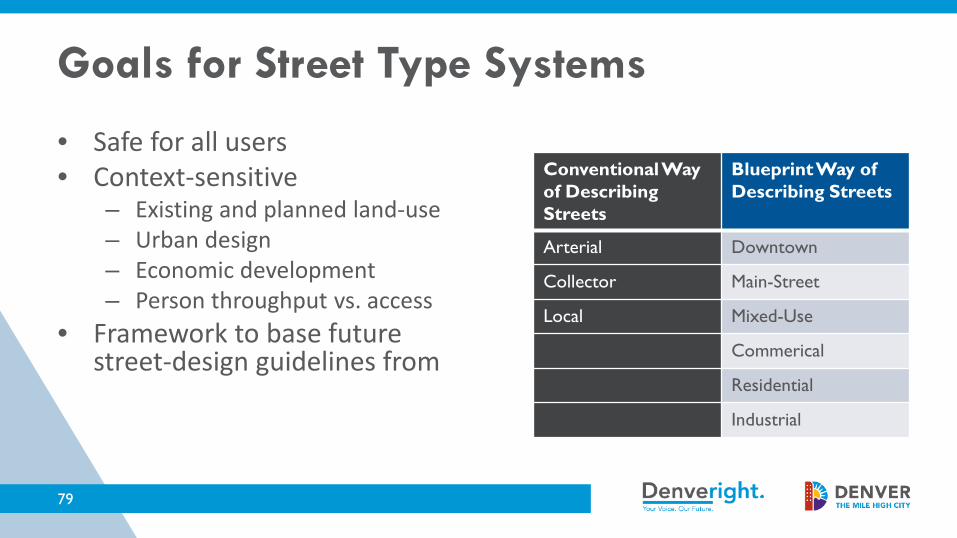
• Safe for all users• Context-sensitive
– Existing and planned land-use– Urban design– Economic development– Person throughput vs. access
• Framework to base future street-design guidelines from
79
Conventional Way of Describing Streets
Blueprint Way of Describing Streets
Arterial Downtown
Collector Main-Street
Local Mixed-Use
Commerical
Residential
Industrial
Goals for Street Type Systems

80
Blueprint 2018 Street Types

• Provides guidance to develop new standards for the design of streets that is sensitive to land-use character and context:
81
• Sidewalk widths• Space for streetscape amenities• Space for café seating• Tree lawns and vegetation• Signal timing and operations
Street Types and Future Regulatory Changes

PolicyExplore regulations to implement vision for street types and the layered modal network.
Example Strategy– Develop comprehensive Street Design Guidelines based
on street types that address components such as green infrastructure, bikeway design, streetscaping, and pedestrian spaces.
82
Street Types and Modal Priority

Mobility and Access
83
- Small Group Recommendations Discussion

Quality of Life Infrastructure
84

85
Why is it important?• Addressing Quality of Life Infrastructure in Blueprint Denver will:
– Help ensure that active recreation is available to all areas of Denver;– Help protect and increase access to Denver’s natural features; – Help define appropriate types and uses of green infrastructure; and – Help create social spaces for residents throughout Denver’s
neighborhoods, centers, and corridors.
Quality of Life Infrastructure
86
Denver’s Game Plan emphasizes the vision of a ‘city in a park’ and supports a set of core principles that address every drop, every person, every dollar, and uniquely Denver. The ultimate goal is to provide quality recreational amenities citywide.
Denver’s Pedestrians and Trails Plan will help make walking a viable and primary way for people to get around town and access recreational resources — comfortably and safely.
Coordination with other Denveright Plans

What we’ve heard from the community:
• Green spaces and community gathering places are essential do Denver’s quality of life.
• Denver needs more tools to ensure our network of open space keeps pace with growth.
Quality of Life Infrastructure

PolicyExpand tools and regulations to ensure that the provision of high-quality parks and public spaces keeps pace with Denver’s growth.
Example Strategy– Evaluate the need for increased requirements for open
space for mid- and large-scale developments in centers and corridors.
88
Quality of Life Infrastructure
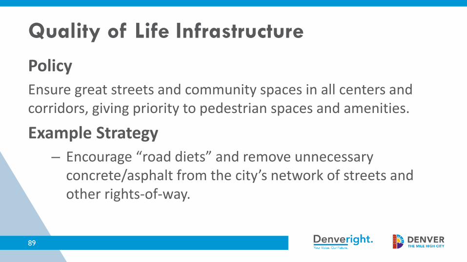
PolicyEnsure great streets and community spaces in all centers and corridors, giving priority to pedestrian spaces and amenities.
Example Strategy– Encourage “road diets” and remove unnecessary
concrete/asphalt from the city’s network of streets and other rights-of-way.
89
Quality of Life Infrastructure
Quality of Life Infrastructure
90
- Small Group Recommendations Discussion
4. Next Steps
91
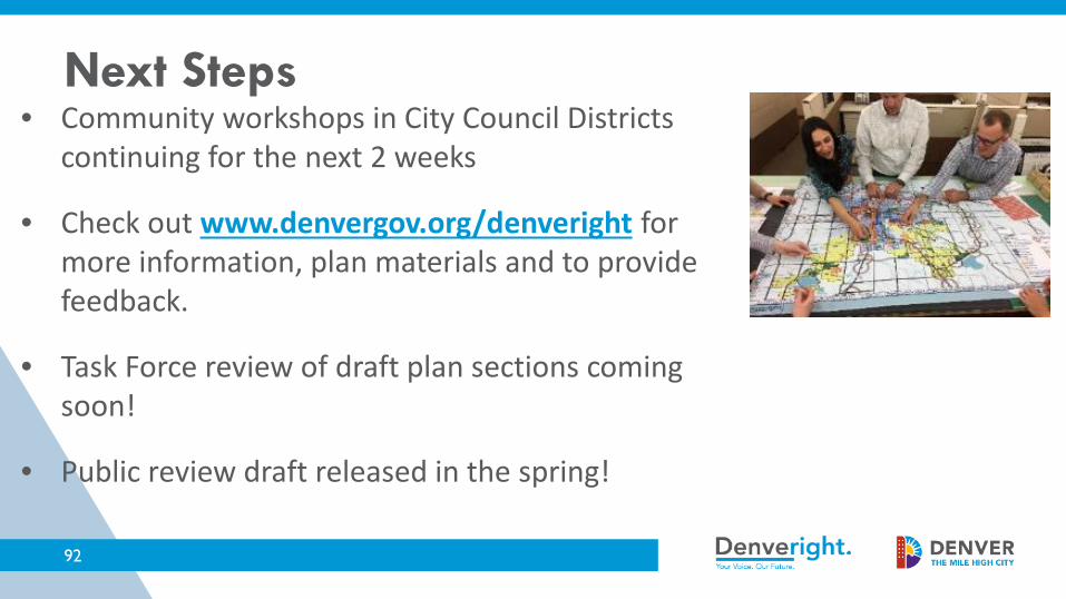
• Community workshops in City Council Districts continuing for the next 2 weeks
• Check out www.denvergov.org/denveright for more information, plan materials and to provide feedback.
• Task Force review of draft plan sections coming soon!
• Public review draft released in the spring!
92
Next Steps

Blueprint Denver Task Force Meeting #16 – February 22, 2018