1
Recreate responsibly and protect your right to enjoy public lands. Despite the rugged appearance of the landscape, the Black Rock Desert is fragile. While few restrictions exist within the National Conservation Area (NCA), careless recreational use can cause irreparable damage to the resources. Do your part to maintain the area. Help minimize human impacts to cultural resources, native vegetation, landscapes and wildlife by respecting the following points when travelling in the NCA: Rehabilitation Areas and Vehicle Closures. Ongoing resto- ration projects protect wildlife and cultural resources that make Black Rock - High Rock country special. Avoid driving or camping in restored areas or areas marked as closed. Desig- nated wilderness areas are closed to all motor and mechanical equipment and vehicles. See maps for boundaries. Respect seasonal closures in High Rock Canyon [Feb. - May]. Other Users. Limit noise from generators, keep speeds slow through camping areas and leave the areas you visit in better condition than you found them. Other Inhabitants. Animals can be extremely sensitive to • Bring what you need: Self sufficiency is as important here today as it was for the Native Americans, emigrants and early pioneers. • Pack all necessary water (one gallon of water per person, per day), food and supplies. Surface water is unreliable and must be treated. • Pack extra supplies in case you get stranded. If you do get stranded or lost, stay with your vehicle until someone finds you. • Be prepared for changing conditions. Afternoon dust storms on the playa can produce white-out conditions. Daytime temperatures can reach over 100 degrees in the summer. Year-round temperatures can fluctuate more than 50 degrees in a single day. Know Before You Go. Protect. Respect. Survive. human disturbances, especially during critical reproduc- tion periods in the spring and in severe weather conditions. Observe wildlife and wild horses from a distance and avoid spending too much time near water sources. Private Property. While the vast majority of Black Rock - High Rock country is public land managed by the BLM, it is critical that people respect the property and rights of private land owners. Leave gates as you find them. Tread Lightly. Travel and camp on durable surfaces. Watch your step. Sensitive species exist throughout the NCA. Soils can be easily damaged and recovery takes many years. Protect Archaeological Sites. Sites are protected on public lands by federal law. Leave artifacts as they are, so that others can see the story of the past. Removing or vandalizing artifacts is not only illegal, it limits their scientific value and the experience of future visitors. Campfires. Bring you own firewood. Fires on the playa and dunes must be contained and elevated to protect the surface from scarring. Extinguish all fires before you leave. Leave No Trace, pack out only what you pack in. • High clearance vehicles with off-road tires (at least 6-ply) are recom- mended, as is a second spare, if you plan to travel on remote roads. • There is no cell phone service in the NCA – Let someone know where you are going and when you expect to return. • The playa is unforgiving when it is wet – DO NOT attempt to drive on the playa when it is wet. Know what to look for, as it can often be wet just under the surface. • From Gerlach, the nearest full-service medical facility is over 70 miles away in Fernley (south of Gerlach via NV State Rt. 447). An emergency phone is located at the Washoe County Sheriff’s office in Gerlach. Survival in a harsh environment. Be prepared when venturing into Black Rock / High Rock Country. Rock and Mineral Collection Geodes, agates, opal, jasper, petrified wood and fossils can all be found in the NCA. Collecting for personal use is allowed. Protect mineral resources and ensure long- term opportunities for collection. Within the NCA and associated wilderness areas only hand tools may be used to dig for minerals and fossils. Do not collect vertebrate fossils such as fish, mammals, reptiles. Rock and mineral collection is limited to 25 pounds per day, plus one piece, for a total of 250 pounds per year. Collecting is allowed for personal use only. Using motorized equipment for collection purposes is prohibited. Hanging Rock Petrified Forest and the Charles Lund Petrified Forest are closed to collection. Alternative Recreation Because of its surface conditions and stark, unpopulated landscape, the playa is conducive to many diverse activities. You’ll find amateur rocket launches, land sailing, land speed trials, hot air ballooning in addition to other unique forms of recreation that can only take place in this environment. Hiking Undeveloped, wild country. With the exception of a few short trails, there are no established routes. Those that do venture here will discover a multitude of canyons, ridge lines and peaks, where few humans have traveled. The Desert Trail, a scenic corridor that runs from Mexico to Canada, crosses through the NCA. Hunting Sportsmen pursue coveted tags for hunting trophy, big game animals, such as California bighorn sheep, mule deer and pronghorn antelope. Excellent chukar hunting also exists in the NCA. Wildlife and fisheries are managed by the Nevada Department of Wildlife (NDOW). Valid State of Nevada hunting licenses and applicable tags are required for all hunting and fishing. More information can be obtained from the NDOW offices or online at ndow.org. Wildlife and Wild Horse Viewing The wildlife within the NCA are a typical representation of the northern Great Basin fauna. Mountain lions, antelope, mule deer, bighorn sheep, sage grouse, badgers, raptors and an assortment of reptiles make their home here. Wild horses and burros are a common sight in the area. Recreation in the NCA In the NCA, the best campsites are found, not made. If you can’t find an existing campsite, locate your camp on durable surfaces such as gravel, rock, dry grasses or dry washes (when the chance of flash floods is low). Camping in the same site for more than 14 days within a 30 day period is prohibited, including cabins. Nevada State Law and BLM regulations require that users camp at least 300 feet from spring and water sources. Pack it in. Pack it out. There is no garbage removal. Dispose of human waste properly, burying it at least 200 feet away from water and campsites. The Playa. Camping on the playa is an experience in itself, offering wide open vistas, vibrant sunsets with dark night skies and thousands of acres to explore. Always be prepared for changing conditions. Winds can be erratic and summer thunderstorms are not unusual. If camping out in the open playa, be sure to stay near your vehicle and use reflective material on your tent to avoid accidental nighttime collisions with vehicles traveling on the playa. Motorized vehicle use is prohibited in the dunes surrounding and on the playa, as they are sensitive habitat areas. Stevens Camp and Massacre Ranch. Several established campsites can be found in addition to rustic user-maintained cabins which are available on a first-come first-served basis. Future campsite designations will be made at Black Rock Hot Spring, Double Hot Spring, Trego Hot Spring, Stevens Camp, Massacre Ranch, segments of the Emigrant Trail and in the Lahontan Cutthroat Trout Wilderness Study Area. Soldier Meadows Area of Critical Environmental Concern (ACEC). Primitive camping facilities are located in the ACEC. Camping is allowed at seven designated sites with fire rings, STAY OUT AND STAY ALIVE. Hot Springs. The BLM does not manage hot springs for recreation use. Use extreme caution around hot springs. People and pets have been severely scalded or killed. Mines. Abandoned mines are dangerous. Some of the potential hazards are old, unstable explosives, poisonous gases, rattlesnakes, unseen vertical shafts and cave-ins. Camping in the NCA vault toilets and trails leading to and around the hot springs. Soldier Meadows Ranch offers private camping, lodging and hot springs for a fee. High Rock Canyon. Five primitive campsites are designated throughout the canyon and provide excellent opportunities to experience a scenic portion of the Applegate Trail. Camp only in designated sites in the ACECs. Climbing is not allowed in High Rock Canyon. BLM NEVADA Black Rock Desert - High Rock Canyon Emigrant Trails National Conservation Area Map & Visitor Information PROTECT WILDLIFE. Do not drive on dunes surrounding the playa. KNOW THE RULES. The few signs in the NCA are there to inform. USE CAUTION when driving. The playa is unforgiving when wet. Hiking in Black Rock - High Rock country. Badgers make their home here. Bighorn Sheep in the Jackson Mountains. Wilderness camping. Camping on the playa. Spring camping in the North Black Rock Range. The longest intact segments (totaling 175 miles) of the historic Emigrant Trails to California and Oregon are located in the Black Rock Desert – High Rock Canyon Emigrant Trails National Conservation Area (NCA). Designated in 2000, the NCA and ten associated wilderness areas give protection to nearly 1.2 million acres within Nevada’s Great Basin. The NCA is comprised of high-desert mountain ranges, volcanic tablelands and the Black Rock Desert playa. Black Rock - High Rock country is a desolate and harsh landscape in which explorers, emigrants and homesteaders struggled to survive. The area and its scenery remain much the same as these early settlers experienced and provides numerous opportunities for solitude and recreation. A land of extremes. In this land of extremes, emigrant wagons crawled along at two miles per hour, yet the landspeed record was set here at 760 mph. From the solitude of isolated wilderness to 50,000 people in temporary Black Rock City, the uses and history of the NCA are rich and diverse. Just as extreme, the weather can be hot and sunny one day and cold and snowy the next. Evidence of climate change can be seen everywhere. Deep parallel horizontal cuts can be seen in the rock cliffs surrounding the playa, created by the pounding waves of ancient Lake Lahontan. Today, weather still alters the landscape. Storm systems, uplifted and dispersed by the Sierra Nevada, come in waves of diverse cloud formations and precipitation. In wet winters, the playa can fill with water, giving temporary life to tiny shrimp. In the summer the playa becomes dry, dusty and a playground for human use. Mountain ranges in the NCA receive as much as 15 inches of precipitation, mostly as snow, per year. The ranges act as biological islands that harbor plant and animal life not found on the desert floor, which receives less than 10 inches of rain per year. It is the landforms that define Black Rock – High Rock country and provide for the extremes that visitors witness. When the pavement ends, the experience begins King Lear Peak rises in the distance behind Black Rock Point and the Black Rock Range. Hummocks provide habitat for wildlife. The Black Rock Desert - High Rock Canyon Emigrant Trails National Conservation Area is a part of the BLM’s National Landscape Conservation System (NLCS): a diverse program that incorporates national scenic and historic trails, wild and scenic rivers, wilderness areas, national monuments and conservation areas. The mission of the NLCS is to conserve, protect and restore nationally significant landscapes that have outstanding cultural, ecological and scientific values for present and future generations of Americans. This 27 million acre Conservation System is said to be the most innovative U.S. land-management program in the last 50 years, joining together the crown jewels of the BLM’s cultural, natural and scientific assets. Quietly revolutionary, instead of protecting “islands” of special land, it conserves whole landscapes. Sudden dust storms on the playa lie in contrast to snow on Pahute Peak. The first Euroamericans to enter this portion of what is now Nevada were a party of explorers led by John C. Frémont. During the winter of 1843-44, Frémont’s party traveled down High Rock Canyon and the west arm of the Black Rock Desert, into the adjacent Smoke Creek Desert, then south to Pyramid Lake. As he explored, Fremont searched for the fabled “Buenaventura River” that was thought to provide navigable access to the Pacific Ocean. Although he didn’t discover the fabled river, he did define the huge area of internal drainages now known as the Great Basin. He also laid the framework for what was to become the historic Applegate Trail. The Applegate Trail In 1846, Jesse Applegate, Levi Scott and fourteen others traced a portion of Frémont’s route to establish an alternate trail to Oregon. This route avoided the dangerous Columbia River of the main Oregon Trail, and gave American settlers in Oregon an escape route should there be a war with Great Britain. The trail was used for several years as the “Southern Road to Oregon.” In 1848, Peter Lassen followed the Applegate Trail to Goose Lake, and then blazed his own trail to his ranch. In the High Rock Canyon area, there are still inscriptions and axle grease markings on the rocks reminding present day visitors of their arduous passage. The ‘49ers The discovery of gold in California in 1848 set off a rush of gold seekers crossing through the Black Rock region. The Applegate and Lassen Trails provided an alternate route for those heading to California. In 1849, after hearing about tough conditions along the California Trail, many emigrants chose the Applegate Trail. However, the Applegate- Lassen route added 150 miles or more to the trek, and the thousands of emigrants quickly exhausted the available resources. The truth was this alternate route was just as difficult as the main routes. The Nobles Trail In 1851, William H. Nobles discovered a wagon route from the Black Rock to Honey Lake Valley, California. In 1852 the new route was laid out, and in 1856 was shortened by the discovery of Trego Hot Springs. In 1859-60, this route became part of the Fort Kearney, South Pass and Honey Lake Wagon road. The Applegate, Lassen and Nobles Trails are part of the California National Historic Trail. The Historic Trails The Emigrant Trail through High Rock Canyon. Glyphs in the rocks record the passage. A sheep herders wagon near Black Rock Point . Photo courtesy of the National Archives. Mountain Ranges Almost entirely treeless, the Calico Mountains’ 28 miles of soils and rocks display a vibrant array of colors and unique rock formations. Despite its arid appearance, several canyons in the range support riparian environments. Donnelly Peak is the high point of the range at 8,533 feet. The Black Rock Range stretches nearly 50 miles north from Black Rock Point, it’s southern most tip and famed Emigrant Trail landmark. The range consists of wet and dry canyons, badlands, sage steppe and cliffs. Perennial streams originating from mountain springs feed terminal Summit Lake to the northwest. Pahute Peak near the center of the range stands at 8,594 feet. Set apart from the other ranges, the towering Jackson Mountains are a juniper-covered, alpine-looking range that stretches for 46 miles. Numerous east-west canyons support cottonwoods, willows and aspen. Its Shakespeare-inspired high point, King Lear Peak, sits at 8,923 feet. High Rock Canyon & Volcanic Tablelands A tortured landscape of time and place, the volcanic tablelands in the northwest region of the NCA are the product of multiple volcanic eruptions. Accumulated layers of lava lifted the tablelands only to be cut into weather- eroded canyons. High Rock Canyon is the largest canyon complex in the NCA tablelands and also contains part of the route of the Applegate Trail. The Black Rock Desert Playa Shaped like a lopsided Y, this desert is often described as having a stem and two arms – the west arm and east arm. The playa, the largest in North America, occupies much of the stem and the west arm. Although this is the desert, evidence of water can be seen everywhere. Visitors can still see the effects of ancient waves on the former shorelines of Lake Lahontan, which covered this area with 500 feet of water 13,000 years ago. Composed of fine clay silt, the playa has a smooth surface to drive on when dry. Sizing up at approximately 35 miles long and 12 miles wide, the 110,000-acre playa is where most recreational activity occurs in the NCA. This dry bed of ancient Lake Lahontan, completely devoid of vegetation, was first described as a “mud lake” by early emigrants who had no better comparison. In the early part of the 20th century, the term “playa” (Spanish for beach) came into use. The playa is flanked by the colorful Calico Mountains to the west and the Jackson Mountains to the east. The Black Rock Range acts as the divider of the desert, splitting it into two arms as it stretches to the north. Several smaller playas can be found in the NCA as well. Wilderness is an indispensable part of the American story. Inspired by the untamed beauty of wilderness that became the forge upon which our uniquely American national character was created, our nation’s leaders passed the Wilderness Act in 1964 and established a system to permanently protect the country’s wild places. Wilderness is America’s Legacy In 2000, ten wilderness areas were designated along with the creation of the Black Rock Desert – High Rock Canyon Emigrant Trail NCA. These ten wilderness areas demonstrate the biological and geological diversity of the Great Basin desert and give a natural and virtually unaltered backdrop to the historic trails. Landforms that define the region Box Canyon. South Jackson Wilderness. Calico Mountains. Bureau of Land Management Winnemucca District Office 5100 E. Winnemucca Blvd. Winnemucca, NV 89445 (775) 623-1500 www.blm.gov/nv Surprise Field Office 602 Cressler Street, P.O. Box 460 Cedarville, CA 96104 (530) 279-6101 Friends of Black Rock / High Rock 380 Main Street, Box 224 Gerlach, NV 89412 (775) 557-2900 www.blackrockdesert.org Report Wildfires Central Nevada Dispatch Center 800-535-6076 775-623-3444 The Oregon-California Trails Association has installed markers along the historic routes.

BLM Information - Home - Friends of Black Rock High …blackrockdesert.org/friends_renamed/files/BLM_VisitorGuide12-10... · the Nevada Department of Wildlife (NDOW). ... landscape

  • Upload
    lekhanh

  • View
    214

  • Download
    0

Embed Size (px)

Citation preview

Recreate responsibly and protect your right to enjoy public lands. Despite the rugged appearance of the landscape, the Black Rock Desert is fragile. While few restrictions exist within the National Conservation Area (NCA), careless recreational use can cause irreparable damage to the resources.

Do your part to maintain the area. Help minimize human impacts to cultural resources, native vegetation, landscapes and wildlife by respecting the following points when travelling in the NCA:

Rehabilitation Areas and Vehicle Closures. Ongoing resto-ration projects protect wildlife and cultural resources that make Black Rock - High Rock country special. Avoid driving or camping in restored areas or areas marked as closed. Desig-nated wilderness areas are closed to all motor and mechanical equipment and vehicles. See maps for boundaries. Respect seasonal closures in High Rock Canyon [Feb. - May].

Other Users. Limit noise from generators, keep speeds slow through camping areas and leave the areas you visit in better condition than you found them.

Other Inhabitants. Animals can be extremely sensitive to

• Bring what you need: Self sufficiency is as important here today as it was for the Native Americans, emigrants and early pioneers.

• Pack all necessary water (one gallon of water per person, per day), food and supplies. Surface water is unreliable and must be treated.

• Pack extra supplies in case you get stranded. If you do get stranded or lost, stay with your vehicle until someone finds you.

• Be prepared for changing conditions. Afternoon dust storms on the playa can produce white-out conditions. Daytime temperatures can reach over 100 degrees in the summer. Year-round temperatures can fluctuate more than 50 degrees in a single day.

Know Before You Go. Protect. Respect. Survive.human disturbances, especially during critical reproduc-tion periods in the spring and in severe weather conditions. Observe wildlife and wild horses from a distance and avoid spending too much time near water sources.

Private Property. While the vast majority of Black Rock - High Rock country is public land managed by the BLM, it is critical that people respect the property and rights of private land owners. Leave gates as you find them.

Tread Lightly. Travel and camp on durable surfaces. Watch your step. Sensitive species exist throughout the NCA. Soils can be easily damaged and recovery takes many years.

Protect Archaeological Sites. Sites are protected on public lands by federal law. Leave artifacts as they are, so that others can see the story of the past. Removing or vandalizing artifacts is not only illegal, it limits their scientific value and the experience of future visitors.

Campfires. Bring you own firewood. Fires on the playa and dunes must be contained and elevated to protect the surface from scarring. Extinguish all fires before you leave.

Leave No Trace, pack out only what you pack in.

• High clearance vehicles with off-road tires (at least 6-ply) are recom-mended, as is a second spare, if you plan to travel on remote roads.

• There is no cell phone service in the NCA – Let someone know where you are going and when you expect to return.

• The playa is unforgiving when it is wet – DO NOT attempt to drive on the playa when it is wet. Know what to look for, as it can often be wet just under the surface.

• From Gerlach, the nearest full-service medical facility is over 70 miles away in Fernley (south of Gerlach via NV State Rt. 447). An emergency phone is located at the Washoe County Sheriff’s office in Gerlach.

Survival in a harsh environment. Be prepared when venturing into Black Rock / High Rock Country.

Rock and Mineral CollectionGeodes, agates, opal, jasper, petrified wood and fossils can all be found in the NCA. Collecting for personal use is allowed. Protect mineral resources and ensure long-term opportunities for collection. Within the NCA and associated wilderness areas only hand tools may be used to dig for minerals and fossils.

Do not collect vertebrate fossils such as fish, mammals, reptiles.

Rock and mineral collection is limited to 25 pounds per day, plus one piece, for a total of 250 pounds per year. Collecting is allowed for personal use only.

Using motorized equipment for collection purposes is prohibited.

Hanging Rock Petrified Forest and the Charles Lund Petrified Forest are closed to collection.

Alternative RecreationBecause of its surface conditions and stark, unpopulated landscape, the playa is conducive to many diverse activities. You’ll find amateur rocket launches, land sailing, land speed trials, hot air ballooning in addition to other unique forms of recreation that can only take place in this environment.

HikingUndeveloped, wild country. With the exception of a few short trails, there are no established routes. Those that do venture here will discover a multitude of canyons, ridge lines and peaks, where few humans have traveled. The Desert Trail, a scenic corridor that runs from Mexico to Canada, crosses through the NCA.

Hunting Sportsmen pursue coveted tags for hunting trophy, big game animals, such as California bighorn sheep, mule deer and pronghorn antelope. Excellent chukar hunting also exists in the NCA. Wildlife and fisheries are managed by the Nevada Department of Wildlife (NDOW). Valid State of Nevada hunting licenses and applicable tags are required for all hunting and fishing. More information can be obtained from the NDOW offices or online at ndow.org.

Wildlife and Wild Horse ViewingThe wildlife within the NCA are a typical representation of the northern Great Basin fauna. Mountain lions, antelope, mule deer, bighorn sheep, sage grouse, badgers, raptors and an assortment of reptiles make their home here. Wild horses and burros are a common sight in the area.

Recreation in the NCAIn the NCA, the best campsites are found, not made. If you can’t find an existing campsite, locate your camp on durable surfaces such as gravel, rock, dry grasses or dry washes (when the chance of flash floods is low).

Camping in the same site for more than 14 days within a 30 day period is prohibited, including cabins.

Nevada State Law and BLM regulations require that users camp at least 300 feet from spring and water sources.

Pack it in. Pack it out. There is no garbage removal.

Dispose of human waste properly, burying it at least 200 feet away from water and campsites.

The Playa. Camping on the playa is an experience in itself, offering wide open vistas, vibrant sunsets with dark night skies and thousands of acres to explore. Always be prepared for changing conditions. Winds can be erratic and summer thunderstorms are not unusual. If camping out in the open playa, be sure to stay near your vehicle and use reflective material on your tent to avoid accidental nighttime collisions with vehicles traveling on the playa.

Motorized vehicle use is prohibited in the dunes surrounding and on the playa, as they are sensitive habitat areas.

Stevens Camp and Massacre Ranch. Several established campsites can be found in addition to rustic user-maintained cabins which are available on a first-come first-served basis.

Future campsite designations will be made at Black Rock Hot Spring, Double Hot Spring, Trego Hot Spring, Stevens Camp, Massacre Ranch, segments of the Emigrant Trail and in the Lahontan Cutthroat Trout Wilderness Study Area.

Soldier Meadows Area of Critical Environmental Concern (ACEC). Primitive camping facilities are located in the ACEC. Camping is allowed at seven designated sites with fire rings,

StAy OUt And StAy AliVe. Hot Springs. The BLM does not manage hot springs for recreation use. Use extreme caution around hot springs. People and pets have been severely scalded or killed.

Mines. Abandoned mines are dangerous. Some of the potential hazards are old, unstable explosives, poisonous gases, rattlesnakes, unseen vertical shafts and cave-ins.

Camping in the NCAvault toilets and trails leading to and around the hot springs. Soldier Meadows Ranch offers private camping, lodging and hot springs for a fee.

High Rock Canyon. Five primitive campsites are designated throughout the canyon and provide excellent opportunities to experience a scenic portion of the Applegate Trail.

Camp only in designated sites in the ACECs. Climbing is not allowed in High Rock Canyon.

BLM

NEV

AD

A

Black Rock Desert - High Rock Canyon Emigrant Trails National Conservation Area

Map & Visitor Information

PROTECT WILDLIFE. Do not drive on dunes surrounding the playa. KNOW THE RULES. The few signs in the NCA are there to inform. USE CAUTION when driving. The playa is unforgiving when wet. Hiking in Black Rock - High Rock country. Badgers make their home here. Bighorn Sheep in the Jackson Mountains. Wilderness camping. Camping on the playa. Spring camping in the North Black Rock Range.

The longest intact segments (totaling 175 miles) of the historic Emigrant Trails to California and Oregon are located in the Black Rock Desert – High Rock Canyon Emigrant Trails National Conservation Area (NCA). Designated in 2000, the NCA and ten associated wilderness areas give protection to nearly 1.2 million acres within Nevada’s Great Basin. The NCA is comprised of high-desert mountain ranges, volcanic tablelands and the Black Rock Desert playa.

Black Rock - High Rock country is a desolate and harsh landscape in which explorers, emigrants and homesteaders struggled to survive. The area and its scenery remain much the same as these early settlers experienced and provides numerous opportunities for solitude and recreation.

A land of extremes.

In this land of extremes, emigrant wagons crawled along at two miles per hour, yet the landspeed record was set here at 760 mph. From the solitude of isolated wilderness to 50,000 people in temporary Black Rock City, the uses and history of the NCA are rich and diverse.

Just as extreme, the weather can be hot and sunny one day and cold and snowy the next. Evidence of climate change can be seen everywhere. Deep parallel horizontal cuts can be seen in the rock cliffs surrounding the playa, created by the pounding waves of ancient Lake Lahontan.

Today, weather still alters the landscape. Storm systems, uplifted and dispersed by the Sierra Nevada, come in waves of diverse cloud formations and precipitation. In wet winters, the playa can fill with water, giving temporary life to tiny shrimp. In the summer the playa becomes dry, dusty and a playground for human use.

Mountain ranges in the NCA receive as much as 15 inches of precipitation, mostly as snow, per year. The ranges act as biological islands that harbor plant and animal life not found on the desert floor, which receives less than 10 inches of rain per year. It is the landforms that define Black Rock – High Rock country and provide for the extremes that visitors witness.

When the pavement ends, the experience begins King Lear Peak rises in the distance behind Black Rock Point and the Black Rock Range. Hummocks provide habitat for wildlife.

The Black Rock Desert - High Rock Canyon Emigrant Trails National Conservation Area is a part of the BLM’s National Landscape Conservation System (NLCS): a diverse program that incorporates national scenic and historic trails, wild and scenic rivers, wilderness areas, national monuments and conservation areas.

The mission of the NLCS is to conserve, protect and restore nationally significant landscapes that have outstanding cultural, ecological and scientific values for present and future generations of Americans. This 27 million acre Conservation System is said to be the most innovative U.S. land-management program in the last 50 years, joining together the crown jewels of the BLM’s cultural, natural and scientific assets. Quietly revolutionary, instead of protecting “islands” of special land, it conserves whole landscapes.

Sudden dust storms on the playa lie in contrast to snow on Pahute Peak.

The first Euroamericans to enter this portion of what is now Nevada were a party of explorers led by John C. Frémont. During the winter of 1843-44, Frémont’s party traveled down High Rock Canyon and the west arm of the Black Rock Desert, into the adjacent Smoke Creek Desert, then south to Pyramid Lake. As he explored, Fremont searched for the fabled “Buenaventura River” that was thought to provide navigable access to the Pacific Ocean. Although he didn’t discover the fabled river, he did define the huge area of internal drainages now known as the Great Basin. He also laid the framework for what was to become the historic Applegate Trail.

the Applegate trail In 1846, Jesse Applegate, Levi Scott and fourteen others traced a portion of Frémont’s route to establish an alternate trail to Oregon. This route avoided the dangerous Columbia River of the main Oregon Trail, and gave American settlers in Oregon an escape route should there be a war with Great Britain. The trail was used for several years as the “Southern Road to Oregon.” In 1848, Peter Lassen followed the Applegate Trail to Goose Lake, and then blazed his own trail to his ranch. In the High Rock Canyon area, there are still inscriptions and axle grease markings on the rocks reminding present day visitors of their arduous passage.

The ‘49ers The discovery of gold in California in 1848 set off a rush of gold seekers crossing through the Black Rock region. The Applegate and Lassen Trails provided an alternate route for those heading to California. In 1849, after hearing about tough conditions along the California Trail, many emigrants chose the Applegate Trail. However, the Applegate-Lassen route added 150 miles or more to the trek, and the thousands of emigrants quickly exhausted the available resources. The truth was this alternate route was just as difficult as the main routes.

the nobles trailIn 1851, William H. Nobles discovered a wagon route from the Black Rock to Honey Lake Valley, California. In 1852 the new route was laid out, and in 1856 was shortened by the discovery of Trego Hot Springs. In 1859-60, this route became part of the Fort Kearney, South Pass and Honey Lake Wagon road. The Applegate, Lassen and Nobles Trails are part of the California National Historic Trail.

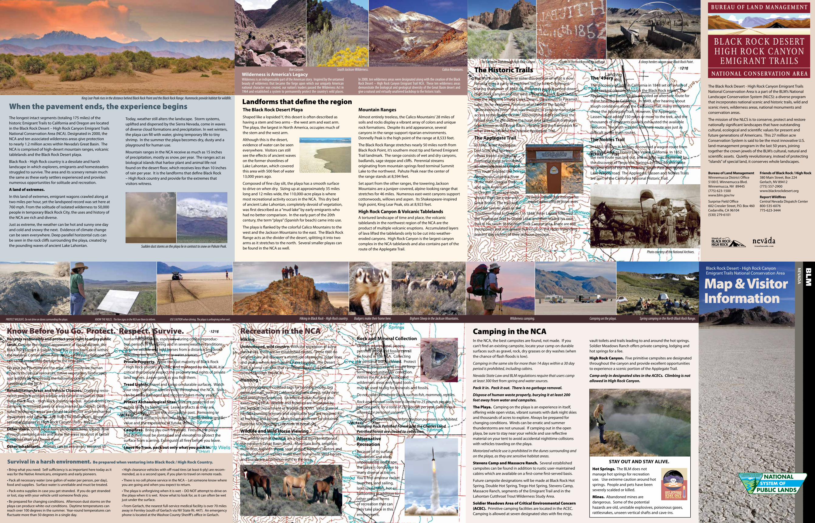
The Historic TrailsThe Emigrant Trail through High Rock Canyon. Glyphs in the rocks record the passage. A sheep herders wagon near Black Rock Point .

Photo courtesy of the National Archives.

Mountain RangesAlmost entirely treeless, the Calico Mountains’ 28 miles of soils and rocks display a vibrant array of colors and unique rock formations. Despite its arid appearance, several canyons in the range support riparian environments. Donnelly Peak is the high point of the range at 8,533 feet.

The Black Rock Range stretches nearly 50 miles north from Black Rock Point, it’s southern most tip and famed Emigrant Trail landmark. The range consists of wet and dry canyons, badlands, sage steppe and cliffs. Perennial streams originating from mountain springs feed terminal Summit Lake to the northwest. Pahute Peak near the center of the range stands at 8,594 feet.

Set apart from the other ranges, the towering Jackson Mountains are a juniper-covered, alpine-looking range that stretches for 46 miles. Numerous east-west canyons support cottonwoods, willows and aspen. Its Shakespeare-inspired high point, King Lear Peak, sits at 8,923 feet.

High Rock Canyon & Volcanic tablelandsA tortured landscape of time and place, the volcanic tablelands in the northwest region of the NCA are the product of multiple volcanic eruptions. Accumulated layers of lava lifted the tablelands only to be cut into weather-eroded canyons. High Rock Canyon is the largest canyon complex in the NCA tablelands and also contains part of the route of the Applegate Trail.

the Black Rock desert PlayaShaped like a lopsided Y, this desert is often described as having a stem and two arms – the west arm and east arm. The playa, the largest in North America, occupies much of the stem and the west arm.

Although this is the desert, evidence of water can be seen everywhere. Visitors can still see the effects of ancient waves on the former shorelines of Lake Lahontan, which covered this area with 500 feet of water 13,000 years ago.

Composed of fine clay silt, the playa has a smooth surface to drive on when dry. Sizing up at approximately 35 miles long and 12 miles wide, the 110,000-acre playa is where most recreational activity occurs in the NCA. This dry bed of ancient Lake Lahontan, completely devoid of vegetation, was first described as a “mud lake” by early emigrants who had no better comparison. In the early part of the 20th century, the term “playa” (Spanish for beach) came into use.

The playa is flanked by the colorful Calico Mountains to the west and the Jackson Mountains to the east. The Black Rock Range acts as the divider of the desert, splitting it into two arms as it stretches to the north. Several smaller playas can be found in the NCA as well.

Wilderness is an indispensable part of the American story. Inspired by the untamed beauty of wilderness that became the forge upon which our uniquely American national character was created, our nation’s leaders passed the Wilderness Act in 1964 and established a system to permanently protect the country’s wild places.

Wilderness is America’s legacyIn 2000, ten wilderness areas were designated along with the creation of the Black Rock Desert – High Rock Canyon Emigrant Trail NCA. These ten wilderness areas demonstrate the biological and geological diversity of the Great Basin desert and give a natural and virtually unaltered backdrop to the historic trails.

Landforms that define the region

Box Canyon. South Jackson Wilderness. Calico Mountains.

Bureau of land Management Winnemucca District Office 5100 E. Winnemucca Blvd. Winnemucca, NV 89445 (775) 623-1500 www.blm.gov/nv

Surprise Field Office 602 Cressler Street, P.O. Box 460 Cedarville, CA 96104 (530) 279-6101

Friends of Black Rock / High Rock 380 Main Street, Box 224 Gerlach, NV 89412 (775) 557-2900 www.blackrockdesert.org

Report Wildfires Central Nevada Dispatch Center 800-535-6076 775-623-3444

The Oregon-California Trails Association has installed markers along the historic routes.