Embed Size (px)
Citation preview
::
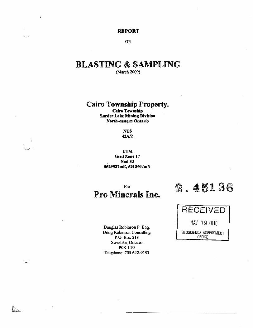
REPORT
ON
BLASTING & SAMPLING (March 2009)
Cairo Township Property. Cairo Township
Lanier Lake Mining Division North-eastem Ontario
NTS "2M.
UTM Grid Zone 17
, Nad83 OS29937mE, 5313404mN
For
Pro Minerals Inc.
Douglas Robinson P. Eng. Doug Robinson Consulting
P.O. Box 218 Swastika, Ontario
POK 1TO Telephone: 70S 642·9153
2045136
RECEIVED
MAY 192010
GEOSCIENCE ASSESSMENT OFFICE
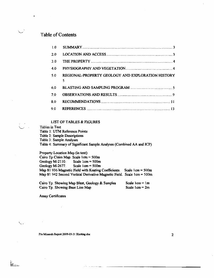
Table of Contents
1.0 SUMMARy ............................................................................................. 3
2.0 LOCATION AND ACCESS .................................................................... 3
3.0 TIm PROPERTY .................................................................................... 4
4.0 PHYSIOGRAPHY AND VEGETATION ................................................ 4
5.0 REGIONAL-PROPERTY GEOLOGY AND EXPLORATION mSTORY
5
6.0 BLASTING AND SAMPLING PROGRAM ........................................... 5
7.0 OBSERVATIONS AND RESULTS ........................................................ 9
8.0 RECO:MM:ENDATIONS ....................................................................... II
9.0 REFERENCES ...................................................................................... 13
LIST OF TABLES & FIGURES \........ Tables in Text
Table 1: UTM Reference Points Table 2: Sample Descriptions Table 3: Sample Analyses Table 4: Summary of Significant Sample Analyses (Combined AA and ICP)
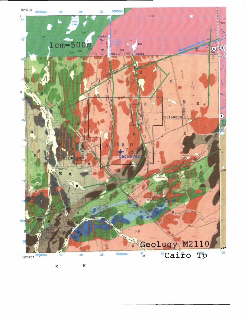
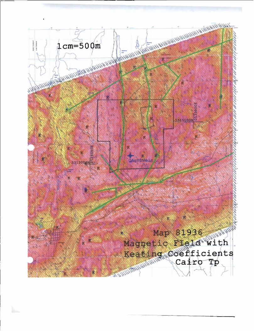
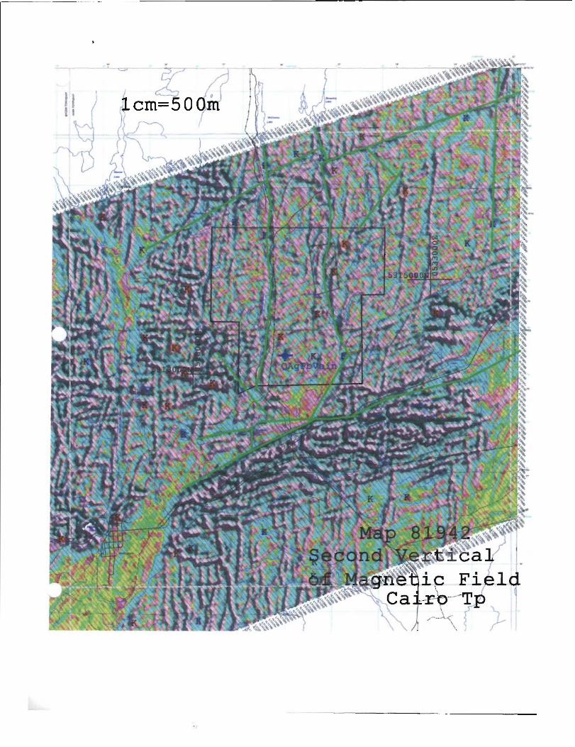
Property Location Map (in text) Cairo Tp Claim Map. Scale lern = sOOm Geology M-2110. Scale lern = 500m Geology M-2677. Scale lern = sOOm Map 81 936 Magnetic Field with Keating Coefficients. Scale 1 em = SOOm Map 81 942 Second Vertical Derivative Magnetic Field. Scale 1 ern = 500m
Cairo Tp. Showing Map Blast, Geology & Samples Cairo Tp. Showing Base Line Map
Assay Certificates
Scale lern == 1m Scale I ern == 2m
Pro Mlmnls Report 2009-03-31 Bla.sting.doc 2
. "---.- ... ~- .. -------------------
1.0 SUMMARY
Pro Minerals Inc. hired Doug Robinson Consulting to monitor blasting and sample conection of the Cairo Property in Febrwuy 2009. The Cairo Property is located in Cairo Tp approximately 46 kilometres west-southwest ofKirldand Lake., Ontario.
The showing investigated consists of lead-sitver-copper Pb--Ag-Cu (quartz) vein. The observations and recommendations of this report are directed to understanding the character of the structure and mineralization with the intent of developing a deposit model and an exploration model to recognize Pb-Ag-Cu veins. Orientation surveys are recommended to accomplish this. The recommended orientation surveys are also intended to explore the possible vertical and Iateral extent of this vein with the intent of identifYing economically recoverable deposit.
2.0 LOCATION AND ACCESS
The property locations referenced in this report and appendices are identified using Nad 83 tITM coordinates. The showing is located at UTM coordinates 0529937mE-5313404mN.
To access the property; proceed west on Highway 66 from Kirkland Lake (approximately 54 kilometres). Take the Matachewan Indian Reserve #72 Road several kilometres north to UTM coordinates 0529632mE-5312394mN. From this location a timber trail leads approximately 1.1 Ian north-northeast to the showing.
Pro Minerals Report 2009-03·31 Blasting.doc 3

I
alfol
z
Property Location Map
3.0 THE PROPERTY
4.0
The property ownership and claim fabric was reviewed on the Ministry of
Northern Development and Mines web site. The property is registered to Pro
Minerals Inc (Client #405533) and Jim Harold Forbes (Client #132578) as
follows:
Registered Owner Claim Units Due Date Work Required
Pro Minerals 4246060 10 201 O-Sep-17 $4,000
JForbes 4202823 15 2009-May-] 7 $6,000
J Forbes 4202824 15 2009-May-17 $6,000
J Forbes 4230]48 16 2010-Apr-Ol $6,400
J Forbes 4230149 11 2010-Apr-Ol $4,400
PHYSIOGRAPHY AND VEGETATION
The property has moderate outcrop relief with original jack pine, spruce and birch cover. Much of the land has been recently clear cut.
Pro Minaals Report 2009-03-31 Blasting.doc 4

5.0 REGIONAL-PROPERTY GEOLOGY AND EXPLORATION HISTORY
The regional and property geology, and exploration history were not studied in the
preparation of this report.
Various ministty maps included in this report were reduced to a common lem = 50 metre format. The location of the Cairo showing ("QAgPbVein"), the property
boWidary, inferred regional structures (green lines) and identified Keating Coefficient anomalies ("'K") are common to all the maps. The author produced the
inferred regional structures from Map 81936. These inferred structures were
identified as magnetic lows. Deep erosional lineaments might contribute significantly to the low magnetic signature used to define the structures.
6.0 BLASTING AND SAMPLING PROGRAM
Work was performed Wider the direction of fltD Forbes, project manager and
Douglas Robinson. Professional Engineer (geologist) and Qualified Person Wider
National Instrument 43-101. Drilling was performed by Eric Marion and blasting
was done by Erie Boyce.
Drilling was performed February 12, 13, 14 and 15, 2009. Blasting was done
February 13, 14, 15 and 16,2009.
The work site is a historic trench with shallow blasts. This outcrop area
investigated was mechanically stripped prior to the 2009 blasting and sampling.
fltD Fomes and his assistants, band shovelled snow to the bedrock surface prior to
February 12. An outcrop area 30 meters long and generally 3 to 4 metres wide
was exposed and was mapped as outcrop February 12,2009.
A thin layer of ice and patchy, frozen limonitic soil (generally 1-4an thick)
prevented direct mapping of the outcrop.
fltD Fomes selected four blast cuts. The ice and soil; where present, were chipped
from the outcrop to expose the rock and to facilitate drilling. Bare outcrop was
requir~ to prevent melting and the release of rock chips into the hole. Rock chips
would wedge the steel in the hole. A Pionjar plugger was used to dril1 60 em (2
foot), 3.0 em diameter boles. The drill pattern consisted of two rows of holes
drilled 0.5 metres apart, with the holes spaced at 0.5 metres. The bigh outcrop
knobs and domes were generally bare and were swept to expose the bedrock.
Much of the bedrock surface bad a layer of ice and locally up to 4 em of dark
rusty brown ferruginous (limonitic) soil having the appearance of gossan that
Pm Minerals Report 2()()9.()3-3J Blasting.doc s
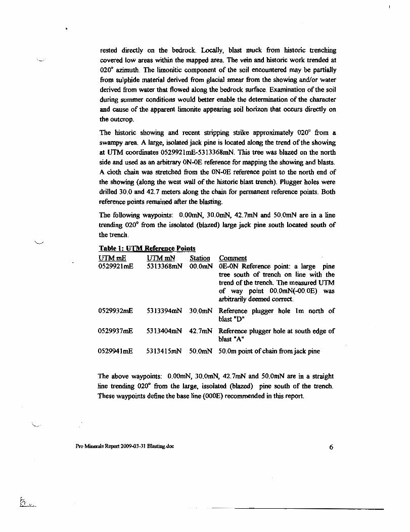
rested directly on the bedrock. Locally, blast muck from historic trenching
covered low areas within the mapped area. The vein and historic work trended at
0200 azimuth. The limonitic component of the soil encountered may be partially
from sulphide material derived from glacial smear from the showing and/or water
derived from water that flowed along the bedrock surface. Examination of the soil
during summer conditions would better enable the determination of the character
and cause of the apparent limonite appearing soil horizon that occurs directly on
the outcrop.
The historic showing and recent stripping strike approximately 0200 from a
swampy area. A large, isolated jack pine is located along the trend of the showing
at UTM coordinates 0529921mE-5313368mN. This tree was blazed on the north
side and used as an arbitrary ON-OE reference for mapping the showing and blasts.
A cloth chain was stretched from the ON-OE reference point to the north end of
the showing (along the west wall of the historic blast trench). Plugger holes were
drilled 30.0 and 42.7 meters along the chain for permanent reference points. Both
reference points remained after the blasting.
The following waypoints: O.OOmN, 30.0mN, 42.7mN and 50.0mN are in a line
trending 0200 from the issolated (blazed) large jack pine south located south of
the trench.
Table 1: UTM Reference Points
urn mE UTM mN Station Comment 0529921mE 5313368mN OO.OmN OE-ON Reference point: a large pine
tree south of trench on line with the trend of the trench. The measured UTM of way point OO.OmN(-OO.OE) was arbitrarily deemed correct.
0529932mE 5313394mN 30.0mN Reference plugger hole 1m north of blast "D"
0529937mE 5313404mN 42.7mN Reference plugger hole at south edge of blast "A"
0529941mE 5313415mN 50.0mN 50.Om point of chain from jack pine
The above waypoints: 0.00mN, 30.OmN, 42.7mN and 50.0mN are in a straight
line trending 0200 from the large, issolated (blazed) pine south of the trench.
These waypoints define the base line (OOOE) recommended in this report.
Pro Miru:rals Report 2009-03-31 Blasting.doc 6

The outline of the freshly exposed stripped area was mapped. All exposures observed were pink syenite of the Cairo stock. This rock is dominated by plagioclase laths to 1 by 5 millimetres.
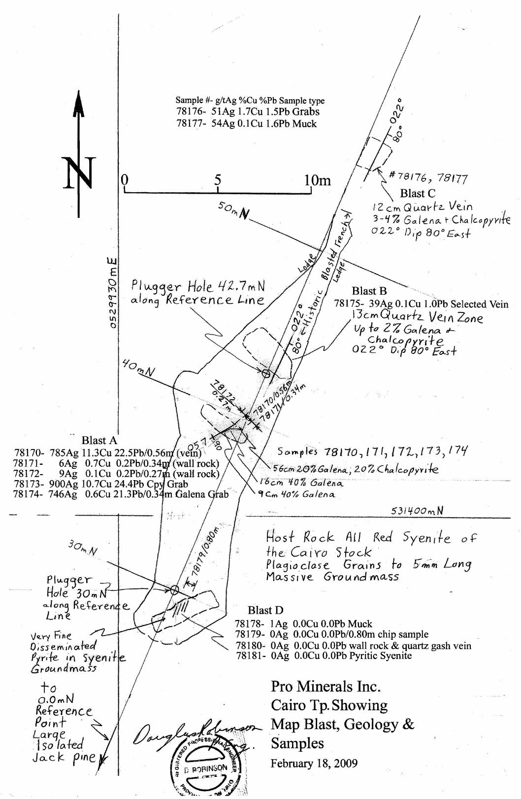
Four blasts were taken and labelled .... An to "D" in the order of blasting. The trenches and the freshly exposed veins were mapped. This map is included as an appendix to this report. Appropriate samples were taken as tabulated below and reported on the field map.
Table 2: Samele Descriptions Sample Trench Chainage Width Weigbt Description 78170 A 395m 0.56m 2.105kg Chip Sample at North face of blast. Vein
at intersection of 0200 and 0500 trending veins (60010 quartz, brecciated with sulphide breccia filling. 20% Galena. 20010 chalcopyrite-pyrite dominated by chalcopyrite).
78171 A 39.5m 0.34m 1.868kg Chip Sample at North face of blast. Wall rock east of veining. Some Chalcopyrite fracture filling observed.
78172 A 395m 0.27m 0.997kg Chip Sample at North face of blast. Wall rock west of veining. Rusty joints.
78173 A 39.5m O.Sl7kg Grab Sample from blast muck. Chalcopyrite ricb grab sample to establish metal distribution. 40% chalcopyrite, possibly some pyrite. Appears to be several % fine galena grains.
78174 A 395m 0.676kg Grab Sample from blast muck. Galena ricb grab to establish metal distnoution. 40010 galena, dominantly fine grained, in part to 3mm cleavages. 1-2% very fine-grained chalcopyrite.
78175 B 43.Sm 1.721kg Selected pieces of blast muck. 50% vein with 2% sulpbides (chalcopyrite-galena) and 50% wall rock. Sample collected to reflect style of mineralization.
78176 C 56.Sm 3.800kg Selected pieces of blast muck (mostly vein material pieces 2-4cm thick). Source quartz vein 12 em wide with 3-4% estimated galena plus quartz stockwork in wall rock. Sulphide content consistent throughout vein material.
78177 C 56.Sm 6.200kg Fines from blast (generally <3.0cm maximum dimension). Collected to represent metal content of the blast.
7
"'-'"
'\." ... "".1/
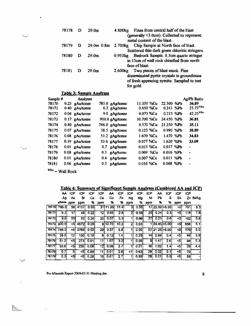
78178 D 29. Om 4.800kg Fines from central half of the blast (generally <3.0cm). Collected to represent metal content of the blast.
78179 D 29.Om O.8m 2.700kg Chip Sample at North face of blast. Scattered thin dark green chloritic stringers.
78180 D 29. Om 0.953kg Bedrock Sample. 0.3cm quartz stringer in 15cm of wall rock chiselled from north face of blast.
78181 D 29.Om 2.600kg Two pieces of blast muck. Fme disseminated pyrite crystals in groundmass of fresh appearing syenite. Sampled to test for gold.
Table 3: Saml!le An!!!:ses Sample # Analyses AglPbRatio 78170 11.350 o/oCu 22.500 o/oPb 34.89 0.25 gAuItonne 785.0 gAgItonne 78171 0.40 gAuItonne 6.2 gAgItonne 0.650o/oCu 0.241 o/oPb " 2S.73WRx
78172 0.04 gAu/tonne 9.0 gAgItonne 0.073o/oCu 0.213 %Pb 42.25WRx
78173 0.17 gAuItonne 900.0 gAgItonne 10.700 o/oCu 24.450 %Pb 36.81
78174 0.40 gAuItonne 746.0 gAgItonne 0.570o/oCu 21.250 o/oPb 35.11 78]75 0.07 gAuItonne 38.5 gAgItonne 0.123o/oCu 0.990 %Pb 38.89 78176 0.08 gAuItonne 51.2 gAgItonne 1.670o/oCu 1.470 %Pb 34.83 78177 0.19 gAuItonne 53.6 gAgItonne 0.077o/oCu 1.620 %Pb 33.09 78178 0.01 gAuItonne 0.7 gAgItonne 0.013 %Cu 0.017 %P1>
78179 0.08 gAuItonne 0.3 gAgItonne 0.009 o/oCu 0.010 %P1>
78180 O.ot gAuItonne 0.4 gAgItonne 0.007o/oCu 0.011 o/oPb 18181 0.06 gAuItonne 0.2 gAgItonne 0.010 %Cu 0.008 o/oPb
WRx = Wall Rock
Table 4: Summa" of Significant Saml!le Analyses (Combined AA and ICP) AA ICP ICP ICP ICP AA ICP ICP ICP ICP AA ICP ICP ICP ~ ~ ~ ~ ~ ~ ~ ~ _ M ~ S ~ ~8~
g1tnnne ppm ppm % ppm % % ppm % ppm % % ppm ppm 78170 785.0 90 4157 0.03 31 11.35
~oo 17 22.50 >5.00 <5 701 5.3
78171 6.2 17 49
~ 0.65 2.8 59 20 0.24 0.3 <5 116 7.9
78172 9.0 55 52 0.07 .66 ~ 0.21 0.6 <5 102 5.8
78173 900.0 <5 4572 O. 8 10.70 10.3 2 0.03 24.45 >5.00 <5 656 5.1
78174 746.0 <5 3765 0.02 29 0.57 5.8 1 0.02 57 21.25 >5.00 <5 176 5.0
78175 38.5 12 150 0.18 9 0.12 1.4 1 0.29 14 0.99 0.4 <5 44 3.9 = 51.2 <5 273 0.01 17 1.67 3.2 1 0;05 9 1.47 2.6 t<5 94 5.3
781 53.6 <5 236 0.09 12 0.08 2.7 1 0.21 16 1.62 1.4 <5 29 4.4
78178 0.7 6 <5 0.69 11 0.01 2.6 <1 0.63 28 0.02 0.1 <5 70 -78179 0.3 <5 <5 0.28 10 0.01 2.7 1 0.55 28 0.01 0.0 <5 59 -
Pro Minerals Report 2009-OJ..31 Blasling.doe 8
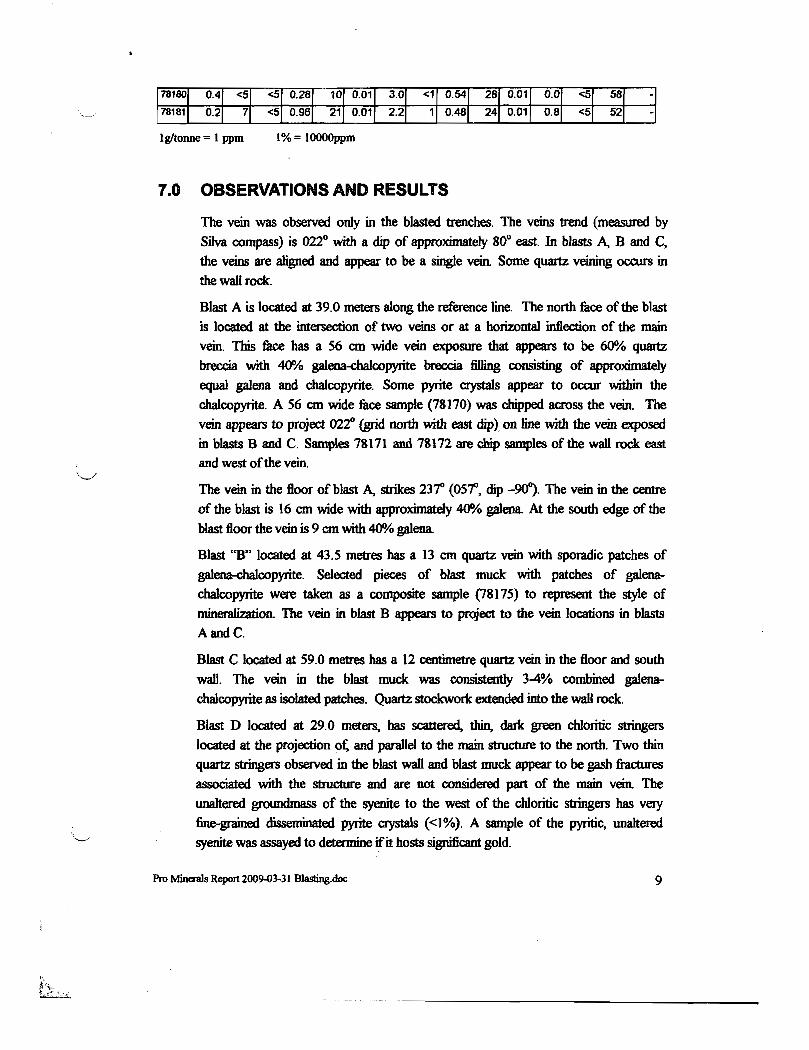
Igltonne = 1 ppm 1% = lOOOOppm
7.0 OBSERVATIONS AND RESULTS
The vein was observed only in the blasted trenches. The veins trend (measured by Silva compass) is 022° with a dip of approximately 8ft east In blasts A. B and C, the veins are aligned and appear to be a single vein. Some quartz veining occurs in the waH rock.
Blast A is located at 39.0 meters along the reference tine. The north face of the blast is located at the intersection of two veins or at a horizontal inflection of the main vein. This face bas a 56 em wide vein exposure that appears to be 6()O/o quartz breccia with 40% galena-dJalcopyrite breccia filling consisting of approximately equal galena and cbaJcopyrite. Some pyrite crystals appear to occur within the chalcopyrite. A 56 em wide face sample (78170) was chipped across the vein. The vein appears to project 022° (grid north with east dip) on line with the vein exposed in blasts Band C. Samples 78171 and 78172 are chip samples of the waD rock east
and west of the vein.
The vein in the floor of blast A, strikes 23r (05~, dip -90~. The vein in the centre
of the blast is 16 em wide with approximately 40% galena. At the south edge of the blast floor the vein is 9 em with 40% galena.
Blast "8" located at 43.5 mettes bas a 13 em quartz vein with sporadic patches of galena-chalcopyrite. Selected pieces of blast muck with patches of galenachalcopyrite were taken as a composite sample (78175) to represent the style of minera.lization. The vein in blast B appears to project to the vein locations in blasts AandC.
Blast C located at 59.0 metres bas a 12 centimetre quartz vein in the floor and south wall The vein in the blast muck was consistently 34% combined galenachalcopyrite as isolated patches. Quartz stockwork extended into the wa11 rock.
Blast D located at 29.0 meters, bas scattered, thin, dark green cbloritic stringers located at the projection ot: and parallel to the main structure to the north. Two thin quartz stringers observed in the blast waJi and blast muck appear to be gash fractures associated with the structure and are not considered part of the main vein. The unaltered groundmass of the syenite to the west of the chIoritic stringers bas very fine..grained disseminated pyrite crystals «1%). A sample of the pyritic, unaltered syenite was assayed to determine if it hosts significant gold.
Pro MinemJs Report 2009-03-31 Blasting.doc 9
Samples 18] 10, 111, 172 and 179 were chipped from the blast faces to represent the approximate grade of the fiu:e over the reported sample widths. These samples were not enhanced by selection.
Sample 78175 (blast B) was a selected sample. The mineralization reflects the
signature of the mineralization and was probably significantly emiched relative to the vein material observed in the muck and in the fiu:e.
Sample 78176 (blast C) consisted of 2-4 em thick chucks of mineralized vein collected from the blast muck. The observed vein material appeared to have consistent mineralization. This sample appears to be representative of the mineralization of the vein. Sample 18171 was a muck sample collected fium the
fines of the blast muck. The Ag and Ph analyses of this blind sample was consistent with the selected grab sample of vein material (the Cu appears to be enriched in the
grab sample 78176).
Sample 7873 was selected to represent the mineralogy of the chalcopyrite rich portion ofvein sweI1ing located at blast A Sample 78174 was conected to represent the galena rich potion of the vein that bas minimal chalcopyrite. These two samples were conected to acc:entuate the metal associations. The Ag/Pb ratios of the six vein and muck samples (78170 and 78173-177) have a narrow range; 33-39grams Ag for each 1% Pb (mineralization in the blast muck samples appears to be dominated by the vein). This tight ratio indicates the silver is intimately associated with the galena and is independent of the cbalcopyrite--pyrite content of the vein. The AgIPb ratio of the two wall. rock samples (78171-112) are comparable to the vein samples indicating the silver in the wall rock silver mineralization is also intimately associated with galena.
The AgIPb ratios of samples 78178-18 I are not considered to be a valid cbaract:erization of the vein mineralization.
The vein and muck samples analysis have a tight range of BilAg ratios from 3.9 to 5.3 indicating the silver and bismuth intimately associated with each other, possibly in solid solution in the galena. 4512 ppm Bi (4.6 kgItonne) in sample 78173 is the
highest bismuth analysis. Bismuth is a common associate of silver deposits in eastern Ontario and many gold deposit types (see Mineral Deposits of Canada 2007).
Carbonate minerals were not observed in the vein or wall rock hosting the vein. The absence of Ca and Mg in the ICP analysis confirms this observation. The vein silver deposits of Cobalt-Gowganda mining camps are hosted in Ca-Mg carbonate veins with high As, Co, Hg, Nt and Sb. The Cairo Tp vein lacks all of these metals indicating the Cairo vein is a separate deposit type.
10
'~.
The Zn values are extremely low. This could indicate the silver, lead and bismuth may be derived from the Cairo Stock. Alternatively the absence of zinc could indicate the high Pb values encountered marks the central portion of metal zoning within a larger system.
The gold values are low, but its presence indicates gold may be economically significant ifminerallmetal zoning is identified.
Emiched mineralization and increased vein dimensions are conunon features at the intersections of veins and at inflections of veins as encountered at blast A
The style of vein mineralization and veining styles encountered in the bJasting appear to be a valid exploration model. Down dip and horizontal vein extensions. and other potential veins appear to be valid exploration targets for continued exploration.
8.0 RECOMMENDATIONS
The stripped area and blast trenches should be washed and mapped, then the vein and wall rock should be saw-channel sampled during the summer field season. Mapping should accurately document the limits, geometty and cross cutting relationships of the vein(s) and document the vein and wall rock mineralization. Mapping should aJso identify the character of the limonitic soil observed coating the outcrop surface. It is necessary to determine if the apparent gossan is related to the mineralization or is a factor related to soil profile development.
A Self Potential (SP) orientation survey is recommended to determine the SP signature of the vein mineralization. The orientation survey is intended to determine if SP can be used to determine the extension of the vein and identify new veins. Eight grid lines at 1120 (grid east) centred on the trace of the zone would be useful. These include lines OON, 25N, 4ON, S3N, 75N, lOON, 125N, 150N, and 175N and 2ooN. Lines 40N, lOON and 200N should be cut 100 meters west and 100 meters east from the base line. The other lines should be cut at least 35 meters west and east from the base line. SP readings should be at taken at a 5 meter spacing. Within 15 meter of the base line, 2.5m readings are recommended.
The relationship of limonitic soil to the readings should be noted as rusting within the soil profile may cause an IP response.
This orientation survey should be considered valid for low carbonate environments. Some deposits in the Larder Lake - Cadillac break are hosted in carbonate alteration. The presence of carbonate in sulphide bearing host rocks
Pro Minerals Report 2Q09..03-3 I 8Iasting.doc 11
-~-~~--~--~-~.--.-----------------
may suppress SP responses. Separate Orientation surveys would be required to
validate SP surveys in carbonate alteration environments.
This showing and other promising Pro Mineral showings should be considered for IP (Induced Polarization) orientation surveys to detennine if IP surveys are a viable exploration tool.
• An "a" spacing" of 12.5 meters is recommended. The survey should
include two conventional 300 meter lines perpendicular to the vein (lines
40N and lOON centred on the vein) and
• one north-south line should be established at 15 meters grid east to run
para1lel to the vein. This would be line OISE from 150S to 300N. This line
would also use a 12.5m a spacing. This single IP line parallel to the zone
would utilize the flat earth IP model and accentuate the IP/resistivity
responses (possibly beyond the sensitivity of conventionailP work).
If line 15E successfully identifies a probable recognizable IP response; a second
IP line at 030E (para1lel to the vein) using a 2S meter "a" spacing is recommended
to define drill targets.
A minimum of four waIl rock of samples (no vein material included) and an
additional 4 samples of fresh syenite should be ICP analysed and whole rock
analysed to establish if wall rock aJteration can be reliably identified. This is
important to establishing the vein signature in apparent minor structures that may
exist beyond the limits of minera1ized veins.
Pro Minerals Report l009~3-31 Blasting.doc 12
... -- ... -~----.-~ .. ----------------
9.0 REFERENCES
MERQ-OGS
1966: LoveD. H.S .. Powell and Cairo townships, TImiskaming District; Ontario Department of Mines, Map 211' 0, scale 1 :31,680.
1983: Lithostratigraphic map of the Abitibi Subprovince; Ontario Geological Survey/Ministry de l'Energie et des Ressources, Quebec; 1:5000 000; catalogued as «Map 2484" in Ontario and "DV 83-16" in Quebec.
2000: Ayer, lA, and Trowell, N.F. 2000. Geological compilation of the Kirldand Lake Area, Abitibi greenstone belt: Ontario Geological Survey, Prefuninary Map P.3425, scale 1:100000.
2004: Ontario Geological Survey. Airborne magnetic swvey, airborne magnetic field and Keating coefficients, Kirkland Lake Larger Jake area; Ontario Geological Survey, map 81936 scale 1:20,000
2004: Ontario Geological Survey. Airborne magnetic survey, shaded image of the
second vertical derivative of the magnetic field and Keating coefficients, Kirldand Lake Larger lake area; Ontario Geological Survey, map 81 942 scale 1:20,000
2005: Ayer, lA, Berger, B.R, Hall, L.AF., HouJe, MG., Johns, G.W., Josey, S., Madon, Z., Rainsfurd, D., Trowell, N.F. and Vaillancourt." C. 2005. Geological compilation of the central Abitibi greenstone belt: Kapuskasing Structural Zone to the Quebec border; Ontario Geological Survey, Preliminary Map P.3565, scale 1:250,000.
2006: Berger, B.R Geological synthesis along Highway 66 from Matachewan to Swastika; Ontario Geological Survey, Open FIle Report 6177, 125 accompanied by Map 2677, scale 1 :50,000
2006: Berger, B.R, Pigeon, L. and Leblanc, G. Precambrian geology Highway 66 area, Swastika to Matachewan Map 2677, scale 1:50,000
2007: Goodfellow W.D. (editor) et an. Mineral Deposits of Canada. A Synthesis of Major Deposit Types, District Metallogeny, the Evolution of Geological Provinces and Exploration Methods. Geological Association of Canada Mineral Deposits Division Special Publication No.5.
Pro MinenIls Report 2009-03·31 Blasting.doc 13
.... -- ... ~~--.. --------------------
CERTIFICATE OF QUALIFICATIONS
I, Douglas Robinson, of24 Victoria Avenue, Swastika, Ontario hereby certifY that:
1. I am a registered professional Engineer of the province of Ontario, No. 39322011.
2. I am a graduate of Queen's University in Kingston Ontario with an Honours Bache10r of Science, Geological Engineering 1975, and Northern College. Sehool of Mines in Haileybwy, Ontario, 1970.
3. I have been practising my profession since graduation.
4. The infunnation contained in this report is the result of work done by myself and the references cited.
Pro Minerals Report 2~3-31 Blasting.doc 14

K K

80"39 '39
I lin
o
12
11
DOm
09
!6OOOm 27
x 1~
G13
131:
e 1·.b,M2 677 r---------------~~~~~~~~------------------------~~------~~~--~~------~~=-~~~ .•.
32Cairo Tt:> 28 29
K K
= . z:" cm=soaiJ
F
r
Sample #;. g!tAg %Cu %Pb Sample type 78176 .. SlAg 1.7Cu 1.5Ph Grabs 78177- 54Ag O.leu 1.6PhMuck
llJ· E.
o I
5 10m 1 J
".~ Pl\.A.g~er Ho/IE- L{2,7 mN ~ .. a.Jo,,:, f<efe.y-ence. I-,ne
Blast B 78175- 39Ag 0.1 Cu 1.0Pb Selected Vein
. 13crn.Q lA..Q rfz.... V e.;" Zotl~ VptQZ 'Z Got lena. tI- o·
N 111 0'
Blast A 78170- 785Ag 113Cu 22.5Pb/O.56. 78171- 6Ag O.7Cu O.2Pb/0.34 78172- .. 9Ag O.lCu 0.2Pb/0.27 (wal1 rock) 78173- 900Ag IO.7eu 24.4Pb Cp Grab 78174- 746Ag O.6Cu 21.3Pb/0.3 In Galena
VfCt.yYFione. ... . o ;ss emil\ (Xfe4 "tr.~k f°t'\~yieJ1I't ." t!i,..OUf\ timets)'
to o.OmN Reference Point .,~ . Larqe .. . ~.o : 'I so/~fed Jax:.k pine· ..
/
Choo.lW:'f yr-f·t-e 022 ViP 80° E~s+
.
So~pjes 78110, J 7 17 171,)1 7 3) 17tf
..•.• 't5'Gcl'il,ZfSJ~Ga1ehQ..;2.() % .. CAttl cop y y, 'fe t"EicHr'41frt%(5iilirfl~ " Cm 1/0% Gal enct
5"/¥OOm'N
(2.fos f 1<0 elL AU. Re.cI5yen.f'fe of' +he.Cair-o 5" t06k .
. PICttjto.cJa.5e. Grains 1-0 g";'"IYlL(jYlJ Ma-s SIV e Gro u"dma..ss
BlastD 78178- 1 Ag O.OCu O.OPbMuck 78179-0Ag G.OCu O.OPb/O.80m chip sample 78180 .. GAg O.Deu O.OPb wall rock & quartz gash vein 78181- OAg o.oeu O.OPb Pyritic Syenite
Pro Minerals Inc .. . Cairo Tp. Showing Map Blast, Geology &
" "
Samples February 18,2009

- ~I A I 5' ; elf Ollt 1'1
~~~--------4------------------ -----~--------------~~-----~
.' + =- _.LtIM N~cr93 Plot Qf WaYfo'nt5
A ppe.a rS to he1-/- 3m
o I
6 I
10m I
t.{ 2, 7MN P{thj'1erHo/e
30l0m N PIU:J jerHqle.
Pro Minerals Inc. Cairo Tp ,Showing
UJ' OO.Obt,N Base Line Map , .f Layge ! 15'0/ CtfeJ ~. .., ~. JCL~ k PAn e GLt~ February 18,2009
g: North E.dj.. e.· .. 0 f5 Wtlm. pg:' ...... ..... .' ..' vfl .. fl / ..'". . . \'if r~efL 13Io..z...ed. ~. a-L~/~Atr7/,-c,"~I?# ..... "", ... ~., LrI lvt eo..s lAved U TM 'g' ~/- ~
~ __ ~~ __ ~~o~···~ ___ .~A~r_b_'+~·~_~_·~_I·t~·~D~e~~rn~d~C~o~y~r~~:r' _F .. _e.~b~I~2M?~O~'_L-__ ~ __ ~51~ILZ;~~~