Embed Size (px)
Citation preview

Black Rock Park Location: 3400 RR 261, Buchanan Dam, TX 78609 County: Llano Size: 25 acres
LCRA's Black Rock Park on Lake Buchanan is popular with campers, swimmers and boaters. The park draws a good-sized crowd on summer weekends. While there are no boat ramps in the park, boaters may launch from a free public ramp at Llano County Park next door. Swimmers plunge into the lake from the park's sandy beach, and ample shoreline provides excellent opportunities for bank fishing.
Black Rock cabins
History
LCRA has operated Black Rock Park since the 1970s.
Facilities 15 general camping water and electric sites that include 30 or 50 amp electrical and
wastewater/potable water hookups, a picnic table, grill and fire ring 21 water-only tent sites that include a picnic table, fire ring and access to a water spigot 18 mini-cabins. Each has electricity, outside water spigot, heat and A/C, a ceiling fan, front
porch, picnic table and a grill. Each cabin will sleep up to five in two sets of bunk beds. Restroom and showers RV dump station
Recreation Fishing Recreation area Sandy beach Swim areas

Nearby towns Kingsland – 8.4 miles (HEB, Ace Hardware) Llano – 17 miles (Super S Foods, Coopers BBQ) Burnet – 16.3 miles (HEB, Walgreens)
Black Rock host site
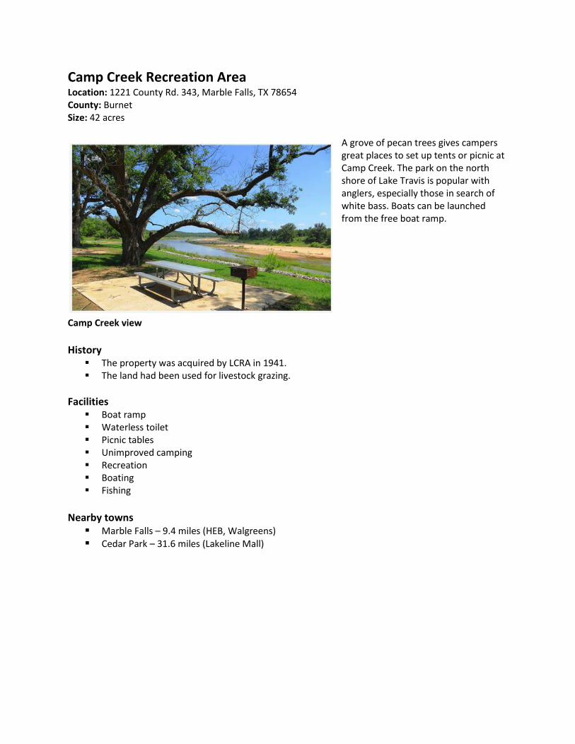
Camp Creek Recreation Area Location: 1221 County Rd. 343, Marble Falls, TX 78654 County: Burnet Size: 42 acres
A grove of pecan trees gives campers great places to set up tents or picnic at Camp Creek. The park on the north shore of Lake Travis is popular with anglers, especially those in search of white bass. Boats can be launched from the free boat ramp.
Camp Creek view
History
The property was acquired by LCRA in 1941. The land had been used for livestock grazing.
Facilities Boat ramp Waterless toilet Picnic tables Unimproved camping Recreation Boating Fishing
Nearby towns
Marble Falls – 9.4 miles (HEB, Walgreens) Cedar Park – 31.6 miles (Lakeline Mall)

Cedar Point Recreation Area Location: 545 Ranch Road 3014, Tow, TX 78762 County: Llano Size: 342 acres
Cedar Point Recreation Area is one of the largest public tracts of land on Lake Buchanan, with 3 miles of shoreline. Cedar Point is one of LCRA's parks left in a more natural state, making it ideal for those who like to ‘‘rough it.’’ Cedar Point is directly across the lake from Canyon of the Eagles Nature Park.
Cedar Point beach
History
Cedar Point was acquired as part of the Lake Buchanan project in 1936. The land had been used for livestock grazing.
Facilities Boat ramp Waterless toilet
Recreation Boating, canoeing and kayaking Hiking and walking trails Horseback riding Fishing Swimming Unimproved camping

Nearby towns Kingsland - 19.3 miles (HEB, Ace Hardware) Llano – 17.4 miles (Super S Foods, Coopers BBQ) Burnet – 27.1 miles (HEB, Walgreens)
Cedar Park host site

Gloster Bend Recreation Area Location: 3533 Hollingsworth Road, Marble Falls, TX 78654 County: Travis Size: 541 acres
More than a mile of grassy shoreline is easily accessible at Gloster Bend Recreation Area on the north shore of Lake Travis. Many visitors use the boat ramp, which is open 24 hours a day. The park is day-use only.
Gloster Bend view
History
Originally part of an 1841 land patent, the property was the location of numerous small communities, hamlets and towns in which farming, sheep, cattle and goats were primary sources of income.
The land was acquired by LCRA as part of the Lake Travis project.
Facilities Boat ramp Picnic tables
Recreation Bicycling – dirt and gravel Fishing Hiking and walking trails Horseback riding Swimming
Amenities Washer and dryer Storage shed
Gloster Bend host site
Nearby towns Marble Falls – 24.8 miles (HEB, Walgreens) Cedar Park – 22.7 miles ( Lakeline Mall)

Grelle Recreation Area Location: 640 County Road 412, Spicewood, TX 78669 County: Burnet Size: 400 acres
Grelle Recreation Area wraps around an isolated cove on the south shore of Lake Travis. The cove's grassy beach is a good swimming spot. A 2-mile hiking trail winds through the area's hills to a plateau with a spectacular view of Lake Travis. Overnight camping is allowed at the 400-acre area, but no facilities are provided. It has one outdoor toilet and no drinking water.
Grelle view
Facilities Restrooms
Recreation Camping on a first-come, first-serve basis Swimming Hiking
Amenities Washer and dryer Storage shed
Grelle host site
Nearby towns
Bee Cave – 19.5 miles (HEB, Hill Country Galleria) Austin – 38.6 miles
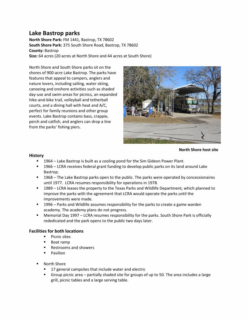
Lake Bastrop parks North Shore Park: FM 1441, Bastrop, TX 78602 South Shore Park: 375 South Shore Road, Bastrop, TX 78602 County: Bastrop Size: 64 acres (20 acres at North Shore and 44 acres at South Shore)
North Shore and South Shore parks sit on the shores of 900-acre Lake Bastrop. The parks have features that appeal to campers, anglers and nature lovers, including sailing, water skiing, canoeing and onshore activities such as shaded day-use and swim areas for picnics, an expanded hike-and-bike trail, volleyball and tetherball courts, and a dining hall with heat and A/C, perfect for family reunions and other group events. Lake Bastrop contains bass, crappie, perch and catfish, and anglers can drop a line from the parks’ fishing piers.
North Shore host site
History 1964 – Lake Bastrop is built as a cooling pond for the Sim Gideon Power Plant. 1966 – LCRA receives federal grant funding to develop public parks on its land around Lake
Bastrop. 1968 – The Lake Bastrop parks open to the public. The parks were operated by concessionaires
until 1977. LCRA resumes responsibility for operations in 1978. 1989 – LCRA leases the property to the Texas Parks and Wildlife Department, which planned to
improve the parks with the agreement that LCRA would operate the parks until the improvements were made.
1996 – Parks and Wildlife assumes responsibility for the parks to create a game warden academy. The academy plans do not progress.
Memorial Day 1997 – LCRA resumes responsibility for the parks. South Shore Park is officially rededicated and the park opens to the public two days later.
Facilities for both locations Picnic sites Boat ramp Restrooms and showers Pavilion
North Shore
17 general campsites that include water and electric Group picnic area – partially shaded site for groups of up to 50. The area includes a large
grill, picnic tables and a large serving table.

South Shore 12 waterfront campsites that include water and electric 20 general campsites that include water and electric Six full campsites with water, electric and sewer hookups 18 mini-cabins that accommodate up to five people each in two sets of bunk beds. Each has
electricity, an outside water spigot, heat and A/C, a ceiling fan, a front porch, a picnic table and grill. Twelve cabins are along the waterfront and six cabins are at Osprey Point.
Osprey Point Hall accommodates 80 people inside and an additional 40 if the outside picnic area is used. The hall has heat and A/C, a catering kitchen with commercial sink, refrigerator, buffet counter, icemaker, tables and chairs, private restrooms and fireplace. Horseshoe pits, washer pits and a larger group barbecue are located outside the hall. The hall can be rented in combination with the six Osprey Point mini-cabins.
Recreation for both locations
Boat ramps Canoe and kayak launch site Fishing Hiking and mountain biking trails Swimming
Amenities Washer and dryer Storage shed Wi-Fi at fee booth
Nearby towns Bastrop – 3.8 miles (HEB, Wal-Mart) Austin – 36.8 miles
South Shore host site

Matagorda Bay Nature Park Location: 6430 FM 2031, Matagorda, TX 77457 County: Matagorda Size: 1,487 acres (400 acres include the park and Natural Science Center; 1,087 acres are protected area)
Matagorda Bay Nature Park (MBNP) is a park and preserve at the mouth of the Colorado River on Matagorda Peninsula. LCRA developed the park to provide recreation, education, wetlands preservation and economic benefit to the region. The park has about 2 miles of frontage on the Gulf of Mexico, 2 miles of river frontage, and several hundred acres of coastal marshes, wetlands and dunes, much of which is protected and restricted as a preserve. It is also one of the best birding areas in the nation.
Matagorda Bay view MBNP features an RV campground and a natural science center. The RV campground provides a variety of recreational vehicle camping options and other park amenities. The Matagorda Bay Natural Science Center provides programs about the importance of water conservation and alternative forms of renewable energy and seeks to encourage stewardship of the Colorado River. Enabling people to experience the river and the region’s natural resources first-hand helps raise awareness and encourages the protection of these resources. History
2001 – LCRA acquires the property as part of its commitment to preserve natural resources for future generations and provide science education, recreation and nature tourism opportunities.
2002 – The Texas Parks and Wildlife Department awards LCRA a $2 million grant to build recreational facilities at the park.
Aug. 3, 2011 – The Environmental Protection Agency’s (EPA) Gulf of Mexico Program honors the Matagorda Bay Natural Science Center with a Gulf Guardian Award in the Youth Environmental Education Division.
Bi-annually – A cattle pen complex is used for the Cattle Swim Roundup, in which cattle are herded across the Colorado River to the pens. This traditional practice dates back to the 19th century.
Natural science education programs The Texas Education Agency (TEA) has identified LCRA natural science centers as model outdoor
education sites for Texas field trips. Natural science centers education programs reinforce the Texas Essential Knowledge and Skills (TEKS) objectives and the processing skills necessary for the Texas Assessment of Knowledge and Skills (TAKS) test.
The educational philosophy at the centers is based on the belief that people learn best in the outdoors through direct experience.
Program curriculums include: Estuary Investigation, GPS on the Trail, Dune Defense and Beach Processes, and Clear into the Future: Water Quality.

The river stewards program is a science education program conducted with school districts in the LCRA service area in the lower basin. Partners include Texas A&M University, Texas State University and the Colorado River Alliance. The program has proven the connection between learning science in the outdoors and higher test scores in TEA state testing.
Matagorda staff collaborates with The University of Texas Bureau of Economic Geology to work with middle and high school students on dune defense and beach processes, studying the importance of dune protection and conservation. The data gathered is used for scientific studies within UT’s Beach Dunes Monitoring Project.
Natural Science Center recreational outdoor programs
Programs offered to the general public include: Day on the Bay Wetland Kayaking Trip, Wings Over the Wetlands and Nature Scavenger Hunt.
Groups visiting Matagorda Bay for tourism purposes also can participate in recreational programs offered at the Natural Science Center. Targeted programs for RV groups include birding, beach-combing and kayaking. Targeted programs for Scout groups include oceanography and environmental science.
Facilities – RV park 22 general camping RV sites that include 30/50 amp electrical service, sewer connections and a picnic table 5 pull-through RV sites that include 30/50 amp electrical service, sewer connections and a picnic table 24 preferred RV sites that include obstructed views of the river and 30/50 amp electrical service, sewer connections and a picnic table 19 waterfront camping RV sites that include 30/50 amp electrical service, sewer connections and a picnic table
Matagorda Bay host site
Group picnic area – partially shaded site for groups of up to 50; includes a large grill, picnic tables and a large serving table
Laundry facilities Restrooms and showers
Recreation Boat ramps Canoe and kayak launch sites Fishing piers Guided tours Hiking and walking trails Natural Science Center

Sandy beach Swimming
Amenities Washer and dryer Wi-Fi at fee booth
Nearby city Bay City – 27.7 miles (HEB, Walgreens)

McKinney Roughs Nature Park Location: 1884 Hwy 71 West, Cedar Creek, TX 78612 County: Bastrop Size: 1,151 acres (130 acres are park and Natural Science Center; and 1,021 acres are protected area)
McKinney Roughs is a nature park at which characteristics of four ecosystems – Post Oak Savannah, Blackland Prairie, East Texas Piney Woods and a riparian zone – converge to create an unusual blend of natural resources. Located 13 miles east of Austin-Bergstrom International Airport, McKinney Roughs is home to hundreds of plant and animal species living within the rolling box canyons, wildflower
McKinney Roughs view meadows and lazy river bends of the Colorado River. McKinney Roughs is a day-use park where visitors can explore close to 18 miles of trails by foot or horseback or take part in one of the park’s many community programs. The McKinney Roughs Natural Science Center provides programs to help educate people about the importance of water conservation and alternative renewable energy solutions, and seeks to encourage stewardship of the Colorado River.
History 1850s through 1950s – property is owned
and worked by the Wise family 1980s – plans for residential development
are put on hold due to an economic downturn
1995 – LCRA acquires the property. Additional adjoining properties are acquired in 1996 and 1998
McKinney Roughs host site

Facilities Day-use park Visitors Center with gift shop and interactive exhibits Facility rental – includes a meeting room for up to 120 people, kitchen area, catered dining hall
that accommodates up to 250 people and three dormitories that can house up to 128 guests Restrooms
Recreation Hiking and walking trails Equestrian trails Outdoor education and recreation programs
Amenities Washer and dryer Wi-Fi at Visitor Center
Nearby towns Bastrop – 9.5 miles ( HEB, Wal-Mart) Austin – 23.6 miles

Muleshoe Bend Recreation Area Location: 2820 County Road 414, Spicewood, TX 78669 Counties: Travis/Burnet Size: 920 acres
Muleshoe Bend Recreation Area is on the south side of Lake Travis, about 20 miles west of Austin, making it an excellent weekend getaway for people in the Austin area. Muleshoe Bend features several recreational opportunities, including a 6.5-mile mountain bike trail and horseback riding. Muleshoe Bend also has plenty of sites for tent camping, picnic tables with views of the lake and a gentle shoreline. Portions of the property are leased to a nearby property association, a yacht and marina association, and a summer youth camp.
Muleshoe Bend view
History 1939-1942 – Muleshoe Bend is acquired by LCRA as six separate tracts for the creation of Lake
Travis. 1990s – Muleshoe Bend undergoes a series of improvements to help ensure resource
protection, site security and public enjoyment.
Facilities Unimproved camping Picnic tables Entrance station Flushing restroom Outdoor shower Potable water
Recreation Bicycling – dirt and gravel Fishing Hiking and walking trails Horseback riding Swimming
Muleshoe Bend host site

Amenities Washer and dryer Storage shed Wi-Fi at fee booth
Nearby towns Bee Cave – 20.3 miles ( HEB, Whole Foods, Hill Country Galleria) Austin – 38.6 miles
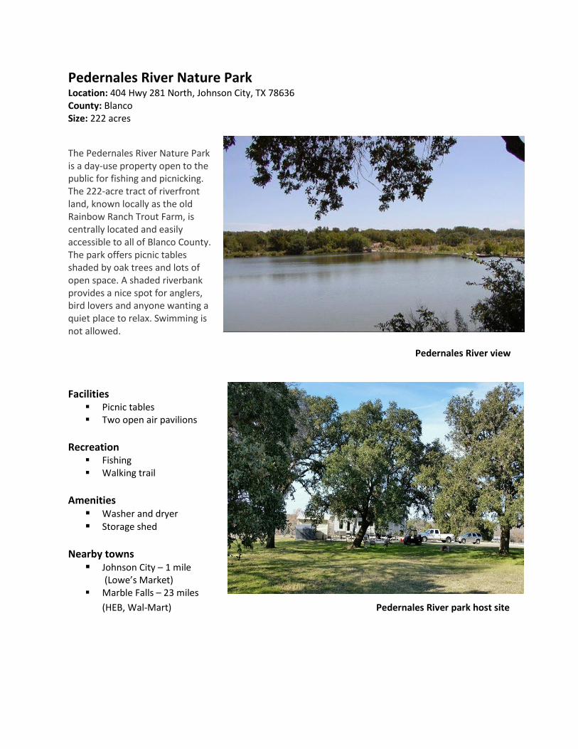
Pedernales River Nature Park Location: 404 Hwy 281 North, Johnson City, TX 78636 County: Blanco Size: 222 acres
The Pedernales River Nature Park is a day-use property open to the public for fishing and picnicking. The 222-acre tract of riverfront land, known locally as the old Rainbow Ranch Trout Farm, is centrally located and easily accessible to all of Blanco County. The park offers picnic tables shaded by oak trees and lots of open space. A shaded riverbank provides a nice spot for anglers, bird lovers and anyone wanting a quiet place to relax. Swimming is not allowed.
Pedernales River view
Facilities Picnic tables Two open air pavilions
Recreation
Fishing Walking trail
Amenities
Washer and dryer Storage shed
Nearby towns
Johnson City – 1 mile (Lowe’s Market)
Marble Falls – 23 miles
(HEB, Wal-Mart) Pedernales River park host site

Plum Park on the Colorado Location: 1517 Prairie Valley Road, Westpoint, TX 78963 County: Fayette Size: 40 acres
Plum Park on the Colorado offers canoeists a great place to access the river between Smithville and La Grange. Park visitors can enjoy a day of picnicking or fishing with the option of staying overnight at the available primitive camping sites. Day-users can enjoy the park from dawn to dusk.
Plum Park view Facilities Unimproved camping Picnic tables Vaulted restroom Potable water
Recreation Fishing Hiking and walking trails Swimming Kayaking and canoeing
Amenities Washer and dryer Storage shed
Plum Park host site Nearby towns
La Grange – 10 miles (HEB, Wal-Mart) Bastrop – 26 miles

Shaffer Bend Recreation Area Location: 706 County Road 343A, Marble Falls, TX 78654 County: Burnet Size: 521 acres
Shaffer Bend Recreation Area is one of LCRA's larger recreation areas, located on the upper part of Lake Travis. The terrain, ranging from bottomlands to bluffs and hills, makes for good hiking and horseback riding. Lake Travis more resembles the original Colorado River here, especially when lake levels are lower. Wildlife viewing opportunities are abundant. Doublehorn Resource Area is located across the lake from Shaffer Bend and can be reached by foot when lake levels are low.
Shaffer Bend swimming hole
History The park was part of the Shaffer-Hood Farmstead and the Meredith Farmstead, both of which
were documented as being settled in the early 20th century. LCRA acquired the property as part of the Lake Travis project.
Facilities Toilet at entry Portable toilet in camping area Unimproved camping Picnic tables, fire rings and grills
Shaffer Bend host site
Recreation

Bicycling – dirt and gravel Fishing Hiking and walking trails Horseback riding Swimming
Amenities Washer and dryer Storage shed
Nearby towns
Marble Falls – 9.2 miles (HEB, Walgreens) Cedar Park – 29.9 miles (Lakeline Mall)

Turkey Bend Recreation Area Location: 4000 Shaw Blvd., Marble Falls, TX 78564 Counties: Burnet and Travis Size: 1,138 acres
Turkey Bend Recreation Area is on the upper north side of Lake Travis, about 9.5 miles west of Lago Vista. It is the second largest public park on Lake Travis. Turkey Bend has popular unimproved camping and fishing spots with easy access to the lake. Much of the shoreline offers views of picturesque homes on the cliffs across the lake.
Turkey Bend view History
The property is carved from three historical land patents granted by the Republic of Texas in 1845 and by the state in 1846 and 1850.
Historical references to Turkey Bend have included the term “pioneer hamlet,” and an early sketch map shows a community located down the bend, near the river just west of the Burnet County line.
Turkey Bend host site

Facilities Unimproved camping Picnic tables, fire rings and grills Flushing toilet Portable toilets
Recreation Bicycling – dirt and gravel Fishing Hiking and walking trails Horseback riding Swimming
Amenities Washer and dryer Storage shed
Nearby towns
Marble Falls – 19 miles (HEB, Walgreens) Cedar Park – 23.9 miles (Lakeline Mall)