Embed Size (px)
Citation preview

Birmingham Urban Heat Islands during 2003 Heatwave Period Preliminary WRF/BEP Simulation
Xiaoming Cai, Richard Bassett and John E. Thornes
School of Geography, Earth and
Environmental SciencesUniversity of Birmingham

36h WRF Precip Forecast
Analyzed Precip
27 Sept. 2002
WRF is an advanced mesoscale forecast and assimilation system, and accelerate research advances into operations
• Collaborative partnership, principally among NCAR, NOAA, DoD, OU/CAPS, FAA, and university community
• Development conducted by 15 WRF Working Groups
• Ongoing active testing and rapidly growing community use
– Over 1,600 registered community users, annual workshops and tutorials for research community
• Operational implementation at NCEP and AFWA in 2004
Weather Research and Forecasting Model (WRF)

• Three-dimensional, time varying, multi-domain nesting• State-of-the-art, transportable, and efficient in a massively parallel computing environment.• Design priority for high-resolution applications• Advanced data assimilation systems developed in tandem with the model itself.• Numerous physics options, tapping into the experience of the full modeling community.• Maintained and supported as a community mesoscale model to facilitate broad use in the research community.• Research advances will have a direct path to operations.
WRF Model Characteristics

Four nested domains are configured
Surface land data Terrain: US SGS (resolution ~ 30”) Landuse type: US SGS (30”), 24 categories Urban type: CORINE 2000 & Owen et al. (2006)
Meteorological initial and boundary conditions US-NCEP Analysis (FNL from GFS) : 1 degree resolution, every 6 hours
WRF-BEP Configuration
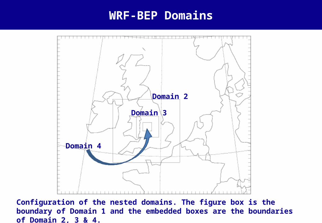
Configuration of the nested domains. The figure box is the boundary of Domain 1 and the embedded boxes are the boundaries of Domain 2, 3 & 4.
Domain 2
Domain 3
Domain 4
WRF-BEP Domains

Domain Lx (km)
Ly (km)
Lz (km)
Nx Ny Nz x (km)
y (km)
1 1800 1476 18 50 41 40 36 36
2 624 588 18 52 49 40 12 12
3 207 195 18 69 65 40 3 3
4 82 79 18 82 79 40 1 1
WRF-BEP Configuration

Domains 3 and 4
Configuration of the nested domains. The figure box is the boundary of Domain 3 and the embedded box is the boundaries of Domain 4.

Domain 4

Four nested domains are configured
Surface land data Terrain: US SGS (resolution ~ 30”) Landuse type: US SGS (30”), 24 categories Urban type: CORINE 2000 & Owen et al. (2006)
Meteorological initial and boundary conditions US-NCEP Analysis (FNL from GFS) : 1 degree resolution, every 6 hours
WRF-BEP Configuration

Urban type & urban fraction for Domain 4
Urban type for Domain 4:30=non-urban; 31=low intensity residential; 32=high intensity residential; 33=commercial
Urban area fraction for Domain 4:
0-100%

Four nested domains are configured
Surface land data Terrain: US SGS (resolution ~ 30”) Landuse type: US SGS (30”), 24 categories Urban type: CORINE 2000 & Owen et al. (2006)
Meteorological initial and boundary conditions US-NCEP Analysis (FNL from GFS) : 1 degree resolution, every 6 hours
WRF-BEP Configuration
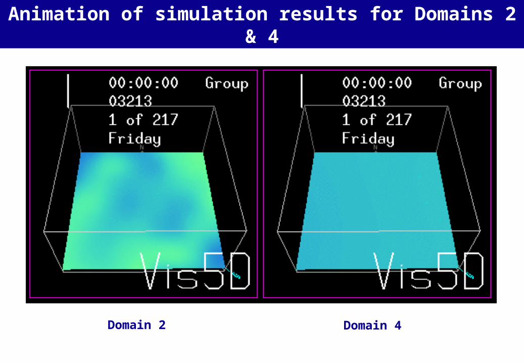
Domain 2
Animation of simulation results for Domains 2 & 4
Domain 4

Temperature at 2 m above
ground
(a)2100
(b) 2200
(c) 2300
(d) 2400
Temperature field 2100-2400 GMT 4 August 2003
(a) (b)
(c) (d)

Temperature field at 0000 GMT 9 August 2003
Temperature at 2 m above ground for Domain 4

Observed temperature at 3 stations 1-10 August 2003

Future work
To fine-tune the model
To validate the model
To simulate various scenarios with different lanuse types
To apply it to 2010 scenarios