Embed Size (px)
Citation preview
birmingham’s local development frameworktheBirminghamplan
Sustainable management ofurban rivers and floodplains
Supplementary Planning Document
june2007
birmingham’s local development frameworktheBirminghamplan
Sustainable management of urban rivers and floodplains
Supplementary Planning Document
june2007
Clive DuttonDirector of Planning and Regeneration
Sustainable management of urban rivers and floodplains
Introduction
1.1 SMURF (Sustainable Managementof Urban Floodplains)
1.2 The planning guidance
1.3 Status of the guidance
Policy context
2.1 Water Framework Directive
2.2 Planning Policy Guidance Notes (PPGs) and Planning Policy Statements (PPSs)
2.3 PPS25 Development and Flood Risk
2.4 West Midlands Regional SpatialStrategy (WMRSS)
2.5 The Birmingham Plan 2005
2.6 Supplementary Planning Guidance
2.7 Strategic Environmental Assessment
Other policies and initiatives in theguidance area
3.1 River Basin Management Plans (RBMPs)
3.2 City Council Cycling Strategy
Consultation
4.1 Stakeholder and Public Consultation
The rivers in Birmingham
5.1 History of the Rivers in Birmingham
5.2 The Historic Environment
5.3 River Tame Character
5.4 River Rea Character
5.5 River Cole Character
5.6 Geology, Flooding and Contamination
5.7 Responsibilities and Management
Policies for development near to river corridors
6.1 Water Quality
6.2 Water Pollution Prevention
6.3 Sustainable Urban Drainage Systems (SUDS) and Surface Water Run Off
6.4 Character of the River Corridors
6.5 The Floodplain
6.6 Nature Conservation and Landscaping
6.7 The Historic Environment
6.8 Design of Developments
6.9 Access
6.10 Education and Recreation
6.11 Safety and Litter
6.12 Community Involvement
Sustainable management of urban rivers and floodplains
3
Contents
5
6
page 12
page 16
1
2
3
4
page 5
page 7
page 10
page 11
Sustainable management of urban rivers and floodplains
4
Planning obligations
Limitation of liability
References for further information
Glossary
Contact details
Appendices
Appendix ASummary of Policies
Appendix BSummary of Other Policies and Guidance
Appendix CContext Plan
Appendix DBirmingham’s Geology
Appendix EBirmingham’s Flood Zone
7page 23
page 24
page 25
page 26
page 32
page 33
8
9
10
11
Photographic contribution from:
Penny MooreFriends of Balaams Wood
Leo McKevittProject Kingfisher
Penny MarriotThe Shire Country Park
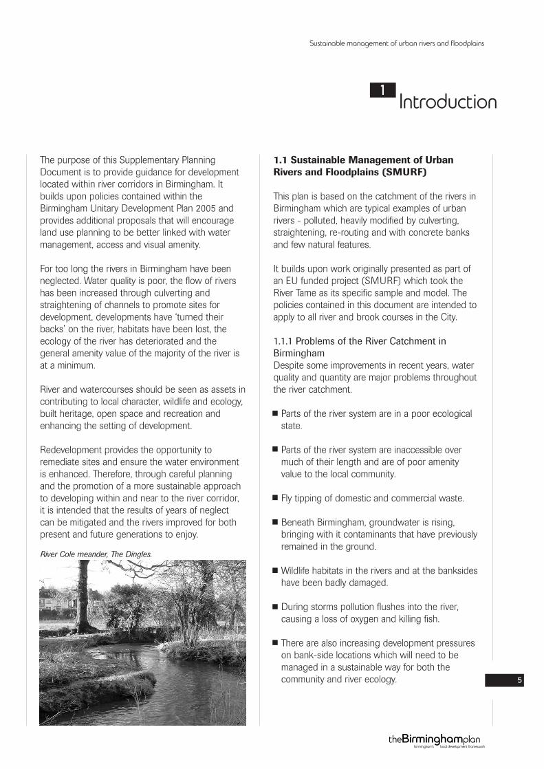
The purpose of this Supplementary PlanningDocument is to provide guidance for developmentlocated within river corridors in Birmingham. Itbuilds upon policies contained within theBirmingham Unitary Development Plan 2005 andprovides additional proposals that will encourageland use planning to be better linked with watermanagement, access and visual amenity.
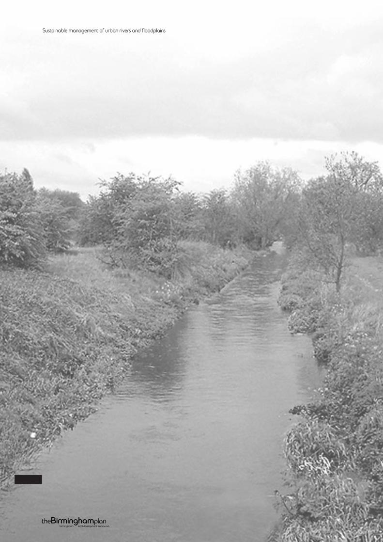
For too long the rivers in Birmingham have beenneglected. Water quality is poor, the flow of rivershas been increased through culverting andstraightening of channels to promote sites fordevelopment, developments have ‘turned theirbacks’ on the river, habitats have been lost, theecology of the river has deteriorated and thegeneral amenity value of the majority of the river isat a minimum.
River and watercourses should be seen as assets incontributing to local character, wildlife and ecology,built heritage, open space and recreation andenhancing the setting of development.
Redevelopment provides the opportunity toremediate sites and ensure the water environmentis enhanced. Therefore, through careful planningand the promotion of a more sustainable approachto developing within and near to the river corridor,it is intended that the results of years of neglectcan be mitigated and the rivers improved for bothpresent and future generations to enjoy.
1.1 Sustainable Management of UrbanRivers and Floodplains (SMURF)
This plan is based on the catchment of the rivers inBirmingham which are typical examples of urbanrivers - polluted, heavily modified by culverting,straightening, re-routing and with concrete banksand few natural features.
It builds upon work originally presented as part ofan EU funded project (SMURF) which took theRiver Tame as its specific sample and model. Thepolicies contained in this document are intended toapply to all river and brook courses in the City.
1.1.1 Problems of the River Catchment inBirminghamDespite some improvements in recent years, waterquality and quantity are major problems throughoutthe river catchment.
Parts of the river system are in a poor ecologicalstate.
Parts of the river system are inaccessible overmuch of their length and are of poor amenityvalue to the local community.
Fly tipping of domestic and commercial waste.
Beneath Birmingham, groundwater is rising,bringing with it contaminants that have previouslyremained in the ground.
Wildlife habitats in the rivers and at the banksideshave been badly damaged.
During storms pollution flushes into the river,causing a loss of oxygen and killing fish.
There are also increasing development pressureson bank-side locations which will need to bemanaged in a sustainable way for both thecommunity and river ecology.
Sustainable management of urban rivers and floodplains
5
Introduction1
River Cole meander, The Dingles.
1.1.2 Aim of the DocumentThe main aim of the SPD is to develop anddisseminate a new methodology for improved landuse planning and water management in urbanfloodplains consistent with the objectives of theWater Framework Directive (WFD). (Please seesection 2.1 for more information on the WFD.)
1.2 The Planning Guidance
This SPD provides Planning Guidance fordevelopment within river corridors.
The focus of the guidance is all the river ‘corridors’within Birmingham. It covers the main areas ofnearby open space and tributaries flowing in to therivers.
This SPD aims to tackle the problems of the riversby encouraging sustainable development andensuring that all new development makes acontribution to the sustainable development,consistent with the objectives of the WaterFramework Directive, thereby helping resolve anycurrent problems.
Policies within the guidance (Chapter 7) have beeninformed by the public consultation carried out aspart of the SMURF project as well as examples ofcurrent best practice from various specialists withinthe City Council and surrounding local authorities(see Chapter 4). Links with existing planning policyare discussed in Chapter 3 and 4.
1.3 Status of the Guidance
This document was adopted as a SupplementaryPlanning Document by the Cabinet of BirminghamCity Council on 25th June 2007, under the provisionof the Planning and Compulsory Purchase Act2004.
Sustainable management of urban rivers and floodplains
6
This Guidance has been prepared within thecontext of European Union (EU), National, Regionaland Local Planning Guidance in particular, thefollowing documents:
2.1 Water Framework Directive
The Water Framework Directive (2000) is a majorpiece legislation, which aims to rationalise EU waterlegislation to achieve an integrated system of waterprotection, improvement and sustainable use.
The WFD objectives include:
Preventing deterioration in water status.
Restoring surface waters to good ecological andchemical status by 2015.
Reducing pollution from priority substances andphasing out certain priority hazardoussubstances.
Achieving objectives for EU protected areas.
Contributing to mitigating the efforts of floodsand droughts.
Preventing and/or limiting pollution input intogroundwater.
Balancing abstraction and recharge.
The Directive came into force on 22 December2000. This was transposed into legislation by theWater Environment (Water Framework Directive)(England and Wales) Regulations 2003 which cameinto force on 2 January 2004. However,implementation of the Directive is a major, long-term task.
The Regulations identify nine River Basin Districts(RBDs) in England and Wales (Birmingham fallswithin the Humber RBD). For each RBD, RiverBasin Management Plans (RBMPs) are thenrequired to be developed and implemented. Draft
RBMPs are to be published for consultation in2008. The Environment Agency is the solecompetent authority charged with the Directive’simplementation in England and Wales.
This SPD is consistent with ‘Initial Advice toPlanning Authorities’ issued in February 2006’
2.2 Planning Policy Guidance Notes (PPGs)and Planning Policy Statements (PPSs)
The UK Government’s planning guidance notes setout the policy framework within which localplanning authorities are required to draw up theirdevelopment plans and take decisions on individualapplications to secure these objectives. These arecurrently being replaced by Planning PolicyStatements.
Particular reference should be made to:
Planning Policy Statement 1:Creating Sustainable Communities.
Planning Policy Guidance 2:Green Belts.
Planning Policy Statement 3: Housing.
Planning Policy Guidance 4:Industrial, Commercial and Small Firms.
Planning Policy Statement 9:Biodiversity and Geological Conservation.
Planning Policy Statement 10:Planning for Sustainable Waste Management.
Planning Policy Statement 11:Regional Spatial Strategies.
Planning Policy Statement 12:Local Development Frameworks.
Planning Policy Guidance 15:Planning and the Historic Environment.
Sustainable management of urban rivers and floodplains
7
Policy context2
Planning Policy Guidance 16:Archaeology and Planning.
Planning Policy Guidance 17:Planning for Open Space, Sport and Recreation.
Planning Policy Statement 23:Planning and Pollution Control.
Planning Policy Statement 25:Development and Flood Risk.
2.3 PPS 25 Development and Flood Risk
This policy statement aims to:
Ensure flood risk is taken into account at allstages of the planning process.
Avoid inappropriate development in areas at riskof flooding.
Direct development away from high risk areas.
It requires:
Flood risk assessments at the regional, strategicand site level.
Sustainability appraisals, land allocations anddevelopment control policies in the LocalDevelopment Framework to be informed by theflood risk assessments.
A sequential test that matches types ofdevelopment to degrees of flood risk.
Partnership working with the EnvironmentalAgency.
It provides for:
Reducing existing flood risk to communities forexample by recreating and safeguardingfunctional flood plain and washlands.
Reducing flood risk to new development throughlocation, layout and design, including theapplication of sustainable urban drainagesystems, sustainable defences and increasedflood storage.
An exception test that allows for developmentthat provides wider sustainability benefits to thecommunity that outweigh flood risk.
2.4 West Midlands Regional SpatialStrategy (WMRSS)
The WMRSS guides the preparation of localauthority development plans and local transportplans. It sets out policies on a range of issuesincluding those for enhancing the environment.
Policy QE9 - The Water Environment, providesguidance on water quality, protection of wetland,species and habitats, consideration of SUDS,maintaining and enhancing river corridors in orderto help with regeneration.
2.5 The Birmingham Plan 2005
Particular reference should be made to Chapter 3(Environment) which includes advice on design ofnew development, good urban design principlesand guidance for sustainable development, floodrisk, water and drainage, waste treatment anddisposal, open space, Green Belt, natureconservation, landfill sites and energy consumption.
References should also be made to the chapters onEnvironment (Chapter 3), which includes historicbuildings, conservation areas and archaeologicalremains. Economy (Chapter 4), Housing (Chapter5), City-wide (Chapter 8) as well as each of therelevant Constituency Chapters for individual riverand brook courses.
2.6 Supplementary Planning Guidance
The Local Development Framework will eventuallyreplace the UDP but a number of SupplementaryPlanning Guidance documents remain in place:
The Nature Conservation Strategy for Birmingham(March 1997).Sets out comprehensive advice and direction
regarding Birmingham’s nature conservation
resource and practical guidelines for action.
Sustainable management of urban rivers and floodplains
8
Places for All (November 2001).Provides general design guidance for all types of
development throughout the City.
Conservation Strategy (1999).
Archaeology Strategy (2003).
Places for Living (March 2001).Provides guidance for creating sustainable,
inspiring and quality residential developments.
Canalside Development in Birmingham - DraftDesign guidelines (1996).
2.7 Strategic Environmental Assessment
The European Directive 2001/42/EC on theAssessment of Certain Plans and Programmes onthe Environment (known as the StrategicEnvironmental Assessment Directive) requires the‘environmental assessment’ of a wide range ofplans and programmes, including among othersthose for town and country planning and land-use.
The Directive’s main area of emphasis in the‘environmental assessment’ procedure are on:collecting and presenting baseline environmentalinformation; predicting environmental effects duringplan preparation; identifying strategic alternatives;consulting the public and relevant authorities aspart of the assessment process; and monitoring theeffects of the plan during its implementation.
The Directive applies to plans and programmes,and modifications to them, whose formalpreparation begins after 21 July 2004. However itwill also apply to plans and programmes whoseformal preparation began before that date, if theyhave not been adopted (or be in a process toadopt) by 21 July 2006.
Sustainable management of urban rivers and floodplains
9
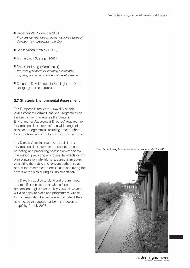
River Tame: Example of engineered channel under the M6.
3.1 River Basin Management Plans(RBMPs)
LEAPs are to be replaced by River BasinManagement Plans (RBMPs), which will be basedon River Basin Districts (RBDs), as required by theWFD. The current plan of potential RBDboundaries is shown in Figure 2. However, it shouldbe noted that these boundaries are not confirmedand are just provided to give an indication of thebasins that might be used. Birmingham and theRiver Tame fall within the Humber RBD. The firstRBMPs are to be produced in 2008 by the EA.
3.2 City Council Cycling Strategy
The Cycling Strategy sets targets for increasingcycle use generally and suggests more detailedtargets for the implementation of a cycle friendlyinfrastructure in Birmingham. (The City Council haslaunched a Cycling and Walking Map ofBirmingham, which include cycling routes nearwater courses).
Sustainable management of urban rivers and floodplains
10
Other policies and initiatives in the guidance area
3
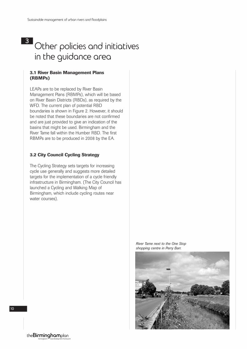
River Tame next to the One Stopshopping centre in Perry Barr.
4.1 Stakeholder and Public Consultation
The SPD was produced following extensive publicconsultation to define the localrequirements/objectives for the future managementof the river system and demonstrate the approachused as part of the EU funded SMURF Project.
An extensive programme of consultation wasdeveloped and carried out by representatives of theUniversity of Birmingham and an independentfacilitator. This has been carried out in order toinform the policies within this guidance.
The initial programme of consultation for theSMURF project involved interviews withstakeholder groups. This helped set up phase II ofthe programme, which consisted of theestablishment of three community groups of up to20 individuals who were able to offer, insight intodifferent community interests (eg. parents, children,residents groups, religious groups etc.) Communitygroups were established in three contrasting areas:Perry Barr (an example of an open section of theriver Tame through parkland); Castle Vale(examples of open culverts and undergroundculverts); and Northfield (River Rea and Worcester& Birmingham Canal and an area that hasexperienced recent flooding).
A series of workshops including an initial sitevisit/briefing day were then carried out with each ofthese groups looking at contrasting case studyareas. These included: contrasting types of urbanarea (residential, industrial, rural etc.); contrastingtypes of river (natural and contained); areas wherethe river has been regenerated; and areas whereflooding has been an issue.
The results of this process included theestablishment of a common community perspectivefor sustainable urban river management, provisionof input into the development of thecomplementary GIS tool and feedback on theissues and barriers to engaging the community andbusinesses in a project such as this. These resultshave in turn helped inform the policies within thisguidance and the information contained within theGIS tool.
Sustainable management of urban rivers and floodplains
11
Consultation4
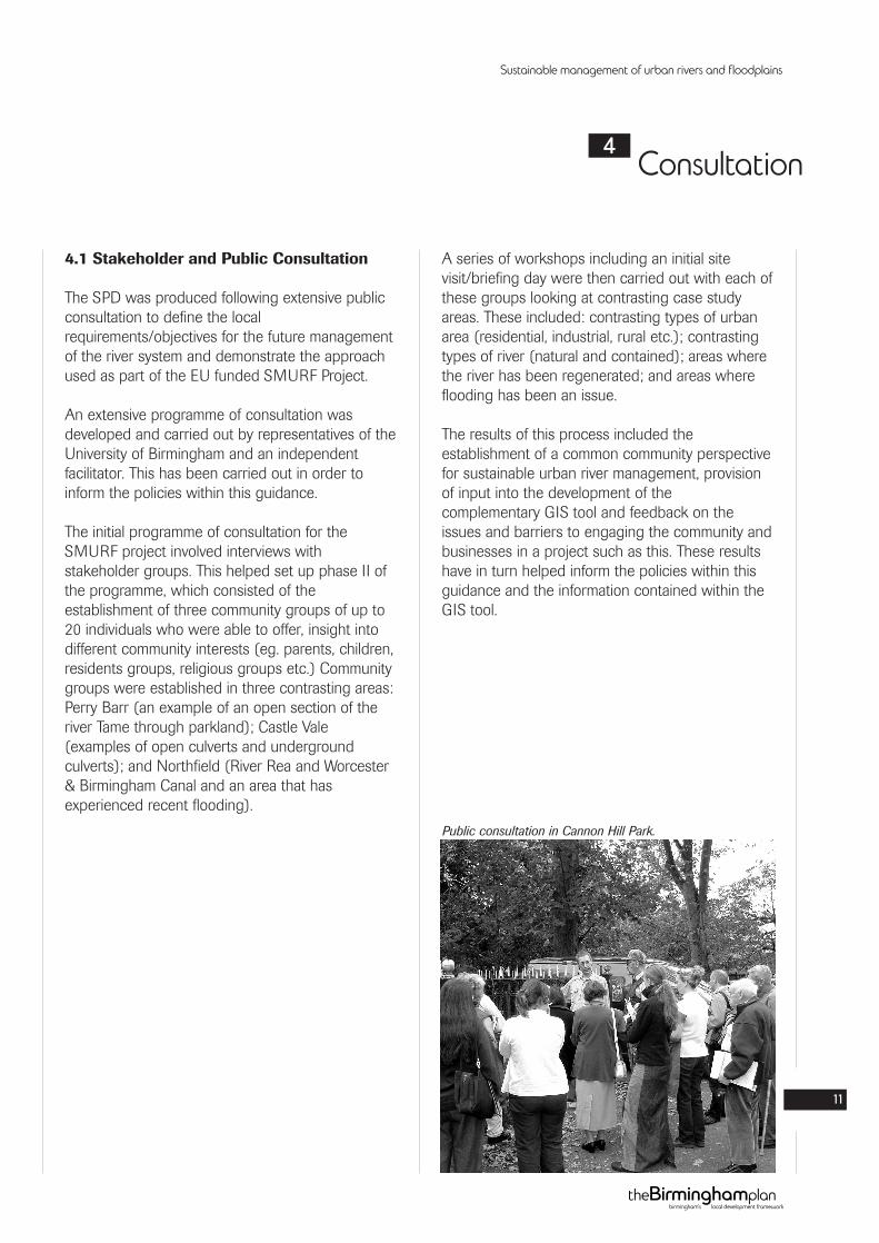
Public consultation in Cannon Hill Park.
5.1 History of the Rivers in Birmingham
The water of the Tame, Rea and Cole and that oftheir tributaries, has been used for domesticpurposes and as a source of fish and waterfowl forthousands of years. The oldest man-made objectfrom Birmingham, a stone axe, was found near theRiver Rea at Saltley. From the Middle Agesonwards the water of the three rivers was alsoused to fill moats and fishponds and for industrialpurposes, including powering watermills via leatsand millpools. Moats such as those at Perry Halland Gannow Green were constructed aroundhouses in the 13th century, as status symbols.Small settlements such as Stechford developednear river crossings in the Middle Ages.
From at least the 16th century the River Rea inDigbeth and Deritend was harnessed for leathertanning and textile processing but the town ofBirmingham itself originated on higher groundnearby rather than alongside the flood-prone river.There were watermills along all three rivers andtheir tributaries by the 11th century. They were firstconstructed to grind grain and some, likeHamstead and Edgbaston, remained corn millsthroughout their working life. Others were laterused for fulling cloth, making paper, sharpeningmetal tools, rolling and slitting metal and as ironforges and furnaces, and additional mills wereconstructed for industrial purposes from the outset.Bricks and tiles were made from local clay in theCole Valley, at Hamstead on the Tame andelsewhere. Despite this industrial development, thesurroundings of Birmingham’s rivers outside thecity centre were predominantly rural until the end ofthe 19th century, including agricultural land andestates around country houses. Although none ofthem has ever been navigable, the valleys of thethree rivers form natural routeways and areoccupied by roads, canals and railways.
5.2 The Historic Environment
The historic environment of the Tame, Rea and Colecorridors consists of a wide range of archaeologicalremains, historic buildings and historic landscapes,some of which are designated as ScheduledAncient Monuments, listed buildings, RegisteredParks or Conservation Areas. They include finds ofprehistoric stone tools; prehistoric burnt mounds;medieval moats; ridge and furrow; severalwatermills, some with surviving buildings, otherswith foundations, some with pools, dams andwatercouses; icehouses; river and canal bridges;brickworks; and industrial buildings. Many othersites, as yet undiscovered or unrecognised, arelikely to survive. Sediments in the valleys of thethree rivers and their tributaries also containevidence of past environmental conditions. Thehistoric environment is a non-renewable resourcewhich is vulnerable to damage or destruction byinappropriate development or other works.Sustainable development therefore includessafeguarding the historic environment.
Sustainable management of urban rivers and floodplains
12
The rivers in Birmingham5
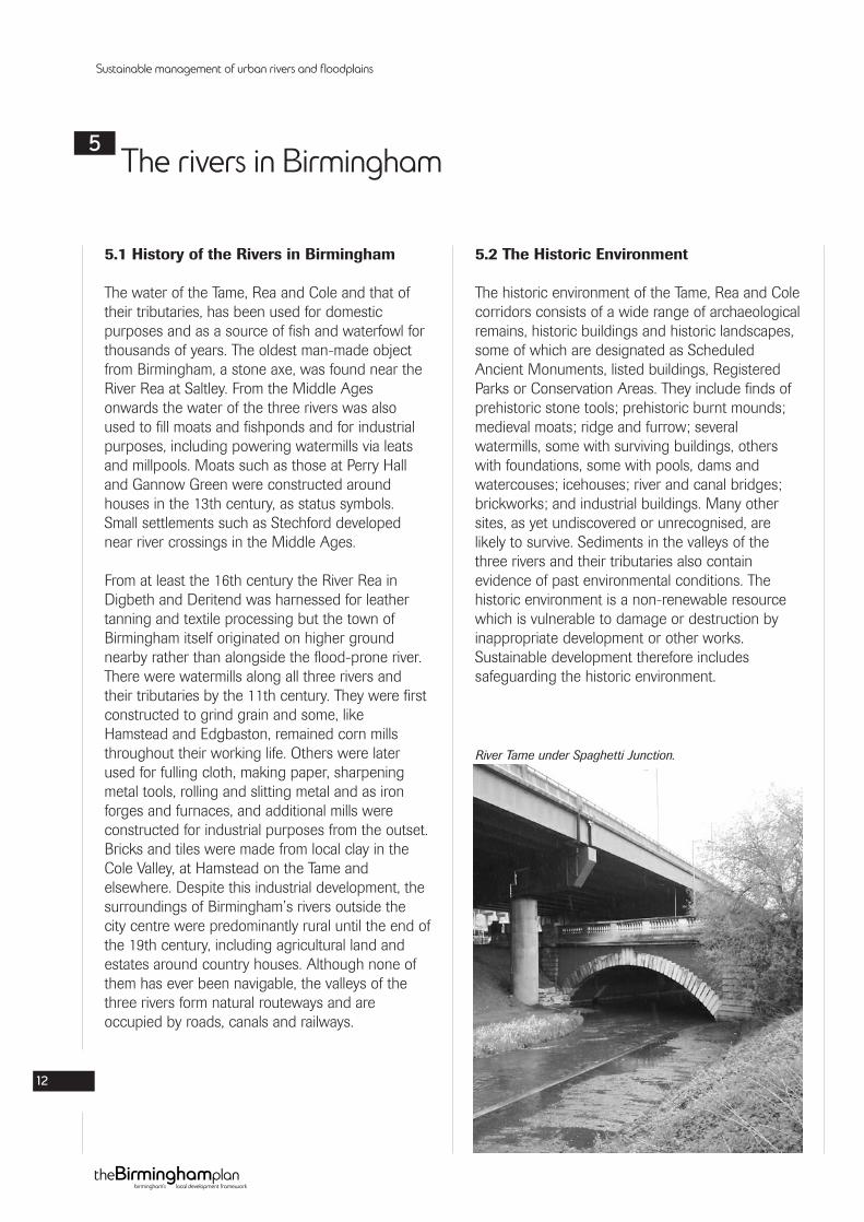
River Tame under Spaghetti Junction.
5.3 River Tame Character
The River Tame is the largest tributary of the RiverTrent. The River Tame rises on the watershedbetween the River Severn and River Trent in thearea of the Midlands known as the Black Country.
The Tame has two main sources, theWolverhampton and Oldbury arms, which join atBescot. From here, the river flows eastwards to thenorth of Birmingham City Centre. The River Reajoins the River Tame close to the Gravelly Hill M6motorway junction. Continuing eastwards out of theWest Midlands conurbation the river then turnsnorth after its confluence with the rivers Blythe,Cole and Bourne and flows into a series ofpurification lakes at Lea Marston. After the lakes,the Tame continues to flow northwards, enteringthe River Trent just east of Alrewas. The Trent thenflows north, finally flowing into the sea via theHumber Estuary.
5.4 River Rea Character
The River Rea rises in the Waseley Hills to thesouth of Birmingham. It is largely natural incharacter until it becomes a hard engineeredchannel at Cannon Hill Park, the exception being atthe former MG Rover car plant and associatedworks at Longbridge where a length of the riverflows underground. The reach from Cannon HillPark to the Ring Road at Highgate, is largely in adeep stone-lined channel behind back gardens andopen space.
The journey taken by the River Rea as it meandersthrough Birmingham, reflects the history of the communities that sprang up throughout thecenturies along its banks. Remains of some of themany mills along the River Rea can still be foundtoday giving a glimpse of the City’s industrial past.Both the archaeological and ecological landscapeof the river has been changed by all of thesecommunities from the Bronze Age to the presentday.
The River Rea is now almost totally hidden fromsight after it enters the city centre at Highgate. Theriver channel is entirely man-made through the citycentre all the way to its confluence with the RiverTame in Nechells.
The heavily urbanised nature of the river meansthat base flows flows are depleted in dry weatherconditions but with rapid response to rainfall as aresult of the sewered run-off. This results in veryrapid increase in flows at time of storms.
5.5 River Cole Character
The River Cole is about 25 miles long. It rises onthe lower slopes at Forhill, one of the south-western ramparts of the Birmingham plateau toenter the River Blythe below Coleshill. Its source isvery near the main watershed of Midland England:tributaries are few and very short except in thelower reaches, outside Yardley, so the Cole is only asmall stream. Average gradient of the centralreaches is 101/2 feet in a mile. There is a fast run-off from the drift-covered clay which makes up itscatchment area, and heavy rain produces suddenfloods: in the absence of replenishing side-streamsthese subside as quickly as they rise. The Cole isnormally shallow, except where weirs maintain anartificial depth.
The River Cole flows out of and back into Solihullon the eastern side of Birmingham. Most of thegreen corridor remains intact with a wide floodplainremaining in places although often with groundlevels raised by fill material. Factory estates andsome housing developments encroach upon thefloodplain here and there.
In common with all urban rivers the Cole isfrequently crossed by highways and relies heavilyon sewered flows from its catchment area. Unlikethe River Rea it is rarely in a hard engineeredchannel although the earth channel has beenaffected by realignment and reprofilling.
Sustainable management of urban rivers and floodplains
13
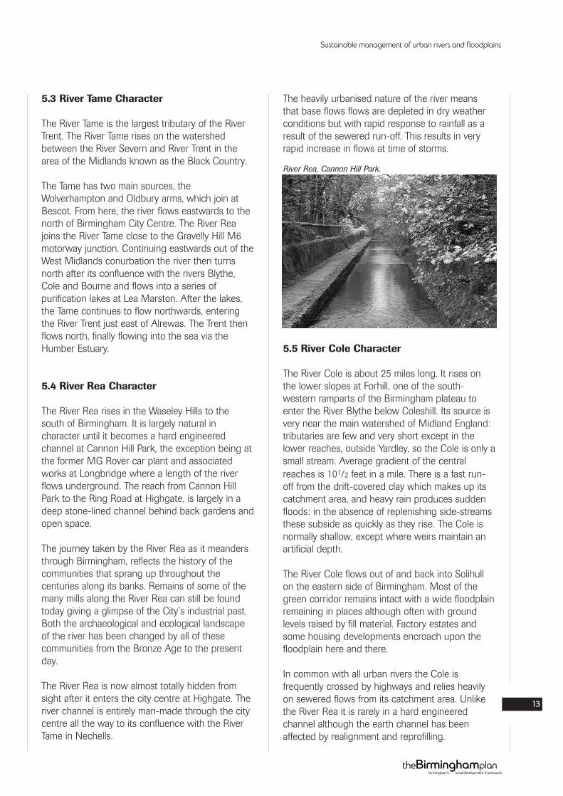
River Rea, Cannon Hill Park.
5.6 Geology, Flooding and Contamination
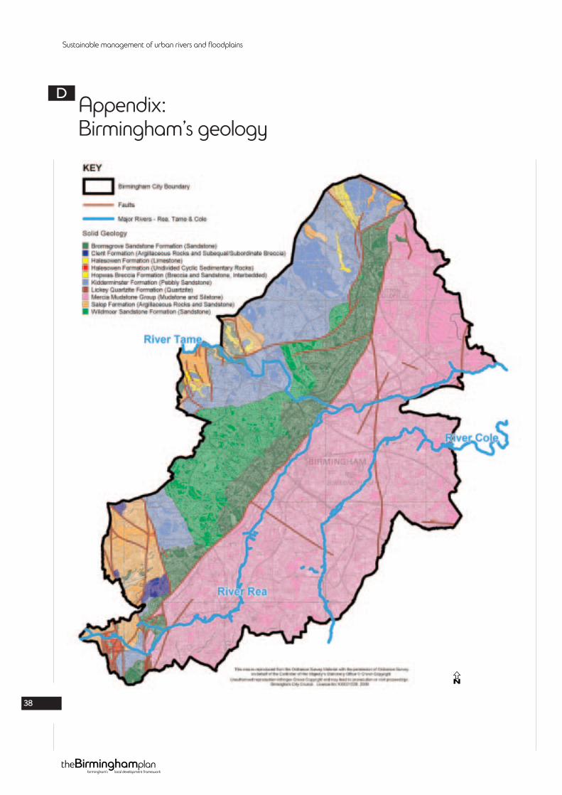
5.6.1 GeologyThe catchment of the river in Birmingham isunderlain by Carboniferous and Triassic geology.The most westerly part of the catchment isunderlain by Carboniferous Coal Measures stratathat are classified as a ‘Minor Aquifer’ for waterresources purposes by the Environment Agencysince they can generally only support locallyimportant abstractions. Further to the east there isan outcrop of Triassic Sherwood Sandstoneunderlying the catchment. This stratum is classifiedas a ‘Major Aquifer’ by the Environment Agencydue to its permeable nature which can yieldsignificant volumes of water. Historic abstractionfrom this stratum led to a fall in groundwater levelswhich have now recovered due to a decline ingroundwater abstraction. It should also be notedthat contamination can potentially move freely inthis permeable stratum. The remainder of thecatchment, to the east of Birmingham City Centre,is underlain by Triassic Mercia Mudstone. Due toits low permeability this stratum can generally onlysupport very minor abstractions and consequentlyit is classified as a ‘Non Aquifer’ by theEnvironment Agency (See Appendix 4 showinggeology).
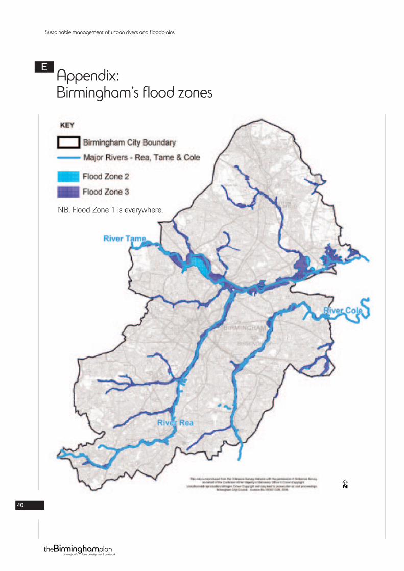
5.6.2 FloodingIn addition, since 1 July 2004, Flood Zones havereplaced the Indicative Floodplain Map as the EA’sflooding constraints map for planning purposes.Flood Zones are split into three different risk zones- from Zone 1 (lowest probability of flooding beingless than 0.1%) to Zone 3a (high probability offlooding being greater than 1%) and Zone 3b (thefunctional floodplain being greater than 5%) andshow where the water would go if there were noflood defences.
The EA have produced Standing Advice for FloodZones that will be used by the local authority inconjunction with the Flood Zones to determineflood risk associated with smaller developments.These Zones will be regularly updated. Furtherinformation is available from the EA website.
Developers are required to submit a flood riskassessment for all proposals on sites of 1 hectareor more in Zone 1 and for all new development inthe other Zones.
5.6.3 ContaminationIntense urbanisation and industrialisation havemeant in many instances the quality of the water ispoor. The amount of previously unregulatedindustry has left a legacy of contaminated land.These effects may be detected many milesdownstream.
Sustainable management of urban rivers and floodplains
14
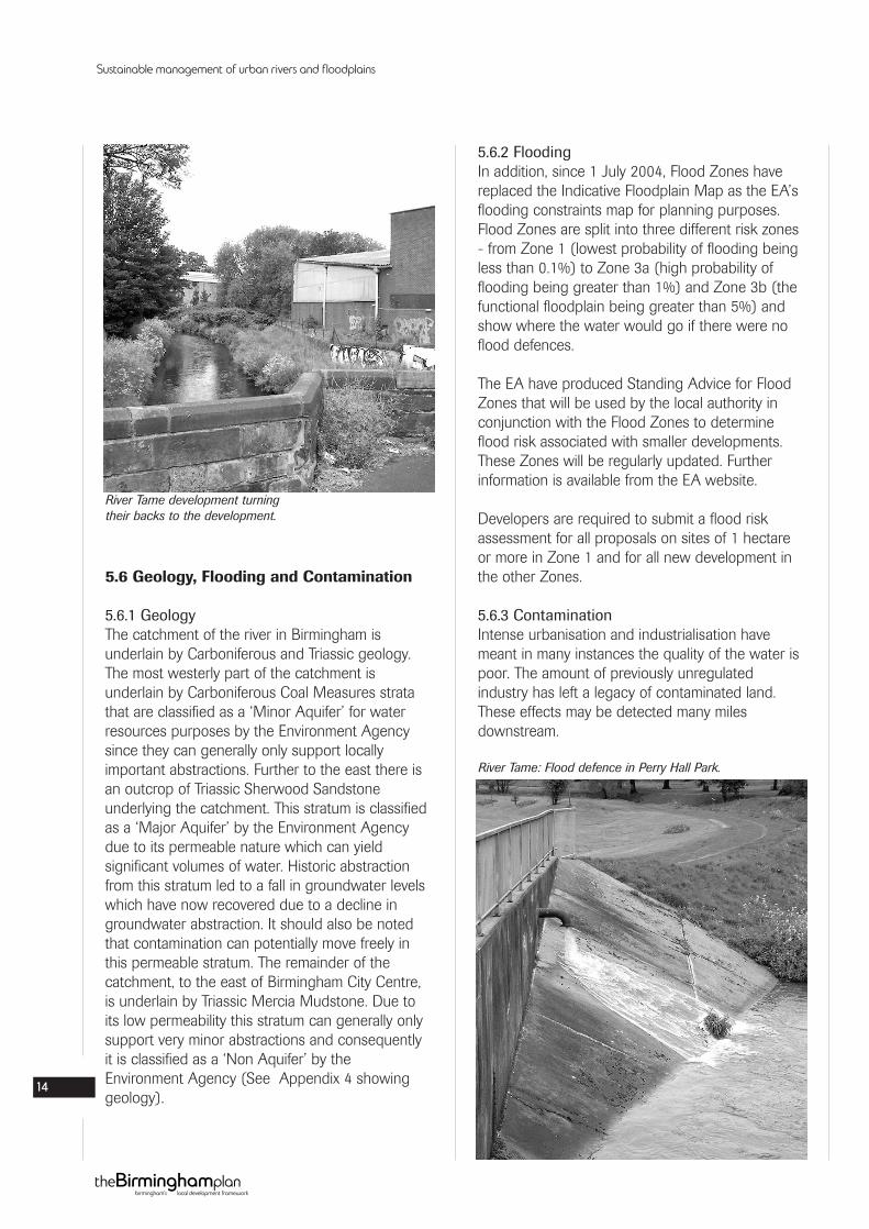
River Tame development turningtheir backs to the development.
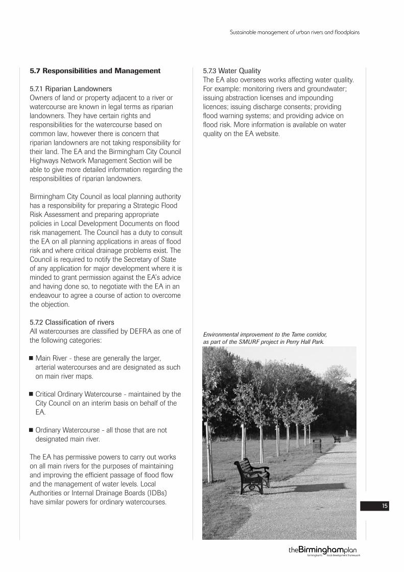
River Tame: Flood defence in Perry Hall Park.
5.7 Responsibilities and Management
5.7.1 Riparian LandownersOwners of land or property adjacent to a river orwatercourse are known in legal terms as riparianlandowners. They have certain rights andresponsibilities for the watercourse based oncommon law, however there is concern thatriparian landowners are not taking responsibility fortheir land. The EA and the Birmingham City CouncilHighways Network Management Section will beable to give more detailed information regarding theresponsibilities of riparian landowners.
Birmingham City Council as local planning authorityhas a responsibility for preparing a Strategic FloodRisk Assessment and preparing appropriatepolicies in Local Development Documents on floodrisk management. The Council has a duty to consultthe EA on all planning applications in areas of floodrisk and where critical drainage problems exist. TheCouncil is required to notify the Secretary of Stateof any application for major development where it isminded to grant permission against the EA’s adviceand having done so, to negotiate with the EA in anendeavour to agree a course of action to overcomethe objection.
5.7.2 Classification of riversAll watercourses are classified by DEFRA as one ofthe following categories:
Main River - these are generally the larger,arterial watercourses and are designated as suchon main river maps.
Critical Ordinary Watercourse - maintained by theCity Council on an interim basis on behalf of theEA.
Ordinary Watercourse - all those that are notdesignated main river.
The EA has permissive powers to carry out workson all main rivers for the purposes of maintainingand improving the efficient passage of flood flowand the management of water levels. LocalAuthorities or Internal Drainage Boards (IDBs)have similar powers for ordinary watercourses.
5.7.3 Water QualityThe EA also oversees works affecting water quality.For example: monitoring rivers and groundwater;issuing abstraction licenses and impoundinglicences; issuing discharge consents; providingflood warning systems; and providing advice onflood risk. More information is available on waterquality on the EA website.
Sustainable management of urban rivers and floodplains
15
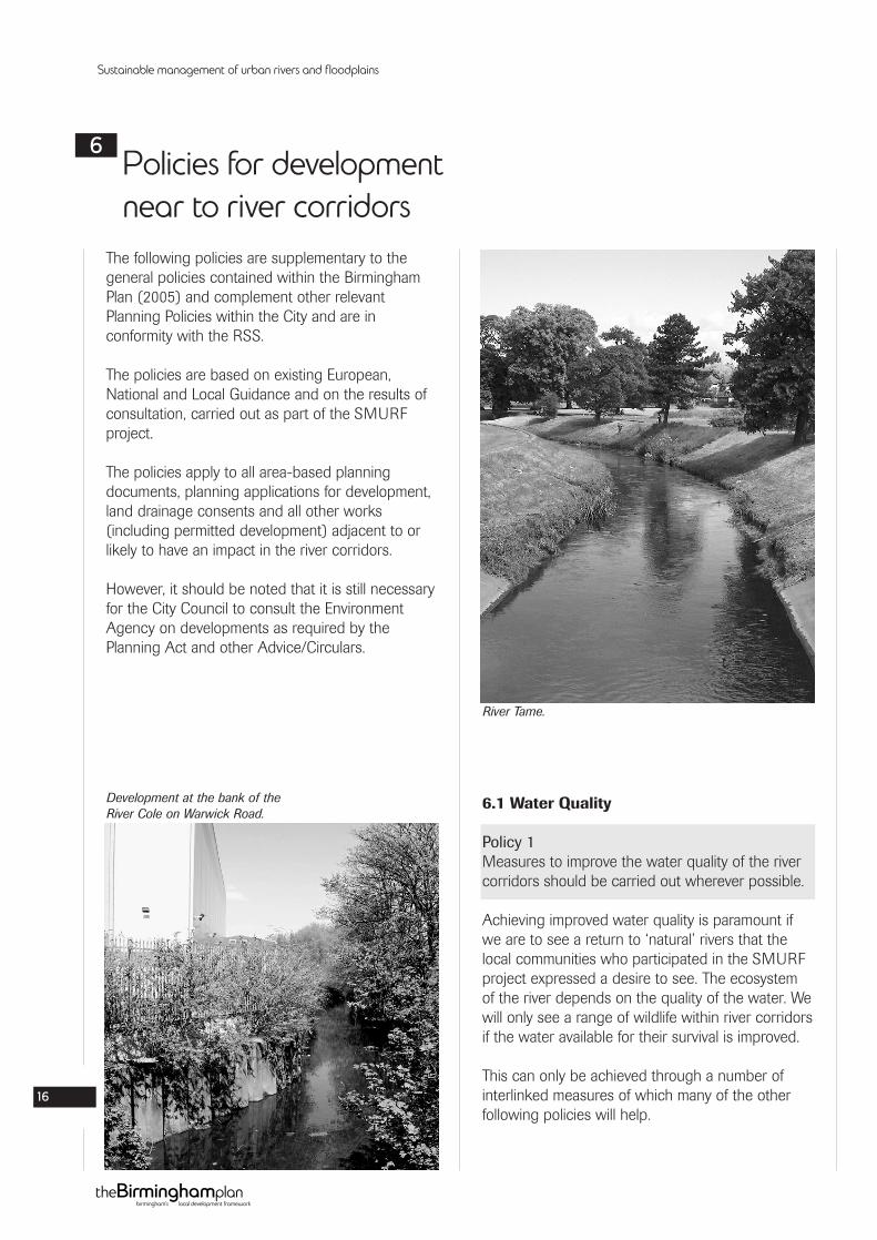
Environmental improvement to the Tame corridor,as part of the SMURF project in Perry Hall Park.
The following policies are supplementary to thegeneral policies contained within the BirminghamPlan (2005) and complement other relevantPlanning Policies within the City and are inconformity with the RSS.
The policies are based on existing European,National and Local Guidance and on the results ofconsultation, carried out as part of the SMURFproject.
The policies apply to all area-based planningdocuments, planning applications for development,land drainage consents and all other works(including permitted development) adjacent to orlikely to have an impact in the river corridors.
However, it should be noted that it is still necessaryfor the City Council to consult the EnvironmentAgency on developments as required by thePlanning Act and other Advice/Circulars.
6.1 Water Quality
Policy 1Measures to improve the water quality of the rivercorridors should be carried out wherever possible.
Achieving improved water quality is paramount ifwe are to see a return to ‘natural’ rivers that thelocal communities who participated in the SMURFproject expressed a desire to see. The ecosystemof the river depends on the quality of the water. Wewill only see a range of wildlife within river corridorsif the water available for their survival is improved.
This can only be achieved through a number ofinterlinked measures of which many of the otherfollowing policies will help.
Sustainable management of urban rivers and floodplains
16
Policies for developmentnear to river corridors
6
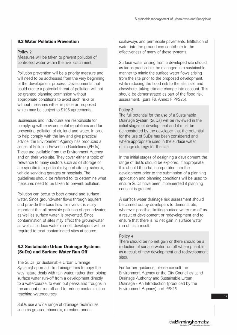
River Tame.
Development at the bank of theRiver Cole on Warwick Road.
6.2 Water Pollution Prevention
Policy 2Measures will be taken to prevent pollution ofcontrolled water within the river catchment.
Pollution prevention will be a priority measure andwill need to be addressed from the very beginningof the development process. Developments thatcould create a potential threat of pollution will notbe granted planning permission withoutappropriate conditions to avoid such risks orwithout measures either in place or proposedwhich may be subject to S106 agreements.
Businesses and individuals are responsible forcomplying with environmental regulations and forpreventing pollution of air, land and water. In orderto help comply with the law and give practicaladvice, the Environment Agency has produced aseries of Pollution Prevention Guidelines (PPGs).These are available from the Environment Agencyand on their web site. They cover either a topic ofrelevance to many sectors such as oil storage orare specific to a particular type of site eg. schools,vehicle servicing garages or hospitals. Theguidelines should be referred to, to determine whatmeasures need to be taken to prevent pollution.
Pollution can occur to both ground and surfacewater. Since groundwater flows through aquifersand provide the base flow for rivers it is vitallyimportant that all possible pollution of groundwater,as well as surface water, is prevented. Sincecontamination of sites may affect the groundwateras well as surface water run-off, developers will berequired to treat contaminated sites at source.
6.3 Sustainable Urban Drainage Systems(SuDs) and Surface Water Run Off
The SuDs (or Sustainable Urban DrainageSystems) approach to drainage tries to copy theway nature deals with rain water, rather than pipingsurface water run-off from a development directlyto a watercourse, to even out peaks and troughs inthe amount of run off and to reduce contaminationreaching watercourses.
SuDs use a wide range of drainage techniquessuch as grassed channels, retention ponds,
soakaways and permeable pavements. Infiltration ofwater into the ground can contribute to theeffectiveness of many of these systems.
Surface water arising from a developed site should,as far as practicable, be managed in a sustainablemanner to mimic the surface water flows arisingfrom the site prior to the proposed development,while reducing the flood risk to the site itself andelsewhere, taking climate change into account. Thisshould be demonstrated as part of the flood riskassessment. (para F6, Annex F PPS25).
Policy 3The full potential for the use of a SustainableDrainage System (SuDs) will be reviewed in theinitial stages of development and it must bedemonstrated by the developer that the potentialfor the use of SuDs has been considered andwhere appropriate used in the surface waterdrainage strategy for the site.
In the initial stages of designing a development therange of SuDs should be explored. If appropriate,this should then be incorporated into thedevelopment prior to the submission of a planningapplication and planning conditions will be used toensure SuDs have been implemented if planningconsent is granted.
A surface water drainage risk assessment shouldbe carried out by developers to demonstrate,wherever possible, limiting surface water run off asa result of development or redevelopment and toensure that there is no net gain in surface waterrun off as a result.
Policy 4There should be no net gain or there should be areduction of surface water run off where possibleas a result of new development and redevelopmentsites.
For further guidance, please consult theEnvironment Agency or the City Council as LandDrainage Authority and Sustainable UrbanDrainage - An Introduction (produced by theEnvironment Agency) and PPS25.
Sustainable management of urban rivers and floodplains
17
6.4 Character of the River Corridors
Policy 5A natural character should be maintained, or whereappropriate, restored to the river channel.
As a result of the public consultation that wascarried out as part of the SMURF project, peoplewished to see ‘natural’ river courses with a varietyof shape and form, that meandered and was notclinical.
Culverts and artificial channels act as a barrier towildlife, the flow of water, reduce natural cleansingand contribute to rivers being ignored rather thanseen as assets. Watercourses with more naturalmeandering profiles and uneven beds encouragediversity, oxygenate water and support more fishand wildlife.
Policy 6Open or closed culverts should only be used whereno alternative exists.
There is strong resistance to culverting ofwatercourses and other options (such as bridgecrossings) should be explored and implementedwhere possible. The Birmingham UDP states thatopening up of culverted streams and rivers will beencouraged. For further guidance and informationplease refer to Environment Agency publication on‘policy regarding culverts’ March 1999.
Policy 7Where development lies adjacent to the rivercorridors or their tributaries every opportunity willbe sought to benefit the river by reinstating anatural, sinuous river channel.
Most channels are designed with flood defence inmind therefore sinuous channels are not alwaysappropriate where there is concern with flood risk.However, where there is no or little risk of floodingevery opportunity should be sought to reinstate anatural sinuous river channel subject to floodmanagement consideration.
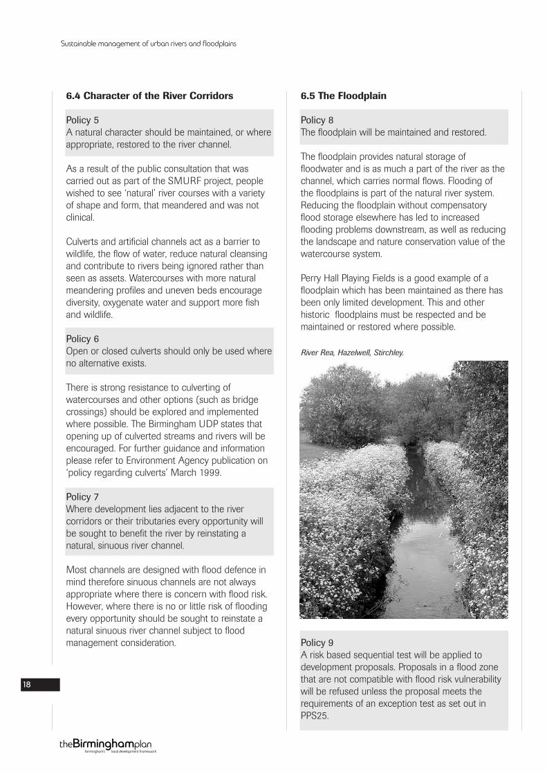
6.5 The Floodplain
Policy 8The floodplain will be maintained and restored.
The floodplain provides natural storage offloodwater and is as much a part of the river as thechannel, which carries normal flows. Flooding ofthe floodplains is part of the natural river system.Reducing the floodplain without compensatoryflood storage elsewhere has led to increasedflooding problems downstream, as well as reducingthe landscape and nature conservation value of thewatercourse system.
Perry Hall Playing Fields is a good example of afloodplain which has been maintained as there hasbeen only limited development. This and otherhistoric floodplains must be respected and bemaintained or restored where possible.
Policy 9A risk based sequential test will be applied todevelopment proposals. Proposals in a flood zonethat are not compatible with flood risk vulnerabilitywill be refused unless the proposal meets therequirements of an exception test as set out inPPS25.
Sustainable management of urban rivers and floodplains
18
River Rea, Hazelwell, Stirchley.
The map of Flood Zones produced by the EA showthe different risk zones for areas near to rivers. TheLocal Authority will determine the flood riskassociated with development in these zones byconsulting the EA’s Standing Advice on FloodZones.
Flood Zone Maps are used to identify theprobability of flooding on a potential developmentsite and proposals within a flood zone will requirethe submission of a flood risk assessment with theplanning application. Where a development is notconsidered vulnerable, residual flood risk may needto be managed through design and other mitigationmeasures.
6.6 Nature Conservation and Landscaping
Policy 10The nature conservation and landscape value of theriver corridor will be safeguarded, enhanced andrestored.
The ‘SMURF project’ consultation revealed that thepublic would like to see natural rivers with a varietyof wildlife and plants, natural ecology, that thereshould be tranquil places where people can relaxwith a variety of light and shade and colour.
Some stretches of river are designated in theNature Conservation Strategy for Birmingham asSites of Local Importance for Nature Conservation(SLINCs) and as Key Wildlife Corridors. It is apriority that this policy is implemented in sections ofriver corridor affected by these nature conservationdesignations.
Where development schemes affect fiver corridors,particularly those designated for their natureconservation importance, an ecological impactassessment is likely to be required in support of aplanning application.
Landscaping to provide visual, accessible and safeamenities and riverside routes should beundertaken.
When sites are being landscaped, only nativespecies should be used and sites should bedesigned to be low maintenance. Invasive speciessuch as Japanese Knotweed and HimalayanBalsam may be present along some of the City’swatercourses, these species should be dealt with inan approved manner.
Both giant hogweed and Japanese Knotweed arelisted in Schedule 9, Part II of the Wildlife andCountryside Act of 1981 (as amended); section14(2) of the Act makes it an offence to plant orcause to grow in the wild the plant species listed inSchedule 9, Part II. The Environment Agency hasproduced detailed guidance on approved methodsof controlling Japanese Knotweed and gianthogweed. Advice is also available from the EA onthe treatment of Himalayan Balsam.
Consultation also revealed that people wished tosee more ‘natural areas’ near to rivers. Cutting of allgrass adjacent to rivers should be discouraged, toencourage natural areas’ near to the rivers edge.However consideration should be given to floodprotection as extra vegetation along the bankwould reduce the carrying capacity and flow of thechannel.
There is a need for holistic and joined upmanagement of the public land areas abutting theriver corridors. It also should be linked with thedraft Birmingham Parks Strategy and Strategy forplaying fields, biodiversity enhancement along theriver as a key wildlife corridor, safeguardingmeasures for protected species eg water vole,kingfisher and measures to fulfill habitat andspecies action plan objectives of the Birminghamand Black Country Biodiversity Action Plan (eg forrivers and streams).
Sustainable management of urban rivers and floodplains
19
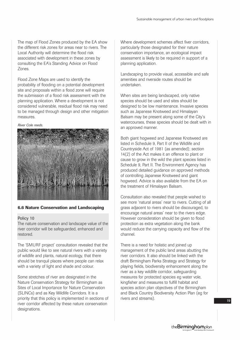
River Cole reeds.
6.7 The Historic Environment.
Policy 11All development proposed within or adjoining rivercorridors and their tributaries must ensure thatarchaeological remains, historic buildings andhistoric landscapes are preserved and protected.
The historic environment is an asset of the Tame,Rea and Cole corridors that shows how the riversand their tributaries have been managed in thepast. When proposals for new development withinor adjoining river corridors and their tributaries areput forward:
The impact of the proposed development on thehistoric environment must be assessed by theapplicant. This may need to include archaeologicalevaluation and/or historic building recording and/orpalaeoenvironmental sampling.
Proposed development which has an adverse effecton historic environment features of nationalimportance or their settings will not be permitted,whether or not they are statutorily protected.
Where in situ preservation of other historicenvironment features affected by the developmentis not feasible or necessary or where there is anopportunity to enhance understanding of thosefeatures through further investigation, ‘preservationby record’ may be acceptable. Such a record mustbe obtained by appropriate methods and mustinclude all affected parts of the historicenvironment, including structural remains,earthworks, archaeological remains below groundand palaeoenvironmental evidence.
Where appropriate and where it does not adverselyaffect the protection and preservation of thehistoric environment, planning conditions will beimposed or planning agreements entered into, toenhance public appreciation and understanding, aspart of the development proposals.
6.8 Design of Developments
Policy 12All development proposed adjacent to the rivercorridors and their tributaries shall be designed totake account of its proximity to the river.
The river provides an ideal focus for developmentoutside of the floodplain (where ground levelspermit this).
In the past, riverside developments have ignoredthe watercourse. Consequently, factory backs,storage yards and security fencing line manysections of the river corridors.
However, as water quality improves and publicawareness of rivers increases, it will be necessaryto focus development around the waterenvironment. This can be done by relating thedevelopment to the river through siting andorientation. Choice of materials should also be inkeeping with the natural environment. For example,developments could incorporate some form ofplanting within the development site itself to makespaces for nature within the river corridor.
For more detailed design guidance refer to theSPD’s ‘Places for All’ and ‘Places for Living’.
Sustainable management of urban rivers and floodplains
20
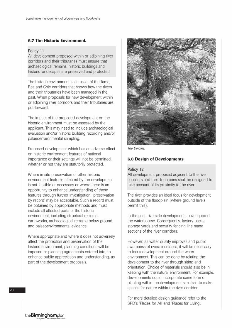
The Dingles.
Birmingham’s Canals Strategy has been effective inregenerating many parts of Birmingham by makingthe canal the focus of development and some ofthe principles can be applied to the river. Referenceshould therefore be made to Birmingham CityCouncil’s “Canalside Development in Birmingham -Design Guidelines”.
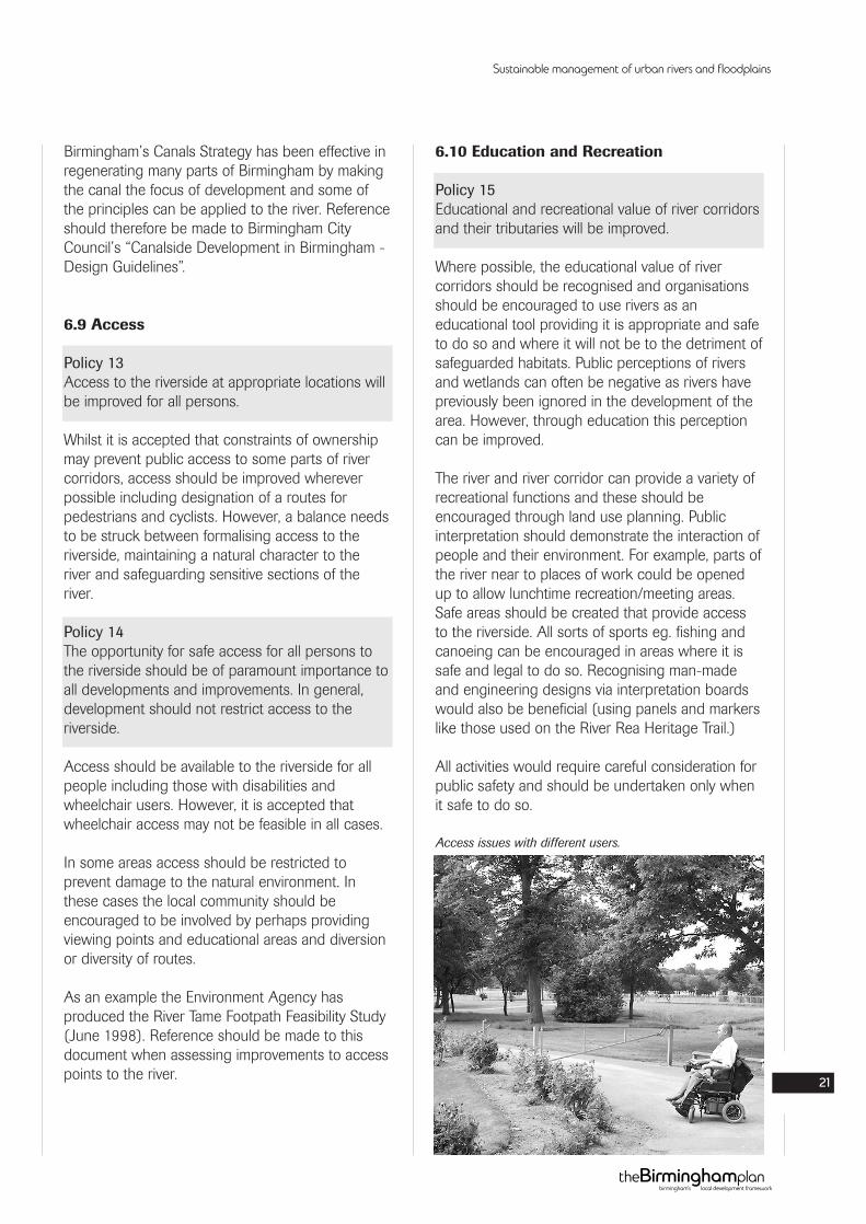
6.9 Access
Policy 13Access to the riverside at appropriate locations willbe improved for all persons.
Whilst it is accepted that constraints of ownershipmay prevent public access to some parts of rivercorridors, access should be improved whereverpossible including designation of a routes forpedestrians and cyclists. However, a balance needsto be struck between formalising access to theriverside, maintaining a natural character to theriver and safeguarding sensitive sections of theriver.
Policy 14The opportunity for safe access for all persons tothe riverside should be of paramount importance toall developments and improvements. In general,development should not restrict access to theriverside.
Access should be available to the riverside for allpeople including those with disabilities andwheelchair users. However, it is accepted thatwheelchair access may not be feasible in all cases.
In some areas access should be restricted toprevent damage to the natural environment. Inthese cases the local community should beencouraged to be involved by perhaps providingviewing points and educational areas and diversionor diversity of routes.
As an example the Environment Agency hasproduced the River Tame Footpath Feasibility Study(June 1998). Reference should be made to thisdocument when assessing improvements to accesspoints to the river.
6.10 Education and Recreation
Policy 15Educational and recreational value of river corridorsand their tributaries will be improved.
Where possible, the educational value of rivercorridors should be recognised and organisationsshould be encouraged to use rivers as aneducational tool providing it is appropriate and safeto do so and where it will not be to the detriment ofsafeguarded habitats. Public perceptions of riversand wetlands can often be negative as rivers havepreviously been ignored in the development of thearea. However, through education this perceptioncan be improved.
The river and river corridor can provide a variety ofrecreational functions and these should beencouraged through land use planning. Publicinterpretation should demonstrate the interaction ofpeople and their environment. For example, parts ofthe river near to places of work could be openedup to allow lunchtime recreation/meeting areas.Safe areas should be created that provide accessto the riverside. All sorts of sports eg. fishing andcanoeing can be encouraged in areas where it issafe and legal to do so. Recognising man-madeand engineering designs via interpretation boardswould also be beneficial (using panels and markerslike those used on the River Rea Heritage Trail.)
All activities would require careful consideration forpublic safety and should be undertaken only whenit safe to do so.
Sustainable management of urban rivers and floodplains
21
Access issues with different users.
6.11 Safety and Litter
Policy 16Measures will be taken to increase safety andprevent litter dumping and crime.
Safety is critical to how people use theenvironment. People will only use the river forrecreation if it is perceived as safe. Developmentsthat are designed with windows and public routesto overlook the river environment can help withperceived and actual safety.
Lighting will be discouraged to minimisedisturbance to wildlife. However, exceptions mayoccur on short sections in built up areas wherethere is potential for frequent public access at nightand public safety considerations.
Litterbins should be provided near to areasfrequented by the public. However, these should befew in number and designed so that rubbish doesnot blow out of the bins. It is preferable that peopleare encouraged to be responsible and take theirlitter home. Signs should also be displayed todiscourage illegal dumping.
6.12 Community Involvement
Policy 17The local community will be consulted in anydevelopments that may have an impact on the rivercorridors.
One of the main aims of the ‘SMURF project’ wasto involve the local community to discover theirviews on the ‘ideal river’. The groups that took partin the project were from different areas ofBirmingham with different experiences of rivers.Whilst many of their views as to the ideal river weresimilar, some were different. It was also evident thatpeople are very keen to get involved and helpdevelop and care for the rivers in their area.
Local knowledge is of major importance in thedevelopment of any site and is vitally important thatlocal representatives are involved from the start.This will help form a ‘knowledge base’ at the startof the project and also encourage local people to‘own’ and care for that area of the river in thefuture.
The level of public consultation on a planningapplication will depend on the type of developmentthat is proposed and will be in accordance with thedraft Statement of Community Involvement (SCI).Ward and Constituency Committee meetings will beused in addition to normal consultation methods aspart of engaging with the wider communities.
Sustainable management of urban rivers and floodplains
22
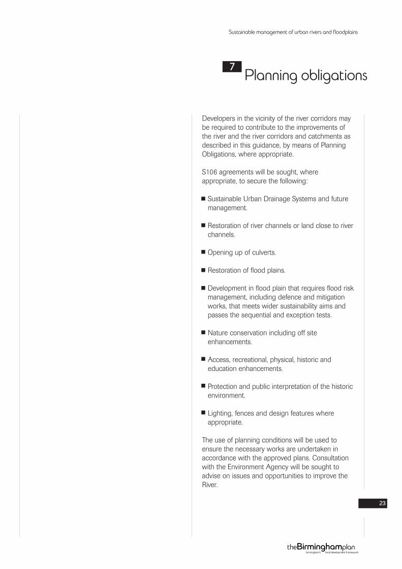
Green Road Ford by Sarehole Recreation Ground.
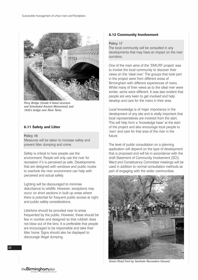
Perry Bridge (Grade II listed structureand Scheduled Ancient Monument) and1930’s bridge over River Tame.
Developers in the vicinity of the river corridors maybe required to contribute to the improvements ofthe river and the river corridors and catchments asdescribed in this guidance, by means of PlanningObligations, where appropriate.
S106 agreements will be sought, whereappropriate, to secure the following:
Sustainable Urban Drainage Systems and futuremanagement.
Restoration of river channels or land close to riverchannels.
Opening up of culverts.
Restoration of flood plains.
Development in flood plain that requires flood riskmanagement, including defence and mitigationworks, that meets wider sustainability aims andpasses the sequential and exception tests.
Nature conservation including off siteenhancements.
Access, recreational, physical, historic andeducation enhancements.
Protection and public interpretation of the historicenvironment.
Lighting, fences and design features whereappropriate.
The use of planning conditions will be used toensure the necessary works are undertaken inaccordance with the approved plans. Consultationwith the Environment Agency will be sought toadvise on issues and opportunities to improve theRiver.
Sustainable management of urban rivers and floodplains
23
Planning obligations7
This SPD is intended to be as helpful as possibleand is believed to be accurate at the time of issue.However, information may be subject to changeand no responsibility can therefore be taken forinaccuracies or omissions. The City Council advisesthat it is the responsibility of developers to checksite areas, conditions and the availability of servicesetc, prior to entering into contracts.
Any views expressed by the Local PlanningAuthority represent the current policy at the timeand may be varied by the Local Planning Authorityas necessary.
Sustainable management of urban rivers and floodplains
24
Limitation of liability8
Birmingham City Council (2005), The BirminghamUnitary Development Plan
Birmingham City Council (1997), NatureConservation Strategy for Birmingham
Birmingham City Council, Canalside Development inBirmingham - Design Guidelines
Booth. D.N, Warwickshire Watermills (1978)
Dilworth, D. Tame. Mills of Staffordshire (1976)
Dudley Metropolitan Borough Council/SandwellMetropolitan Borough Council, Stour Valley ActionPlan
Environment Agency (July 2004), A Flood RiskManagement Strategy for the River Tame: ScopingReport
Environment Agency (June 1998), River TameFootpath Feasibility Study Survey
Environment Agency (1980), Nature’s Way -Designing for Pollution Prevention (Video)
Environment Agency (1998), Nature’s Way -Designs that Prevent Water Pollution (Leaflet)
Environment Agency (March 1997), Liaison withLocal Planning Authorities.
Environment Agency (March 1999), LocalEnvironment Agency Plan - Action Plan (WestMidlands - Tame)
Environment Agency, Pollution PreventionGuidelines (PPG1 - PPG27)
Environment Agency (July 2002) Managing WaterAbstraction
Environment Agency, Sustainable Urban Drainage -An Introduction
For further information on the SMURF project:www.smurf-project.info
Gerrard and Slater (1996) Managing AConurbation - Birmingham and its Region.
Hodder, M (2004) Birmingham: the hidden historyLand Use Consultants for The Countryside Agency(December 2001), The Green Arc Partnership - AProspectus
National Rivers Authority (January 1996), TameCatchment Management Consultation Report
Stoke on Trent City Council - Rivers of Renewal.Stoke on Trent’s Rivers Strategy
Biodiversity Action Plan for Birmingham and theBlack Country.
ODPM (July 2004), A Draft Practical Guide to theStrategic Environmental Assessment Directive
ODPM (October 2003), The StrategicEnvironmental Assessment Directive: Guidance forPlanning Authorities
SMURF Project Team (July 2003) SMURF ProjectMethodology and Techniques
HR Wallingford & Wallingford Software (July 2003)Integrated Catchment Planning and Land UsePlanning - Benchmark Report on existing ‘know-how’ in the EU
SMURF Project Team (June 2003) Report of‘Know-How’ Workshop, 25th April 2003, Universityof Birmingham
UK Groundwater Forum, Groundwater - OurHidden Asset
Upton C (1997) A History of Birmingham
West Midlands County Council (1988), BarrBeacon and Sandwell Valley Countryside andRecreation Subject (Local) Plan
Environment Agency (2006), The Water FrameworkDirective and Planning - Initial advice to planningauthorities in England and Wales.
Sustainable management of urban rivers and floodplains
25
References for further information9
A
Abstraction licenseAn authorisation granted by the EnvironmentAgency to allow the removal of water from asource.
AquiferA water bearing-stratum situated below groundlevel. The water contained in aquifers is known asground water.
Artificial channelsNot a natural channel where a river flows through.
AttenuationBreakdown or dilution of contaminant in water.
B
BCCBirmingham City Council
Best practiceA technique or methodology that, throughexperience and research, has proven to reliablylead to a desired result.
BiodiversityThe range of soils, climate, water, plants andanimals that make up the worlds of life andlandscape.
Biodiversity Action Plan (BAP)Plan identifying targets improving and protectingbiodiversity in an area. There are regional, countyand local BAP’s.
BrookA small stream
Brownfield Site Previously developed land.
C
CatchmentThe total area from which a single river collectssurface run off.
Carboniferous and Triassic GeologyA general name for all strata formed in theCarboniferous and Triassic periods of geologicalhistory. Carboniferous strata were formedapproximately 360 to 290 million years ago, whileTriassic strata were formed approximately 250 to210 million years ago. The Carboniferous andTriassic periods were separated by the Permianperiod which is not represented to any significantextent in the Birmingham area.
Carboniferous Coal Measures StrataA general name for strata formed in the later stagesof the Carboniferous period. Coal Measuresgenerally comprise a succession of beds ofmudstone, siltstone, sandstone and seams of coal.Due to the permeability of the sandstone beds andthe fractures within the strata Coal Measures areclassified as a Minor Aquifer under theEnvironment Agency’s ‘Policy and Practice for theProtection of Groundwater’.
ChannelisationThe practice of straightening a water course orstream to remove meanders and make the waterflow faster. Sometimes concrete is used to line thesides and bottom.
Climate ChangeCommonly used interchangeably with ‘globalwarming’ and ‘the greenhouse effect’.
ConservationThe preservation or restoration of the naturalenvironment and wildlife, or the careful use of aresource.
Sustainable management of urban rivers and floodplains
26
Glossary10
Controlled WashlandsAn area of the floodplain that is allowed to flood oris deliberately flooded by a river or stream for floodmanagement purposes, with potential to form awetland habitat.
CorridorA strip of natural habitat that connects twoadjacent nature reserves to allow migration oforganisms from one place to another.
CulvertsChannel carrying water across or under a roadcanal etc.
D
Discharge consentsAuthorisation from your Environmental Regulator todischarge any sewerage, trade effluent orcontaminated surface water to controlled waters inthe form of a discharge consent.
E
EcologyThe study of the relationships between living thingsand their environment (see Ecosystem).
Eco RecordThe Ecological Database for the Black Country andBirmingham. It is managed by The Wildlife Trust forBirmingham and the Black Country on behalf ofBirmingham City Council, Dudley, Sandwell, Walsalland Wolverhampton Borough Councils.
Ecosystem The system in which animals and plants depend ontheir environment and the environment depends onthem.
EffluentLiquid waste from industrial agricultural or sewageplants.
EnvironmentPhysical surroundings; all that is around you.
Environmental AssessmentA process designed to identify, analyse andevaluate the environmental effects of proposedprojects.
Environmental indicatorsOffer a simple measure of the status of anenvironmental attribute. Examples include indicatorsof potential damage, such as toxic emissions, aswell as indicators of potential benefits, such asbiodiversity. Environmental indicators can be usedin trade-off analysis.
European DirectiveThe legislative acts of the European Union (EU)can have different forms: regulations, directives,decisions, recommendations and opinions.
F
FaunaAnimals and all living things in an ecosystem thatare not plants (see Flora).
Flood flowFlow of water from a reservoir down a spillway. Thishappens when the reservoir overflows because ofheavy rain in its catchment.
Flood mitigationLevee banks and other structures which hold backwater in time of flood, reducing (mitigating)damage to property.
FloodplainLow-lying land around a river which becomesinundated (covered in water) when the river levelrises in time of flood.
FloraFlowers and plants and things that look like plants,including fungi.
G
GIS (Geographical Information System)Both a database designed to handle geographicdata as well as a set of computer operations thatcan be used to analyse the data.
Sustainable management of urban rivers and floodplains
27
GIS layersThe visual representation of a geographic data setin any digital map environment. Conceptually, layeris a slice or starum of the geographic reality in aparticular area and is a more or less equivalent to alegend item on a paper map. On a road map, forexample, national parks, political boundaries andrivers are examples of different layers.
Good statusA general term meaning the status achieved by asurface water body when both the ecological statusand its chemical status are at least good or, forgroundwater, when both its quantative status andchemical status are at least good.
Green BeltA designation used by planning authorities on landadjacent to towns or cities, defined for the purposeof restricting the outward expansion of the urbanarea and to protect the countryside.
Green WedgeAn area within the Green Belt that extend into thecity, often along a river valley. They provide links tothe open countryside.
GroundwaterWater which saturate a porous soil or rocksubstratum (or aquifer). Water held in storagebelow ground level.
Groundwater abstractionThe removal of water below ground level eitherpermanently or temporarily.
H
HabitatsThe place where a population (eg. human, animal,plant, micro-organism) lives and its surroundings,both living and non-living.
HabitatThe are where a plant or animal lives and growsunder natural conditions.
Highly modified riverA river often in an urban environment, which hasbeen modified to cope with flooding andurbanisation and often of poor quality.
I
InfiltrationThe movement of water through soil or otherporous material; the entry of stormwater into thesewerage treatment plant (see Effluent).
InfluentThe waste water that enters a sewage treatmentplant (see Effluent).
L
Landscape architecture Design and detailing of external spaces.
LEAPLocal Environment Agency Plan
Listed BuildingsList of buildings of special architectural or historicinterest compiled by Central Government under thePlanning (Listed Buildings and Conservation) Act1990.
Local Development Framework (LDF)New system for local planning, introduced by thePlanning and Compulsory Purchase Act 2004,which will replace existing statutory plans.
Local Nature Reserves (LNR’s)Statutory nature reserves, designated by localauthorities under national legislation.
M
Major AquiferThese are highly permeable formations usually witha known or probable presence of significantfracturing. They may be highly productive and ableto support large abstractions for public supply andother purposes.Environment Agency Policy and Practice for theProtection of Groundwater.
MeanderThe circuitous winding or sinuosity of a stream,used to refer to a bend in the river.
Sustainable management of urban rivers and floodplains
28

Minor AquiferThese can be fractured or potentially fracturedrocks, which do not have a high permeability, orother formations of variable permeability. Althoughthese aquifers will seldom produce large quantitiesof water for abstractions, they are important bothfor local supplies and in supplying base flow forrivers. In certain local circumstances minor aquiferscan be highly vulnerable to pollution.Environment Agency Policy and Practice for theProtection of Groundwater.
N
Non AquiferThese are formations with negligible permeabilitythat are generally regarded as not containinggroundwater in exploitable quantities. However,groundwater flow through such rocks, althoughimperceptible, does take place, and needs to beconsidered when assessing the risk associated withvery slowly degrading pollutants.Environment Agency Policy and Practice for theProtection of Groundwater.
P
Permeable StrataA general term to describe geological layers whichhave the ability to transmit water due to theirphysical structure. Water can move either betweenindividual grains of a rock or in fractures.
Permissive powersPower which confer on the Agency the right to dothings but not the duty to do them.
PollutionPollution is anything that would harm us and otherliving things in an environment. Water pollutiongenerally includes chemicals, bacteria and viruses,other micro-organisms and rubbish. These arecalled pollutants.
PollutantA substance that destroys the purity of air, water orland.
PPSPlanning Policy Statements.
PPGPlanning Policy Guidance.
R
ReachA length of river.
ReservoirAny natural or artificial holding area used to store,regulate or control water.
Riparian Of, or on, land adjacent to the river.
RiverA body of running water of considerable volumeusually moving over the earth’s surface in a channelor bed.
River BasinThe area of land from which all surface water run-off flows, through a sequence of streams, rivers andlakes into the sea at a single river mouth, estuary ordelta.
River Basin District PlanA plan of an area where all the surface run-offflows through the river basin into the sea at asingle river mouth, estuary or delta.
River catchmentThis is where water is drained by a particular riversystem.
RPGRegional Planning Guidance.
RSSRegional Spatial Statements.
Run-offRainfall water which flows from a catchment into ariver, stream, lake or reservoir.
S
Scenario managerThe scenario manager allows the creation, viewingand modification of a scenario.
SedimentationThe process by which suspended particles in wastewater settle to the bottom.
Sustainable management of urban rivers and floodplains
29
Sewage and sewerageSewage is the waste carried in our sewers.Sewerage is the system of pipes, pumps andtreatment plants to manage sewage.
SINC Site of Importance for Nature Conservation.
Sites and Monuments Record (SMR)Record of known sites of archaeologicalimportance held by the City Council.
Sites of Special Scientific Interest (SSSI)Nationally important areas of land, designatedunder Section 28 of the Wildlife and CountrysideAct 1981 by English Nature as being of a specialinterest by reasons of their flora, fauna, geologicalor physiographical features.
SLINC Site of Local Importance for Nature Conservation.
SMURFSustainable Management of Urban Rivers andFloodplains.
SPDSupplementary Planning Document.
Species and Habitat Action PlansSummary of descriptions of ecologicalconservation, wildlife, natural, semi-natural andurban habitats and the current status and issuesaffecting the habitat and broad policies to addressand improve them.
SPGSupplementary Planning Guidance.
Strategic Environmental AssessmentDerived from the SEA Directive 2001/42/EC whichtook effect in July 2004. SEA involves thesystematic identification and evaluation of theimpacts of a strategic action (eg. a plan orprogramme) on the environment. The proposedLocal Development Framework will require a SEA.
StreamA body of running water moving over the earth’ssurface in a channel or bed.
SuDsSustainable Urban Drainage System.
Surface waterWater which flows or is stored on the groundsurface.
SustainabilityThe ability of an ecosystem to maintain ecologicalprocesses and functions, biological diversity andproductivity over time.
SustainableThe yield of a natural resource that can beproduced continually from generation togeneration, without depleting the resource.
Sustainable DevelopmentDevelopment that meets the needs of the presentwithout compromising the ability of futuregenerations to meet their own needs.
SwalesVegetated areas used in place of curbs or pavedgutters to transport stormwater run-off. They canalso temporarily hold small quantities of run-off andallow it to infiltrate into the soil.
T
ToxicHarmful, destructive or deadly to living things.
Triassic Mercia MudstoneRed-brown, silty mudstones deposited in theTriassic period following deposition of the TriassicSherwood Sandstones. Due to the fine grainednature of the mudstones these strata have onlynegligible permeability and are therefore classifiedas a Non Aquifer under the Environment Agency’s‘Policy and Practice for the Protection ofGroundwater’. Occasional thin beds of siltstonesand sandstones (known as ‘skerries’) can supportvery minor abstractions.
Sustainable management of urban rivers and floodplains
30
Triassic Sherwood SandstoneA collective term to describe a number ofsandstone formations deposited in the Triassicperiod which have similar aquifer properties andare therefore considered as a single unit in terms ofgroundwater. Due to the structure of these stratathey have a significant permeability and cansupport large abstractions, consequently they areclassified as a Major Aquifer under the EnvironmentAgency’s ‘Policy and Practice for the Protection ofGroundwater’. However, the permeability of thestrata also means that contaminants can moverelatively easily through them and they are thereforevulnerable to contamination. Occasional mudstonebeds may locally inhibit the movement ofgroundwater.
TributaryA stream or river that flows into another largerstream or river.
U
Urban DesignThe interface between planning and architecture. Itcan also mean the design of the city as a whole orelements within it.
Urban fringeCan be described as the ‘landscape interfacebetween town and country’.
UDPUnitary Development Plan.
Urban riverA river which flows through an urban environmentand is modified to cope with flooding andurbanisation.
W
Water TableThe level of water in an aquifier.
WetlandsLow lying areas of land regularly or permanentlycovered with either fresh or salt water. They occurnaturally and can be constructed.
Wildlife corridorsStrips of trees, shrubs and vegetation that providecover and habitat for wildlife and serve as travellanes for movement across open areas andbetween isolated patches of habitat. They providewildlife with access to the different types of habitatthey require.
Sustainable management of urban rivers and floodplains
31
South Planning and Regeneration TeamKazi HussainAlpha Tower,Suffolk Street Queensway, Birmingham, B1 1TU.Tel: (0121) 303 [email protected]
DrainageClive WrightVaughan FletcherHighways Network Management, 1 Lancaster Circus,Queensway, Birmingham B4 7DQ.Tel: (0121) 303 7235 or (0121) 303 [email protected] orvaughan.fletcher@birmingham,.gov.uk
ArchaeologyMike Hodder Conservation Team, Alpha Tower,Suffolk Street Queensway, Birmingham, B1 1TU.Tel: (0121) 464 [email protected] or www.birmingham.gov.uk/archaeology
GISNick TringhamPlanning Information Team, Alpha Tower,Suffolk Street Queensway, Birmingham, B1 1TU.Tel: (0121) 303 [email protected]
DesignMartin Brown City Design Team, Alpha Tower,Suffolk Street Queensway, Birmingham, B1 1TU.Tel: (0121) 303 [email protected]
LandscapesMartin Wright City Design Team, Alpha Tower,Suffolk Street Queensway, Birmingham, B1 1TU.Tel: (0121) 303 [email protected]
Walking and CyclingWill Martin Transportation, 1 Lancaster Circus,Queensway, Birmingham, B4 7DQ.Tel: (0121) 303 [email protected]
Nature Conservation and EcologyNicola Farrin Sustainability Team, Alpha Tower,Suffolk Street Queensway, Birmingham, B1 1TU.Tel: (0121) 303 [email protected]
Most Birmingham City Councilpublications can be made available inalternative formats or languages.
If you have difficulty reading thisdocument please call us on (0121) 3033030 to ask if a full or summary versioncan be made available in large print,another format or another language.
If you have hearing difficulties pleasecall us via Typetalk 18001 0121 3033030 or e-mail us at:info@devdir@birmingham .gov.uk
Sustainable management of urban rivers and floodplains
32
Contact details11
Policy 1Measures to improve the water quality of the rivercorridors should be carried out wherever possible.
Policy 2Measures will be taken to prevent pollution ofcontrolled water within the river catchment.
Policy 3The full potential for the use of a SustainableDrainage System (SUDS) will be reviewed in theinitial stages of development and it must bedemonstrated by the developer that the potentialfor the use of SUDS has been considered andwhere appropriate used in the surface waterdrainage strategy for the site.
Policy 4There should be no net gain or there should be areduction of surface water run off where possibleas a result of new development and redevelopmentsites.
Policy 5A natural character will be maintained, or whereappropriate, restored to the river channel.
Policy 6Open or closed culverts should only be used whereno alternative exists.
Policy 7Where development lies adjacent to the rivercorridors or their tributaries every opportunity willbe sought to benefit the river by reinstating anatural, sinuous river channel.
Policy 8The floodplain will be maintained and restored.
Policy 9A risk based sequential test will be applied todevelopment proposals. Proposals in a flood zonethat are not compatible with flood risk vulnerabilitywill be refused unless the proposal meets therequirements of an exception test as set out inPPS25.
Policy 10The nature conservation and landscape value of theriver corridor will be safeguarded, enhanced andrestored.
Policy 11All development proposed within or adjoining rivercorridors and their tributaries must ensure thatarchaeological remains, historic buildings andhistoric landscapes are preserved and protected.
Policy 12All development proposed adjacent to the rivercorridors and their tributaries shall be designed totake account of its proximity to the river.
Policy 13Access to the riverside at appropriate locations willbe improved for all persons.
Policy 14The opportunity for safe access for all persons tothe riverside should be of paramount importance toall developments and improvements. In general,development should not restrict access to theriverside.
Policy 15Educational and recreational value of river corridorsand their tributaries will be improved.
Sustainable management of urban rivers and floodplains
33
Appendix:Summary of policies
A

Policy 16Measures will be taken to increase safety andprevent litter dumping and crime.
Policy 17The local community will be consulted in anydevelopments that may have an impact on the rivercorridors.
Sustainable management of urban rivers and floodplains
34
The draft Supplementary Planning Document hasbeen produced in the context of the followingPlanning Policies.
National Level
National Planning Policy guidance (PPG) andPlanning Policy Statement (PPS), are:
PPS 1Delivering Sustainable Development (February2004).
PPG2Green Belts (January 1995).
PPS3Housing (November 2006).
PPG4Industrial, commercial development and small firms.
PPS 9Biodiversity and Geological Conservation (August2005).
PPG10Planning for sustainable waste management.
PPS11Regional Spatial Strategies (October 2004).
PPS12Local Development Framework (October 2004).
PPG15Planning and the Historic Environment (1994).
PPG16Archaeology and Planning.
PPG17Planning for Open Space, Sport and Recreation(July 2002).
PPS23Planning and Pollution Control (2004).
PPS25Development and Flood Risk (Dec 2005).
Regional Level
West Midlands Regional Spatial Strategy (June2004)
The draft Supplementary Planning Document hasbeen produced in the context of the West MidlandsSpatial Strategy (RSS), formerly known as RegionalPlanning Guidance for West Midlands. It sets outwhat should happen where and when across theWest Midlands Regional up to 2021.
The Spatial Strategy covers a wide range ofsubjects including housing, economic development,the built historic and natural environmentrenewable energy, mineral waste and transport.
Relevant policiesQE1Conserving and enhancing the environment.
QE2Restoring degraded area and managing andcreating high quality new environment.
QE3Creating a high quality built environment for all.
QE4Greenery urban green spaces and public spaces.
QE5Protection and enhancement of the historicenvironment.
QE6The conservation, enhancement and restoration ofthe region landscape.
QE7Protecting, managing and enhancing the region’sbiodiversity and nature conservation resources.
Sustainable management of urban rivers and floodplains
35
Appendix:Summary of other planning policies and guidance
B
QE8Forestry and Woodlands.
QE9The water environment.
T3Walking and Cycling.
T9The management and development of national andregional transport networks.
Local Level
The Birmingham Plan, Birmingham UnitaryDevelopment Plan (UDP) 2005.
The draft Supplementary Planning Document hasbeen prepared in accordance with the adoptedUDP 2005.
References should be particularly made to chapter3 on Environment, which covers an number ofpolicy areas such as surface run off, SustainableUrban Drainage, Open Space, Flooding, NatureConservation, Green Belt, Historic buildings,Conservation Areas and archaeological remainsand development proposals affectingarchaeological remains.
And references should also be made to Chapter 4on the Economy, Chapter 5 on Housing and therelevant Constituency Chapters.
Sustainable management of urban rivers and floodplains
36
Sustainable management of urban rivers and floodplains
37
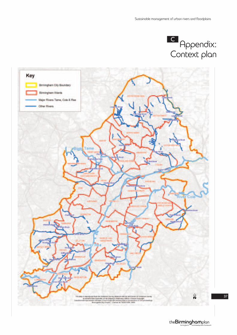
Appendix:Context plan
C
N
Sustainable management of urban rivers and floodplains
38
Appendix:Birmingham’s geology
D
N
Sustainable management of urban rivers and floodplains
39N
Sustainable management of urban rivers and floodplains
40
Appendix:Birmingham’s flood zones
E
NB. Flood Zone 1 is everywhere.
N
Sustainable management of urban rivers and floodplains
Supplementary Planning Document
june2007
birmingham’s local development frameworktheBirminghamplan