Embed Size (px)
Citation preview
1
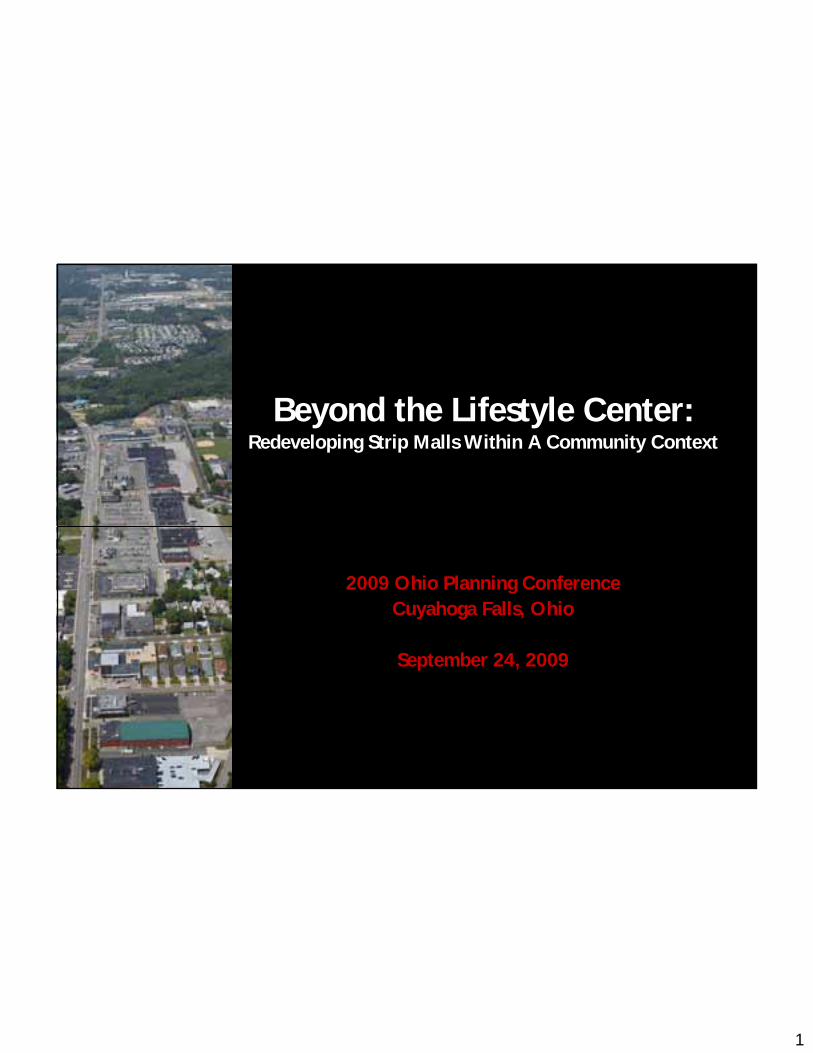
Beyond the Lifestyle Center:Redeveloping Strip Malls Within A Community Context
2009 Ohio Planning Conference Cuyahoga Falls, Ohio
September 24, 2009

2
IntroductionCity of Cuyahoga FallsCity of Cuyahoga Falls
Sue Sue TrubyTruby, Director of Development, Director of Development
Fred Guerra, AICP Planning DirectorFred Guerra, AICP Planning Director
MSI DesignMSI Design
Andrew Andrew OverbeckOverbeck, AICP, AICP
BialoskyBialosky + Partners+ Partners
Jack Jack BialoskyBialosky, AIA, LEED AP, AIA, LEED AP
David David CraunCraun, LEED AP, LEED AP
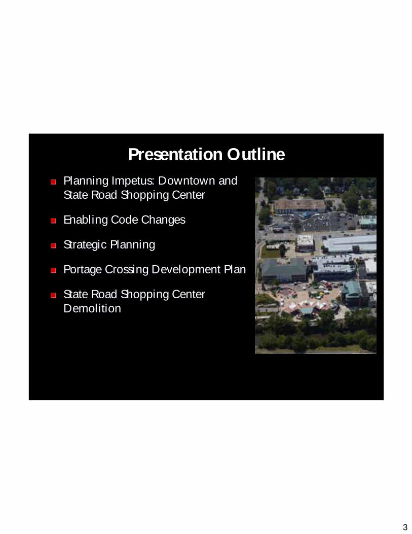
3
Presentation OutlinePlanning Impetus: Downtown and Planning Impetus: Downtown and State Road Shopping CenterState Road Shopping Center
Enabling Code ChangesEnabling Code Changes
Strategic PlanningStrategic Planning
Portage Crossing Development PlanPortage Crossing Development Plan
State Road Shopping Center State Road Shopping Center DemolitionDemolition
4
MSI Design
Bialosky + Partners
Robert L. Stark Enterprises
Project Team
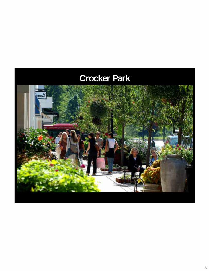
5
Crocker Park
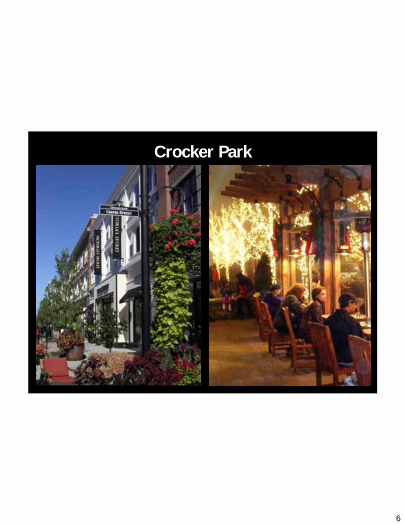
6
Crocker Park

7
Eton Collection

8
Eton Collection

9
Planning Imeptus: State Road + Downtown
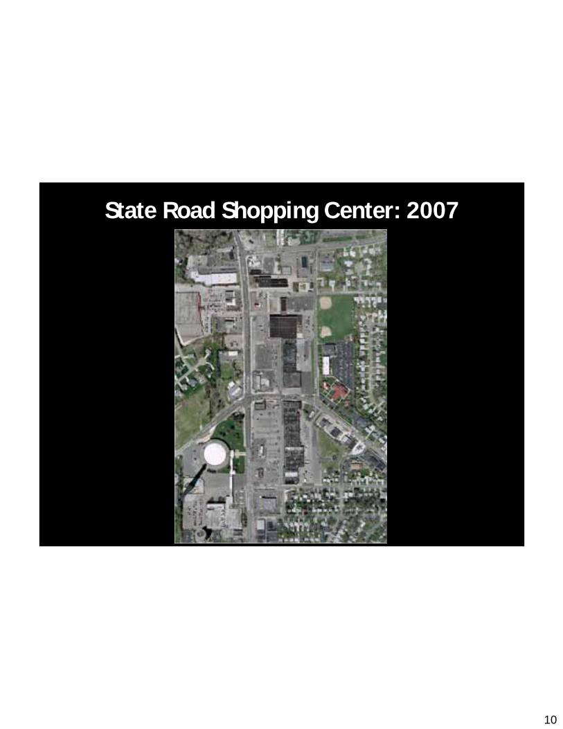
10
State Road Shopping Center: 2007
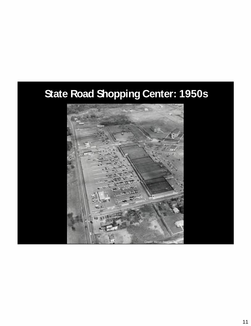
11
State Road Shopping Center: 1950s
Credit: Akron Beacon Journal
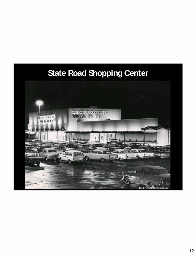
12
State Road Shopping Center
Credit: Akron Beacon Journal
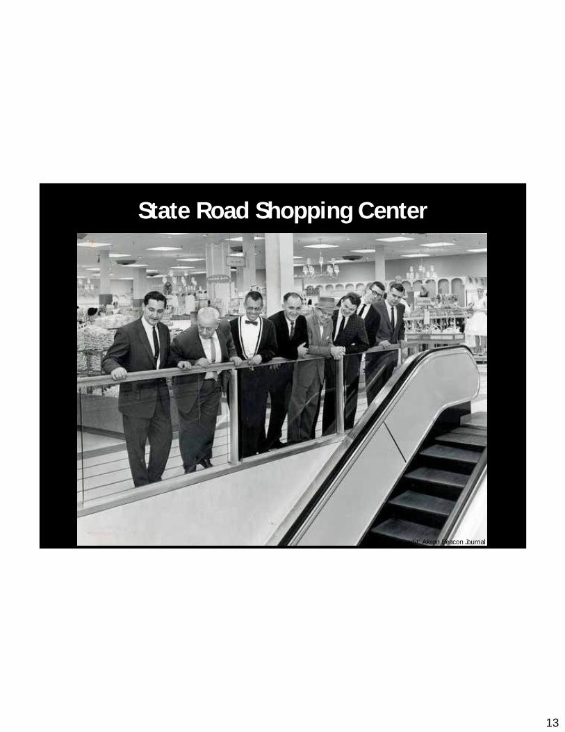
13
State Road Shopping Center
Credit: Akron Beacon Journal

14
State Road Shopping Center

15
Existing Character: Natural Features
Downtown

16
Existing Character: Parking Garages
Downtown

17
Existing Character: Front Street
Downtown
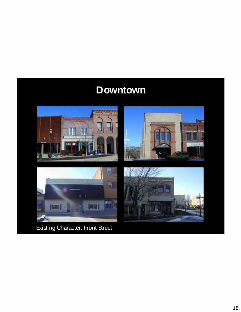
18
Existing Character: Front Street
Downtown
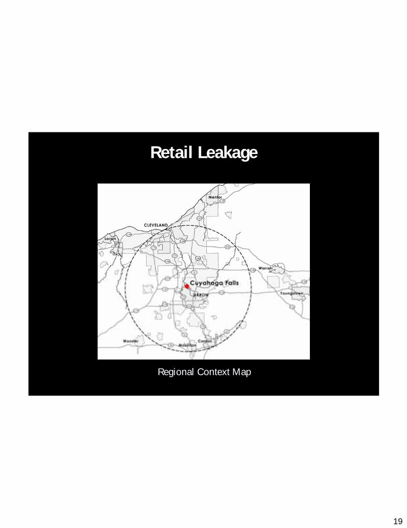
19
Regional Context MapRegional Context Map
Retail Leakage
20
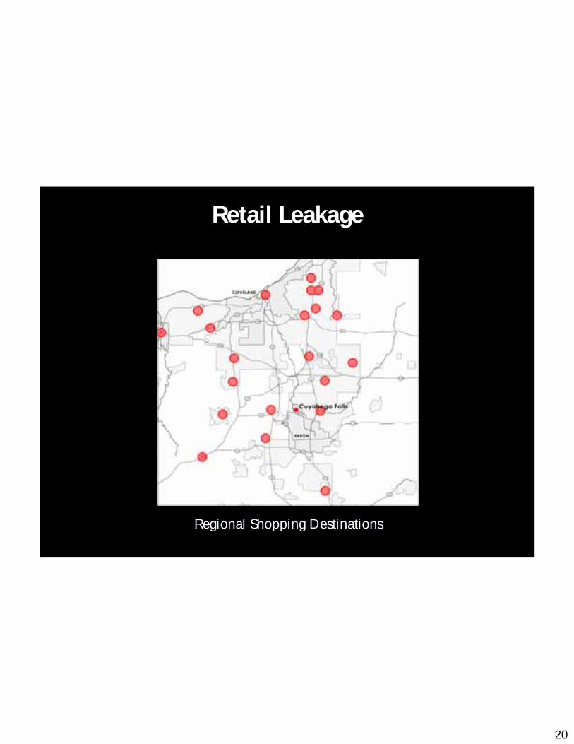
Regional Shopping DestinationsRegional Shopping Destinations
Retail Leakage

21
Regional Shopping Destinations Popular Regional Shopping Destinations Popular
with Cuyahoga Falls Residentswith Cuyahoga Falls Residents
Retail Leakage
22
Code Changes to Enable Redevelopment

23
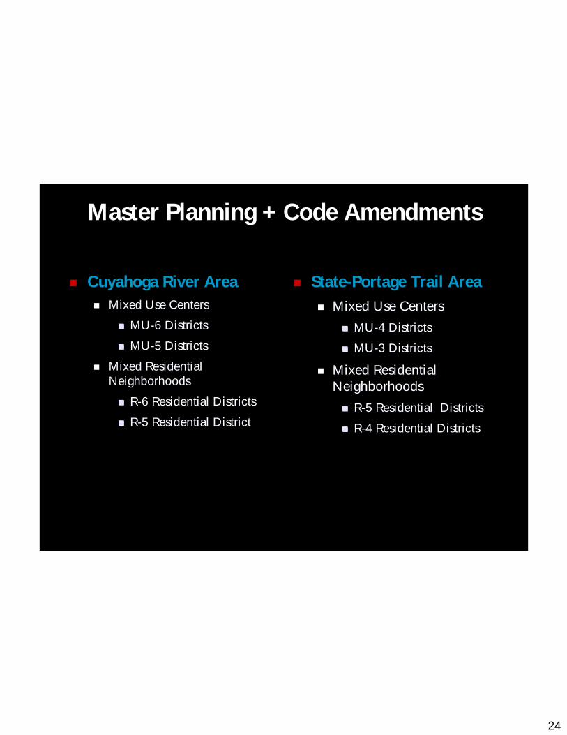
Master Planning + Code Amendments
24
Master Planning + Code Amendments
Cuyahoga River AreaMixed Use CentersMixed Use Centers
MUMU--6 Districts6 Districts
MUMU--5 Districts5 Districts
Mixed Residential Mixed Residential NeighborhoodsNeighborhoods
RR--6 Residential Districts6 Residential Districts
RR--5 Residential District5 Residential District
State-Portage Trail AreaMixed Use CentersMixed Use Centers
MUMU--4 Districts4 Districts
MUMU--3 Districts3 Districts
Mixed Residential Mixed Residential NeighborhoodsNeighborhoods
RR--5 Residential Districts5 Residential Districts
RR--4 Residential Districts4 Residential Districts
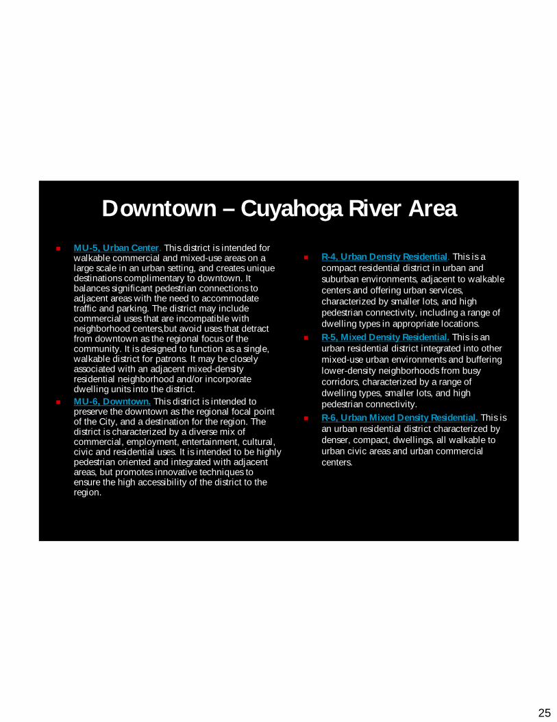
25
MU-5, Urban Center. This district is intended for walkable commercial and mixed-use areas on a large scale in an urban setting, and creates unique destinations complimentary to downtown. It balances significant pedestrian connections to adjacent areas with the need to accommodate traffic and parking. The district may include commercial uses that are incompatible with neighborhood centers,but avoid uses that detract from downtown as the regional focus of the community. It is designed to function as a single, walkable district for patrons. It may be closely associated with an adjacent mixed-density residential neighborhood and/or incorporate dwelling units into the district.MU-6, Downtown. This district is intended to preserve the downtown as the regional focal point of the City, and a destination for the region. The district is characterized by a diverse mix of commercial, employment, entertainment, cultural, civic and residential uses. It is intended to be highly pedestrian oriented and integrated with adjacent areas, but promotes innovative techniques to ensure the high accessibility of the district to the region.
R-4, Urban Density Residential. This is a compact residential district in urban and suburban environments, adjacent to walkablecenters and offering urban services, characterized by smaller lots, and high pedestrian connectivity, including a range of dwelling types in appropriate locations.R-5, Mixed Density Residential. This is an urban residential district integrated into other mixed-use urban environments and buffering lower-density neighborhoods from busy corridors, characterized by a range of dwelling types, smaller lots, and high pedestrian connectivity.R-6, Urban Mixed Density Residential. This is an urban residential district characterized by denser, compact, dwellings, all walkable to urban civic areas and urban commercial centers.
Downtown – Cuyahoga River Area
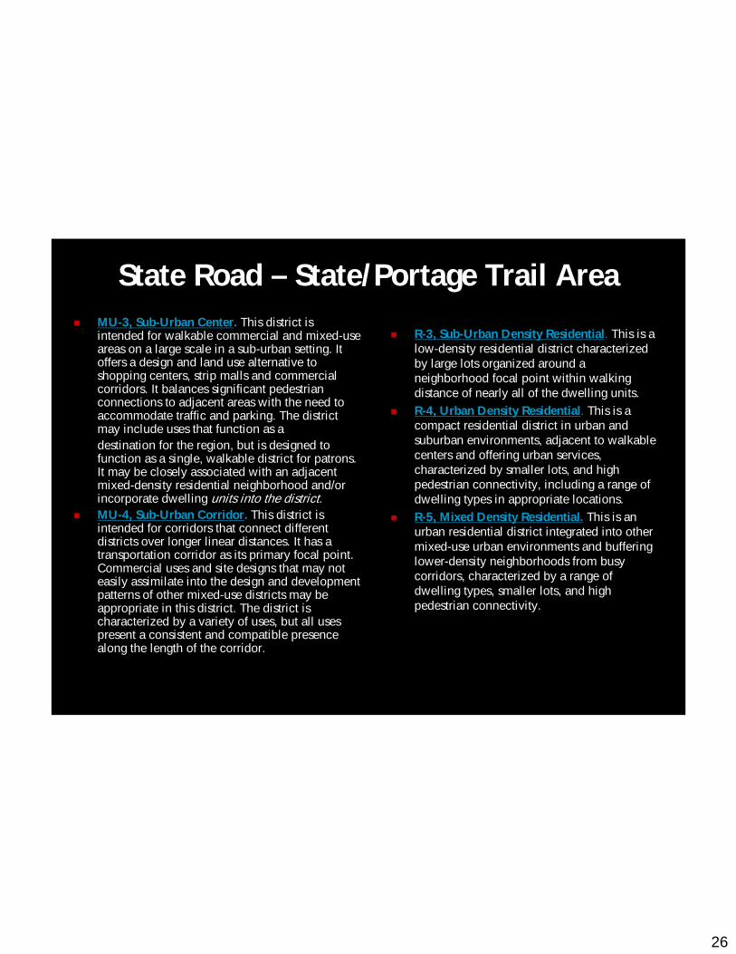
26
State Road – State/Portage Trail AreaMU-3, Sub-Urban Center. This district is intended for walkable commercial and mixed-use areas on a large scale in a sub-urban setting. It offers a design and land use alternative to shopping centers, strip malls and commercial corridors. It balances significant pedestrian connections to adjacent areas with the need to accommodate traffic and parking. The district may include uses that function as adestination for the region, but is designed to function as a single, walkable district for patrons. It may be closely associated with an adjacent mixed-density residential neighborhood and/or incorporate dwelling units into the district.MU-4, Sub-Urban Corridor. This district is intended for corridors that connect different districts over longer linear distances. It has a transportation corridor as its primary focal point. Commercial uses and site designs that may not easily assimilate into the design and development patterns of other mixed-use districts may be appropriate in this district. The district is characterized by a variety of uses, but all uses present a consistent and compatible presence along the length of the corridor.
R-3, Sub-Urban Density Residential. This is a low-density residential district characterized by large lots organized around a neighborhood focal point within walking distance of nearly all of the dwelling units.R-4, Urban Density Residential. This is a compact residential district in urban and suburban environments, adjacent to walkablecenters and offering urban services, characterized by smaller lots, and high pedestrian connectivity, including a range of dwelling types in appropriate locations.R-5, Mixed Density Residential. This is an urban residential district integrated into other mixed-use urban environments and buffering lower-density neighborhoods from busy corridors, characterized by a range of dwelling types, smaller lots, and high pedestrian connectivity.
27
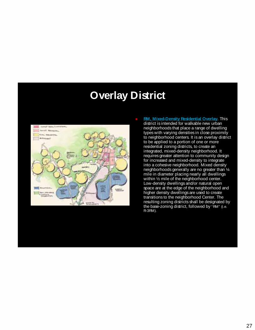
RM, Mixed-Density Residential Overlay. This district is intended for walkable new urban neighborhoods that place a range of dwelling types with varying densities in close proximity to neighborhood centers. It is an overlay district to be applied to a portion of one or more residential zoning districts, to create an integrated, mixed-density neighborhood. It requires greater attention to community design for increased and mixed-density to integrate into a cohesive neighborhood. Mixed density neighborhoods generally are no greater than ¼mile in diameter placing nearly all dwellings within ½ mile of the neighborhood center. Low-density dwellings and/or natural open space are at the edge of the neighborhood and higher density dwellings are used to create transitions to the neighborhood Center. The resulting zoning districts shall be designated by the base-zoning district, followed by “RM” (i.e. R-3RM).
Overlay District
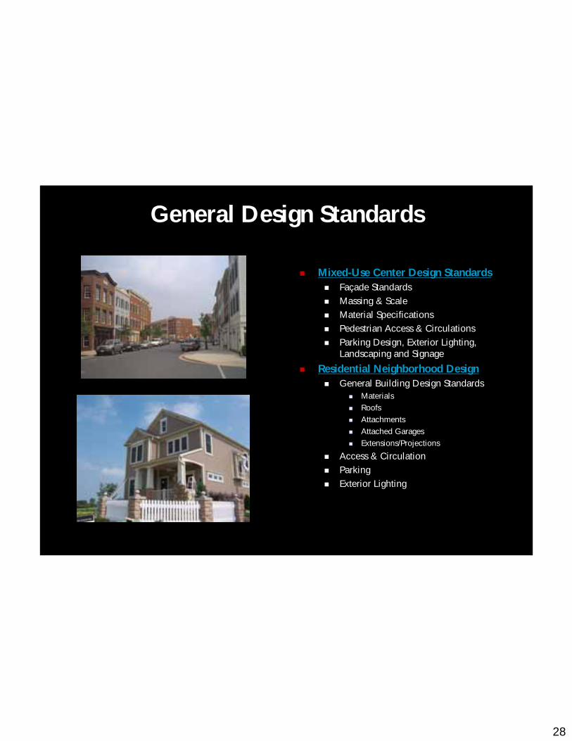
28
Mixed-Use Center Design StandardsFaçade StandardsMassing & ScaleMaterial SpecificationsPedestrian Access & CirculationsParking Design, Exterior Lighting, Landscaping and Signage
Residential Neighborhood DesignGeneral Building Design Standards
MaterialsRoofsAttachmentsAttached GaragesExtensions/Projections
Access & CirculationParkingExterior Lighting
General Design Standards
29
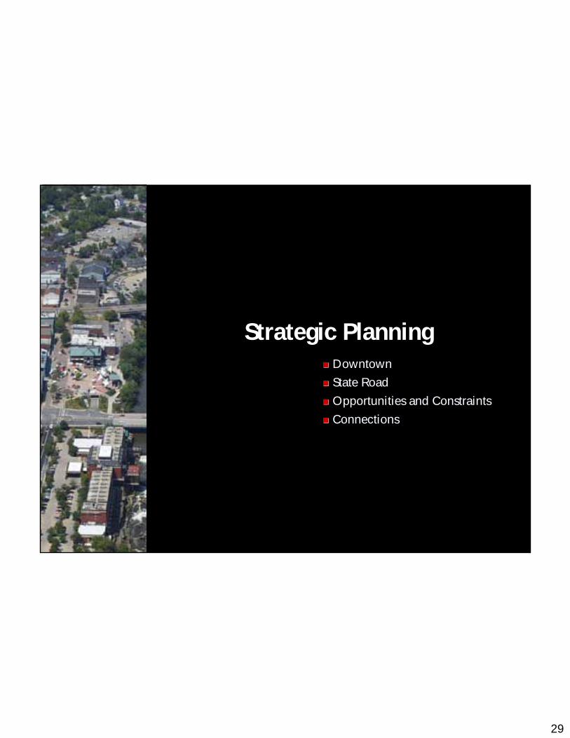
Strategic PlanningDowntownDowntown
State RoadState Road
Opportunities and ConstraintsOpportunities and Constraints
ConnectionsConnections
30
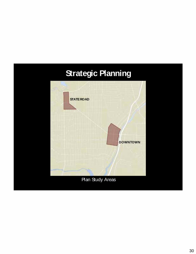
Strategic Planning
Plan Study AreasPlan Study Areas
STATE ROAD
DOWNTOWN
31
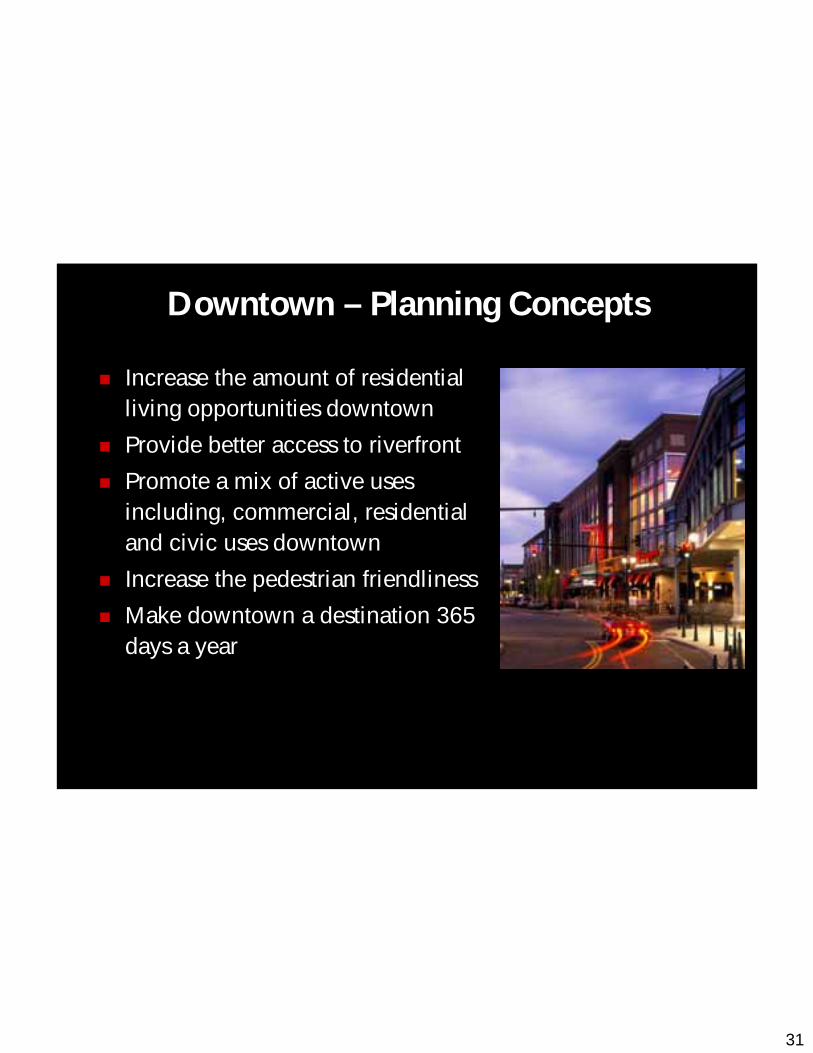
Increase the amount of residential living opportunities downtown
Provide better access to riverfront
Promote a mix of active uses including, commercial, residential and civic uses downtown
Increase the pedestrian friendliness
Make downtown a destination 365 days a year
Downtown – Planning Concepts
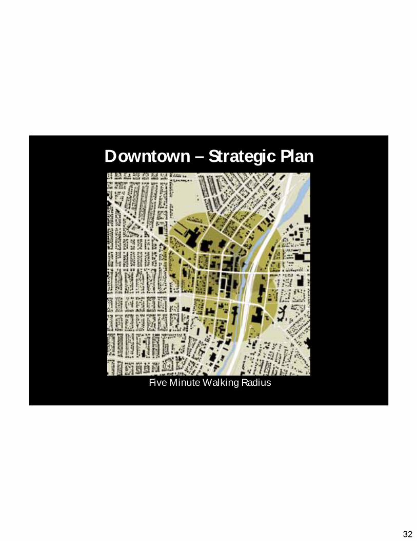
32
Five Minute Walking Radius
Downtown – Strategic Plan
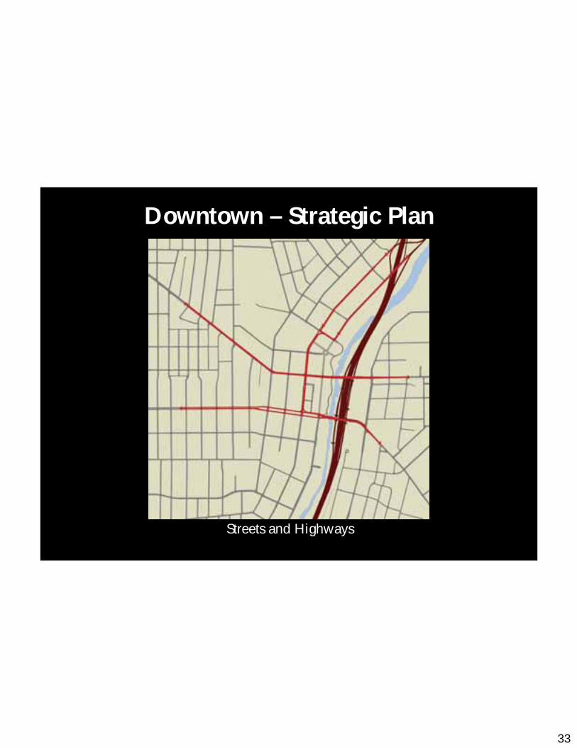
33
Streets and Highways
Downtown – Strategic Plan

34
Zoning
MU-6
MU-5
MU-4
MU-2
R-6
R-5
R-4
E-1
Legend
Downtown – Strategic Plan
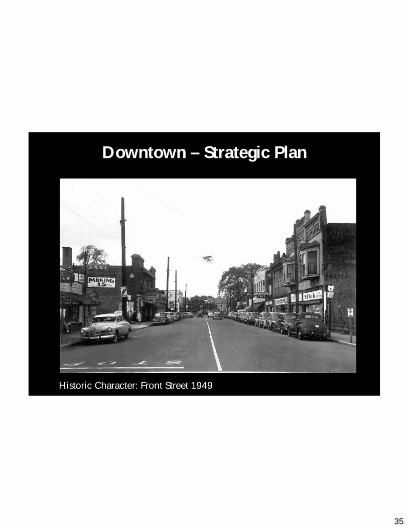
35
Historic Character: Front Street 1949
Downtown – Strategic Plan

36
Front Street BenchmarksFront Street Benchmarks
Downtown – Strategic Plan
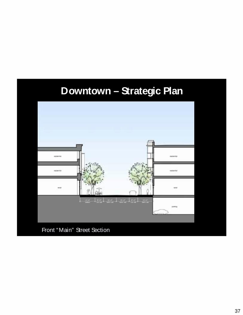
37
Front Front ““MainMain”” Street SectionStreet Section
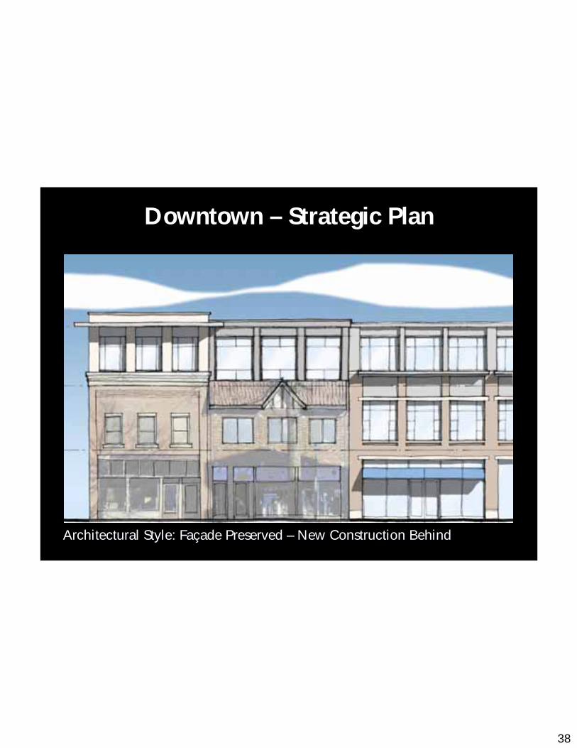
Downtown – Strategic Plan
38
Architectural Style: FaArchitectural Style: Faççade Preserved ade Preserved –– New Construction BehindNew Construction Behind
Downtown – Strategic Plan
39
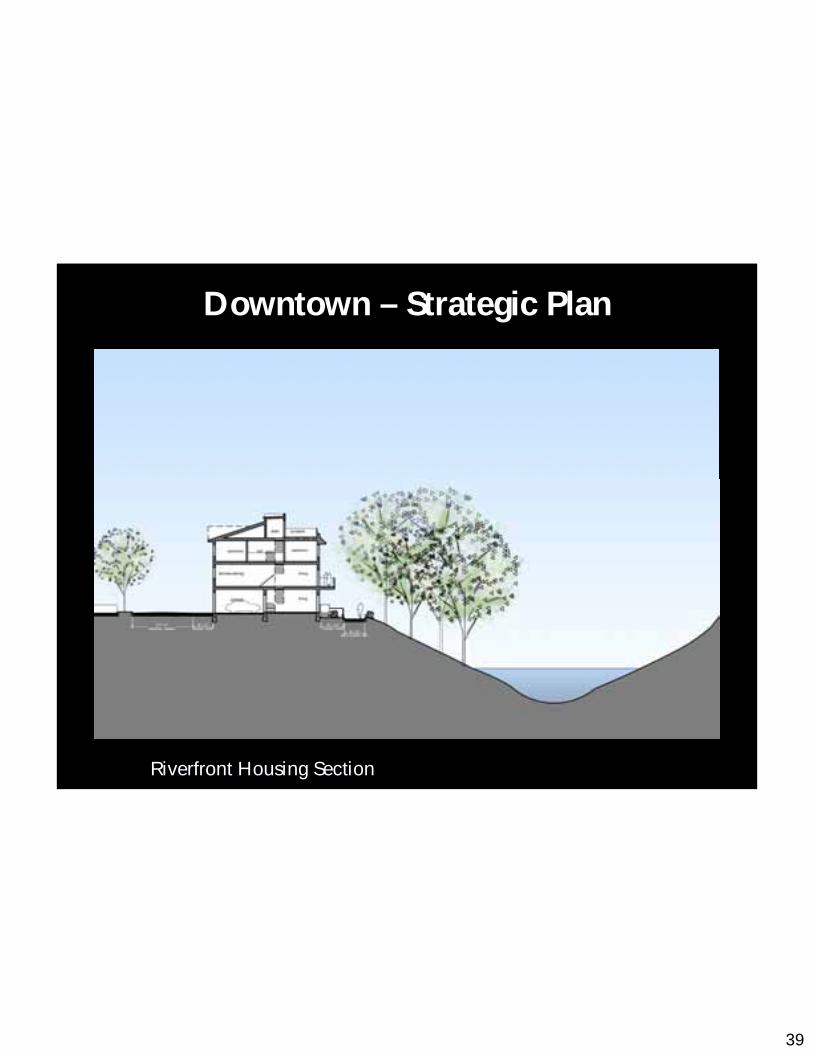
Riverfront Housing SectionRiverfront Housing Section
Downtown – Strategic Plan
40
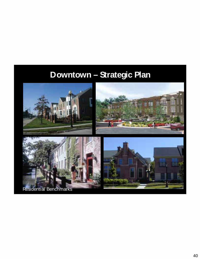
Residential BenchmarksResidential Benchmarks
Downtown – Strategic Plan
41
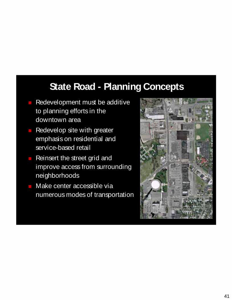
Redevelopment must be additive to planning efforts in the downtown area
Redevelop site with greater emphasis on residential and service-based retail
Reinsert the street grid and improve access from surrounding neighborhoods
Make center accessible via numerous modes of transportation
State Road - Planning Concepts

42
Streets
State Road – Strategic PlanSt
ate
Roa
d
Portage Trail
Graham Road

43
Building Diagram
State Road – Strategic Plan
44
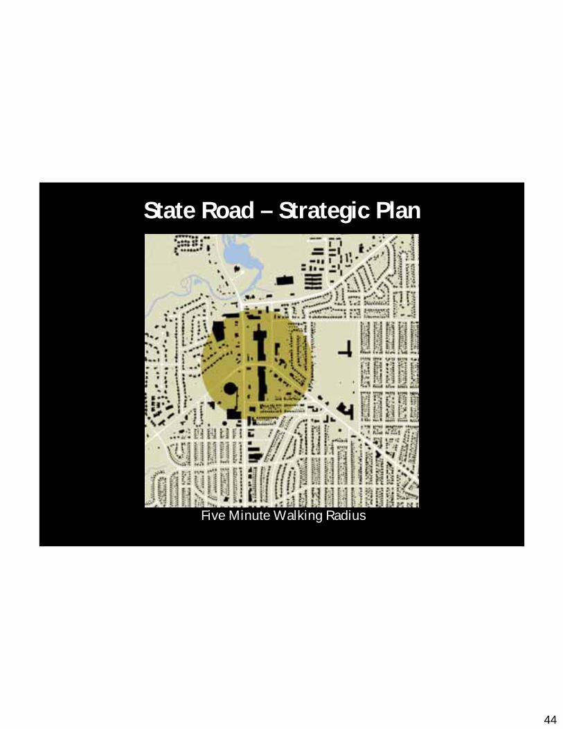
Five Minute Walking Radius
State Road – Strategic Plan
45
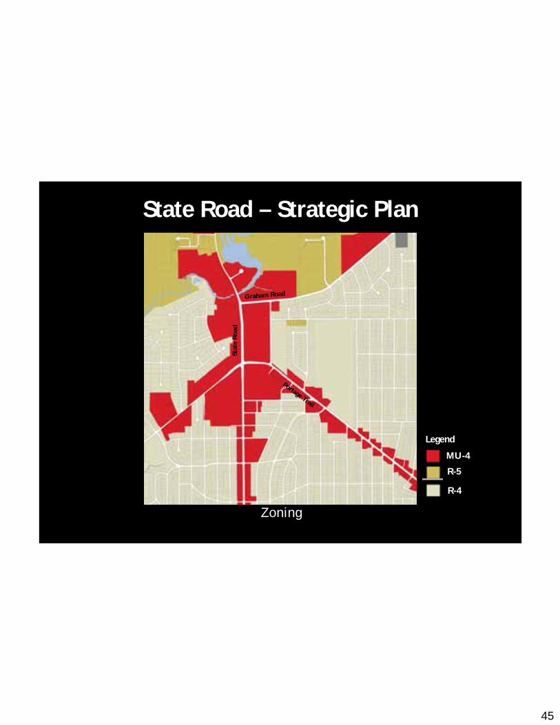
Zoning
MU-4
R-5
R-4
Legend
Stat
e R
oad
Portage Trail
Graham Road
State Road – Strategic Plan

46
New Circulation: Roadways
Graham Road
Stat
e R
oad
Silverlake Avenue
Portage Trail13
thSt
reet
State Road – Strategic Plan
47
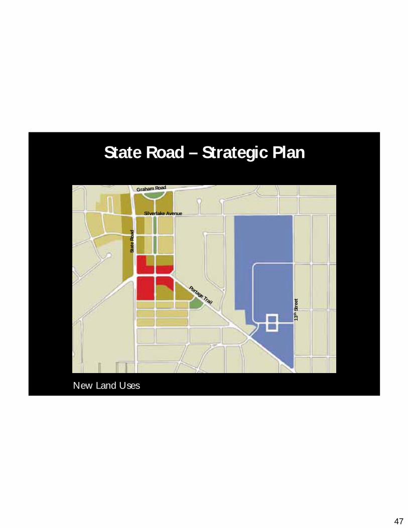
New Land Uses
Graham Road
Stat
e R
oad
Silverlake Avenue
Portage Trail13
thSt
reet
State Road – Strategic Plan
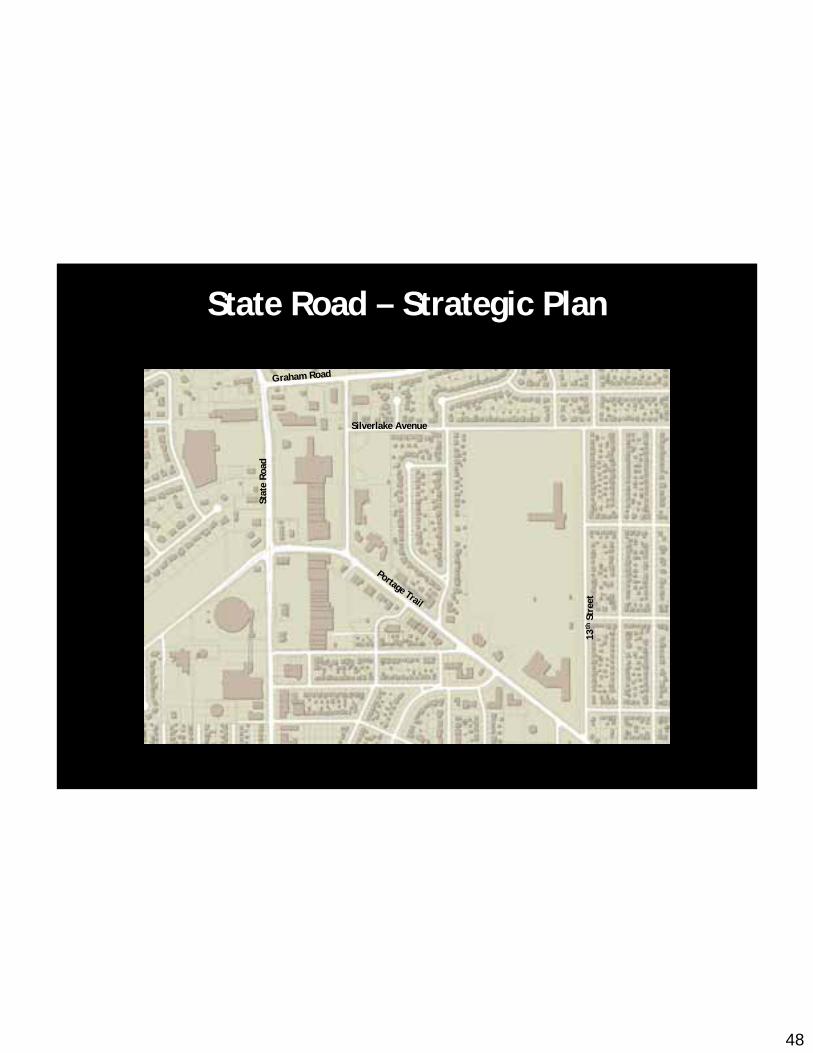
48
Graham Road
Stat
e R
oad
Silverlake Avenue
Portage Trail13
thSt
reet
State Road – Strategic Plan

49
State Road Plan
Graham Road
Stat
e R
oad
Silverlake Avenue
Portage Trail13
thSt
reet
State Road – Strategic Plan
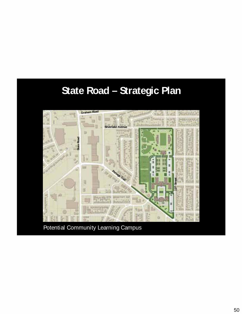
50
Potential Community Learning Campus
Graham Road
Stat
e R
oad
Silverlake Avenue
Portage Trail13
thSt
reet
State Road – Strategic Plan
51
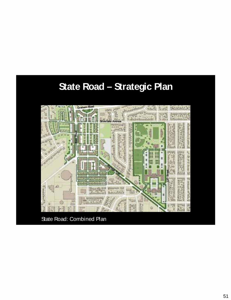
State Road: Combined Plan
Graham Road
Stat
e R
oad
Silverlake Avenue
Portage Trail13
thSt
reet
Graham Road
Stat
e R
oad
Silverlake Avenue
Portage Trail
13th
Stre
et
State Road – Strategic Plan
52
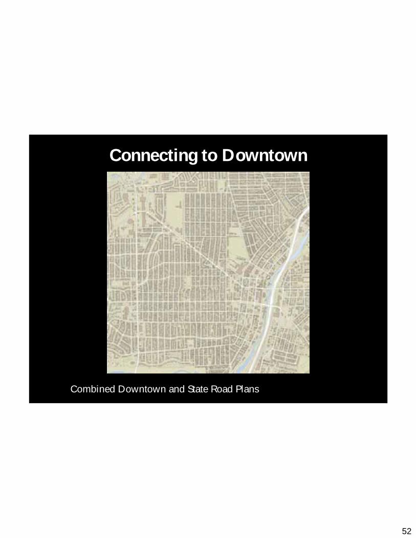
Combined Downtown and State Road Plans
Connecting to Downtown
53
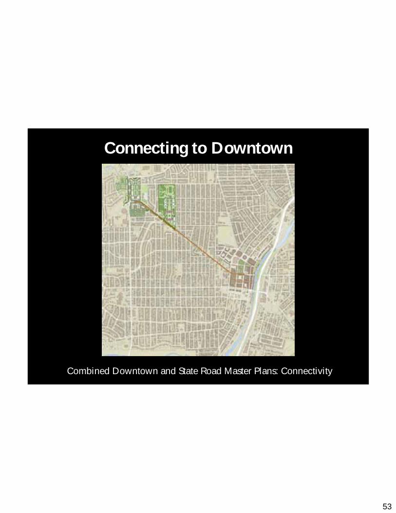
Combined Downtown and State Road Master Plans: Connectivity
Connecting to Downtown

54
Portage Crossing Development Plan
55
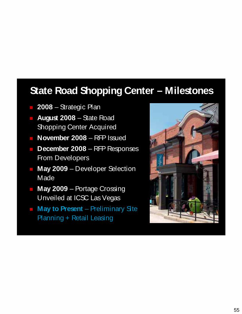
State Road Shopping Center – Milestones
2008 – Strategic Plan
August 2008 – State Road Shopping Center Acquired
November 2008 – RFP Issued
December 2008 – RFP Responses From Developers
May 2009 – Developer Selection Made
May 2009 – Portage Crossing Unveiled at ICSC Las Vegas
May to Present – Preliminary Site Planning + Retail Leasing

56
Portage Crossing: Before
57
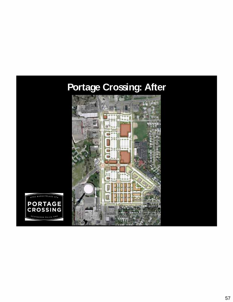
Portage Crossing: After
58
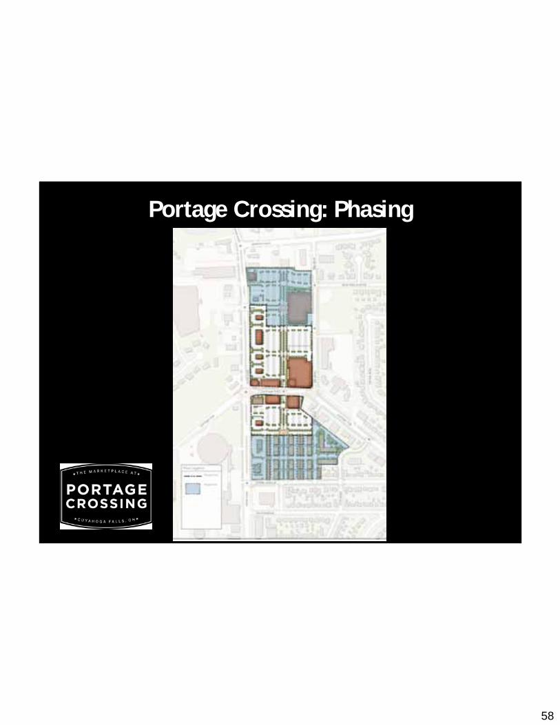
Portage Crossing: Phasing
59
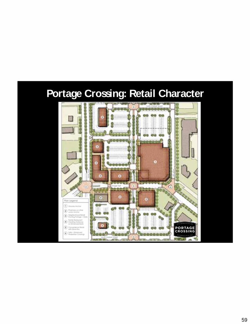
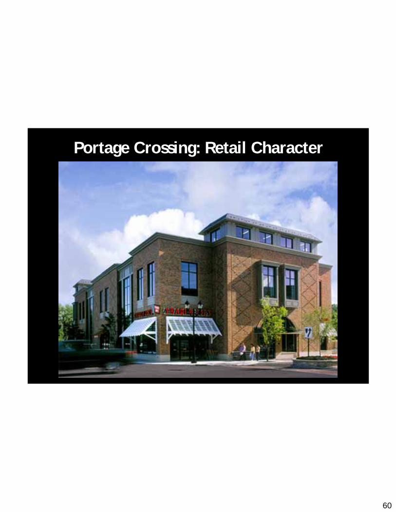
Portage Crossing: Retail Character
60
Portage Crossing: Retail Character

61
Portage Crossing: Retail Character
62
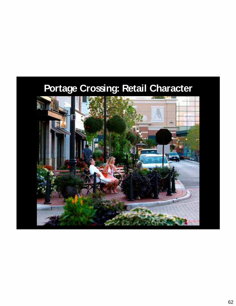
Portage Crossing: Retail Character
63
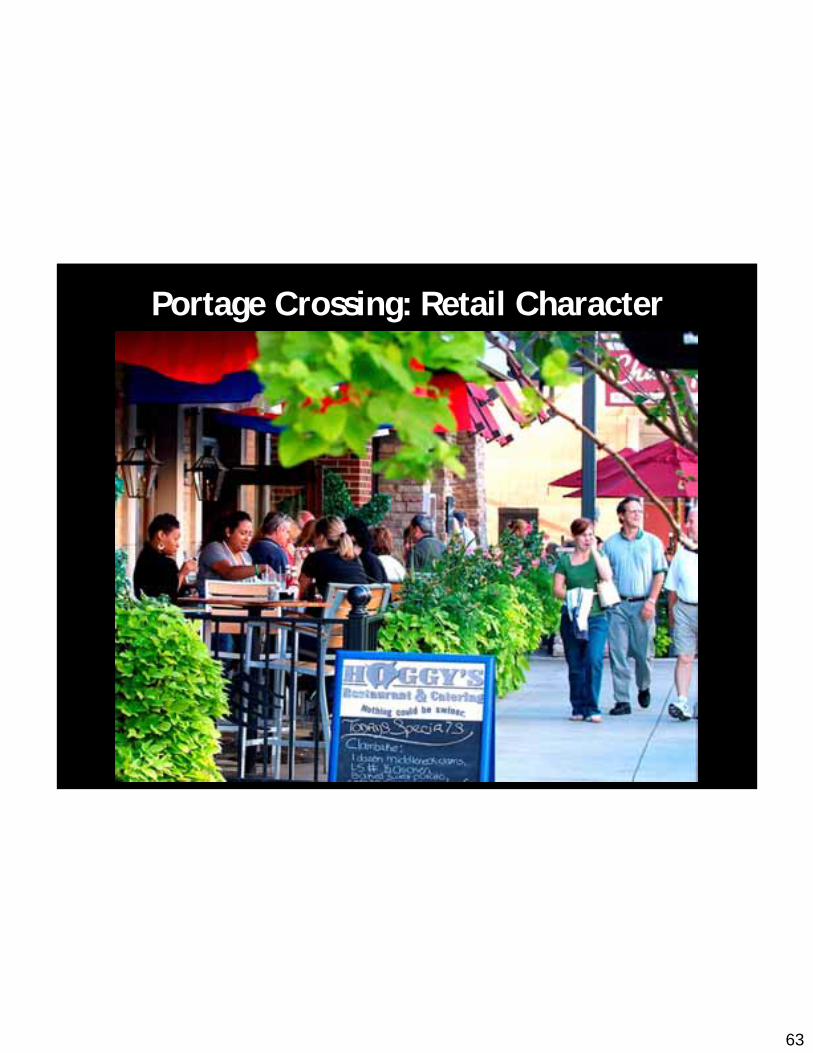
Portage Crossing: Retail Character
64
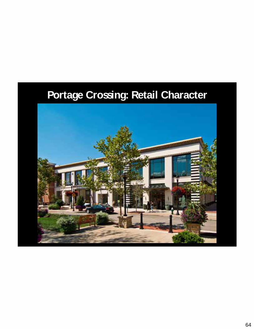
Portage Crossing: Retail Character

65
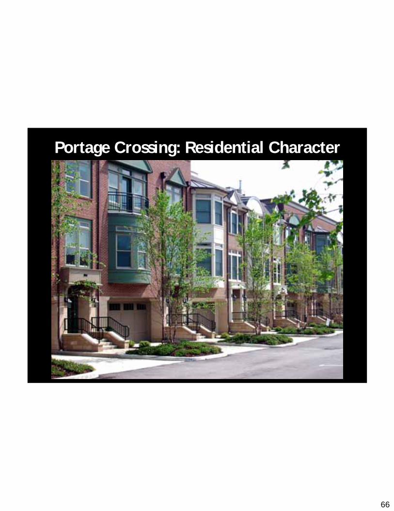
Portage Crossing: Residential Character
66
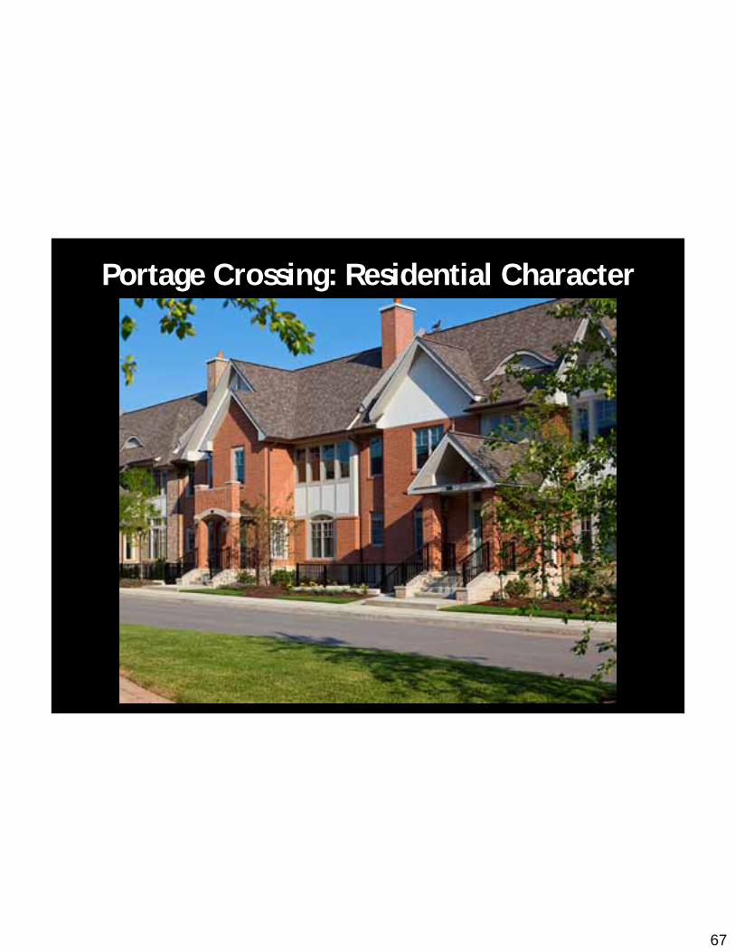
Portage Crossing: Residential Character
67
Portage Crossing: Residential Character

68
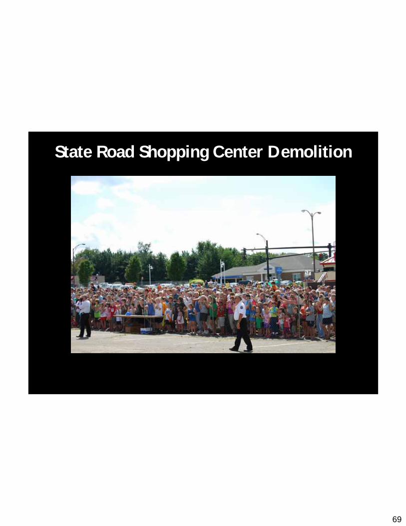
State Road Shopping Center Demolition
69
State Road Shopping Center Demolition

70
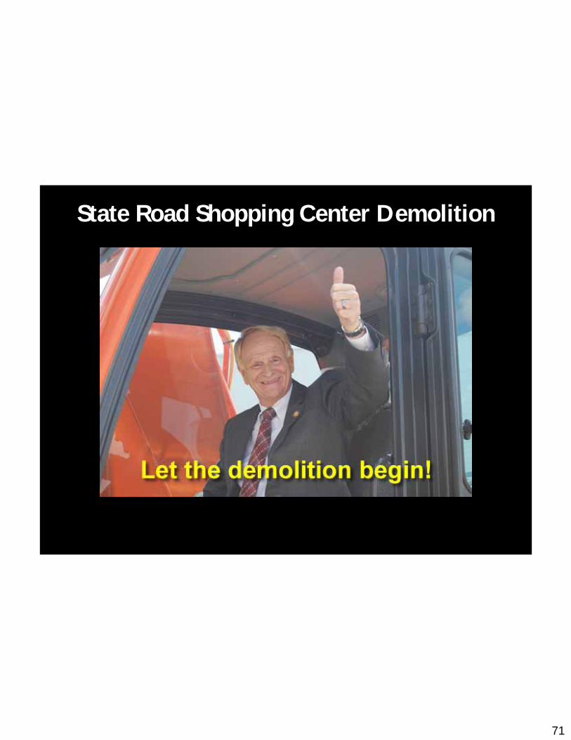
State Road Shopping Center Demolition
71
State Road Shopping Center Demolition
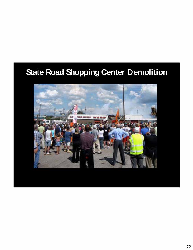
72
State Road Shopping Center Demolition

73
State Road Shopping Center Demolition
74
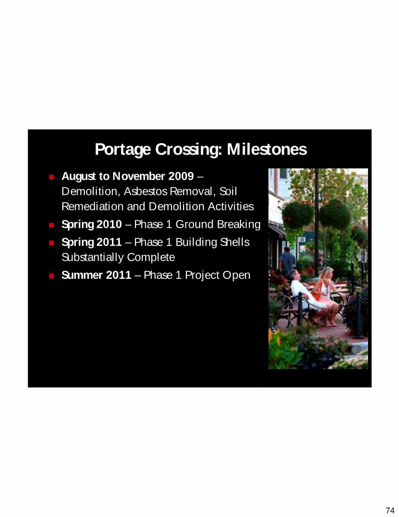
Portage Crossing: Milestones
August to November 2009 –Demolition, Asbestos Removal, Soil Remediation and Demolition Activities
Spring 2010 – Phase 1 Ground Breaking
Spring 2011 – Phase 1 Building Shells Substantially Complete
Summer 2011 – Phase 1 Project Open

75
Questions
76