Embed Size (px)
Citation preview
between Leman and Ower Bank, North Sea
Record ID 342
Authors Year
Godwin, H. and Godwin, M. 1933
Location description Deposit location
Deposit description Deposit stratigraphy
Peat lumps (moorlog) trawled up.
Associated artefacts Early work
Barbed bone weapon tip embedded in a lump of peat (early Boreal), 25 miles (40 km) from coast in 19-20 fathoms (6 [sic] m) water [36 m]. This original peat not kept.
Sample method
Samples trawled up by Colinda in 1931 and 1932.
Depth of deposit 14C ages available
No
Notes
[Also: Tool c. 11740 ± 150BP (Housely, 1991) (Mesolithic); peat 8500 years BP; Smith and Bonsall (1991); Barton (1999); Coles (1998)].
Subsite details
ID 275
Location Depth
Description
Moorlog samples retrieved from near harpoon discovery site. Pollen analysis carried out (Godwin & Godwin and Erdtman) suggests pre Boreal age.
Coastal peat resource database (Hazell, 2008) Page 1 of 52
ID 276
Location Depth
From between the two north buoys of the Leman and Ower.
Description
Moorlog sample retrieved by trawler 'Colinda'
Bibliographic reference
Godwin, H. and Godwin, M. 1933 'British Maglemose harpoon sites', Antiquity, 7, 36-48.
Coastal peat resource database (Hazell, 2008) Page 2 of 52
between Leman and Ower Bank, North Sea
Record ID 449
Authors Year
Godwin, H. and Willis, E. 1959
Location description Deposit location
53deg10'N Lat, 2deg0'E Long [TG 67320 70789 converted]
Deposit description Deposit stratigraphy
Peat bed.
Associated artefacts Early work
Mesolithic barbed point embedded in the peat.
Sample method
Dredging.
Depth of deposit 14C ages available
Water depth of 120 ft [36.6 m]. Yes
Notes
14C details
ID 317 Laboratory code Q-105
Sample location Depth of sample Dated sample description
[TG 67320 70789] [converted]
Dredged. (-90 ft OD) -37 m water depth
Peat.
Age (uncal) Age (cal) Delta 13C
8422 ± 170 [?8425] n/a
Notes
Also see Godwin (1960).
Bibliographic reference
Godwin, H. and Willis, E. 1959 'Cambridge University Natural Radiocarbon Measurements I', Radiocarbon, 1, 63-75.
Coastal peat resource database (Hazell, 2008) Page 3 of 52
between Leman and Ower Bank, North Sea
Record ID 464
Authors Year
Bonsall, C. and Smith, C. 1989
Location description Deposit location
Deposit description Deposit stratigraphy
Associated artefacts Early work
Antler/bone
Sample method
Depth of deposit 14C ages available
Yes
Notes
(see Archaeometry 27/28/29/31).
14C details
ID 330 Laboratory code OxA-1950
Sample location Depth of sample Dated sample description
53degN 2degE [converted TG 68356 52263]
Antler/bone (barbed point)
Age (uncal) Age (cal) Delta 13C
11740 ± 150 -21.0
Notes
Bibliographic reference
Bonsall, C. and Smith, C. 1989 'Late Palaeolithic and Mesolithic bone and antler artefacts from Britain: first reaction to accelerator dates', Me solithic Miscellany, 10, 33-38.
Coastal peat resource database (Hazell, 2008) Page 4 of 52
between Leman and Ower Bank, North Sea
Record ID 560
Authors Year
Burkitt, M. 1932
Location description Deposit location
25 miles from the Norfolk coast.
Deposit description Deposit stratigraphy
Moorlog.
Associated artefacts Early work
Maglemose-type harpoon dredged up by The Colinda, skipper PE Lockwood. Now at Norwich Castle Museum.
Sample method
Depth of deposit 14C ages available
No
Notes
Bibliographic reference
Burkitt, M. 1932 'A Maglemose harpoon dredged up recently from the North Sea', Man, 32, 118.
Coastal peat resource database (Hazell, 2008) Page 5 of 52
Brown Bank, North Sea
Record ID 100
Authors Year
Verhart, L. 1995
Location description Deposit location
Deposit description Deposit stratigraphy
35 km-long, narrow ridge, 19 m under water. Unsure if former beach barrier, spit or barrier island. Along the ridge, deep gullies cut into clay and peat layers
Associated artefacts Early work
Unworked animal bones, oldest of which are Weichselian. Mesolithic worked bones and stone also found (dated typologically), mainly by fishermen. Also, evidence of dog gnawing
Sample method
.
Depth of deposit 14C ages available
No
Notes
Refers to occupied North Sea as 'North Sea Plain'. [NB Brown Bank is Dutch territory].
Bibliographic reference
Verhart, L. 1995 'Fishing for the Mesolithic. The North Sea: a submerged Mesolithic landscape' in 'Man and sea in the Mesolithic', (ed.s) Fischer, A., 291-302.
Coastal peat resource database (Hazell, 2008) Page 6 of 52
Dogger Bank, North Sea
Record ID 78
Authors Year
Coles, B. 1998
Location description Deposit location
Deposit description Deposit stratigraphy
Peat remains - birch, willow and hazel
Associated artefacts Early work
Mineralised animal bones; antler/bone artefact
Sample method
Depth of deposit 14C ages available
Yes
Notes
14C details
ID 32 Laboratory code
Sample location Depth of sample Dated sample description
Bone artefact
Age (uncal) Age (cal) Delta 13C
c. 6050 cal. BC
Notes
Bibliographic reference
Coles, B. 1998 'Doggerland; a speculative survey', Proceedings of the Prehistoric Society, 64, 45-81.
Coastal peat resource database (Hazell, 2008) Page 7 of 52
Dogger Bank, North Sea
Record ID 79
Authors Year
Hansen, J. 1981
Location description Deposit location
Eastern Dogger Bank
Deposit description Deposit stratigraphy
Tree stumps
Associated artefacts Early work
Sample method
Seismic survey
Depth of deposit 14C ages available
40-50 m depth No
Notes
Bibliographic reference
Hansen, J. 1981 'Naturgasprojektet og de marinarkæologiske forundersøgelser:en forundersøgelse udført af Fredningsstyrelsen i samarbejde med Nationalmuseets Skibshistorisk laboratorium', Copenhagen: Fredningsstyrelsen.
Coastal peat resource database (Hazell, 2008) Page 8 of 52
Dogger Bank, North Sea
Record ID 80
Authors Year
Shennan, I., Lambeck, K., Horton, B., Innes, J., L
2000a
Location description Deposit location
[c. OY 220 902, from map]
Deposit description Deposit stratigraphy
Thin silt peat layer (4 cm thick), formed under saltmarsh conditions during relatively slow marine transgression.
Peat is on top of diamicton, and under 4 m of sand silt.
Associated artefacts Early work
Sample method
Geotechnical core 55/+02/213VE (sand and gravel extraction)
Depth of deposit 14C ages available
-31.06 m OD (top of peat layer) Yes
Notes
[See page 303 and Table 1]. Wessex Archaeology (2003c) is a related report for Area 466, NW Doggerbank.
Coastal peat resource database (Hazell, 2008) Page 9 of 52
14C details
ID 33 Laboratory code AA22662
Sample location Depth of sample Dated sample description
[c. OY 220 902, from map] -31.06 m OD Top of peat layer.
Age (uncal) Age (cal) Delta 13C
8140 ± 50/55 14C years BP -26.63
Notes
Core 55/+02/213VE. Positive sea level tendency. Reliable sea-level index point. [Different errors reported in table and text].
Bibliographic reference
Shennan, I., Lambeck, K., Horton, B., Innes, J., L 2000a 'Modelling western North Sea palaeogeographies and tidal changes during the Holocene' in 'Holocene land-ocean interaction and environmental change around the North Sea', (ed.s) Shennan, I. and Andrews, J., 299-319, The Geological Society Special Publication No. 166.
Coastal peat resource database (Hazell, 2008) Page 10 of 52
Dogger Bank, North Sea
Record ID 81
Authors Year
Whitehead, H. and Goodchild, H. 1909
Location description Deposit location
Deposit description Deposit stratigraphy
Moorlog peat deposit retrieved by fishermen.
Associated artefacts Early work
Sample method
Depth of deposit 14C ages available
No
Notes
Bibliographic reference
Whitehead, H. and Goodchild, H. 1909 'Some notes on "moorlog", a peaty deposit from the Dogger Bank in the North Sea', Essex Naturalist, 16, 51-60.
Coastal peat resource database (Hazell, 2008) Page 11 of 52
Dogger Bank, North Sea
Record ID 82
Authors Year
Louwe Kooijmans, L. (1970-71)
Location description Deposit location
Deposit description Deposit stratigraphy
Peat and moorlog deposits.
Associated artefacts Early work
Descriptions of numerous implements.
Sample method
Depth of deposit 14C ages available
No
Notes
[Peat deposits plotted on Figure 18 - sites taken from Clark (1936), Vermeer-Louman (1934) and Oele (1971)].
Bibliographic reference
Louwe Kooijmans, L. (1970-71) 'Mesolithic bone and antler implements from the North Sea and from the Netherlands', Ber. Rijksdienst oudheidk. Bodemonderz., 20/21, 27-73+plates.
Coastal peat resource database (Hazell, 2008) Page 12 of 52
Dogger Bank, North Sea
Record ID 84
Authors Year
Behre, K. and Menke, B. 1969
Location description Deposit location
SE of Dogger Bank.
Deposit description Deposit stratigraphy
Peat deposits 9500-9000 year - Late Preboreal.
Associated artefacts Early work
Sample method
Bored.
Depth of deposit 14C ages available
-46 m water depth. No
Notes
Behre and Menke (1969) referred to in Fitch et al. (2005)
Bibliographic reference
Behre, K. and Menke, B. 1969 'Pollenanallyische Untersuchungen an einem Bohrkern der südlichen Doggerbank', Beiträge zur Meereskunde, 24/25, 123-129.
Coastal peat resource database (Hazell, 2008) Page 13 of 52
Dogger Bank, North Sea
Record ID 651
Authors Year
Veenstra, H. 1965
Location description Deposit location
Southeastern margin of Dogger Bank.
Deposit description Deposit stratigraphy
Peat.
Associated artefacts Early work
Sample method
Depth of deposit 14C ages available
Yes
Notes
14C age is from Jelgersma (1961). Subsequent accumulation rates are calculated as an average of 0.3 mm/year.
14C details
ID 504 Laboratory code
Sample location Depth of sample Dated sample description
39 m
Age (uncal) Age (cal) Delta 13C
9300 14C years BP
Notes
Preboreal
Bibliographic reference
Veenstra, H. 1965 'Geology of the Dogger Bank area, North Sea', Marine Geology, 3(4), 245-262.
Coastal peat resource database (Hazell, 2008) Page 14 of 52
Flemish Bight, North Sea
Record ID 103
Authors Year
Flemming, N. 2002
Location description Deposit location
52-53degN, 2-4degE (whole sheet area)
Deposit description Deposit stratigraphy
Basal peat in Elbow Formation. Contains coastal bivalve Spisula subtruncata. Holocene.
Associated artefacts Early work
Sample method
Depth of deposit 14C ages available
No
Notes
BGS sediment maps
Bibliographic reference
Flemming, N. 2002 'The scope of strategic environmental assessment of North Sea areas SEA3 and SEA2 in regard to prehistoric archaeological remains', Department of Trade and Industry, London.
Coastal peat resource database (Hazell, 2008) Page 15 of 52
Frigg Island, North Sea
Record ID 102
Authors Year
Long, D., Wickham-Jones, C. and Ruckley, N.
1986
Location description Deposit location
Deposit description Deposit stratigraphy
Frigg Island, thought to be inundated about 12,000 years ago (Blystad, 1989). Context indicates late glacial age.
Associated artefacts Early work
Small, retouched flake considered to be anthropogenic
Sample method
Depth of deposit 14C ages available
No
Notes
Bibliographic reference
Long, D., Wickham-Jones, C. and Ruckley, N. 1986 'A flint artefact from the northern North Sea' in 'Studies in the Upper Palaeolithic of Britain and northwest Europe', (ed.s) Roe, D., 55-62, BAR International Series, Oxford.
Coastal peat resource database (Hazell, 2008) Page 16 of 52
Indefatigable, North Sea
Record ID 104
Authors Year
Flemming, N. 2002
Location description Deposit location
53-54deg N, 2-4degE (whole sheet area)
Deposit description Deposit stratigraphy
Elbow Formation (early Holocene clay and peat) 5-20 m thick mapped in SE half of BGS sheet. Holocene.
Associated artefacts Early work
Sample method
Depth of deposit 14C ages available
No
Notes
BGS sediment maps
Bibliographic reference
Flemming, N. 2002 'The scope of strategic environmental assessment of North Sea areas SEA3 and SEA2 in regard to prehistoric archaeological remains', Department of Trade and Industry, London.
Coastal peat resource database (Hazell, 2008) Page 17 of 52
Leman Bank, North Sea
Record ID 90
Authors Year
Shennan, I., Lambeck, K., Horton, B., Innes, J., L
2000a
Location description Deposit location
53.33533, 1.74333 [TG 49191 88610 converted]
Deposit description Deposit stratigraphy
Core 53/+01/1567
Associated artefacts Early work
Sample method
Depth of deposit 14C ages available
Yes
Notes
LOIS core.
Coastal peat resource database (Hazell, 2008) Page 18 of 52
14C details
ID 38 Laboratory code AA23946
Sample location Depth of sample Dated sample description
53.33533, 1.74333 [TG 49191 88610 converted]
-32.77 m OD
Age (uncal) Age (cal) Delta 13C
8775 ± 70 14C years BP
-28.88
Notes
Core 53/+01/1567. Positive sea-level indicator.
Bibliographic reference
Shennan, I., Lambeck, K., Horton, B., Innes, J., L 2000a 'Modelling western North Sea palaeogeographies and tidal changes during the Holocene' in 'Holocene land-ocean interaction and environmental change around the North Sea', (ed.s) Shennan, I. and Andrews, J., 299-319, The Geological Society Special Publication No. 166.
Coastal peat resource database (Hazell, 2008) Page 19 of 52
Leman Bank, North Sea
Record ID 650
Authors Year
Godwin, H. 1960
Location description Deposit location
Deposit description Deposit stratigraphy
Peat.
Associated artefacts Early work
Sample method
Depth of deposit 14C ages available
Yes
Notes
[Referred to in Lambeck, 1995].
14C details
ID 503 Laboratory code
Sample location Depth of sample Dated sample description
Age (uncal) Age (cal) Delta 13C
8400 years BP
Notes
Bibliographic reference
Godwin, H. 1960 'Radiocarbon dating and Quaternary history in Britain', Proceedings of the Royal Society of London, Series B, 153, 287-320.
Coastal peat resource database (Hazell, 2008) Page 20 of 52
Noah's woods, North Sea
Record ID 101
Authors Year
Reid, C. 1913
Location description Deposit location
Deposit description Deposit stratigraphy
Reference to peat and wood findings indicating that the North Sea was once dry land.
Associated artefacts Early work
Sample method
Depth of deposit 14C ages available
No
Notes
Bibliographic reference
Reid, C. 1913 'Submerged forests', Cambridge: Cambridge University Press.
Coastal peat resource database (Hazell, 2008) Page 21 of 52
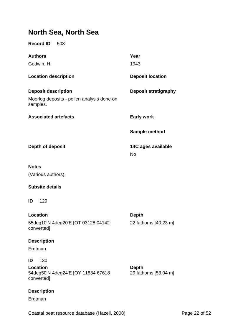
North Sea, North Sea
Record ID 508
Authors Year
Godwin, H. 1943
Location description Deposit location
Deposit description Deposit stratigraphy
Moorlog deposits - pollen analysis done on samples.
Associated artefacts Early work
Sample method
Depth of deposit 14C ages available
No
Notes
(Various authors).
Subsite details
ID 129
Location Depth
55deg10'N 4deg20'E [OT 03128 04142 converted]
22 fathoms [40.23 m]
Description
Erdtman
ID 130
Location Depth 54deg50'N 4deg24'E [OY 11834 67618 converted]
29 fathoms [53.04 m]
Description
Erdtman
Coastal peat resource database (Hazell, 2008) Page 22 of 52
ID 131
Location Depth
55deg32' N 4deg27'E [OT 06757 45533 converted]
18 fathoms [32.92 m]
Description
Erdtman
ID 132
Location Depth
54deg50'N 4deg35'E [OY 22515 68613 converted]
22 fathoms [40.23 m]
Description
Erdtman
ID 133
Location Depth
54deg46'N 4deg0'E [OX 85761 57839 converted]
28 fathoms [51.21 m]
Description
Erdtman
ID 134
Location Depth
55deg0'N 4deg38'E [OY 23958 87418 converted]
23 fathoms [42.06 m]
Description
Erdtman
Coastal peat resource database (Hazell, 2008) Page 23 of 52
ID 135
Location Depth
53deg19'N 2degE [TG 67320 70789 converted]
19 fathoms [34.75 m]
Description
Erdtman (x2)
ID 136
Location Depth
53deg19'N 2degE [TG 67320 70789 converted]
19 fathoms [34.75 m]
Description
H and ME Godwin (x4)
ID 137
Location Depth
56deg25'N 5deg55'E [OO 87766 53073 converted]
21 fathoms [38.40 m]
Description
Vermeer-Louman (x3)
ID 138
Location Depth
56deg25'N 5deg55'E [OO 87766 53073 converted]
21 fathoms [38.40 m]
Description
Vermeer-Louman
Coastal peat resource database (Hazell, 2008) Page 24 of 52
ID 139
Location Depth
Unknown Unknown
Description
Vermeer-Louman
ID 140
Location Depth
Shore pebble Unknown
Description
H Godwin
Bibliographic reference
Godwin, H. 1943 'Coastal peat beds of the British Isles and North Sea', Journal of Ecology, 31, 199-247.
Coastal peat resource database (Hazell, 2008) Page 25 of 52
North Sea, North Sea
Record ID 519
Authors Year
Jarke, J. 1956
Location description Deposit location
Deposit description Deposit stratigraphy
Associated artefacts Early work
Sample method
Depth of deposit 14C ages available
No
Notes
Referred to in Caston (1979) Pg 216.
Subsite details
ID 148
Location Depth
[OX 49716 64204 from map]
Description
Peat.
ID 149
Location Depth
[OX 63470 93253 from map]
Description
Peat.
Coastal peat resource database (Hazell, 2008) Page 26 of 52
ID 150
Location Depth
[OX 90403 78754 from map]
Description
Peat.
ID 151
Location Depth
[OS 90655 12350 from map]
Description
Peat.
Bibliographic reference
Jarke, J. 1956 'Der Boden der sudlichen Nordsee 1. Beitrag: Eine neue Bodenkarte der sudlichen Nordsee', Dtsch Hydrogr. Z., 9, 1-9.
Coastal peat resource database (Hazell, 2008) Page 27 of 52
North Sea, North Sea
Record ID 575
Authors Year
Moodley, L. and van Weering, T. 1993
Location description Deposit location
Southern North Sea, off Netherlands
Deposit description Deposit stratigraphy
Two peat layers within core. Sand on clay on peat.
Associated artefacts Early work
Sample method
Depth of deposit 14C ages available
Peat layer 213-222 cm in core. Yes
Notes
Series of 14C dates on the core.
Subsite details
ID 172
Location Depth
213-222 cm in core
Description
Basal peat.
ID 173
Location Depth
c.120-121 cm in core
Description
Peat layer.
Coastal peat resource database (Hazell, 2008) Page 28 of 52
ID 174
Location Depth
c.133-136 cm in core.
Description
Peat layer. 14C age from just below this layer was excluded as too old.
14C details
ID 427 Laboratory code Utc-2074
Sample location Depth of sample Dated sample description
215 cm in core Basal peat layer.
Age (uncal) Age (cal) Delta 13C
8720 ± 90 BP
Notes
Core M2.
ID 428 Laboratory code Utc-2072
Sample location Depth of sample Dated sample description
140 cm in core. Plant debris.
Age (uncal) Age (cal) Delta 13C
9210 ± 90 BP
Notes
Omitted as too old - reworked material.
Bibliographic reference
Moodley, L. and van Weering, T. 1993 'Foraminiferal record of the Holocene developmetn of the marine environment in the southern North Sea', Netherlands Journal of Sea Research, 31(1), 43-52.
Coastal peat resource database (Hazell, 2008) Page 29 of 52
North Sea, North Sea
Record ID 576
Authors Year
Jelgersma, S. 1961
Location description Deposit location
Deposit description Deposit stratigraphy
Dredged peat.
Associated artefacts Early work
Sample method
Depth of deposit 14C ages available
Yes
Notes
Basal peat deposits found by Jelgersma (1961) are named in Oele and Schuttenhelm 40m below sea level).
14C details
ID 431 Laboratory code
Sample location Depth of sample Dated sample description
-26 m NAP Moorlog peat
Age (uncal) Age (cal) Delta 13C
8400 ± 300 10000-8500 cal. year BP
Notes
Pollen A. Zone IIb Late Boreal. Dredged.
Coastal peat resource database (Hazell, 2008) Page 30 of 52
ID 432 Laboratory code
Sample location Depth of sample Dated sample description
-35 m NAP Moorlog peat
Age (uncal) Age (cal) Delta 13C
9000 ± 300 10900-9400 cal. year BP
Notes
Pollen B. Zone Ic Late Preboreal. Dredged.
ID 433 Laboratory code
Sample location Depth of sample Dated sample description
-33 m NAP Moorlog peat
Age (uncal) Age (cal) Delta 13C
8700 ± 300 10300-9000 cal. year BP
Notes
Pollen C. Zone IIa Early Boreal. Dredged.
ID 434 Laboratory code
Sample location Depth of sample Dated sample description
-28 m NAP Moorlog peat
Age (uncal) Age (cal) Delta 13C
8500 ± 300 10000-8600 cal. year BP
Notes
Pollen D. Zone IIa Early Boreal (younger than sample Pollen C). Dredged.
Coastal peat resource database (Hazell, 2008) Page 31 of 52
ID 436 Laboratory code GrN-2274
Sample location Depth of sample Dated sample description
Off IJmuiden, Netherlands -21.5 to -21.52 NAP Base of Lower peat.
Age (uncal) Age (cal) Delta 13C
8070 ± 100
Notes
Bored. Pollen Zone II Late Boreal. (Page 30).
Bibliographic reference
Jelgersma, S. 1961 'Holocene sea level changes in the Netherlands', Mededelingen van de Geologische Stichting, C-VI, 1-101.
Coastal peat resource database (Hazell, 2008) Page 32 of 52
North Sea, North Sea
Record ID 577
Authors Year
Jelgersma, S., Oele, E. and Wiggers, A. 1979
Location description Deposit location
Deposit description Deposit stratigraphy
Peat.
Associated artefacts Early work
Sample method
Depth of deposit 14C ages available
Yes
Notes
Pg 133 and Fig IV-28 (Pg 117).
Subsite details
ID 209
Location Depth
Description
Block A18. Peat deposit.
ID 210
Location Depth
Description
Block B13. Peat deposit.
Coastal peat resource database (Hazell, 2008) Page 33 of 52
ID 211
Location Depth
Description
Block E11. Peat deposit.
ID 212
Location Depth
Description
Block K7. Peat deposit.
ID 213
Location Depth
Description
Block K12. Peat deposit.
ID 214
Location Depth
Description
Block K14. Peat deposit.
ID 215
Location Depth
-51m below mean sea level.
Description
Block E13. Peat deposit.
Coastal peat resource database (Hazell, 2008) Page 34 of 52
14C details
ID 429 Laboratory code GrN-5758
Sample location Depth of sample Dated sample description
-46 m below MSL Phragmites peat
Age (uncal) Age (cal) Delta 13C
9935 ± 55 11667-10993 cal. years -28.95 BP
Notes
Block F15.
ID 430 Laboratory code GrN-5759
Sample location Depth of sample Dated sample description
-47 m below MSL Phragmites peat
Age (uncal) Age (cal) Delta 13C
9445 ± 80 10894-10214 cal. years -29.64 BP
Notes
Block F14.
Bibliographic reference
Jelgersma, S., Oele, E. and Wiggers, A. 1979 'Depositional history and coastal development in the Netherlands and the adjacent North Sea since the Eemian' in 'The Quaternary history of the North Sea', (ed.s) Oele, E., Schuttenhelm, R. and Wiggers, A., 115-142, University of Uppsala.
Coastal peat resource database (Hazell, 2008) Page 35 of 52
North Sea, North Sea
Record ID 578
Authors Year
Vermeer-Louman, G. 1934
Location description Deposit location
Doggersbank
Deposit description Deposit stratigraphy
Peat.
Associated artefacts Early work
Sample method
Depth of deposit 14C ages available
-39 m below MSL No
Notes
9300 ± 100. Zone Ib. Pollen. Late Pre-Boreal.
Bibliographic reference
Vermeer-Louman, G. 1934 'Pollenanalytisch onder zoek van den West-Nederlandschen bodem', Unpublished PhD thesis, University of Amsterdam.
Coastal peat resource database (Hazell, 2008) Page 36 of 52
North Sea, North Sea
Record ID 579
Authors Year
Oele, E. 1971a
Location description Deposit location
Deposit description Deposit stratigraphy
Peat.
Associated artefacts Early work
Sample method
Depth of deposit 14C ages available
No
Notes
[Referred to in Louwe Kooijmans 1970-71].
14C details
ID 437 Laboratory code
Sample location Depth of sample Dated sample description
-24.5 NAP Peat.
Age (uncal) Age (cal) Delta 13C
Notes
Boreal. (Goeree Light vessel).
Bibliographic reference
Oele, E. 1971a 'The Quaternary geology of the southern area of the Dutch pa rt of the North Sea', Geologie en Mijnbouw, 50(3), 461-474.
Coastal peat resource database (Hazell, 2008) Page 37 of 52
North Sea, North Sea
Record ID 580
Authors Year
Oele, E. 1969
Location description Deposit location
NW of Frisian Isles
Deposit description Deposit stratigraphy
Peat Early Preboreal.
Associated artefacts Early work
Sample method
Bored.
Depth of deposit 14C ages available
-47 m OD No
Notes
Bibliographic reference
Oele, E. 1969 'The Quaternary geology of the Dutch part of the North Sea, north of the Frisian Isles', Geologie en Mijnbouw, 48, 467-480.
Coastal peat resource database (Hazell, 2008) Page 38 of 52
North Sea, North Sea
Record ID 582
Authors Year
Behre, K., Menke, B. and Streif, H. 1979
Location description Deposit location
German Bight
Deposit description Deposit stratigraphy
Associated artefacts Early work
Sample method
Depth of deposit 14C ages available
Yes
Notes
14C details
ID 439 Laboratory code Hv7095
Sample location Depth of sample Dated sample description
-38.09 m below MSL Basal peat - brackish.
Age (uncal) Age (cal) Delta 13C
8190 ± 140 9450-8618 -29.80
Notes
Borehole 235.
Coastal peat resource database (Hazell, 2008) Page 39 of 52
ID 440 Laboratory code Hv7094
Sample location Depth of sample Dated sample description
-38.19 m below MSL Basal peat - brackish.
Age (uncal) Age (cal) Delta 13C
8485 ± 125 9822-9210 -29.40
Notes
Borehole 235.
Bibliographic reference
Behre, K., Menke, B. and Streif, H. 1979 'The Quaternary geological development of the German part of the North Sea' in 'The Quaternary history of the North Sea', (ed.s) Oele, E., Schuttenhelm, R. and Wiggers, A., 85-113.
Coastal peat resource database (Hazell, 2008) Page 40 of 52
off North Norfolk, North Sea
Record ID 343
Authors Year
Shennan, I., Lambeck, K., Horton, B., Innes, J., L
2000a
Location description Deposit location
Deposit description Deposit stratigraphy
Associated artefacts Early work
Sample method
LOIS cores.
Depth of deposit 14C ages available
Yes
Notes
Subsite details
ID 83
Location Depth
Description
14C details
Coastal peat resource database (Hazell, 2008) Page 41 of 52
ID 250 Laboratory code AA27142
Sample location Depth of sample Dated sample description
52.99183, 1.10683 [TG 08492 48383 converted]
-19.89 m OD (15 m water depth)
Top of peat.
Age (uncal) Age (cal) Delta 13C
7580 ± 70 14C years BP
Notes
11 cm of silt peat overlain by 5 m clay, in Core 52/+01/2699. Contact is positive sea-level index point.
ID 514 Laboratory code AA27148
Sample location Depth of sample Dated sample description
53.04183, 1.10583 [TG 08184 53940 converted]
-22.87 m OD
Age (uncal) Age (cal) Delta 13C
7975 ± 55 14C years BP
Notes
Core 53/+01/1530. Limiting sea-level tendency.
Bibliographic reference
Shennan, I., Lambeck, K., Horton, B., Innes, J., L 2000a 'Modelling western North Sea palaeogeographies and tidal changes during the Holocene' in 'Holocene land-ocean interaction and environmental change around the North Sea', (ed.s) Shennan, I. and Andrews, J., 299-319, The Geological Society Special Publication No. 166.
Coastal peat resource database (Hazell, 2008) Page 42 of 52
off North Norfolk, North Sea
Record ID 419
Authors Year
Balson, P. 1999
Location description Deposit location
Deposit description Deposit stratigraphy
LOIS cores - show basal peat overlain by up to 14 m thick of silts and clayey silts. Peat is often thin (a few cms) and contains Pediastrum alga (freshwater).
Some cores the peat is truncated (eroded). Not truncated where show gradual upward transition through saltmarsh peats and intertidal muds.
Associated artefacts Early work
Sample method
Depth of deposit 14C ages available
No
Notes
i.e. flooding of land surface with freshwater ponds and marshes in shallow depresssions, by the rapidly advancing sea. Occurred 9000-7500 BP, at c. 12 mm/yr.
Bibliographic reference
Balson, P. 1999 'The Holocene coastal evolution of eastern England: evidence from the southern offshore North Sea' in 'Procs. 4th Intern. Symp. Coastal Eng. Sci. of Coastal Sedim. Proc.', (ed.s) Kraus, N., 1284-1294.
Coastal peat resource database (Hazell, 2008) Page 43 of 52
Sandettie-Fairy Bank, North Sea
Record ID 98
Authors Year
Kirby, R. and Oele, E. 1975
Location description Deposit location
[c. TR 901 606]
Deposit description Deposit stratigraphy
One core retrieved early Holocene deposit (with basal transgressive Pre-Boreal peat layer), on top of Weichselian fluvatile layer, on cold-water marine Eemian sediments
Associated artefacts Early work
Sample method
vibrocore
Depth of deposit 14C ages available
No
Notes
Bibliographic reference
Kirby, R. and Oele, E. 1975 'The geological history of the Sandettie-Fairy Bank area, southern North Sea', Philosophical Transactions of the Royal Society of London, Series A, 279, 257-267.
Coastal peat resource database (Hazell, 2008) Page 44 of 52
Sandettie-Fairy Bank, North Sea
Record ID 99
Authors Year
Kirby, R. and Oele, E. 1975
Location description Deposit location
Deposit description Deposit stratigraphy
Two peat blocks, thought to be from same horizon as layer (Record 98)
Associated artefacts Early work
Sample method
Depth of deposit 14C ages available
Yes
Notes
14C details
ID 50 Laboratory code
Sample location Depth of sample Dated sample description
Peat block
Age (uncal) Age (cal) Delta 13C
9374 ± 90 BP
Notes
Coastal peat resource database (Hazell, 2008) Page 45 of 52
ID 51 Laboratory code
Sample location Depth of sample Dated sample description
Peat block
Age (uncal) Age (cal) Delta 13C
9949 ± 125 BP
Notes
Bibliographic reference
Kirby, R. and Oele, E. 1975 'The geological history of the Sandettie-Fairy Bank area, southern North Sea', Philosophical Transactions of the Royal Society of London, Series A, 279, 257-267.
Coastal peat resource database (Hazell, 2008) Page 46 of 52
Sheringham Shoal, North Sea
Record ID 478
Authors Year
Wessex Archaeology Jan 2006
Location description Deposit location
Deposit description Deposit stratigraphy
Offshore windfarm site - vibrocores contain peat.
Associated artefacts Early work
Sample method
Vibrocore.
Depth of deposit 14C ages available
No
Notes
Also reference to possible peat deposits in Brew (2005) for Royal Haskoning.
Subsite details
ID 110
Location Depth
21.33 to 21.42 m below sea level.
Description
VC7 - black peat, occasional roots. Below is sand, and above is clay.
Coastal peat resource database (Hazell, 2008) Page 47 of 52
ID 111
Location Depth
16.60-16.66 m below sea level.
Description
VC9 - black peat. Above is silty clay, below is clay and sands.
ID 112
Location Depth
24.33-24.43 m below sea level
Description
VC15 - black peat with estuarine molluscs. Above is sand, below is silty clay. (Also, above is peaty sand layer).
ID 113
Location Depth
17.93-18.02 m below sea level.
Description
VCB - homogeneous black peat.
ID 114
Location Depth
20.11-20.13 m below sea level.
Description
VCD - black peat. Frequent Phragmites. Above is sand, below is silty clay.
ID 115
Location Depth
19.51-19.67 m below sea level.
Description
VCE7 - very dark brown peat. Occasional Phragmites.
Coastal peat resource database (Hazell, 2008) Page 48 of 52
ID 116
Location Depth
27.10-27.71 m below sea level.
Description
VCG - black peat. Frequent Phragmites stems.
Bibliographic reference
Wessex Archaeology Jan 2006 'Sheringham Shoal offshore windfarm. Stage 2 Archaeological recording and sampling of vibrocores. Ref 61032.02', Report publically available online through COWRIE website..
Coastal peat resource database (Hazell, 2008) Page 49 of 52
Well Bank, North Sea
Record ID 91
Authors Year
Shennan, I., Lambeck, K., Horton, B., Innes, J., L
2000a
Location description Deposit location
[c. TG 780 305, from map]
Deposit description Deposit stratigraphy
Suite of cores containing organic deposits at similar depths.
Organic silts are overlain by clastic sediments.
Associated artefacts Early work
Sample method
LOIS cores.
Depth of deposit 14C ages available
Between -37 and -39 m (varies between cores).
Yes
Notes
[Core codes should be checked; 52 or 53 - inconsistencies between text, table and Figure 1].
14C details
ID 39 Laboratory code AA27143
Sample location Depth of sample Dated sample description
-37.52 m OD Upper contact
Age (uncal) Age (cal) Delta 13C
9145 ± 60 14C -28.47 years BP
Notes
Silt limus overlain by sand, in Core 52/+02/1398 (Well Bank 4). Positive sea-level indicator.
Coastal peat resource database (Hazell, 2008) Page 50 of 52
ID 40 Laboratory code AA27144
Sample location Depth of sample Dated sample description
-37.92 m OD
Age (uncal) Age (cal) Delta 13C
8995 ± 60 14C years BP -28.01
Notes
Core 52/+02/1399 (Well Bank 4a). Positive sea-level index point.
ID 41 Laboratory code AA27145
Sample location Depth of sample Dated sample description
-38.61 m OD
Age (uncal) Age (cal) Delta 13C
9045 ± 65 14C years BP -28.63
Notes
Core 52/+02/1400 (Well Bank 3). Positive sea-level index point.
ID 42 Laboratory code AA27146
Sample location Depth of sample Dated sample description
-38.88 m OD
Age (uncal) Age (cal) Delta 13C
9155 ± 70 14C years BP -28.96
Notes
Core 53/+02/1496 (Well Bank 7). Positive sea-level index point.
Coastal peat resource database (Hazell, 2008) Page 51 of 52
Coastal peat resource database (Hazell, 2008) Page 52 of 52
ID 43 Laboratory code AA27147
Sample location Depth of sample Dated sample description
-37.59 m OD
Age (uncal) Age (cal) Delta 13C
9155 ± 75 14C years BP -28.70
Notes
Core 53/+02/1497 (Well Bank 8). Positive sea-level index point.
ID 515 Laboratory code AA23944
Sample location Depth of sample Dated sample description
-38.53 m OD
Age (uncal) Age (cal) Delta 13C
9270 ± 75 14C years BP
Notes
Core 53/+02/1495 (Well Bank 1). Positive sea-level index point.
ID 516 Laboratory code AA23945
Sample location Depth of sample Dated sample description
-38.97 m OD
Age (uncal) Age (cal) Delta 13C
11325 ± 85 14C years BP
Notes
Core 53/+01/1495 (Well Bank 1). Limiting sea-level indicator.
Bibliographic reference
Shennan, I., Lambeck, K., Horton, B., Innes, J., L 2000a 'Modelling western North Sea palaeogeographies and tidal changes during the Holocene' in 'Holocene land-ocean interaction and environmental change around the North Sea', (ed.s) Shennan, I. and Andrews, J., 299-319, The Geological Society Special Publication No. 166.

If you would like this document in a different format, please contact our Customer Services department: Telephone: 0870 333 1181 Fax: 01793 414926 Textphone: 01793 414878 E-mail: [email protected]