Embed Size (px)
Citation preview
Prepared For: Pennsylvania Department of Transportation
Prepared By: Parsons Brinckerhoff Quade & Douglas
Traffic Planning and Design, Inc. FINAL VERSION
February 2003
PennDOT Planning Services and Implementation
Work Order # 7 Development of Model Access Management Ordinances Task 3: Access Management Best Practices

PennDOT Planning Services and Implementation Access Management Best Practices
PARSONS BRINCKERHOFF 2
TRAFFIC PLANNING AND DESIGN, INC.
INTRODUCTION An access management program contains three basic elements: a classification system, requirements for a traffic impact or access study, and a list of best practices. The first element is an access classification system. Classification systems assign specific design criteria to roadways based on the function and desired level of access control for various functional classifications of roadways. An access classification can be developed based on the projected land use patterns and the roadway functional classification system contained in the adopted municipal comprehensive plan. Other resources that can assist a municipality in developing an access classification system include the roadway functional classification system adopted by the county or state. Some municipalities desire to implement an access management program for a particular area of their jurisdiction. In these cases, an area-specific access management study can be used to develop the classification system and best access management practices. The second element of an access management program identifies the requirements that determine when a new development must complete a traffic impact or access study. The requirements are usually based on threshold volumes of new peak hour trips that a development will generate. In other cases, the requirements are based on the safety and congestion issues of affected roadways. The traffic impact or access study should be the starting point for the evaluation of access management practices. When a traffic impact study is not warranted based on the threshold or other criterion, an access study that evaluates all access roads or driveways should be required. The third element is a list of best practices that municipalities would use to accomplish access management goals and objectives. The project team has developed a list of best practices for access management, including land use regulations that may be employed by local governments in Pennsylvania. The list of best practices for access management included in this report was developed from common practices employed by other states, and guidance on access management provided by the Transportation Research Board (TRB) and the Federal Highway Administration. This report analyzes the positive and negative aspects of each practice in terms of practicality, ease of implementation, schedule to achieve desired outcomes, cost of implementation, and coordination issues. This report does not include a discussion of the Pennsylvania Municipalities Planning Code (MPC) as it will be reviewed in detail during the next deliverable, Legislative and Policy Barriers Technical Memorandum. ACCESS CLASSIFICATION SYSTEMS The research of access management programs employed by other states revealed that an access classification system is the foundation of an access management program at the state and municipal level. A classification system is used to assign design criteria and standards to roadways and roadway segments. Each category in the classification system should reflect the roadway function, and the desired level of access control. Typically, roadways with a higher intended function would have more restrictive design standards. The roadways with a lower intended function will have less restrictive design standards.

PennDOT Planning Services and Implementation Access Management Best Practices
PARSONS BRINCKERHOFF 3
TRAFFIC PLANNING AND DESIGN, INC.
Developing a classification system for a municipal access management ordinance would involve the following steps:
1. Define Access Management Categories – The categories are the structure for applying design standards to roadways or segments. The categories should reflect the degree of access versus the function of the roadway. Typically, the higher the classification, the greater the emphasis on traffic flow.
2. Assign an Access Management Category to Each Roadway or Segment – Each segment of roadway in the municipality is assigned an access management category. Each segment is subject to that category’s design standards during the land development approval and permitting process.
The number and type of access management categories depend on the planning objectives of the municipality, projected patterns of growth and development and the characteristics of the roadway system. The following are factors for municipalities to consider in defining access management categories:
1. Level of Importance of Roadways – The majority of the states researched define access management categories based on the roadway functional classification system. The local comprehensive plan establishes the functional classification system and level of importance for roadways. Categories often include expressway, principal arterial, minor arterial, collector and local roads.
2. Characteristics of Roadways – Roadway characteristics should be determined for the existing and future system as established in the comprehensive plan. Characteristics that should be evaluated include traffic volumes, travel speeds, geometric design, connectivity to other roadways, and type of land uses accessed.
3. Land Use Goals and Objectives – The definition of access management categories should consider land development projections, growth management goals, and the transportation system that will be needed to support projected traffic volumes. Typically, the land development projections and growth management goals contained in the local comprehensive plan are based on projections at least 20 years into the future.
When determining the number and types of access management categories, the municipality should develop a system that is consistent with the roadway functional classification system identified in municipal and county comprehensive plans, and the system utilized by the state. If a municipality does not have a designated functional classification contained in its comprehensive plan, it should default to the county or state system. Table 1 presents an example of a basic access management classification system that meets these goals.

PennDOT Planning Services and Implementation Access Management Best Practices
PARSONS BRINCKERHOFF 4
TRAFFIC PLANNING AND DESIGN, INC.
Table 1 Basic Access Management Classification System
Category Name Description 1 Freeway/Expressway A highway that provides access only at
signalized intersections and interchanges.
2 Principal Arterial A roadway that is of regional importance, and intended to serve high volumes of traffic traveling long distances.
3 Minor Arterial A roadway that is similar to a principal arterial, but intended to serve shorter trips within the region. It provides more frequent access than a principal arterial.
4 Major Collector A roadway that provides movement between arterials and local streets. It carries moderate volumes, and serves local trips. It provides more frequent access than arterials. A major collector may provide access to adjacent properties, but usually not individual residences.
5 Minor Collector A roadway that is similar to a major collector but has less traffic volumes. It facilitates shorter trips and provides more frequent access including, in some instances, individual residences.
6 Local This category includes all remaining
roads in the system. A local road provides the highest frequency of access, connections to the collectors, and primarily serves short trips.
Classification systems may be more sophisticated depending on the characteristics of the municipality. An urbanized area may have more classification categories than a rural area. Other factors that may be considered for more sophisticated systems include the intensity and type of land uses, traffic volumes, travel speeds, and access frequency. Rural areas are typically characterized by low-density land development, random traffic patterns and higher travel speeds. Urbanized or fully developed areas exhibit higher densities of mixed uses

PennDOT Planning Services and Implementation Access Management Best Practices
PARSONS BRINCKERHOFF 5
TRAFFIC PLANNING AND DESIGN, INC.
(particularly intense commercial areas), higher traffic volumes, lower travel speeds, and more frequent access and intersections. Central business districts are similar to urbanized areas, but they usually have less of a need for access management and more concern with pedestrian issues, sight distance, transit accommodations, freight delivery, and corner clearance. Suburban areas include those areas that are developed or experiencing intense growth pressures, but do not qualify as urbanized areas. Municipalities may have more than one of the above areas. In order for municipalities to meet the diverse needs that characterize Pennsylvania, some may wish to establish a more sophisticated access management classification system for its roadway network. This can be accomplished by developing subcategories for urbanized areas, central business districts, commercial corridors and suburban areas. Table 2 shows a possible classification system for municipalities to meet their special access management needs.
Table 2 Access Management Classification System Based on Area Type
Category Name Area Type 1 Freeway/Expressway Urban/Suburban 2 Rural 3 Arterial Urban 4 Suburban 5 Rural 6 Commercial Center 7 Collector Urban 8 Suburban 9 Rural 10 Commercial Center 11 Local Urban 12 Suburban/Rural
After a municipality has established an access management classification system, the next step is to assign each segment of the roadway network to the most appropriate category. The following features should be examined for each segment:
• The intended function of the segment as a component of the overall roadway network. It should be determined if the segment’s function is to serve interstate, intrastate, regional or local traffic.
• The planned long-term movement and access functions of the segment.
PennDOT Planning Services and Implementation Access Management Best Practices
PARSONS BRINCKERHOFF 6
TRAFFIC PLANNING AND DESIGN, INC.
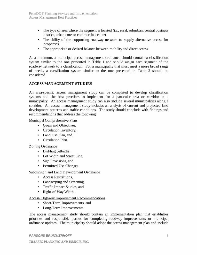
• The type of area where the segment is located (i.e., rural, suburban, central business district, urban core or commercial center).
• The ability of the supporting roadway network to supply alternative access for properties.
• The appropriate or desired balance between mobility and direct access. At a minimum, a municipal access management ordinance should contain a classification system similar to the one presented in Table 1 and should assign each segment of the roadway network to a classification. For a municipality that must meet a more broad range of needs, a classification system similar to the one presented in Table 2 should be considered. ACCESS MANAGEMENT STUDIES An area-specific access management study can be completed to develop classification systems and the best practices to implement for a particular area or corridor in a municipality. An access management study can also include several municipalities along a corridor. An access management study includes an analysis of current and projected land development patterns and traffic conditions. The study should conclude with findings and recommendations that address the following:
Municipal Comprehensive Plans • Goals and Objectives, • Circulation Inventory, • Land Use Plan, and • Circulation Plan.
Zoning Ordinance • Building Setbacks, • Lot Width and Street Line, • Sign Provisions, and • Permitted Use Changes.
Subdivision and Land Development Ordinance • Access Restrictions, • Landscaping and Screening, • Traffic Impact Studies, and • Right-of-Way Width.
Access/Highway Improvement Recommendations • Short-Term Improvements, and • Long-Term Improvements.
The access management study should contain an implementation plan that establishes priorities and responsible parties for completing roadway improvements or municipal ordinance updates. The municipality should adopt the access management plan and include

PennDOT Planning Services and Implementation Access Management Best Practices
PARSONS BRINCKERHOFF 7
TRAFFIC PLANNING AND DESIGN, INC.
it in the land development review process. A copy should also be forwarded to PennDOT for their consideration in the review of Highway Occupancy Permits (HOP) and the design of other capital improvements in the Twelve Year Program. TRAFFIC IMPACT STUDIES Municipalities use traffic impact studies as a planning tool to determine the need and methods of implementing access management practices of adopted ordinances. A traffic impact study should be completed when thresholds, or conditions, are met based on the size of the development and its impact to adjacent access points and intersections. PennDOT Publication 282 uses the following thresholds to warrant traffic impact studies:
PennDOT recommends that a traffic impact study be required if the proposed development is expected to generate 3,000 or more vehicle trips per day (total inbound and outbound traffic) – or – the total adjoining roadway plus development traffic will exceed 1,000 vehicles per hour during the peak hour of adjacent traffic, and 100 or more of these trips are newly generated peak direction trips to or from the site. PennDOT also recommends that studies could be required if the development is expected to have a significant impact on the safety and/or traffic flow of the affected highway.
The following presents a variety of recommended thresholds from other institutions, agencies and state DOTs: Institute of Transportation Engineers (ITE):
ITE recommends that a traffic study be required if the proposed development generates 100 or more new peak one-way (inbound or outbound) trips during the peak period of the proposed development or adjacent street traffic. The following thresholds in Table 3 show typical developments and the size required to generate approximately 100 one-way trips, based on the manual Trip Generation, Sixth Edition (1997), an Institute of Transportation Engineers (ITE) Informational Report.
Table 3
ITE Typical Development Thresholds
Land Use Size of Development Single Family Detached 100 dwelling units Other Residential 185 dwelling units Commercial 26,000 square feet Restaurant 9,000 square feet Office 65,000 square feet Industrial 100,000 square feet Hotel 140 occupied rooms
ITE also recommends that studies could be required if the following conditions exist:
1. Traffic problems currently exist on surrounding roadways;

PennDOT Planning Services and Implementation Access Management Best Practices
PARSONS BRINCKERHOFF 8
TRAFFIC PLANNING AND DESIGN, INC.
2. The level of service on near-by roadways will be significantly affected; 3. Sensitivity of the adjacent areas will be impacted; or 4. Proposed access is within close proximity to other site driveways or intersections.
Chester County Planning Commission (CCPC): Table 4 presents the CCPC recommended thresholds from The Circulation Manual (1993) for any development that accesses an arterial or collector road:
Table 4 CCPC Recommended Thresholds
Land Use Size of Development Single Family Detached 45 dwelling units Other Residential 80 dwelling units Commercial 10,000 square feet Restaurant/Convenience Store 2,000 square feet Office 17,000 square feet Industrial 50,000 square feet Institutional 30,000 square feet
CCPC also recommends a traffic impact study be required for any development that intends to access a local road and includes the following conditions:
• Any non-residential or non-agricultural uses; • More than 45 single family detached dwelling units with one access point; • More than 80 dwelling units for all other residential uses with one access point; or • Any residential use generating more than 100 total peak hour trips.
CCPC recommends that a traffic impact study could also be required if one of the following conditions are met:
1. Any combination of uses that will generate more than 1,500 vehicle trips per day; 2. The proposed development is located near roadways, or intersections that are
already heavily congested or are operating at or below a level of service D; 3. The proposed development will impact roadways that have been identified as
having inadequate or unsafe circulation or stopping distances; 4. The proposed driveway is within close proximity (less than 200 feet) to an existing
or proposed medium or high volume (over 750 average daily traffic) driveway or intersection; and
5. Traffic from the development would be significant enough to change the designated functional classification of a roadway.
PennDOT Planning Services and Implementation Access Management Best Practices
PARSONS BRINCKERHOFF 9
TRAFFIC PLANNING AND DESIGN, INC.
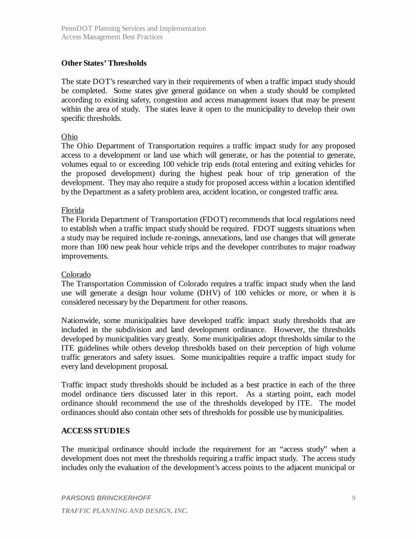
Other States’ Thresholds The state DOT’s researched vary in their requirements of when a traffic impact study should be completed. Some states give general guidance on when a study should be completed according to existing safety, congestion and access management issues that may be present within the area of study. The states leave it open to the municipality to develop their own specific thresholds. Ohio The Ohio Department of Transportation requires a traffic impact study for any proposed access to a development or land use which will generate, or has the potential to generate, volumes equal to or exceeding 100 vehicle trip ends (total entering and exiting vehicles for the proposed development) during the highest peak hour of trip generation of the development. They may also require a study for proposed access within a location identified by the Department as a safety problem area, accident location, or congested traffic area. Florida The Florida Department of Transportation (FDOT) recommends that local regulations need to establish when a traffic impact study should be required. FDOT suggests situations when a study may be required include re-zonings, annexations, land use changes that will generate more than 100 new peak hour vehicle trips and the developer contributes to major roadway improvements. Colorado The Transportation Commission of Colorado requires a traffic impact study when the land use will generate a design hour volume (DHV) of 100 vehicles or more, or when it is considered necessary by the Department for other reasons. Nationwide, some municipalities have developed traffic impact study thresholds that are included in the subdivision and land development ordinance. However, the thresholds developed by municipalities vary greatly. Some municipalities adopt thresholds similar to the ITE guidelines while others develop thresholds based on their perception of high volume traffic generators and safety issues. Some municipalities require a traffic impact study for every land development proposal. Traffic impact study thresholds should be included as a best practice in each of the three model ordinance tiers discussed later in this report. As a starting point, each model ordinance should recommend the use of the thresholds developed by ITE. The model ordinances should also contain other sets of thresholds for possible use by municipalities. ACCESS STUDIES The municipal ordinance should include the requirement for an “access study” when a development does not meet the thresholds requiring a traffic impact study. The access study includes only the evaluation of the development’s access points to the adjacent municipal or

PennDOT Planning Services and Implementation Access Management Best Practices
PARSONS BRINCKERHOFF 10
TRAFFIC PLANNING AND DESIGN, INC.
state maintained roadway. The access study should evaluate the appropriate best practices for access management from tier one including:
• Driveway spacing standards; • Signalized intersection spacing; • Left turn lanes; • Acceleration lanes; • Deceleration/right turn lanes; • Driveway radius; • Driveway width; • Driveway throat length; • Driveway profile; • Safe sight distance; and • Corner clearance.
ACCESS MANAGEMENT BEST PRACTICES The project team has compiled this inventory of access management best practices for consideration in the development of model ordinances for municipalities in Pennsylvania. Each access management practice includes:
1) Advantages to implementation, 2) Obstacles to implementation, 3) General design guidelines, and 4) Current PennDOT standards.
It should be noted that PennDOT is currently in the process of revising the Pennsylvania Code, Title 67 Transportation, Chapter 441 Access to and Occupancy of Highways by Driveways and Local Roads. This process has been ongoing for a number of years and there is no definite timeframe for completion at this time. Those practices that are known to be under revision have been noted. Other practices are presented as they are currently found in Chapter 441 regulations. The Access Management Manual, published by the Transportation Research Board of the National Academies (2003) provided all figures in this report, with the exception of Figure 3 “Intersection and Safe Stopping Sight Distance”, which is a modification of PennDOT Form 950 revised by Engineering District 8-0. The best access management practices have been categorized into three tiers based on ease of implementation, schedule to achieve desired outcomes, and the level of coordination required between the municipality, property owners and the state. Within each tier, the access management best practices are either transportation or land use related. The organization of the practices into three tiers will assist in the development of the model
PennDOT Planning Services and Implementation Access Management Best Practices
PARSONS BRINCKERHOFF 11
TRAFFIC PLANNING AND DESIGN, INC.
ordinances in the later stages of the project. The access management best practices have been categorized relative to the following tier descriptions:
Tier 1: The practices included in this tier are those that involve one driveway, intersection or property. These practices can be implemented during the land development approval process and require coordination among the municipality, property owner and, if appropriate, PennDOT. The land use practices can be implemented through minor changes to existing municipal ordinances. The practices included in this tier are generally the easiest to implement because they cost less, take less time to implement and require the least amount of coordination between the property owner, municipality and PennDOT.
Tier 2: The practices placed in this tier include those that involve multiple driveways, intersections or properties. The practices in this tier can be implemented during the land development approval process, but they could require a higher level of coordination between the municipality, multiple property owners and PennDOT. Some of the practices could require implementation through multiple land development approvals. The land use practices may require substantial changes to existing municipal ordinances. The practices in this tier can be more costly and require a longer period of time to implement than the practices in Tier 1, due to the participation of multiple property owners.
Tier 3: The practices included in this tier involve multiple driveways, intersections and properties; however, these practices cover a much larger corridor or area. Some practices may require the highest degree of coordination between property owners, the municipality and PennDOT. In most situations, the transportation-related practices would require capital funding for implementation. These types of practices could require years to fully implement. The land use practices would require substantial changes to existing municipal ordinances and, in some instances, separate ordinances. These practices are more expensive, require much higher levels of coordination between stakeholders and much more time to implement than Tier 1 and 2 practices.
The three tiers of model access management ordinances will be developed in an all-inclusive manner as a Tier 2 ordinance would include all the best practices that would be contained in a Tier 1 ordinance, and a Tier 3 ordinance would include all the best practices from Tier 1 and Tier 2 ordinances. The following sections list the best practices according to the tiers described above.

PennDOT Planning Services and Implementation Access Management Best Practices
PARSONS BRINCKERHOFF 12
TRAFFIC PLANNING AND DESIGN, INC.
Tier 1 Access Management Practices Regulation of Parcel Dimensions Description: The regulation of lot size and dimensions including frontage,
setbacks, and prohibition of irregular lot shapes such as flag lots.
Advantages to Implementation: The regulation of lot size and dimensions is critical to implementing proper access management practices such as corner clearance, driveway location and spacing, and right-of-way preservation.
Obstacles to Implementation: Property owners may oppose perceived over-regulation of their property. Some may take the position that the government should not regulate the subdivision of their land for development purposes.
General Design Guidelines: Greater lot frontage requirements allow for greater spacing between driveways. Set back requirements should allow adequate area for the future improvement or widening of the corridor. Minimum lot size is particularly important for corner lots at intersections. Greater lot sizes at intersections allow driveways to be located outside the corner clearance area of the intersection.
PennDOT Standard: None. Driveway Spacing Standards Description: Driveway spacing is the distance between two driveways.
States and TRB have diverse definitions of driveway spacing. For example, Iowa DOT defines it as the distance from centerline to centerline between two driveways. TRB defines driveway spacing as the distance from outside curb line of the first driveway throat to the inside curb line of the next driveway throat. Some states define it as inside edge to inside edge while others measure from the end of radius of one driveway to the beginning of the radius of the next driveway. It is important that the definition of driveway spacing creates a tangent distance between the end of the radius of one driveway and the beginning of the turning radius at the next driveway. Without such a requirement, a radius from one driveway could tie into the radius of an adjacent driveway using the other definitions.
Advantages to Implementation: Standards reduce the number of access locations a motorist must monitor at one time. Adequate driveway spacing allows
PennDOT Planning Services and Implementation Access Management Best Practices
PARSONS BRINCKERHOFF 13
TRAFFIC PLANNING AND DESIGN, INC.
greater speeds for through traffic, reduces the number of potential conflict points and helps preserve the capacity of the roadway.
Obstacles to Implementation: Driveway spacing is difficult to implement in areas that are already developed, such as in commercial areas or corridors. It is also difficult to implement this practice when there are no supporting land use regulations governing lot frontage or dimensions.
General Design Guidelines: The driveway spacing standards vary from state to state. The spacing standards should be related to the classification and speed of the roadway. The higher the roadway classification, the greater the spacing requirement for the classification. Principal arterial roadways would be the most restrictive, whereas a local road would be the least. High volume generators are typically given at least two driveways. New driveways should be aligned with driveways and intersections on the opposite side of the roadway, wherever feasible.
Another tool that is used by some municipalities to reduce the number of driveways on primary roads is to require that access be obtained from local roads instead of arterial roads where the property has access to both types of roadways.
PennDOT Standard: Pennsylvania Code, Title 67, Chapter 441. According to Chapter 441, multiple driveways serving the same property (non-residential) must be spaced a minimum of 15 feet apart (measured along the right-of-way line) and 20 feet apart (measured along shoulder, curb, or ditch line). For all uses, diagrams show this distance as being measured from the end of one radius to the beginning of the one at the next driveway. Although not specifically defined for all uses, fuel station diagrams show a tangent distance of 10 feet from the radius to a neighboring property line. As written, standards for driveway spacing along the same property line are more restrictive than along neighboring properties.
PennDOT requires that no portion of any access including its turning radius can extend across a property line. This means that the driveways can be spaced so that the radius of one driveway ties into the radius of another driveway.
If the Department anticipates that a property may be subdivided and that such subdivision will result in an unacceptable number or arrangement of driveways, the Department may require the property owner to enter into an access covenant prior to the issuance of a highway occupancy

PennDOT Planning Services and Implementation Access Management Best Practices
PARSONS BRINCKERHOFF 14
TRAFFIC PLANNING AND DESIGN, INC.
permit that restricts the number and location of future driveways.
Signalized Intersection Spacing Description: The distance between two signalized at-grade intersections,
measured centerline to centerline.
Advantages to Implementation: Adequate separation distance between signalized intersections is necessary to prevent queues from one intersection extending into, or otherwise influencing operations at an adjacent intersection. Furthermore, uniform spacing of traffic signals provides better traffic flow progression. Limiting the number of traffic signals in a corridor also reduces the number of locations where queuing of vehicles may obstruct turning movements from driveways or side streets.
Obstacles to Implementation: Traffic signal spacing can be difficult to implement in established commercial areas. In these areas, it is not always feasible to implement uniform spacing. Mid-block high volume driveways may require a signal for efficient ingress and egress movements. These driveways often break the uniform spacing. Spacing standards are difficult to retrofit along developed commercial corridors where traffic signals are often closely spaced. In these situations, the municipality would have to complete an engineering study for each signalized intersection to determine if the signal can be removed to meet uniform spacing standards. There are also many offset t-intersections on major corridors in Pennsylvania that require signalization. The offset between these separate signalized intersections can be as little as 200 feet. Thus, spacing standards are difficult to retrofit, unless the intersections are reconstructed.
General Design Guidelines: Traffic signal spacing standards are a function of the cycle length of the traffic signal, and the desired travel speed. The Access Management Manual, published by TRB states that traffic signal spacing at half-mile intervals is generally desirable. Optimum and uniform signal spacing is essential for efficient progression and appropriate speeds.
PennDOT Standard: None.
PennDOT Planning Services and Implementation Access Management Best Practices
PARSONS BRINCKERHOFF 15
TRAFFIC PLANNING AND DESIGN, INC.
Left Turn Lanes Description: A left turn lane is an auxiliary lane used exclusively for left
turn movements. Left turn lanes are usually provided for either a high left turn volume into a driveway or side street, or when a combination of left turn volumes and high through volumes cause long delays.
Advantages to Implementation: A left turn lane allows turn movements to be removed from the through lanes, reducing the delay for the through movement. This separation of traffic movements also increases the capacity of an intersection or arterial and reduces rear end crashes.
Obstacles to Implementation: Left turn lanes may require substantial right-of-way acquisition, and involve the reconstruction of a considerable length of roadway in order to provide the appropriate transitions and lane shift tapers. In developed areas, right-of-way acquisition can be difficult and very expensive because structures may be located within the required right-of-way.
General Design Guidelines: ITE recommends that at high-speed rural intersections, left turn lanes should be provided for safety reasons, whether or not warrants are satisfied. The length of left turn lanes should accommodate the 95th percentile queue and provide adequate distance for deceleration into the lane. However, the length of left turn lanes can be restricted by topography and existing land uses.
PennDOT Standard: AASHTO recommends using HRR 211 for unsignalized intersections and the Highway Capacity Manual (HCM) for signalized intersections. PennDOT is currently developing new standards for left turn lanes at signalized intersections.
Acceleration Lanes Description: An acceleration lane is an auxiliary lane at a side street or
driveway that enables vehicles entering the main roadway to increase speed to enter the flow of traffic with little disruption to the through traffic.
Advantages to Implementation: Acceleration lanes allow vehicles from an access point to merge near or at the same speed as the through traffic. For limited access highways and some principal arterials, acceleration lanes are critical for maintaining smooth traffic flow, and for minimizing disruption caused by entering traffic.

PennDOT Planning Services and Implementation Access Management Best Practices
PARSONS BRINCKERHOFF 16
TRAFFIC PLANNING AND DESIGN, INC.
Obstacles to Implementation: Drivers typically do not use acceleration lanes correctly along collector roads, local roads and most minor arterials. In most cases, when entering the flow of traffic, drivers will wait at the driveway for a gap in the through traffic and turn right without using the acceleration lane. They are also difficult to retrofit due to potential right-of-way constraints.
General Design Guidelines: Acceleration lanes consist of a taper and acceleration length. Generally, long tapers enhance the function of an acceleration lane. Acceleration lanes should be implemented during the land development approval process.
PennDOT Standard: AASHTO standards. PennDOT is developing new standards for auxiliary turn lanes at signalized intersections.
Deceleration/Right Turn Lanes Description: A deceleration lane is an auxiliary lane that enables vehicles to
decrease speed before turning right into a driveway or side street.
Advantages to Implementation: Deceleration lanes separate vehicles slowing to make a right turn from through traffic. They allow the right turns to be completed without impeding the travel speed of through traffic. These lanes can also reduce rear end crashes and increase capacity at an intersection or driveway.
Obstacles to Implementation: Deceleration lanes can be difficult to retrofit due to right-of-
way acquisition and constraints. Continuous right-turn lanes should be avoided because they can be confused for an additional through lane. For roadways that have a bicycle lane, conflict points are created at the point vehicles must merge into the right-turn lane.
General Design Guidelines: Deceleration and right-turn lanes consist of a taper, deceleration length and storage length. Generally, long tapers enhance the function of a deceleration lane. The application of standards is related to the driveway use and classification of the road being accessed.
PennDOT Standard: Some PennDOT Districts use AASHTO standards for interchanges while others use empirically-developed guidelines. Taper lengths are generally 75 to 200 feet long, depending on speed. A lane width of 14 feet is recommended where curbing exists, and a lane width of 12 feet is recommended where no curbing exists. PennDOT is developing new standards for auxiliary turn lanes at signalized intersections.

PennDOT Planning Services and Implementation Access Management Best Practices
PARSONS BRINCKERHOFF 17
TRAFFIC PLANNING AND DESIGN, INC.
Driveway Radius Description: The driveway radius (often referred to as the turning radius)
is a paved adjustment between the edge of the main roadway, and the edge of a driveway that facilitates right-turn movements in or out of a driveway (Figure 1).
Figure 1 – Driveway Design Elements
Advantages to Implementation: Large turning radii allow for easier ingress and egress
maneuvers. Very large turning radii can be used to increase entry speeds where deceleration lanes are not feasible. Large radii are relatively easy to retrofit.
Obstacles to Implementation: A small radius may make entering a driveway more difficult and cause the entering vehicle to slow down or almost stop upon entering. Thus, improperly designed radii can affect the speed and capacity of through traffic on the adjacent roadway. Improper radii can cause large trucks to complete their turning movement in the opposing lane of traffic on the driveway or main road. Larger radii can also increase the distance for pedestrians to cross a driveway. Improvements to existing driveways or streets may require utility and signal equipment relocation.
General Design Guidelines: A driveway radius should be designed for the largest vehicle, including public transportation vehicles, expected to use the

PennDOT Planning Services and Implementation Access Management Best Practices
PARSONS BRINCKERHOFF 18
TRAFFIC PLANNING AND DESIGN, INC.
driveway on a daily basis. The speed and grade of the adjacent roadway are also considerations.
• Typical commercial driveway radii are 30 to 60 feet. • Typical residential driveway radii are 10 to 30 feet.
PennDOT Standard: Pennsylvania Code, Title 67, Transportation, Chapter 441. A range of design criteria are recommended based on the classification of the driveway. The classification of the roadway being accessed is not considered. Driveway radii cannot encroach on the adjacent property frontage.
Driveway Throat Width Description: The narrowest dimension of a driveway measured
perpendicular to the driveway centerline (Figure 1).
Advantages to Implementation: Wider driveways can provide better on-site circulation and facilitate turning movements when the proper turning radii cannot be provided.
Obstacles to Implementation: If driveways have excessive width, a driver may become confused on where to position the vehicle for ingress and egress movements. Also, pedestrians must walk a greater distance to cross the driveway exposing them longer to vehicular traffic.
General Design Guidelines: Non-commercial driveways should have a width between 10 feet and 24 feet. Commercial driveways vary from a minimum of 10 to 16 feet wide in one direction to a maximum of two inbound or three outbound lanes (10 to 12 feet each). In areas where public transportation service exists, throat widths should be designed to accommodate simultaneous two-way traffic by passenger vehicles and buses.
PennDOT Standard: Pennsylvania Code, Title 67, Transportation, Chapter 441. A range of design criteria for widths is recommended based on the classification of the driveway. The classification of the intersecting adjacent roadway is not considered.
Driveway Throat Length Description: The distance along a driveway from the edge of the travel
lane on the intersecting street to the first interior intersection (Figure 1).
Advantages to Implementation: Adequate throat length for a driveway permits vehicles to exit the roadway without immediately encountering conflicts created by an internal intersection. Immediate conflicts can

PennDOT Planning Services and Implementation Access Management Best Practices
PARSONS BRINCKERHOFF 19
TRAFFIC PLANNING AND DESIGN, INC.
cause successive entering vehicles to queue onto the roadway. Adequate throat length also provides sufficient space for queuing of exiting vehicles, particularly at signalized driveways.
Obstacles to Implementation: The retrofit of throat lengths would result in reconstruction costs for a property owner. Lengthy driveway throats can decrease the amount of available parking for commercial uses and create complicated internal circulation patterns.
General Design Guidelines: Traffic volumes, type of vehicles and queues are the primary considerations for the design of driveway throat lengths. The proper throat length for a driveway should be determined during the land development approval process.
PennDOT Standard: Design criteria are based on the classification of the driveway. Medium use driveways require a minimum driveway throat length of 120 feet. A high volume use driveway requires a minimum length of 150 feet.
Driveway Profile Description: The change in grade between the roadway cross slope, and
the slope of a driveway (Figure 2).
Figure 2 – Driveway Profile Advantages to Implementation: A properly designed profile allows for more efficient and safe
entry and exit from the driveway. It allows vehicles to complete a smooth 90-degree turning maneuver without a “bottoming” out of the vehicle against the pavement.
Obstacles to Implementation: Parcels with topographical constraints and limited property frontage could incur significant construction costs.
General Design Guidelines: Design guidelines must consider the types of vehicles that will use the driveway. Abrupt changes in grade should be avoided.
PennDOT Standard: Pennsylvania Code, Title 67, Transportation, Chapter 441. PennDOT has grading requirements for driveways. In

PennDOT Planning Services and Implementation Access Management Best Practices
PARSONS BRINCKERHOFF 20
TRAFFIC PLANNING AND DESIGN, INC.
general, the initial change in grade cannot be greater than eight percent. Subsequent changes in grade vary according to the driveway classification.
Safe Sight Distance Description: The distance required for drivers to safely make a left turn or
right turn from a driveway or intersecting roadway , or for a driver to safely make a left turn from a roadway into a driveway (Figure 3).
Figure 3 – Intersection and Safe Stopping Sight Distance
Advantages to Implementation: Adequate sight distance ensures that drivers can safely enter
or exit a driveway or intersecting roadway. It is critical that safe sight distance requirements are met for the safe operation of vehicles at driveways or access road intersections.
Obstacles to Implementation: The cost of constructing some driveways can be expensive when the parcel has limited frontage and topographic

PennDOT Planning Services and Implementation Access Management Best Practices
PARSONS BRINCKERHOFF 21
TRAFFIC PLANNING AND DESIGN, INC.
constraints. Sight distances may be limited by pedestrian, public transportation and bicycle facilities because vehicles are required to stop behind crosswalks, bicycle lanes and bus stops. If improvements are needed on adjacent properties to achieve minimum sight distance standards, easements are typically needed from the adjacent property owners.
General Design Guidelines: Safe stopping sight distance requirements should address left turning vehicles entering driveways as well as left and right turning vehicles exiting from the driveway. Guidelines should address how sight distance measurements should be taken and applied at the location of the proposed driveway.
PennDOT Standard: PennDOT Publications 201, 282 and 441 contain sight distance requirements. PennDOT’s minimum requirements for sight distance are based on the Minimum Safe Stopping Sight Distance formula. Guidelines should not only address required sight distance, but also how measurements at prospective driveways or access road intersections should be conducted.
Corner Clearance Alternate Name: Driveway Setback. Description: Corner clearance is the distance along a roadway between an
intersecting street and the first driveway. Figure 4 illustrates upstream corner clearance.
Figure 4 – Upstream Corner Clearance
Advantages to Implementation: Corner clearance minimizes driveway-intersection conflicts
and provides a greater distance for vehicles to merge into through traffic. It also reduces the chance of confusion as to where a vehicle with a right-turn signal is turning.

PennDOT Planning Services and Implementation Access Management Best Practices
PARSONS BRINCKERHOFF 22
TRAFFIC PLANNING AND DESIGN, INC.
Obstacles to Implementation: Depending upon the location of the property frontage, upstream queues may extend past the minimum driveway spacing or property frontage. Topography may dictate the location of driveway to achieve acceptable sight distances. Irregular lot frontages may dictate the location of the access point rather than the corner clearance standard. The restriction of turning movements that provide direct access to commercial uses at the corner of an intersection may create an economic hardship for the business owner.
General Design Guidelines: Corner clearance, at a minimum, should be equal to or greater than driveway spacing standards. On high volume or high-speed roadways, a longer corner clearance is preferable. It is undesirable for driveways to be located within the functional area of an intersection. The functional area includes all areas where separate turn lanes exist. Preferably, driveways on a corner property should be located on the minor street or as close to the property line farthest from the intersection as is possible.
PennDOT Standard: Pennsylvania Code, Title 67, Transportation, Chapter 441. Driveways adjacent to intersections are subject to the following requirements: • A minimum 10-foot tangent distance between a highway
intersection radius and first driveway radius. • Distance from the edge of pavement of the intersecting
highway to the radius of the first permitted driveway shall be a minimum of 20 feet on curbed highways and 30 feet on uncurbed highways.
• Access to corner lots may be restricted to only that roadway which can more safely accommodate traffic.
Driveway Channelization Description: Raised channelization islands are used at a driveway’s
intersection with a public road when it is necessary to prohibit or restrict left turn movements into or out of the driveway. The practice can be used to restrict driveway movements to right-in/right-out, right-in/right-out and left-in, or right-in/right-out and left-out on undivided roadways or roadways without a median.
Advantages of Implementation: The restriction of left turns into a driveway may reduce
interruptions to through traffic on major roadways. Restrictions are an effective measure for corner lots at intersections, because they eliminate left turning movements

PennDOT Planning Services and Implementation Access Management Best Practices
PARSONS BRINCKERHOFF 23
TRAFFIC PLANNING AND DESIGN, INC.
within the functional area of the intersection. Channelizing islands are a less controversial access management practice to restrict left turns at high volume driveways than medians. Islands provide a refuge area for pedestrians crossing high volume driveways.
Obstacles to Implementation: Channelizing islands can be controversial when recommended for commercial uses because they place a restriction on a direct access movement into the business. Often times, a driver can make prohibited movements with relative ease despite the channelization island. Thus, enforcement at the local level can be important for successful implementation.
General Design Guidelines: AASHTO recommends a minimum island size of 75 square feet in most cases. Mountable curbs are often used to enable easy access for emergency response vehicles. Proper signage is needed to indicate the prohibited movements and minimize violations.
PennDOT Standard: Pennsylvania Code, Title 67, Transportation, Chapter 441. If sight distance requirements cannot be met, the Department may prohibit left turns by entering or exiting vehicles. A raised concrete island may be required to implement left-turn restrictions at driveways.
Tier 2 Access Management Practices Bonuses and Incentives Description: A municipality can relax density, height, open space, parking,
signage and other restrictions if a developer agrees to incorporate access management practices into the site development.
Advantages to Implementation: Bonuses and incentives provide the municipality with a negotiating tool to implement access management practices such as shared driveways, single access points, frontage roads and internal access to outparcels.
Obstacles to Implementation: Surrounding property owners may oppose bonuses or
incentives for a particular development that is under consideration.

PennDOT Planning Services and Implementation Access Management Best Practices
PARSONS BRINCKERHOFF 24
TRAFFIC PLANNING AND DESIGN, INC.
General Design Guidelines: Careful consideration must be given to granting bonuses and incentives. Increased densities and building heights must blend with the existing character of the community. Relaxation of parking requirements in certain instances may create internal circulation problems if the parking demand far exceeds the reduced supply. Relaxation of open space requirements must fit into the overall conservation plan of the municipality.
PennDOT Standard: None. Right-of-way Preservation Description: The acquisition of an area of land through purchase,
dedication or easement needed to accommodate the future widening of a roadway (Figure 5).
Figure 5 – Right-of-way Preservation
Advantages to Implementation: The acquisition of right-of-way well in advance of needed
improvements can help reduce overall project costs. The acquisition of right-of-way can be done much more efficiently by the municipality than the state.
Obstacles to Implementation: The acquisition of right-of-way must be completed on a property-by-property basis, which can take a considerable amount of time. Negotiations with property owners over “fair market value” of land can be contentious and time consuming.
PennDOT Planning Services and Implementation Access Management Best Practices
PARSONS BRINCKERHOFF 25
TRAFFIC PLANNING AND DESIGN, INC.
General Design Guidelines: Adequate building setback standards are essential to the preservation of right-of-way for future roadway improvements. The acquisition of right-of-way can be implemented through the designation of ultimate right-of-ways in the municipal subdivision and land development ordinance. The ultimate right-of-way is the area of land beyond the dedicated or legal right-of-way needed to accommodate the future widening of a roadway. The ultimate right-of-way varies based on the functional classification of the roadway. Ultimate right-of-ways should be based on a full build-out of the municipality.
PennDOT Standard: None. The state highway law once had a provision for ultimate right-of-way, but it was declared unconstitutional by the Pennsylvania Supreme Court. Some municipalities contain provisions in ordinances for ultimate right-of-way. However, the MPC does not contain any provisions permitting its use by municipalities.
Median Acceleration Lanes Description: An auxiliary lane located in the median area or shadow
opposite of a left turn lane that enables left turning vehicles from a driveway at a t-intersection to cross one direction of traffic to a “safe haven” area and then merge into the other direction of traffic.
Advantages to Implementation: For driveways at t-intersections that do not meet traffic signal warrants, median acceleration lanes can improve the capacity because vehicles turning left from the driveway only have to wait for a gap in one direction of traffic at a time on the main street.
Obstacles to Implementation: Median acceleration lanes at unsignalized, four-way intersections can create confusing conflict points. Median acceleration lanes may require right-of-way acquisition from adjacent property owners.
General Design Guidelines: A median acceleration lane at a t-intersection can serve as an interim measure before a fourth leg and signalization is added. The median acceleration lane can be converted into a left turn lane to the fourth leg. The lanes should be signed and marked properly to ensure correct use and avoid confusing turning movements.
PennDOT Standard: None.
PennDOT Planning Services and Implementation Access Management Best Practices
PARSONS BRINCKERHOFF 26
TRAFFIC PLANNING AND DESIGN, INC.
Shared Driveways Alternate Names: Joint access, cross access.
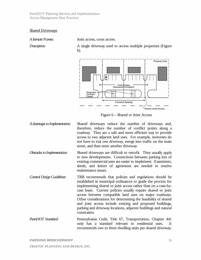
Description: A single driveway used to access multiple properties (Figure 6).
Figure 6 – Shared or Joint Access
Advantages to Implementation: Shared driveways reduce the number of driveways and,
therefore, reduce the number of conflict points along a roadway. They are a safe and more efficient way to provide access to two adjacent land uses. For example, motorists do not have to exit one driveway, merge into traffic on the main street, and then enter another driveway.
Obstacles to Implementation: Shared driveways are difficult to retrofit. They usually apply to new developments. Connections between parking lots of existing commercial uses are easier to implement. Easements, deeds, and letters of agreement are needed to resolve maintenance issues.
General Design Guidelines: TRB recommends that policies and regulations should be established in municipal ordinances to guide the process for implementing shared or joint access rather than on a case-by-case basis. Current policies usually require shared or joint access between compatible land uses on major roadways. Other considerations for determining the feasibility of shared and joint access include existing and proposed buildings, parking and driveway locations, adjacent buildings and natural constraints.
PennDOT Standard: Pennsylvania Code, Title 67, Transportation, Chapter 441 only has a standard relevant to residential uses. It recommends two to three dwelling units per shared driveway.

PennDOT Planning Services and Implementation Access Management Best Practices
PARSONS BRINCKERHOFF 27
TRAFFIC PLANNING AND DESIGN, INC.
If a driveway serves more than three properties it is classified as a local road. In some cases, access covenants (discussed under driveway spacing) leads to the implementation of shared driveways.
Internal Access to Outparcels Description: Internal access consists of an on-site circulation system that
serves the out parcels, as well as the interior development. Requirements for internal access are most applicable to shopping centers and office parks.
Advantages to Implementation: Internal access reduces the number of direct access points on major roadways in commercial and employment areas, thus reducing the number of conflict points. The reduction in the amount of driveways along the property frontage also creates more areas for landscaping to improve the aesthetics of the corridor. Figure 7 indicates a unified access, while Figure 8 indicates the numerous conflict points that are created by not having unified access.
Figure 7 – Unified Access Figure 8 – Numerous Access Points Obstacles to Implementation: Property owners may avoid internal access requirements by
individually selling out parcels. Some owners of out parcels may lobby for direct access to the roadway.
General Design Guidelines: TRB recommends that proposed developments under the same ownership, phased development plans, or properties consolidated for development should be considered one property. The regulations should require that all access to out parcels be internalized using the main access point of the principal use. Compatible building setback requirements are critical to designing a safe and efficient internal circulation system. If the building setbacks are too large, they can limit
PennDOT Planning Services and Implementation Access Management Best Practices
PARSONS BRINCKERHOFF 28
TRAFFIC PLANNING AND DESIGN, INC.
the design options for acceptable internal circulation. The internal access system must be signed properly to help direct drivers to the out parcels.
PennDOT Standard: Normally, not more than two driveways will be permitted for a commercial use. An additional driveway is permitted if the property frontage exceeds 600 feet. Therefore, separate access points can be provided to out parcels when one entity owns the entire site.
Driveway Spacing From Interchange Ramps Description: Minimum distance between the end of an acceleration lane or
beginning of a deceleration lane to the first permitted driveway or side street.
Advantages to Implementation: Proper interchange area management reduces the conflicts between merging traffic from interchange ramps and traffic entering or exiting from driveways. Minimum distance requirements provide adequate distance for traffic merging from ramps to avoid traffic queues from the nearest intersection and to enter left turn lanes.
Obstacles to Implementation: Properties with lot frontage entirely within the minimum
spacing distance must gain access through other properties. These properties may require a waiver from the standards.
General Design Guidelines: NCHRP Report 420 recommends that an unsignalized access be located at least 750 feet from an interchange ramp, and that a signalized access be located one half mile or greater from the terminus of an interchange ramp. The minimum spacing standards can be maintained in some instances through the acquisition and preservation of limited access right-of-way. Traffic control measures at ramp termini should be carefully analyzed when the desired spacing between driveways and interchange ramps cannot be provided.
PennDOT Standard: Pennsylvania Code, Title 67, Transportation, Chapter 441 recommends a minimum distance of 50 feet between the terminus of interchange ramps and access points.
Frontage Roads Description: A roadway that runs parallel to an arterial between the right-
of-way of the major roadway, and the property and building
PennDOT Planning Services and Implementation Access Management Best Practices
PARSONS BRINCKERHOFF 29
TRAFFIC PLANNING AND DESIGN, INC.
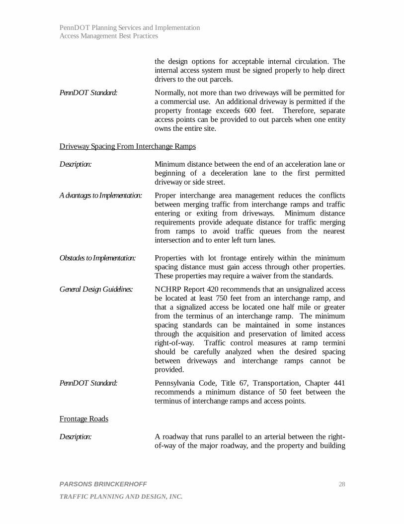
set back line, as indicated in Figure 9. It provides access to multiple properties.
Figure 9 – Frontage Road
Advantages to Implementation: Frontage roads service multiple driveways thus minimizing
the number of access points on an arterial. They separate local traffic from high speed through traffic. Furthermore, businesses are still visible from the major roadway. It is an effective access management tool in undeveloped areas.
Obstacles to Implementation: Frontage roads could require a significant donation of right-of-way by multiple property owners. Short spacing between the intersections of the connector roads and the major roadway can cause queues that extend through the intersections. These intersections have low capacity and the traffic volumes generated by a commercial development could result in severe congestion and high crash rates. Frontage roads contribute to commercial strip development rather than compact activity centers. Frontage roads are very difficult to retrofit in fully developed areas.
General Design Guidelines: AASHTO standards include a separation distance of 75 to 150 feet from the frontage road to the arterial, and 300 feet should be provided in rural areas. The separation distance includes the tangent and radii between the arterial and frontage road. For heavy traffic generators, a frontage road should be incorporated into the site circulation plan. Horizontal curves can be used to increase the distance between the intersection of a connector road and the major roadway. Best practices such as internal access to out parcels, shared driveways and shared parking can be utilized along frontage roads to help maximize their access management benefits.
PennDOT Standard: AASHTO standards and local roads in Design Manual 2 per
Pennsylvania Code, Title 67, Transportation, Chapter 441.

PennDOT Planning Services and Implementation Access Management Best Practices
PARSONS BRINCKERHOFF 30
TRAFFIC PLANNING AND DESIGN, INC.
Service Roads Description: Service roads are publicly or privately owned roadways
auxiliary to a major roadway that provides access to several non-residential parcels, as indicated in Figure 10.
Figure 10 – Service Road Advantages to Implementation: Service roads allow the development of small parcels along a
major roadway without providing access to each parcel from the major roadway. These roads can provide access to properties on either side. Service roads are often less costly than frontage roads and are easier to retrofit in developed areas.
Obstacles to Implementation: The development of several small parcels on both sides of a service road can create confusing and conflicting ingress and egress movements. For service roads that intersect a state roadway, conflicts can occur between state and local access standards.
General Design Guidelines: The distance between the major roadway and service road must be sufficient to create developable sites. A Policy on Geometric Design of Highways and Streets, AASHTO (2001) recommends an outer separation distance of 300 feet. NCHRP Report 420, “Impact of Access Management Techniques” (1999) recommends an outer separation distance of at least 300 feet on high-volume crossroads. The Institute of Transportation Engineers publication, Transportation and Land Development recommends an outer separation distance of at least 120 feet. The outer separation distance includes the tangent and radii between the major roadway and service road. Initial developments may have to be given temporary access to the major roadway until the service road is fully implemented.

PennDOT Planning Services and Implementation Access Management Best Practices
PARSONS BRINCKERHOFF 31
TRAFFIC PLANNING AND DESIGN, INC.
PennDOT Standard: AASHTO Standards. Tier 3 Access Management Practices Zoning Overlay Districts Description: An access management overlay district adds special
requirements to existing zoning districts on a corridor, intersection or interchange. The requirements of the underlying districts are retained.
Advantages to Implementation: Overlay districts can be developed to fit the unique characteristics of a particular area or corridor. They can be used as a tool to implement the goals and objectives of an access management plan.
Obstacles to Implementation: Overlay districts must be added to the municipal zoning ordinance, which typically requires the retainage of a consultant, and a public involvement process. If overlay districts are not developed properly, they can lead to complex regulations and significant administrative costs.
General Design Guidelines: The overlay district must be adopted by the governing body of the municipality and incorporated in the existing zoning ordinance. The affected area must be designated on a map and the limits described in the ordinance. The district must be large enough to ensure adequate separation of driveways from an intersection or interchange. The requirements of the overlay district are not restricted to properties with frontage along a particular roadway. The zoning overlay district can also contain provisions for safe and convenient pedestrian, bicycle and public transportation access to commercial uses.
PennDOT Standard: None. The Pennsylvania Municipalities Planning Code enables zoning overlay districts.
Official Map Description: An official map identifies the public interest and need for the
purpose of reserving lands for future public use. It can be used for the widening of existing and proposed streets, pedestrian facilities, bicycle trails and easements.
Advantages to Implementation: An official map serves as a tool to reserve right-of-way for future acquisition prior to the development of the lands that are needed for future road improvements. Structures cannot
PennDOT Planning Services and Implementation Access Management Best Practices
PARSONS BRINCKERHOFF 32
TRAFFIC PLANNING AND DESIGN, INC.
be developed within streets or roadways shown on the official map.
Obstacles to Implementation: In some instances, a review of the official map may have to be completed by adjacent municipalities, the county local authorities and other public bodies. The governing body must hold a public hearing. Some adjacent property owners may be opposed to the municipality reserving land for future expansion of the roadway network.
General Design Guidelines: The areas of land to be reserved through the official map must be consistent with the local comprehensive plan.
PennDOT Guidelines: None. The Pennsylvania Municipalities Planning Code enables the official map.
Installation of Non-traversable and Directional Medians Description: Medians can be used to reduce conflict areas by restricting
turn movements into and out of driveways that are located on an undivided highway (generally four or more lanes). Medians are designed to physically prevent left turns into a driveway or onto a side street and left and through movements from a driveway or side street. Directional medians contain breaks at key locations to provide access to a particular land use or side street (Figure 11). A separate left-turn lane is typically used at a break in the median.
Advantages to Implementation: Medians separate opposing traffic flows and reduce the conflict points created by uncontrolled turning movements. Pedestrian safety is enhanced because only one direction of traffic has to be crossed at a time. A pedestrian refuge area can be created in the median for midblock pedestrian crossings. Landscaped medians improve the aesthetics of a roadway.
Obstacles to Implementation: Medians can be cost-prohibitive depending on the width of the median, the material used, and required additional right-of-way. Medians cannot be implemented with a piecemeal approach. Typically the installation of a median in an existing corridor must be either programmed in the PennDOT Twelve Year Program. Medians are usually met with resistance in commercial areas due to the restrictions that are placed on direct access to businesses.
General Design Guidelines: Median widths vary from 4 to 18 feet or greater for a protected left-turn bay, allowing left turns into a driveway or side street.

PennDOT Planning Services and Implementation Access Management Best Practices
PARSONS BRINCKERHOFF 33
TRAFFIC PLANNING AND DESIGN, INC.
Access restrictions created by the placement of a median can be mitigated through the use of jug handles and permitting u-turns at signalized intersections. Jug handles also eliminate the need for left-turn signal phases on the main roadway (Figure 12).
PennDOT Standard: AASHTO standards.
Figure 11 – Directional Median Figure 12 – Indirect Left Turn at Opening for Left Median Opening Turns and U-turns Continuous Two-way Left Turn Lanes (TWLTL) Description: A continuous lane located between opposing traffic streams
that provides a safe refuge area for vehicles completing left turns from both directions of travel, as indicated in Figure 13.
Figure 13 – Two-way Left Turn Lane
Advantages to Implementation: TWLTLs separate left turning vehicles from the through
traffic. They are generally safer than undivided highways and increase capacity and reduce travel time for through traffic.
PennDOT Planning Services and Implementation Access Management Best Practices
PARSONS BRINCKERHOFF 34
TRAFFIC PLANNING AND DESIGN, INC.
Obstacles to Implementation: TWLTLs can cause the potential for conflicts between left turning vehicles from opposing travel streams. They do not provide a refuge area for pedestrians as opposed to medians.
General Design Guidelines: The use of TWLTLs requires careful consideration of driveway locations to prevent overlapping left turns. The construction of TWLTLs for new roadways can require significant right-of-way acquisition. In some cases, TWLTLs can be rather easily retrofitted for corridors that consist of four travel lanes. For corridors consisting of only two travel lanes, TWLTLs can be much more difficult to retrofit due to right-of-way constraints and potential impacts to existing structures and properties.
PennDOT Standard: AASHTO Standards. Many of the transportation best practices in Tiers 1, 2 and 3 can be used as retrofit techniques to improve access management for existing driveways along developed corridors. The best practices from Tier 1 would likely be implemented with the greatest ease because they would only involve one property owner. The practices from Tier 2 would be more difficult to implement because they would require cooperation among multiple property owners. The best practices from Tier 3 would be the most difficult to implement as retrofit techniques in developed areas, because they would require substantial property acquisition that could be limited by existing structures and coordination among multiple property owners. The best opportunity to retrofit existing driveways to accomplish municipal access management goals often occurs during corridor capital improvement projects. For example, if an existing arterial is planned to be widened from one to two lanes in each direction, retrofit techniques can be included in the final design of the project. Use of right-of-way preservation and the official map are the most effective land use best practices contained in the three tiers for retrofitting existing driveways or corridors because they are often the initial step in using the transportation best practices for retrofitting. NEXT STEPS The project team will identify potential legislative and policy barriers that could hinder the implementation of access management programs. Once potential barriers have been identified, the team will contact up to five states to determine how they overcame similar obstacles that allowed them to implement an access management program. The team will also survey up to 15 local governments, builders, PennDOT staff, and others to obtain perceptions of who is, or should be, principally responsible for access management initiatives and to identify any real or perceived barriers to implementation of an access management program. This input will be used to identify institutional barriers and how they can best be overcome.

PennDOT Planning Services and Implementation Access Management Best Practices
PARSONS BRINCKERHOFF 35
TRAFFIC PLANNING AND DESIGN, INC.
REFERENCES State DOTs
• Colorado State Highway Access Code • Florida State Highway System Access Management Classification System and
Standards Florida Median Opening and Access Management Decision Process • Iowa Access Management Handbook • Michigan Access Management Booklet • Missouri: A Comprehensive Process for Developing a Statewide Access
Management Program • Oregon Highway Plan – Chapter 3: Access Management • South Dakota Highway Access Control Process • Utah State Highway Access Management • New York State Department of Transportation: Best Practices in Arterial
Management
Reference Materials • Access Management Manual – TRB • Pennsylvania Municipalities Planning Code – PA DCED • Implementing a Comprehensive Access Management Program in the State of Texas
– ITE 2002 Conference Paper • Access Management on Arterial Roads – Lehigh Valley Planning Commission • Access Management Handbook – Iowa • Transportation and Land Development – ITE • Traffic Engineering Handbook – ITE • Green Book – AASHTO • Chester County Circulation Handbook • NCHRP Report 420: Impacts of Access Management Techniques • An Introduction to Access Management – Stover & Koepke