Embed Size (px)
Citation preview

Best Practices for Airport Obstruction Management
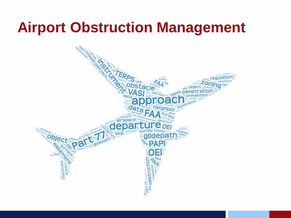
Airport Obstruction Management
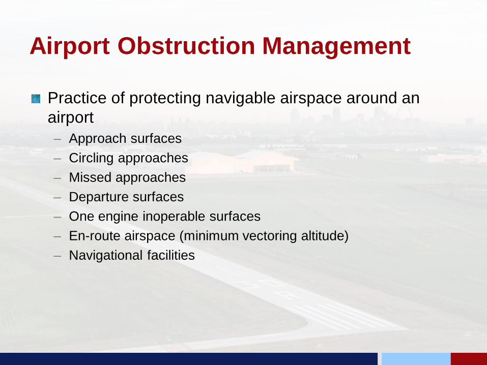
Airport Obstruction Management
Practice of protecting navigable airspace around an airport– Approach surfaces– Circling approaches– Missed approaches– Departure surfaces– One engine inoperable surfaces– En-route airspace (minimum vectoring altitude)– Navigational facilities
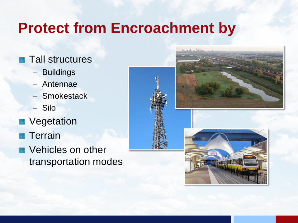
Protect from Encroachment by
Tall structures– Buildings– Antennae– Smokestack– Silo
VegetationTerrainVehicles on other transportation modes
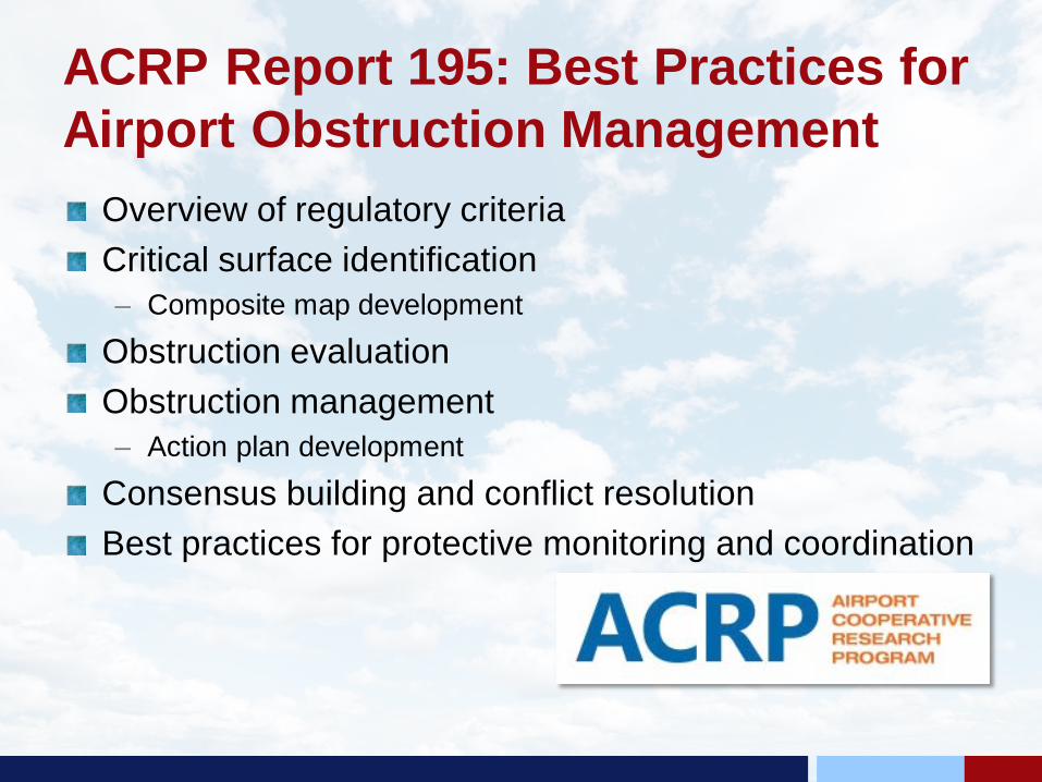
ACRP Report 195: Best Practices for Airport Obstruction Management
Overview of regulatory criteriaCritical surface identification– Composite map development
Obstruction evaluationObstruction management– Action plan development
Consensus building and conflict resolutionBest practices for protective monitoring and coordination

Object, Obstruction, Obstacle and Hazards
Object – item that protrudes into airspaceObstruction – object that upon FAA evaluation is required to be marked, lighted and identified on publicationsObstacle – object that does or would penetrate and obstacle clearance surfaceControlling Obstacle – obstacle around which a flight procedure is designedHazard to Air Navigation – an obstruction that would have a substantial adverse effect to a significant volume of aeronautical operations
Responsibility for Obstruction Management
Airport SponsorIndiana Tall Structures Act (I.C. 8-21-10)FAA can only evaluate and modify the system to maintain safety
Obstruction Management ProcessIdentify airport’s role now and futureIdentify applicable airspace surfacesCreate composite airspace surface mapIdentify lowest critical surfaceGather object data for airportEvaluate object data against airspace surfacesIdentify potential obstruction mitigation or management activitiesEngage stakeholders - build support for obstruction mitigation and managementMonitor and maintain
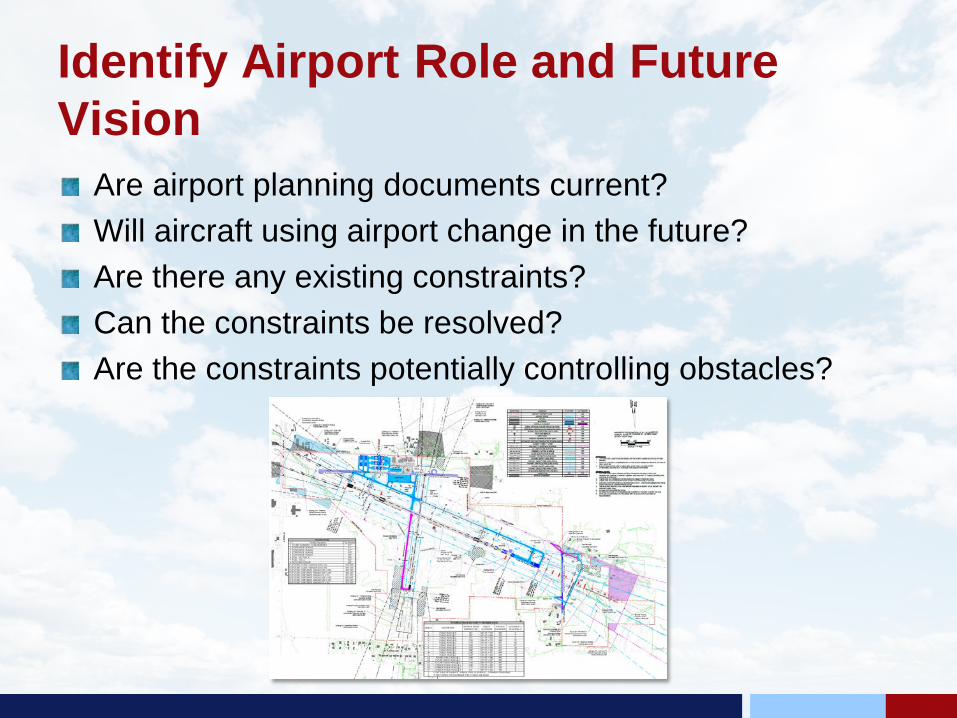
Identify Airport Role and Future Vision
Are airport planning documents current?Will aircraft using airport change in the future?Are there any existing constraints?Can the constraints be resolved?Are the constraints potentially controlling obstacles?

Identify Critical Airspace Surfaces
Identify federal regulatory and design airspace surfaces– 14 CFR Part 77 (FAR Part 77): Safe, Efficient Use and
Preservation of Navigable Airspace– FAA Advisory Circular 150/5300-13A: Airport Design– FAA Order 8260.3D: U.S. Standards for Terminal Instrument
Procedures (TERPS)Does air carrier one engine inoperable (OEI) apply?– FAA AC 120-91: Airport Obstacle Analysis and ICAO Annex 6:
Operation of AircraftIdentify any state or local regulatory or zoning surfaces
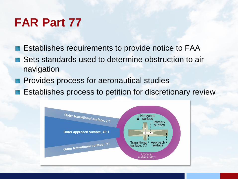
FAR Part 77
Establishes requirements to provide notice to FAASets standards used to determine obstruction to air navigationProvides process for aeronautical studiesEstablishes process to petition for discretionary review
FAA Advisory Circular 150/5300-13ASets appropriate design standards based on size of aircraft using the airportProvides threshold siting criteria and departure protectionFAA Engineering Brief 99 threshold siting criteria update
FAA Engineering Brief 91: Management of Vegetation in the Airport Environment
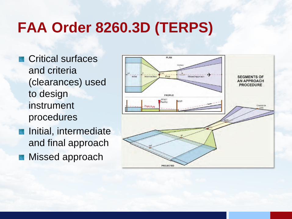
FAA Order 8260.3D (TERPS)
Critical surfaces and criteria (clearances) used to design instrument proceduresInitial, intermediate and final approachMissed approach
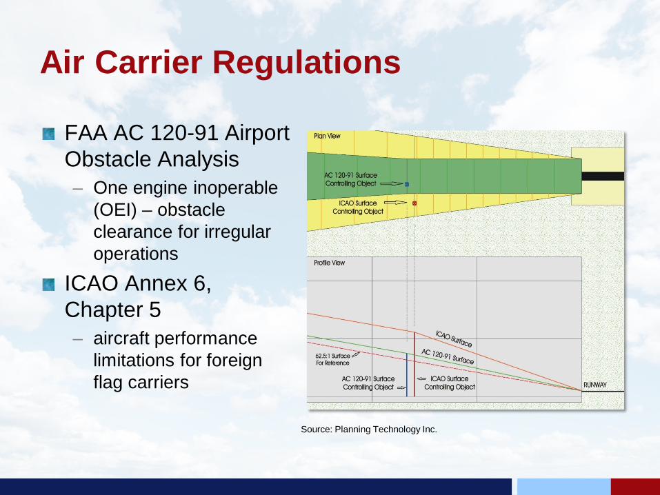
Air Carrier Regulations
FAA AC 120-91 Airport Obstacle Analysis– One engine inoperable
(OEI) – obstacle clearance for irregular operations
ICAO Annex 6, Chapter 5– aircraft performance
limitations for foreign flag carriers
Source: Planning Technology Inc.
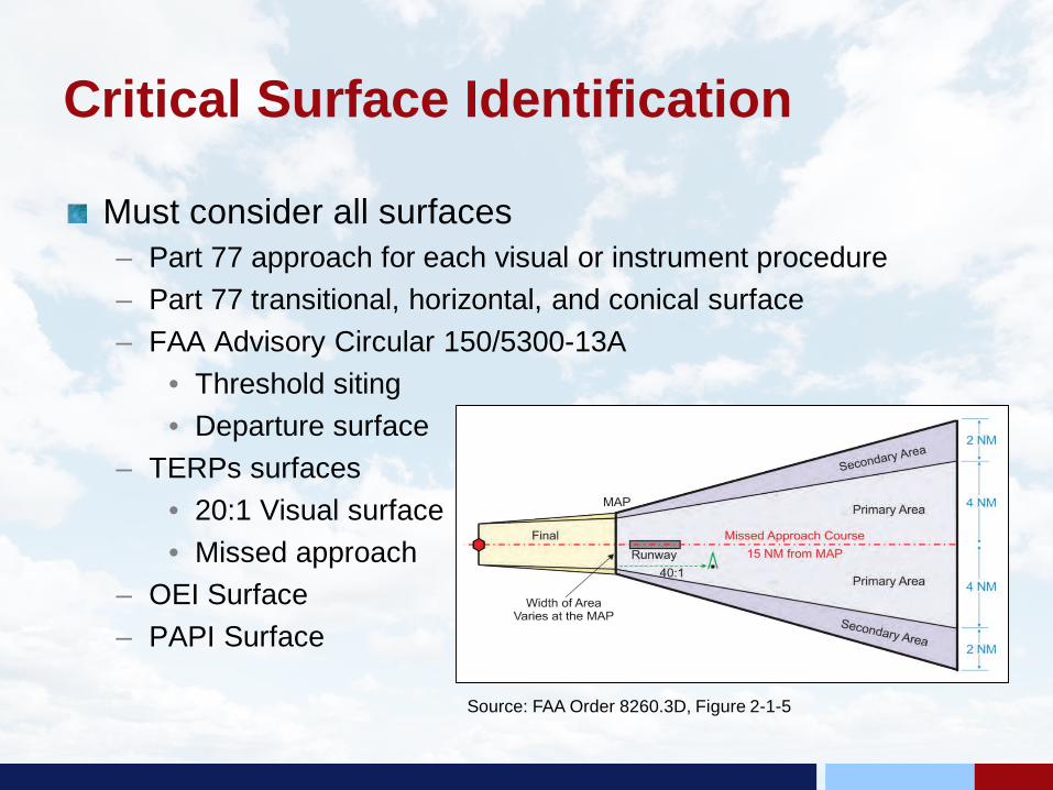
Critical Surface Identification
Must consider all surfaces– Part 77 approach for each visual or instrument procedure– Part 77 transitional, horizontal, and conical surface– FAA Advisory Circular 150/5300-13A
• Threshold siting• Departure surface
– TERPs surfaces• 20:1 Visual surface• Missed approach
– OEI Surface– PAPI Surface
Source: FAA Order 8260.3D, Figure 2-1-5

Composite Map3D model of airport’s airspaceIdentified height of desired most critical surface over any given pointConsider long-term airport build-out
Source: Planning Technology Inc.

Critical Surface Identification
Some special considerations– Utility runways
having vertically guided approaches
– Nonprecision runways with instrument departure procedures
30:1 VERTICAL GUIDANCE SURFACERUNWAY WIDTH + 200’ X 10,000’ X 1,520’

Departure Surface
Source: Planning Technology Inc.

Critical Surface Identification
Some special considerations– Misses approach
segment– Circling or offset
approaches– Step down for non-
vertically guidedapproach
– Protection of OEI surface for air carriers
Source: Planning Technology Inc.
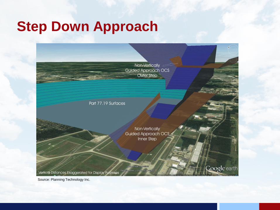
Step Down Approach
Source: Planning Technology Inc.
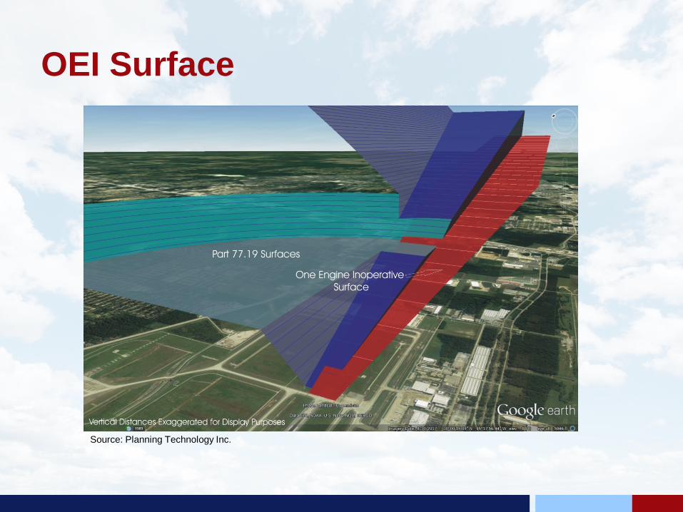
OEI Surface
Source: Planning Technology Inc.

PAPI Surface
Source: Planning Technology Inc.
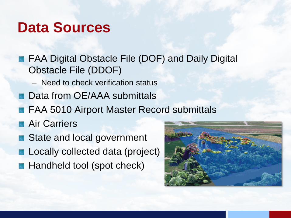
Data Sources
FAA Digital Obstacle File (DOF) and Daily Digital Obstacle File (DDOF)– Need to check verification status
Data from OE/AAA submittalsFAA 5010 Airport Master Record submittalsAir CarriersState and local governmentLocally collected data (project)Handheld tool (spot check)
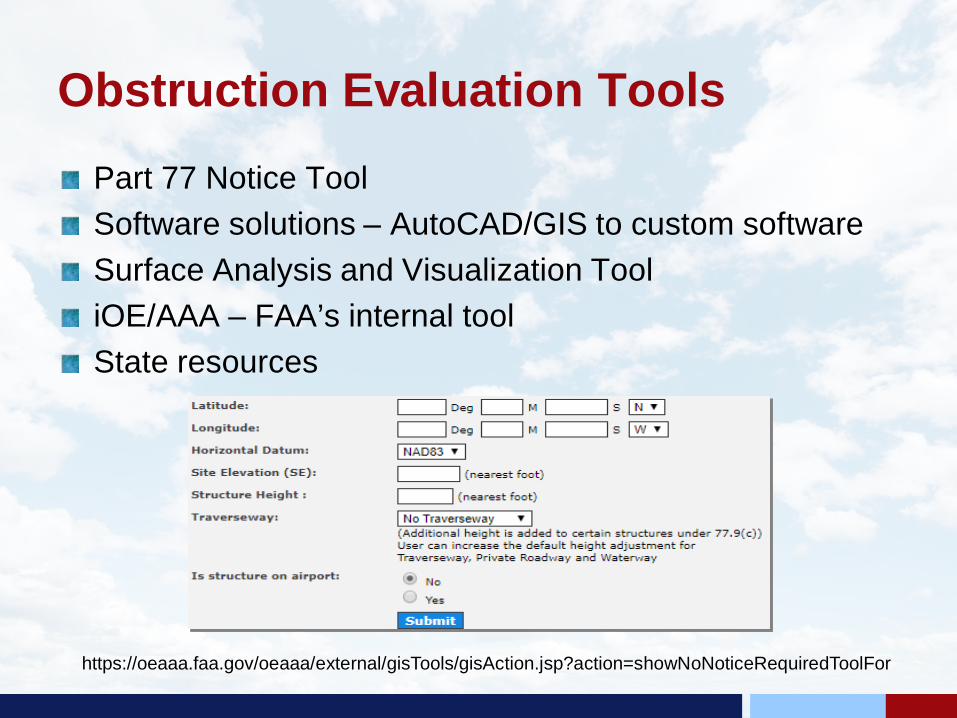
Obstruction Evaluation ToolsPart 77 Notice ToolSoftware solutions – AutoCAD/GIS to custom softwareSurface Analysis and Visualization TooliOE/AAA – FAA’s internal toolState resources
https://oeaaa.faa.gov/oeaaa/external/gisTools/gisAction.jsp?action=showNoNoticeRequiredToolFor

Indiana Tall Structures Permit
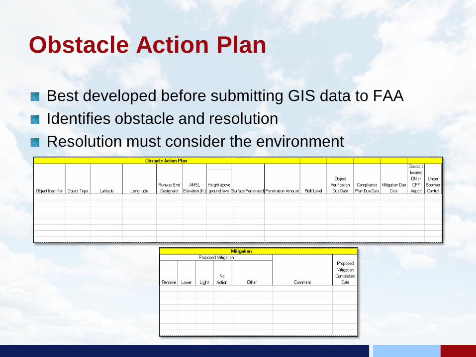
Obstacle Action Plan
Best developed before submitting GIS data to FAAIdentifies obstacle and resolutionResolution must consider the environment

Obstruction Mitigation and Management
Tied to grant assurancesAirport sponsor has primary responsibility but cannot do it aloneGoal is proactive rather than reactive managementNeed coordination and working relationship with nonairport stakeholders
Obstruction Management Tools
Prevention methods– Airport leases– Avigation easements– Airport zoning ordinances
• Overlay• Land Use
– High-set aside areas– Transfer of development rights– Purchase of development rights
Be aware of when these tools need to be updated
Building Support
Proactive management provides best opportunity to collaborateDevelop a communication strategy– What do they want?– What do they need?– How does obstruction management impact their daily activities?– What do the stand to lose or gain from an obstruction
management issue?
Identify the Audience
Identify the stakeholders– Do they have decision making authority?
Communicate the obstruction effects to decision makersIs cross-jurisdictional coordination needed?Engage with adjacent property ownersCoordinate with real estate and communication infrastructure industriesEngage with the general public

Crafting the Message
Is this new information for them or has your audience been exposed to these concepts before?– Be specific as to the impact
Does your audience understand why obstruction management is so important to your airport?– Make it easy to understand– Tailor your message to the audience
Do you have visual aids, such as graphics or videos, to help them understand?– Use graphics and visuals to provide context
Building Consensus
Mutual gains in multi-stakeholder negotiations– Be fully informed on technical and jurisdictional issues– Understand and respect opposing viewpoints– Be willing to consider reasonable alternatives
Collaboration requires– A common sense of purpose and identification of the problem– Participants educating each other– Participants sharing in the implementation of solutions– Participants being kept informed as situations evolve

Maintaining and Monitoring
Comprehensive airport obstruction management program involves: – Airport strategic and operational planning– Identifying applicable criteria– Using of best available resources for data collection and analysis– Considering innovative and solution-oriented mitigation
measures through collaboration and consensus building– ONGOING COMMUNICATION - Community and stakeholder
engagement before, during and following the implementation of obstruction management measures
– Continuous monitoring of program performance to achieve the goal of protecting the airport from encroachment

ACRP WebResource 7
Presentation templatesBibliography of referencesContains sample airspace composite maps
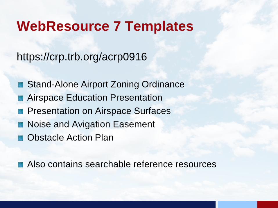
WebResource 7 Templates
https://crp.trb.org/acrp0916
Stand-Alone Airport Zoning OrdinanceAirspace Education PresentationPresentation on Airspace SurfacesNoise and Avigation EasementObstacle Action Plan
Also contains searchable reference resources
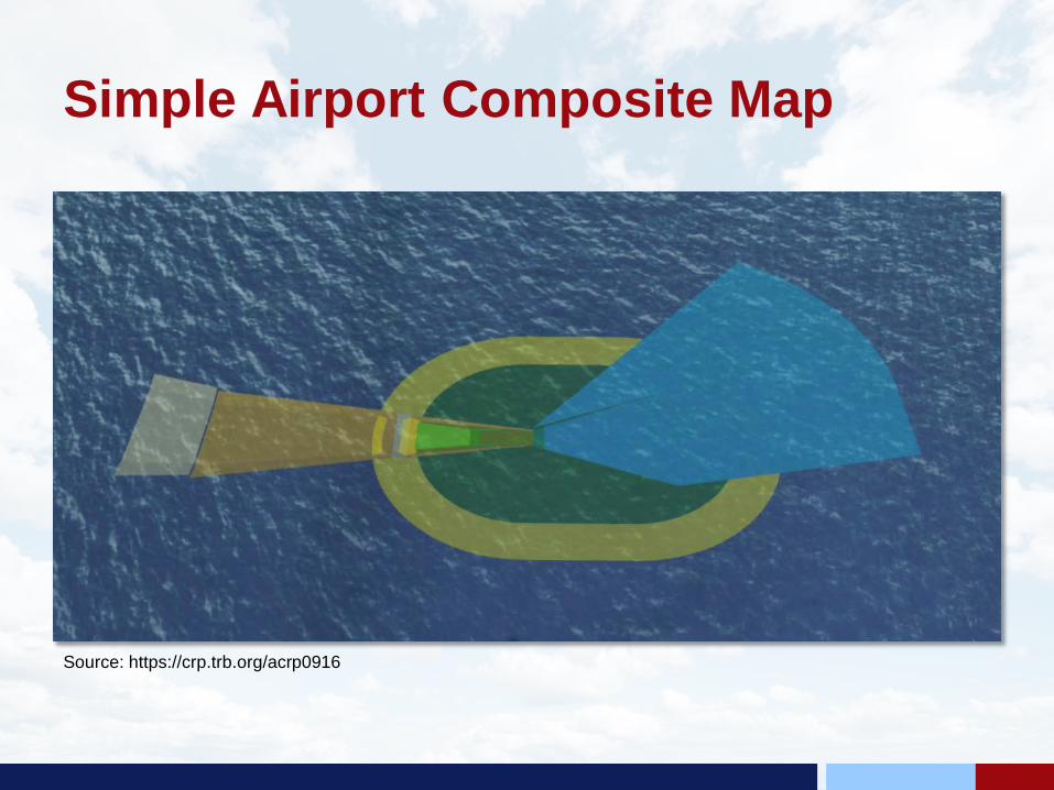
Simple Airport Composite Map
Source: https://crp.trb.org/acrp0916
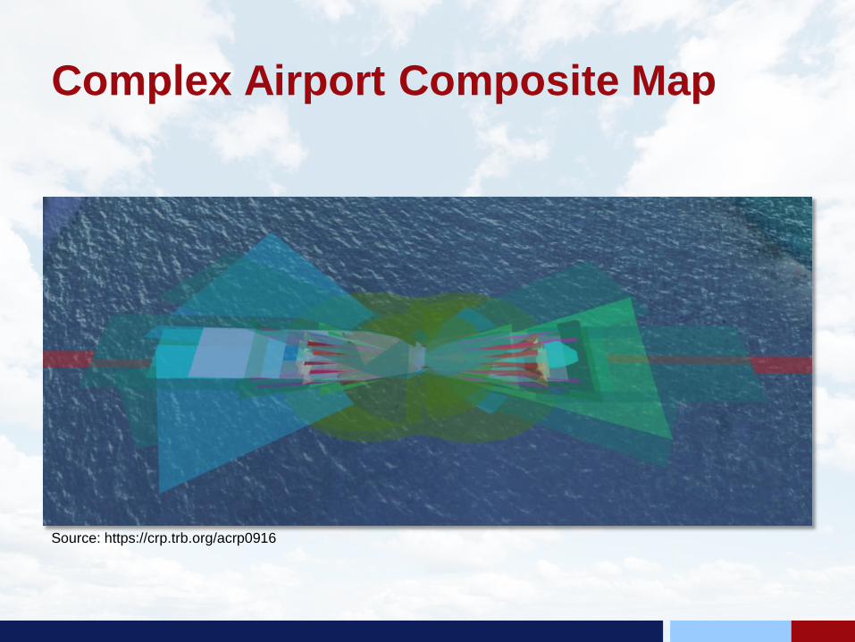
Complex Airport Composite Map
Source: https://crp.trb.org/acrp0916