Embed Size (px)
DESCRIPTION
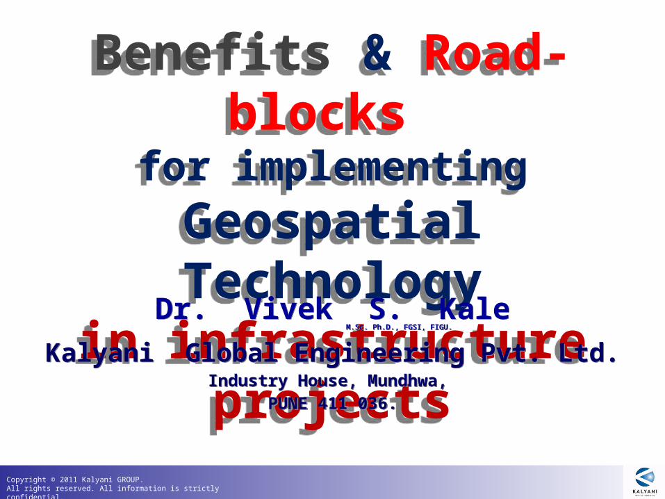
Benefits & Road-blocks for implementing Geospatial Technology in infrastructure projects. Dr. Vivek S. Kale M.Sc. Ph.D., FGSI, FIGU. Kalyani Global Engineering Pvt. Ltd. Industry House, Mundhwa , PUNE 411 036. Infrastructure Projects: Highways. - PowerPoint PPT Presentation
Citation preview
Copyright © 2011 Kalyani GROUP. All rights reserved. All information is strictly confidential.
Benefits & Road-blocks
for implementing Geospatial
Technology in infrastructure
projects
Benefits & Road-blocks
for implementing Geospatial
Technology in infrastructure
projects
Dr. Vivek S. KaleM.Sc. Ph.D., FGSI, FIGU.
Dr. Vivek S. KaleM.Sc. Ph.D., FGSI, FIGU.
Kalyani Global Engineering Pvt. Ltd.Industry House, Mundhwa,
PUNE 411 036.
Kalyani Global Engineering Pvt. Ltd.Industry House, Mundhwa,
PUNE 411 036.
Copyright © 2011 Kalyani GROUP. All rights reserved. All information is strictly confidential.
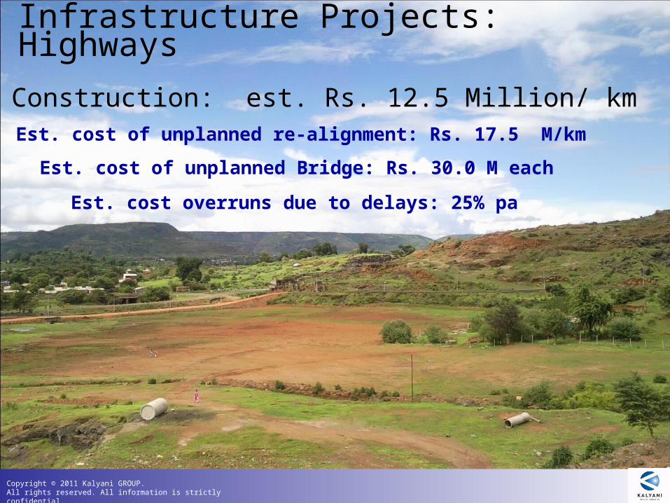
Infrastructure Projects: Highways
Est. cost of unplanned Bridge: Rs. 30.0 M each
Est. cost of unplanned re-alignment: Rs. 17.5 M/km
Road Construction: est. Rs. 12.5 Million/ km
Est. cost overruns due to delays: 25% pa
Copyright © 2011 Kalyani GROUP. All rights reserved. All information is strictly confidential.
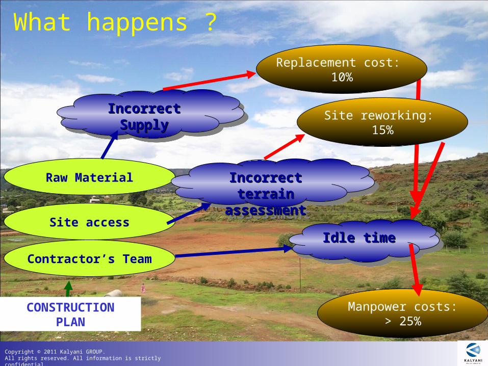
What happens ?
Contractor’s Team
Site access
Raw Material
Idle timeIdle timeIdle timeIdle time
Incorrect Incorrect terrain terrain
assessmentassessment
Incorrect Incorrect terrain terrain
assessmentassessment
Incorrect Incorrect SupplySupply
Incorrect Incorrect SupplySupply
CONSTRUCTIONPLAN
Manpower costs:> 25%
Site reworking: 15%
Replacement cost: 10%
Copyright © 2011 Kalyani GROUP. All rights reserved. All information is strictly confidential.
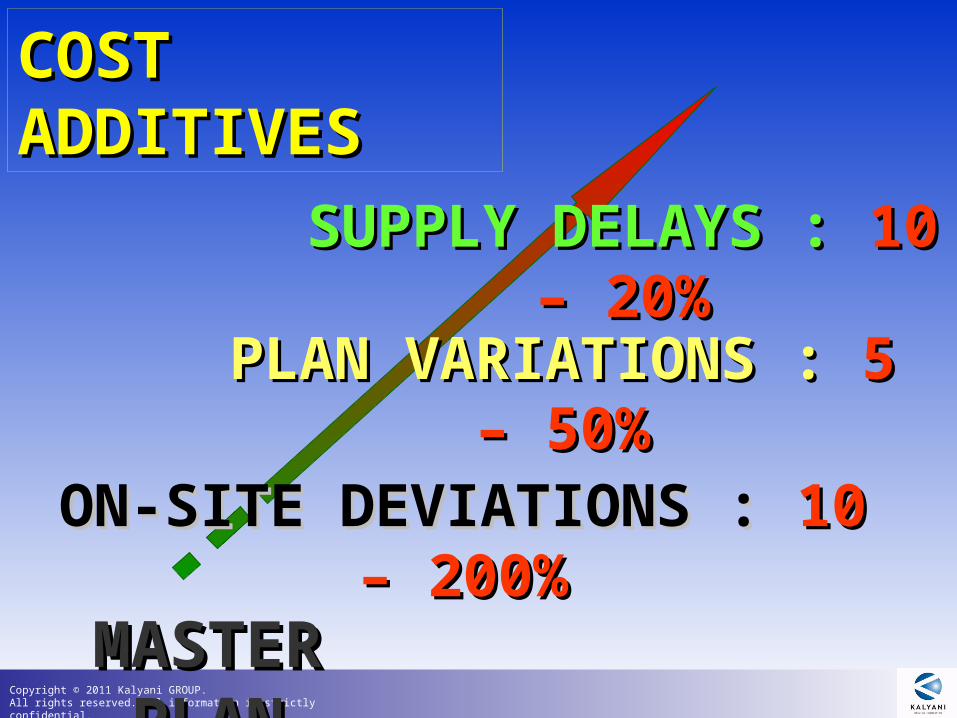
COST ADDITIVESCOST ADDITIVES
MASTER PLANMASTER PLAN
ON-SITE DEVIATIONS : ON-SITE DEVIATIONS : 10 – 200%10 – 200%
PLAN VARIATIONS : PLAN VARIATIONS : 5 – 50%5 – 50%
SUPPLY DELAYS : SUPPLY DELAYS : 10 – 20%10 – 20%
Copyright © 2011 Kalyani GROUP. All rights reserved. All information is strictly confidential.
Infrastructure Projects: Highways
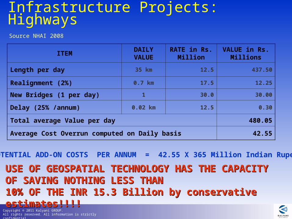
ITEMDAILY VALUE
RATE in Rs. Million
VALUE in Rs. Millions
Length per day 35 km 12.5 437.50
Realignment (2%) 0.7 km 17.5 12.25
New Bridges (1 per day) 1 30.0 30.00
Delay (25% /annum) 0.02 km 12.5 0.30
Total average Value per day 480.05
Average Cost Overrun computed on Daily basis 42.55
Source NHAI 2008
POTENTIAL ADD-ON COSTS PER ANNUM = 42.55 X 365 Million Indian Rupees
USE OF GEOSPATIAL TECHNOLOGY HAS THE CAPACITYUSE OF GEOSPATIAL TECHNOLOGY HAS THE CAPACITYOF SAVING NOTHING LESS THAN OF SAVING NOTHING LESS THAN 10% OF THE INR 15.3 Billion by conservative estimates!!!!10% OF THE INR 15.3 Billion by conservative estimates!!!!
Copyright © 2011 Kalyani GROUP. All rights reserved. All information is strictly confidential.
Infrastructure Projects: Highways
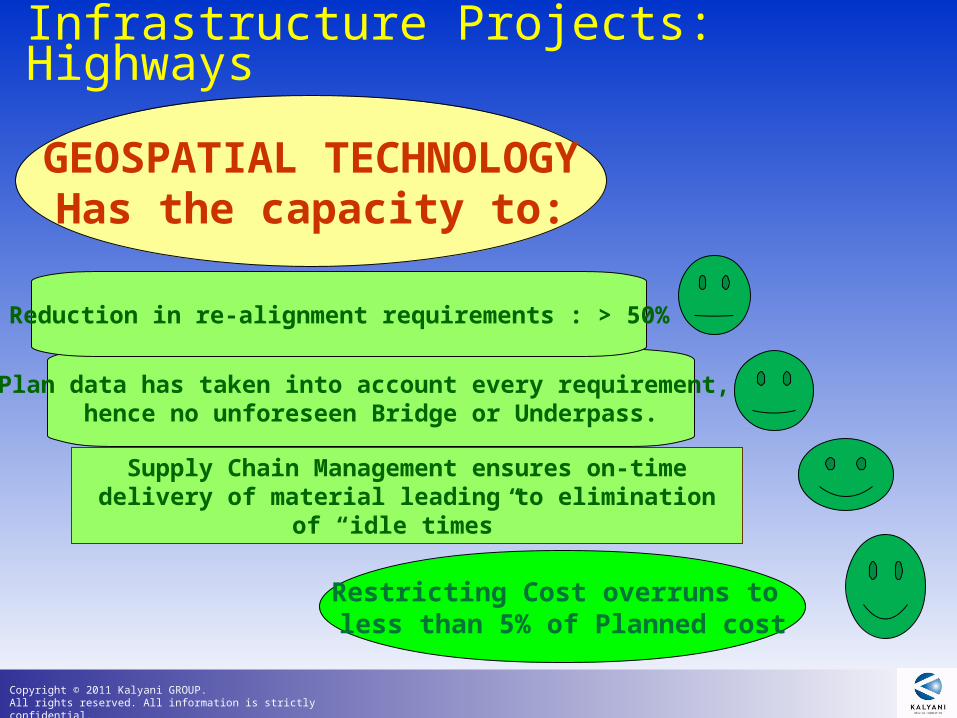
Supply Chain Management ensures on-time delivery of material leading to elimination of “idle times”
Plan data has taken into account every requirement, hence no unforeseen Bridge or Underpass.
Reduction in re-alignment requirements : > 50%
Restricting Cost overruns to less than 5% of Planned cost
GEOSPATIAL TECHNOLOGYHas the capacity to:
Copyright © 2011 Kalyani GROUP. All rights reserved. All information is strictly confidential.
GEOSPATIAL TECHNOLOGY
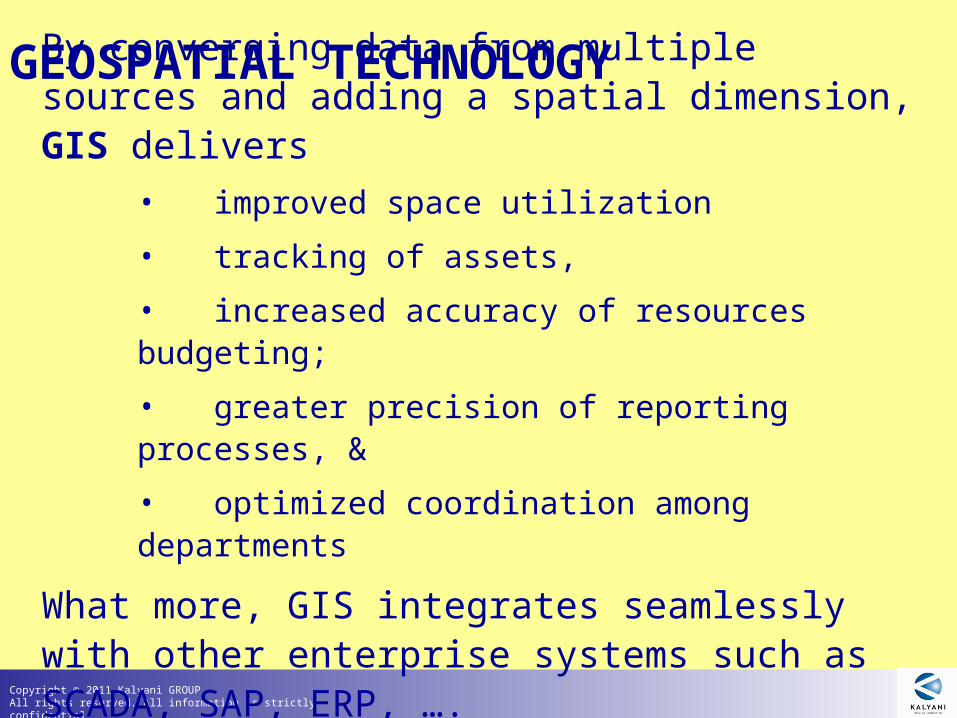
By converging data from multiple sources and adding a spatial dimension, GIS delivers
• improved space utilization
• tracking of assets,
• increased accuracy of resources budgeting;
• greater precision of reporting processes, &
• optimized coordination among departments
What more, GIS integrates seamlessly with other enterprise systems such as SCADA, SAP, ERP, ….
Copyright © 2011 Kalyani GROUP. All rights reserved. All information is strictly confidential.
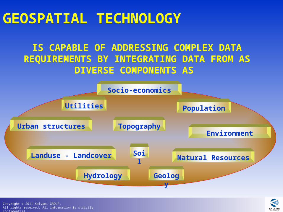
Topography
Hydrology Geology
Utilities
Soil
Population
Landuse - Landcover
Urban structures
Socio-economics
Environment
Natural Resources
GEOSPATIAL TECHNOLOGY
IS CAPABLE OF ADDRESSING COMPLEX DATA REQUIREMENTS BY INTEGRATING DATA FROM AS DIVERSE COMPONENTS AS
Copyright © 2011 Kalyani GROUP. All rights reserved. All information is strictly confidential.
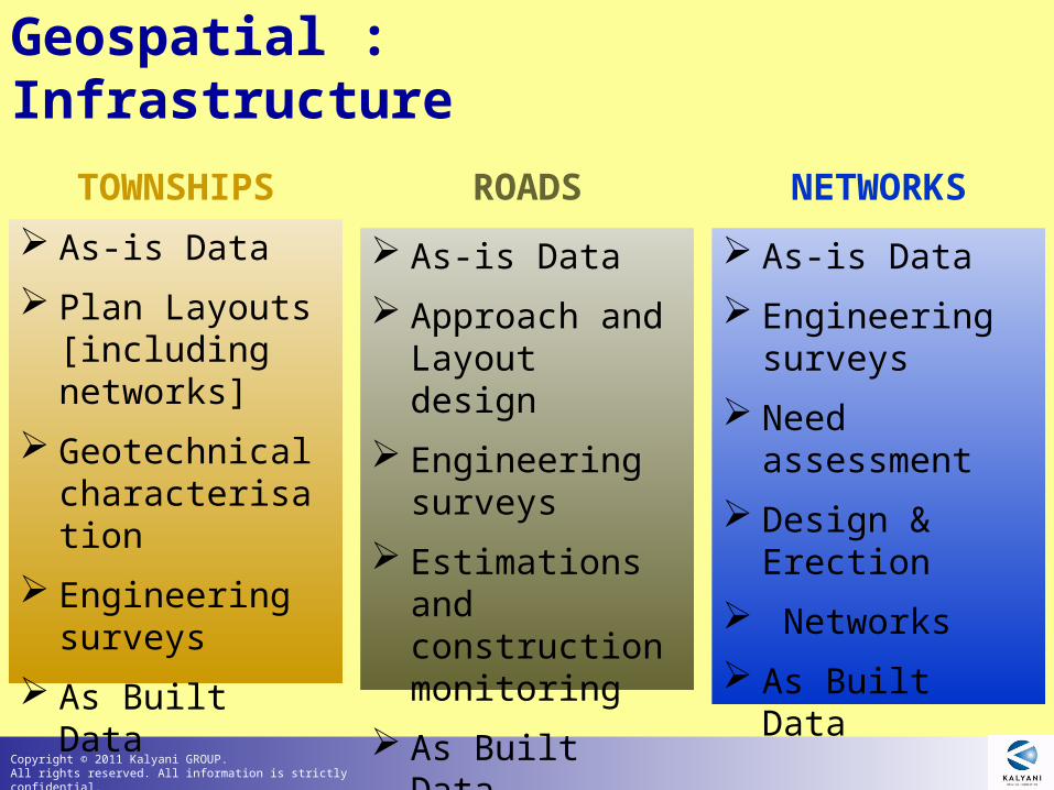
Geospatial : Infrastructure
As-is Data
Plan Layouts [including networks]
Geotechnical characterisation
Engineering surveys
As Built Data
TOWNSHIPS
As-is Data
Approach and Layout design
Engineering surveys
Estimations and construction monitoring
As Built Data
ROADS
As-is Data
Engineering surveys
Need assessment
Design & Erection
Networks
As Built Data
NETWORKS
Copyright © 2011 Kalyani GROUP. All rights reserved. All information is strictly confidential.
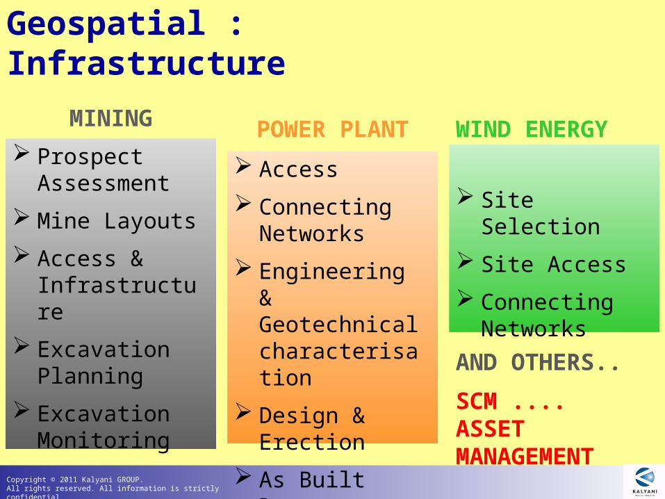
Site Selection
Site Access
Connecting Networks
WIND ENERGY Prospect
Assessment
Mine Layouts
Access & Infrastructure
Excavation Planning
Excavation Monitoring
MINING
Access
Connecting Networks
Engineering & Geotechnical characterisation
Design & Erection
As Built Data
POWER PLANT
Geospatial : Infrastructure
AND OTHERS..
SCM ....ASSET MANAGEMENT
Copyright © 2011 Kalyani GROUP. All rights reserved. All information is strictly confidential.
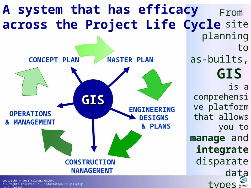
From site planning
toas-builts,
GIS is a
comprehensive platform that allows you to
manage and integrate disparate
data types. CONSTRUCTION MANAGEMENT
CONCEPT PLAN MASTER PLAN
OPERATIONS& MANAGEMENT
ENGINEERING DESIGNS & PLANS
A system that has efficacy across the Project Life Cycle
GISGIS
Copyright © 2011 Kalyani GROUP. All rights reserved. All information is strictly confidential.
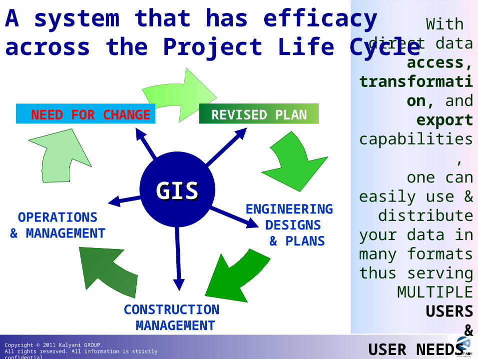
With direct data
access, transformation,
and export capabilities,
one can easily use & distribute
your data in many formats
thus servingMULTIPLE
USERS&
USER NEEDS.CONSTRUCTION MANAGEMENT
CONCEPT PLAN MASTER PLAN
OPERATIONS& MANAGEMENT
ENGINEERING DESIGNS & PLANS
GISGIS
NEED FOR CHANGE
REVISED PLAN
A system that has efficacy across the Project Life Cycle
Copyright © 2011 Kalyani GROUP. All rights reserved. All information is strictly confidential.
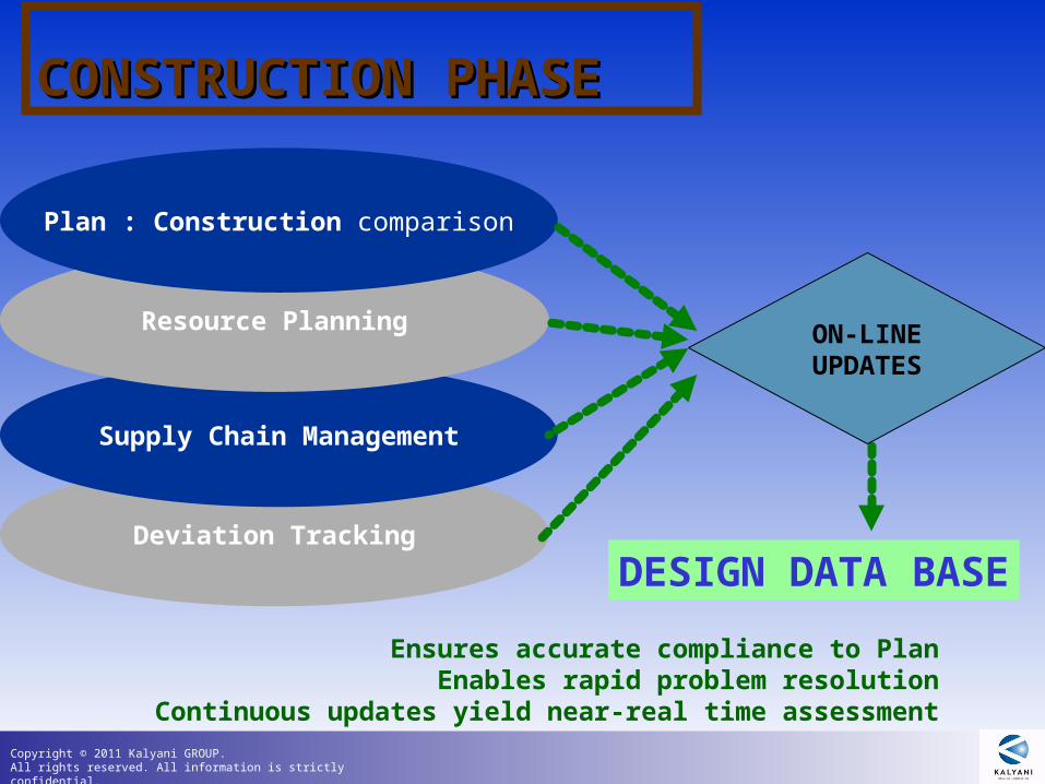
Deviation Tracking
Supply Chain Management
CONSTRUCTION PHASE CONSTRUCTION PHASE
Resource Planning
Plan : Construction comparison
DESIGN DATA BASE
ON-LINEUPDATES
Ensures accurate compliance to PlanEnables rapid problem resolution
Continuous updates yield near-real time assessment
Copyright © 2011 Kalyani GROUP. All rights reserved. All information is strictly confidential.
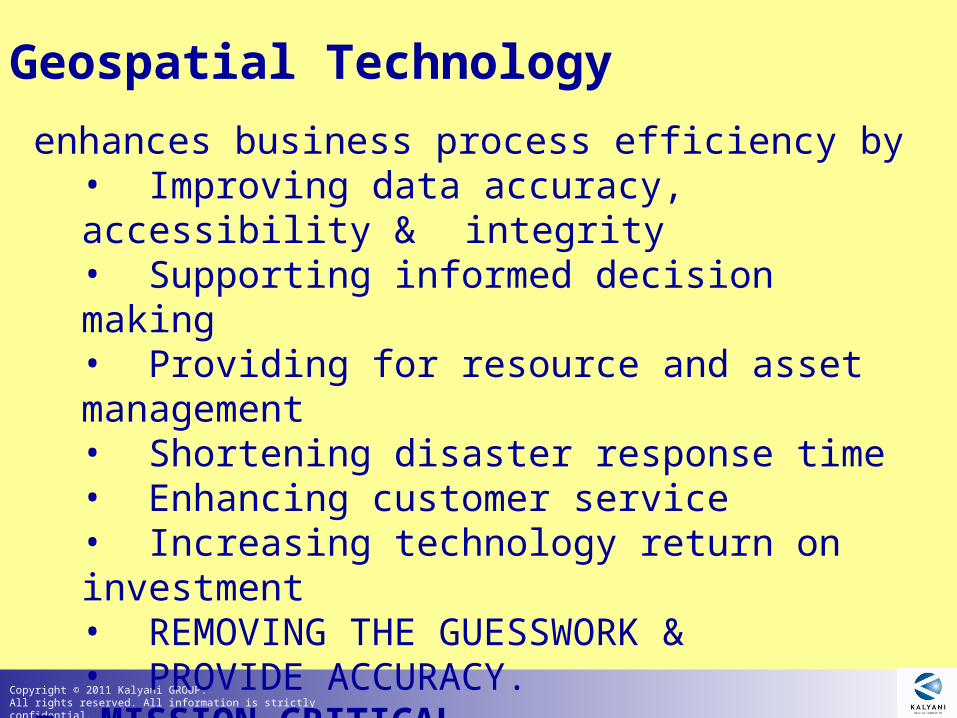
enhances business process efficiency by • Improving data accuracy, accessibility &integrity• Supporting informed decision making• Providing for resource and asset management• Shortening disaster response time • Enhancing customer service• Increasing technology return on investment• REMOVING THE GUESSWORK &• PROVIDE ACCURACY.
= MISSION CRITICAL DECISION SUPPORT SYSTEM
Geospatial Technology
Copyright © 2011 Kalyani GROUP. All rights reserved. All information is strictly confidential.
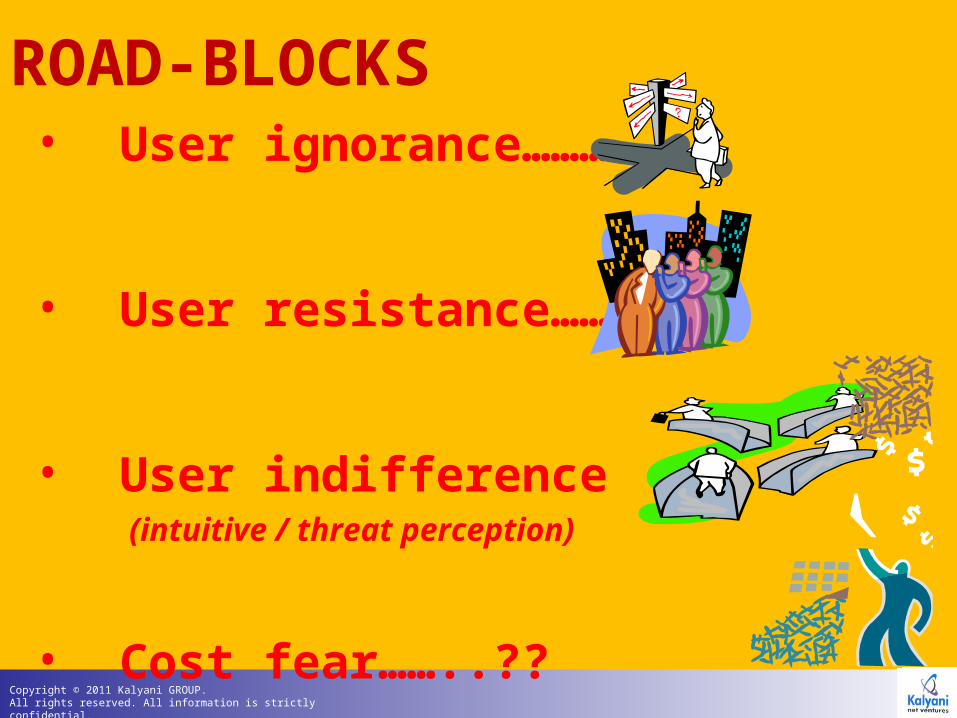
• User ignorance……….
• User resistance…….
• User indifference (intuitive / threat perception)
• Cost fear……..??
ROAD-BLOCKS
Copyright © 2011 Kalyani GROUP. All rights reserved. All information is strictly confidential.
Spatial Information Systems have 2 primary Spatial Information Systems have 2 primary
component: component: software and data/ contentssoftware and data/ contents..
The software platforms have reached a very high level The software platforms have reached a very high level stability and robustness over the last 20 years.stability and robustness over the last 20 years.
We are sadly way behind on the ‘contents’ front. We are sadly way behind on the ‘contents’ front.
ADDRESSING THE ADDRESSING THE
‘‘CONTENTS’ CONTENTS’
Is an urgent requirement.Is an urgent requirement.
Copyright © 2011 Kalyani GROUP. All rights reserved. All information is strictly confidential.
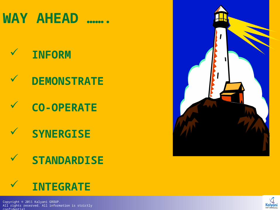
INFORM
DEMONSTRATE
CO-OPERATE
SYNERGISE
STANDARDISE
INTEGRATE
WAY AHEAD …….
Copyright © 2011 Kalyani GROUP. All rights reserved. All information is strictly confidential.
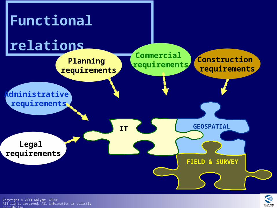
GEOSPATIAL
FIELD & SURVEY
IT
Functional relations
Commercial requirements
Administrative requirements
Planning requirements
Legal requirements
Construction requirements
Copyright © 2011 Kalyani GROUP. All rights reserved. All information is strictly confidential.
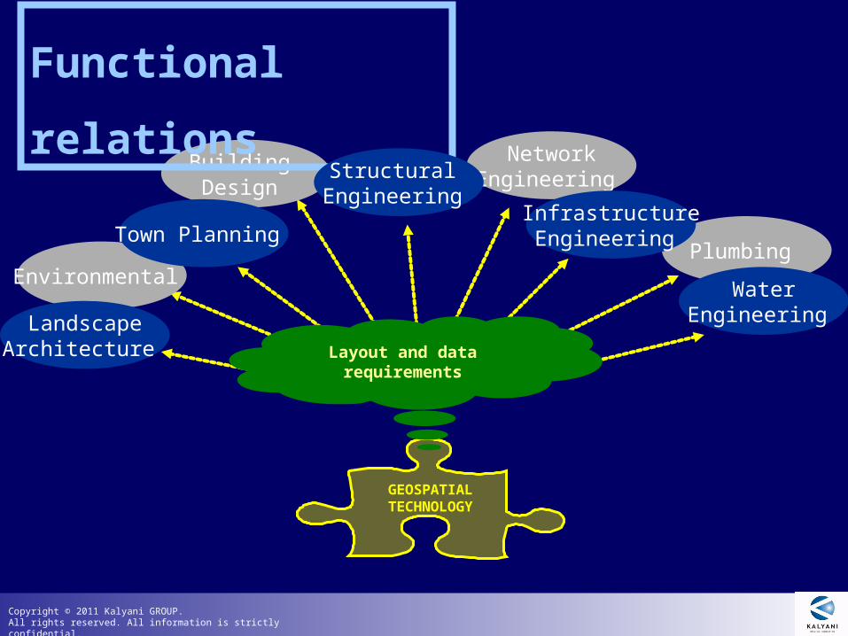
Plumbing
Building Design
NetworkEngineering
Environmental
Functional relations
GEOSPATIAL TECHNOLOGY
LandscapeArchitecture
Town Planning
Structural Engineering
InfrastructureEngineering
WaterEngineering
Layout and data requirements
Copyright © 2011 Kalyani GROUP. All rights reserved. All information is strictly confidential.
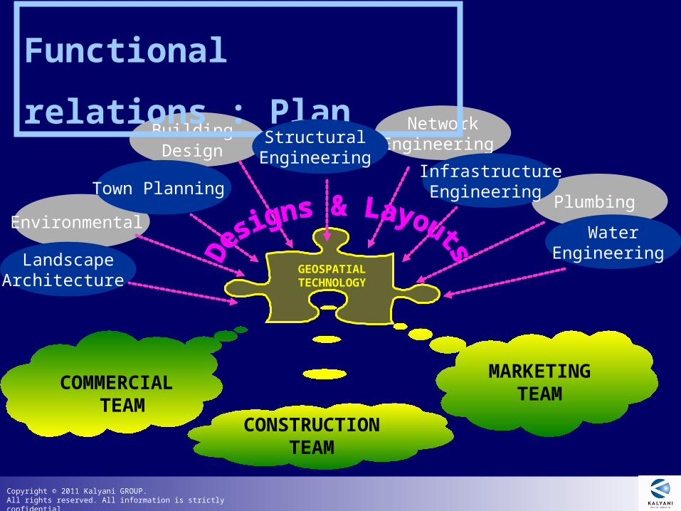
Plumbing
Building Design
NetworkEngineering
Environmental
Functional relations : Plan
GEOSPATIAL TECHNOLOGY
LandscapeArchitecture
Town Planning
Structural Engineering
InfrastructureEngineering
WaterEngineering
MARKETING TEAM
COMMERCIAL TEAM
CONSTRUCTION TEAM
Copyright © 2011 Kalyani GROUP. All rights reserved. All information is strictly confidential.
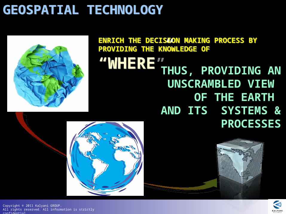
GEOSPATIAL TECHNOLOGYGEOSPATIAL TECHNOLOGY
ENRICH THE DECISION MAKING PROCESS BY PROVIDING THE KNOWLEDGE OF
“WHERE”
ENRICH THE DECISION MAKING PROCESS BY PROVIDING THE KNOWLEDGE OF
“WHERE” THUS, PROVIDING ANUNSCRAMBLED VIEW
OF THE EARTH AND ITS SYSTEMS & PROCESSES

Copyright © 2011 Kalyani GROUP. All rights reserved. All information is strictly confidential.
All rights reserved. All information is strictly confidential and may not be disclosed third parties without the approval from authorised officer of the Kayani Group.
THANK YOU FOR YOUR ATTENTION