Embed Size (px)
Citation preview

What is Bushland Condition Monitoring?
What is it?
A standardized method to measure
1. Health / Condition in bushland2. Changes in condition over time What does it comprise?
3. A manual in 3 volumes2. SABAT database (South Australian Biodiversity Assessment
Tool)
3. 1650 + sites to date across SA

What is Bushland Condition?
healthy not fragmented functional self-sustaining not under threat providing habitat

How does it work?
• 30m x 30m quadrat - uses a quadrat to be representative of a patch
• 10 Indicators - measures 10-15 aspects of vegetation (Vol. 1) - converts raw data into indicator scores using simple calculations (Vol. 1)
• Benchmarks - compares indicator scores against benchmarks, specific for different vegetation types (Vol. 3)
• Condition Classes - Assigns indicator scores to 1 of 5 condition classes from Very Poor – Excellent, on the basis of this comparison

Method uses a 30m x 30m quadrat to be REPRESENTATIVE of the patch
But any patch usually comprises areas of
1. Dominant Condition2. Better Condition3. Worse Condition4. Edges
So need to make a decision about which area/s to set up in
Which leads us back to considering the PURPOSE of the monitoring site
Representivity

PURPOSE OF MONITORING3 main reasons for monitoring
1. Performance Monitoring (P)Looking to see a change due to change in management (weeding, fencing, grazing control)
2. Resource Condition Monitoring (R)Looking for a snapshot of condition across a defined area / vegetation type (random patch selection)
3. Community Engagement (E)Looking to engage landholders with the ecological and biodiversity value of their bushland patches

REPRESENTIVITY and PURPOSEin selecting Site Location
• Performance monitoringo looking for a part that will be affected by
the change in managemento that is most likely to show a changeo a section in worse condition
• Resource Condition Monitoringo want to be representative of most
vegetation in the patcho in section of dominant condition for the
patch• Community Engagemento want to show vegetation in its best lighto in area of better condition for the patch
Site Selection MetadataWhichever is chosen (Dominant, Better, Worse) RECORD which it is and why it was chosen

Site Selection Metadata
EXTRAPOLATION CONFIDENCE• Different management on neighbouring properties• Ecological gradients – soil, aspect, slope, exposure, etc.
Extrapolation Metadata• use SA vegetation mapping polygons• assign extrapolation confidence to nearby patches as
high, moderate, low• E.g. “the quadrat is representative of (better than
average / dominant/ worse than average) condition in surrounding patches of to a distance of x km”
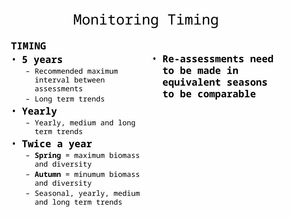
Monitoring Timing
TIMING• 5 years
– Recommended maximum interval between assessments
– Long term trends
• Yearly– Yearly, medium and long term trends
• Twice a year – Spring = maximum biomass and
diversity– Autumn = minumum biomass and
diversity– Seasonal, yearly, medium and long
term trends
• Re-assessments need to be made in equivalent seasons to be comparable

What are the BCM Indicators? (Volume 1)
1. Plant Species Diversity2. Weed Abundance and Threat3. Structural Diversity (A. ground cover, B. native life forms)4. Regeneration5. Tree and Shrub Health (dieback, lerp, mistletoe)6. Tree Habitat Features (habitat value, hollows, logs)7. Feral Animals8. Total Grazing Pressure9. Fauna Species Diversity10. Bushland Degradation Risk

What are the benchmarks? (Volume 3)
• 10-15 benchmark communities for each NRM region
• Brings together many vegetation associations, sharing similar characteristics in terms of structure, soils, rainfall, and understorey species, under a smaller number of major groupings
• Volume 3 – communities described, in terms of geography, species, vegetation structure, soils, and benchmarks for the 10 indicators
• E.g. of benchmark table

The 10 Indicators – Methods and Scoring
• What is measured and how?• How is the indicator score calculated?• How is the condition class assigned?

Indicator 1. Plant Species Diversity
METHOD• All plant species - record all plant species inside
quadrat, including weeds (use later)• Overhanging plants - plant can be overhanging /
not rooted in quadrat• Dead Plants - include dead plants if still attached
by roots to ground• Mistletoe - don’t forget to look for• Moss and Lichen – not included

Indicator 1. Plant Species DiversityMethod
• Start - start with obvious overstorey and understorey species
• Microbotany - on your knees in a corner get your eye in for ground level / small understorey spp.
• Searching - make sure cover all quadrat - walk around the edges of quadrat in circular direction then come back to centre
• Plant Refuges - Check bases of trees, shrubs and rocks
• Working Names - Use for species you don’t know “small, fuzzy lanceloate opposite leaves”
• Collect specimens - Indicate collected plants with © - press for future reference
• Taxanomic uncertainty – write “?” before genus or species name to show not sure e.g. ?*Trifolium sp., e.g. Austrostipa ?nodosa

Indicator 1. Plant Species Diversity
Method
• Weeds - write “*” in front of plant name to indicate is weed e.g. *Plantago lanceolataNot sure if weed? write (U) next to name / working name
• In addition, while searching quadrat for species - take note of the most abundant weeds, plus regeneration and grazing of native species (for later)

Indicator 1. Species Diversity
Indicator Score Calclulation
• Add up the number of native species
Deriving a Condition Rating
• Compare the score against the benchmarks in the tables
• Spring species count multiply benchmarks x 20%
Some communities are expected to have less species than others, even in good condition• E.g. Good condition for samphire
= 5 species vs heathy forest (24) • E.g. Good condition in Heathy
forest in Autumn = 24 species (Spring = 29)

Indicator 2. Weed Abundance and Threat
Method• 5 most abundant - decide which are 5
most abundant inside quadrat (abundance = % projective cover)
• Estimate %cover (projective cover = shade caused by a light shining from directly above, as a proportion of the whole quadrat)
• Include dead plants - if they are still attached to ground (e.g. annual grasses, dried up herbs - not forming litter yet).

Indicator 2. Weed Abundance and Threat
Calculating the Indictor Score
• Cover Ratings - assign %cover for each species to a cover rating using table
• Weed Threat Ratings - assign the weed threat rating for the species according to the table
• Individual Species Score = cover rating x threat rating
• Site Score = sum for the 5 species you have chosen
Deriving a condition rating
• Compare – against the benchmarks in the table
• Assign – a condition class from Very Poor to Excellent
Notes• some vegetation communities are
more susceptible and/or resilient to weeds than others
• e.g. SMLR 1 Heathy Woodlands: Poor = 18 or more, while for SMLR 8 Samphire: Poor = 9

Indicator 2. Weed Abundance and Threat - Red Alert Weeds
Method
• High Threat Weeds = rating 3, 4, or 5
• Record presence/absence• in quadrat• in surrounding bushland patch• elsewhere on property
• Remember to record as you drive to site and walk to the bushland
Calculating Indicator Score
• Score for Quadrat = number of species
• Score for Patch = number of species (including quadrat)
• Score for Property = number of species (including patch and quadrat)
• Not benchmarked

Structural Diversity A – Ground Cover
Method
• Estimate %cover of ground cover components Native Weed Litter Rock Moss, lichen, microphytic crust Bare Ground
• Imagine the mosaic – after quadrat sawn off with a chainsaw at shoe-sole height
• Trees and shrubs = cross-section of stems
• Hanging foliage = resting on the ground
• Moss and lichen - on rocks as well as soil (record amount on each)
• Overlap – there may be some overlap • hard to tell layers apart• real overlap e.g. litter on moss,
foliage on weed• carpet / lino analogy• accounting for overlap - add up
the total and see if you can account for the overlap
• Bare Ground – is most important component for calculating the score

Structural Diversity A – Ground Cover
Calculating the Score
• Cover Ratings non-bare components - convert %cover for non-bare ground components to a cover rating using the table
• Sum non-bare cover ratings - for all the non-bare components
• Cover Rating of Bare Ground - convert %cover of bare ground to cover rating using the table
• Site Score = add the sum of non-bare and bare ratings together
Deriving a Condition Rating
• Compare Site Score – against the benchmarks using the tables
• Assign a Condition Class - from Very Poor to Excellent
Notes
• E.g. Coastal dune communities are expected to have higher bare ground than sclerophyll forests and woodlands

Indicator3. Structural Diversity B – Native Life-forms
METHOD• Estimate %cover - in each life-form
category (Volume 1)• Cover Ratings – assign a cover rating
to each layer using the tableNOTES• Group native species – in each layer• Dead Plants – include dead plants if
still attached• Flower Heads – included in height• Current Life-form – not what it may
grow into• “Tussocks” = sedges, rushes and
similar forms - non-grass, perennial, mostly stiff blades – Juncus, Gahnia, Dianella, Schoenus spp.
• Woody Herbs – counted as herbs e.g. Vittadinia spp.
CALCULATING THE INDICATOR SCORE
• Site Score = sum of cover ratings
ASSIGNING A CONDITION CLASS
• Compare – the score against the benchmarks for the vegetation community and assign a condition rating from Very Poor to Excellent
NOTES• Some plant communities are expected
to have greater diversity of life-forms than others
• E.g. Samphire: Good = 8• Heathy Forest: Good = 15

Indicator4. Regeneration
METHOD
• Count Seedlings and Juveniles - inside the quadrat for each native tree shrub species
• Count Adults – for each species with seedling or juvenile
• Count Number of height classes - for each native tree and shrub species
NOTES• Seedling - Eucalypts: < 1mOther tree species: <0.5m Shrubs: <10cm (use judgement)• Juvenile – smaller than adult + yet to
flower or fruit• Very numerous - estimate
CALCULATING THE INDICATOR SCORE• Site Score = number of native tree and
shrub species with either a seedling or juvenile present
• Seedling Abundance – assign rating using table and sum for site
• Juvenile Abundance – as above
ASSIGNING A CONDITION CLASS• Compare – the score against the
benchmarks for the vegetation community and assign a condition rating from Very Poor to Excellent
NOTES• •

Indicator 5. Tree and Shrub HealthMETHOD• Tree Map - map the 10 nearest trees
to the corner post• Inside or Outside Quadrat? both• Measure distance - bearing – species -
number of trunks – girth at breast height (GBH) (1.35m)
NOTES• Which trees? – native, adult, from
species comprising the dominant overstorey layer (tallest layer with >5% cover)
• doesn’t have to be currently in upper stratum, as long as is adult
• Alive or Dead (as long as still attached by roots)
• Dead, snapped off trees - don’t measure if no trunk at 1.35m (breast height)
NOTES• 1 tree or 2 trees? - if trunks touch above
ground = 1 tree

Indicator 5. Tree and Shrub Health – 1. DiebackMETHOD• Estimate %Dieback for each of the 10
trees• Apply dieback rating to each tree
using the table and diagrams
Dieback • = % of canopy missing/dead due to ill
health• View from all sides – to estimate
dieback• From the tips (not density) imagine
branches have leaves all the way to ends
• Lower branches – don’t count loss of leaves on lowest branches
• Epicormic leaves - do count as dieback
• Long Dead Branches? Judgement call - dieback or possibly storm damage
CALCULATING THE INDICATOR SCORE
• Site Score = sum of individual dieback ratings 10
ASSIGNING A CONDITION CLASS
• Compare – the score against the benchmarks for the vegetation community and assign a condition rating from Very Poor to Excellent
NOTES• Do different communities expect
different levels of dieback?• •

Indicator 5. Tree and Shrub Health – 2. Lerp DamageMETHOD• Estimate % of leaves with Lerp
Damage for each of the 10 trees• Assign Lerp Damage Rating to each
tree using the table and diagrams
Lerp Damage
• Datum = % of leaves with signs of significant lerp damage (>10% of individual leaf area?)
• Difficult to distinguish – Lerp may be difficult to distinguish from other forms of attack estimate total % of leaves with damage from any source.
• Use binoculars – and extrapolate from a representative clump
• Check upper branches – older leaves on lower branches have more accumulated damage
CALCULATING THE INDICATOR SCORE
• Site Score = sum of individual dieback ratings 10
ASSIGNING A CONDITION CLASS
• Compare – the score against the benchmarks for the vegetation community and assign a condition rating from Very Poor to Excellent
NOTES• Different species are more or less
susceptible to lerp

Indicator 5. Tree and Shrub Health – 3. Mistletoe
METHOD• Count the number of mistletoe on
each of the 10 trees• Assign a Mistletoe Rating to each tree
using the table
Mistletoe
• Alive or Dead? Count alive only• Difficult to distinguish – Mistletoe
mimic their host• Use binoculars
CALCULATING THE INDICATOR SCORE
• Site Score = sum of individual dieback ratings 10
DERIVING A CONDITION CLASS
• Compare – the score against the benchmarks for the vegetation community and assign a condition rating from Very Poor to Excellent
NOTES• Species susceptibility – some species
are more susceptible to mistletoe

Indicator 6. Tree Habitat Value A. Tree Habitat Value3 MEASURESA. Tree Habitat ValueB. Tree HollowsC. Fallen Trees and Logs
CALCULATING THE INDICATOR SCORE• Individual Tree Score = size
category rating + canopy health rating + hollows rating
• Site Score = number of trees with score >5
DERIVING A CONDITION CLASS• Compare – the score against
the benchmarks for the vegetation community and assign a condition rating from Very Poor to Excellent
NOTES
A. Tree Habitat Value
METHOD
• Measure the Girth- at breast height (1.35m)- multistems? – measure largest- assign a size rating from the table
• Assign a Canopy Health Rating – - using the %dieback estimations already done
• Hollows - search for hollows and assign a hollow rating to each tree using the table
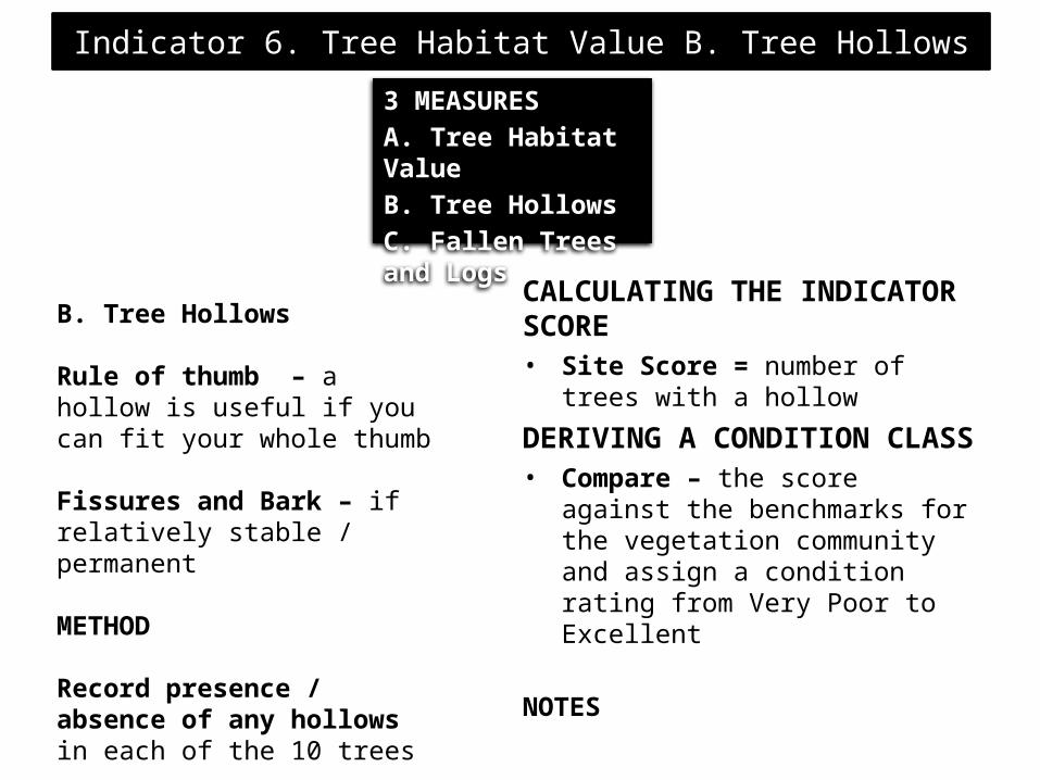
Indicator 6. Tree Habitat Value B. Tree Hollows3 MEASURESA. Tree Habitat ValueB. Tree HollowsC. Fallen Trees and Logs
CALCULATING THE INDICATOR SCORE• Site Score = number of trees with a
hollow
DERIVING A CONDITION CLASS• Compare – the score against the
benchmarks for the vegetation community and assign a condition rating from Very Poor to Excellent
NOTES
B. Tree Hollows
Rule of thumb – a hollow is useful if you can fit your whole thumb
Fissures and Bark – if relatively stable / permanent
METHOD
Record presence / absence of any hollows in each of the 10 trees

Indicator 6. Tree Habitat Value C. Fallen Trees and Logs3 MEASURESA. Tree Habitat ValueB. Tree HollowsC. Fallen Trees and Logs
CALCULATING THE INDICATOR SCORE• Site Score = number of logs in the
quadrat
DERIVING A CONDITION CLASS• Compare – the score against the
benchmarks for the vegetation community and assign a condition rating from Very Poor to Excellent
NOTES• Minimum size criteria - Is the same
minumum size reasonable for mallee as for woodland species?
C. Fallen Trees and Logs
• Not attached by roots • Minimum size 10 cm wide at
widest point• 1 log or 2 – judgement call - if
obviously detached from a larger limb, count separately
• Weed species – include
METHOD
Record number of logs inside the quadrat

Indicator 7. Feral Animal Abundance
CALCULATING THE INDICATOR SCORE• Site Score = number of logs in the
quadrat
DERIVING A CONDITION CLASS• Compare – the score against the
benchmarks for the vegetation community and assign a condition rating from Very Poor to Excellent
NOTES• Minimum size criteria - Is the same
minumum size reasonable for mallee as for woodland species?
METHOD
Record number of signs inside a 50m radius of the centre of quadrat
• Vertebrates - include introduced birds
• Main signs - dung, scratchings, dens / burrows, live animal
• Stock animals – include sheep, goats, deer etc. if not mandated
• Kangaroos / Koalas – make a note, but record separately

Indicator 8. Grazing Pressure
CALCULATING THE INDICATOR SCORE• Individual Species Score = sum of
grazing ratings for that species• Site Score = sum of grazing ratings for
all native species
DERIVING A CONDITION CLASS• Compare – the score against the
benchmarks for the vegetation community and assign a condition rating from Very Poor to Excellent
NOTES• Palatability – useful information can
also be obtained using information on palatability of species, where known
3 Grazing Intensities - Light – Heavy - Severe
METHOD
Record number of plants / percentage of plant population grazed at each level of intensity for each native species
Assign a grazing rating – to each instance of grazing using the table
• Native Species – all native species including herbs / non woody species
• Total population size – record / estimate this for the calculations
• Who is grazing? – doesn’t matter whether native or introduced grazer
• Koala / Cocky grazing on upper canopy – not included

Indicator 9. Fauna Species Diversity
CALCULATING THE INDICATOR SCORE• Score = number of species
DERIVING A CONDITION CLASS• Not benchmarked
NOTES
• This information is important to relate vegetation condition with habitat function
• Not benchmarked• Cumulative
METHOD
• Record observations of native animal species
• Vertebrate species only• Collect - notes, photos, dung, and
other traces
NOTES• Important to collect: date, time,
weather, location, behaviour

Indicator 10. Bushland Degradation Risk
CALCULATING THE INDICATOR SCORE• Site Score = sum of ratings for A, B, C
and D
DERIVING A CONDITION CLASS• Compare – the score against the
benchmarks (common to all benchmark communities) and assign a condition rating from Very Poor to Excellent
NOTES
METHOD
Record information on A. Size and Nature of Remnant B. Shape of RemnantC. Surrounding Land UseD. Remnancy in Environmental
Association
Assign a ratings to these using the tables
A. Size and Nature – desktop• Boundary fences – patches end
at boundary fencesB. Shape – desktopC. Land Use – field and desktopD. Remnancy – Nature Maps
• Near edge of EA – use average

Visual %Cover Estimation
• Projective Cover = area of shade caused by a light shining from directly above, as a proportion of the whole quadrat
• 2-step process – involves estimating Extent and Density and then multiplying them together
• %Extent = the fraction of the quadrat covered by the sum of polygons around the perimeters of canopies
• %Density = the fraction of shade produced by the leaves and branches within a typical plant canopy polygon
• %Cover = %Extend x %Density
Method %Extent• Tetris - imagine stacking polygons of
canopies into a corner, tetris-style, without compression
• Standard Corners – use diagrams of standard corners of different fractions of a 30m x 30m quadrat to decide which corner they would fit into
• Standard Area Diagrams – use diagrams of standard areas 5%, 25%, 50% and 75% to estimate the cover of canopies without compression
Method % density• Look up (or down) through the
canopy and estimate the fraction of shade made by the leaves under a light shining directly from above.
• Revise and Cross-check against other components etc. until you’re happy

Stepwise estimation
> or < 95% ? > or < 90% ? > or < 75% ?> or < 50% ? > or < 25% ? > or < 5% ? > or < 1% ?

Cover Diagrams

Estimating Cover – Pushing into a Corner
30 m x 30 m square
1%
5%
10%
25%
50%
3m
3m
7m
7m
10m
10m
30 m
30 m
3 m x 3 m square in a 30 m x 30 m square
0.1%
0.5%
1m 2m
3m
1%
3m
2m
1m
30 cm
30 cm
.01%

Cover Calculation Matrix0% 1% 5% 10% 15% 20% 25% 30% 35% 40% 45% 50% 55% 60% 65% 70% 75% 80% 85% 90% 95% 100%1% 0 0 0 0 0 0 0 0 0 0 1 1 1 1 1 1 1 1 1 1 15% 0 0 1 1 1 1 2 2 2 2 3 3 3 3 4 4 4 4 5 5 5
10% 0 1 1 2 2 3 3 4 4 5 5 6 6 7 7 8 8 9 9 10 1015% 0 1 2 2 3 4 5 5 6 7 8 8 9 10 11 11 12 13 14 14 1520% 0 1 2 3 4 5 6 7 8 9 10 11 12 13 14 15 16 17 18 19 2025% 0 1 3 4 5 6 8 9 10 11 13 14 15 16 18 19 20 21 23 24 2530% 0 2 3 5 6 8 9 11 12 14 15 17 18 20 21 23 24 26 27 29 3035% 0 2 4 5 7 9 11 12 14 16 18 19 21 23 25 26 28 30 32 33 3540% 0 2 4 6 8 10 12 14 16 18 20 22 24 26 28 30 32 34 36 38 4045% 0 2 5 7 9 11 14 16 18 20 23 25 27 29 32 34 36 38 41 43 4550% 1 3 5 8 10 13 15 18 20 23 25 28 30 33 35 38 40 43 45 48 5055% 1 3 6 8 11 14 17 19 22 25 28 30 33 36 39 41 44 47 50 52 5560% 1 3 6 9 12 15 18 21 24 27 30 33 36 39 42 45 48 51 54 57 6065% 1 3 7 10 13 16 20 23 26 29 33 36 39 42 46 49 52 55 59 62 6570% 1 4 7 11 14 18 21 25 28 32 35 39 42 46 49 53 56 60 63 67 7075% 1 4 8 11 15 19 23 26 30 34 38 41 45 49 53 56 60 64 68 71 7580% 1 4 8 12 16 20 24 28 32 36 40 44 48 52 56 60 64 68 72 76 8085% 1 4 9 13 17 21 26 30 34 38 43 47 51 55 60 64 68 72 77 81 8590% 1 5 9 14 18 23 27 32 36 41 45 50 54 59 63 68 72 77 81 86 9095% 1 5 10 14 19 24 29 33 38 43 48 52 57 62 67 71 76 81 86 90 95
100% 1 5 10 15 20 25 30 35 40 45 50 55 60 65 70 75 80 85 90 95 100
Perc
ent o
f Qua
drat
Cov
ered
by
Cano
pies
Percent of Canopies covered by leaves and branches

E.G. Estimating Canopy Cover
Quadrat Covered by Canopies Outlines461 m2
461 m2 / 900 m2 = 51%
Canopies Covered by Leaves and Branches45%
• Overall Cover• 45% x 51%• = 23% = ‘sparse’
Quadrat = 900 m2

Step 0 – Assigning a Benchmark Vegetation Community
Notes
Current vegetation association – may be significantly different to the pre-European state
Pre-European or other target – pre-European may not always be the most desirable, or practical target for management
Method
• Current Formation - is it significantly modified or relatively unmodified
• Understorey – is it significantly modified or relatively unmodified
• Volume 3 – use the decision tree and chapter descriptions to determine which one is appropriate

2. Forests and Woodlands with an Open sclerophyll Shrub Understorey – Benchmark
ScoresIndicator Very Poor Poor Moderate Good Excellent1. Species Diversity < 6 6 - 12 13 - 20 21 - 30 31+2. Weed Abundance & Threat
> 28 19 - 28 13 - 18 8 - 12 < 8
3. Structural Diversity A - Ground Cover
< 0 0 1 - 2 3 4
3. Structural Diversity B – Plant Life Forms
< 6 6 - 8 9 - 13 14 - 18 19+
4. Regeneration – Trees 0 1 2 3 4+4. Regeneration Trees & Woody Shrubs
0 1 2 - 3 4 - 5 6+
5. Tree Health – Dieback < –4 -4 to –1.1 -1.0 to 0.9 1 to 2.5 > 2.5 5. Tree Health - Lerp -4 to -1.6 -1.5 to 0.4 0.5 to 1.9 2 to 3 > 3 5. Tree Health - Mistletoe < -3 -3 to –2.1 -2 to –0.6 -0.5 to 0.4 > 0.56. Tree Habitat Score 0 - 1 2 - 3 4 - 6 7 - 8 9 - 106. Tree Hollow Score 0 1 2 - 4 5 - 6 7+6. Fallen Trees and Logs 0 1 2 3 4+7. Feral Animal Abundance
> 7 5.1 - 7 2.1 - 5 1.1 - 2 0 - 1
7. Feral Animal Frequency
< -22 -22 to -16 -15 to –11 -10 to –5 -4 to 0
8. Total Grazing Pressure < -17 -17 to –10 -9 to -5 -4 to -1 0

Site Establishment
Equipment
2 Star Droppers aerial photo 3 x 60m tapes camera compass binoculars Dressmakers measuring tape
First Steps
select site for quadrat permanently mark and
photograph describe the bushland
patch

1 - Setting upQuadratSize 30m x 30m any configuration of 900m2
Orientation
NSEW is standard corner post (star dropper) – one of northern corners (photo considerations) photo post (star dropper) – 10 m from corner looking into middle of quadrat (45o
to one side)
Location Representative Non-edge
RecordingNon-standard set-up is permissible, all details being carefully recorded

Site Naming Conventione.g. B U R – M C K B – B – 2
• Part 1 _ _ _ = 1st 3 letters of nearest town or gazzetted locality (e.g. Burra)
• Part 2 _ _ _ _ = 1st 3 letters of landowner’s surname + landowner’s first initial (Brian McKeough)
• Part 3 _ = letter A, B, C… assigned to each separate patch of bushland on a property (2nd patch with a monitoring site on this property)
• Part 4 _ = number 1, 2, 3… assigned to each successive quadrat set up in a patch (2nd quadrat set up in this patch)
• Roadside: Part 2 _ _ _ _ = 1st 4 letters of road name
• Reserves: Part 2 _ _ _ _ = 1st 2 letters of reserve name + initials of park status e.g. CP

Step 2 – Setting up Photopoints
METHOD• Set up quadrat with a view to a good
photo• Camera-post = cnr stake• Sighter post = 10m @ 45o (or other
good sightline)• Record distance and bearing, height
of camera / camera post and sighter post
• Photo - focus and centre on the site-board
• Quadrat edges – also take photos down edges to show orientation of quadrat for re-assessments
• Re-assessments - similar time of day = similar light conditions.

Step 3 - Bushland Description
Describing the patch / sub-patch
= the area of which the quadrat is a representative sample
1. Vegetation Structure2. Landscape Description3. Disturbance History
A. Vegetation Structure
South Australian Vegetation Classification System structural formationUses:
1. Life form of the tallest layer (e.g. tree, shrub)
2. Ave. height of the tallest layer3. % Cover of the tallest layer
METHODDominant stratum - identify the tallest layer with cover 5%Average Height – estimate the ave. ht of plants that belong to this stratum%Cover – estimate the average % projective cover in the patch / sub-patch

3 - Bushland Description
A. Vegetation StructureSouth Australian Vegetation Classification System structural formation
Uses:1. Life form of the tallest layer (e.g.
tree, shrub)2. Ave. height of the tallest layer3. % Cover of the tallest layer
METHODDominant stratum - identify the tallest layer with cover 5%Average Height – estimate the ave. ht of plants that belong to this stratum%Cover – estimate the average % projective cover in the patch / sub-patch
Determining the structural formationUsing the combination of 1, 2, and 3 and the table, assign the patch a vegetation formation
Notes• Average %cover in patch maybe
different to %cover in quadrat• weeds may comprise part of the
dominant stratum• Benchmark Community – current
formation may not correspond to assigned Benchmark Community due to disturbance

Vegetation Formations in South Australia
LIFE FORM/ HEIGHT CLASS
PROJECTIVE FOLIAGE COVER OF TALLEST STRATUM Dense (70 – 100%) Mid-dense (30 – 70%) Sparse (10 – 30%) Very Sparse (<10%)
Trees > 30m Tall closed forest Tall open forest Tall woodland Tall open woodland Trees 10 – 30m Closed forest Open forest Woodland Open woodland Trees 5 – 10m Low closed forest Low open forest Low woodland Low open woodland Trees <5m Very low closed forest Very low open forest Very low woodland Very low open woodland Mallee > 3m Closed mallee Mallee Open mallee Very open mallee Mallee < 3m Closed low mallee Low mallee Open low mallee Very open low mallee Shrubs > 2m Tall closed shrubland Tall shrubland Tall open shrubland Tall very open shrubland Shrubs 1 – 2m Closed shrubland Shrubland Open shrubland Very open shrubland Shrubs < 1m Low closed shrubland Low shrubland Low open shrubland Low very open shrubland Grasses Closed grassland Grassland Open grassland Very open grassland Sedges Closed sedgeland Sedgeland Open sedgeland Very open sedgeland

Cover Calculation Matrix0% 1% 5% 10% 15% 20% 25% 30% 35% 40% 45% 50% 55% 60% 65% 70% 75% 80% 85% 90% 95% 100%1% 0 0 0 0 0 0 0 0 0 0 1 1 1 1 1 1 1 1 1 1 15% 0 0 1 1 1 1 2 2 2 2 3 3 3 3 4 4 4 4 5 5 5
10% 0 1 1 2 2 3 3 4 4 5 5 6 6 7 7 8 8 9 9 10 1015% 0 1 2 2 3 4 5 5 6 7 8 8 9 10 11 11 12 13 14 14 1520% 0 1 2 3 4 5 6 7 8 9 10 11 12 13 14 15 16 17 18 19 2025% 0 1 3 4 5 6 8 9 10 11 13 14 15 16 18 19 20 21 23 24 2530% 0 2 3 5 6 8 9 11 12 14 15 17 18 20 21 23 24 26 27 29 3035% 0 2 4 5 7 9 11 12 14 16 18 19 21 23 25 26 28 30 32 33 3540% 0 2 4 6 8 10 12 14 16 18 20 22 24 26 28 30 32 34 36 38 4045% 0 2 5 7 9 11 14 16 18 20 23 25 27 29 32 34 36 38 41 43 4550% 1 3 5 8 10 13 15 18 20 23 25 28 30 33 35 38 40 43 45 48 5055% 1 3 6 8 11 14 17 19 22 25 28 30 33 36 39 41 44 47 50 52 5560% 1 3 6 9 12 15 18 21 24 27 30 33 36 39 42 45 48 51 54 57 6065% 1 3 7 10 13 16 20 23 26 29 33 36 39 42 46 49 52 55 59 62 6570% 1 4 7 11 14 18 21 25 28 32 35 39 42 46 49 53 56 60 63 67 7075% 1 4 8 11 15 19 23 26 30 34 38 41 45 49 53 56 60 64 68 71 7580% 1 4 8 12 16 20 24 28 32 36 40 44 48 52 56 60 64 68 72 76 8085% 1 4 9 13 17 21 26 30 34 38 43 47 51 55 60 64 68 72 77 81 8590% 1 5 9 14 18 23 27 32 36 41 45 50 54 59 63 68 72 77 81 86 9095% 1 5 10 14 19 24 29 33 38 43 48 52 57 62 67 71 76 81 86 90 95
100% 1 5 10 15 20 25 30 35 40 45 50 55 60 65 70 75 80 85 90 95 100
Perc
ent
of Q
uadr
at C
over
ed b
y Ca
nopi
es
Percent of Canopies covered by leaves and branches

Part B: Landscape DescriptionSlope (circle any of the following in the Assessment Area)Relatively flat land, slope < 50 Moderately steep, slope 50– 200
Steep hillside, slope > 200
Landform (circle any in Assessment Area)Flat/plain Valley bottom Ridge-top Hill slope
Swamp Creekline River Floodplain Sand dune Inter-
dune Swale
Soil type (Tick one)
Mainly Sand Sandy-loam Mainly Loam Clay-loam Mainly Clay Other: Ironstone
(fine texture, water penetrates rapidly) (high moisture holding capacity)
Assessment Site Landscape (use the descriptive words above to describe landscape for each assessment site)
Assessment Site No. 1 On mod –steep slope in scrub, thin sandy
loam over ironstone ridge.
Assessment Site No. 2 In Gully, mainly sandy loam with sparse ironstone.
How does this assessment area vary from other areas of bush?

3. Bushland DescriptionB. Landscape Description
• Slope is the ground at head height = 20m away ? slope 5o
is the ground at head height = 5m away ? slope 20o
• Aspect = useful information (which direction would a ball roll ?)
• Soilois it sand, loam, clay, clay-loam ?owhat colour is it ? yellow, brown, red, grey, black ?oare there rocks ? are they outcropping-like ? or strew-like ?

3. Bushland DescriptionC. Disturbance History
• Past Land-use• Current Land Use• Fire History• Tree Clearance• Understorey Clearance