Embed Size (px)
Citation preview
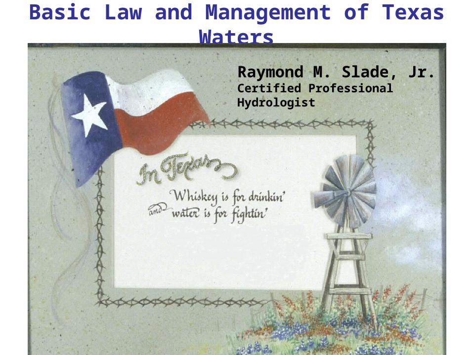
Basic Law and Management of Texas Waters
Raymond M. Slade, Jr. Certified Professional Hydrologist

Purpose
The purpose of this presentation is to present basic summary information regarding Texas water law and Texas water management.
Hyperlinks within this presentation (presented in this color) provide detailed or additional information for issues presented on the slides. Click on the links to view their information (Internet connection required to view link contents).
Within this presentation TWDB represents the Texas Water Development Board and TCEQ represents the Texas Commission on Environmental Quality

Presentation organization
History of Natural Resource Protection in TexasWater law• Introduction and history• Texas Administrative Code and Water Code
Water Planning• Texas Water Plan• River Authorities• Groundwater Districts
Recent Water Planning• Regional water planning• Surface water availability modeling and planning• Groundwater availability modeling and planning
Specific laws and rulesReferences for additional information
Each of these section titles are presented in the colors shown above and third order headings are presented in blue
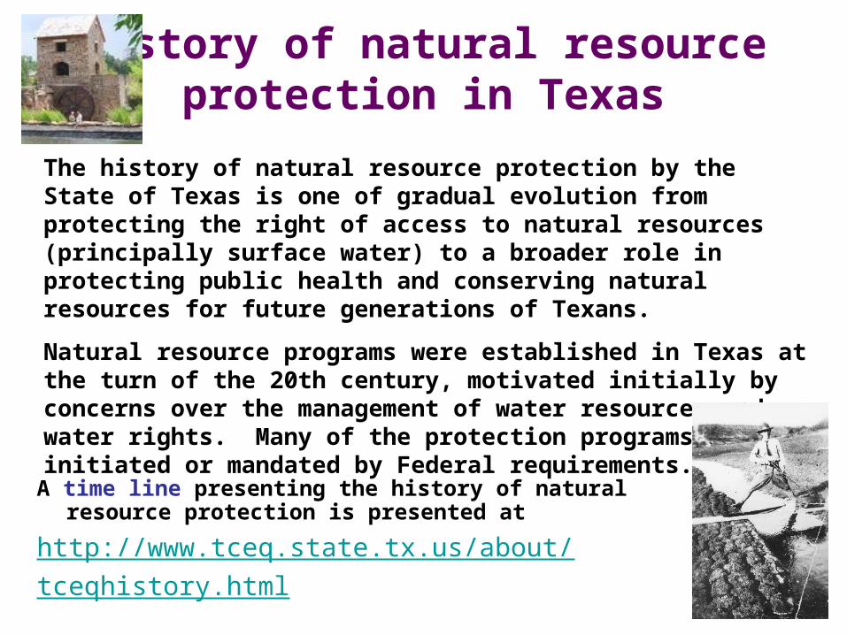
History of natural resource protection in Texas
A time line presenting the history of natural resource protection is presented at
http://www.tceq.state.tx.us/about/tceqhistory.html
The history of natural resource protection by the State of Texas is one of gradual evolution from protecting the right of access to natural resources (principally surface water) to a broader role in protecting public health and conserving natural resources for future generations of Texans.
Natural resource programs were established in Texas at the turn of the 20th century, motivated initially by concerns over the management of water resources and water rights. Many of the protection programs are initiated or mandated by Federal requirements.
A summary of Texas water law is presented athttp://www.tshaonline.org/handbook/online/articles/WW/gyw1.html
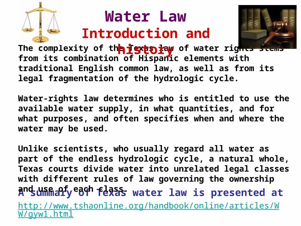
The complexity of the Texas law of water rights stems from its combination of Hispanic elements with traditional English common law, as well as from its legal fragmentation of the hydrologic cycle.
Water-rights law determines who is entitled to use the available water supply, in what quantities, and for what purposes, and often specifies when and where the water may be used.
Unlike scientists, who usually regard all water as part of the endless hydrologic cycle, a natural whole, Texas courts divide water into unrelated legal classes with different rules of law governing the ownership and use of each class.
Water LawIntroduction and history

Legal Framework
In Texas, surface water and ground water are property rights
Surface water belongs to the state
Permits to appropriate surface waters are granted by the Texas Commission on Environmental Quality (TCEQ).
Ground water is an individual property right, established by case law.
However, state law empowers local or regional groundwater management authorities and states that Groundwater Conservation Districts are the preferred method of groundwater management.

Texas Administrative Code and Water Code
Texas Administrative Code
The TAC is a compilation of all state agency rules in Texas. There are 16 titles in the TAC. Each title represents a category and relating agencies are assigned to the appropriate title.
Click on link to viewhttp://info.sos.state.tx.us/pls/pub/readtac$ext.viewtac
• Title 30 covers environmental quality and apply to the TCEQ. These rules also are available on TCEQ homepage at
http://www.tceq.state.tx.us/rules/indxpdf.html
• Title 31 part 10 covers the TWDB http://info.sos.state.tx.us/pls/pub/readtac$ext.ViewTAC?tac_view=3&ti=31&pt=10
• Title 31 part 2 covers the Texas Parks and Wildlife Department• regarding water resource protection
http://info.sos.state.tx.us/pls/pub/readtac$ext.ViewTAC?tac_view=3&ti=31&pt=2

Texas Water code
Click on link to view
http://tlo2.tlc.state.tx.us/statutes/wa.toc.htm
Sec. 1.001. PURPOSE OF CODE. (a) This code is enacted as a part of the state's continuing statutory revision program, begun by the Texas Legislative Council in 1963 as directed by the legislature in Chapter 448, Acts of the 58th Legislature, Regular Session, 1963 (Article 5429b-1, Vernon's Texas Civil Statutes). The program contemplates a topic-by-topic revision of the state's general and permanent statute law without substantive change.
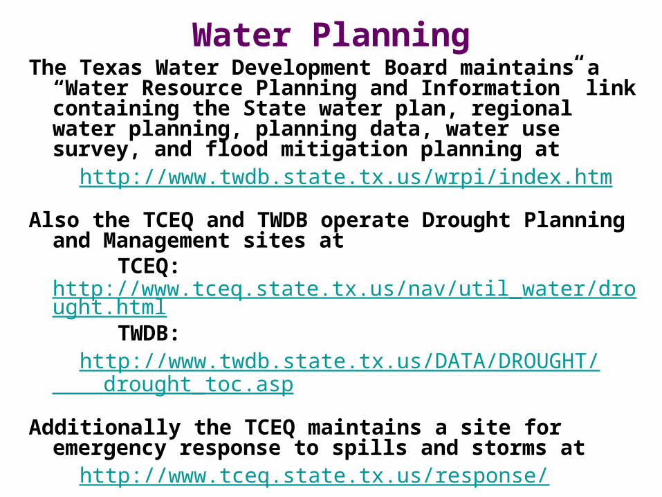
Water PlanningThe Texas Water Development Board maintains a “Water
Resource Planning and Information” link containing the State water plan, regional water planning, planning data, water use survey, and flood mitigation planning at
http://www.twdb.state.tx.us/wrpi/index.htm
Also the TCEQ and TWDB operate Drought Planning and Management sites at
TCEQ: http://www.tceq.state.tx.us/nav/util_water/drought.html
TWDB: http://www.twdb.state.tx.us/DATA/DROUGHT/
drought_toc.asp
Additionally the TCEQ maintains a site for emergency response to spills and storms at
http://www.tceq.state.tx.us/response/

Texas Water Plan
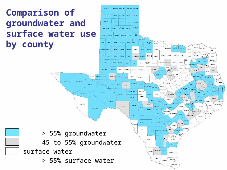
> 55% groundwater
45 to 55% groundwater and surface water
> 55% surface water
Comparison of groundwater and surface water use by county
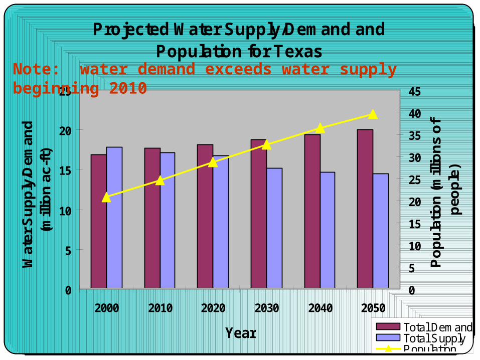
Projected Water Supply/Demand and Population for Texas
0
5
10
15
20
25
2000 2010 2020 2030 2040 2050
Year
Wat
er S
up
ply
/Dem
and
(m
illio
n a
c-ft
)
0
5
10
15
20
25
30
35
40
45
Po
pu
latio
n (m
illio
ns
of
peo
ple
)
Total DemandTotal SupplyPopulation
Note: water demand exceeds water supply beginning 2010
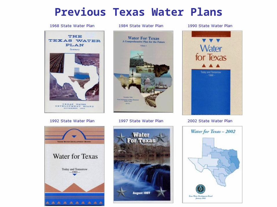
Previous Texas Water Plans

The 2007 State Water Plan was adopted by the Board on November 14, 2006.
• Previous versions of the State Water Plan involved Statewide planning
conducted by the TWDB.
• The 2007 Plan is based on a "bottom-up" consensus-driven approach to water planning that involves 16 regional water planning groups This process is described later in the Recent Water Planning section.
• Within TWDB guidelines, each regional planning group reviews water use projections and water availability volumes in dry or drought-of-record conditions.
• When a water need is identified, the planning groups recommend water management strategies to meet the need.
• Once the planning group adopts the regional water plan, the plan is sent to the TWDB for approval. The TWDB then compiles information from the regional water plans and other sources to develop the state water plan.
2007 (current) State Water Plan
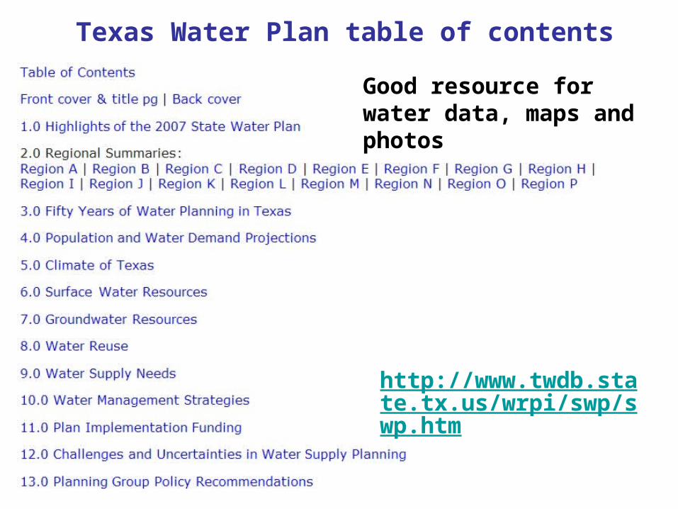
Texas Water Plan table of contents
Good resource for water data, maps and photos
http://www.twdb.state.tx.us/wrpi/swp/swp.htm

Water Planning and Water Use Survey Maps
Click on link to view data and maphttp://wiid.twdb.state.tx.us/ims/WIID/Viewer.asp?MapService=wuswp
The water use survey presents historic maps for surface and groundwater use for various water use categories (i.e. municipal and irrigation use).
The water planning tool presents, for future years, maps of projected population, water needs and unmet needs, and water availability, demands, and supply.
A glossary for planning terms is at http://www.twdb.state.tx.us/assistance/rwpg/DB02/glossary.asp

River Authorities

River Authorities (cont)
• River Authorities are created by the Texas Legislature • In 1929 The Legislature created the first river authority (Brazos
River Authority).
Fourteen Texas river authorities help protect and monitor more than 70 percent of the state’s surface water. River authorities receive most of their revenue from services sold to customers, usually water or electricity. They also may receive federal, state or private grants, which are often designated for specific purposes such as planning, wastewater treatment or conservation. Some authorities also draw revenue from parks and recreation facilities. Authorities can levy taxes, but usually do not, and can issue revenue bonds — with voter approval — or obtain loans from the Texas Water Development Board.
TITLE 5. SPECIAL LAW DISTRICTS of the Texas Water Code contains CHAPTER 152. RIVER AUTHORITIES ENGAGED IN DISTRIBUTION AND SALE OF ELECTRIC ENERGY
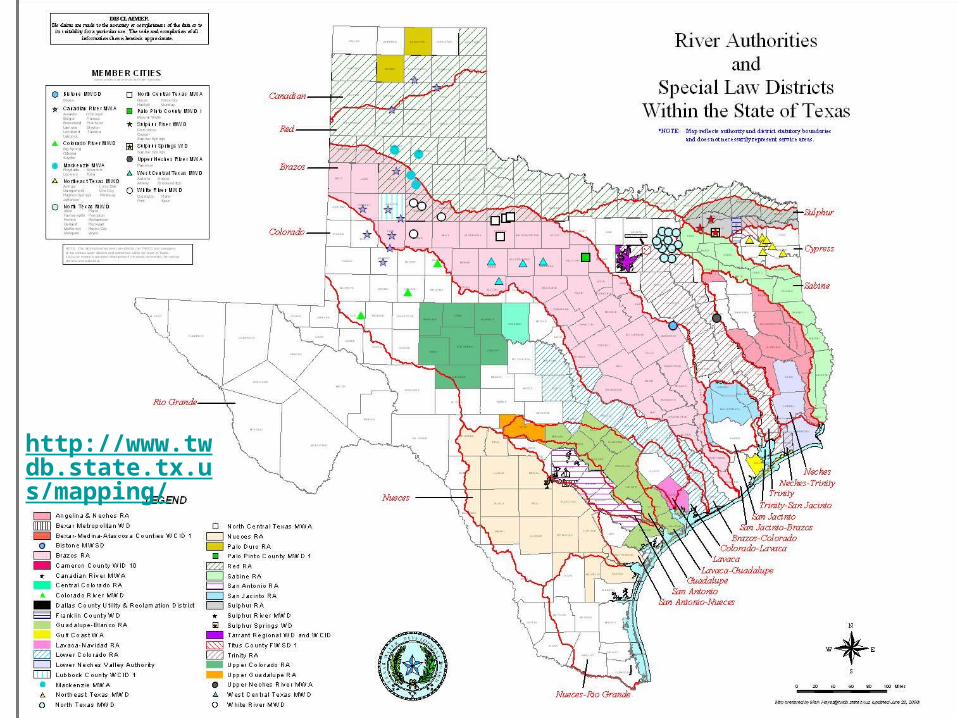
http://www.twdb.state.tx.us/mapping/
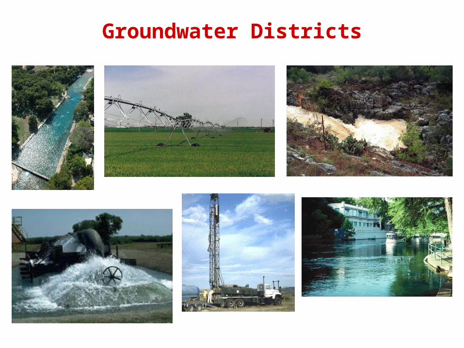
Groundwater Districts

Legislature can give special powers to districts to address specific water problems
The Texas State Legislature in 1949 authorized the creation of Groundwater Conservation Districts to perform certain prescribed duties, functions, and hold specific powers as set forth in Article 7880-3c, Texas Civil Statutes, changed to Chapter 52 of the Texas Water Code, currently Chapter 36 of the Texas Water Code.
Groundwater Districts (cont)
Texas Alliance of Groundwater Districtshttp://www.texasgroundwater.org/
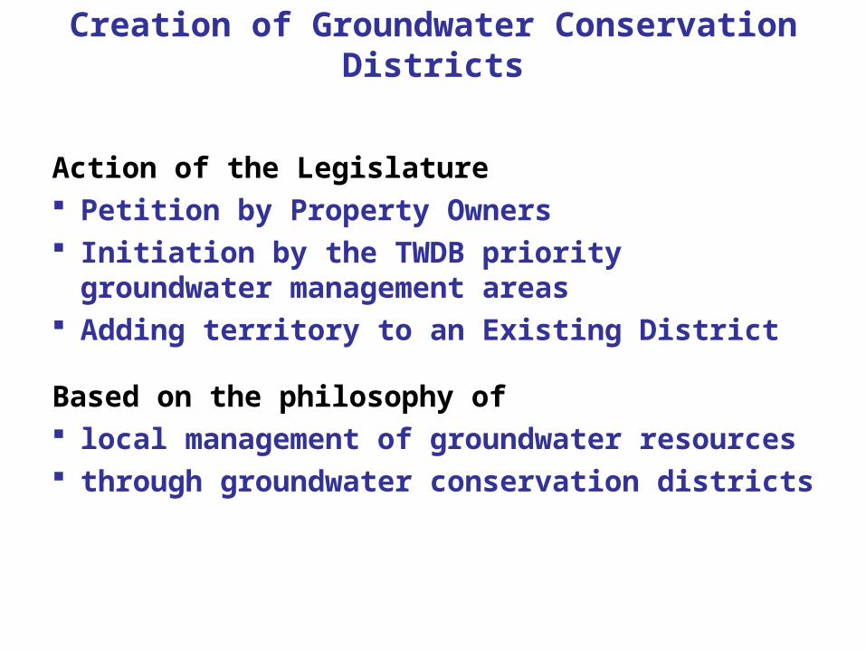
Creation of Groundwater Conservation Districts
Action of the Legislature Petition by Property Owners Initiation by the TWDB priority groundwater
management areas Adding territory to an Existing District
Based on the philosophy of local management of groundwater resources through groundwater conservation districts
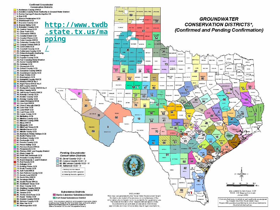
http://www.twdb.state.tx.us/mapping/
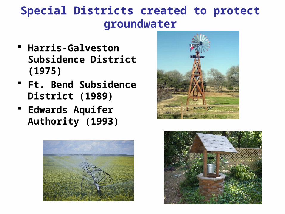
Special Districts created to protect groundwater
Harris-Galveston Subsidence District (1975)
Ft. Bend Subsidence District (1989)
Edwards Aquifer Authority (1993)

Recent Water Planning
• 1996 Texas drought– Governor Bush asks “how much water do we
have? How much are we using? How much do we need?” -- Ooops. No good answers!
• 1997 Senate Bill 1 passed by Legislature
– Regionalizes water planning in Texas and establishes surface water availability modeling
• 2001 Senate Bill 2 passed by Legislature
– Establishes groundwater availability modeling and initiates instream flow assessment
Note: Instream flow represents the flow rate to sustain a healthy habitat, biology, and geomorphology in the stream
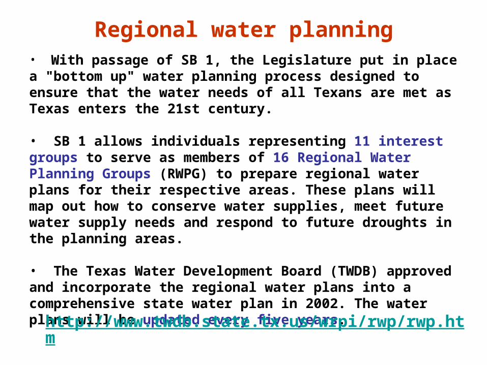
Regional water planning• With passage of SB 1, the Legislature put in place a "bottom up" water planning process designed to ensure that the water needs of all Texans are met as Texas enters the 21st century.
• SB 1 allows individuals representing 11 interest groups to serve as members of 16 Regional Water Planning Groups (RWPG) to prepare regional water plans for their respective areas. These plans will map out how to conserve water supplies, meet future water supply needs and respond to future droughts in the planning areas.
• The Texas Water Development Board (TWDB) approved and incorporate the regional water plans into a comprehensive state water plan in 2002. The water plans will be updated every five years.
http://www.twdb.state.tx.us/wrpi/rwp/rwp.htm

Regional Planning Rules
Adopted TWDB Rules are published under Title 31, Part 10 of the Texas Administrative Code on the Secretary of State's website.
• Chapter 355 - Research and Planning Funding • Chapter 356 - Groundwater Management • Chapter 357 - Regional Water Planning
Guidelines • Chapter 358 - State Water Planning
Guidelines • Chapter 363 - Financial Assistance Programs
http://www.twdb.state.tx.us/wrpi/rwp/rules.htm

Location of the 16 Regional Water Planning groups
http://www.twdb.state.tx.us/mapping/
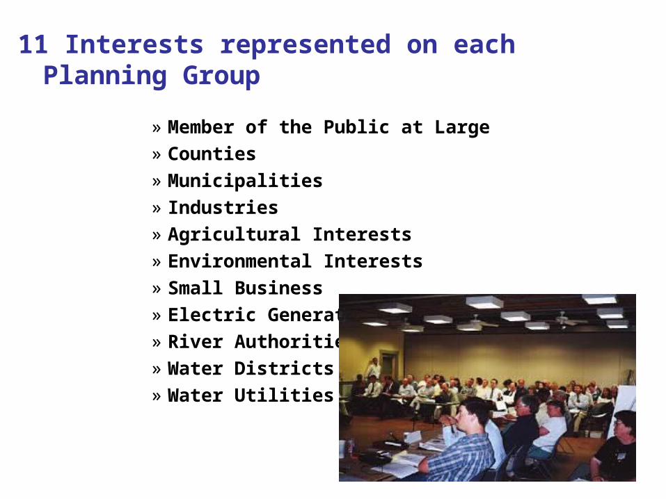
11 Interests represented on each Planning Group
» Member of the Public at Large» Counties» Municipalities » Industries » Agricultural Interests » Environmental Interests» Small Business » Electric Generating Utilities » River Authorities » Water Districts» Water Utilities

Regional Water Planning Steps - 1
• Determine water demands• Determine water supplies during low
flows• Determine surplus or need• Determine impact of not meeting needs• Develop alternatives, strategies, and
any unmet needs
Regional Water Planning Steps - 2
• Identify ecologically unique streams and rivers
• Identify unique reservoir sites• Coordinate with neighboring regions• Propose regulatory, administrative or
legislative recommendations to improve water resource management in the state

Products from Regional Planning
• The Regional Planning homepage is at
http://www.twdb.state.tx.us/wrpi/rwp/rwp.htm• The latest Regional Plans are online at
http://www.twdb.state.tx.us/wrpi/rwp/previous.htm
Surface Water Availability Modeling and Planning
Approach for Surface Water Availability Modeling and Planning
• Determine available water during drought conditions
• Evaluate impacts of reuse on existing water rights
• Evaluate impacts of cancellation on existing water rights
• Determine firm yields of major reservoirs
• Use as a permitting tool
Water Availability Modeling in TexasPursuant to 1997 Senate Bill 1
Water Rights Analysis Package (WRAP) model developed at Texas A&M University and adopted for Texas WAM System
Water Availability Modeling (WAM) System implemented by TNRCC/TCEQ, its partner agencies, and contractors pursuant to Senate Bill 1 (SB1) enacted by the Texas Legislature in June 1997

Water Availability Modeling
A water availability model is a computer-based simulation predicting the amount of water that would be in a river or stream under a specified set of conditions.
The model of a specific river basin consists of two parts:
• the modeling program, called "WRAP", short for Water Rights Analysis Package
• a text file that contains basin-specific information for WRAP to process (these text files are called input files)
Details for water availability modeling are presented on the TCEQ website at:
http://www.tceq.state.tx.us/permitting/water_supply/water_rights/wam.html
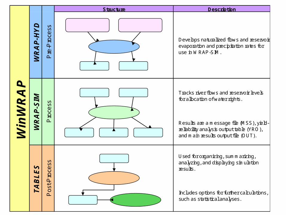
Structure Description
Develops naturalized flows and reservoir evaporation and precipitation rates for use in WRAP-SIM.
Tracks river flows and reservoir levels for allocation of water rights.
Results are a message file (MSS), yield-reliability analysis output table (YRO), and main results output file (OUT).
Used for organizing, summarizing, analyzing, and displaying simulation results.
Includes options for further calculations, such as statistical analyses.
WR
AP
-HY
DW
RA
P-S
IMT
AB
LE
S
Win
WR
AP
Pre
-Pro
cess
Pro
cess
Po
st-P
roce
ss
Historical Flow Evaporation Data
WRAP-HYD
FLO EVA
WRAP-SIM
MSS OUT YRO
FLO EVA
OUT
TABLES
OUT Excel

Water Availability Models – flow definitions
• Naturalized Flows – flows that would have occurred in the absence of human activity
• Regulated Flows – actual flow at a given point in the basin
• Unappropriated Flows the amount of flow available for appropriation
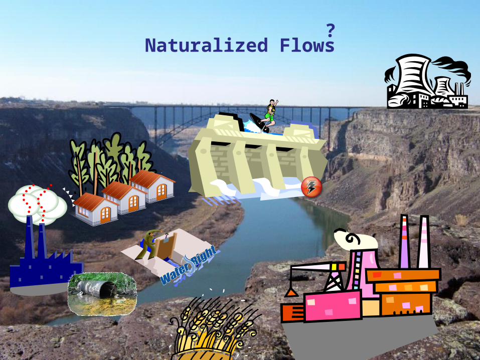
Naturalized Flows?

Naturalized Flows
• WRAP is Based on Naturalized Flows
NF naturalized flow
GF gaged flow
D water supply diversions upstream
RF return flow upstream
EP reservoir evaporation minus precipitation
S change in storage in upstream reservoirs
• Used to predict reliabilities (water availability)
NF = GF + Di – RFi + EPi + Si
NF
GF
D
RF
EPS

Additional details for use of the model• Water Availability Models are used to determine whether water would
be available for a newly requested water right or amendment.
• TCEQ staff uses two models in evaluating applications:
• the Full Authorization simulation, in which all water rights utilize their maximum authorized amounts, is used to evaluate applications for perpetual water rights and amendments.
• the Current Conditions simulation, which includes return flows, is used to evaluate applications for term water rights and amendments.
• If water is available, these models estimate how often the applicant could count on water under various conditions. For example, would water be available only one month out of the year, half the year, or all year? And would that water be available in a repeat of the drought of record?
• In evaluating applications for a new appropriation of water and some applications for amendments to existing water rights, TCEQ staff must consider recommended environmental flow needs. Environmental flow needs include instream flows and freshwater inflows to bays and estuaries.
• The water availability models provide information that assists TCEQ staff in determining whether to recommend the granting or denial of an application.
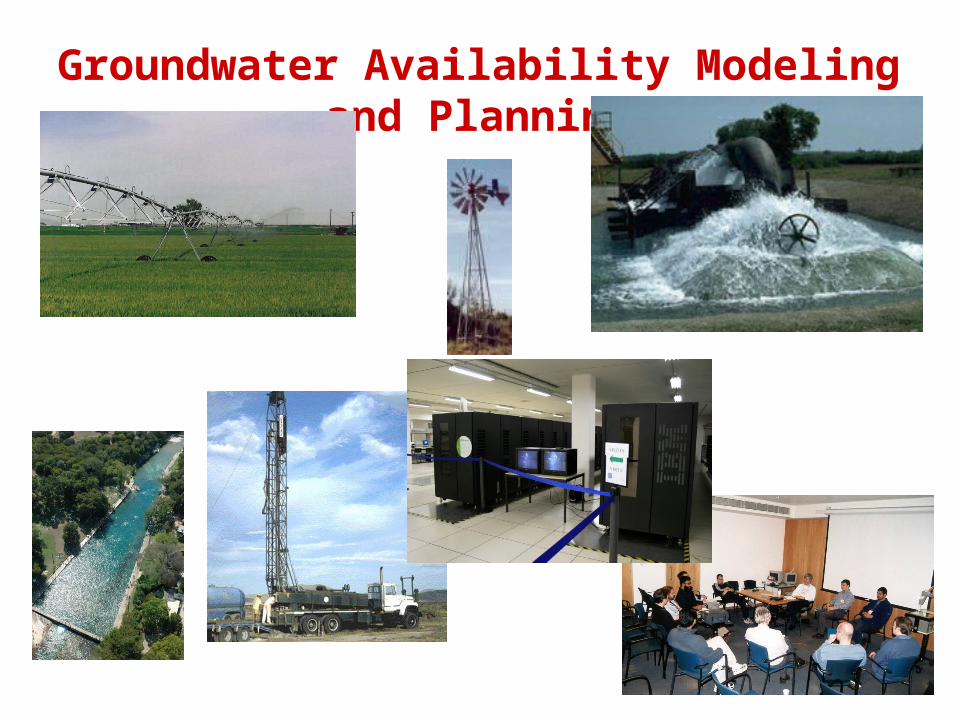
Groundwater Availability Modeling and Planning

Groundwater Availability Modeling and Planning (cont)
GAM's Mission: to provide reliable, timely data on groundwater
availability to the citizens of Texas to ensure adequacy of supplies or recognition of inadequacy of supplies throughout the 50 year planning horizon.
GAM will result in publicly available numerical groundwater flow models for the major and minor aquifers of Texas.
http://www.twdb.state.tx.us/gam/
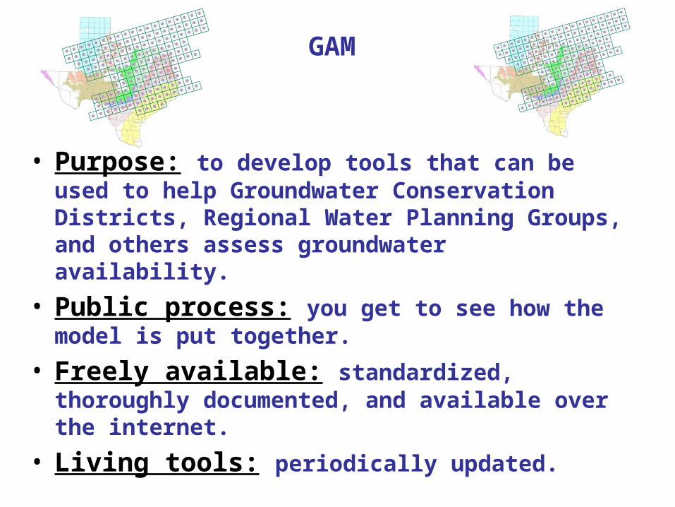
• Purpose: to develop tools that can be used to help Groundwater Conservation Districts, Regional Water Planning Groups, and others assess groundwater availability.
• Public process: you get to see how the model is put together.
• Freely available: standardized, thoroughly documented, and available over the internet.
• Living tools: periodically updated.
GAM

• A GAM is a tool that can be used to assess groundwater availability once Groundwater Conservation Districts and Regional Water Planning Groups decide how to define groundwater availability (typically based on specified limits of groundwater decline from future pumpage, maintaining springflows, etc).
GAMs and Groundwater Availability
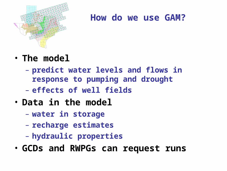
• The model– predict water levels and flows in response to
pumping and drought– effects of well fields
• Data in the model– water in storage– recharge estimates– hydraulic properties
• GCDs and RWPGs can request runs
How do we use GAM?
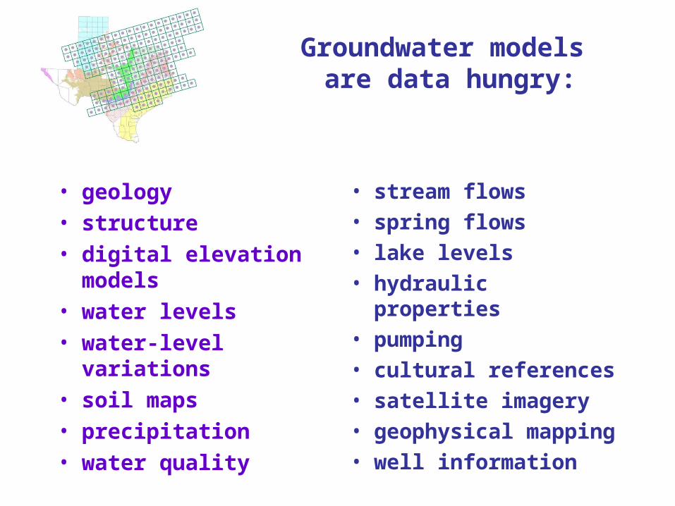
• geology• structure• digital elevation
models• water levels• water-level variations• soil maps• precipitation• water quality
• stream flows• spring flows• lake levels• hydraulic properties• pumping• cultural references• satellite imagery• geophysical mapping• well information
Groundwater models are data hungry:
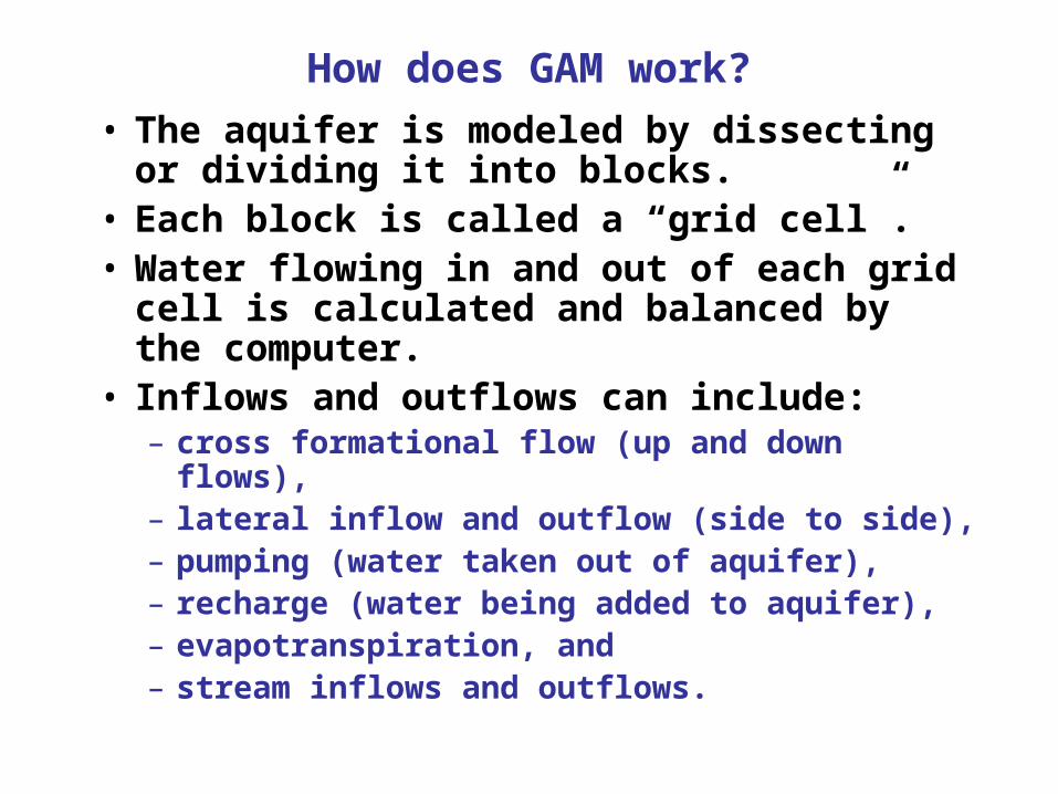
How does GAM work?
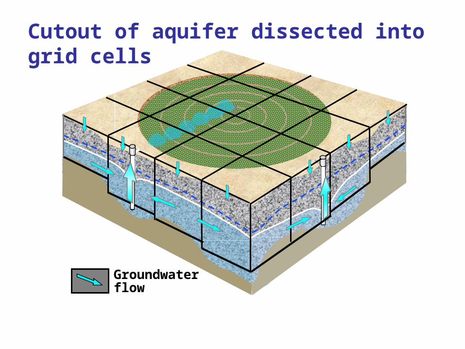
• The aquifer is modeled by dissecting or dividing it into blocks.
• Each block is called a “grid cell”.• Water flowing in and out of each grid cell
is calculated and balanced by the computer.
• Inflows and outflows can include:– cross formational flow (up and down flows), – lateral inflow and outflow (side to side), – pumping (water taken out of aquifer), – recharge (water being added to aquifer), – evapotranspiration, and – stream inflows and outflows.
Groundwaterflow
Cutout of aquifer dissected into grid cells

• PermeabilityPermeability
• Storage Storage
• ThicknessThickness
IrrigationIrrigationreturn flowreturn flow
NaturalNaturalrechargerecharge
Water Water remaining remaining in storagein storage
Flow in one grid cell

mile
Saturatedthickness (ft)
700600500400300200100
500
N
0 30
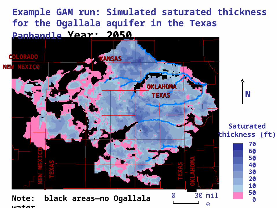
Example GAM run: Simulated saturated thickness for the Ogallala aquifer in the Texas Panhandle Year: 2005
NE
W M
EX
ICO
NE
W M
EX
ICO
TE
XA
ST
EX
AS
TE
XA
ST
EX
AS
OK
LA
HO
MA
OK
LA
HO
MA
NEW MEXICONEW MEXICO
COLORADOCOLORADO KANSASKANSAS
TEXASTEXASOKLAHOMAOKLAHOMA
Note: black areas—no Ogalala water
Click to next slide and back to view difference in saturated thickness from 2005 to 2050
mile
Saturatedthickness (ft)
700600500400300200100
500
N
0 30
NE
W M
EX
ICO
NE
W M
EX
ICO
TE
XA
ST
EX
AS
TE
XA
ST
EX
AS
OK
LA
HO
MA
OK
LA
HO
MA
NEW MEXICONEW MEXICO
COLORADOCOLORADO KANSASKANSAS
TEXASTEXASOKLAHOMAOKLAHOMA
Example GAM run: Simulated saturated thickness for the Ogallala aquifer in the Texas Panhandle Year: 2050
Note: black areas—no Ogallala water

Simulated drawdown for 2050Ogallala aquifer
Oklahoma
Texas
New Mexico
KansasColorado
Decline in groundwater levels from 2005 to 2050
(millions of acre-ft per year)
Capitan Reef
Seymour
Brazos AlluviumDockum
Lipan
Ellenburger - San Saba
WoodbineMarble FallsRita Blanca
Edwards-Trinity High PlainsNacatoch
RustlerBlossom
390,000
250,000
110,000
81,000
49,000
46,000
26,000
22,000
5,300
5,000
4,700
4,000
810
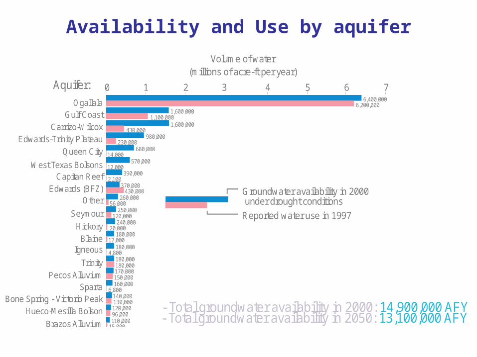
Aquifer:
Ogallala 6,400,000
Gulf Coast 1,600,000
Carrizo-Wilcox 1,600,000
Queen City 680,000
West Texas Bolsons 570,000
Edwards (BFZ) 370,000
Hickory 240,000
Blaine 180,000
Marathon 30,000
Trinity 180,000
Other 260,000
Igneous 180,000
Pecos AlluviumSparta
Bone Spring - Victorio Peak
170,000
160,000
140,000
Hueco-Mesilla Bolson 120,000
Edwards-Trinity Plateau 980,000
0 1 2 3 4 5 6 7
6,200,000
1,100,000
430,000
230,000
14,000
12,000
2,100
430,000
56,000
120,000
20,000
17,000
4,800
180,000
15,000
6,800
130,000
150,000
96,000
41,000
66,000
5,900
130
17,000
1,600
6,200
2,000
3,500
1,600
1,000
- Total groundwater availability in 2000: 14,900,000 AFY- Total groundwater availability in 2050: 13,100,000 AFY
Groundwater availability in 2000 under drought conditions
Reported water use in 1997
Volume of water
Availability and Use by aquifer
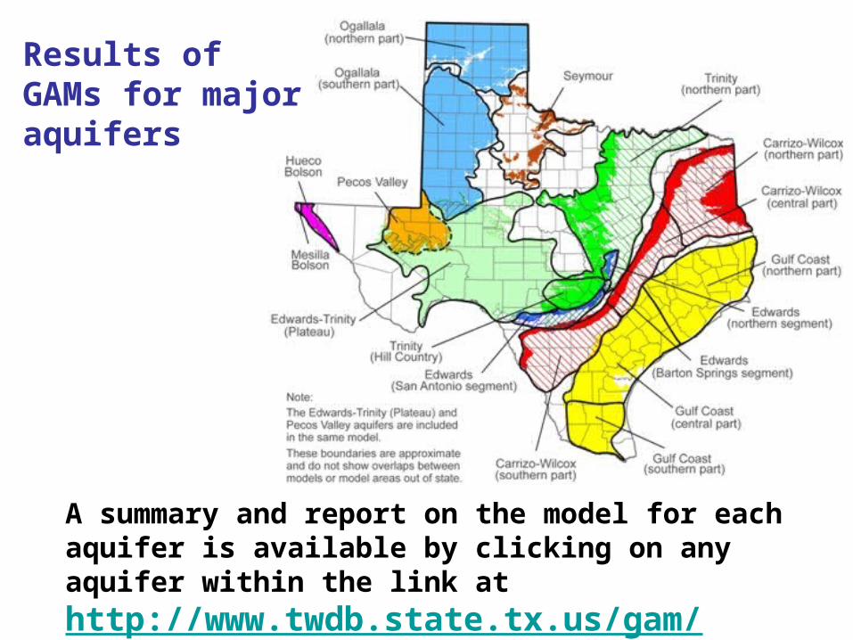
A summary and report on the model for each aquifer is available by clicking on any aquifer within the link at http://www.twdb.state.tx.us/gam/
Results of GAMs for major aquifers
Specific laws and rules
• Overview of Laws Regarding the Navigation of Texas Streams http://www.tpwd.state.tx.us/publications/nonpwdpubs/water_issues/rivers/navigation/riddell/
• Public access to streams
• http://www.tpwd.state.tx.us/publications/nonpwdpubs/water_issues/rivers/navigation/riddell/publicaccess.phtml
• If A River Runs Through It, What Law Applies? http://www.tpwd.state.tx.us/publications/nonpwdpubs/water_issues/rivers/navigation/kennedy/kennedy_faq.phtml
• Texas surface water quality monitoring required by the Federal Clean Water Act http://www.tceq.state.tx.us/compliance/monitoring/water/quality/data/wqm/305_303.html
A map presenting the location of the segment numbers for the monitoring is at http://www.tceq.state.tx.us/assets/public/gis/docs/seg2000.pdf
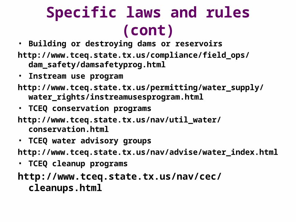
Specific laws and rules (cont)• Building or destroying dams or reservoirs
http://www.tceq.state.tx.us/compliance/field_ops/dam_safety/damsafetyprog.html
• Instream use program
http://www.tceq.state.tx.us/permitting/water_supply/water_rights/instreamusesprogram.html
• TCEQ conservation programs
http://www.tceq.state.tx.us/nav/util_water/conservation.html• TCEQ water advisory groups
http://www.tceq.state.tx.us/nav/advise/water_index.html• TCEQ cleanup programs
http://www.tceq.state.tx.us/nav/cec/cleanups.html

References for additional information• Texas Environmental Almanac from Texas Environmental Center
and Texas Center for Policy Studies Chapter 1: Water quantity http://www.texascenter.org/almanac/QUANTITYCH1P1.HTML Chapter 2: Water Quality http://www.texascenter.org/almanac/QUALITYCH2P1.HTML
• Texas Water Matters http://www.texaswatermatters.org/
• A Texans guide to water and water-rights marketing http://www.twdb.state.tx.us/publications/reports/WaterRightsMarketingBrochure.pdf
• Hydrology and Texas Water Law: ...A Logician’s Nightmare by Otis W. Templer
http://digitalcommons.unl.edu/cgi/viewcontent.cgi?article=1049&context=greatplainsresearch