Embed Size (px)
Citation preview

Basic elements of civilization
• Political (territory-based) institutions • Organized religion• Urban/administrative centers• Hierarchical system of classes• Taxation (far from universal)• Division, specialization of labor• Further technological development• Trade (but note Paleolithic luxury trade)• Writing (a late step!)

Ancient Civilizations:
A comparative analysis of ancient Egypt and Mesopotamia

Mesopotamia
-Mesopotamia is a Greek word meaning 'between the rivers'.
- The rivers are the Tigris and Euphrates which flow through modern Iraq. The Euphrates also flows through much of Syria.
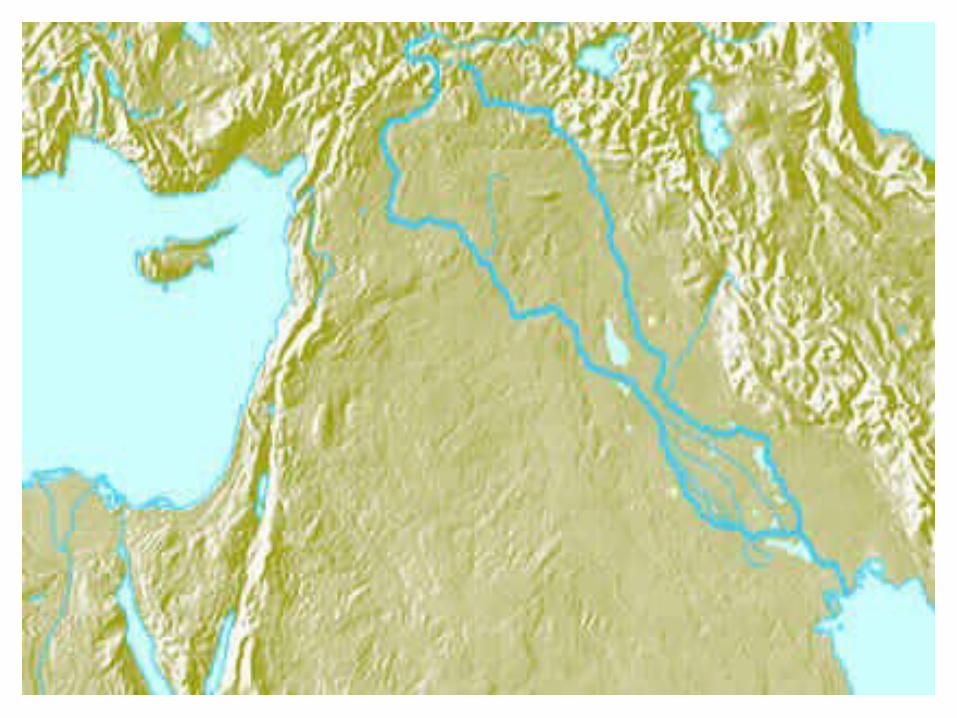

Where?
• Ancient Mesopotamia lay in what we know today as Iraq, northeast Syria, and part of southeast Turkey.
• It stretched from the Persian Gulf northwest through the valley of the Tigris and Euphrates rivers.
• It was part of an area known as the ‘Fertile Crescent: Stretching from the Persian gulf through Northeast Syria to the Mediterranean Sea.

Modern Map of Mesopotamia

Mesopotamian Cities
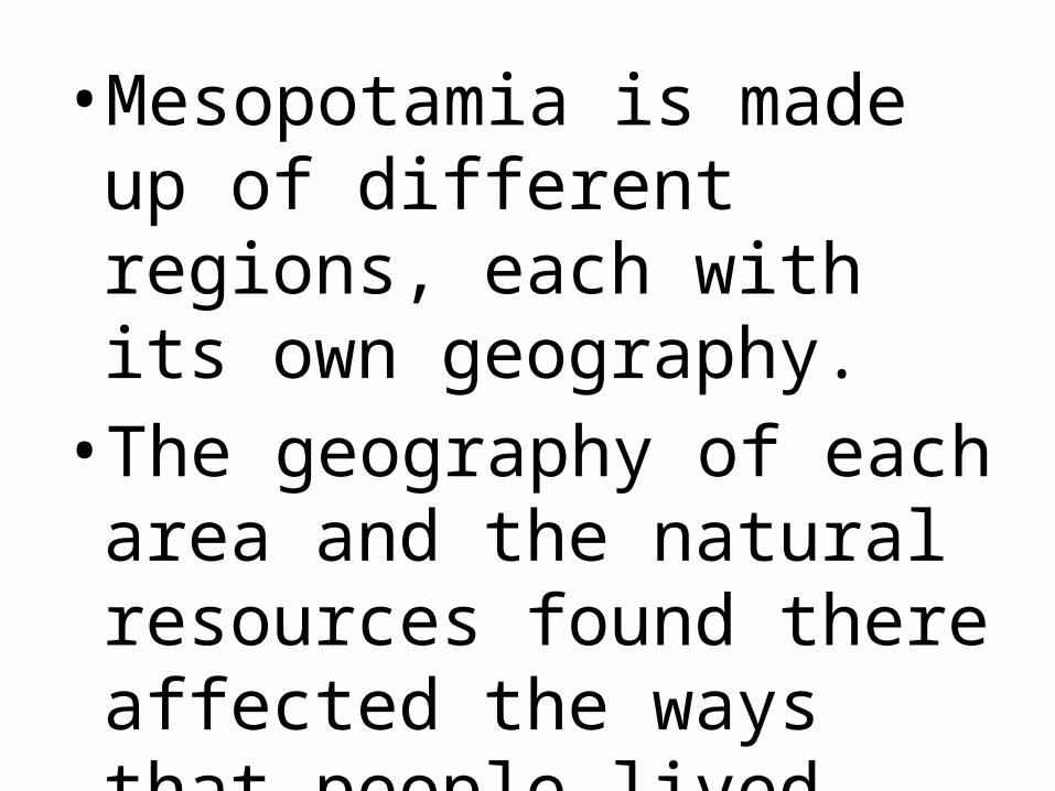
•Mesopotamia is made up of different regions, each with its own geography. • The geography of each area
and the natural resources found there affected the ways that people lived.


Northern Mesopotamia• Northern Mesopotamia is made up
of hills and plains. The land is quite fertile due to seasonal rains, and the rivers and streams flowing from the mountains. Early settlers farmed the land and used timber, metals and stone from the mountains nearby.

Southern Mesopotamia• Southern Mesopotamia is made up of
marshy areas and wide, flat, barren plains. Cities developed along the rivers which flow through the region. Early settlers had to irrigate the land along the banks of the rivers in order for their crops to grow. Since they did not have many natural resources, contact with neighbouring lands was important.

Farming/Irrigation
• Farmers in ancient Sumer grew imported crops like barley in a land without much rainfall and with a limited water supply. • One of the ways that they were able to
do this was through developing a system for controlling the flow and direction of water from the river.

Farming Irrigation
• Canals and irrigation ditches were built for redirecting the water to the fields used for farming. • Regulators were then used to raise
and lower the water levels in the canals and ditches so the water could be used by the farmers.

Farming Irrigation
• During the growing season, each farmer was allowed only a certain amount of water.
• When it was a farmer's turn to water his fields the regulator was adjusted so that water ran from the canal into an irrigation ditch which ran alongside the farmer's fields. The farmer could then water his fields.

Geo-Political Overview
• Four main Peoples dominated Mesopotamia in turn: the Sumerians, the Babylonians, the Assyrians, and the Chaldeans.
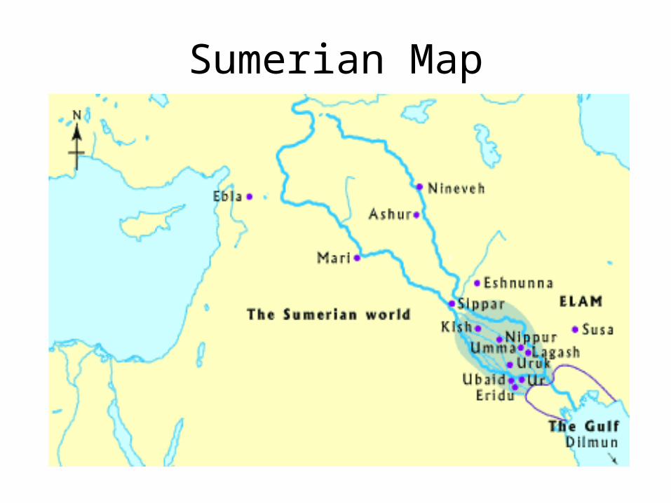
Sumerian Map

Sumerians: 3500BCE to 1900BCE
• Sumerians came down the banks of the Euphrates and Tigris rivers sometime around 3500 BCE from the mountains to the northeast.
• Small farming communities grew into the some of the first great cities of the world.
• In the first 1000 years Sumerians lived in independent city states, ruled by separate kings.
• Bronze age begins

Babylonians: 1900BCE to 1300BCE*
Babylonians:
• Amorites set up their capital in Babylonia around 1900BCE
• Hammurabi Law Code is developed• One of the first known uses of currency• Hittites destroy empire 1595BCE• Kassites conquer area and rule until 1555BCE
when they are displaced by Assyrians.

Assyrians: 1300BCE to 609BCE

Assyrians
• Placed importance on science and mathematics
• Large empire expanded into Egypt• Learned to make iron from the Hitties

Chaldeans: 609BCE to 530BCE

Chaldeans
• Babylon once again an important centre in Mesopotamia
• Hanging Gardens of Babylon constructed• King Nebuchanezzar• Interests in astronomy leads to more efficient
calendars

Ancient Mesopotamian Map

Mesopotamian Natural Resources

Egypt

Egyptian Geography
• The ancient Egyptians thought of Egypt as being divided into two types of land, the 'black land' and the 'red land'.

Egyptian geography: Black land• The 'black land' was the fertile land
on the banks of the Nile. The ancient Egyptians used this land for growing their crops. This was the only land in ancient Egypt that could be farmed because a layer of rich, black silt was deposited there every year after the Nile flooded.

Egyptian Geography: Red land• The 'red land' was the barren desert
that protected Egypt on two sides. These deserts separated ancient Egypt from neighbouring countries and invading armies. They also provided the ancient Egyptians with a source for precious metals and semi-precious stones.

Geographical Features

Natural Resources

Oasis
• An oasis is an area of land in the middle of a desert with a natural water source. Some of the oases in ancient Egypt were large enough so that people could settle there and grow fruit and grain. One oasis was actually the site of a vineyard which produced wine for the pharaoh.

Quarries
• The ancient Egyptians quarried many different types of stone. Limestone, sandstone and granite were some of the most common stones used in making statues, and building temples and pyramids.

Mines
The mines of the eastern desert produced important natural resources like gold and semi-precious stones. • The ancient Egyptians used these
materials to make jewellery and special objects for the pharaoh and his family, members of the nobility, and temples.

Archaeological Sites

Egyptian Terrain Map