Embed Size (px)
DESCRIPTION
Hydrodynamic, Water Quality, and Ecological Modeling to Assess System-wide Impacts of Restoration Efforts in Coastal Louisiana and Mississippi. Barbara A. Kleiss, Ph.D. Environmental Lab and Mississippi Valley Division. LCA S&T Program Goals. - PowerPoint PPT Presentation
Citation preview
US Army Corpsof Engineers® Engineer Research and Development Center
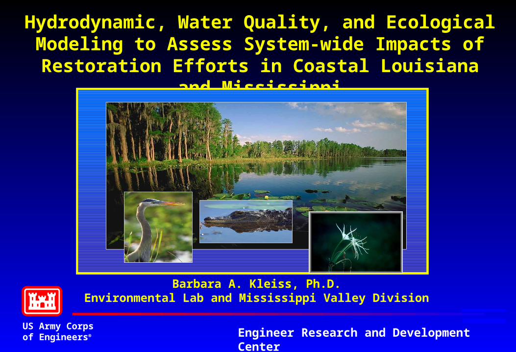
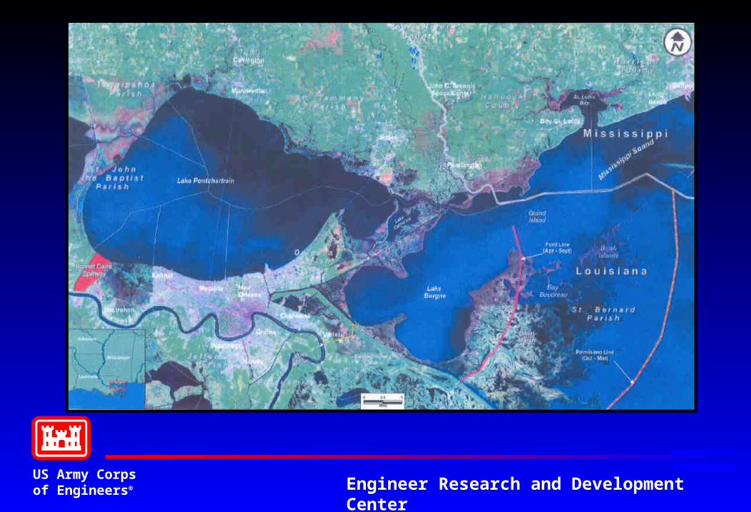
Hydrodynamic, Water Quality, and Ecological Modeling to Assess System-wide Impacts of Restoration Efforts
in Coastal Louisiana and Mississippi
Barbara A. Kleiss, Ph.D.Environmental Lab and Mississippi Valley Division
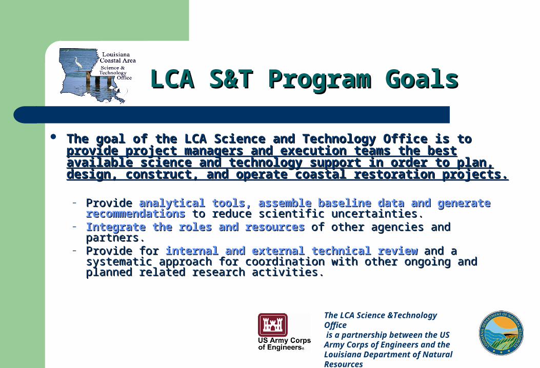
LCA S&T Program GoalsLCA S&T Program Goals
The goal of the LCA Science and Technology Office is to The goal of the LCA Science and Technology Office is to provide provide project managers and execution teams the best available science project managers and execution teams the best available science and technology support in order to plan, design, construct, and and technology support in order to plan, design, construct, and operate coastal restoration projects.operate coastal restoration projects.
– ProvideProvide analytical tools, assemble baseline data and generate analytical tools, assemble baseline data and generate recommendationsrecommendations to reduce scientific uncertainties. to reduce scientific uncertainties.
– Integrate the roles and resourcesIntegrate the roles and resources of other agencies and partners. of other agencies and partners. – Provide for Provide for internal and external technical reviewinternal and external technical review and a systematic and a systematic
approach for coordination with other ongoing and planned related research approach for coordination with other ongoing and planned related research activities. activities.
The LCA Science &Technology Office is a partnership between the US Army Corps of Engineers and the Louisiana Department of Natural Resources
US Army Corpsof Engineers® Engineer Research and Development Center
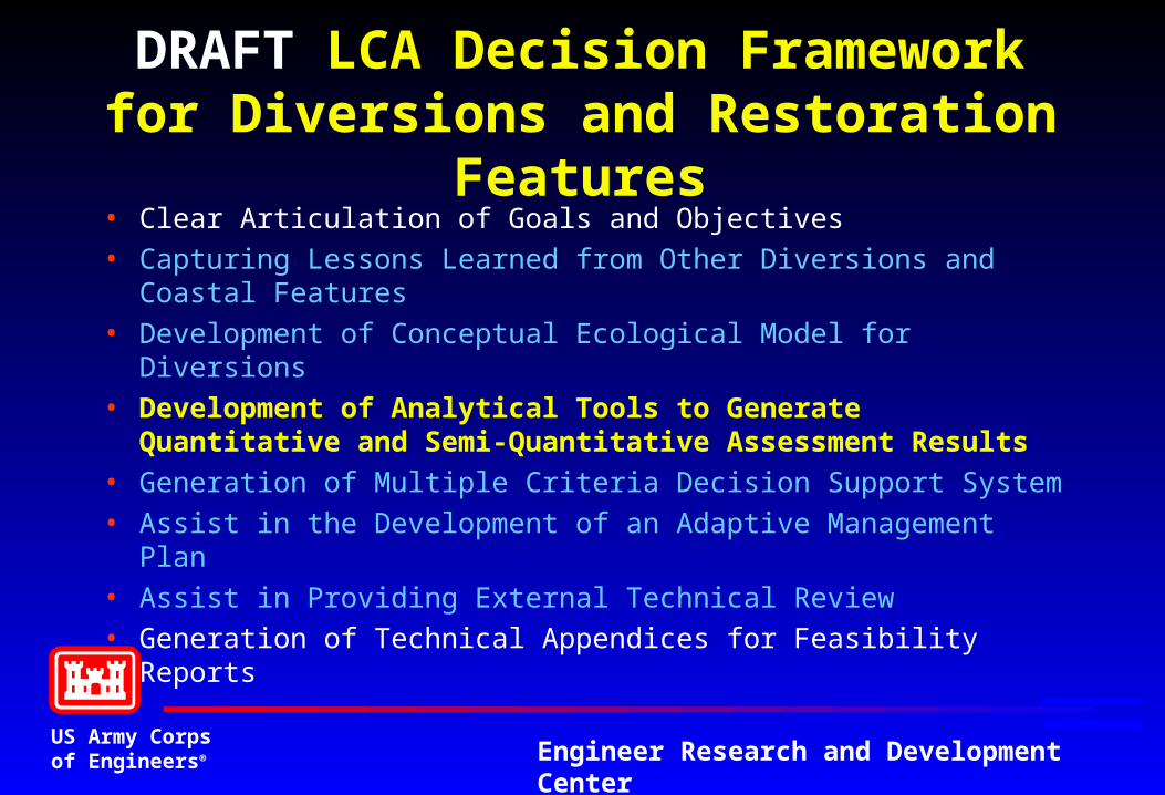
DRAFT LCA Decision Framework for Diversions and Restoration Features
• Clear Articulation of Goals and Objectives
• Capturing Lessons Learned from Other Diversions and Coastal Features
• Development of Conceptual Ecological Model for Diversions
• Development of Analytical Tools to Generate Quantitative and Semi-Quantitative Assessment Results
• Generation of Multiple Criteria Decision Support System
• Assist in the Development of an Adaptive Management Plan
• Assist in Providing External Technical Review
• Generation of Technical Appendices for Feasibility Reports
US Army Corpsof Engineers® Engineer Research and Development Center
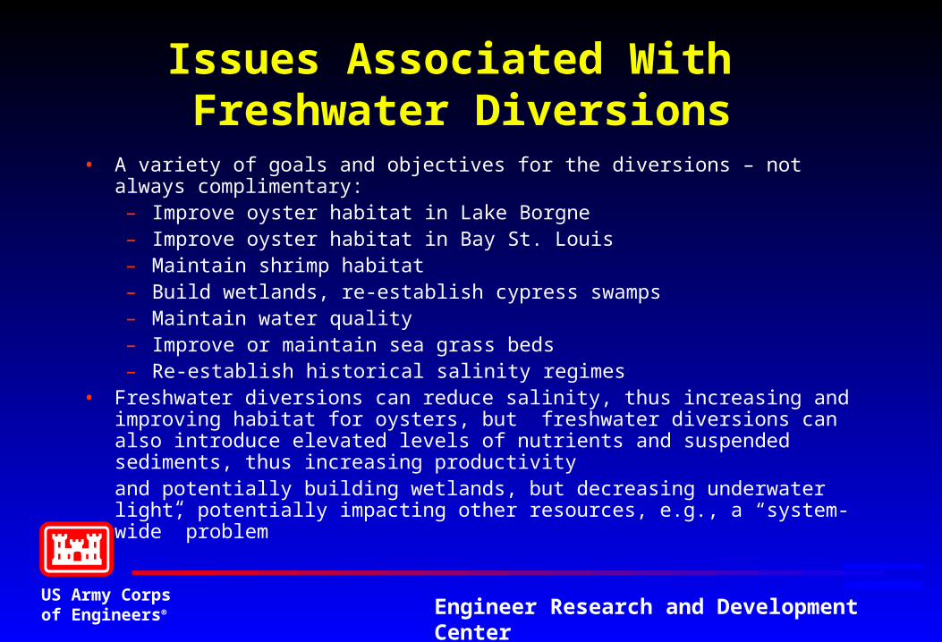
Issues Associated With Freshwater Diversions
• A variety of goals and objectives for the diversions – not always complimentary:– Improve oyster habitat in Lake Borgne– Improve oyster habitat in Bay St. Louis– Maintain shrimp habitat– Build wetlands, re-establish cypress swamps– Maintain water quality– Improve or maintain sea grass beds– Re-establish historical salinity regimes
• Freshwater diversions can reduce salinity, thus increasing and improving habitat for oysters, but freshwater diversions can also introduce elevated levels of nutrients and suspended sediments, thus increasing productivity and potentially building wetlands, but decreasing underwater light, potentially impacting other resources, e.g., a “system-wide” problem
US Army Corpsof Engineers® Engineer Research and Development Center
US Army Corpsof Engineers® Engineer Research and Development Center
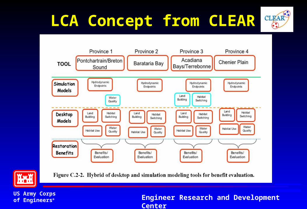
LCA Concept from CLEAR
US Army Corpsof Engineers® Engineer Research and Development Center
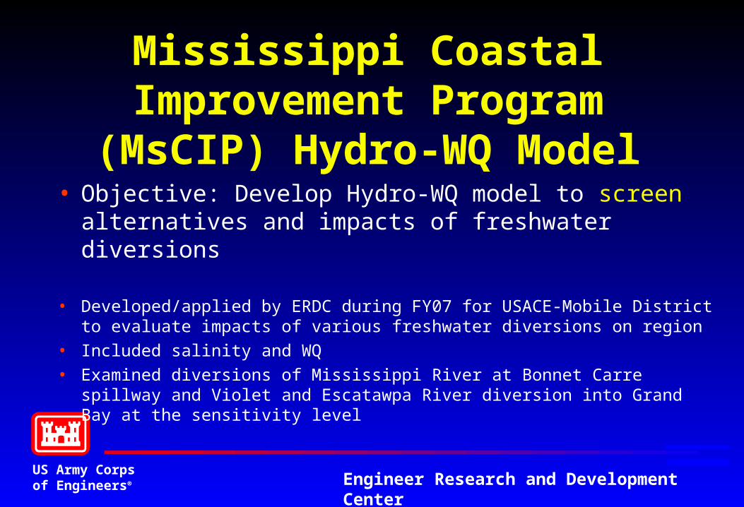
Mississippi Coastal Improvement Program (MsCIP)
Hydro-WQ Model• Objective: Develop Hydro-WQ model to screen
alternatives and impacts of freshwater diversions
• Developed/applied by ERDC during FY07 for USACE-Mobile District to evaluate impacts of various freshwater diversions on region
• Included salinity and WQ
• Examined diversions of Mississippi River at Bonnet Carre spillway and Violet and Escatawpa River diversion into Grand Bay at the sensitivity level
US Army Corpsof Engineers® Engineer Research and Development Center
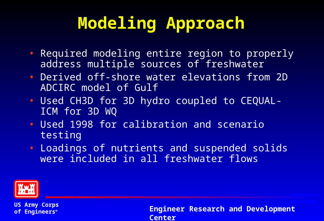
Modeling Approach
• Required modeling entire region to properly address multiple sources of freshwater
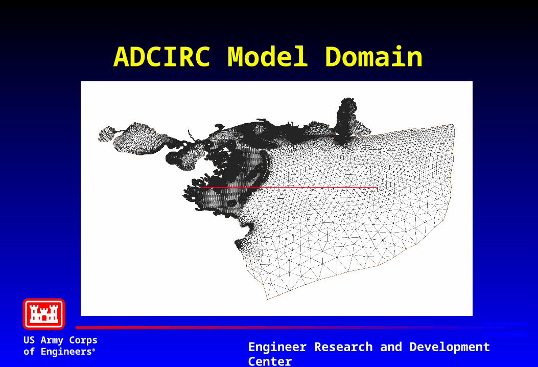
• Derived off-shore water elevations from 2D ADCIRC model of Gulf
• Used CH3D for 3D hydro coupled to CEQUAL-ICM for 3D WQ
• Used 1998 for calibration and scenario testing• Loadings of nutrients and suspended solids were included
in all freshwater flows
US Army Corpsof Engineers® Engineer Research and Development Center
ADCIRC Model Domain
US Army Corpsof Engineers® Engineer Research and Development Center
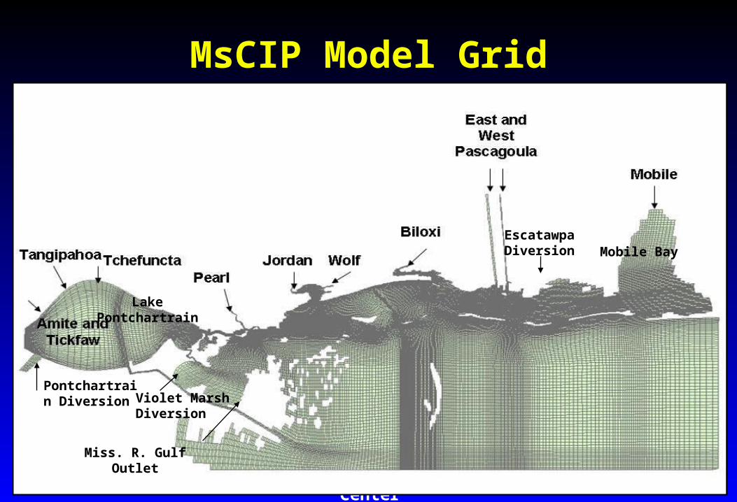
MsCIP Model Grid
Pontchartrain Diversion Violet Marsh
Diversion
Escatawpa Diversion
Lake Pontchartrain
Mobile Bay
Miss. R. Gulf Outlet
US Army Corpsof Engineers® Engineer Research and Development Center
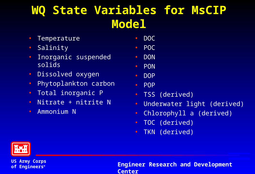
WQ State Variables for MsCIP Model
• Temperature
• Salinity
• Inorganic suspended solids
• Dissolved oxygen
• Phytoplankton carbon
• Total inorganic P
• Nitrate + nitrite N
• Ammonium N
• DOC
• POC
• DON
• PON
• DOP
• POP
• TSS (derived)
• Underwater light (derived)
• Chlorophyll a (derived)
• TOC (derived)
• TKN (derived)
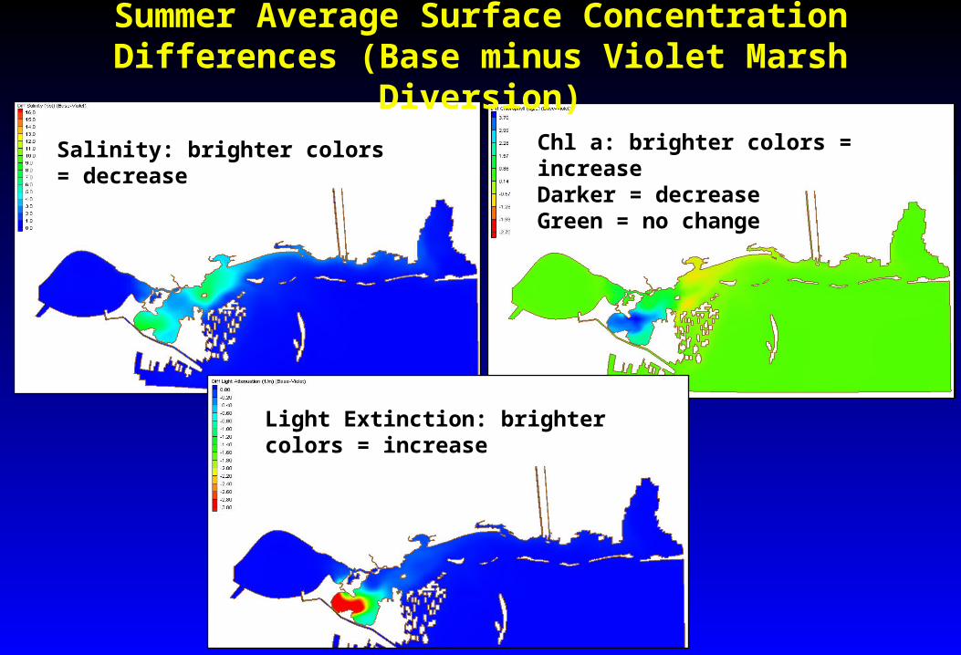
Summer Average Surface Concentration Differences (Base minus Violet Marsh Diversion)
Salinity: brighter colors = decrease
Chl a: brighter colors = increaseDarker = decreaseGreen = no change
Light Extinction: brighter colors = increase
US Army Corpsof Engineers® Engineer Research and Development Center
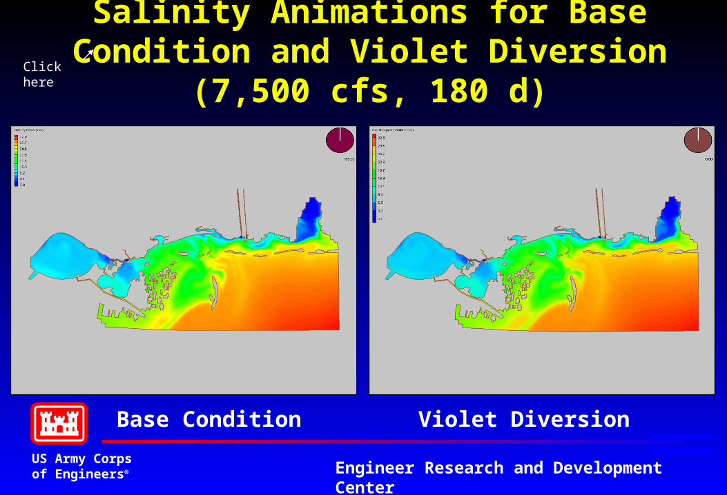
Salinity Animations for Base Condition and Violet Diversion (7,500 cfs, 180 d)
Base Condition Violet Diversion
Click here
US Army Corpsof Engineers® Engineer Research and Development Center
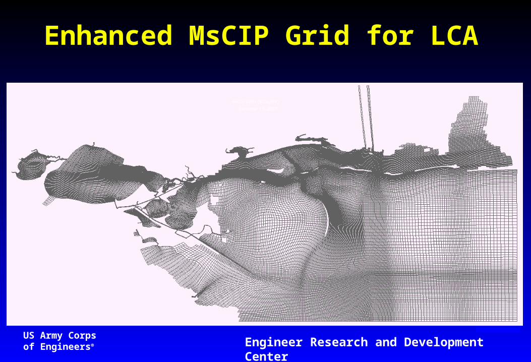
Enhanced MsCIP Grid for LCA
US Army Corpsof Engineers® Engineer Research and Development Center
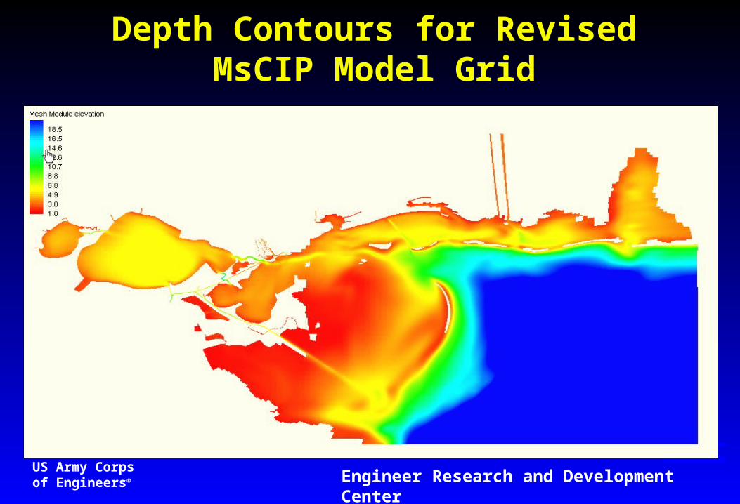
Depth Contours for Revised MsCIP Model Grid
US Army Corpsof Engineers® Engineer Research and Development Center
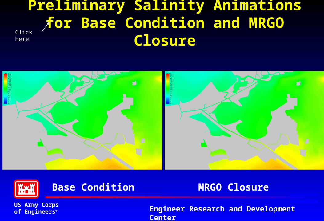
Preliminary Salinity Animations for Base Condition and MRGO Closure
Base Condition MRGO Closure
Click here
US Army Corpsof Engineers® Engineer Research and Development Center
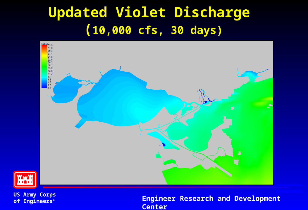
Updated Violet Discharge (10,000 cfs, 30 days)
US Army Corpsof Engineers® Engineer Research and Development Center
Future Plans & Goals
• Developing decision making framework document - forecast benefits and impacts of alternatives
• Continue refinement of the MsCIP (Violet) model. Complete development of the multi-grid version to decrease model simulation time. Implement an improved and more efficient advective transport routine, spatially varying wind and wave forcing, wetting and drying algorithms and sediment transport capabilities.
• Link MsCIP model to CLEAR models or other ecological models for species impacts
US Army Corpsof Engineers® Engineer Research and Development Center
Future Plans & Goals
• Build in vegetation and mechanistic sediment accretion models for land building with feedback to hydro-WQ
• Provide a tool that can forecast long term impacts and benefits of freshwater diversions and other coastal feature restoration efforts, including changes to barrier islands, and changes in circulation due to modifications to channels and inlets
US Army Corpsof Engineers® Engineer Research and Development Center