Embed Size (px)
Citation preview

53
Important Bird Areas in the Caribbean – Bahamas
INTRODUCTION
The Commonwealth of The Bahamas is an archipelago ofc.700 islands and c.2,000 cays and rocks extending over 1,100km. The archipelago, which lies north and east of Cuba, runsfrom east of the southern end of Florida (USA), south-eastuntil it terminates at the Turks and Caicos Islands (to theUK) which are geologically a continuation of the islands. TheBahamas are exposed parts of a limestone platform that isdivided into several shallow banks. Little Bahama Bank islocated along the northern coasts of Grand Bahama andencompasses all of Abaco and its North Atlantic offshorerocks and cays. The Great Bahama Bank (which is rich inmarine life) stretches from north of the Biminis and BerryIslands, southward to hug the southern shoreline of NewProvidence and the western shores of Andros, Eleuthera, CatIsland, the Exumas, Long Island and the Ragged Islands. TheCay Sal Bank (which is biologically impoverished) is locatedat the extreme western sea border of The Bahamas, very closeto Cuba. The islands of the Bahamas are low and flat withridges that usually rise to no more than 15–20 m. However,there are precipitous slopes under water, between and withinthe convoluted banks. The Tongue of the Ocean is a 30-kmwide trench between New Providence and Andros which drops
to depths of 2,000 m. The islands have no rivers or streamsand the soil is fertile but thin, and often lodged in shallowsand “banana holes” within the harsh limestone rock. Afreshwater lens exists close to the surface, resting on theunderlying salt-water.
The Bahamas are often divided, ecologically, into threeregions: Northern Bahamas (Grand Bahama, Biminis, BerryIslands, Abacos, North Andros, and New Providence) whereall the larger islands are covered primarily by Caribbean pinePinus caribaea woodland (with a broadleaf shrub and palmunderstorey), although much of this woodland was logged inthe mid-twentieth century; Central Bahamas (South Andros,Eleuthera, Cat Island, the Exumas, Ragged Islands, LongIsland, Rum Cay, Conception Island and San Salvador), inwhich the islands are covered primarily in broadleaf“coppice”—a dense, low semi-evergreen forest; and SouthernBahamas (Crooked Island, Acklins Island, Samana Cay,Mayaguana, Little and Great Inagua), where the islands aredrier and support dry shrubland. New Providence, in spite ofbeing one of the smaller islands, is home to c.69% of theBahamian population and the nation’s capital. Grand Bahamais second only to New Providence in terms of development,and it supports 16% of the population. It is also home to thelongest underwater cave system in the world. The rest of the
■■■■■ BAHAMASLAND AREA 13,940 km2 ALTITUDE 0–63 mHUMAN POPULATION 330,550 CAPITAL NassauIMPORTANT BIRD AREAS 39, totalling 4,700 km2
IMPORTANT BIRD AREA PROTECTION 23%BIRD SPECIES 300THREATENED BIRDS 6 RESTRICTED-RANGE BIRDS 7
PREDENSA MOORE AND LYNN GAPE(BAHAMAS NATIONAL TRUST)
Brown Noddy nesting in Graham’s Harbour IBA, San Salvador: the Bahamas islandssupport significant populations of many seabird species. (PHOTO: WILLIAM HAYES)

54
Important Bird Areas in the Caribbean – Bahamas
The Exuma Cays Land and Sea Park IBA in the northern Exumas, Central Bahamas. (PHOTO: OLGA STOKES)
Bahamas islands are called the “Family Islands” which aresparsely populated and retain their natural beauty. Of theseFamily Islands, Great and Little Abaco (and its cays) areconsidered “the sailing capital of the world”, and the islandshave a booming tourist trade. Andros is the largest island inthe Bahamas, with extensive creeks, interlacing channels, bays,bights and inlets. It is also home to many blue holes and as aresult is renowned for its cave-diving. Inagua is thesouthernmost island in the Bahamas with the nation’s onlyRamsar site—Inagua National Park—which is home to over40,000 Caribbean Flamingo Phoenicopterus ruber (and manyother waterbirds). The company Morton Bahamas Ltd.produces salt from the salinas at one end of Lake Rosa (whichoccupies c.30% of the island). Morton is one of the largestsalt producers in North America.
The Bahamas has the third highest per capita income in thewestern hemisphere (after the USA and Canada). Tourism isthe primary economic activity, accounting for c.65% of thegross domestic product (GDP). The government’s currenteconomic thrust is to put an anchor resort on each of the majorFamily Islands which will have huge implications for thebiodiversity of these otherwise relatively untouched islands.Offshore finance is the nation’s second largest industry,accounting for c.15% of GDP. The settlement history of theBahamas is convoluted and often different on each island.Plantations were established on some of the islands during thelate eighteenth century, and large-scale agriculture was trialedin the mid-twentieth century when much of remaining virginpine forests in the Northern Bahamas were logged. Subsequentdevelopment (especially on New Providence and GrandBahama, but also locally on the other inhabited islands) hashad a profound negative impact on the surrounding habitats.
The climate of the Bahamas is subtropical to tropical, andis moderated significantly by the waters of the Gulf Streamwhich keeps the islands warmer than Florida in the winterand cooler in the summer. Summer is the rainy season withJune and October the wettest months. However, the SouthernBahamas only get half the rainfall that the northern Bahamasreceive. The islands are frequently hit by hurricanes; forexample, Hurricane Andrew in 1992, Floyd in 1999, Francisand Jeanne in 2004, and Wilma in 2005. Low-pressure systemsassociated with tropical waves and resulting in strong windsand drenching rain are a regular feature in the Bahamas.
■■■■■ ConservationIn the Bahamas, the Ministry of Environment is currently theprincipal government department involved in conservation andthe environment. Within this ministry is the BahamasEnvironment Science and Technology Commission, also knownas the BEST Commission, which was established in 1994. The
BEST Commission manages the implementation of multilateralenvironmental agreements and reviews environmental impactassessments and environmental management plans fordevelopment projects within the Bahamas. The BahamasNational Trust (BNT)1 was established in 1959 under theBahamas National Trust Act. It is a non-profit organisation,funded by private donations, an endowment fund and asignificant subvention from the Government of the Bahamas.BNT advises the government on conservation policies and ischarged with safeguarding the nation’s environmental heritage.One of its statutory roles is to hold environmentally importantlands in trust for the country. BNT also has the responsibilityfor managing the national park system. The park system nowconsists of 25 parks and protected areas (10 parks weredesignated in 2002), covering 283,400 ha throughout thearchipelago. Many of these extraordinary and ofteninnovatively managed parks are also IBAs and are mentionedin more detail within the individual IBA profiles below. BNTworks in partnership with the Bahamas government, localbusiness, national and international conservation organisations,schools and the community.
In the Bahamas, there is a constant quest for economicadvancement, but without the necessary knowledge andappreciation that the nation’s environment has limitations, thiscould have catastrophic long-term consequences. In the past,valuable timber (pine and coppice) were cut, monocultureagriculture was practiced, and introduced livestock (goats) andslash-and-burn agriculture expanded to less arable areas. Atthe same time, subsistence, commercial and recreationalhunting and fishing, introduction of alien species, urban sprawl,road works, careless tapping of the freshwater lens, interferencewith natural drainage, dredging and reclamation of wetlandsand tidal mangroves, pesticide spraying to eradicatemosquitoes, malaria, yellow fever, crop pests, problems ofsewage and solid waste disposal and many other humanintrusions have all taken a huge toll on local biodiversity, andthus threaten the essence of the nation’s valuable tourismproduct.
In order to promote appropriate development for the FamilyIslands (which have previously been little impacted bydevelopment), there is an urgent need for a national landmanagement or development plan. This would help identifysensitive areas (such as the IBAs) which should be subject tolimited exploitation and/or should be placed in the protectedarea system. As an island archipelago, the Bahamas needs tobe particularly sensitive to the tourism carrying capacity, waterresource use and wetland destruction. Strategic planning for
1 The Bahamas National Trust (BirdLife in the Bahamas) is referred tothroughout this chapter by the acronym BNT.

55
Important Bird Areas in the Caribbean – Bahamas
the marina needs for the entire archipelago could effectivelylimit destruction of mangrove wetlands and tidal creeks.However, for such planning to be adopted there needs to be aclear appreciation and understanding of the need to limit ormitigate the effects of development on the biodiversity of theislands.
Lack of environmental legislation and, more importantly,the lack of enforcement of environmental legislation continueto be an obstacle for conservation in the Bahamas. The verynature of the archipelagic nation creates enforcement problemscompounded by insufficient human resources in both the RoyalBahamas Police Force and the Royal Bahamas Defense Force.Draft enabling legislation for the environment has recently beendeveloped by the BEST Commission, and includesEnvironmental Impact Assessment Final Draft Regulations;Pollution Control and Waste Management Final DraftRegulations; Draft National Environmental Policy; andEnvironmental Management Final Draft Legislation.Enactment of such legislation will provide the basic frameworkfor the coherent management of the nation’s uniqueenvironment.
All conservation partners in the Bahamas agree that astronger environmental ethic needs to be established. This canonly be accomplished through a major public outreachcampaign targeting both school-age and adult citizens as well.In particular, decision-makers need to be made aware of ourenvironmental responsibilities so that collectively the threatsoutlined below can be addressed. Government agencies andthe BNT are faced with a paucity of trained environmentalstaff. Many of those that are trained seek employment inunrelated but higher salaried professions in the financial orlegal sectors. Even in-country field research capacity is minimalbut vital to inform regulations for marine and terrestrial naturalresource management. However, there is growing awarenessthat visiting researchers and international projects have aresponsibility to help with this training and capacity issue. TheKirtland’s Warbler Training and Research Program, acollaboration between BNT, U.S. Forest Service, The NatureConservancy and the College of the Bahamas has beenexemplary in providing opportunities for Bahamian studentsto gain expert field and academic training.
Habitat destruction and degradation caused by humanpopulation growth and extensive changes in land use practicesis impacting on the birdlife and other biodiversity. Local speciesextinctions are happening, e.g. the Great Lizard-cuckooSaurothera merlini has been extirpated from New Providenceover the last 10 years. While the habitat loss that leads to suchextinctions is best addressed through improved planning,legislation, protection and enforcement, the BNT is workingto engage local communities in the protection of critical areas.For example, local Site Support Groups in Abaco, New
Providence and Inagua are working with the BNT to developnative tree nurseries and to re-plant areas with nativevegetation. BNT is also working with local nurseries to promotethe propagation of native trees and vegetation by these private-sector businesses. In the Bahamas, it is common practice totreat the wetlands as wastelands to be filled in to provide moreland or to be dredged for canals and marinas. The work of theBNT through the West Indian Whistling-duck and WetlandsConservation Program (a program of the Society for theConservation and Study of Caribbean Birds) has gone someway to raising awareness of the critical importance of wetlandsfor biodiversity, as nursery grounds for economically importantfisheries, and for coastal zone protection (including flood andhurricane damage mitigation). BNT has recently partnered withRARE Conservation to implement a Pride Campaign, a socialmarketing campaign to educate Bahamians about the value ofwetlands and change the perception of them as “wastelands”or dumping grounds. The site focus for this Pride Campaign isHarrold and Wilsons Ponds National Park, one of the IBAsdescribed below.
Biodiversity in the Bahamas is facing a constant threat byintroduced or invasive species, both plants (e.g. Brazilian pepperSchinus terebinthefolius and casuarina Casuarina equisetifolia)and animals (e.g. feral cats Felis catus, raccoons Procyon lotorand wild hogs Sus scrofa) alike. The historic and culturalpractice of using small islands as natural corrals for goats hasimpacted the vegetation on many remote cays. The BNT isworking with a Site Support Group to manage invasive plantsat Harrold and Wilsons Ponds National Park, and with Friendsof the Environments (another Site Support Group) in Abacoto manage the feral cat population. In the last two years, feralcats predated 50% of the “Bahama Parrot” Amazonaleucocephala bahamensis nests on the island. Conservationagencies in conjunction with the BEST Commission haveadopted, and are promoting, a National Invasive Species Policy.
■■■■■ BirdsOver 300 species of bird have been recorded from theBahamas, 109 of which breed on the islands, 169 are migrantsthat pass through the islands or winter, and 45 are vagrantsthat have occurred only a few times each. Only three breedinglandbirds are summer visitors: Antillean NighthawkChordeiles gundlachii, Grey Kingbird Tyrannus dominicensisand Black-whiskered Vireo Vireo altiloquus. However, manyof the seabirds are only present during their spring and summerbreeding seasons. Neotropical migrants (that breed in NorthAmerica) comprise c.50% of the total land bird population inthe northern islands from November through March. Thenumber and diversity of migrants declines from north to souththrough the islands. Bahamas Endemic Bird Area (EBA)restricted-range birds total seven extant species (see Table 1).
Infrastructure for visitation (and education and awareness) isbeing put in place by BNT in a number of IBAs such as this
viewing platform and boardwalk in the Blue Holes NationalPark, Central Andros. (PHOTO: SHELLEY CANT)
The “Bahama Parrot” has been the focus of research andconservation project actions such as the management of the
predatory feral cat population on Abaco. (PHOTO: HENRY NIXON)
56
Important Bird Areas in the Caribbean – Bahamas
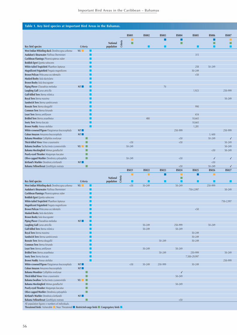
Table 1. Key bird species at Important Bird Areas in the Bahamas.
Crite
ria
BS001 BS002 BS003 BS004 BS005 BS006 BS007■ ■ ■ ■ ■
National ■ ■ ■ ■
Key bird species Criteria population ■ ■ ■ ■ ■
West Indian Whistling-duck Dendrocygna arborea VU ■ ■
Audubon’s Shearwater Puffinus lherminieri ■ 315Caribbean Flamingo Phoenicopterus ruber ■
Reddish Egret Egretta rufescens ■
White-tailed Tropicbird Phaethon lepturus ■ 258 50–249Magnificent Frigatebird Fregata magnificens ■ 50–249Brown Pelican Pelecanus occidentalis ■ <50Masked Booby Sula dactylatra ■
Brown Booby Sula leucogaster ■
Piping Plover Charadrius melodus NT ■ ■ 70Laughing Gull Larus atricilla ■ 1,923 250–999Gull-billed Tern Sterna nilotica ■
Royal Tern Sterna maxima ■ 50–249Sandwich Tern Sterna sandvicensis ■
Roseate Tern Sterna dougallii ■ 990Common Tern Sterna hirundo ■
Least Tern Sterna antillarum ■ 654Bridled Tern Sterna anaethetus ■ 480 10,665Sooty Tern Sterna fuscata ■ 10,665Brown Noddy Anous stolidus ■ 1,281White-crowned Pigeon Patagioenas leucocephala NT ■ 250–999 250–999Cuban Amazon Amazona leucocephala NT ■ 3, 600Bahama Woodstar Calliphlox evelynae ■ <50 50–249 ✓
Thick-billed Vireo Vireo crassirostris ■ <50 <50 50–249Bahama Swallow Tachycineta cyaneoviridis VU ■ ■ 50–249 50–249Bahama Mockingbird Mimus gundlachii ■ <50 50–249Pearly-eyed Thrasher Margarops fuscatus ■
Olive-capped Warbler Dendroica pityophila ■ 50–249 <50 ✓ ✓
Kirtland’s Warbler Dendroica kirtlandii NT ■ <50Bahama Yellowthroat Geothlypis rostrata ■ <50 50–249 ✓
BS021 BS022 BS023 BS024 BS025 BS026 BS027■ ■ ■ ■ ■ ■
National ■
Key bird species Criteria population ■ ■ ■ ■ ■ ■ ■
West Indian Whistling-duck Dendrocygna arborea VU ■ ■ <50 50–249 50–249 250–999Audubon’s Shearwater Puffinus lherminieri ■ 750–2,997 50–249Caribbean Flamingo Phoenicopterus ruber ■
Reddish Egret Egretta rufescens ■
White-tailed Tropicbird Phaethon lepturus ■ 750–2,997Magnificent Frigatebird Fregata magnificens ■
Brown Pelican Pelecanus occidentalis ■ <50Masked Booby Sula dactylatra ■
Brown Booby Sula leucogaster ■
Piping Plover Charadrius melodus NT ■ ■
Laughing Gull Larus atricilla ■ 50–249 250–999 50–249Gull-billed Tern Sterna nilotica ■ 50–249 50–249Royal Tern Sterna maxima ■ 50–249Sandwich Tern Sterna sandvicensis ■ 50–249Roseate Tern Sterna dougallii ■ 50–249 50–249Common Tern Sterna hirundo ■
Least Tern Sterna antillarum ■ 50–249 50–249Bridled Tern Sterna anaethetus ■ 50–249 250–999 50–249Sooty Tern Sterna fuscata ■ 7,500–29,997Brown Noddy Anous stolidus ■ 250–999White-crowned Pigeon Patagioenas leucocephala NT ■ <50 50–249 250–999 50–249Cuban Amazon Amazona leucocephala NT ■Bahama Woodstar Calliphlox evelynae ■ ✓
Thick-billed Vireo Vireo crassirostris ■ 50–249Bahama Swallow Tachycineta cyaneoviridis VU ■ ■
Bahama Mockingbird Mimus gundlachii ■ 50–249Pearly-eyed Thrasher Margarops fuscatus ■
Olive-capped Warbler Dendroica pityophila ■
Kirtland’s Warbler Dendroica kirtlandii NT ■Bahama Yellowthroat Geothlypis rostrata ■ <50All population figures = numbers of individuals.Threatened birds: Vulnerable ■; Near Threatened ■. Restricted-range birds ■. Congregatory birds ■.
Crite
ria

57
Important Bird Areas in the Caribbean – Bahamas
Bahamas IBAsBS008 BS009 BS010 BS011 BS012 BS013 BS014 BS015 BS016 BS017 BS018 BS019 BS020
■ ■ ■ ■ ■ ■ ■
■ ■ ■ ■ ■ ■ ■
■ ■ ■ ■ ■ ■ ■ ■ ■
<50150–747 250–999
750–2,997
85 38 <50250–999 50–249 50–249 50–249
<50<50 <50
50–249
50–249 50–24950–249 50–249
250–99950–249 250–999 <50 250–999
✓ <50 <50 <50 <50 <50 <50<50 <50 <50 250–999
50–249 <50 50–249<50 50–249 <50 <50 50–249
<5060
<50 <50 <50 <50 <50 ✓
BS028 BS029 BS030 BS031 BS032 BS033 BS034 BS035 BS036 BS037 BS038 BS039■ ■
■ ■
■ ■ ■ ■ ■ ■ ■ ■ ■ ■ ■ ■
50–249279 150–747 150–747
20,000–49,999250–999
60 50–249297 50–249
<50 250–999<50
150 50–249 1,650 150–747 50–249 250–999
50–249 50–24815 50–249
30 <50 <50 50–249750–2,997 50–249
150–747 50–249 50–24950–249
150–747 150–747 150–747 50–24950–249 150–747 50–249 50–249
90050–249 50–249
2,500–9,999✓ ✓
✓ <50
✓ <50✓ <50

58
Important Bird Areas in the Caribbean – Bahamas
The Bahamas EBA includes the Turks and Caicos Islands (tothe UK) with which the Bahamas share four of the restricted-range birds, namely Bahama Woodstar Calliphlox evelynae,Bahama Mockingbird Mimus gundlachii, Pearly-eyedThrasher Margarops fuscatus and Thick-billed Vireo Vireocrassirostris. Of the remainder, Olive-capped WarblerDendroica pityophila occurs also in Cuba, but BahamaYellowthroat Geothlypis rostrata and Bahama SwallowTachycineta cyaneoviridis are endemic to the islands. Theyellowthroat is common on Grand Bahama and Abaco, lesscommon on Andros and Cat Island, uncommon on NewProvidence and non-existent on the other islands. The swallowis locally common and breeds on Grand Bahama, Abaco andAndros, less common on New Providence, and uncommon tonon-existent in the central and southern Bahama Islands. Aneighth restricted-range bird (and third national endemic) wasthe Brace’s Emerald Cholorostilbon bracei which is nowextinct. It was known only from a single specimen collectedin 1877. A subspecies of the Greater Antillean Oriole, Icterusdominicensis northropi is found only on Andros (where it isthreatened), having been extirpated from Abaco.
Globally threatened birds in the Bahamas include theVulnerable West Indian Whistling-duck Dendrocygna arboreaand Tachycineta cyaneoviridis, and the Near ThreatenedWhite-crowned Pigeon Patagioenas leucocephala, CubanAmazon Amazona leucocephala bahamensis, Piping PloverCharadrius melodus and Kirtland’s Warbler Dendroicakirtlandii. Dendrocygna arborea only occurs on Andros,Inagua, Cat Island, Long Island and Exuma where significantnumbers occur in a few areas (such as Hog Cay off LongIsland). The species is protected by law under the BahamasWild Birds (Protection) Act. Tachycineta cyaneoviridis relieson pine forests for breeding, but the movements of the speciesoutside the breeding season are poorly known although itappears that significant numbers over-winter in the country.Patagioenas leucocephala is a target for recreational hunting,but poaching and excessive hunting is common becausealthough laws exist for the species’ protection, enforcement isinadequate. Charadrius melodus is an uncommon winterresident in the Bahamas although some specific beaches andtidal flat areas (which need to be designated as protected areas)do support significant numbers. Eleuthera supports the largest
The Bahama Yellowthroat is endemic to the Bahamas while the Bahama Woodstar occurs also in the Turks and Caicos Islands.(PHOTOS: ANTHONY HEPBURN)
population of wintering Dendroica kirtlandii currently known,and is the focus of a multi-institutional initiative, the Kirtland’sWarbler Training and Research Program.
Over 14 species of seabirds breed in the Bahamas, but theirpreferred habitats of isolated cays with steep cliffs or rockyshorelines, and with low vegetation near to deep water, arebeing lost due to increased human uses of coastal areasthrough resort developments, disturbance, and increasedpollution of near-shore waters. Seabird eggs (and adults) arealso collected. Recent (2002–2006) surveys in the NorthernBahamas identified over 60 seabird breeding locations inGrand Bahama, Biminis, Berry Islands and Abacos showingjust how important these northern islands are for their seabirdpopulations.
The Bahama islands are of great importance to wetlandbirds, but their usage of individual wetland sites variesseasonally and between years depending on weather and localconditions. This suggests that a network of protected wetlandsites is critical to the long-term viability of the nation’swaterbird populations. Large numbers of migratoryshorebirds use these wetlands as stop-over sites and aswintering grounds, as do ducks and significant numbers ofresident egrets and herons and other species. However, thesewaterbirds face many threats including draining and infillingof wetlands, contamination of food supplies, oil spills,introduced mammalian predators, disturbance, and hunting.However, conservation efforts can have a profound impact.In 1905, the National Audubon Society (BirdLife in the US)requested the Government of the Bahamas to provide legalprotection for the Caribbean Flamingo Phoenicopterus ruber.The government responded by passing the Wild Birds(Protection) Act. An initial attempt to save the flamingobreeding colonies on Andros failed in the 1950s, but a researchprogram was established and a colony was discovered onGreat Inagua. A 99-year lease was agreed, the Inagua NationalPark was established, and the flamingo colony (over the next40 years) increased from less than 10,000 birds to over 40,000.Conservation of birdlife in the Bahamas has been concentratedon a few high-profile species such as the Caribbean FlamingoPhoenicopterus ruber, West Indian Whistling-duckDendrocygna arborea, “Bahama Parrot” Amazonaleucocephala bahamensis, White-crowned Pigeon Patagioenas

59
Important Bird Areas in the Caribbean – Bahamas
leucocephala and Kirtland’s Warbler Dendroica kirtlandii.However, more attention is now being paid to critical sites(such as IBAs) and habitats (such as the dry forests) as wellas the species themselves.
IMPORTANT BIRD AREAS
The Bahamas’ 39 IBAs—the nation’s international sitepriorities for bird conservation—cover 4,700 km² (includingextensive marine areas). The IBAs include nine of the BNT-managed national parks and protected areas. However, justtwo IBAs are protected in their entirety. Seven are partprotected, part unprotected, while for 30 of the IBAs there iscurrently no legal protection.
The IBAs have been identified on the basis of 30 key birdspecies (listed in Table 1) that variously trigger the IBAcriteria. These 30 species include six globally threatened birds(two Vulnerable and four Near Threatened), all sevenrestricted-range species, and 20 congregatory waterbirds/seabirds.
Significant populations of the Bahamas’ key bird speciesare found in two or more IBAs. Also, as the IBAs are almostevenly split between the Northern, Central and SouthernBahamas, there is good geographic representation for mostspecies (where this is possible) throughout the archipelago.For shear numbers, both the North Atlantic Abaco Cays IBA(BS005) and Cay Sal IBA (BS025) stand out as supportingthe largest numbers of seabirds, while Great Inagua IBA(BS039) is home to the largest congregation of waterbirds.
Over 40,000 Caribbean Flamingos breed in Great Inagua as a result of successful, long-term conservation action on the island.(PHOTO: OLGA STOKES)
Great Inagua IBA supports huge numbers of waterbirds. (PHOTO: LYNN GAPE)

60
Important Bird Areas in the Caribbean – Bahamas
Figure 1. Location of Important Bird Areas in the Bahamas.

61
Important Bird Areas in the Caribbean – Bahamas

62
Important Bird Areas in the Caribbean – Bahamas
■■■■■ Site descriptionLucayan National Park IBA encompasses a section of south-central Grand Bahama including the tidal Gold Rock Creekand adjacent beach. The IBA supports a wide diversity ofhabitats including a tall dune system, mixed scrub, wet coppice,pine forest, mangrove swamp and beach. Within the park,Ben’s Cave and Burial Ground Cave are entrances to one ofthe longest underwater cave system in the world. Explorershave found pre-Columbian human skeletons and artefacts inBurial Mound Cave. The Grand Bahama South Shore IBA(BS003) adjoins the park to the west.
■■■■■ BirdsThis IBA is significant for supporting three (of the 7) BahamasEBA restricted-range birds, namely Thick-billed Vireo Vireocrassirostris, Bahama Swallow Tachycineta cyaneoviridis andOlive-capped Warbler Dendroica pityophila. Tachycinetacyaneoviridis is Vulnerable, and is regularly seen in the LucayanNational Park during the breeding season. The key bird speciesare all confined to the coppice and pine forest north of the
BS001 Lucayan National Park
COORDINATES 26°36’N 78°28’WADMIN REGION Grand BahamaAREA 16 haALTITUDE 0–4 mHABITAT Forest, wetland
National Park
east–west Queen’s Highway. Waterbirds frequent the mangroveswamps, and shorebirds and terns occur along the beach.
■■■■■ Other biodiversityThe recently discovered Lucayan oar-foot “shrimp”Spelionectes lucayensis is endemic to the caves in this IBA.The Bahamas blind cave fish Lucifuga (Stygicola) spelaeotes(a Bahamian endemic) occurs. Buffy flower bat Erophyllasezekorni occurs in Ben’s Cave during the summer. Twoendemic orchids Encyclia fucata and Cattleyopsis lendeniiflourish in the park.
■■■■■ ConservationLucayan National Park IBA is managed by BNT, and thereis a boardwalk through the mangroves at Gold Rock Creek.Speculative proposals to develop a resort in eastern GrandBahama could impact on the borders of this IBA, anddevelopments are occurring all the time outside of the nationalpark. Natural forest fires within the pine forest are a threatthat needs management.
THREATENED BIRDS
RESTRICTED-RANGE BIRDS
BIOME-RESTRICTED BIRDS
CONGREGATORY BIRDS
BahamaSwallow
Monitoring currently being undertaken by local SiteSupport Groups, and also on some of the high profile speciesshould be used to feed into the annual assessment of state,pressure and response variables at each of the Bahamas’ IBAsin order to provide an objective status assessment, andhighlight management interventions that might be requiredto maintain these internationally important biodiversity sites.With over 75% of IBAs unprotected, key species monitoringand status assessments will be critical to lobby for protectionand develop conservation strategies.
KEY REFERENCES
BAINTON, A. M. AND WHITE, A. W. (2006) A bibliography of birds,ornithology and birding in The Bahamas and Turks and CaicosIslands. Nassau, Bahamas: Media Enterprises Ltd.
BENDON, J. (1997) Moon over Mayaguana: return to Booby Cay.Iguana Times 6(4): 81–88.
ETHERIDGE, H. (2001) Yachtman’s guide to the Bahamas (includingTurks and Caicos). Coral Gables: Tropic Island Publishers.
HALLETT, B. (2006) Birds of The Bahamas and the Turks and CaicosIslands. Oxford, U.K.: Macmillan Caribbean.
KUSHLAN, J. A. (2006) Seabird nesting and conservation in thenorthern Bahamas. (Unpublished report for the BahamasNational Trust).
RAFFAELE, H. WILEY J., GARRIDO, O., KEITH, A. AND RAFFAELE, J.(1998) A guide to the birds of the West Indies. Princeton, NewJersey: Princeton University Press.
SEALEY, N. E. (1994) Bahamian landscapes: an introduction to thegeography of the Bahamas. Nassau, Bahamas: Media PublishingLtd.
SPRUNT, A. (1984) The status and conservation of seabirds of theBahama Islands. Pp157–168 in J. P. Croxall, P. G. H. Evans andR. W. Schreiber eds. Status and conservation of the world’sseabirds. Cambridge, U.K.: International Council for BirdPreservation (ICBP Techn. Publ. 2).
SUTTON, A. H., Sorenson, L. G. and Keeley, M. A. (2001) WondrousWest Indian wetlands: teachers’ resource book. Boston, Mass.:West Indian Whistling-Duck Working Group of the Society ofCaribbean Ornithology.
WARDLE, C. AND MOORE, P. (2006) Important Bird Area programfield trip to Mangrove Cay and South Andros. Nassau: BahamasNational Trust. (Unpublished field trip report).
WARDLE, C. AND MOORE, P. (2007) Important Bird Area programfield trip to Cat Island. Nassau: Bahamas National Trust.(Unpublished field trip report).
WARDLE, C. AND MOORE, P. (2007) Important Bird Area programfield trip to South Andros. Nassau: Bahamas National Trust.(Unpublished field trip report).
WHITE, A. W. (1998) A birder’s guide to the Bahama Islands (includingTurks and Caicos). Colorado Springs, Colorado: AmericanBirding Association.
ACKNOWLEDGEMENTS
The authors would like to thank the BNT Ornithology Group, TheSam Nixon Bird Club (Inagua), Carolyn Wardle, Henry Nixon,Anthony White, Herb Rafaelle, Bruce Hallett, Rosemarie Guam,William Mackin, Lisa Sorenson, Jim Kushlan, William Hayes, DavidEwert, Joe Wunderle, Kim Thurlow, The Nature ConservancyBahamas Programme, Morton Bahamas Ltd., Friends of theEnvironment, Anita Knowles, David Knowles, Caroline Stahala andFrank Rivera for their invaluable contributions to bird conservationin the Bahamas, and thus to the development of the Important BirdArea program.
1
3

63
Important Bird Areas in the Caribbean – Bahamas
THREATENED BIRDS
RESTRICTED-RANGE BIRDS
BIOME-RESTRICTED BIRDS
CONGREGATORY BIRDS
■■■■■ Site descriptionPeterson Cay National Park IBA lies c.2 km offshore on thesouth (leeward) side of Grand Bahama, c.2 km east of theentrance to the Grand Lucayan Waterway. It is a windsweptand sparsely vegetated limestone island, and the only cay onthe south side of Grand Bahama. The cay has a rocky shorelinewith a sandy beach on the north side, and shrubland on thetop of the cay. Shallow sand bars and coral reefs extend tothe west of the cay. The IBA includes all marine areas up to 1km from the cay.
■■■■■ BirdsThis IBA supports a globally significant nesting colony ofBridled Tern Sterna anaethetus, with 160 pairs found in 2005.
■■■■■ Other biodiversityNo globally threatened or restricted-range species have beenrecorded.
BS002 Peterson Cay National Park
COORDINATES 26°33’N 78°30’WADMIN REGION Grand BahamaAREA 435 haALTITUDE 0–1 mHABITAT Rocky areas, sea, shrubland
National Park/Unprotected
■■■■■ ConservationPeterson Cay National Park IBA is crown owned, andmanaged as a national park (the smallest in the Bahamas) byBNT. Marine areas up to 500 m from the cay are protected aspart of the national park, leaving some of the marine areas ofthe IBA unprotected. The cay is uninhabited, but is activelyused for ecotourism by resident kayak tour guides and residentand visiting boaters. There is potential for uncontrolledtourism to introduce predators such as rats Rattus spp. (orindeed other animals) to the cay. It is not know if this hasalready happened. Disturbance to the tern colony is also athreat, and the extent to which this already happens isunknown.
BridledTern
THREATENED BIRDS
RESTRICTED-RANGE BIRDS
BIOME-RESTRICTED BIRDS
CONGREGATORY BIRDS
BS003 Grand Bahama South Shore
COORDINATES 26°38’N 78°06’WADMIN REGION Grand BahamaAREA 44 haALTITUDE 0–3 mHABITAT Rocky areas, coastline, shrubland
Unprotected
PipingPlover
■■■■■ Site descriptionThe Grand Bahama South Shore IBA extends along the southcoast of Grand Bahama from the Grand Lucayan Waterway’ssouth entrance eastward for c.11 km through the settlementof Ole Freetown and on to the western boundary of theLucayan National Park (IBA BS001). It comprises a longstretch of uninterrupted sandy beach, beach flats and dunesincluding Barbary beach
■■■■■ BirdsThis IBA is significant for the Near Threatened Piping PloverCharadrius melodus which winters on the beach along with arange of other shorebirds, and also herons and egrets. Duringthe 2006 census 70 Charadrius melodus were recorded atthis site.
■■■■■ Other biodiversityNothing recorded.
■■■■■ ConservationGrand Bahamas South Shore IBA is crown land but isunprotected. It is a popular beach for recreational activity,attracting hundreds of residents and tourist alike. There aresmall restaurant and bar developments along the beach(outside of the IBA), but currently no large developments (asyet). The heavy recreational use of the beach causesdisturbance to C. melodus and other wintering shorebirds.Invasive alien Casuarina trees threaten the stability of thebeach, and the native vegetation behind the beach.
✔
1
✔

64
Important Bird Areas in the Caribbean – Bahamas
■■■■■ Site descriptionLittle Abaco IBA is at the northernmost end of Abaco whereit is just 15 km north of Grand Bahama. Little Abaco extendsfor about 30 km west of the northern point of Great AbacoIsland (at Angel Fish Point) to which it is joined by a shortcauseway (“the bridge”). The island supports extensive tractsof virgin Caribbean pine Pinus caribaea forest, and has longstretches of sandy beach. There are five settlements: CrownHaven (at the westernmost tip), Fox Town, Wood cay, MountHope and Cedar Harbour.
■■■■■ BirdsThe pine forests in this IBA support four (of the seven) BahamasEBA restricted-range birds, namely Bahama WoodstarCalliphlox evelynae, Thick-billed Vireo Vireo crassirostris,Olive-capped Warbler Dendroica pityophila and BahamaYellowthroat Geothlypis rostrata. The resident endemic raceof Yellow-throated Warbler Dendroica dominica also occurs.
BS004 Little Abaco
COORDINATES 26°53’N 77°41’WADMIN REGION AbacoAREA 16,428 haALTITUDE 0–3 mHABITAT Forest, shrubland, rocky areas, coastline
Unprotected
A sizeable population of the Near Threatened White-crownedPigeon Patagioenas leucocephala breeds. Little Abaco can bethe first landfall for many Neotropical migrants in the fall.
■■■■■ Other biodiversityNo globally threatened or restricted-range species have beenrecorded.
■■■■■ ConservationLittle Abaco IBA is a mixture of crown and private lands,but it is currently unprotected. The pine forest in the IBA isthought to be the oldest, and only remaining virgin stand inthe Bahamas. However, it is being degraded through illegalclearance, bulldozing and other human activities. TheGovernment is currently building a trash transfer stationwithin the pine forest, and as the human population of Abacoincreases, the pressure on the forest for development andlumber will intensify.
White-crowned
Pigeon
THREATENED BIRDS
RESTRICTED-RANGE BIRDS
BIOME-RESTRICTED BIRDS
CONGREGATORY BIRDS
BS005 North Atlantic Abaco Cays
COORDINATES 26°53’N 77°33’WADMIN REGION AbacoAREA 41,165 haALTITUDE 0–1 mHABITAT Rocky areas, sea, shrubland
National Park/Unprotected
■■■■■ Site descriptionNorth Atlantic Abaco Cays IBA embraces the cays along thenorthern and north-eastern edge of the Little Bahama Bank.It runs from the 1,555-ha Walker’s Cay National Park in thenorth (the northernmost point of the Bahamas), east andsouth-east to Scotland Cay (north of Marsh Harbour)including Pensacola, Spanish, Powell, Manjack, Green Turtle,Whale and Great Guana cays, and many isolated rocks. Thevegetation on many of the cays comprises fringing mangrovesand scrub. Gilliam Bay, at the south-east point of Green TurtleCay, has extensive sand and mudflats at low tide.
■■■■■ BirdsThis IBA is significant for its breeding seabirds. The breedingpopulations of Laughing Gull Larus atricilla, Roseate TernSterna dougallii, Least Tern S. antillarum and Bridled TernS. anaethetus are globally important. Those of Audubon’sShearwater Puffinus lherminieri, White-tailed TropicbirdPhaethon lepturus, Magnificent Frigatebird Fregatamagnificens, Brown Pelican Pelecanus occidentalis, Sooty Tern
S. fuscata and Brown Noddy Anous stolidus are regionallyso. Brown Booby Sula leucogaster also breeds and the flats atGilliam Bay support many shorebirds.
■■■■■ Other biodiversityNothing recorded.
■■■■■ ConservationNorth Atlantic Abaco Cays IBA is a mixture of private andcrown ownership. Walker’s Cay is protected as a national parkand managed by BNT. This includes a large marine area aswell as the cay. The rest of the IBA is unprotected. Many ofthe cays are uninhabited. Others are sparsely populated all orpart of the year. Game and commercial fishing and tourismrelated activities are the primary occupation of the residentswithin the IBA. Threats include illegal egg collecting andhunting, clearance for development, pollution (from urbandevelopments and visiting boaters), disturbance, andintroduced alien predators.
THREATENED BIRDS
RESTRICTED-RANGE BIRDS
BIOME-RESTRICTED BIRDS
CONGREGATORY BIRDS
BridledTern
1
4
✔

65
Important Bird Areas in the Caribbean – Bahamas
■■■■■ Site descriptionSouthern Abaco IBA embraces a large swathe of southernAbaco including the 8,296-ha Abaco National Park, and areasup to the east coast of southern Abaco, Hole-in-the-Wall atthe southernmost tip of the island (where there are some low,coastal cliffs), and areas to the west of the park. Most of theIBA comprise undeveloped Caribbean pine Pinus caribaeaforest and black land coppice.
■■■■■ BirdsThe IBA is significant for supporting the majority of the Abacopopulation of the Near Threatened Cuban Amazon (“BahamaParrot”) Amazona leucocephala. Surveys in 2006 estimatedc.3,600 individuals. Based on a number of recent sightings,small numbers of the Near Threatened Kirtland’s WarblerDendroica kirtlandii are thought to winter in the IBA. Thepine forests support good populations of four (of the seven)Bahamas EBA restricted-range birds, namely BahamaWoodstar Calliphlox evelynae, Bahama Mockingbird Mimusgundlachii, Olive-capped Warbler Dendroica pityophila andBahama Yellowthroat Geothlypis rostrata. The resident raceof Yellow-throated Warbler Dendroica dominica also occurs,as do Cuban Emerald Chlorostilbon ricordii and Key West
Quail-dove Geotrygon chrysia. A regionally significantpopulation of White-tailed Tropicbird Phaethon lepturus breedat Hole-in-the-Wall.
■■■■■ Other biodiversityThe Atala hairstreak butterfly Eumaeus atala (confined tosouthern Florida, Cuba and Bahamas) is abundant in the pineforests of southern Abaco.
■■■■■ ConservationOver 40% of this IBA is protected within the Abaco NationalPark which was established in 1994, primarily to protect the“Bahama Parrot”. The parrot nests in limestone sinkholeswithin the pine forest areas, but uses the coppice extensivelyfor feeding. BNT has developed a management plan for thepark, and for the parrot which is vulnerable to predation byferal cats, introduced racoons and other predators. Game andpig hunting takes place in the park and surrounding areaswhich are primarily privately owned and unprotected. Fire isa significant threat and has been the focus of significantconservation efforts. The parrot has also been the focus ofmuch conservation and research attention.
THREATENED BIRDS
RESTRICTED-RANGE BIRDS
BIOME-RESTRICTED BIRDS
CONGREGATORY BIRDS
BS007 Red Bays
COORDINATES 25°13’N 78°11’WADMIN REGION AndrosAREA 1,369 haALTITUDE 0–7 mHABITAT Coastlne, forest, shrubland
Unprotected
■■■■■ Site descriptionRed Bays IBA it at the northernmost end of Andros island,on the west coast. It is centred on the settlement of Red Bay,the only settlement on the west coast of Andros. It was foundedin the 1800s by Seminole Indians and escaped slaves fromFlorida. Sponge fishing is an active occupation as is the uniquewoven straw work produced by the residents. The IBAembraces a diverse area of Caribbean pine Pinus caribaeaforest, broadleaf coppice, mangroves, shoreline scrub andbeach. There is some small-scale agriculture (mostly slash-and-burn agriculture) with second-growth vegetation takingover abandoned areas.
■■■■■ BirdsThis IBA supports regionally significant numbers of winteringLaughing Gull Larus atricilla and breeding Royal Tern Sternamaxima. Six (of the seven) Bahamas EBA restricted-rangebirds occur, including the Vulnerable Bahama Swallow
Tachycineta cyaneoviridis. The Near Threatened White-crowned Pigeon Patagioenas leucocephala is found insignificant numbers. Other species such as Cuban EmeraldChlorostilbon ricordii, Western Spindalis Spindalis zena andGreat Lizard-cuckoo Coccyzus merlini are present, and theendemic subspecies of Greater Antillean Oriole Icterusdominicensis northropi occurs in the coconut palm trees withinthe Red Bay settlement. A diversity of waterbirds frequentsthe coast.
■■■■■ Other biodiversityNothing recorded.
■■■■■ ConservationRed Bays IBA is a mixture of crown and privately ownedland and is unprotected. Local development (in the form ofslash-and-burn to cultivate and build) is causing some habitatdestruction, and there is disturbance to breeding seabirds.
BahamaSwallow
THREATENED BIRDS
RESTRICTED-RANGE BIRDS
BIOME-RESTRICTED BIRDS
CONGREGATORY BIRDS
BS006 Southern Abaco
COORDINATES 25°58’N 77°13’WADMIN REGION AbacoAREA 23,836 haALTITUDE 0–6 mHABITAT Pine forest, shrubland, dry forest, coast,
cliff, wetland
CubanAmazon
National Park/Unprotected
2
6
✔
2
4
✔

66
Important Bird Areas in the Caribbean – Bahamas
■■■■■ Site descriptionSan Andros Pond IBA is located in northern North Androswhere it is situated within the security boundary at the SanAndros Airport. It comprises a small freshwater pond withassociated shrubland and coppice (but also cultivated fieldsand verges associated with the airport). The pond isimmediately surrounded by overgrown vegetation. The IBAis situated within the airport security boundary.
■■■■■ BirdsThis IBA supports a significant number of Vulnerable WestIndian Whistling-duck Dendrocygna arborea. The currentstatus of the ducks is unknown since the sides of the pondbecame overgrown thus precluding easy observation. TheVulnerable Bahama Swallow Tachycineta cyaneoviridis alsooccurs at the IBA in good numbers. Three (of the seven)Bahamas EBA restricted-range birds occur, namely Bahama
BS008 San Andros Pond
COORDINATES 25°03’N 78°02’WADMIN REGION AndrosAREA 1 haALTITUDE 0–10 mHABITAT Wetland, shrubland
Unprotected
Woodstar Calliphlox evelynae, T. cyaneoviridis and BahamaYellowthroat Geothlypis rostrata. The pond attracts a rangeof waterbirds while the coppice is important for winteringNeotropical migrant landbirds.
■■■■■ Other biodiversityNothing recorded.
■■■■■ ConservationSan Andros Pond IBA is on a mix of crown and private lands,and is within the airport security boundary. Access is restrictedwithin the airport boundary due to increased securitymeasures, and the pond can only be visited by specialpermission. This provides the pond and the associated birdssome degree of de facto protection. However, any expansionof the airport could easily destroy this IBA.
BahamaSwallow
THREATENED BIRDS
RESTRICTED-RANGE BIRDS
BIOME-RESTRICTED BIRDS
CONGREGATORY BIRDS
BS009 Stafford Creek to Andros Town
COORDINATES 24°47’N 77°53’WADMIN REGION AndrosAREA 8,536 haALTITUDE 0–10 mHABITAT Wetland, forest, shrubland, coastline
National Park/Unprotected
■■■■■ Site descriptionStafford Creek to Andros Town IBA embraces a large tractof land extending along the north-east coast of Central Androsfrom the settlements of Stafford Creek in the north, throughStaniard Creek and Coakley Town to Andros Town (alsoknown as Fresh Creek) in the south. It encompasses the sandybeach flats, Caribbean pine Pinus caribaea forest, broadleafcoppice, wetland, and inland blue holes. In extends inland toinclude the Blue Hole National Park. The area is used forlarge scale domestic and commercial agriculture; fly, sport,and commercial fishing; and ecotourism, general tourism andresearch.
■■■■■ BirdsThis IBA supports important populations of four (of the seven)Bahamas EBA restricted-range birds, namely BahamaWoodstar Calliphlox evelynae, Bahama Swallow Tachycinetacyaneoviridis, Bahama Mockingbird Mimus gundlachii andBahama Yellowthroat Geothlypis rostrata. Tachycinetacyaneoviridis is a Vulnerable species. Up to 85 NearThreatened Piping Plover Charadrius melodus have beenrecorded wintering along this stretch of coast. Othercharacteristic birds within the IBA include Great Lizard-
cuckoo Coccyzus merlini, Key West Quail-dove Geotrygonchrysia, Cuban Emerald Chlorostilbon ricordii and manyothers.
■■■■■ Other biodiversityThe Vulnerable rock iguana Cyclura cychlura cychlura occursthroughout the pine and coppice areas.
■■■■■ ConservationStafford Creek to Andros Town IBA is a mix of crown andprivate lands, most of which is unprotected. However, thewestern portion of the IBA (including areas of pine forest andcoppice) is protected within the Blue Holes National Park(managed and being developed for visitation by the BNT).Offshore from the beaches (and just outside) of this IBA isthe Andros Barrier Reef National Park. There are two researchcentres within the IBA: Forfar Field Station, midway betweenStafford and Staniard Creeks, which is a field site of theInternational Field Studies Program; and the BahamasEnvironmental and Research Centre located at StaniardCreek, a joint project of George Mason University and Collegeof the Bahamas. Development and agriculture threaten vitalhabitats and hunting causes disturbance to the birds.
THREATENED BIRDS
RESTRICTED-RANGE BIRDS
BIOME-RESTRICTED BIRDS
CONGREGATORY BIRDS
2
3
2
4
✔
BahamaSwallow
67
Important Bird Areas in the Caribbean – Bahamas
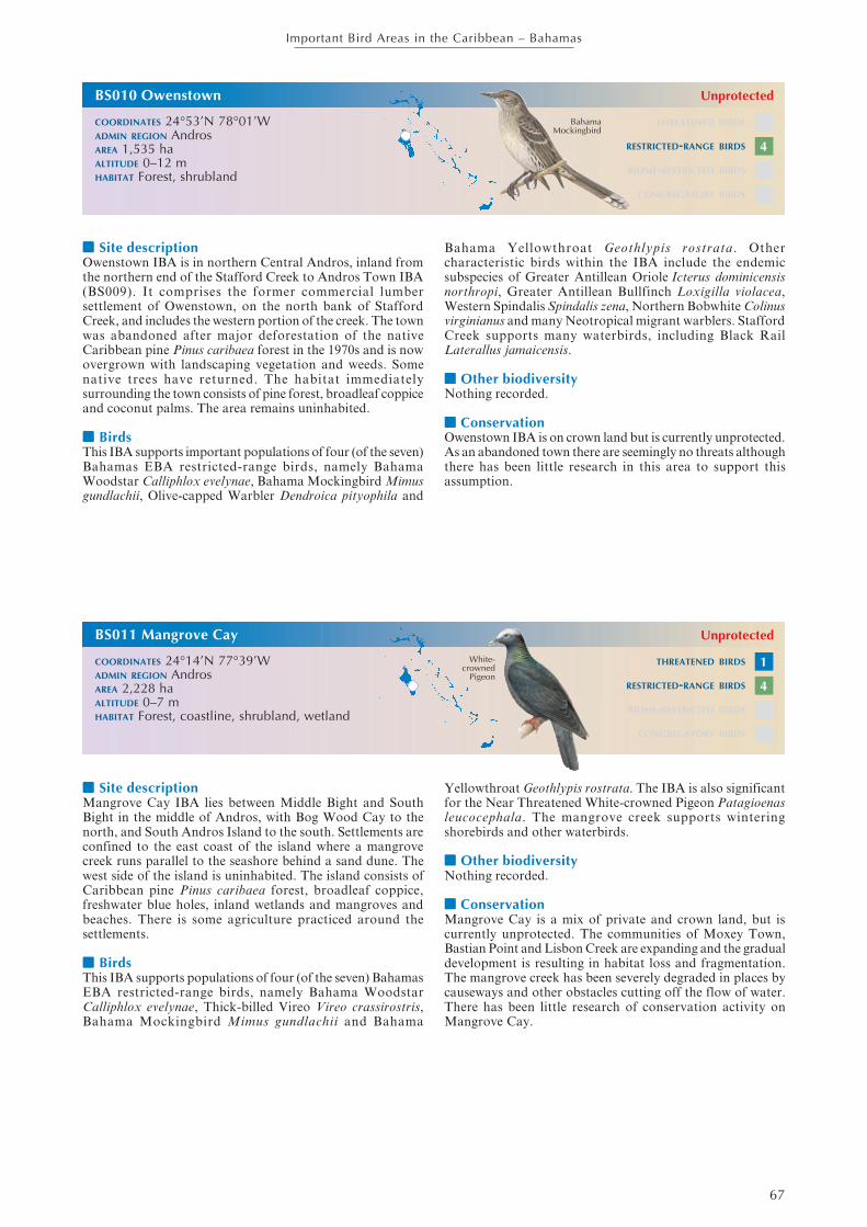
■■■■■ Site descriptionOwenstown IBA is in northern Central Andros, inland fromthe northern end of the Stafford Creek to Andros Town IBA(BS009). It comprises the former commercial lumbersettlement of Owenstown, on the north bank of StaffordCreek, and includes the western portion of the creek. The townwas abandoned after major deforestation of the nativeCaribbean pine Pinus caribaea forest in the 1970s and is nowovergrown with landscaping vegetation and weeds. Somenative trees have returned. The habitat immediatelysurrounding the town consists of pine forest, broadleaf coppiceand coconut palms. The area remains uninhabited.
■■■■■ BirdsThis IBA supports important populations of four (of the seven)Bahamas EBA restricted-range birds, namely BahamaWoodstar Calliphlox evelynae, Bahama Mockingbird Mimusgundlachii, Olive-capped Warbler Dendroica pityophila and
Bahama Yellowthroat Geothlypis rostrata. Othercharacteristic birds within the IBA include the endemicsubspecies of Greater Antillean Oriole Icterus dominicensisnorthropi, Greater Antillean Bullfinch Loxigilla violacea,Western Spindalis Spindalis zena, Northern Bobwhite Colinusvirginianus and many Neotropical migrant warblers. StaffordCreek supports many waterbirds, including Black RailLaterallus jamaicensis.
■■■■■ Other biodiversityNothing recorded.
■■■■■ ConservationOwenstown IBA is on crown land but is currently unprotected.As an abandoned town there are seemingly no threats althoughthere has been little research in this area to support thisassumption.
THREATENED BIRDS
RESTRICTED-RANGE BIRDS
BIOME-RESTRICTED BIRDS
CONGREGATORY BIRDS
BS011 Mangrove Cay
COORDINATES 24°14’N 77°39’WADMIN REGION AndrosAREA 2,228 haALTITUDE 0–7 mHABITAT Forest, coastline, shrubland, wetland
Unprotected
■■■■■ Site descriptionMangrove Cay IBA lies between Middle Bight and SouthBight in the middle of Andros, with Bog Wood Cay to thenorth, and South Andros Island to the south. Settlements areconfined to the east coast of the island where a mangrovecreek runs parallel to the seashore behind a sand dune. Thewest side of the island is uninhabited. The island consists ofCaribbean pine Pinus caribaea forest, broadleaf coppice,freshwater blue holes, inland wetlands and mangroves andbeaches. There is some agriculture practiced around thesettlements.
■■■■■ BirdsThis IBA supports populations of four (of the seven) BahamasEBA restricted-range birds, namely Bahama WoodstarCalliphlox evelynae, Thick-billed Vireo Vireo crassirostris,Bahama Mockingbird Mimus gundlachii and Bahama
Yellowthroat Geothlypis rostrata. The IBA is also significantfor the Near Threatened White-crowned Pigeon Patagioenasleucocephala. The mangrove creek supports winteringshorebirds and other waterbirds.
■■■■■ Other biodiversityNothing recorded.
■■■■■ ConservationMangrove Cay is a mix of private and crown land, but iscurrently unprotected. The communities of Moxey Town,Bastian Point and Lisbon Creek are expanding and the gradualdevelopment is resulting in habitat loss and fragmentation.The mangrove creek has been severely degraded in places bycauseways and other obstacles cutting off the flow of water.There has been little research of conservation activity onMangrove Cay.
White-crowned
Pigeon
THREATENED BIRDS
RESTRICTED-RANGE BIRDS
BIOME-RESTRICTED BIRDS
CONGREGATORY BIRDS
BS010 Owenstown
COORDINATES 24°53’N 78°01’WADMIN REGION AndrosAREA 1,535 haALTITUDE 0–12 mHABITAT Forest, shrubland
BahamaMockingbird
Unprotected
4
1
4

68
Important Bird Areas in the Caribbean – Bahamas
■■■■■ Site descriptionDriggs Hill to Mars Bay IBA is on the eastern side of SouthAndros Island. From Driggs Hill at the northernmost tip ofSouth Andros it runs south (following the road) for c.48 kmthrough Congo Town, The Bluff, Kemp’s Bay, over deep creekand Little Creek to Mars Bay in the south. The IBA extendsc.5 km inland from the east coast, and embraces a number ofblue holes including Rat Bat Lake and Twins, north of CongoTown airport, and Nine Tasks Blue Hole and Evelyn GreenBlue Hole south of The Bluff. The IBA supports impenetrableshrubland coppice and unexplored wetlands, numerous creeksand a shallow shoreline with tidal flats. The human populationis small and focus on low key agriculture, fishing and tourismactivities
■■■■■ BirdsThis IBA supports populations of four (of the seven) BahamasEBA restricted-range birds, namely Bahama WoodstarCalliphlox evelynae, Thick-billed Vireo Vireo crassirostris,Bahama Mockingbird Mimus gundlachii and BahamaYellowthroat Geothlypis rostrata. The IBA is also significantfor the Near Threatened White-crowned Pigeon Patagioenasleucocephala. Mars Bay is important for wintering Near
BS012 Driggs Hill to Mars Bay
COORDINATES 24°03’N 77°34’WADMIN REGION AndrosAREA 10,060 haALTITUDE 0–5 mHABITAT Wetland, shrubland, coastline
Unprotected
Threatened Piping Plover Charadrius melodus. Other speciespresent in the IBA include Great Lizard-cuckoo Coccyzusmerlini, the endemic subspecies of Greater AntilleanOriole Icterus dominicensis northropi and the Bahamas onlyknown nesting site for Cave Swallow Petrochelidon fulva (inlimestone cavities in Nine Tasks Blue Hole and at Twins BlueHole). The IBA also supports many waterbirds.
■■■■■ Other biodiversityThe Vulnerable Andros rock iguana Cyclura cychlura cychluraoccurs in this IBA.
■■■■■ ConservationDriggs Hill to Mars Bay IBA is a mix of private and crownland, but is unprotected. The ecosystem is currently relativelyintact, although development is an ever-present threat whilethis IBA remains unprotected. The IBA is one of the premierPatagioenas leucocephala hunting sites in the Bahamas, andthis should be monitored in relation to annual populationestimates for this Near Threatened bird. Disturbance (bypeople and dogs) of shorebirds (especially Charadrius melodus)on the tidal beach flats is a problem that needs to be monitoredand managed.
White-crowned
PigeonTHREATENED BIRDS
RESTRICTED-RANGE BIRDS
BIOME-RESTRICTED BIRDS
CONGREGATORY BIRDS
BS013 Goulding Cay Wild Bird Reserve
COORDINATES 25°01’N 77°34’WADMIN REGION New ProvidenceAREA 412 haALTITUDE 0 mHABITAT Rocky areas, sea, shrubland
Unprotected
■■■■■ Site descriptionGoulding Cay IBA lies 3 km off the westernmost end of NewProvidence. It is directly offshore of Jaws Beach, near LyfordCay. Goulding Cay is a 4-ha uninhabited offshore rocky caywith low coastline vegetation such as bay marigolds, baylavender, bay cedar, sea purslane and railroad vines. The IBAincludes all marine areas within 1 km of the cay.
■■■■■ BirdsThis IBA is seabird colony. Regionally significant numbersof Bridled Tern Sterna anaethetus and Brown Noddy Anousstolidus nest on the cay each summer (May–August). SootyTern S. fuscata also breed on the cay.
■■■■■ Other biodiversityNothing recorded.
■■■■■ ConservationGoulding Cay Wild Bird Reserve is crown owned land andlegally recognised reserve, making hunting on the island illegal.However, formal protected status has yet to be granted bythe government. The BNT Ornithology Group has beenmonitoring the seabirds since 2004 with little apparent changein the populations being counted each year. There is noevidence of egg collecting or indeed of the presence of ratsRattus spp. on the island, and disturbance from tourist anddiving boats (the cay is a popular dive site, but landing isdifficult) appears to be minimal.
THREATENED BIRDS
RESTRICTED-RANGE BIRDS
BIOME-RESTRICTED BIRDS
CONGREGATORY BIRDS
BrownNoddy
2
4
✔
✔

69
Important Bird Areas in the Caribbean – Bahamas
■■■■■ Site descriptionHarrold and Wilson Ponds National Park IBA is in centralNew Providence, south-west of Nassau. It encompasses a largearea of freshwater ponds with areas of mud, and fringingvegetation of reeds, sedge, broadleaf coppice and some pinelands. Being so close to the nation’s capital agriculture andcommercial and residential development had encroached onthe site before it was designated a national park in 2002.
■■■■■ BirdsThis IBA supports a diversity of species and is particularlyimportant for its waterbirds. The population of Laughing GullLarus atricilla is globally significant, while those of Gull-billedTern Sterna nilotica and Royal Tern S. maxima are regionallyso. Large numbers of cormorants, herons, egrets, ibises, ducksand shorebirds frequent the IBA. The Near Threatened White-crowned Pigeon Patagioenas leucocephala occurs, as does theVulnerable Bahama Swallow Tachycineta cyaneoviridis whichis one of three Bahamas EBA restricted-range birds to befound around the ponds.
■■■■■ Other biodiversityNothing recorded.
■■■■■ ConservationHarrold and Wilson Ponds National Park IBA is a mix ofcrown and private lands. However, the area is now designateda national park under the management of the BNT. Being soclose to Nassau, this IBA is an ideal educational andecotourism site, and an interpretation and public use plan hasbeen developed. Implementation of this plan has started (2007)and boardwalks, observation platforms and educationalsignage have been installed. The IBA still faces the threat ofpollution from adjacent housing developments (and squatters)and dumping and infill to “reclaim” land. A commercialchicken farm has been closed down and the land will beannexed to the park. Invasive plants such as Casuarina andBrazilian pepper crowd out native species, but are the focusof a BNT invasive species management project in the park.
THREATENED BIRDS
RESTRICTED-RANGE BIRDS
BIOME-RESTRICTED BIRDS
CONGREGATORY BIRDS
BS015 South Beach Tidal Flats
COORDINATES 25°00’N 77°19’WADMIN REGION New ProvidenceAREA 376 haALTITUDE 0–6 mHABITAT Coastline, shrubland, wetland, rocky areas
Unprotected
■■■■■ Site descriptionSouth Beach Tidal Flats IBA extends along c.3 km of NewProvidence’s south-eastern coastline. It follows the line ofMarshall Road, from Blue Hill Road, south-west towards CayPoint. The IBA is characterised by sand and limestone tidalflats, with rocky banks supporting low mangroves. It alsoincludes some freshwater wetlands just inland of the beach,and shrublands adjacent to the beach.
■■■■■ BirdsThis IBA is significant for its wintering population of the NearThreatened Piping Plover Charadrius melodus. The numbersof Laughing Gull Larus atricilla and Royal Tern Sternamaxima are regionally important. Large numbers of a widediversity of shorebirds use this IBA as a stop-over site and aswintering habitat. Least Tern S. antillarum are common inthe nesting season, migrant warblers and resident land birds
can be found in the shrubland along the shoreline, and thefreshwater wetlands Marshall Road support a wide range ofwaterbirds.
■■■■■ Other biodiversityNothing recorded.
■■■■■ ConservationSouth Beach Tidal Flats IBA comprises crown lands (the tidalzone) and private lands inland, none of which is currentlyprotected. The population in this area is expanding rapidlyleading to habitat destruction from development anddisturbance of birds by people and dogs. The shoreline is apopular beach and picnic area, and it is also a favouredlaunching point for resident fishermen. Pollution fromadjacent developments and illegal dumping are additionalthreats to this IBA.
PipingPlover
THREATENED BIRDS
RESTRICTED-RANGE BIRDS
BIOME-RESTRICTED BIRDS
CONGREGATORY BIRDS
National Park
LaughingGull
2
3
✔
1
✔
BS014 Harrold and Wilson Ponds National Park
COORDINATES 25°02’N 77°22’WADMIN REGION New ProvidenceAREA 81 haALTITUDE 0–5 mHABITAT Wetlands, shrubland

70
Important Bird Areas in the Caribbean – Bahamas
■■■■■ Site descriptionSalt Cay IBA is an island c.5 km north-east of Nassau, andc.1.5 km north of the eastern end of Paradise Island. Alsoknown as Blue Lagoon Island, it is the easternmost island ina chain of cays that extends towards Eleuthera. The islandhas been much altered over time. Originally supporting a saltmarsh, this was dredged out in the 1900s and connected tothe sea to make the lagoon. Over 5,000 palm trees were plantedat this time. The eastern end of the island is a popular tourismand recreation destination. The western end is very narrowand rocky. The island, which is c.3 km long, supportsshrubland and has a mix of sandy and rocky shoreline. TheIBA includes marine areas up to 1 km from the cay.
■■■■■ BirdsThis IBA is regionally significant for its population ofLaughing Gull Larus atricilla. Many wintering shorebirdsoccur, and Roseate Tern Sterna dougallii is reported to nest
BS016 Salt Cay
COORDINATES 25°09’N 77°03’WADMIN REGION New ProvidenceAREA 968 haALTITUDE 0–2 mHABITAT Sea, rocky areas, shrubland
Unprotected
although numbers are unknown. White-cheeked Pintail Anasbahamensis nest on Salt Cay, but move their young to ParadiseIsland once they have fledged.
■■■■■ Other biodiversityNothing recorded.
■■■■■ ConservationSalt Cay IBA is privately owned and unprotected. The easternend of the island is heavily used by day visitors (taking boattrips from Nassau). Dolphin Encounters—a natural seawaterdolphin experience facility—is based around the lagoon andis one of the Bahamas’ premier tourist attractions. Furtherdevelopment will impact three breeding seabirds. It isunknown what introduced predators are present on the island,although it is likely that rats Rattus spp. occur and arepredating gull and tern eggs and chicks.
LaughingGull
THREATENED BIRDS
RESTRICTED-RANGE BIRDS
BIOME-RESTRICTED BIRDS
CONGREGATORY BIRDS
BS017 Booby Island
COORDINATES 25°05’N 77°11’WADMIN REGION New ProvidenceAREA 825 haALTITUDE 0–1 mHABITAT Rocky areas, sea, shrubland
Unprotected
■■■■■ Site descriptionBooby Island IBA lies 22 km north-east of the eastern end ofNew Providence, towards the western end of the chain of caysthat extends towards Eleuthera. It is north-east of Rose island.Booby Island is 3 km long and less than 100 m wide, and hasa low, rocky coralline shoreline that makes access difficult. Itsupports minimal vegetation such as sea purslane, bay cedarand other salt resistant plants. The IBA includes marine areasup to 1 km from the island.
■■■■■ BirdsThis IBA supports a number of breeding seabirds. Thepopulation of Roseate Tern Sterna dougallii is globallysignificant, while those of Laughing Gull Larus atricilla, LeastTern S. antillarum and Bridled Tern S. anaethetus are
regionally so. Brown Noddy Anous stolidus, Sooty Tern S.fuscata and Brown Booby Sula leucogaster also breed in theIBA. A range of shorebirds have been recorded.
■■■■■ Other biodiversityNothing recorded.
■■■■■ ConservationBooby Island IBA is crown land but is unprotected. The BNTOrnithology Group visited the island to count breedingseabirds in September 2007 which could form the baseline formonitoring this important seabird island. Rats Rattus spp.and illegal egg collecting are potential but unconfirmedproblems.
THREATENED BIRDS
RESTRICTED-RANGE BIRDS
BIOME-RESTRICTED BIRDS
CONGREGATORY BIRDS
Roseate Tern
✔
✔

71
Important Bird Areas in the Caribbean – Bahamas
■■■■■ Site descriptionSouth Tarpum Bay IBA embraces the southern third ofEleuthera Island. It extends from Tarpum Bay and WindingBay in the north for c.35 km through Rock Sounds toBannerman Town at the southernmost end of the island. TheIBA is a mosaic of small agricultural and fishing settlements,small agricultural plots, mature broadleaf coppice of varyingheights, abandoned plantation, shrubland, coastal coppice andbeach habitats.
■■■■■ BirdsThis IBA supports the largest known concentration ofwintering Near Threatened Kirtland’s Warbler Dendroicakirtlandii which was discovered in the IBA in 2002. Duringthe winter 2003–2004 at least 60 birds were recorded at 15different locations in southern Eleuthera. The NearThreatened White-crowned Pigeon Patagioenas leucocephalaalso occurs in significant numbers, and four (of the seven)Bahamas EBA restricted-range birds, namely BahamaWoodstar Calliphlox evelynae, Bahama YellowthroatGeothlypis rostrata, Thick-billed Vireo Vireo crassirostris andBahama Mockingbird Mimus gundlachii are present. Great
Lizard-cuckoo Coccyzus merlini and Greater AntilleanBullfinch Loxigilla violacea also occur.
■■■■■ Other biodiversityNo globally threatened or endemic terrestrial species have beenrecorded.
■■■■■ ConservationSouth Tarpum Bay IBA is a mix of crown and privately ownedland, but none of it is protected. Habitat is being lost as aresult of increased residential and resort development, andslash-and-burn land clearance is common. The BNTOrnithology Group discovered D. kirtlandii in this IBA in 2002since when the species has been the focus of an intensive, multi-institutional research program (the Kirtland’s WarblerResearch and Training Program). The species’ winter habitatpreferences are for early successional fruiting scrub and lowcoppice. Wild sage (Lantana involucrata and L. bahamensis),West Indian snowberry (Chiococca alba), and black torch(Erithalis fruticosa) appear to be especially important and thisshould be considered in relation to any conservationmanagement interventions.
THREATENED BIRDS
RESTRICTED-RANGE BIRDS
BIOME-RESTRICTED BIRDS
CONGREGATORY BIRDS
BS019 Allan’s Cays
COORDINATES 24°44’N 76°50’WADMIN REGION ExumasAREA 745 haALTITUDE 0–2 mHABITAT Coastline, rocky areas, shrubland, sea
Unprotected
■■■■■ Site descriptionAllan’s Cays IBA is at the northern end of the Exuma Caysbetween Ship Channel Cay and Highborne Cay. It comprisesthree small, uninhabited cays, namely Allan’s Cay, SouthwestAllan’s Cay and Leaf Cay. The shoreline of Allan’s andSouthwest Allan’s Cays is comprised of mainly honeycomblimestone rock (including cliffs on Allan’s Cay) and Leaf Cayhas sandy soil and beaches. The cays support some areas ofshrubland. The IBA includes marine areas up to 1 km fromthe cays.
■■■■■ BirdsThe rocky cliffs on Allan’s Cay support a regionally significantcolony of Audubon’s Shearwater Puffinus lherminieri.
■■■■■ Other biodiversityThe Vulnerable rock iguanas Cyclura cychlura inornata andC. c. figginisi occur on Leaf Cay and Southwest Allan’s Cay.All iguanas are protected by law in the Bahamas.
■■■■■ ConservationAllan’s Cay IBA is crown owned but unprotected. The caysare a popular scuba-diving and snorkelling destination andthere are daily powerboat trips to the cays from Nassau. Thereis a constant threat of disturbance to the birds and the iguanasby commercial and private boating activity, including fromdogs taken ashore for exercise. Puffinus lherminieri facesnatural threats from resident Barn Owl Tyto alba andwintering Peregrine Falcon Falco peregrinus, but moreworryingly rats Rattus spp. were confirmed as present in 2007.
Audubon’sShearwater THREATENED BIRDS
RESTRICTED-RANGE BIRDS
BIOME-RESTRICTED BIRDS
CONGREGATORY BIRDS
BS018 South Tarpum Bay
COORDINATES 24°48’N 76°12’WADMIN REGION EleutheraAREA 17,505 haALTITUDE 0–7 mHABITAT Shrubland, wetland, coastline
Unprotected
✔
Kirtland’sWarbler
2
4
72
Important Bird Areas in the Caribbean – Bahamas
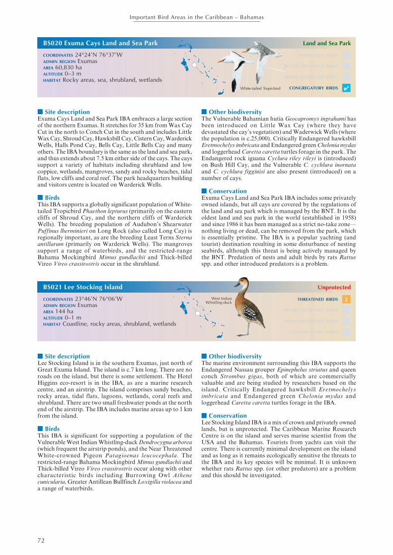
■■■■■ Site descriptionExuma Cays Land and Sea Park IBA embraces a large sectionof the northern Exumas. It stretches for 35 km from Wax CayCut in the north to Conch Cut in the south and includes LittleWax Cay, Shroud Cay, Hawksbill Cay, Cistern Cay, WarderickWells, Halls Pond Cay, Bells Cay, Little Bells Cay and manyothers. The IBA boundary is the same as the land and sea park,and thus extends about 7.5 km either side of the cays. The cayssupport a variety of habitats including shrubland and lowcoppice, wetlands, mangroves, sandy and rocky beaches, tidalflats, low cliffs and coral reef. The park headquarters buildingand visitors centre is located on Warderick Wells.
■■■■■ BirdsThis IBA supports a globally significant population of White-tailed Tropicbird Phaethon lepturus (primarily on the easterncliffs of Shroud Cay, and the northern cliffs of WarderickWells). The breeding population of Audubon’s ShearwaterPuffinus lherminieri on Long Rock (also called Long Cay) isregionally important, as are the breeding Least Terns Sternaantillarum (primarily on Warderick Wells). The mangrovessupport a range of waterbirds, and the restricted-rangeBahama Mockingbird Mimus gundlachii and Thick-billedVireo Vireo crassirostris occur in the shrubland.
BS020 Exuma Cays Land and Sea Park
COORDINATES 24°24’N 76°37’WADMIN REGION ExumasAREA 60,830 haALTITUDE 0–3 mHABITAT Rocky areas, sea, shrubland, wetlands
Land and Sea Park
■■■■■ Other biodiversityThe Vulnerable Bahamian hutia Geocapromys ingrahami hasbeen introduced on Little Wax Cay (where they havedevastated the cay’s vegetation) and Waderwick Wells (wherethe population is c.25,000). Critically Endangered hawksbillEretmochelys imbricata and Endangered green Chelonia mydasand loggerhead Caretta caretta turtles forage in the park. TheEndangered rock iguana Cyclura riley rileyi is (introduced)on Bush Hill Cay, and the Vulnerable C. cychlura inornataand C. cychlura figginisi are also present (introduced) on anumber of cays.
■■■■■ ConservationExuma Cays Land and Sea Park IBA includes some privatelyowned islands, but all cays are covered by the regulations ofthe land and sea park which is managed by the BNT. It is theoldest land and sea park in the world (established in 1958)and since 1986 it has been managed as a strict no-take zone—nothing living or dead, can be removed from the park, whichis essentially pristine. The IBA is a popular yachting (andtourist) destination resulting in some disturbance of nestingseabirds, although this threat is being actively managed bythe BNT. Predation of nests and adult birds by rats Rattusspp. and other introduced predators is a problem.
White-tailed Tropicbird
THREATENED BIRDS
RESTRICTED-RANGE BIRDS
BIOME-RESTRICTED BIRDS
CONGREGATORY BIRDS
BS021 Lee Stocking Island
COORDINATES 23°46’N 76°06’WADMIN REGION ExumasAREA 144 haALTITUDE 0–1 mHABITAT Coastline, rocky areas, shrubland, wetlands
Unprotected
■■■■■ Site descriptionLee Stocking Island is in the southern Exumas, just north ofGreat Exuma Island. The island is c.7 km long. There are noroads on the island, but there is some settlement. The HotelHiggins eco-resort is in the IBA, as are a marine researchcentre, and an airstrip. The island comprises sandy beaches,rocky areas, tidal flats, lagoons, wetlands, coral reefs andshrubland. There are two small freshwater ponds at the northend of the airstrip. The IBA includes marine areas up to 1 kmfrom the island.
■■■■■ BirdsThis IBA is significant for supporting a population of theVulnerable West Indian Whistling-duck Dendrocygna arborea(which frequent the airstrip ponds), and the Near ThreatenedWhite-crowned Pigeon Patagioenas leucocephala. Therestricted-range Bahama Mockingbird Mimus gundlachii andThick-billed Vireo Vireo crassirostris occur along with othercharacteristic birds including Burrowing Owl Athenecunicularia, Greater Antillean Bullfinch Loxigilla violacea anda range of waterbirds.
■■■■■ Other biodiversityThe marine environment surrounding this IBA supports theEndangered Nassau grouper Epinephelus striatus and queenconch Strombus gigas, both of which are commerciallyvaluable and are being studied by researchers based on theisland. Critically Endangered hawksbill Eretmochelysimbricata and Endangered green Chelonia mydas andloggerhead Caretta caretta turtles forage in the IBA.
■■■■■ ConservationLee Stocking Island IBA is a mix of crown and privately ownedlands, but is unprotected. The Caribbean Marine ResearchCentre is on the island and serves marine scientist from theUSA and the Bahamas. Tourists from yachts can visit thecentre. There is currently minimal development on the islandand as long as it remains ecologically sensitive the threats tothe IBA and its key species will be minimal. It is unknownwhether rats Rattus spp. (or other predators) are a problemand this should be investigated.
THREATENED BIRDS
RESTRICTED-RANGE BIRDS
BIOME-RESTRICTED BIRDS
CONGREGATORY BIRDS
West IndianWhistling-duck
✔
2

73
Important Bird Areas in the Caribbean – Bahamas
■■■■■ Site descriptionGrog Pond IBA is situated c.16 km north-west of GeorgeTown on Great Exuma. It is bounded on the north by theQueen’s Highway, and on the east, south and west by BahamaSound Development. Grog Pond is an inland wetland. GrogPond is a shallow, brackish water lake with clumps of blackmangroves and fringing saltmarsh, buttonwood and coppice.
■■■■■ BirdsThis IBA is significant for supporting a population of theVulnerable West Indian Whistling-duck Dendrocygna arborea,and the Near Threatened White-crowned Pigeon Patagioenasleucocephala. The numbers of Laughing Gull Larus atricilla,Gull-billed Tern Sterna nilotica and Least Tern S. antillarumpresent in the IBA are regionally significant. The restricted-range Bahama Mockingbird Mimus gundlachii and Thick-billed Vireo Vireo crassirostris occur along with GreaterAntillean Bullfinch Loxigilla violacae and a range of
waterbirds including duck, herons, egrets, ibises andshorebirds
■■■■■ Other biodiversityNothing recorded.
■■■■■ ConservationGrog Pond IBA is privately owned and unprotected. It hasthe potential to become a community-led eco-tourism site,recreation area and a centre for students and adults to learnabout the environment, and the BNT has been pursuing thisconcept. However, the surrounding coppice has been dividedinto residential plots and it appears that development isimminent. The area has been used as an illegal garbage dump(despite the “no dumping” signs). Hunting is also prevalentat this site, as is the collection of pond-stone by local buildersfor patios and walkways.
THREATENED BIRDS
RESTRICTED-RANGE BIRDS
BIOME-RESTRICTED BIRDS
CONGREGATORY BIRDS
BS023 Tee Cay, Goat Cay and Long Rocks
COORDINATES 24°35’N 75°50’WADMIN REGION Cat IslandAREA 820 haALTITUDE 0 mHABITAT Rocky areas, sea, shrubland
Unprotected
■■■■■ Site descriptionTee Cay, Goat Cay and Long Rocks IBA is located betweennorthern Cat Island and (to the west) Little San Salvador.The islands are physically nearer to (1–3 km from) Little SanSalvador. Goat Cay lies north-east of Little San Salvador,Long Rocks lies due east, Tee Cay south-east. The cays areuninhabited limestone ridges partially covered with scrublandvegetation such as seagrape, cacti, haulback and other nativeplants. There is a sandy cove on Goat Cay. The IBA includesmarine areas up to 1 km from the cays.
■■■■■ BirdsThis IBA is significant for its breeding seabirds. The populationof Roseate Tern Sterna dougallii is thought to be globallysignificant and that of Bridled Tern Sterna anaethetus regionallyso. Sooty Tern S. fuscata, Brown Noddy Anous stolidus,
Magnificent Frigatebird Fregata magnificens and Brown BoobySula leucogaster are all thought to breed on the cays. The NearThreatened White-crowned Pigeon Patagioenas leucocephalahas been reported nesting on Goat Cay.
■■■■■ Other biodiversityNothing recorded.
■■■■■ ConservationTee Cay, Goat Cay and Long Rocks IBA is poorly knownand there is little direct information available except fromboaters. Breeding season surveys of the seabirds are a clearpriority. The cays are unprotected. The seabirds are prone topredation from introduced species (e.g. rats Rattus spp.) fromvisiting boats, and from refugees that are occasionally landedin the IBA.
White-crowned
Pigeon
THREATENED BIRDS
RESTRICTED-RANGE BIRDS
BIOME-RESTRICTED BIRDS
CONGREGATORY BIRDS
BS022 Grog Pond
COORDINATES 23°34’N 75°53’WADMIN REGION ExumasAREA 245 haALTITUDE 0–7 mHABITAT Wetlands, shrubland
Unprotected
2
✔
1
✔
West IndianWhistling-duck
74
Important Bird Areas in the Caribbean – Bahamas
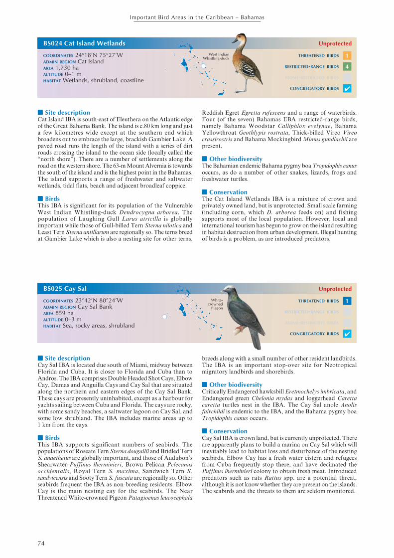
■■■■■ Site descriptionCat Island IBA is south-east of Eleuthera on the Atlantic edgeof the Great Bahama Bank. The island is c.80 km long and justa few kilometres wide except at the southern end whichbroadens out to embrace the large, brackish Gambier Lake. Apaved road runs the length of the island with a series of dirtroads crossing the island to the ocean side (locally called the“north shore”). There are a number of settlements along theroad on the western shore. The 63-m Mount Alvernia is towardsthe south of the island and is the highest point in the Bahamas.The island supports a range of freshwater and saltwaterwetlands, tidal flats, beach and adjacent broadleaf coppice.
■■■■■ BirdsThis IBA is significant for its population of the VulnerableWest Indian Whistling-duck Dendrocygna arborea. Thepopulation of Laughing Gull Larus atricilla is globallyimportant while those of Gull-billed Tern Sterna nilotica andLeast Tern Sterna antillarum are regionally so. The terns breedat Gambier Lake which is also a nesting site for other terns,
BS024 Cat Island Wetlands
COORDINATES 24°18’N 75°27’WADMIN REGION Cat IslandAREA 1,730 haALTITUDE 0–1 mHABITAT Wetlands, shrubland, coastline
Unprotected
Reddish Egret Egretta rufescens and a range of waterbirds.Four (of the seven) Bahamas EBA restricted-range birds,namely Bahama Woodstar Calliphlox evelynae, BahamaYellowthroat Geothlypis rostrata, Thick-billed Vireo Vireocrassirostris and Bahama Mockingbird Mimus gundlachii arepresent.
■■■■■ Other biodiversityThe Bahamian endemic Bahama pygmy boa Tropidophis canusoccurs, as do a number of other snakes, lizards, frogs andfreshwater turtles.
■■■■■ ConservationThe Cat Island Wetlands IBA is a mixture of crown andprivately owned land, but is unprotected. Small scale farming(including corn, which D. arborea feeds on) and fishingsupports most of the local population. However, local andinternational tourism has begun to grow on the island resultingin habitat destruction from urban development. Illegal huntingof birds is a problem, as are introduced predators.
THREATENED BIRDS
RESTRICTED-RANGE BIRDS
BIOME-RESTRICTED BIRDS
CONGREGATORY BIRDS
BS025 Cay Sal
COORDINATES 23°42’N 80°24’WADMIN REGION Cay Sal BankAREA 859 haALTITUDE 0–3 mHABITAT Sea, rocky areas, shrubland
Unprotected
■■■■■ Site descriptionCay Sal IBA is located due south of Miami, midway betweenFlorida and Cuba. It is closer to Florida and Cuba than toAndros. The IBA comprises Double Headed Shot Cays, ElbowCay, Damas and Anguilla Cays and Cay Sal that are situatedalong the northern and eastern edges of the Cay Sal Bank.These cays are presently uninhabited, except as a harbour foryachts sailing between Cuba and Florida. The cays are rocky,with some sandy beaches, a saltwater lagoon on Cay Sal, andsome low shrubland. The IBA includes marine areas up to1 km from the cays.
■■■■■ BirdsThis IBA supports significant numbers of seabirds. Thepopulations of Roseate Tern Sterna dougallii and Bridled TernS. anaethetus are globally important, and those of Audubon’sShearwater Puffinus lherminieri, Brown Pelican Pelecanusoccidentalis, Royal Tern S. maxima, Sandwich Tern S.sandvicensis and Sooty Tern S. fuscata are regionally so. Otherseabirds frequent the IBA as non-breeding residents. ElbowCay is the main nesting cay for the seabirds. The NearThreatened White-crowned Pigeon Patagioenas leucocephala
breeds along with a small number of other resident landbirds.The IBA is an important stop-over site for Neotropicalmigratory landbirds and shorebirds.
■■■■■ Other biodiversityCritically Endangered hawksbill Eretmochelys imbricata, andEndangered green Chelonia mydas and loggerhead Carettacaretta turtles nest in the IBA. The Cay Sal anole Anolisfairchildi is endemic to the IBA, and the Bahama pygmy boaTropidophis canus occurs.
■■■■■ ConservationCay Sal IBA is crown land, but is currently unprotected. Thereare apparently plans to build a marina on Cay Sal which willinevitably lead to habitat loss and disturbance of the nestingseabirds. Elbow Cay has a fresh water cistern and refugeesfrom Cuba frequently stop there, and have decimated thePuffinus lherminieri colony to obtain fresh meat. Introducedpredators such as rats Rattus spp. are a potential threat,although it is not know whether they are present on the islands.The seabirds and the threats to them are seldom monitored.
THREATENED BIRDS
RESTRICTED-RANGE BIRDS
BIOME-RESTRICTED BIRDS
CONGREGATORY BIRDS
White-crowned
Pigeon
1
4
✔
1
✔
West IndianWhistling-duck

75
Important Bird Areas in the Caribbean – Bahamas
■■■■■ Site descriptionLong Island and Hog Cay IBA lies south of Cat Island andsouth-east of the southern end of the Exumas. The island isabout 128 km long and a maximum of 6.5 km wide. Hog Cayis a privately-owned island on the leeward side of northernLong Island. Long Island supports a variety of habitatsincluding shrubland, coppice, freshwater and saltwaterwetlands, mangroves swamps and tidal flats. Wetlands arescattered throughout the interior of the island and there arefrequent roadside ponds. Fishing and farming are the mainoccupations of the local population.
■■■■■ BirdsThis IBA is significant for supporting a large population ofthe Vulnerable West Indian Whistling-duck Dendrocygnaarborea which roost on Hog Cay each night. The island’swetlands are also home to a diversity of waterbirds includingducks, herons, egrets and migratory shorebirds. SandwichTern Sterna sandvicensis and Roseate Tern S. dougallii breedon Hog and Galliott Cays. The breeding population of
Laughing Gull Larus atricilla is regionally important. Therestricted-range Bahamas Mockingbird Mimus gundlachii andThick-billed Vireo Vireo crassirostris also occur. A populationof the Near Threatened White-crowned Pigeon Patagioenasleucocephala occurs, but the numbers involved are unknown.
■■■■■ Other biodiversityThe Near Threatened Gervais’s funnel-eared bat Nyctielluslepidus and Brazilian free-tailed bat Tadarida brasiliensis occur(along with a number of other bat species).
■■■■■ ConservationLong Island and Hog Cay IBA is a mixture of crown andprivately owned land, but none of it is protected. The ownerof Hog Cay provided daily feed for the large flock of D.arborea which roost on the cay at night. Residential and urbandevelopment is leading to habitat destruction, and illegalhunting is a problem. Feral cats, wild goats and pigs are allcommon and are impacting the vegetation and nesting birds.
THREATENED BIRDS
RESTRICTED-RANGE BIRDS
BIOME-RESTRICTED BIRDS
CONGREGATORY BIRDS
BS027 Conception Island
COORDINATES 23°50’N 75°06’WADMIN REGION Conception IslandAREA 2,905 haALTITUDE 0 mHABITAT Rocky areas, sea, shrubland
National Park/Unprotected
■■■■■ Site descriptionConception Island IBA lies c.40 km south-west of SanSalvador, midway between Cat Island and Rum Cay. It isc.5 km by 2.5 km and it encircles an interior lagoon. The islandis uninhabited and comprises coral reefs, sandy beaches, rockyand low coralline cliff shores, mangrove, low scrub andcoppice. Offshore to the east lies Booby Cay, and to the south-west is South Rocks. The island is an attractive destinationfor yachts. The IBA includes marine areas up to 1 km fromthe islands.
■■■■■ BirdsThis IBA is characterised by its breeding seabirds. Thepopulation of White-tailed Tropicbird Phaethon lepturus isglobally significant while those of Audubon’s ShearwaterPuffinus lherminieri, Bridled Tern Sterna anaethetus andBrown Noddy Anous stolidus are regionally so. Booby Cayhas one of the largest colonies of Sooty Tern S. fuscata in theBahamas (and is also where the A. stolidus nests). Therestricted-range Bahama Mockingbird Mimus gundlachii andBahama Woodstar Calliphlox evelynae are present and ducks,
herons and shorebirds are common in the interior lagoon. Apopulation of the Near Threatened White-crowned PigeonPatagioenas leucocephala occurs, but the numbers involvedare unknown.
■■■■■ Other biodiversityCritically Endangered hawksbill Eretmochelys imbricata andEndangered green Chelonia mydas turtles are common in theinterior lagoon.
■■■■■ ConservationConception Island is owned by the crown and is protected asa national park under the management of the BNT. However,Booby Cay and South Rocks and the surrounding shallowwater are not included in the protected area. Hunting andillegal egg collecting by boaters and fishermen stopping overon the island are significant threats to the breeding seabirds.The mouth of the lagoon is sometimes illegally blocked byfishermen in order to catch fish and turtles trapped in theinterior.
White-tailed Tropicbird
THREATENED BIRDS
RESTRICTED-RANGE BIRDS
BIOME-RESTRICTED BIRDS
CONGREGATORY BIRDS
BS026 Long Island and Hog Cay
COORDINATES 23°35’N 75°16’WADMIN REGION Long IslandAREA 81,010 haALTITUDE 0–7 mHABITAT Rocky areas, shrubland, wetlands,
coastline, sea
Unprotected
✔
1
✔
West IndianWhistling-duck

76
Important Bird Areas in the Caribbean – Bahamas
■■■■■ Site descriptionGraham’s Harbour IBA lies off the north coast of SanSalvador where several pristine cays are found in the“harbour’s” shallow waters. The area is characterised byshallow reefs and rock throughout the bay, with White Caynearest the reef edge, Green Cay on the north-western side,and Gaulin, Cato and Cut cays near to the north shore of SanSalvador. The cays are uninhabited with rocky shorelines andsome sandy beaches, and supporting low scrub.
■■■■■ BirdsThe cays in Graham’s Harbour are important seabird colonies.Regionally significant populations of Brown Booby Sulaleucogaster and Bridled Tern Sterna anaethetus nest on GreenCay, which also supports some breeding MagnificentFrigatebird Fregata magnificensis. Frigatebirds and BrownBooby Sula leucogaster nest on White Cay, and Brown NoddyAnous stolidus, Sterna anaethetus and Sooty Tern S. fuscata
BS028 Graham’s Harbour
COORDINATES 24°08’N 74°28’WADMIN REGION San SalvadorAREA 4,262 haALTITUDE 0–6 mHABITAT Rocky areas, coastline, shrubland, sea
Unprotected
nest on Gaulin and Cato Cays, albeit not in significantnumbers.
■■■■■ Other biodiversityAbout 250 Endangered rock iguanas Cyclura rileyi rileyi wereliving on Green Cay in 1997.
■■■■■ ConservationGraham’s Harbour IBA is a mix of crown and privately ownedland and is currently unprotected. However, the BNT hastargeted this area as a potential national park and a managedecotourism site. Invasive plants (that crowd out native flora)are a potential threat that needs monitoring as it would ruinthe pristine state of the cays. Similarly, invasive predators suchas rats Rattus spp. could deplete the seabird populations. Thearrival of such alien invasives should be monitored for, alongwith the seabird populations. Visitation by tourists needs tobe well controlled to avoid disturbance to nesting seabirds.
BrownBooby
THREATENED BIRDS
RESTRICTED-RANGE BIRDS
BIOME-RESTRICTED BIRDS
CONGREGATORY BIRDS
BS029 Southern Great Lake
COORDINATES 24°00’N 74°30’WADMIN REGION San SalvadorAREA 1,530 haALTITUDE 0–3 mHABITAT Wetlands, shrubland
Unprotected
■■■■■ Site descriptionSouthern Great Lake IBA embraces the saline wetland thatoccupies a large proportion of the interior of southern SanSalvador. The wetlands are extensive and largely unobservedor explored due to the difficulty of access. The wetland issurrounded by dry shrubland and there are fringingmangroves. San Salvador is a small island (8 km by 19 km)with less than 1,000 people resident. The southern wetlandsare therefore little disturbed.
■■■■■ BirdsThis IBA supports globally significant breeding populationsof Gull-billed Tern Sterna nilotica and Laughing Gull Larusatricilla. The Great Lake is home to a wide diversity ofwaterbirds including the endemic diminutive race of Double-crested Cormorant Phalacrocorax auritus, egrets and herons.Four (of the 7) Bahamas EBA restricted-range birds, namelyBahama Woodstar Calliphlox evelynae, Pearly-eyed ThrasherMargarops fuscatus, Thick-billed Vireo Vireo crassirostris and
Bahama Mockingbird Mimus gundlachii are present. Theendemic race of West Indian Woodpecker Melanerpessuperciliaris is present in the IBA.
■■■■■ Other biodiversityThe Endangered rock iguanas Cyclura rileyi rileyi is found inthe interior lake areas. An endemic blind snake Leptotypholopscolumbi is present.
■■■■■ ConservationSouthern Great Lake IBA is crown land, but is currentlyunprotected. An observation platform overlooking thenorthern end of the lake (near Cockburn Town) is the onlyeasily accessible viewing point and thus the wetland and thepopulations of its waterbirds are poorly known. Resortdevelopment is an ever present (but as yet unrealised) threat.The expanded airport at Cockburn Town has recently causedconsiderable habitat destruction although this has notimpinged on the lake system.
THREATENED BIRDS
RESTRICTED-RANGE BIRDS
BIOME-RESTRICTED BIRDS
CONGREGATORY BIRDS
✔
4
✔
Double-crested
Cormorant

77
Important Bird Areas in the Caribbean – Bahamas
■■■■■ Site descriptionSandy Point IBA is located at the south-western tip of SanSalvador. The IBA includes residential areas (a subdivisionof an urban development called “Columbus Landing”), theruins known as Watling’s Castle and surrounding shrubland.However, the primary interest is the sandy beaches.
■■■■■ BirdsThe beaches in this IBA support a regionally importantpopulation of Least Tern Sterna antillarum. Many Charadriusspp. plovers use the beaches too. The surrounding shrublandis home to four (of the 7) Bahamas EBA restricted-range birds,namely Bahama Mockingbird Mimus gundlachii, BahamaWoodstar Calliphlox evelynae, Pearly-eyed ThrasherMargarops fuscatus and Thick-billed Vireo Vireo crassirostris.
The endemic race of West Indian Woodpecker Melanerpessuperciliaris also occurs.
■■■■■ Other biodiversityNothing recorded.
■■■■■ ConservationSandy Point IBA is a mix of crown and privately owned landand is unprotected. The beaches are public and are a populardestination for tourists and locals from the residentialcommunity within the IBA. The recreational traffic on thebeaches poses a serious threat to the nesting S. antillarum.Predation from household pet cats and dogs, and alsofrom introduced predators such as rats Rattus spp. is also aproblem.
THREATENED BIRDS
RESTRICTED-RANGE BIRDS
BIOME-RESTRICTED BIRDS
CONGREGATORY BIRDS
BS031 Low Cay, High Cay and Sandy Hook
COORDINATES 23°57’N 74°29’WADMIN REGION San SalvadorAREA 1,225 haALTITUDE 0–4 mHABITAT Coastline, rocky areas, sea, shrubland,
wetlands
Unprotected
■■■■■ Site descriptionLow Cay, High Cay and Sandy Hook IBA is at the south-eastern end of San Salvador. Sandy Hook is a subdivision ofan urban development called “Columbus Landing”. It is apeninsula with the sandy Snow Bay Beach on it eastern side,and Pigeon Creek (a tidal lagoon) to its north and west. Lowand High Cays are small rocky cays located 0.5–1 km offshoreto the south-east of Sandy Hook. Pigeon Creek supportsmangrove and there is some shrubland on Sandy Hook, butthe primary habitats of importance are the sandy beaches androcky cays. The IBA includes marine areas 1 km from theshore and from the cays.
■■■■■ BirdsThis IBA is home to regionally significant populations ofbreeding Least Tern Sterna antillarum (on the beaches atSandy Hook), and Audubon’s Shearwater Puffinus lherminieriand Bridled Tern S. anaethetus (on the offshore cays). Mixed
flocks of seabirds, including (additionally) Roseate Tern S.dougallii, Sooty Tern S. fuscata and Brown Noddy Anousstolidus are seen feeding close to the mouth of Pigeon Creekin the fall.
■■■■■ Other biodiversityNothing recorded.
■■■■■ ConservationLow Cay, High Cay and Sandy Hook IBA is a mix of crownand privately-owned land. The residential development atSandy Hook is likely to be further expanded which will causeinevitable habitat destruction and increase the disturbance tobirds on Snow Bay Beach. The cays are visited by tourists (onjet skis) from the Club Med Resort. Local “guides” use thecays for commercial purposes. This visitation is unregulatedand will cause inevitable disturbance to the nesting seabirds. Itis unknown whether rats Rattus spp. are present on the cays.
Audubon’sShearwater
THREATENED BIRDS
RESTRICTED-RANGE BIRDS
BIOME-RESTRICTED BIRDS
CONGREGATORY BIRDS
BS030 Sandy Point
COORDINATES 23°56’N 74°33’WADMIN REGION San SalvadorAREA 885 haALTITUDE 0–18 mHABITAT Coastline, shrubland, sea
Unprotected
✔
LeastTern
4
✔

78
Important Bird Areas in the Caribbean – Bahamas
■■■■■ Site descriptionSamana Cay is located 32 km north-east of Crooked Island(Crooked and Acklins islands). It is a small island (c.16 kmby 3 km) completely surrounded by coral reefs and with asmall offshore islet—Propeller Cay—situated off its easternend. The cascarilla tree Croton elutaria grows profusely onthe island. Samana Cay is uninhabited (although there isevidence of Lucayan inhabitants present up until the 1500s).However, it is visited frequently by locals for fishing andcollecting cascarilla bark. There is no fresh water on the cay.The IBA includes marine areas up to 1 km from the cay.
■■■■■ BirdsA globally significant population of Bridled Tern Sternaanaethetus nests on Propeller Cay, along with a range of otherseabirds including Audubon’s Shearwater Puffinus lherminieri,
BS032 Samana Cay
COORDINATES 23°05’N 73°44’WADMIN REGION AcklinsAREA 8,650 haALTITUDE 0–1 mHABITAT Rocky areas, shrubland, sea, coastline
Unprotected
Sooty Tern S. fuscata and Brown Noddy Anous stolidus. Aregionally important population of Royal Tern S. maximabreeds in the IBA. Brown Booby Sula leucogaster has beenfound roosting on Propeller Cay although there is no evidenceof breeding.
■■■■■ Other biodiversityNothing recorded.
■■■■■ ConservationSamana Cay is crown land but is unprotected. Disturbanceto seabirds is likely to be caused by visitors (locals collectingbark and fishing and boaters). There is some local, small scalefarming practiced on the island, and refugees land on the islandseeking food and shelter. It is unknown whether rats Rattusspp. are present on the cays.
BridledTern
THREATENED BIRDS
RESTRICTED-RANGE BIRDS
BIOME-RESTRICTED BIRDS
CONGREGATORY BIRDS
BS033 Cay Lobos
COORDINATES 22°26’N 77°39’WADMIN REGION South Great Bahama BankAREA 700 haALTITUDE 0–1 mHABITAT Rocky areas, sea, shrubland
Unprotected
■■■■■ Site descriptionCay Lobos IBA is a minute cay (c.250 long) located on thesouthern edge of the Great Bahama Bank, c.32 km north ofCuba’s Cayo Romano. The cay (which is in Bahamianterritorial waters) is uninhabited. The Cay Lobos lighthousewas built on the island in 1860, and this is the dominantfeature. A small area of low shrubland surrounds thelighthouse, but the rest of the cay comprises sandy beach andsurrounding reef.
■■■■■ BirdsThis IBA supports a globally significant breeding populationof Roseate Tern Sterna dougallii, and regionally importantpopulations of Least Tern S. antillarum and Bridled TernS. anaethetus. Many Neotropical migratory birds werecollected on the island (attracted by the light of the lighthouse)
between 1899 and 1901, but there is little subsequentinformation on the landbirds using this site.
■■■■■ Other biodiversityNothing recorded.
■■■■■ ConservationCay Lobos is crown land but is unprotected. There is no threatof development on the island which is, however, a stoppingpoint for fishermen (both Bahamian and Cuban) whoinevitably disturb the breeding seabirds. Illegal egg collectingand killing of the birds by refugees and fishermen is thoughtto be a threat to the seabird populations. It is unknown if ratsRattus spp. are present on the cay. Scuba-divers visit the cayto dive on the surrounding reefs.
THREATENED BIRDS
RESTRICTED-RANGE BIRDS
BIOME-RESTRICTED BIRDS
CONGREGATORY BIRDS
RoseateTern
✔
✔

79
Important Bird Areas in the Caribbean – Bahamas
■■■■■ Site descriptionCay Verde IBA is an isolated cay at the south-easternmostedge of the Grand Bahama Bank, 48 km east of GreaterRagged Island and 110 km west of the southern tip of AcklinsIsland. It covers about 16 ha and supports extensive growthof sea grape Coccoloba uvifera, prickly pear Opuntia sp. andsea lavender. However, there is no fresh water on the cay,and it is uninhabited. The IBA includes marine areas up to 1km from the cay.
■■■■■ BirdsThis IBA supports a large seabird colony. The breedingpopulations of Magnificent Frigatebird Fregata magnificens(99 pairs) and Brown Booby Sula leucogaster (550 pairs) areregionally significant although these estimates (made in 1979)were 60% lower than counts done in 1907. Other seabirds nest
on the island including Sooty Tern Sterna fuscata, BridledTern S. anaethetus, Brown Noddy Anous stolidus andAudubon’s Shearwater Puffinus lherminieri although there isno recent data.
■■■■■ Other biodiversityNothing recorded.
■■■■■ ConservationCay Verde IBA is crown owned but is unprotected. Illegalegg collecting and killing of the birds by refugees and fishermenis thought to be a threat to the seabird populations. It isunknown if rats Rattus spp. are present on the cay. With littlerecent information concerning the status of the island and itsseabirds, this IBA should be a target for monitoringexpedition.
THREATENED BIRDS
RESTRICTED-RANGE BIRDS
BIOME-RESTRICTED BIRDS
CONGREGATORY BIRDS
BS035 Mira Por Vos
COORDINATES 22°06’N 74°31’WADMIN REGION AcklinsAREA 2,168 haALTITUDE 0 mHABITAT Rocky areas, shrubland, sea
Unprotected
■■■■■ Site descriptionMira Por Vos IBA comprises a series of uninhabited rockyislands and shoals spread across c.100 km2. It is locatedc.14 km south-west of Salina Point, Acklins. South Caysupports a pond and North Rock one of the main seabirdcolonies.
■■■■■ BirdsThis IBA is home to many seabirds. The breeding populationsof Brown Booby Sula leucogaster (on North Rock) andAudubon’s Shearwater Puffinus lherminieri are regionallysignificant. Sooty Tern Sterna fuscata, Bridled Tern S.anaethetus and Brown Noddy Anous stolidus also breed in
the IBA. Caribbean Flamingo Phoenicopterus ruber andReddish Egret Egretta rufescens have been seen at a pond onSouth Cay.
■■■■■ Other biodiversityNothing recorded.
■■■■■ ConservationMira Por Vos IBA is crown land but is currently unprotected.Little is known about the threats to the islands and theirseabirds, but it is possible that refugees and fishermen landon the rocks to take eggs and birds for food. It is unknown ifrats Rattus spp. are present on any of the islands.
Audubon’sShearwater
THREATENED BIRDS
RESTRICTED-RANGE BIRDS
BIOME-RESTRICTED BIRDS
CONGREGATORY BIRDS
BS034 Cay Verde
COORDINATES 22°01’N 75°11’WADMIN REGION South Great Bahama BankAREA 690 haALTITUDE 0–1 mHABITAT Shrubland, rocky areas, sea
Unprotected
✔
MagnificentFrigatebird ✔
80
Important Bird Areas in the Caribbean – Bahamas
■■■■■ Site descriptionGuana Cays IBA comprises a group of small cays (includingNorth Cay, Fish Cay and Guana Cay) and associated rocksand reefs. The cays are aligned in a loose chain across thesouth-western reef edge and entrance to the Bight of Acklins,lying between Crooked Island’s Long Cay to the north andBinnacle Hill on Acklins Island to the south. They are assumedto be uninhabited, have rocky (coralline) coastlines, andsupport some scrub vegetation. The IBA extends to includemarine areas up to 1 km from the cays.
■■■■■ BirdsThis IBA supports a range of seabirds. The breeding coloniesof Sandwich Tern Sterna sandvicensis and Roseate Tern S.dougallii are globally significant, while those of Least Tern S.
BS036 Guana Cays
COORDINATES 22°27’N 74°13’WADMIN REGION AcklinsAREA 682 haALTITUDE 0 mHABITAT Rocky areas, sea, shrubland
Unprotected
antillarum, Bridled Tern S. anaethetus and MagnificentFrigatebird Fregata magnificens are regionally so.
■■■■■ Other biodiversityNothing recorded, although it is likely that globally threatenedsea-turtles are present.
■■■■■ ConservationGuana Cays IBA is crown land but is unprotected. The caysare poorly known in terms of their biodiversity, and an up-to-date assessment of their seabird populations is needed. Anysuch visit should assess current threats to the IBA such asdisturbance from tourists (scuba divers, bone-fishers) andfishermen, or indeed the potential presence of predators suchas rats Rattus spp.
SandwichTern
THREATENED BIRDS
RESTRICTED-RANGE BIRDS
BIOME-RESTRICTED BIRDS
CONGREGATORY BIRDS
BS037 Booby Cay
COORDINATES 22°19’N 72°43’WADMIN REGION MayaguanaAREA 2,340 haALTITUDE 0 mHABITAT Coastline, shrubland, wetlands
Unprotected
■■■■■ Site descriptionBooby Cay IBA lies less than 500 m offshore from theeasternmost end of the isolated Mayaguana Island. Thisuninhabited cay covers only c.75 ha, and dips in the centre ofthe island have formed two ponds which shrink and grow inwater level and salinity according to rainfall (although theyoccupy c.30% of the island). There is a sandy beach along thenorth-western shore, and the south-east portion of the caysupports impenetrable shrubland coppice vegetation.Buttonwood, cacti and other plants grow around the centralponds.
■■■■■ BirdsThis IBA supports a regionally significant population ofBrown Booby Sula leucogaster. It is unknown if other seabirdsbreed on the island. There are reports of up to 80 non-breedingCaribbean Flamingo Phoenicopterus ruber on the cay(presumably part of the resident non-breeding flock onMayaguana).
■■■■■ Other biodiversityA subspecies of the Critically Endangered Bahamas rockiguana Cyclura carinata bartschi is endemic to Booby Cay(although in 1998 a colony was established on Mayaguana).
■■■■■ ConservationBooby Cay IBA has been leased by the crown to a privateindividual who established the goats on the island that havesignificantly impacted the vegetation. There is no protectionafforded this cay, although the BNT has proposed that it beincluded in the national parks system on the basis of thepresence of the iguana and the breeding seabirds. Some goatshave been removed, but this action needs to be completed tosafeguard the island’s biodiversity. Local conch fishermenoccasionally overnight on the island. The status of introducedpredators including cats and rats Rattus spp. is unknown.
THREATENED BIRDS
RESTRICTED-RANGE BIRDS
BIOME-RESTRICTED BIRDS
CONGREGATORY BIRDS
BrownBooby
✔
✔

81
Important Bird Areas in the Caribbean – Bahamas
■■■■■ Site descriptionBooby Rocks and Pirates Bay IBA is located on the north-western tip of the isolated Mayaguana Island. Booby Rocksare a cluster of rocks c.400 m offshore from the rocky shoreof Northwest Point, at the head of the wide shallow PiratesBay. Sandy beaches extend along Pirates Bay to BlackwoodPoint at the north-eastern tip of the bay. The IBA includesmarine areas up to 1 km from the shore and Booby Rocks,and also the shallow mangrove wetlands (with adjacentcoppice) lie on the landward side of the bay.
■■■■■ BirdsThis IBA supports a range of seabirds, all in regionallysignificant populations. There is a Brown Booby Sulaleucogaster nesting colony on Booby Rocks, and White-tailedTropicbird Phaethon lepturus nest on the cliffs at NorthwestPoint. Non-breeding numbers of Brown Pelican Pelecanusoccidentalis, Masked Booby Sula dactylatra and Royal TernSterna maxima are also regionally important. MagnificentFrigatebird Fregata magnificens nest in the IBA. The wetlands
support shorebirds, ducks, herons and egrets. Reddish EgretEgretta rufescens is apparently common, and up to 200Caribbean Flamingo Phoenicopterus rubber frequent thewetlands at Blackwood Point. The Near Threatened White-crowned Pigeon Patagioenas leucocephala breeds in the IBA.
■■■■■ Other biodiversityNothing recorded.
■■■■■ ConservationBooby Rocks and Pirates Bay IBA is unprotected crown andprivate land. A mega resort development started to be builtin 2006. It includes plans to connect the wetlands to the seafor a commercial marina in the north-western corner of theisland (within the IBA) which will have a serious impact onthe natural vegetation and these currently undisturbed freshand salt-water habitats. It is unknown if predators are presenton Booby Rocks, or indeed if there are other threats impingingon the seabird populations within the IBA.
THREATENED BIRDS
RESTRICTED-RANGE BIRDS
BIOME-RESTRICTED BIRDS
CONGREGATORY BIRDS
BS039 Great Inagua
COORDINATES 21°04’N 73°21’WADMIN REGION InaguaAREA 178,140 haALTITUDE 0–5 mHABITAT Wetlands
National Park/Ramsar Site/Unprotected
■■■■■ Site descriptionGreat Inagua IBA embraces the entire island of Great Inagua—the southernmost (and third largest) island in the Bahamas,lying just 90 km north-east of the easternmost tip of Cuba.The island is c.90 km by 30 km, and Lake Rosa occupies c.30%of the western end. Lake Rosa is a permanent shallow brackishlake, up to 1.5 m deep with small islands scattered throughout.It is fringed with brackish marshes, and dense mangroveswamps on the northern and eastern borders. The rest of theisland comprises seasonal marshes, open shrubland andbroadleaf coppice on the higher ground. The western portionof Lake Rosa is managed for commercial salt production.
■■■■■ BirdsThis IBA is home to a wide diversity and large numbers ofwaterbirds. Over 40,000 Caribbean Flamingo Phoenicopterusruber occur (the largest colony outside of Cuba), andpopulations of Reddish Egret Egretta rufescens, Roseate TernSterna dougallii, Common Tern Sterna hirundo and theVulnerable West Indian Whistling-duck Dendrocygna arboreaare globally significant. A number of other waterbirds arepresent in regionally important numbers. Over 6,000 Near
Threatened Cuban Amazon (“Bahama Parrot”) Amazonaleucocephala bahamensis occur on the island, and there arerecords of the Vulnerable Bahama Swallow Tachycinetacyaneoviridis although numbers involved are unknown.
■■■■■ Other biodiversityCritically Endangered hawksbill Eretmochelys imbricata andEndangered green Chelonia mydas turtles are present, and theendemic Inagua freshwater turtle Chrysemys malonei occurs.
■■■■■ ConservationGreat Inagua is a mix of crown and private land. About 50%of it is protected within the Inagua National Park (which isalso designated a Ramsar site), although the park has justone warden to manage and monitor it. Recognising theseissues, the BNT has been working with the local Sam NixonBird Club (a Site Support Group) to monitor the IBA and itsbirds and to develop micro-enterprises to assist in theestablishment of ecotourism on the island. Wild pigs, donkeysand cats all represent a threat to the natural vegetation andnesting waterbirds. Occasional unauthorised hunting occurswithin portions of the national park.
Cuban Amazon THREATENED BIRDS
RESTRICTED-RANGE BIRDS
BIOME-RESTRICTED BIRDS
CONGREGATORY BIRDS
BS038 Booby Rocks and Pirates Bay
COORDINATES 22°19’N 72°44’WADMIN REGION MayaguanaAREA 3,620 haALTITUDE 0–3 mHABITAT Rocky areas, sea, shrubland, wetlands
Unprotected
White-crowned
Pigeon1
✔
3
✔


![The Bahamas Nationality Regulations - Bahamas Immigration€¦ · THE BAHAMAS NATIONALITY [CH.190 – 7[Original Service 2001] STATUTE LAW OF THE BAHAMAS 16. An application for a](https://img.pdfslide.us/doc/110x75/5ec52238bbef09285e547b38/the-bahamas-nationality-regulations-bahamas-immigration-the-bahamas-nationality.jpg)