Embed Size (px)
Citation preview
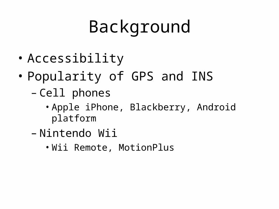
Background
• Accessibility
• Popularity of GPS and INS– Cell phones
• Apple iPhone, Blackberry, Android platform
– Nintendo Wii• Wii Remote, MotionPlus
Background: GPS
• First put into practical use in the 90’s. More commonly used in the 21st century
• GPS is for navigation, syncing computer networks time, missile guidance
• Some applications that make use of GPS are Garmin’s, Google maps, mobile apps
• GPS satellites are maintained by the Air force and can be used by anybody
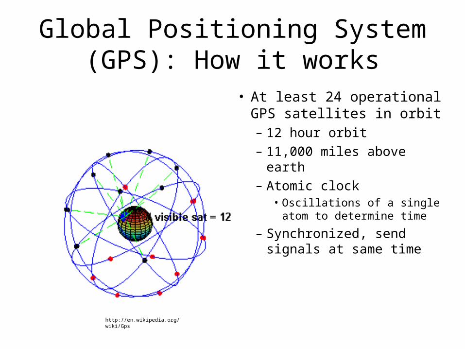
Global Positioning System (GPS): How it works
• At least 24 operational GPS satellites in orbit – 12 hour orbit– 11,000 miles above earth– Atomic clock
• Oscillations of a single atom to determine time
– Synchronized, send signals at same time
http://en.wikipedia.org/wiki/Gps
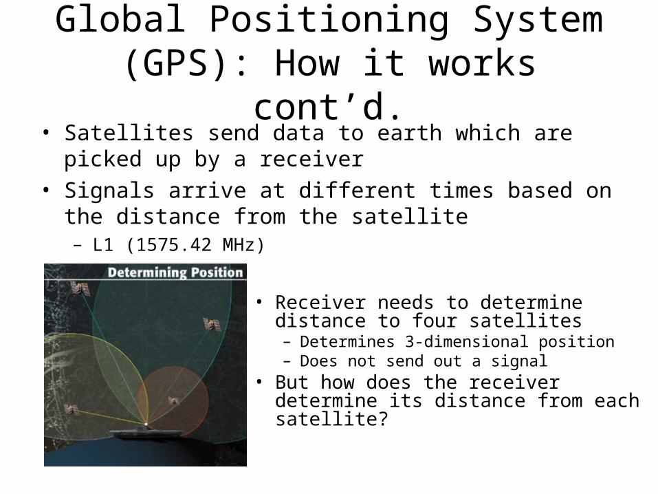
Global Positioning System (GPS): How it works cont’d.
• Satellites send data to earth which are picked up by a receiver
• Signals arrive at different times based on the distance from the satellite– L1 (1575.42 MHz)
• Receiver needs to determine distance to four satellites– Determines 3-dimensional position– Does not send out a signal
• But how does the receiver determine its distance from each satellite?
Global Positioning System (GPS): How it works cont’d.
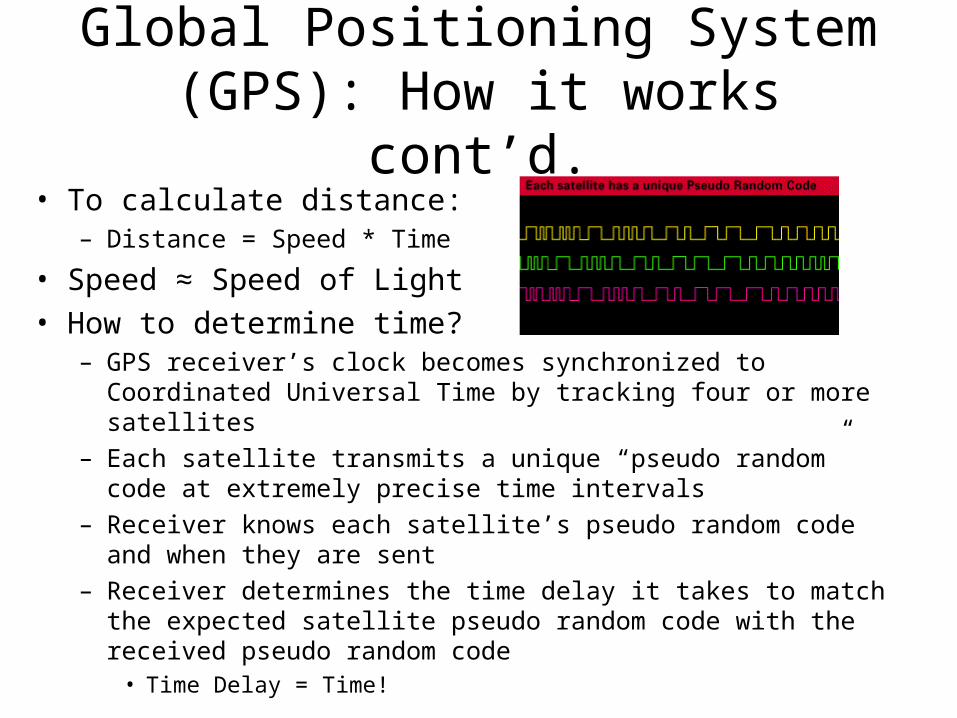
• To calculate distance:– Distance = Speed * Time
• Speed ≈ Speed of Light• How to determine time?
– GPS receiver’s clock becomes synchronized to Coordinated Universal Time by tracking four or more satellites
– Each satellite transmits a unique “pseudo random” code at extremely precise time intervals
– Receiver knows each satellite’s pseudo random code and when they are sent
– Receiver determines the time delay it takes to match the expected satellite pseudo random code with the received pseudo random code
• Time Delay = Time!
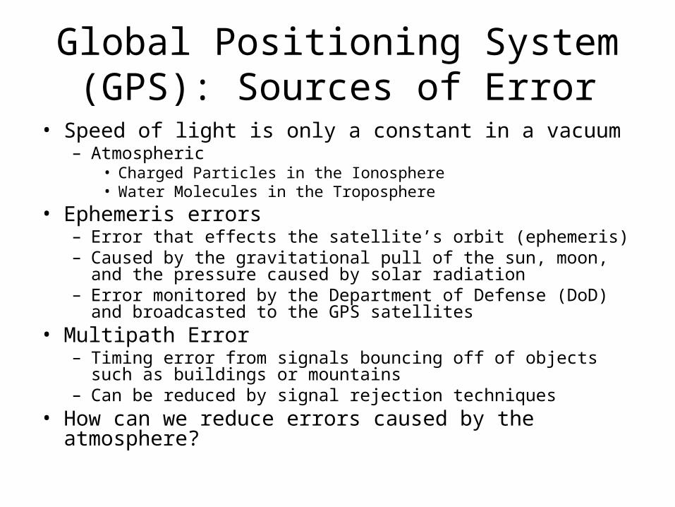
Global Positioning System (GPS): Sources of Error
• Speed of light is only a constant in a vacuum– Atmospheric
• Charged Particles in the Ionosphere• Water Molecules in the Troposphere
• Ephemeris errors– Error that effects the satellite’s orbit (ephemeris) – Caused by the gravitational pull of the sun, moon, and the
pressure caused by solar radiation– Error monitored by the Department of Defense (DoD) and
broadcasted to the GPS satellites• Multipath Error
– Timing error from signals bouncing off of objects such as buildings or mountains
– Can be reduced by signal rejection techniques• How can we reduce errors caused by the atmosphere?
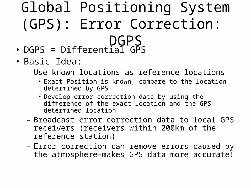
Global Positioning System (GPS): Error Correction: DGPS
• DGPS = Differential GPS• Basic Idea:
– Use known locations as reference locations• Exact Position is known, compare to the location determined
by GPS• Develop error correction data by using the difference of the
exact location and the GPS determined location
– Broadcast error correction data to local GPS receivers (receivers within 200km of the reference station)
– Error correction can remove errors caused by the atmosphere—makes GPS data more accurate!
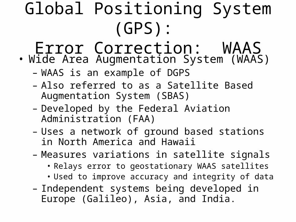
Global Positioning System (GPS): Error Correction: WAAS
• Wide Area Augmentation System (WAAS)– WAAS is an example of DGPS – Also referred to as a Satellite Based Augmentation
System (SBAS)– Developed by the Federal Aviation Administration
(FAA)– Uses a network of ground based stations in North
America and Hawaii– Measures variations in satellite signals
• Relays error to geostationary WAAS satellites• Used to improve accuracy and integrity of data
– Independent systems being developed in Europe (Galileo), Asia, and India.
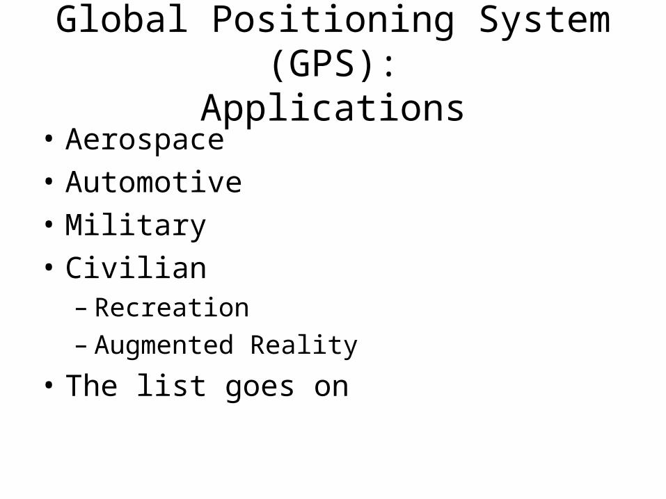
Global Positioning System (GPS):Applications
• Aerospace
• Automotive
• Military
• Civilian– Recreation– Augmented Reality
• The list goes on
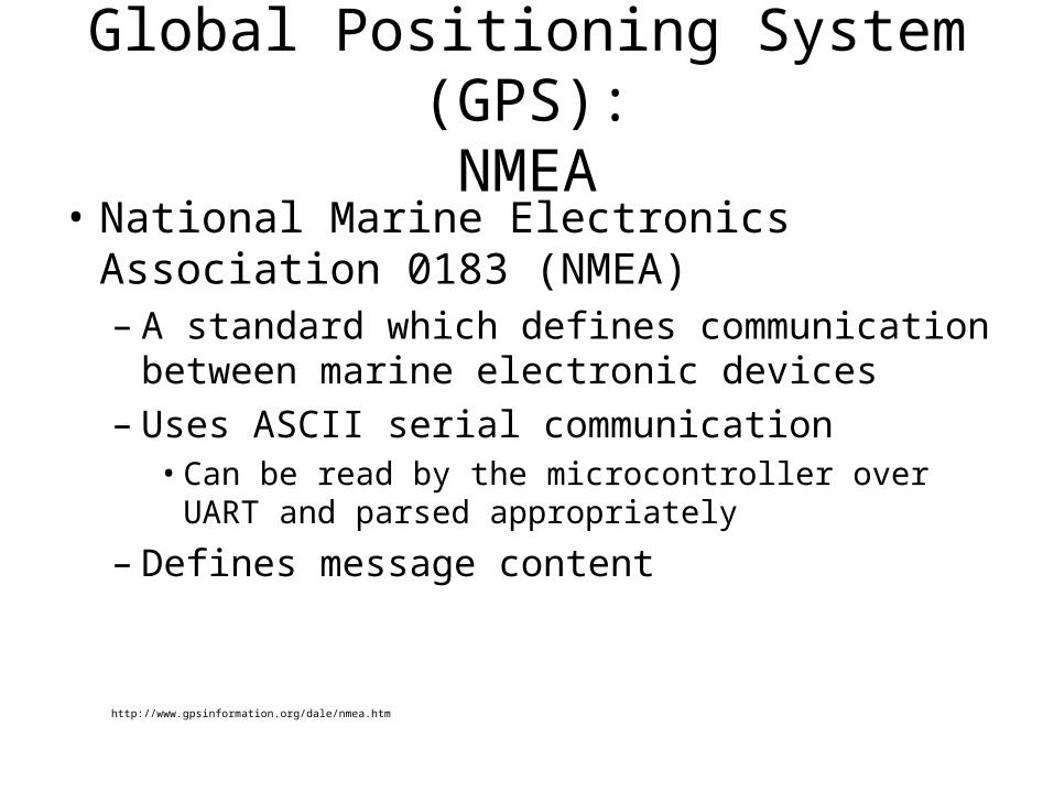
Global Positioning System (GPS):NMEA
• National Marine Electronics Association 0183 (NMEA)– A standard which defines communication
between marine electronic devices– Uses ASCII serial communication
• Can be read by the microcontroller over UART and parsed appropriately
– Defines message content
http://www.gpsinformation.org/dale/nmea.htm
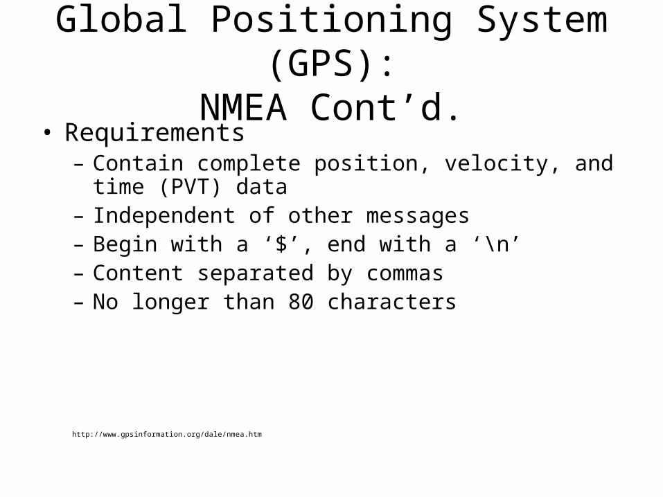
Global Positioning System (GPS):NMEA Cont’d.
• Requirements– Contain complete position, velocity, and time (PVT)
data– Independent of other messages– Begin with a ‘$’, end with a ‘\n’– Content separated by commas – No longer than 80 characters
http://www.gpsinformation.org/dale/nmea.htm
Global Positioning System (GPS):NMEA Cont’d.
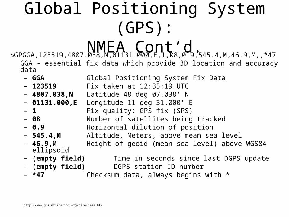
$GPGGA,123519,4807.038,N,01131.000,E,1,08,0.9,545.4,M,46.9,M,,*47GGA - essential fix data which provide 3D location and accuracy data– GGA Global Positioning System Fix Data– 123519 Fix taken at 12:35:19 UTC– 4807.038,N Latitude 48 deg 07.038' N– 01131.000,E Longitude 11 deg 31.000' E– 1 Fix quality: GPS fix (SPS)– 08 Number of satellites being tracked– 0.9 Horizontal dilution of position– 545.4,M Altitude, Meters, above mean sea level– 46.9,M Height of geoid (mean sea level) above WGS84 ellipsoid– (empty field) Time in seconds since last DGPS update– (empty field) DGPS station ID number– *47 Checksum data, always begins with *
http://www.gpsinformation.org/dale/nmea.htm