Embed Size (px)
DESCRIPTION
A document supporting Babcock's HRO application. Community Council's response will be published shortly
Citation preview
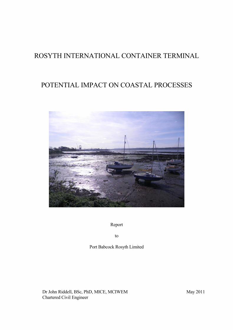
ROSYTH INTERNATIONAL CONTAINER TERMINAL
POTENTIAL IMPACT ON COASTAL PROCESSES
Report
to
Port Babcock Rosyth Limited
Dr John Riddell, BSc, PhD, MICE, MCIWEM May 2011Chartered Civil Engineer

ROSYTH INTERNATIONAL CONTAINER TERMINAL
PROPOSED DREDGED NAVIGATION CHANNEL
1 Introduction
1 Port Babcock Rosyth Limited (hereafter 'Babcock') proposes to construct a container
terminal for shipping at its Rosyth site on the north side of the Forth Estuary through the
promotion of two Harbour Revision Orders under the Harbours Act 1964 ('the proposed
HROs'). To support the application the technical adviser to Babcock, Jacobs, has prepared
an Environmental Statement ('ES') and a Planning Statement.
2 The proposed development includes the formation of a 150 m wide navigation channel
extending from the natural deep water of the Forth Estuary into the proposed ship berthing
area. The approach channel will be dredged to achieve a water depth of 8.5 m below Chart
Datum ('CD') at Rosyth. CD at Rosyth is 2.95 m below Ordnance Datum Newlyn.
Proposed side slopes are 1 vertical to 2 horizontal and the estimated in-situ volume of
material to be dredged is about 600,000 cubic metres. Under the Marine (Scotland) Act
2010 a licence for the dredging operation will require to be obtained from Marine Scotland.
3 It is intended to beneficially use all of the dredged material for infilling of part of an
existing basin to be redeveloped as the container storage and handling area. For dredged
material to be relocated ashore it is likely that the dredging will be undertaken by a cutter
suction dredger and pumped to land by the dredger through a pipeline. As this type of
dredger lifts and transports the material mixed with water, after settlement of the solids
within the fill area the transporting water will need to be returned to the sea. The discharge
will require to be licensed by the Scottish Environment Protection Agency.
4 All dredging operations involve disturbance of the in-situ material. The disturbance can
result in the placement into suspension of fine sized sediment such as clay and silt. The
potential for generation of suspended solids during the dredging operation will be
considered by Marine Scotland.
5 Should any of the material to be dredged be unsuitable for infill then a license will be
_______________________________________________________________________________________
Rosyth Container Terminal Page 1 5/2011.Jacobs.2a
sought from Marine Scotland for its relocation in one of the recognised 'spoil grounds'
within the Firth of Forth.
6 It is possible that the new deepwater channel will be subject to siltation. To ensure
continued safe navigation it is likely that any such siltation will result in periodic dredging
in order to maintain the required depth. Any future maintenance dredging and the disposal
of the dredged material resulting from maintenance dredging does not form part of the
proposed HROs and will require to be separately licensed by Marine Scotland as and when
an application relating to these activities comes forward from those who would might wish
to undertake such work.
7 As a result of the statutory consultation process representations have been received about
the dredging and disposal aspects of the proposed development. Charlestown, Limekilns
and Pattiesmuir Community Council ('CLPCC') and local residents of Limekilns are
concerned about possible changes in the level and nature of the foreshore and intertidal
area to the west (ie upstream) of the proposed dredged channel. Scottish Natural Heritage
wishes to be satisfied that any temporary or long term change in the concentration of
suspended solids in the Firth of Forth that might result from the new channel will not affect
migratory fish, particularly salmon.
8 To assist with resolving these issues the writer was requested by Jacobs to review the ES
and other documentation. This report provides that review. As well as examining the
relevant sections of the ES, the writer has undertaken a walkover inspection of the
intertidal area to the west of the Rosyth site during the low water of 10th April 2011, met
with Jacobs and Babcock to discuss aspects of the dredging, and considered other
information available relating to past and present dredging/disposal operations in the Firth
of Forth.
2 Local Changes to Foreshore and Intertidal Area
1 The proposed initial or capital dredging will involve dredging of material that is mainly
below the level of mean low water spring ('MLWS') tides. Reference to the relevant
_______________________________________________________________________________________
Rosyth Container Terminal Page 2 5/2011.Jacobs.2a
Admiralty Chart suggests that only a small length of the proposed channel will extend
landward of the MLWS point into the present intertidal area adjoining the south wall of the
existing basin. However, the proposed depth of the channel of around 9 m below the
MLWS level has the potential to impact on the intertidal and foreshore area to the west of
the site, most likely by possible erosion, although localised accretion resulting from
deposition of suspended sediment during dredging could also occur.
2 The possible impacts of any such changes can be varied. Those identified by the writer are as follows:
• siltation/erosion at the harbour of Bruce Haven affecting the current recreational
use of the harbour,
• accretion/erosion at and close to the existing shore protection/coast defence works
located at Charles Way between Bruce Haven and the Rosyth site with the
possibility of these works being damaged or requiring to be extended,
• accretion/erosion of the general intertidal area to the west of Rosyth with a possible
adverse impact on the ecological value of the area,
3 The low water walkover inspection of the intertidal and foreshore area to the west of the
Rosyth site showed that the area comprises superficial or surface deposits of silty clay, silt,
sand and occasional gravel, and rock. The steeply rising land above high water mark also
comprises rock. So far as could be determined most of the intertidal superficial sediments
exist in quite thin layers overlying rock. A possible exception is the area in front of Charles
Way where the steeply sloping ground beyond the high water mark gives way to a much
flatter area of land. Most of the intertidal rock outcrops are covered in a good growth of
seaweeds.
4 The coarser surface sediments, mainly sand, exist closer to the high water mark than the
low water mark and were noted as being more common on those parts of the shore most
exposed to wave action from the south-west and west. The predominant wind and wave
direction is from the south-west, ie from upstream, as evidenced by the pier/breakwater of
Bruce Haven having been constructed on the west side of that small harbour. An area of
raised rock to the east of the gabion basket protection works at Charles Way has resulted in
a tombola of coarser material. The absence of extensive uninterrupted areas of sand
within the intertidal area would indicate that sand movement is not significant other than
_______________________________________________________________________________________
Rosyth Container Terminal Page 3 5/2011.Jacobs.2a
very locally. However, the part of the shore protected by the gabions fronting Charles Way
is likely to comprise coarser material susceptible to wave action erosion. As such the shore
protection relatively recently constructed is likely to reduce the supply of sediment to the
natural erosion/accretion process.
5 Over the more seaward part of the intertidal area the finer surface material, likely in size
terms to be silty sand, silt or silty clay, exists in relatively thin patches between the raised
areas of intertidal rock, but with increasing depth likely nearer the low tide level as the
water depth increases and the presence of surface rock disappears. As the material to be
dredged is judged to be suitable for infill it is likely that below the low water mark the silt
layer thins and gives way to thicker deposits of sand.
6 The surface layers of silt/silty clay were noted as being very loose and unconsolidated, and
easily disturbed and placed into suspension. That noted in the intertidal area during the site
inspection is considered to be highly mobile and likely to be transported through the area
by tidal flow and the turbulence of wave action. The source of the material is that naturally
occurring within the Forth Estuary and moving within the estuary by the flow of the tide.
7 With regard to potential erosion of the coastline between Limekilns and the Rosyth site the
writer notes the apparent coincidence of erosion and earlier capital dredging at Rosyth
referred to by CLPCC, but would suggest that the more likely cause would be a period of
strong wave action coincident with high tides or a tidal surge. It is of course possible that
the extension of deeper water nearer to the shore as a result of the dredging will increase
wave action from the south to east over the intertidal area. This may impact on the
immediate intertidal area but because of the intervening rock will have no impact at the
high water mark.
8 The presence of rock at shallow depth within most of the intertidal area limits
onshore/offshore sand transport and the raised rock and other features limit longshore sand
transport. These natural features indicate to the writer that erosion of the existing
foreshore will not be exacerbated by the formation and any subsequent maintenance of the
proposed channel. However, this is not to say that there will be no further change in beach
level in front of the Charles Way gabions as there is clearly a natural wave generated
_______________________________________________________________________________________
Rosyth Container Terminal Page 4 5/2011.Jacobs.2a
erosion/accretion process active in this part of the foreshore. It may be that localised beach
nourishment could improve the recreational value of that part of the shoreline and also help
to stabilise the foreshore.
9 The writer considers that the formation and any subsequent maintenance of the proposed
channel will not adversely impact on Bruce Haven and the recreational use of that harbour
in relation to wave action and water depth. Again the presence of intervening rock and
other natural existing features of the intertidal area make it difficult to see any mechanism
whereby the channel at Rosyth could result in any significant erosion or accretion at the
harbour.
10 The deposits of silt and silty clay within the intertidal area are primarily of ecological
importance. The infilling by siltation of an earlier dredged channel to the west of that now
proposed and the requirement for maintenance dredging of the existing Rosyth navigation
channel indicate that the proposed channel will also be prone to siltation as nature attempts
to restore the present regime condition. The deepened channel will result in locally
reduced flow velocities (but perhaps not reduced turbulence) which will encourage
deposition. Mechanisms for transporting sediment within the area clearly exist. The
question then is whether the very small volumes of silt/silty clay within the intertidal area
to the west of the channel will be a significant source of sediment relative to that which
moves daily through the area. In other words, will sediment move from the intertidal area
between Limekilns and Rosyth into the deepened channel in preference to deposition from
the tidal flow through the deepened area.
11 The writer considers that during ebb tide conditions it is likely that some fine sediments
will be moved from the intertidal area to the west downstream into the deepened channel
and in doing so will contribute to the siltation of the new channel. However, it is equally
likely that fine sediment will continue to be carried into the intertidal area during the same
ebb tide and with the rough and irregular nature of the rock surface and low tidal velocities
will continue to deposit in the area. The writer therefore considers that the present
dynamic nature of these deposits is likely to increase with a potentially greater turnover of
sediment. The writer is not able to comment on whether such increased turnover is likely
to have a negative or positive impact in relation to the ecological value of the deposits.
_______________________________________________________________________________________
Rosyth Container Terminal Page 5 5/2011.Jacobs.2a
12 Accretion/erosion of the material below MLWS could have an effect on the bed material
within the intertidal area. The presence of rock will again limit any such effect to one of no
significance given the large quantity of material moving daily.
3 Increased Suspended Solids/Turbidity During Dredging and Disposal
1 As earlier described the potential exists to place dredged material into suspension within
the water column during dredging. Suspended solids can have an adverse impact on the
marine environment. They can reduce light levels by increased turbidity, they can form a
physical barrier through which fish and other aquatic species may be reluctant to pass, and
on deposition can affect feeding and spawning areas.
2 Because of these potential problems there has been much research in recent years into the
environmental impact of dredging and disposal and into suspended solids generation
during the various forms of dredging and disposal operations. As a result there is now an
extensive literature on the subject (see books Dredging in Coastal Waters, Editor D Eisma,
Taylor & Francis, 2005 and Environmental Aspects of Dredging, Editor R N Bray, Taylor
& Francis, 2008, also the proceedings of the World Dredging Congresses which take place
every four years) .
3 In determining whether dredging may have a significant adverse environmental impact it is
essential to understand the suspended sediment generating potential, the intensity or
concentration of any resulting sediment plume, the duration and the areal extent of the
suspended sediment generation, the background or natural levels of suspended solids,
including both natural and other man-induced fluctuations, those parts of the ecological
system that exist within these existing levels, and the limits which might result in an
adverse impact. Without careful thought, investigation and understanding either unrealistic
or unjustifiable restrictions can be placed on dredging and disposal by regulatory agencies,
or significant damage can be caused to the marine environment.
4 Some examples for illustration include an agency restricting the overflow of suspended
_______________________________________________________________________________________
Rosyth Container Terminal Page 6 5/2011.Jacobs.2a
solids from a hopper barge when the concentration was less than that created by the
propellers of ships using the same channel, the imposition of 'textbook' maximum
suspended solids limits less than what was subsequently measured to be natural
background levels, and a failure to appreciate the difference in effect between turbidity and
suspended solids. There have been examples of coral reefs very adversely impacted by
very low concentrations of suspended solids and of eel grass colonies that have expanded
as a result of the increased nutrients released by dredging activity. Silt curtains have at
times been specified to contain suspended solids, but often as a response to aesthetic rather
than real environmental concerns.
5 Considering the proposed capital dredging operation, if this is undertaken by a cutter
suction dredger discharging through a pipeline to the shore (likely to be the method of
choice), suspended solids generation will be restricted to the area of the rotating cutter
head. Both laboratory and prototype measurements carried out show that the
concentrations produced by cutter heads are quite low and very localised even although
suspended solids generation is almost continuous with this type of dredging. Given that
various field measurements by SEPA and others have established that suspended solids are
present within the Forth at significant concentrations it is considered that a cutter suction
dredging operation will have no noticeable adverse impact on these levels.
6 Depending on the strength of the material to be dredged it may be that a small volume will
be unsuitable for a cutter suction dredger to remove and will require to be excavated by a
backhoe type of dredger. Efficient mechanical dredging by a backhoe bucket should
attempt to remove the material at its in-situ density in order to maximise production and
reduce costs. Suspended solids generation in that situation tends to be limited to material
washing out of the bucket as it is moved vertically through the water column. As material
lost in this way has to be redredged, a good machine operator will control movements to
minimise wash-out. Again the effect on existing suspended solids concentrations is likely
to be negligible.
7 Any hard material dredged by a backhoe dredger will probably be loaded into a hopper
barge for transport to the discharge site. Economics dictate that the maximum in-situ
volume is within the hopper during its passage from the dredging to the discharge site.
_______________________________________________________________________________________
Rosyth Container Terminal Page 7 5/2011.Jacobs.2a
This will usually involve overflow or spillage of water that is in the hopper prior to the
start of loading. As loading of the hopper proceeds the water is likely to contain suspended
solids as a result of mixing within the hopper. However, any overflow will be limited to a
relatively small proportion of the barge loading time so that there will be a reasonably long
'recovery time' between overflow periods. Overflow can of course be restricted or even
prohibited as part of the dredging consent if the licensing authority considers that to be
necessary.
8 Given the location and quite small scale (in terms of surface area and volume) of the
proposed channel dredging it is very unlikely that suspended solids created by any
economically realistic and consented dredging will result in any significant adverse impact
outwith the immediate area of the dredging. There may be a short term increase in silt
deposition within the nearby intertidal area but it is very unlikely that this will be
noticeable relative to the present natural deposition/erosion. It is considered that there will
be no adverse impact in relation to any obstruction to the passage of fish or other living
creatures given the relatively small extent of the potentially impacted area.
4 Conclusions
1 Following a review of the ES and other relevant information and a detailed walkover
inspection, the writer considers that the dredging of a navigation approach channel from
the Firth of Forth to the site of the proposed container terminal will have no significant
adverse impact on existing erosion/accretion patterns on the foreshore and intertidal area
between the proposed channel and Limekilns. In particular, the writer considers that
neither the initial capital dredging nor the completed channel will adversely impact on (a)
the existing recreational usage of the small harbour at Bruce Haven, (b) the existing coastal
defence works at Charles Way and (c) the amenity and ecological value of the intertidal
area.
2 Suspended solids generation by a cutter suction dredger of the type most likely to be used
to dredge the channel has been well researched and has been shown to be small and
localised. The return flow to the sea of water pumped ashore with the dredged material will
_______________________________________________________________________________________
Rosyth Container Terminal Page 8 5/2011.Jacobs.2a
be controlled by SEPA in relation to the maximum concentration of suspended solids.
Marine Scotland, the licensing authority for the dredging operation, can restrict the
overflow of suspended solids from any barge that may be used if the presence of hard
material requires use of a backhoe dredger. Suspended solids generation by a backhoe
bucket has again been shown to be small and localised.
3 The foreshore and intertidal area between Rosyth and Limekilns is subject to both wave
action and tidal flow. It is a dynamic, not static, marine environment. The man made
structures of Bruce Haven harbour and the coastal defences at Charles Way are within that
environment. Changes will continue to take place. The presence of rock either on the
surface or at shallow depth will ensure that the impact of the proposed dredged channel
will have no significant adverse impact on these continuing changes.
Dr John Riddell, BSc, PhD, MICE, MCIWEM May 2011
Chartered Civil Engineer
_______________________________________________________________________________________
Rosyth Container Terminal Page 9 5/2011.Jacobs.2a
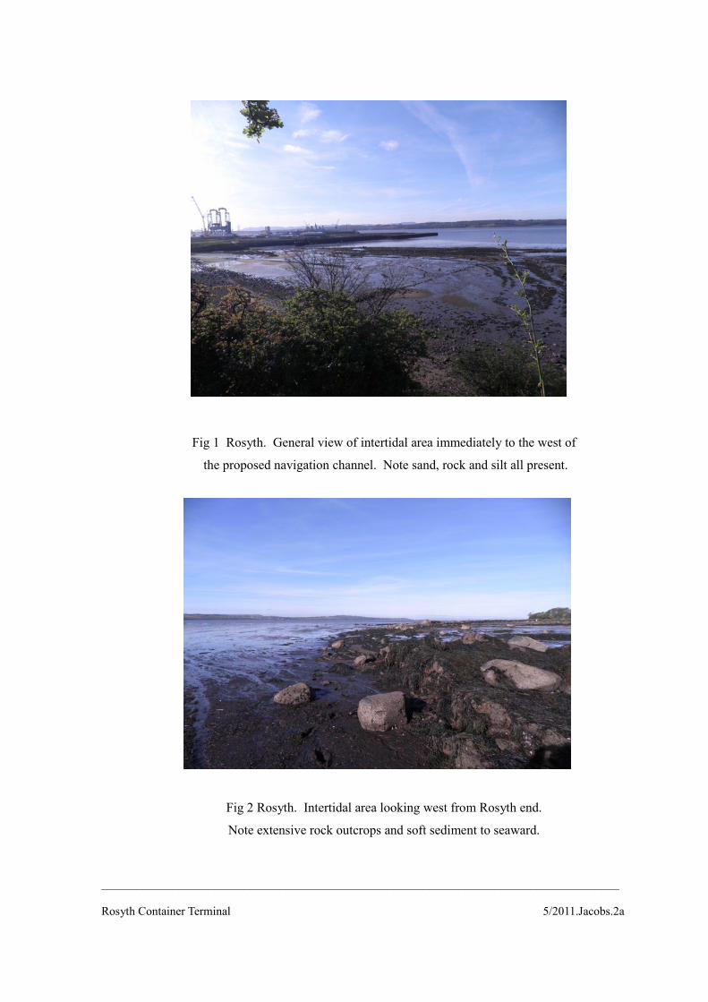
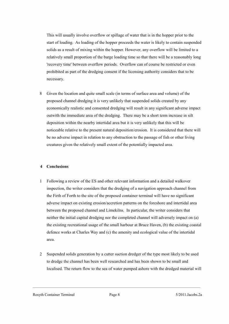
Fig 1 Rosyth. General view of intertidal area immediately to the west of
the proposed navigation channel. Note sand, rock and silt all present.
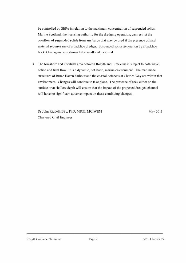
Fig 2 Rosyth. Intertidal area looking west from Rosyth end.
Note extensive rock outcrops and soft sediment to seaward.
_______________________________________________________________________________________
Rosyth Container Terminal 5/2011.Jacobs.2a
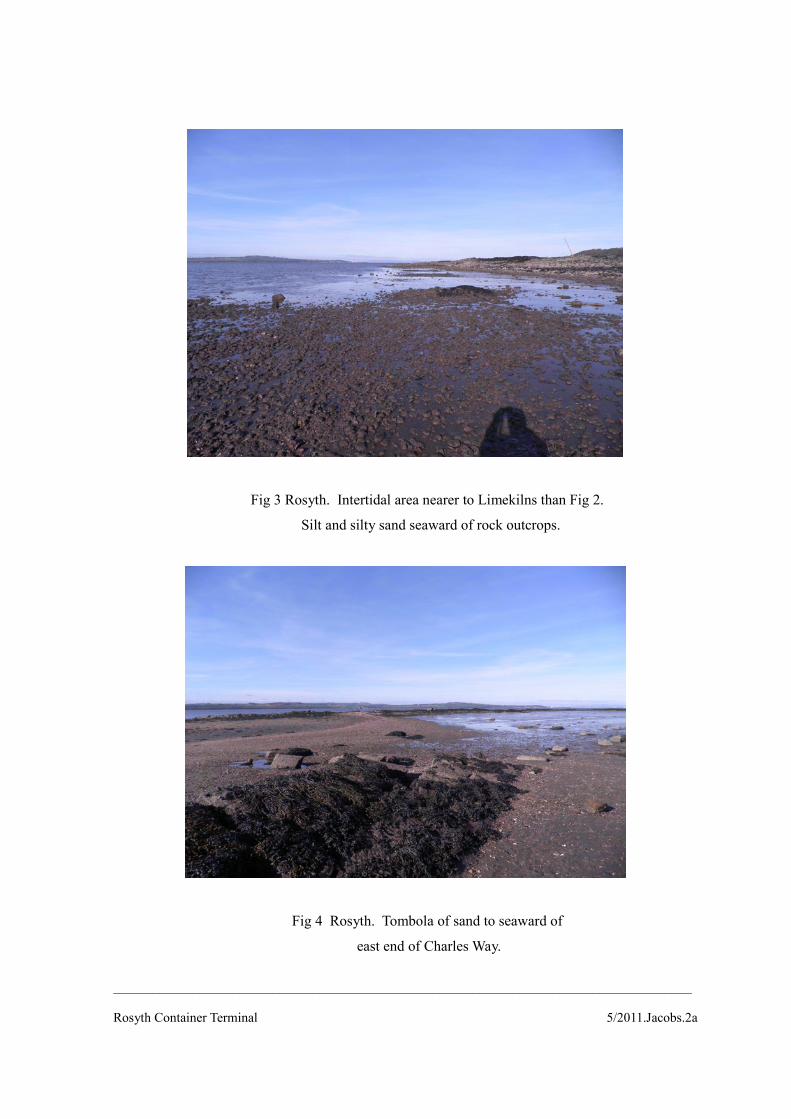
Fig 3 Rosyth. Intertidal area nearer to Limekilns than Fig 2.
Silt and silty sand seaward of rock outcrops.
Fig 4 Rosyth. Tombola of sand to seaward of
east end of Charles Way.
_______________________________________________________________________________________
Rosyth Container Terminal 5/2011.Jacobs.2a
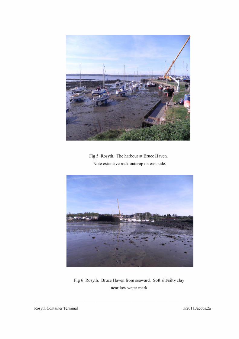
Fig 5 Rosyth. The harbour at Bruce Haven.
Note extensive rock outcrop on east side.
Fig 6 Rosyth. Bruce Haven from seaward. Soft silt/silty clay
near low water mark.
_______________________________________________________________________________________
Rosyth Container Terminal 5/2011.Jacobs.2a
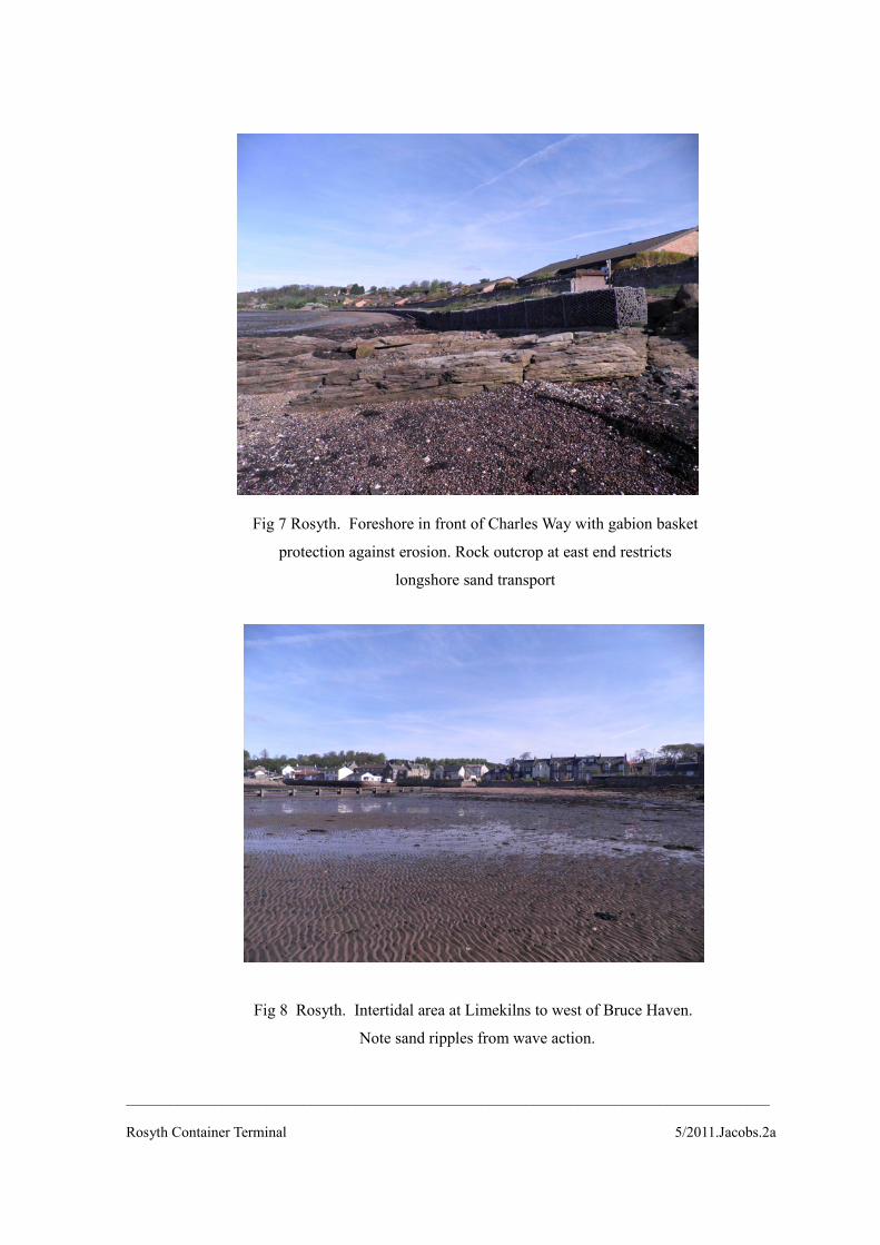
Fig 7 Rosyth. Foreshore in front of Charles Way with gabion basket
protection against erosion. Rock outcrop at east end restricts
longshore sand transport
Fig 8 Rosyth. Intertidal area at Limekilns to west of Bruce Haven.
Note sand ripples from wave action.
_______________________________________________________________________________________
Rosyth Container Terminal 5/2011.Jacobs.2a