Embed Size (px)
Citation preview

BA 8/19• In a paragraph, what makes the U.S. one of the most powerful
and richest nations in the world? Explain your answer.
• **since you are writing a paragraph, you do NOT have to write the question***

Why “in the world” do we need to know this stuff??• http://www.youtube.com/watch?v=7_pw8duzGUg
• And then there’s this: http://www.youtube.com/watch?v=lj3iNxZ8Dww

Unit 2:Climate, Landforms & Bodies of Water in the United States
Chapter 7 & 8
SSWG8 The student will describe the interaction of physical and human systems that have shaped contemporary Canada and the United States. a. Describe the location of major physical features and their impact on Canada and the United States. b. Describe the major climates of Canada and the United States and how they affect Canada and the United States. c. Explain the reasons for the population distribution in Canada and the United States. d. Explain how the physical geography of Canada and the United States contributed to regional growth and development.

ClimateThe U.S. contains all the 4 major climates
1.High Latitude- Alaska
2. Middle Latitude- Most of country3. Dry- Mojave Desert (CA) 4. Tropical- Hawaii & southern Florida

Landforms of the East
Three major landforms in the east:
1. Coastal plain2. Piedmont3. Appalachian Mountains

1. Coastal Plain
• Stretches along the Atlantic Ocean and Gulf of Mexico from New England to Mexico
• Lies close to sea level

2. Piedmont• Piedmont- area at the bottom of the Appalachian mountains
• Area west of coastal plain
• Stretches from New Jersey to Alabama

Fall Line• The Fall Line- boundary between the Piedmont and the
coastal plain
• Area full of rapids and waterfalls• Small ships couldn’t pass it
• Created boundary for early settlements

3. Appalachian Mountains
• Rise to the west and north of the Piedmont
• Stretch from Alabama to SE Canada

Bodies of Water• Major rivers include the Mississippi River and Colorado River
• Continental divide- divides North America’s river systems into those flowing eastward and westward• Located at the peak of the Rocky Mountains

Major Regions of the U.S.
The United States is divided into 4 regions:
1. Northeast2. Midwest3. South4. West
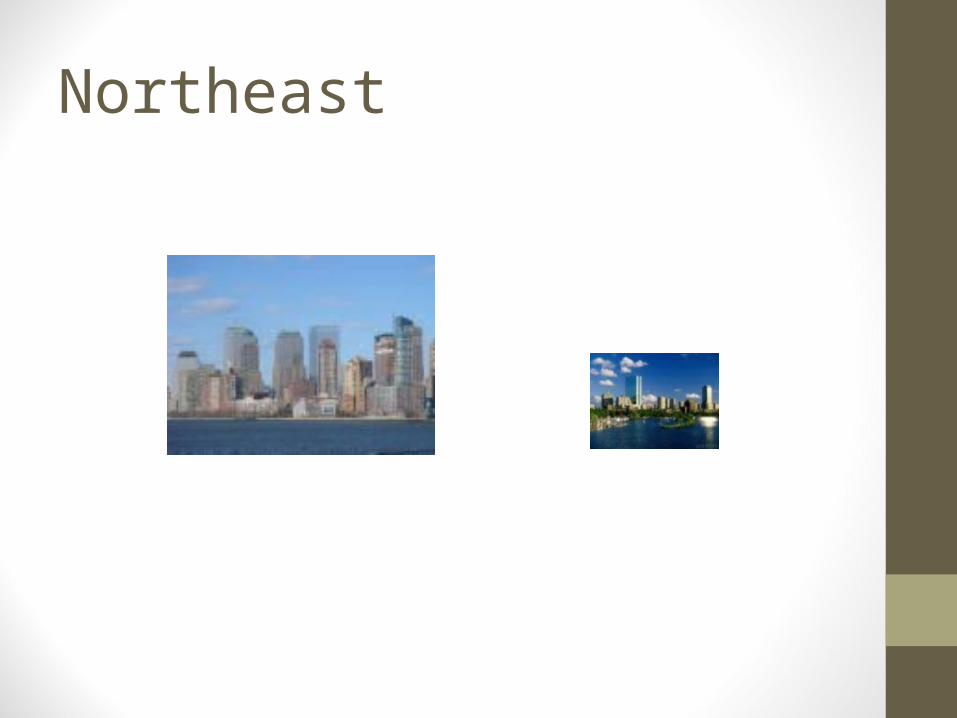
Northeast
1. Northeast• Most densely populated area of the U.S.• About 1/5 of country’s population
• Smallest of the regions
• Political and financial center of U.S.
• Has most amount of industry
• Includes Maine, New Hampshire, Vermont, Massachusetts, Rhode Island, Connecticut, New York, New Jersey, Pennsylvania, West Virginia, Maryland, Delaware, and Washington D.C.

Northeast continued
• Most of area’s population is located in a megalopolis
• Megalopolis: group of cities that have grown into one large, built up area
• Ex: Boston, New York, Philadelphia, Baltimore, Washington D.C.
• Linked by highways, railroads, and airports

Midwest

2. Midwest• Country’s major farming region
• Includes Ohio, Indiana, Illinois, Michigan, Wisconsin, Minnesota, Iowa, and Missouri.
• Area has many river systems and productive soils
• Major cities linked by Great Lakes and Mississippi River
• Major cities include Chicago, Cleveland, Detroit

Midwest continued
Includes Corn Belt and Dairy Belt
1. Corn Belt- Nebraska to Ohio• Country’s corn producer
2. Dairy Belt- north of Corn Belt• Includes Wisconsin, Minnesota, and Michigan• Makes country’s dairy products
South

3. South• Holds 30% of population• Most of any region
• Area includes Virginia, North Carolina, South Carolina, Georgia, Florida, Alabama, Mississippi, Tennessee, Kentucky, Arkansas, Louisiana, and Texas

South continued• Region is a major source of raw materials• Example: lumber, cotton, tobacco
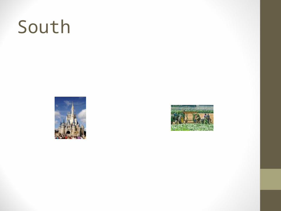
• Warm climate makes area popular tourist destination• Ex: Disney World, Busch Gardens, Sea World
• Major cities include Dallas, Atlanta, Miami, and New Orleans

West

4. West
• Largest and most sparsely populated region
• 25% of country’s population
• Includes Great Plains and Rocky Mountains
• Much of the area consists of dry plateaus, deserts, and high mountains

West continued
• West is part of Pacific Ring of Fire• Many active volcanoes and earthquake faults
• Parts of California lie on the San Andreas Fault• Reason for earthquakes
• Mount Rainier, Mount Hood, Mount Shasta and Mount St. Helens are all active volcanoes


West continued
• Western region broken into 2 parts:
1. Interior West2. Pacific States
• Interior West: North Dakota, South Dakota, Nebraska, Kansas, Oklahoma, New Mexico, Colorado, Wyoming, Montana, Idaho, Utah, Nevada, Arizona
• Pacific States: California, Oregon, Washington, Alaska, and Hawaii
Interior west
• Region known for raising livestock, wheat farming and mining• Copper: Arizona, New Mexico, Utah• Gold: Nevada
• Major cities include Phoenix and Denver

Pacific States
• Area where most people live
• California has largest population of any state in country
• Computer technology greatly helped area• Silicon Valley in San Francisco
• Major cities include Los Angeles, San Francisco, Seattle, and San Diego