Embed Size (px)
Citation preview
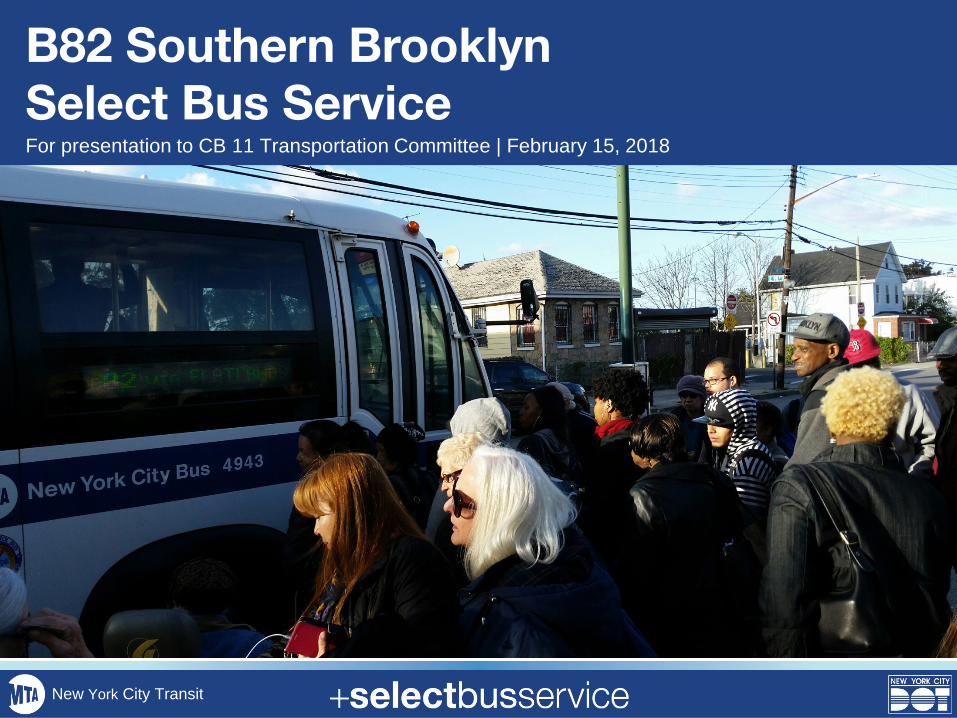
B82 Southern Brooklyn Select Bus ServiceFor presentation to CB 11 Transportation Committee | February 15, 2018
New York City Transit
• Project Background
• B82 SBS Plan & Street Designs
• Next Steps
• Questions and Discussion
Overview
2
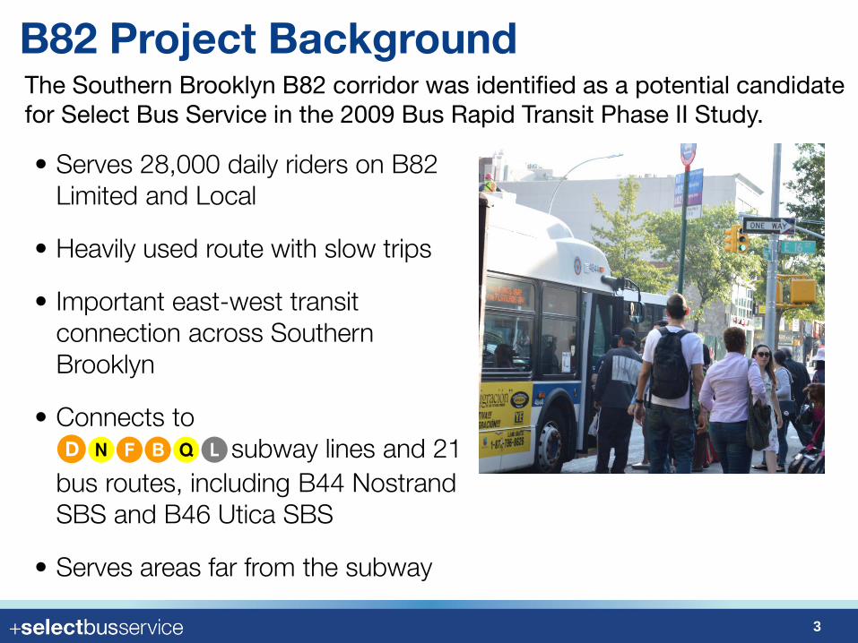
B82 Project BackgroundThe Southern Brooklyn B82 corridor was identified as a potential candidate for Select Bus Service in the 2009 Bus Rapid Transit Phase II Study.
• Serves 28,000 daily riders on B82 Limited and Local
• Heavily used route with slow trips
• Important east-west transit connection across Southern Brooklyn
• Connects to DNFBQL subway lines and 21 bus routes, including B44 NostrandSBS and B46 Utica SBS
• Serves areas far from the subway
3
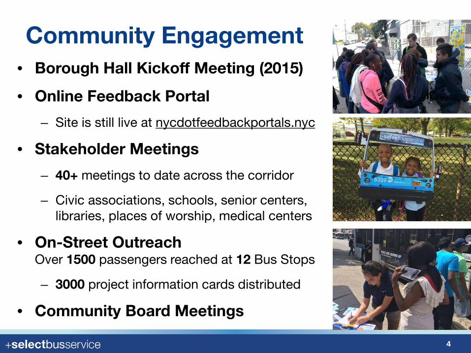
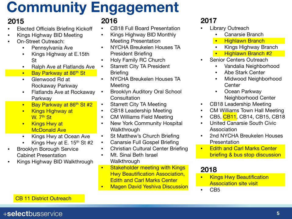
Community Engagement• Borough Hall Kickoff Meeting (2015)
• Online Feedback Portal
– Site is still live at nycdotfeedbackportals.nyc
• Stakeholder Meetings
– 40+ meetings to date across the corridor
– Civic associations, schools, senior centers, libraries, places of worship, medical centers
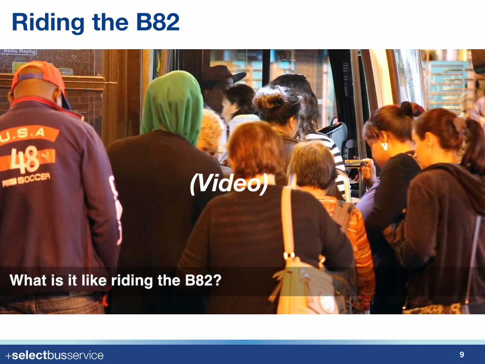
• On-Street OutreachOver 1500 passengers reached at 12 Bus Stops
– 3000 project information cards distributed
• Community Board Meetings
4
Community Engagement
5
2015• Elected Officials Briefing Kickoff• Kings Highway BID Meeting• On-Street Outreach:
• Pennsylvania Ave• Kings Highway at E.15th
St• Ralph Ave at Flatlands Ave• Bay Parkway at 86th St• Glenwood Rd at
Rockaway Parkway• Flatlands Ave at Rockaway
Parkway• Bay Parkway at 86th St #2• Kings Highway at
W. 7th St• Kings Hwy at
McDonald Ave• Kings Hwy at Ocean Ave• Kings Hwy at E. 15th St #2
• Brooklyn Borough Service Cabinet Presentation
• Kings Highway BID Walkthrough
2016• CB18 Full Board Presentation• Kings Highway BID Monthly
Meeting Presentation• NYCHA Breukelen Houses TA
President Briefing• Holy Family RC Church • Starrett City TA President
Briefing• NYCHA Breukelen Houses TA
Meeting• Brooklyn Auditory Oral School
Consultation• Starrett City TA Meeting• CB18 Leadership Meeting• CM Williams Field Meeting• New York Community Hospital
Walkthrough• St Matthew’s Church Briefing• Canarsie Full Gospel Briefing• Christian Cultural Center Briefing• Mt. Sinai Beth Israel
Walkthrough• Stakeholder meeting with Kings
Hwy Beautification Association, Edith and Carl Marks Center
• Magen David Yeshiva Discussion
2018 • Kings Hwy Beautification
Association site visit• CB5
2017 • Library Outreach
• Canarsie Branch• Highlawn Branch• Kings Highway Branch• Highlawn Branch #2
• Senior Centers Outreach• Vandalia Neighborhood• Abe Stark Center• Midwood Neighborhood
Center• Ocean Parkway
Neighborhood Center• CB18 Leadership Meeting• CM Williams Town Hall Meeting• CB5, CB11, CB14, CB15, CB18 • United Canarsie South Civic
Association• 2nd NYCHA Breukelen Houses
Presentation• Edith and Carl Marks Center
briefing & bus stop discussion
CB 11 District Outreach
Community Engagement
6
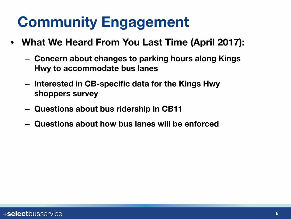
• What We Heard From You Last Time (April 2017):
– Concern about changes to parking hours along Kings Hwy to accommodate bus lanes
– Interested in CB-specific data for the Kings Hwy shoppers survey
– Questions about bus ridership in CB11
– Questions about how bus lanes will be enforced
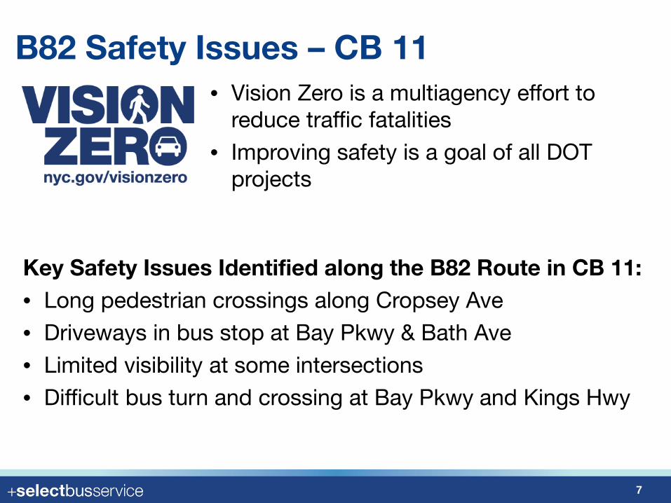
B82 Safety Issues – CB 11• Vision Zero is a multiagency effort to
reduce traffic fatalities• Improving safety is a goal of all DOT
projects
7
Key Safety Issues Identified along the B82 Route in CB 11:• Long pedestrian crossings along Cropsey Ave• Driveways in bus stop at Bay Pkwy & Bath Ave • Limited visibility at some intersections• Difficult bus turn and crossing at Bay Pkwy and Kings Hwy
B82 Transit Issues – CB 11
8
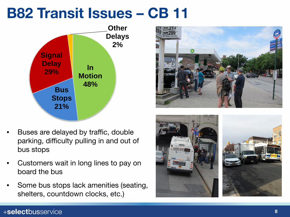
• Buses are delayed by traffic, double parking, difficulty pulling in and out of bus stops
• Customers wait in long lines to pay on board the bus
• Some bus stops lack amenities (seating, shelters, countdown clocks, etc.)
In Motion
48%Bus
Stops 21%
Signal Delay 29%
Other Delays
2%
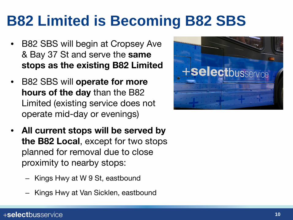
B82 Limited is Becoming B82 SBS
10
• B82 SBS will begin at Cropsey Ave & Bay 37 St and serve the same stops as the existing B82 Limited
• B82 SBS will operate for more hours of the day than the B82 Limited (existing service does not operate mid-day or evenings)
• All current stops will be served by the B82 Local, except for two stops planned for removal due to close proximity to nearby stops:
– Kings Hwy at W 9 St, eastbound
– Kings Hwy at Van Sicklen, eastbound
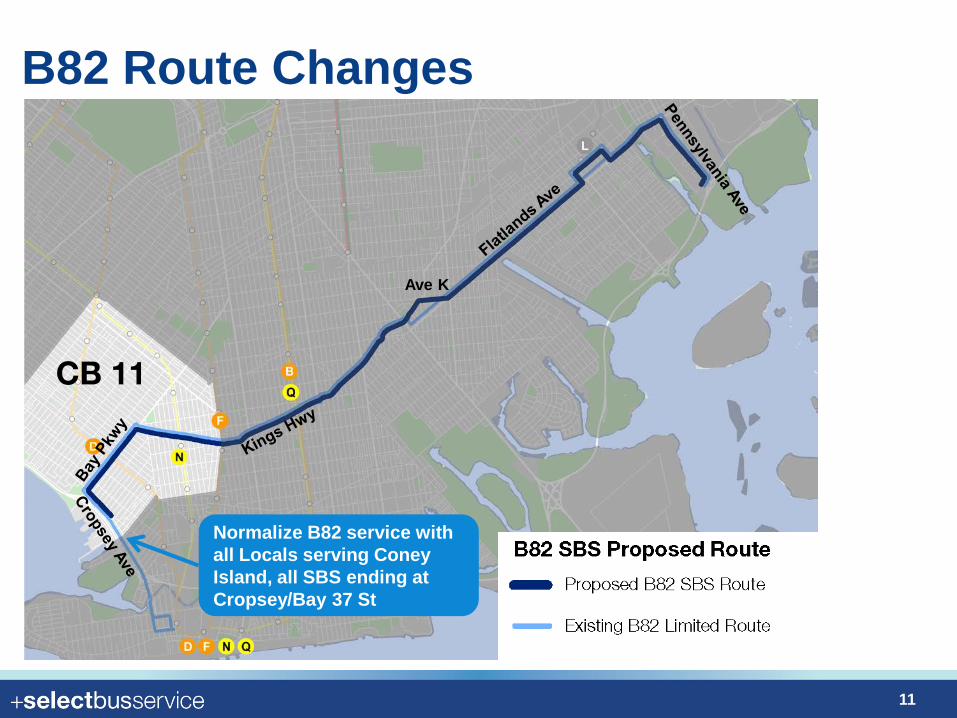
B82 Route Changes
11
Normalize B82 service with all Locals serving Coney Island, all SBS ending at Cropsey/Bay 37 St
CB 11
Ave K
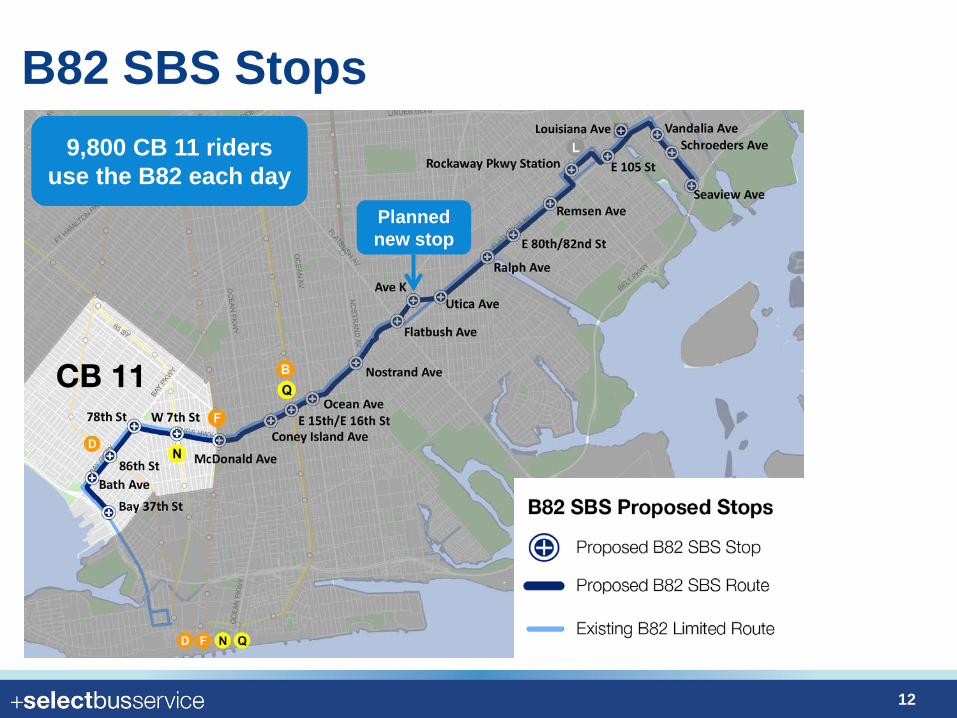
B82 SBS Stops
12
Planned new stop
CB 11
Louisiana Ave
9,800 CB 11 riders use the B82 each day
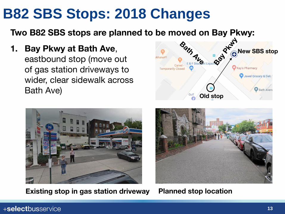
B82 SBS Stops: 2018 Changes
13
1. Bay Pkwy at Bath Ave, eastbound stop (move out of gas station driveways to wider, clear sidewalk across Bath Ave)
Two B82 SBS stops are planned to be moved on Bay Pkwy:
Existing stop in gas station driveway Planned stop location
Old stop
New SBS stop
B82 SBS Stops: 2018 Changes
14
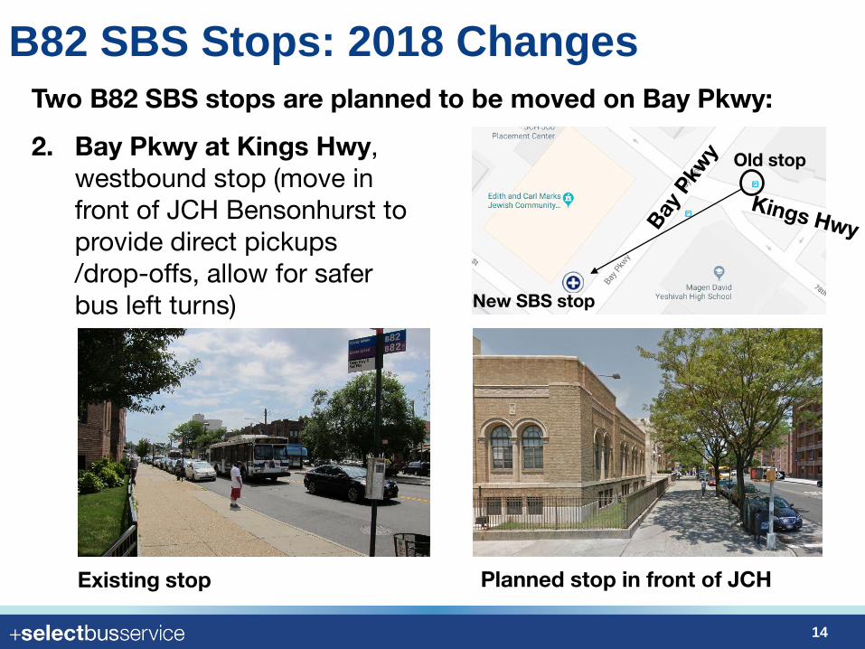
2. Bay Pkwy at Kings Hwy, westbound stop (move in front of JCH Bensonhurst to provide direct pickups /drop-offs, allow for safer bus left turns)
Two B82 SBS stops are planned to be moved on Bay Pkwy:
Existing stop Planned stop in front of JCH
Old stop
New SBS stop
B82 SBS Street Changes
15
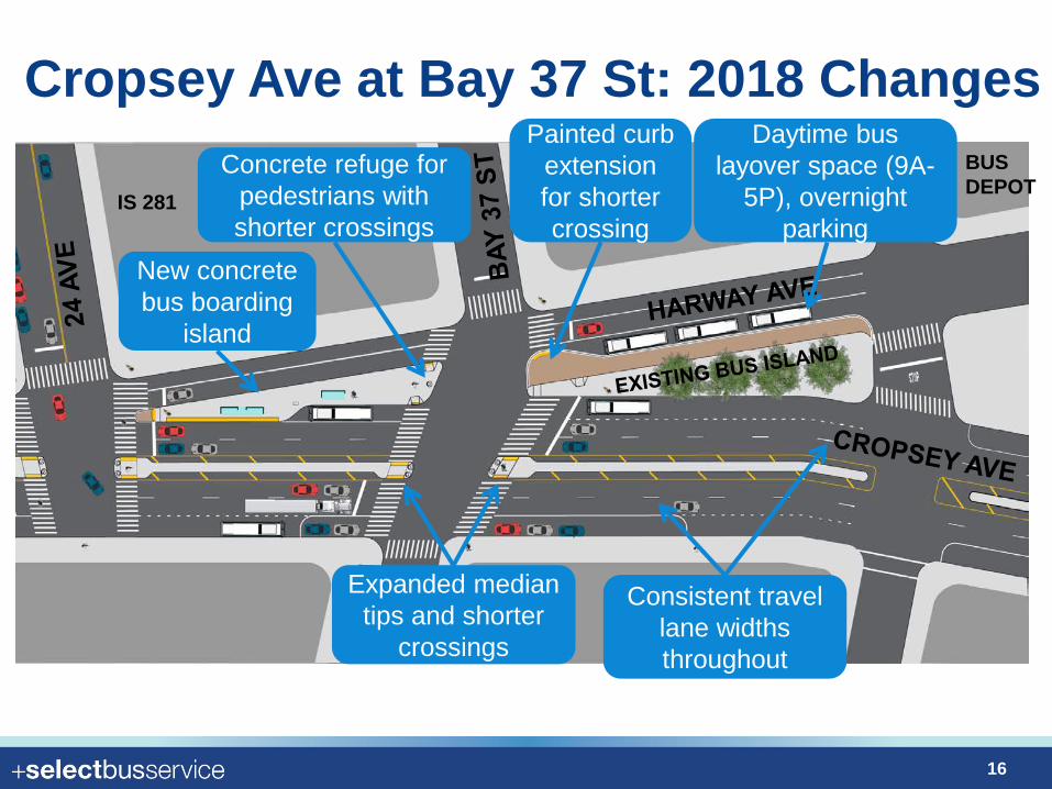
Cropsey Ave at Bay 37 St: 2018 Changes
16
New concrete bus boarding
island
Expanded median tips and shorter
crossings
Daytime bus layover space (9A-
5P), overnight parking
Painted curb extension for shorter crossing
Consistent travel lane widths throughout
Concrete refuge for pedestrians with shorter crossings
BUS DEPOT
IS 281
17
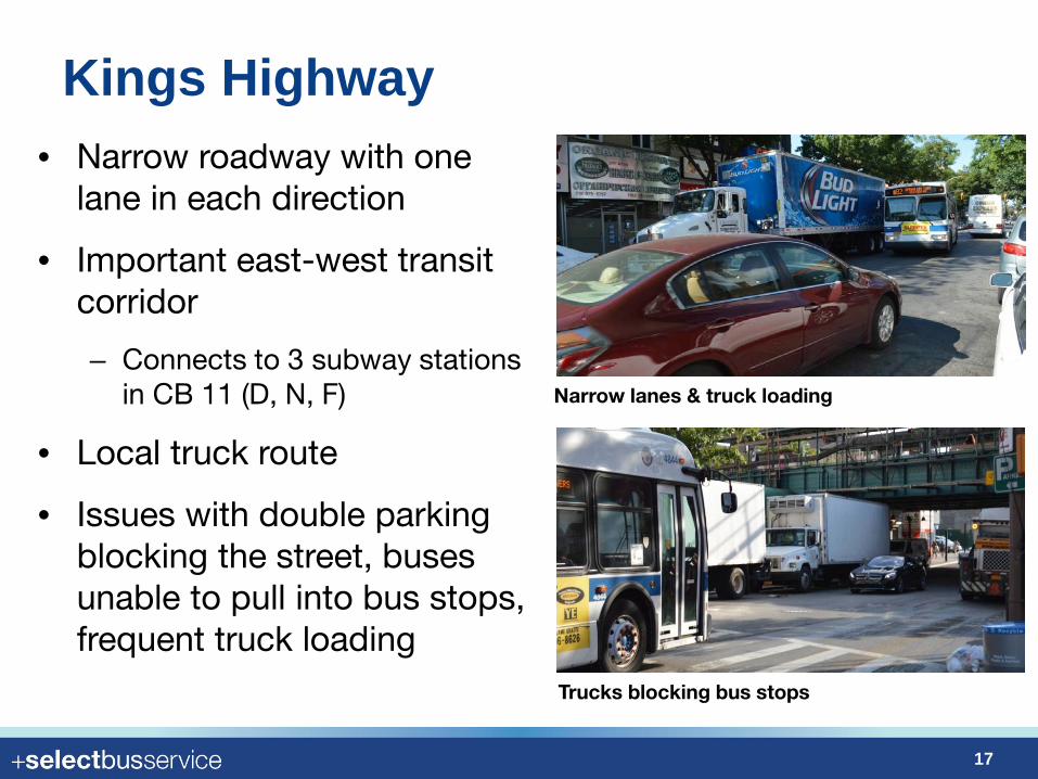
• Narrow roadway with one lane in each direction
• Important east-west transit corridor
– Connects to 3 subway stations in CB 11 (D, N, F)
• Local truck route
• Issues with double parking blocking the street, buses unable to pull into bus stops, frequent truck loading
Narrow lanes & truck loading
Trucks blocking bus stops
Kings Highway

Kings Highway Shoppers Survey: CB 11 Results
18
How People Get to Kings Highway Primary Purpose of Trip
1. Shopping (grocery, drug/discount store, clothing/shoes)
2. Work3. Dining/restaurant4. Medical
• Face-to-face interviews with 2,500 people on Kings Highway between W 10th St and McDonald Ave
Weekday
Weekend
1. Shopping (grocery, drug/discount store, clothing/shoes)
2. Dining/restaurant3. Work4. Personal errand
Car22%
Transit21%Walk
55%Subway
12%
Bus9%
Walk60%
Car20%
Transit19% Subway
11%
Bus8%
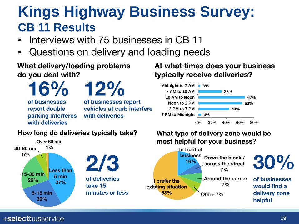
Kings Highway Business Survey: CB 11 Results
19
• Interviews with 75 businesses in CB 11• Questions on delivery and loading needsWhat delivery/loading problems do you deal with?
16%of businesses report double parking interferes with deliveries
12%of businesses report vehicles at curb interfere with deliveries
At what times does your business typically receive deliveries?
How long do deliveries typically take?
Less than 5 min37%
5-15 min30%
15-30 min26%
30-60 min6%
Over 60 min1%
2/3of deliveries take 15 minutes or less
What type of delivery zone would be most helpful for your business?
In front of business
16%Down the block / across the street
7%
Around the corner7%
I prefer the existing situation
63% Other 7%
30%of businesses would find a delivery zone helpful
4%44%
63%67%
33%3%
0% 20% 40% 60% 80%
7 PM to Midnight2 PM to 7 PMNoon to 2 PM
10 AM to Noon7 AM to 10 AM
Midnight to 7 AM
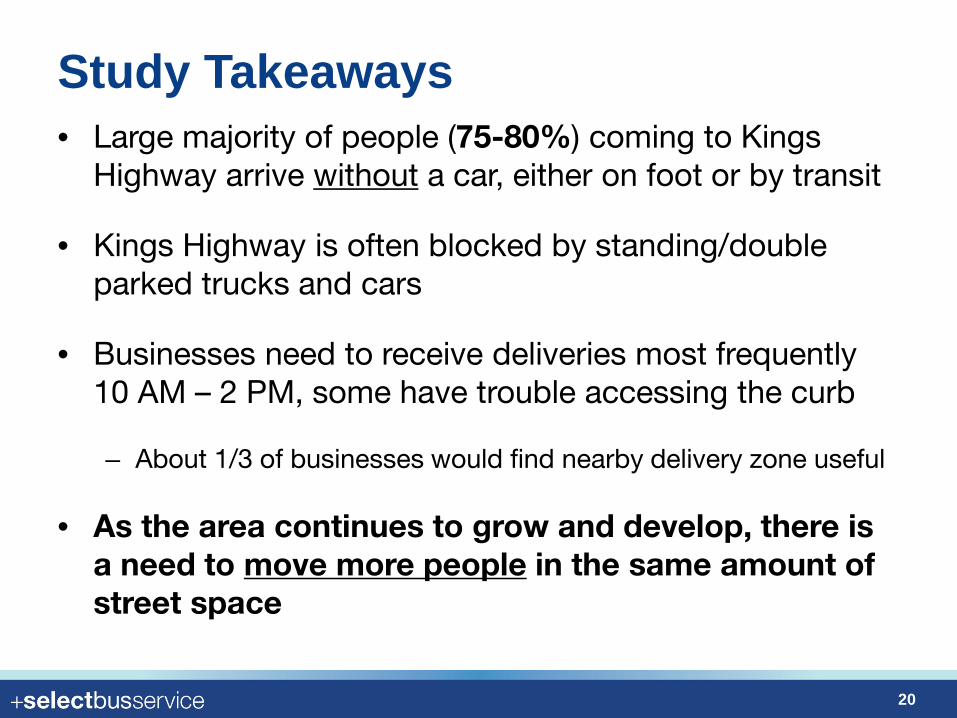
Study Takeaways
20
• Large majority of people (75-80%) coming to Kings Highway arrive without a car, either on foot or by transit
• Kings Highway is often blocked by standing/double parked trucks and cars
• Businesses need to receive deliveries most frequently 10 AM – 2 PM, some have trouble accessing the curb
– About 1/3 of businesses would find nearby delivery zone useful
• As the area continues to grow and develop, there is a need to move more people in the same amount of street space
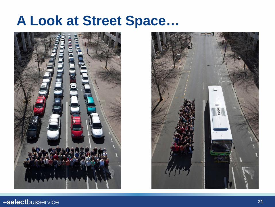
A Look at Street Space…
21
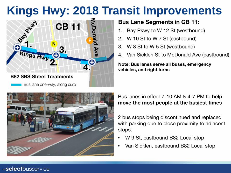
Kings Hwy: 2018 Transit Improvements
Bus lanes in effect 7-10 AM & 4-7 PM to help move the most people at the busiest times
CB 11
Note: Bus lanes serve all buses, emergency vehicles, and right turns
Bus Lane Segments in CB 11:1. Bay Pkwy to W 12 St (westbound)
2. W 10 St to W 7 St (eastbound)
3. W 8 St to W 5 St (westbound)
4. Van Sicklen St to McDonald Ave (eastbound)
1.
2.3.
4.
N F
2 bus stops being discontinued and replaced with parking due to close proximity to adjacent stops:
• W 9 St, eastbound B82 Local stop
• Van Sicklen, eastbound B82 Local stop
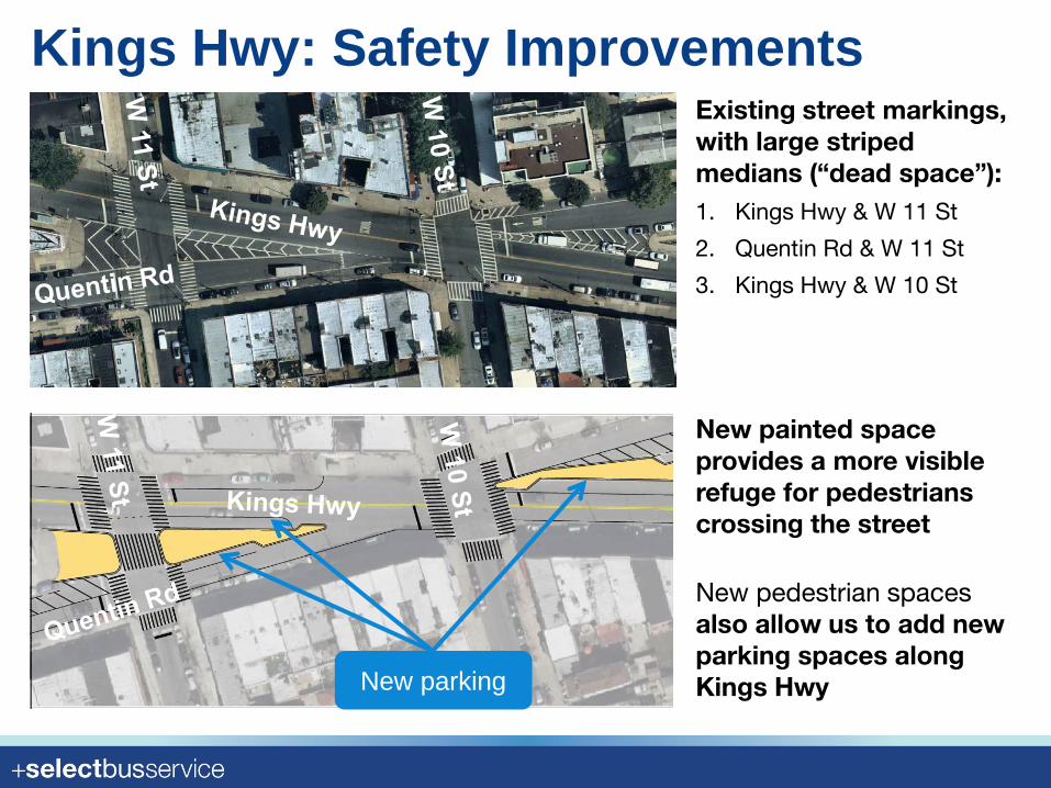
Kings Hwy: Safety Improvements
New pedestrian spaces also allow us to add new parking spaces along Kings Hwy
New painted space provides a more visible refuge for pedestrians crossing the street
Existing street markings, with large striped medians (“dead space”):1. Kings Hwy & W 11 St
2. Quentin Rd & W 11 St
3. Kings Hwy & W 10 St
New parking
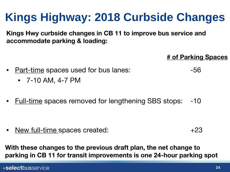
Kings Highway: 2018 Curbside Changes
24
SBS Example – Main St, Queens, Q44 SBS
Kings Hwy curbside changes in CB 11 to improve bus service and accommodate parking & loading:
• Part-time spaces used for bus lanes: -56
• 7-10 AM, 4-7 PM
• Full-time spaces removed for lengthening SBS stops: -10
• New full-time spaces created: +23
# of Parking Spaces
With these changes to the previous draft plan, the net change to parking in CB 11 for transit improvements is one 24-hour parking spot
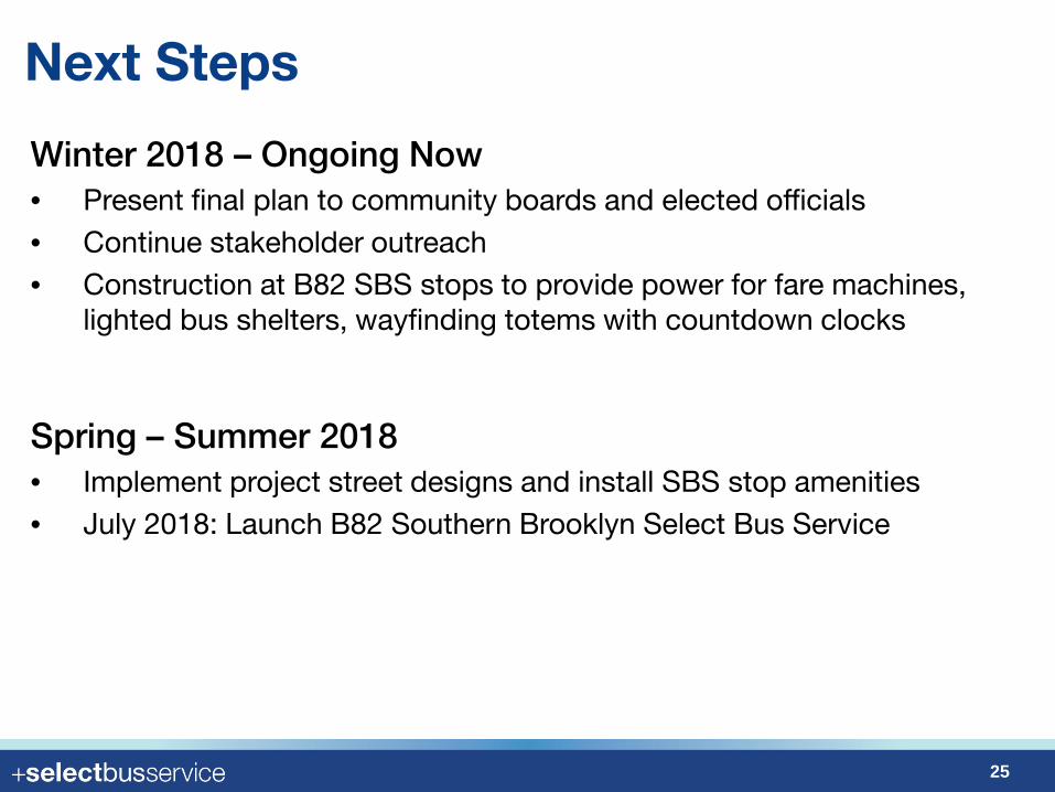
Winter 2018 – Ongoing Now• Present final plan to community boards and elected officials• Continue stakeholder outreach• Construction at B82 SBS stops to provide power for fare machines,
lighted bus shelters, wayfinding totems with countdown clocks
Spring – Summer 2018• Implement project street designs and install SBS stop amenities• July 2018: Launch B82 Southern Brooklyn Select Bus Service
25
Next Steps

Thank You!• Questions?
• We appreciate your input! You can provide it at your convenience online:– www.nyc.gov/brt or– nycdotfeedbackportals.nyc/south-brooklyn-sbs
• To invite us to community events or give other feedback,
please email us at [email protected]
26
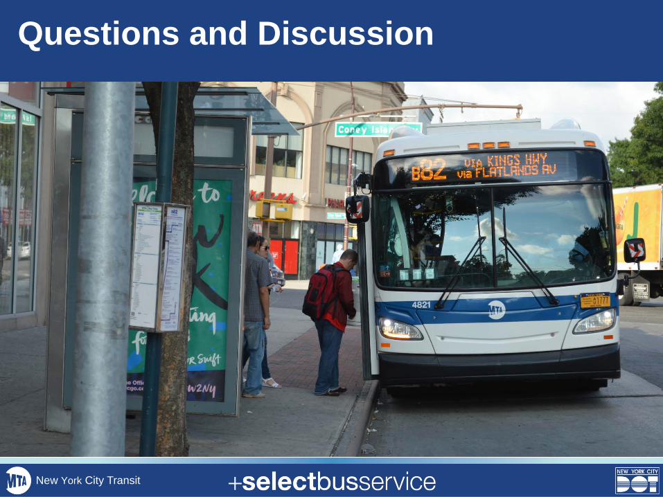
Questions and Discussion
New York City Transit

Appendix
30
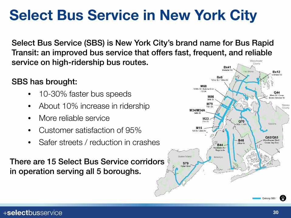
Select Bus Service (SBS) is New York City’s brand name for Bus Rapid Transit: an improved bus service that offers fast, frequent, and reliable service on high-ridership bus routes.
SBS has brought:
• 10-30% faster bus speeds
• About 10% increase in ridership
• More reliable service
• Customer satisfaction of 95%
• Safer streets / reduction in crashes
There are 15 Select Bus Service corridors in operation serving all 5 boroughs.
Select Bus Service in New York City
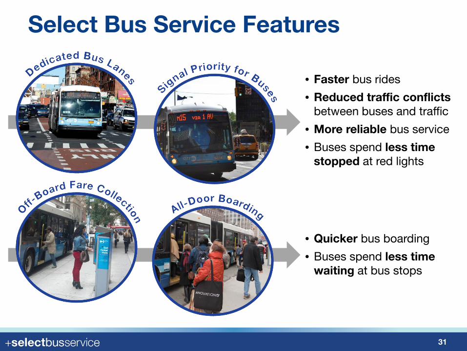
Select Bus Service Features
31
• Faster bus rides
• Reduced traffic conflicts between buses and traffic
• More reliable bus service
• Buses spend less time stopped at red lights
• Quicker bus boarding
• Buses spend less time waiting at bus stops
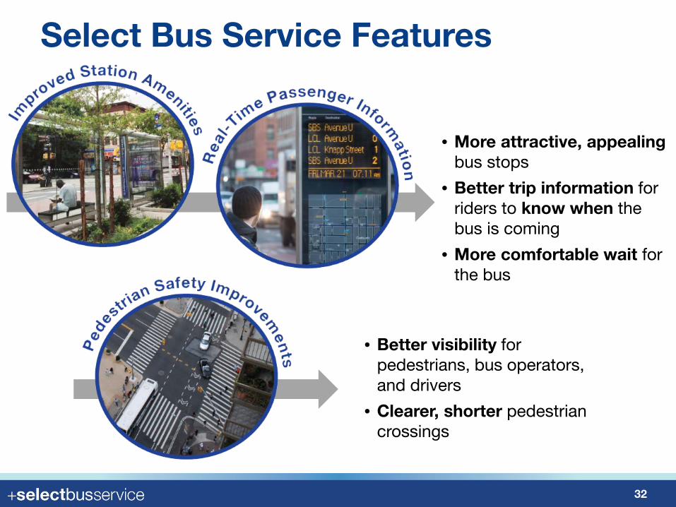
Select Bus Service Features
32
• Better visibility for pedestrians, bus operators, and drivers
• Clearer, shorter pedestrian crossings
• More attractive, appealingbus stops
• Better trip information for riders to know when the bus is coming
• More comfortable wait for the bus
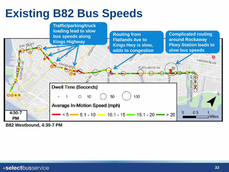
Existing B82 Bus Speeds
33
Complicated routing around Rockaway Pkwy Station leads to slow bus speeds
Routing from Flatlands Ave to Kings Hwy is slow, adds to congestion
Traffic/parking/truck loading lead to slow bus speeds along Kings Highway
B82 Westbound, 4:30-7 PM
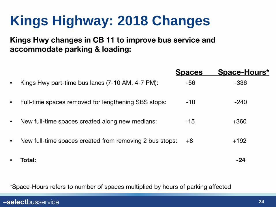
Kings Highway: 2018 Changes
34
SBS Example – Main St, Queens, Q44 SBS
Kings Hwy changes in CB 11 to improve bus service and accommodate parking & loading:
Spaces Space-Hours*• Kings Hwy part-time bus lanes (7-10 AM, 4-7 PM): -56 -336
• Full-time spaces removed for lengthening SBS stops: -10 -240
• New full-time spaces created along new medians: +15 +360
• New full-time spaces created from removing 2 bus stops: +8 +192
• Total: -24
*Space-Hours refers to number of spaces multiplied by hours of parking affected