Embed Size (px)
Citation preview
1
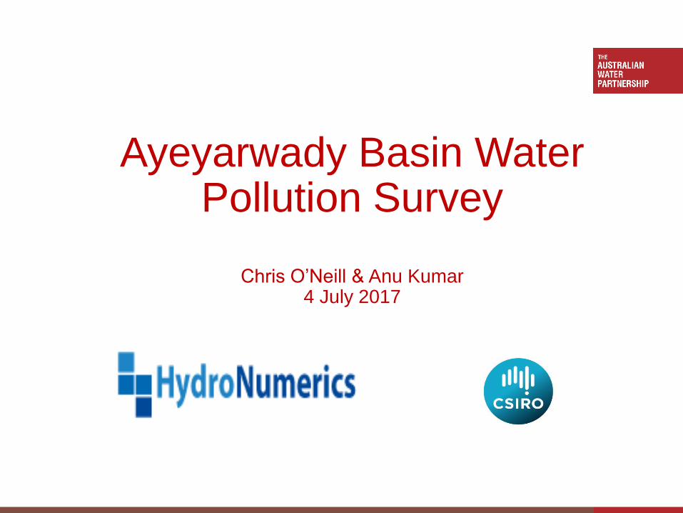
Ayeyarwady Basin Water Pollution Survey
Chris O’Neill & Anu Kumar4 July 2017
2
Background
• Mark Stevens “Good science and quality science can inform policy”
• Baseline WQ information for future basin planning
• Limited information available on pollution
• Water Stewardship = understanding risks of scarcity and pollution
• Pollution is a growing issue
• Increasing environmental and anthropogenic pressure
AWP Myanmar Activity 3: Pollution Assessment for Ayeyarwady
3
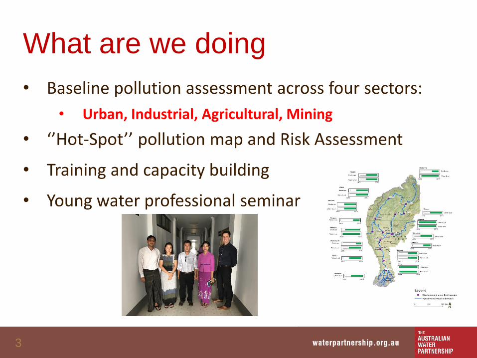
What are we doing
• Baseline pollution assessment across four sectors:
• Urban, Industrial, Agricultural, Mining
• ‘’Hot-Spot’’ pollution map and Risk Assessment
• Training and capacity building
• Young water professional seminar
4
5
Background
• Mark Stevens “Good science and quality science can inform policy”
• Limited information available on pollution
• WB funded scenario-based basin planning
• New concepts of water stewardship and social licence
AWP Myanmar Activity 3: Pollution Assessment for Ayeyarwady
6
Economic risks
• Intensification
• Deregulation
• Illegal mining
• Small-Medium Enterprises (SME) proliferation
• Human health costs
• Salinity impacts on agriculture
7
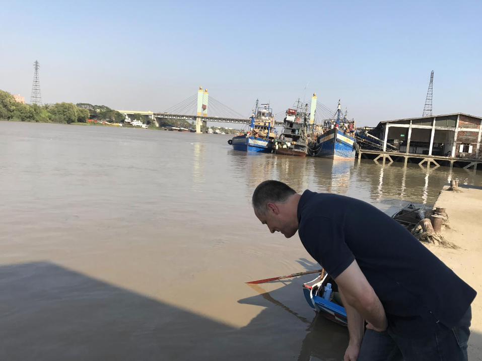
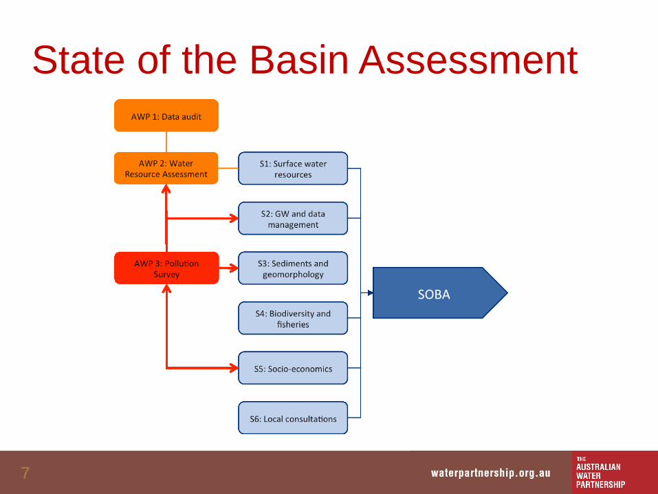
State of the Basin Assessment
8
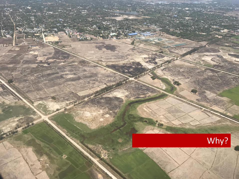
Why?
9
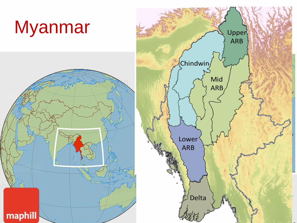
Myanmar
• Mark Stevens “Good science and quality science can inform policy”
• Baseline WQ information for future basin planning
• Limited information available on pollution
• Water Stewardship = understanding risks of scarcity and pollution
• Pollution is a growing issue
• Increasing environmental and anthropogenic pressure
AWP Myanmar Activity 3: Pollution Assessment for Ayeyarwady
10
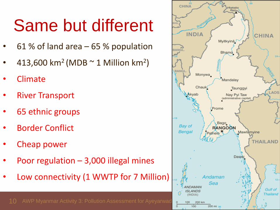
Same but different• 61 % of land area – 65 % population
• 413,600 km2 (MDB ~ 1 Million km2)
• Climate
• River Transport
• 65 ethnic groups
• Border Conflict
• Cheap power
• Poor regulation – 3,000 illegal mines
• Low connectivity (1 WWTP for 7 Million)
AWP Myanmar Activity 3: Pollution Assessment for Ayeyarwady
11
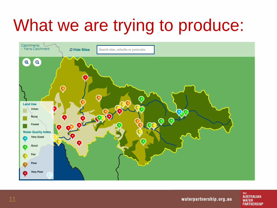
What we are trying to produce:
12
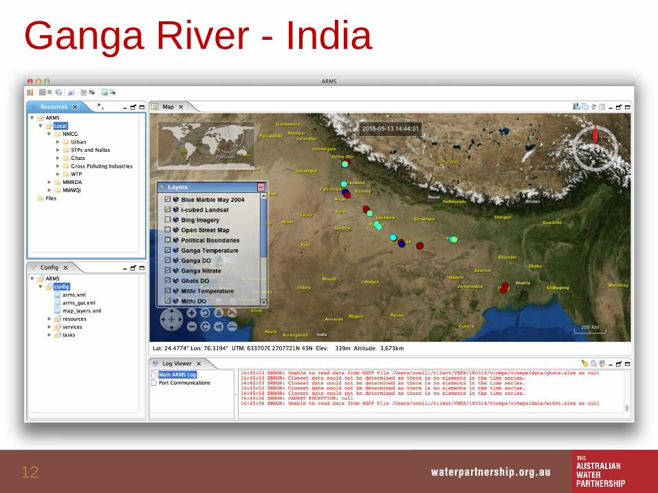
Ganga River - India
16
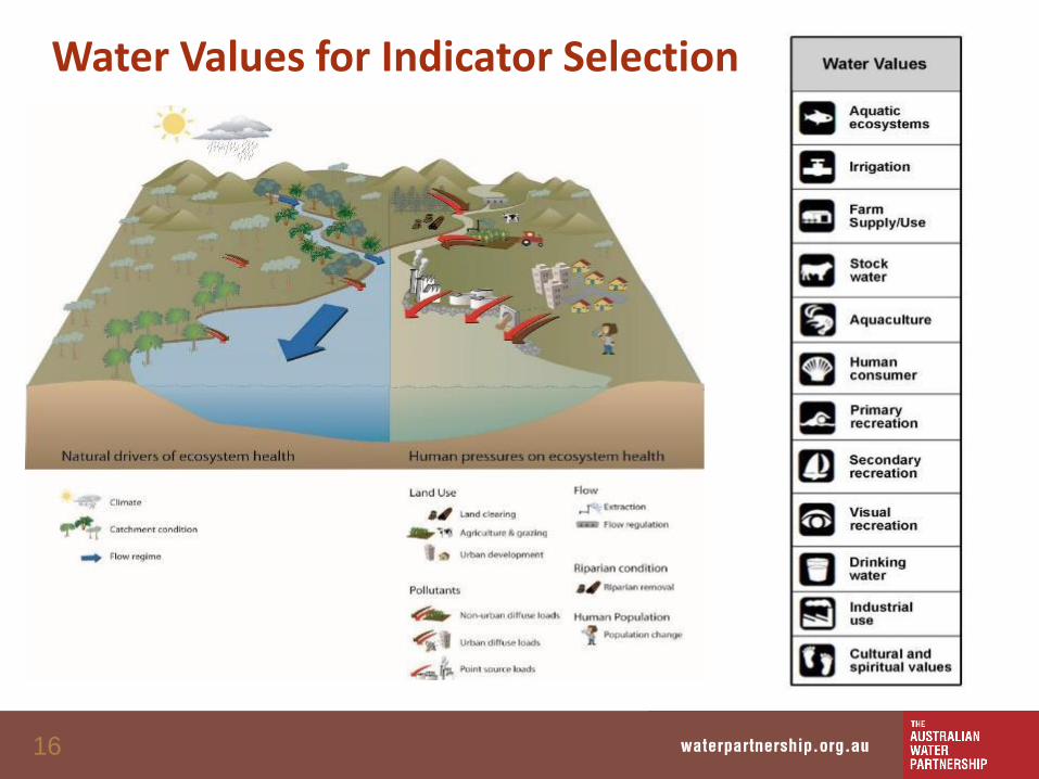
Water Values for Indicator Selection
20
To get this:
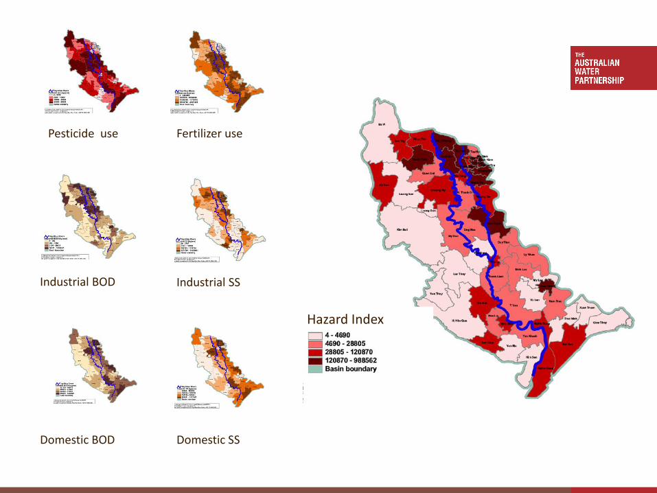
21
Pesticide use Fertilizer use
Industrial BOD Industrial SS
Domestic BOD Domestic SS
RiversHazard Index
22
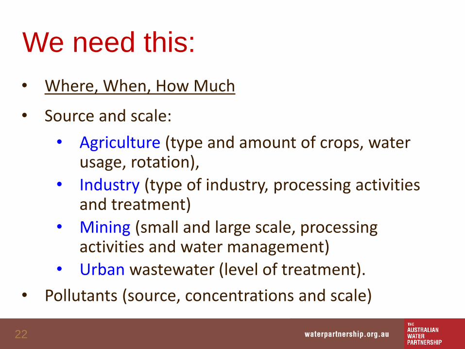
We need this:
• Where, When, How Much
• Source and scale:
• Agriculture (type and amount of crops, water usage, rotation),
• Industry (type of industry, processing activities and treatment)
• Mining (small and large scale, processing activities and water management)
• Urban wastewater (level of treatment).
• Pollutants (source, concentrations and scale)
24
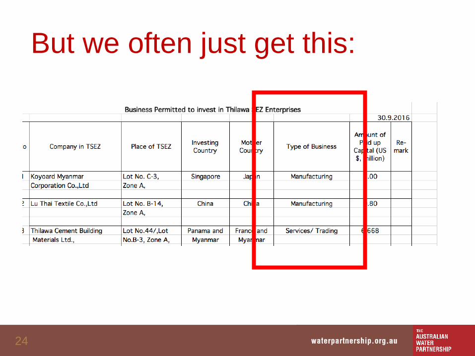
But we often just get this:
25
Aggregation
26
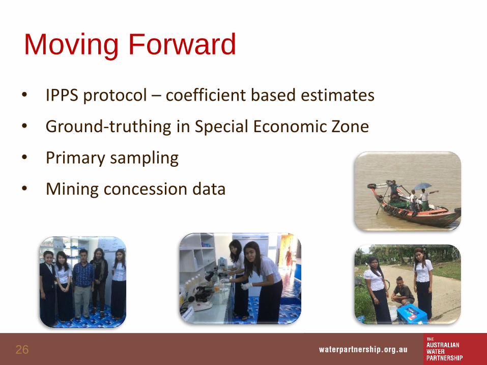
Moving Forward
• IPPS protocol – coefficient based estimates
• Ground-truthing in Special Economic Zone
• Primary sampling
• Mining concession data
27
Thoughts
• Collaboration is critical
• Pick your goals (Environment, Human Health)
• Look for secondary sources
• Network, Network, Network
• Start with values

28