Embed Size (px)
Citation preview
AVIATION WEATHER
CLOUDS
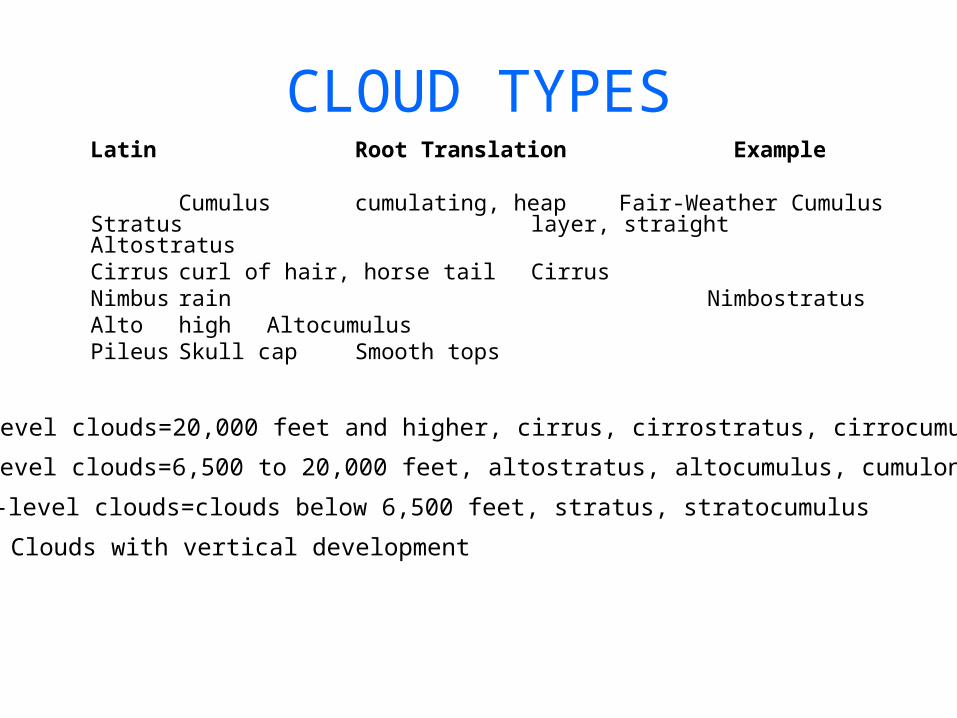
CLOUD TYPESLatin Root Translation Example
Cumulus cumulating, heap Fair-Weather CumulusStratus layer, straight AltostratusCirrus curl of hair, horse tail CirrusNimbus rain NimbostratusAlto high AltocumulusPileus Skull cap Smooth tops
High-level clouds=20,000 feet and higher, cirrus, cirrostratus, cirrocumulus
Mid-level clouds=6,500 to 20,000 feet, altostratus, altocumulus, cumulonimbus
Low-level clouds=clouds below 6,500 feet, stratus, stratocumulus
Clouds with vertical development
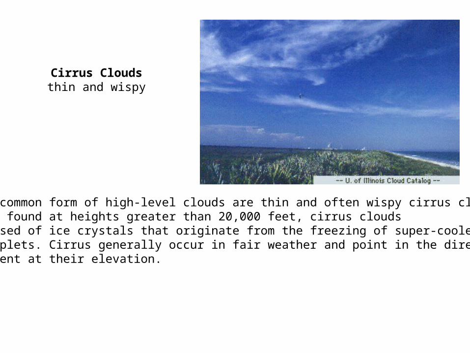
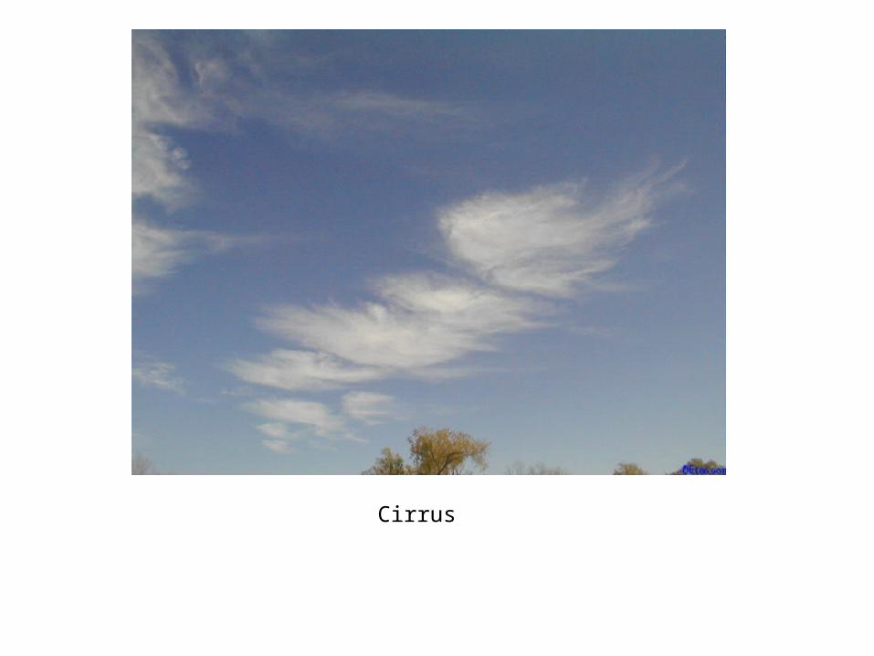
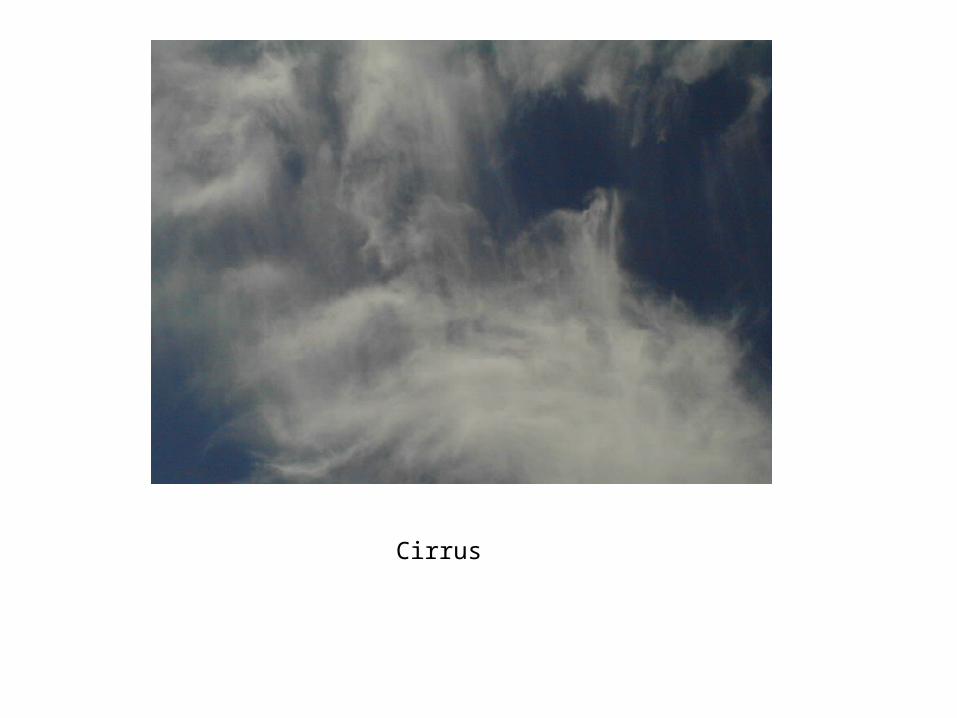
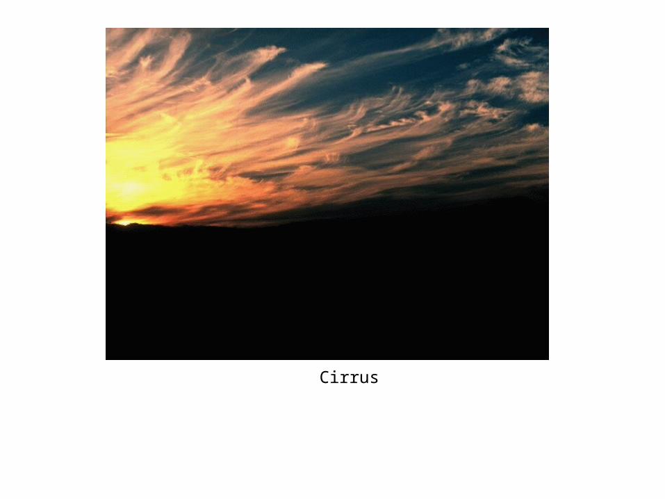
The most common form of high-level clouds are thin and often wispy cirrus clouds. Typically found at heights greater than 20,000 feet, cirrus clouds are composed of ice crystals that originate from the freezing of super-cooled water droplets. Cirrus generally occur in fair weather and point in the direction of air movement at their elevation.
Cirrus Clouds thin and wispy
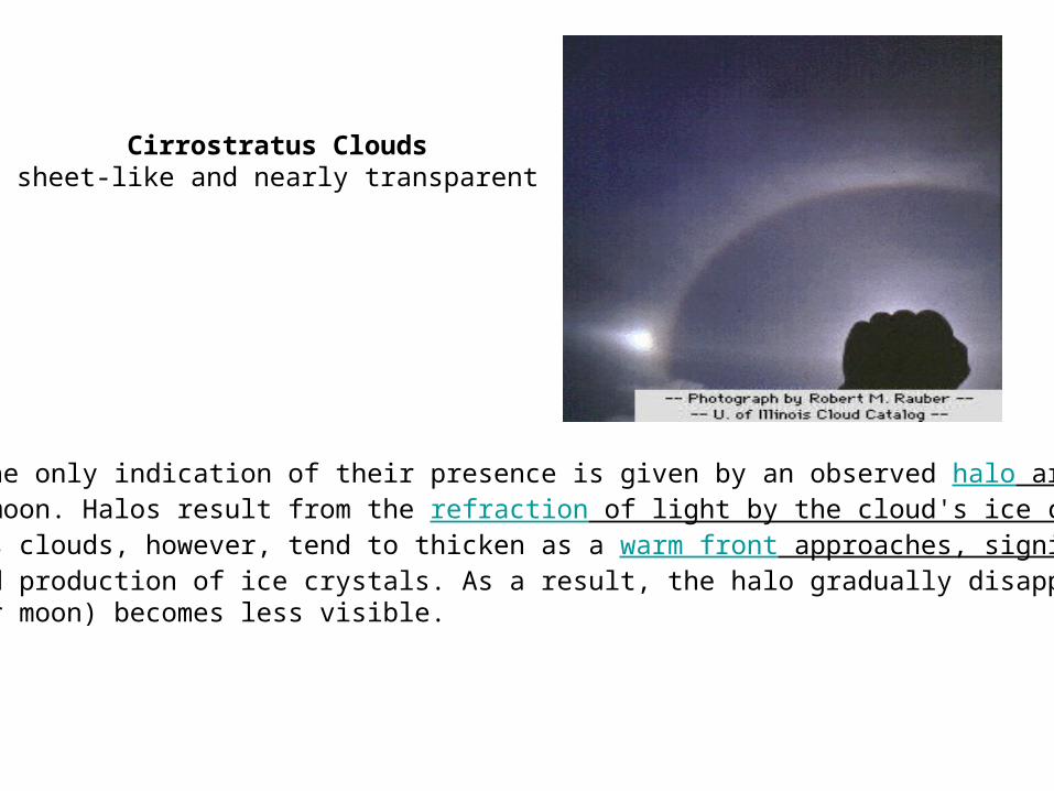
Sometimes the only indication of their presence is given by an observed halo around the sun or moon. Halos result from the refraction of light by the cloud's ice crystals. Cirrostratus clouds, however, tend to thicken as a warm front approaches, signifying an increased production of ice crystals. As a result, the halo gradually disappears and the sun (or moon) becomes less visible.
Cirrostratus Clouds sheet-like and nearly transparent
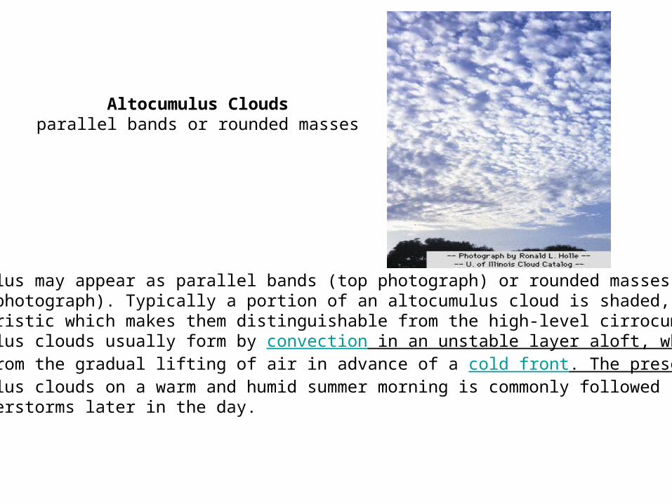
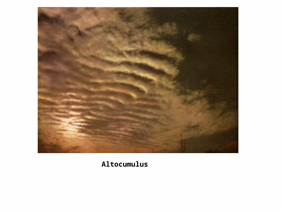
Altocumulus may appear as parallel bands (top photograph) or rounded masses (bottom photograph). Typically a portion of an altocumulus cloud is shaded, acharacteristic which makes them distinguishable from the high-level cirrocumulus. Altocumulus clouds usually form by convection in an unstable layer aloft, which may result from the gradual lifting of air in advance of a cold front. The presence of altocumulus clouds on a warm and humid summer morning is commonly followed by thunderstorms later in the day.
Altocumulus Clouds parallel bands or rounded masses
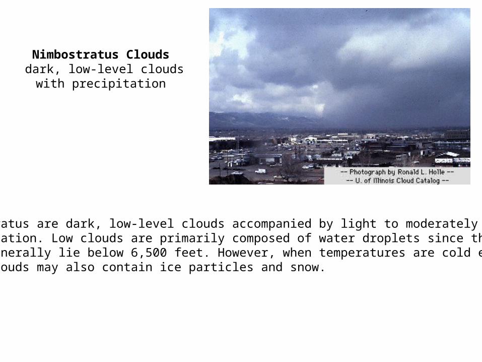
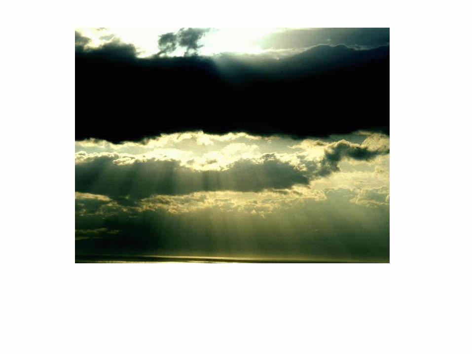
Nimbostratus Clouds dark, low-level clouds with
precipitation
Nimbostratus are dark, low-level clouds accompanied by light to moderately falling precipitation. Low clouds are primarily composed of water droplets since their bases generally lie below 6,500 feet. However, when temperatures are cold enough, these clouds may also contain ice particles and snow.
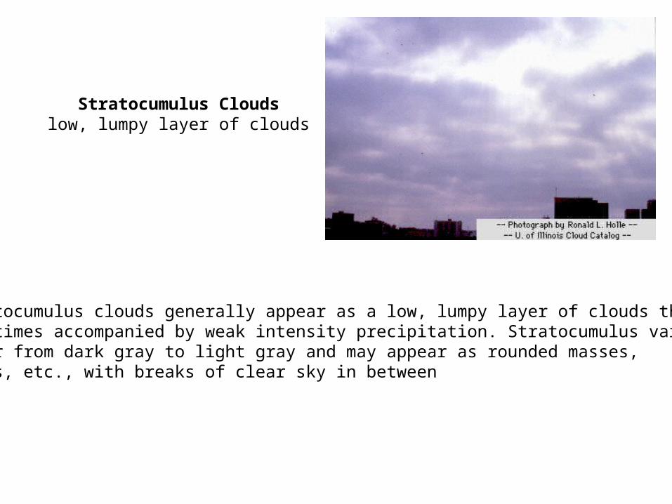
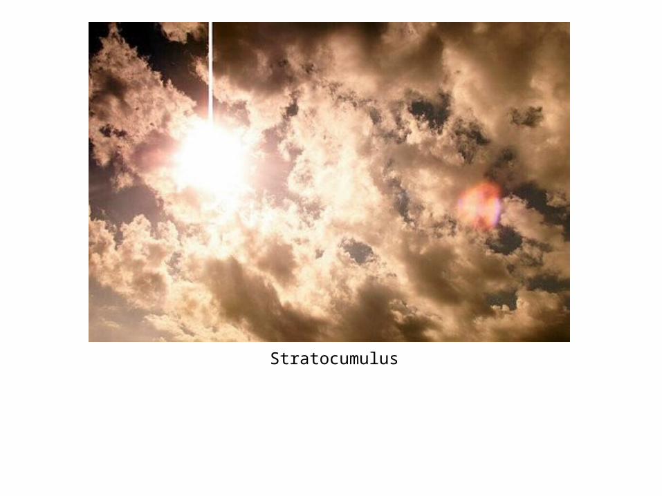
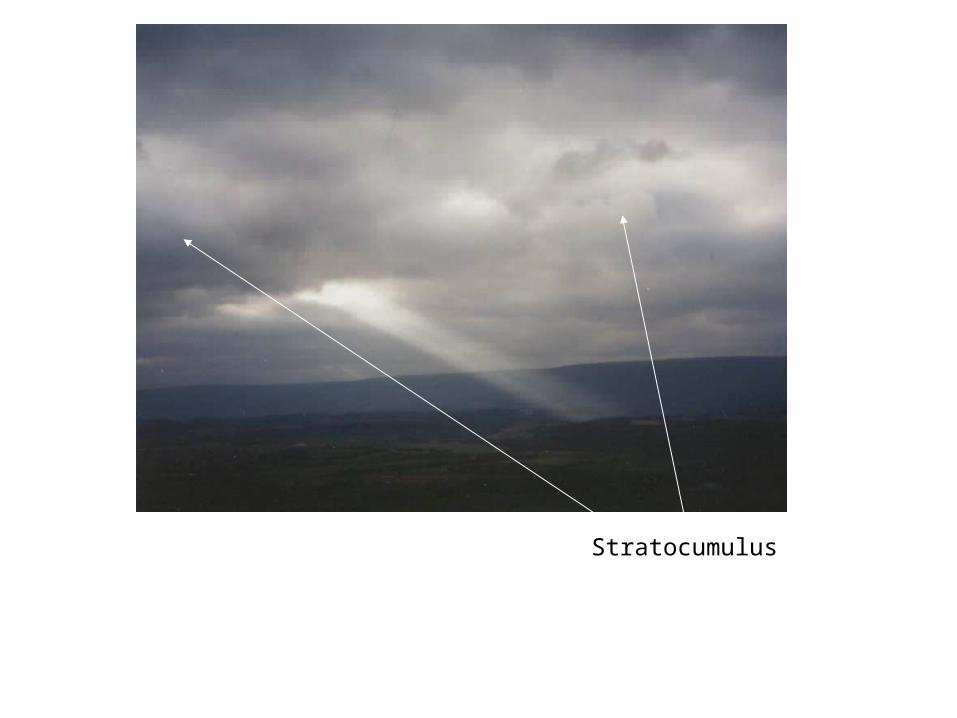
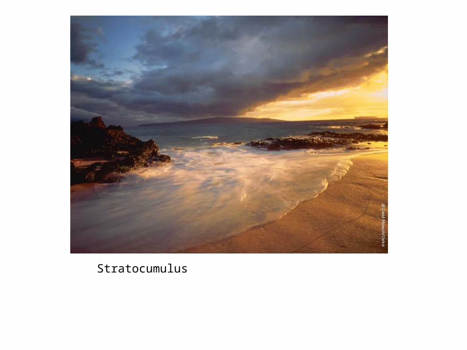
Stratocumulus clouds generally appear as a low, lumpy layer of clouds that is sometimes accompanied by weak intensity precipitation. Stratocumulus vary in color from dark gray to light gray and may appear as rounded masses, rolls, etc., with breaks of clear sky in between
Stratocumulus Clouds low, lumpy layer of clouds
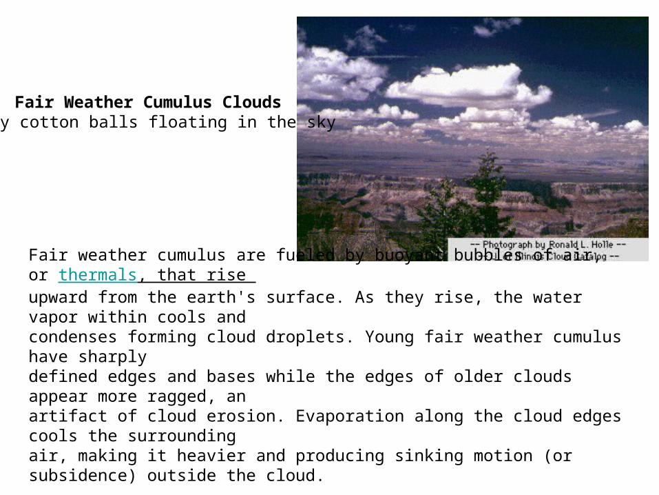
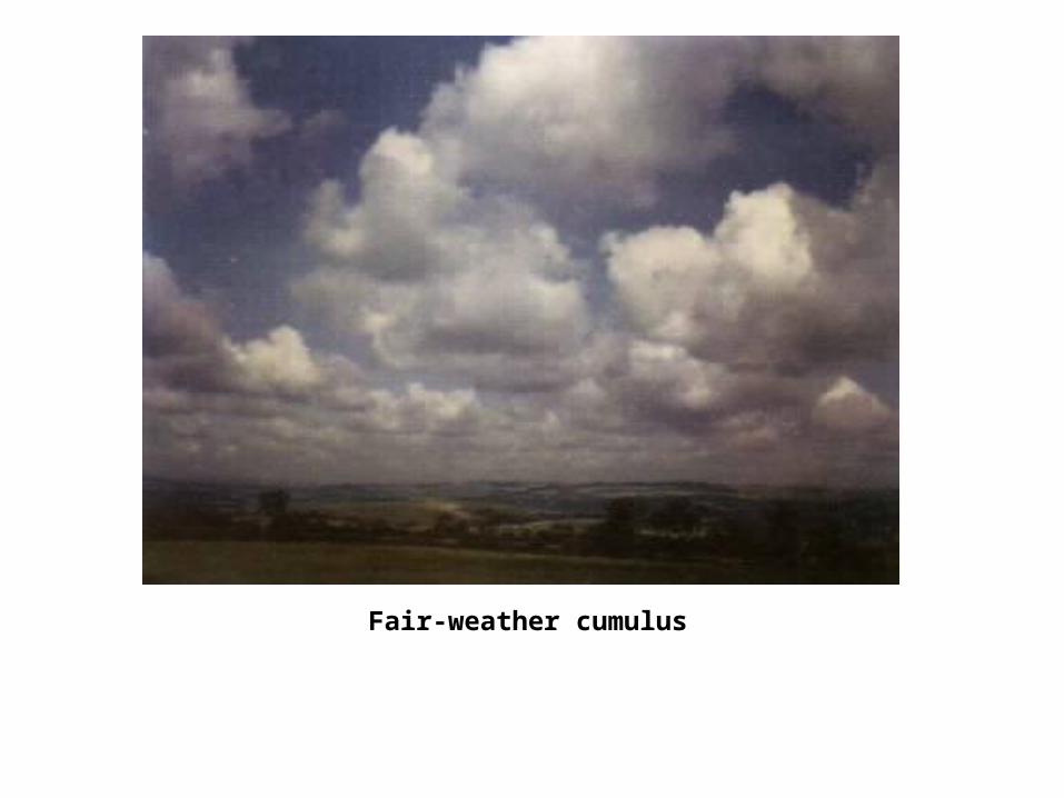
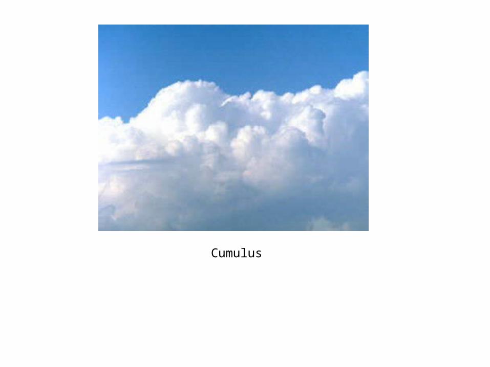
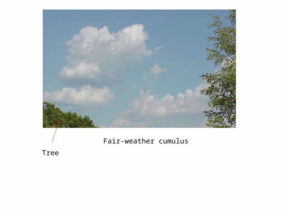
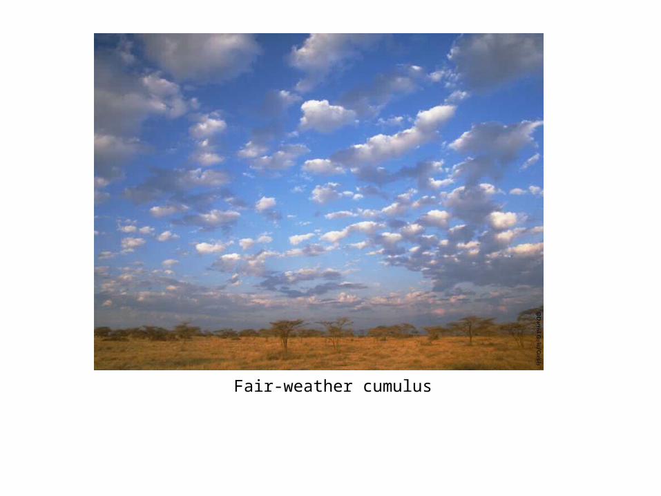
Fair weather cumulus are fueled by buoyant bubbles of air, or thermals, that rise upward from the earth's surface. As they rise, the water vapor within cools and condenses forming cloud droplets. Young fair weather cumulus have sharply defined edges and bases while the edges of older clouds appear more ragged, an artifact of cloud erosion. Evaporation along the cloud edges cools the surrounding air, making it heavier and producing sinking motion (or subsidence) outside the cloud.
Fair Weather Cumulus Clouds puffy cotton balls floating in the sky
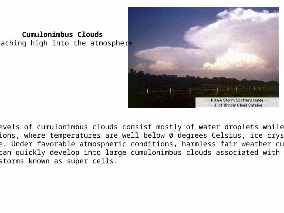
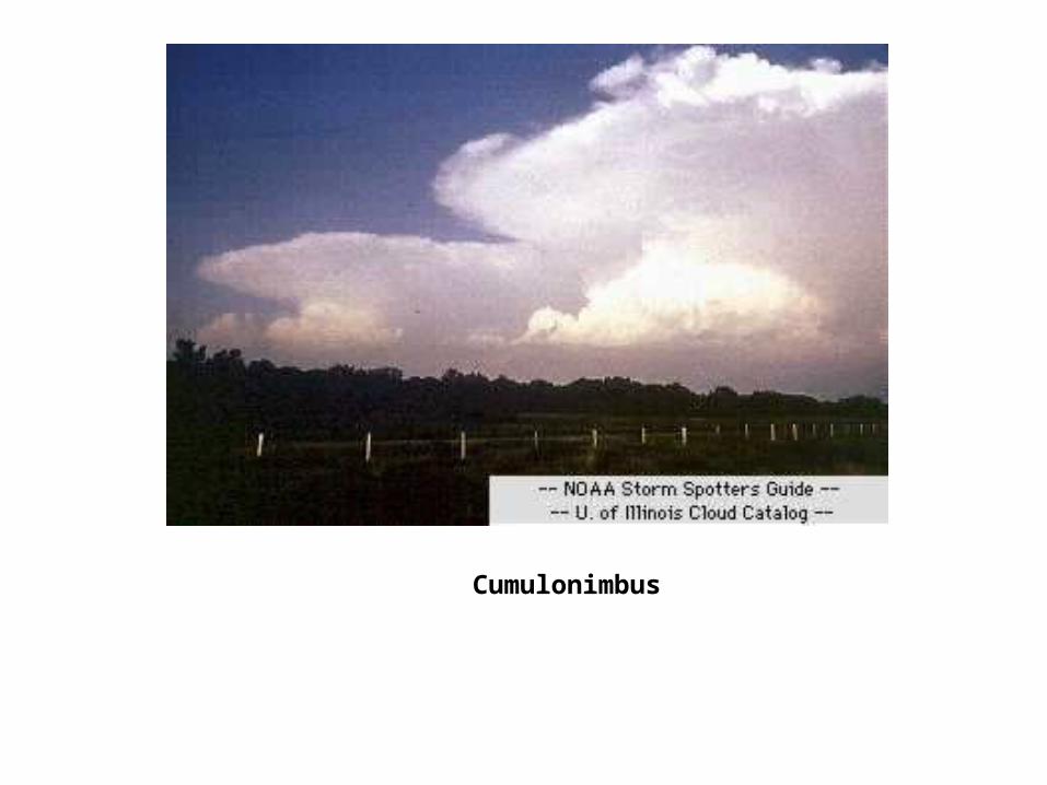
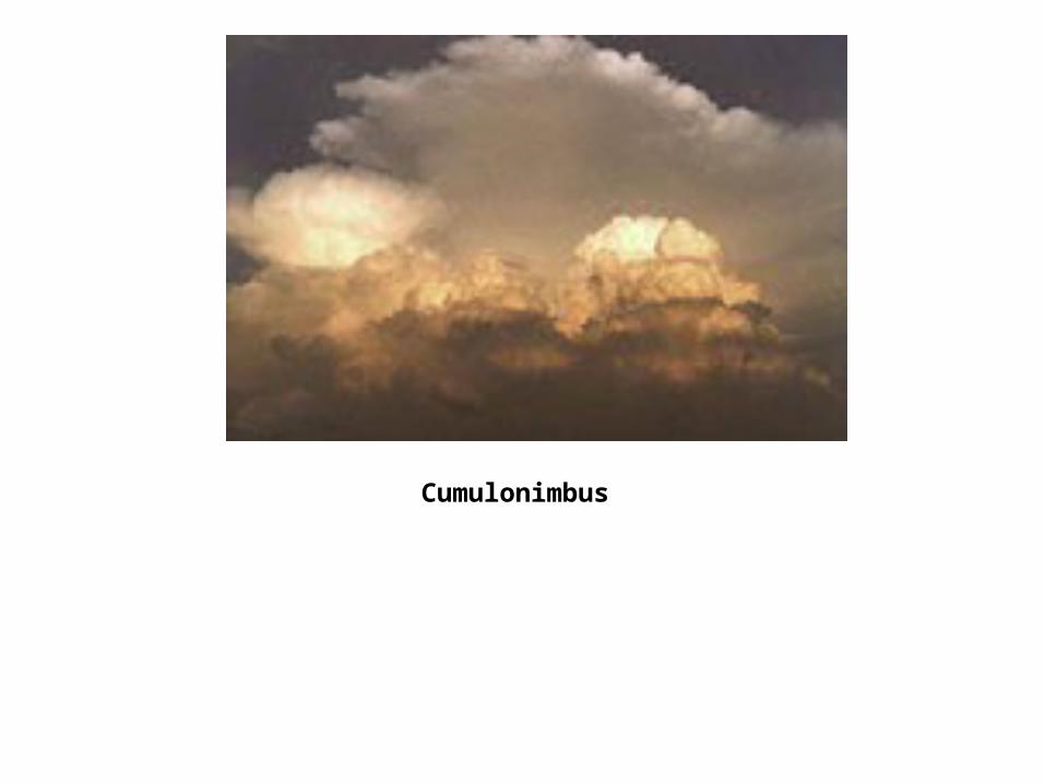
Lower levels of cumulonimbus clouds consist mostly of water droplets while at higher elevations, where temperatures are well below 0 degrees Celsius, ice crystals dominate. Under favorable atmospheric conditions, harmless fair weather cumulus clouds can quickly develop into large cumulonimbus clouds associated with powerful thunderstorms known as super cells.
Cumulonimbus Clouds reaching high into the atmosphere
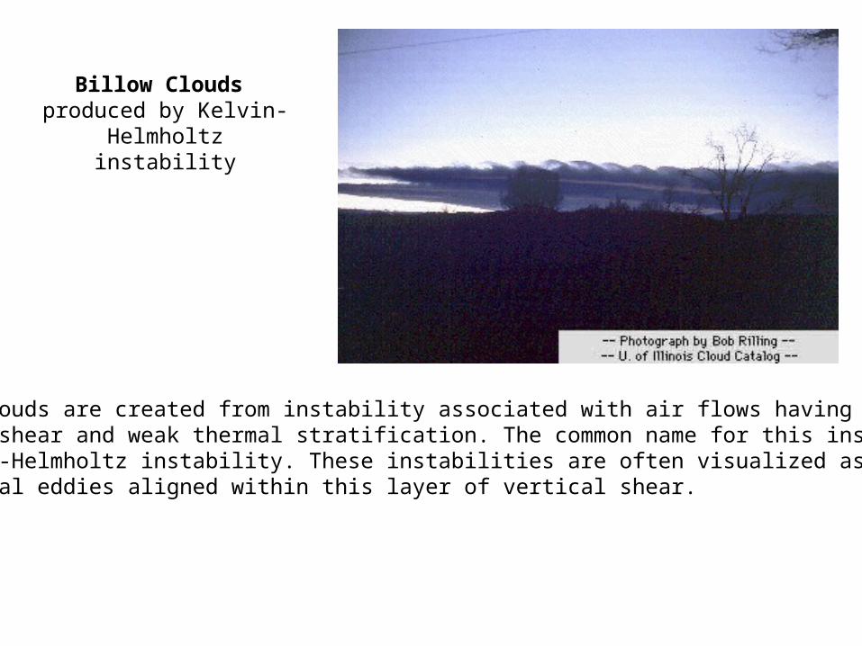
Billow clouds are created from instability associated with air flows having marked vertical shear and weak thermal stratification. The common name for this instabilityis Kelvin-Helmholtz instability. These instabilities are often visualized as a row of horizontal eddies aligned within this layer of vertical shear.
Billow Clouds produced by Kelvin-Helmholtz instability
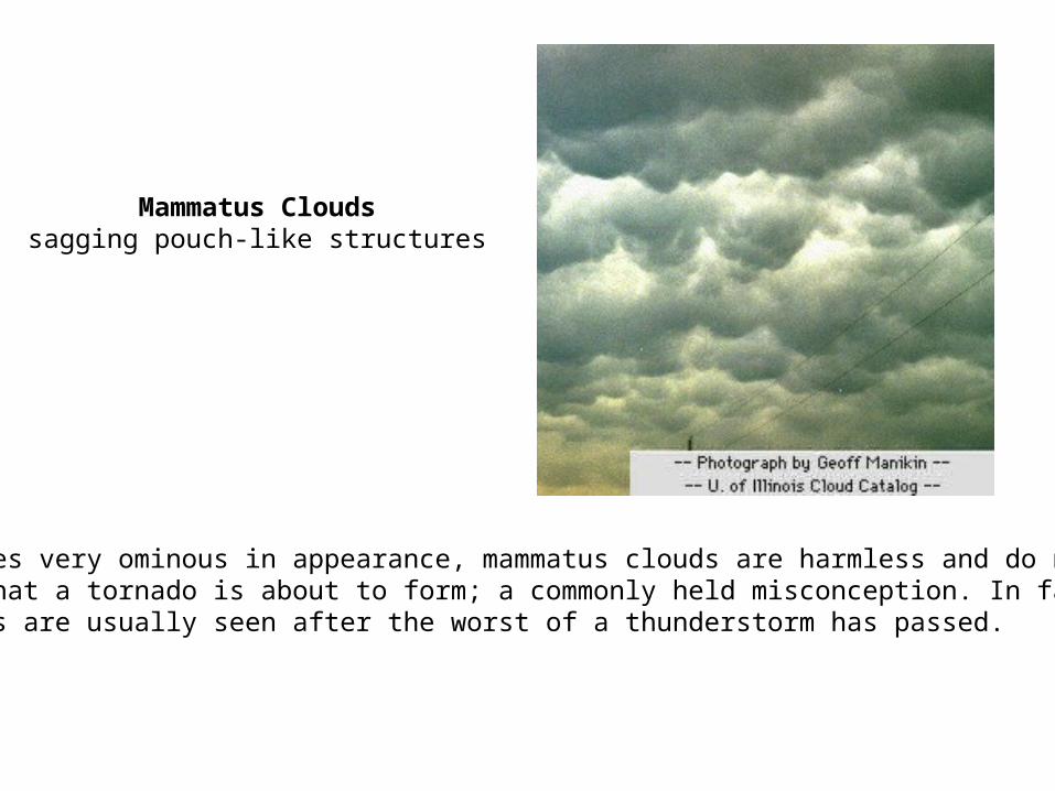
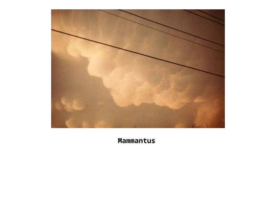
Mammatus Clouds sagging pouch-like structures
Sometimes very ominous in appearance, mammatus clouds are harmless and do not mean that a tornado is about to form; a commonly held misconception. In fact, mammatus are usually seen after the worst of a thunderstorm has passed.
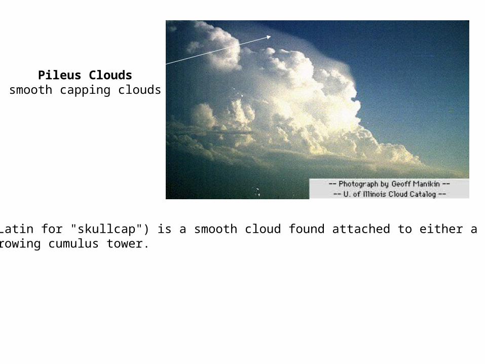
Pileus Clouds smooth capping clouds
Pileus (Latin for "skullcap") is a smooth cloud found attached to either a mountain top or growing cumulus tower.
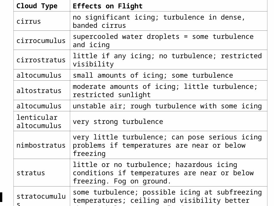
Cloud Type Effects on Flight
cirrus no significant icing; turbulence in dense, banded cirrus
cirrocumulus supercooled water droplets = some turbulence and icing
cirrostratus little if any icing; no turbulence; restricted visibility
altocumulus small amounts of icing; some turbulence
altostratus moderate amounts of icing; little turbulence; restricted sunlight
altocumulus unstable air; rough turbulence with some icing
lenticular altocumulus
very strong turbulence
nimbostratusvery little turbulence; can pose serious icing problems if temperatures are near or below freezing
stratuslittle or no turbulence; hazardous icing conditions if temperatures are near or below freezing. Fog on ground.
stratocumulussome turbulence; possible icing at subfreezing temperatures; ceiling and visibility better than with low stratus clouds
cumulus sunstable air will give some turbulence, but no significant icing
towering cumulus
strong turbulence,rain showers; clear icing above freezing level
cumulonimbus unstable air; violent turbulence; strong possibility for icing

CLOUD IDENTIFICATION TEST
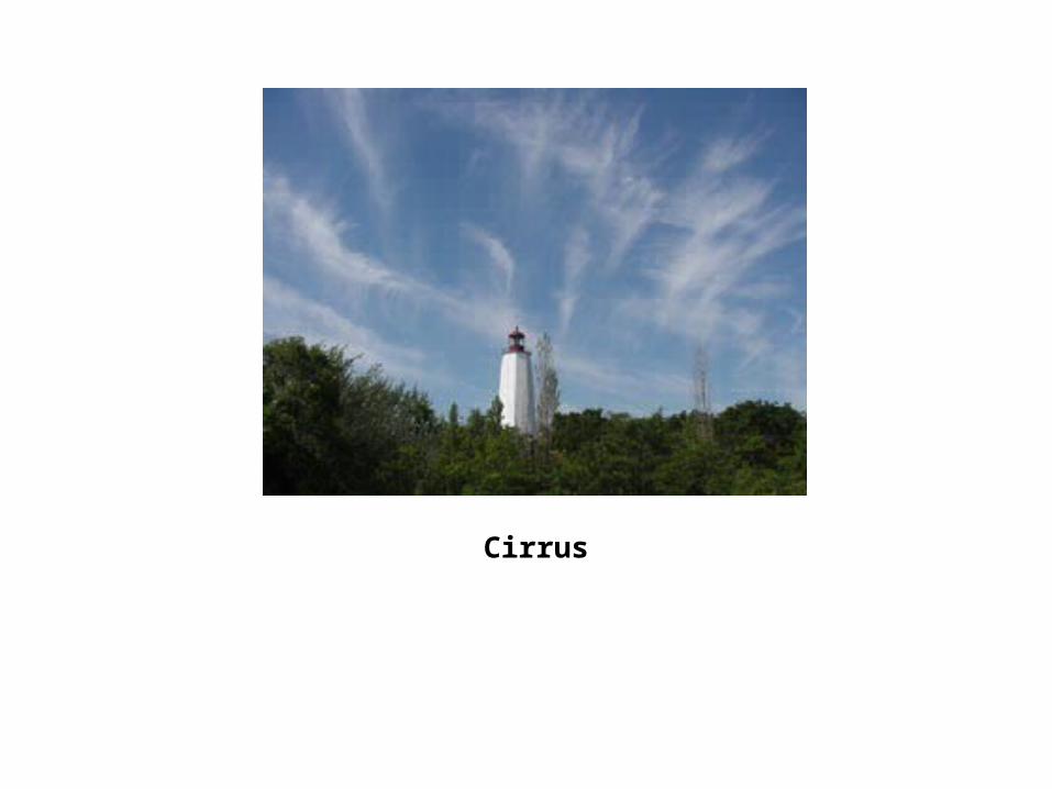
Cirrus
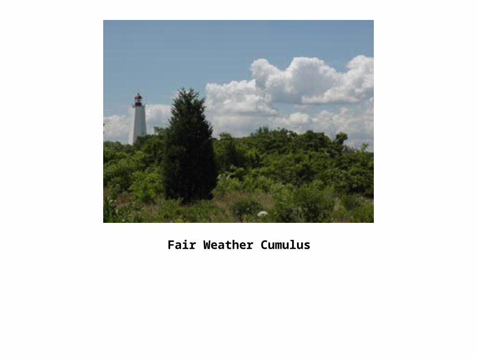
Fair Weather Cumulus
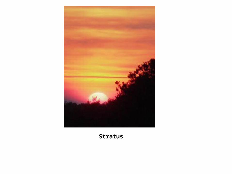
Stratus
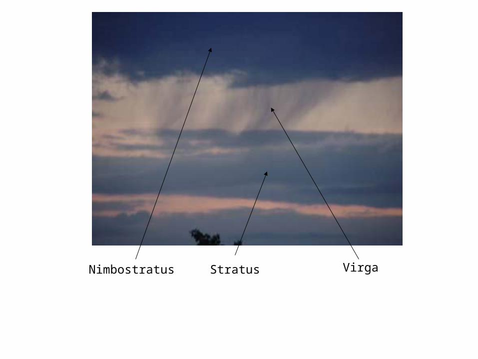
Nimbostratus Stratus Virga
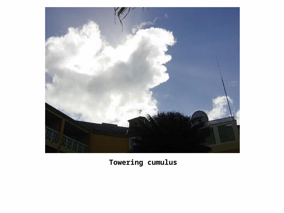
Towering cumulus
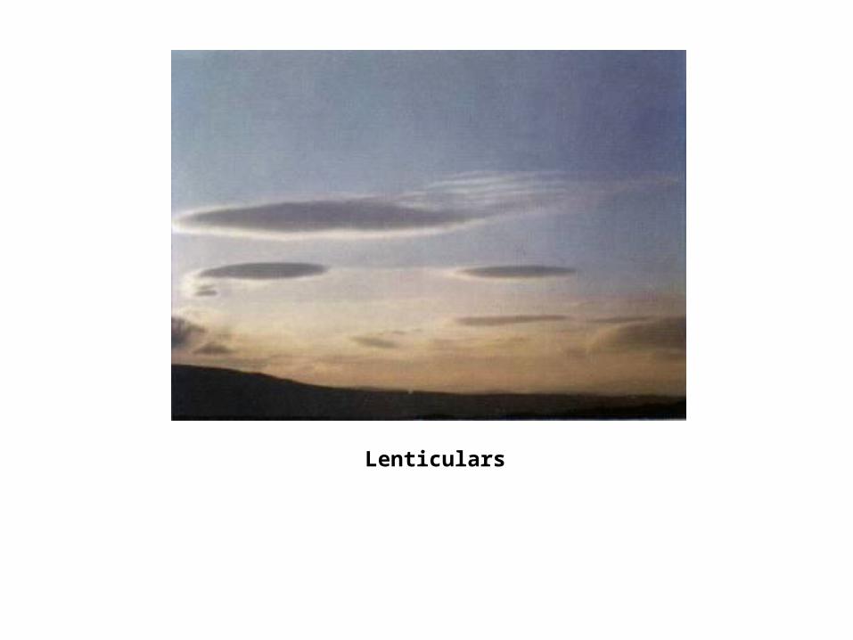
Lenticulars
Fair-weather cumulus
Altocumulus
Cumulonimbus
Stratocumulus
Cumulonimbus

Mammantus
Mammantus
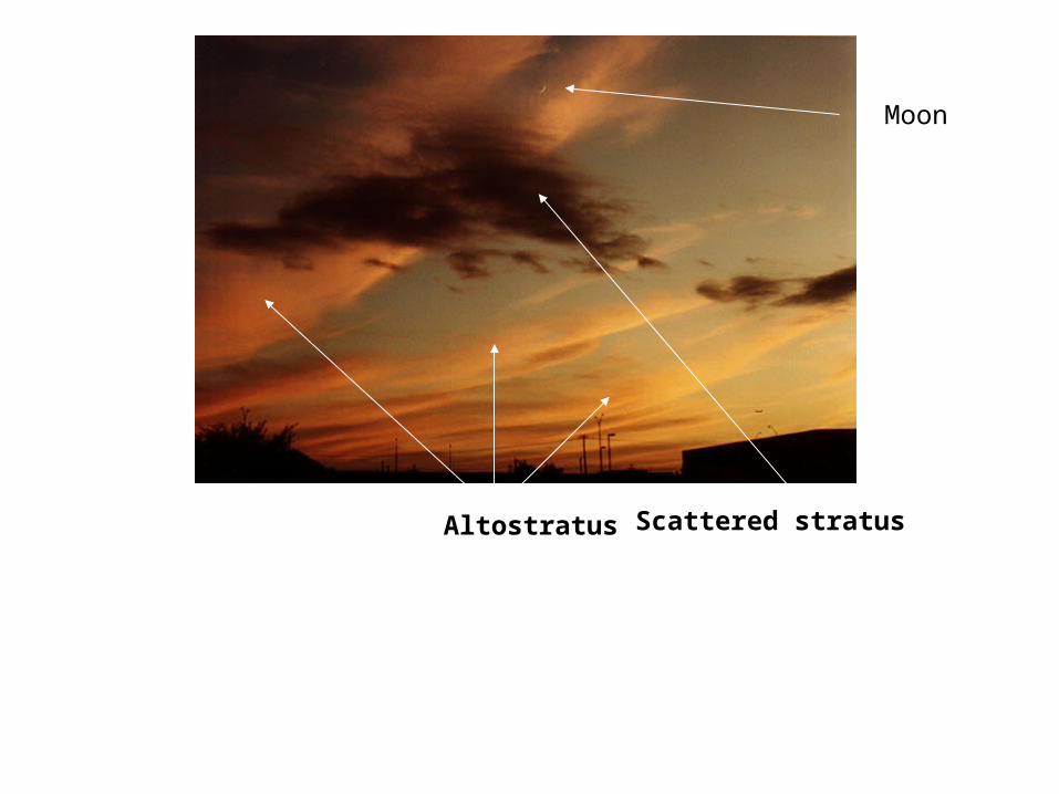
Altostratus Scattered stratus
Moon
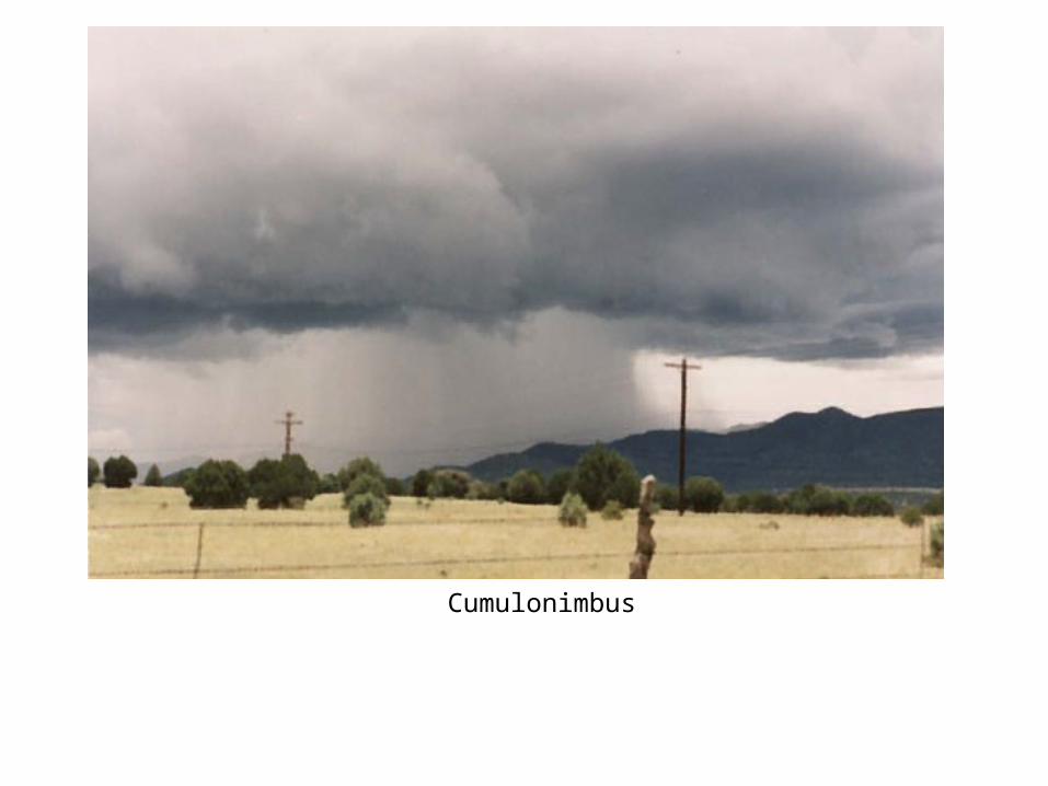
Cumulonimbus
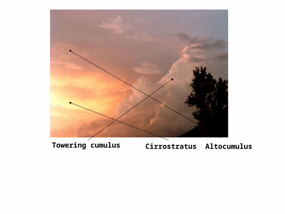
Towering cumulus Cirrostratus Altocumulus
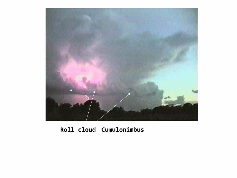
CumulonimbusRoll cloud
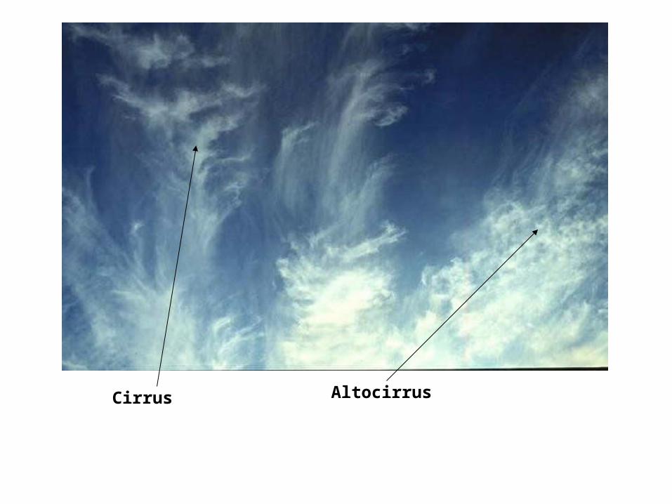
Cirrus Altocirrus
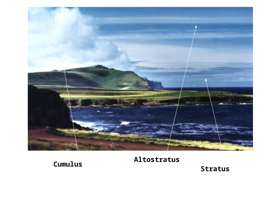
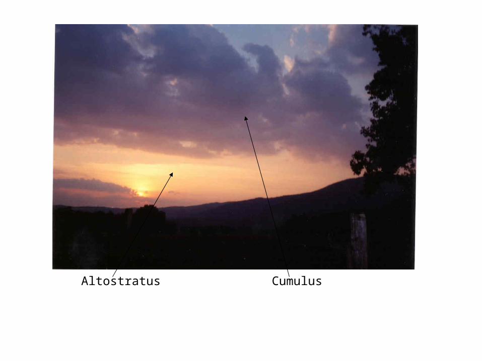
CumulusAltostratus
Stratus
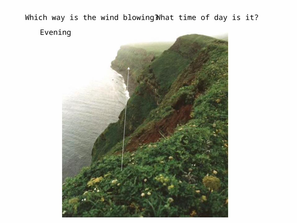
Which way is the wind blowing? What time of day is it?
Evening
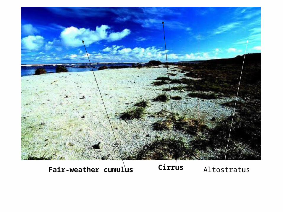
Fair-weather cumulus Cirrus Altostratus
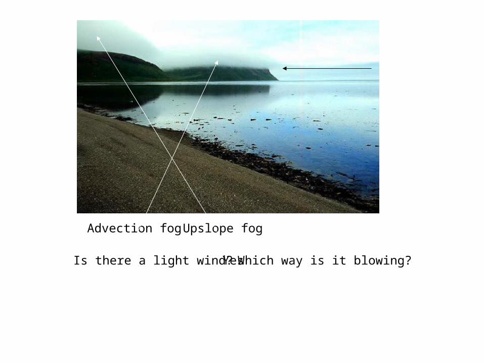
Is there a light wind? Yes Which way is it blowing?
Advection fog Upslope fog
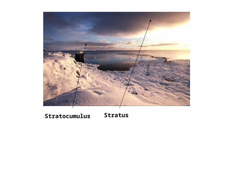
StratusStratocumulus
Cumulus

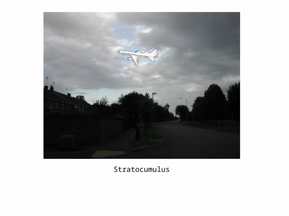
Stratocumulus
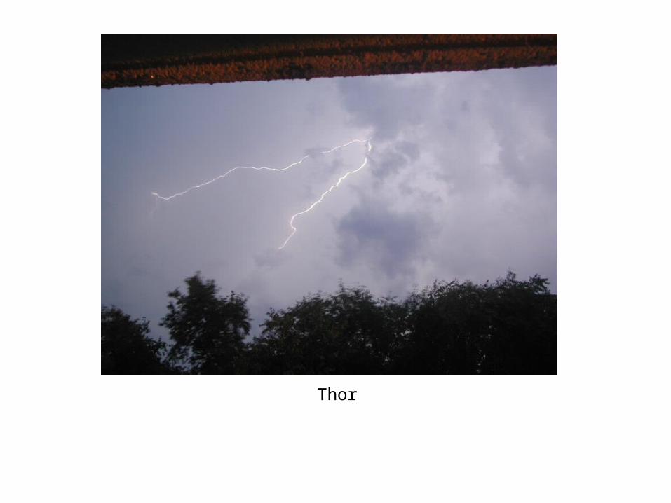
Thor
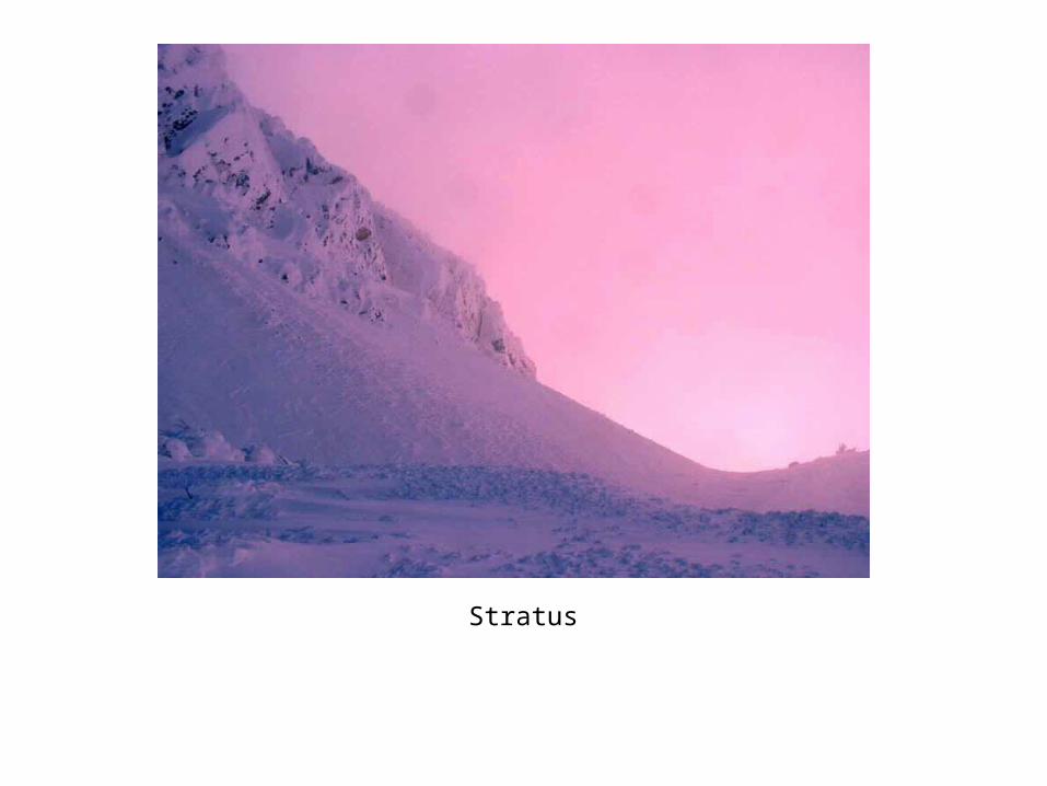
Stratus
Fair-weather cumulus
Tree
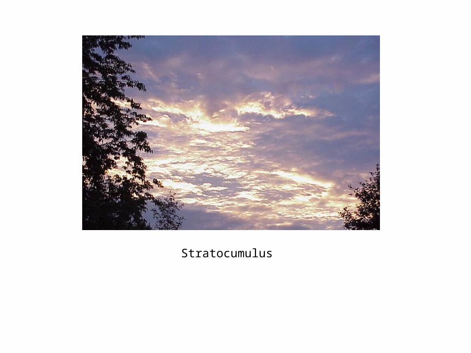
Stratocumulus
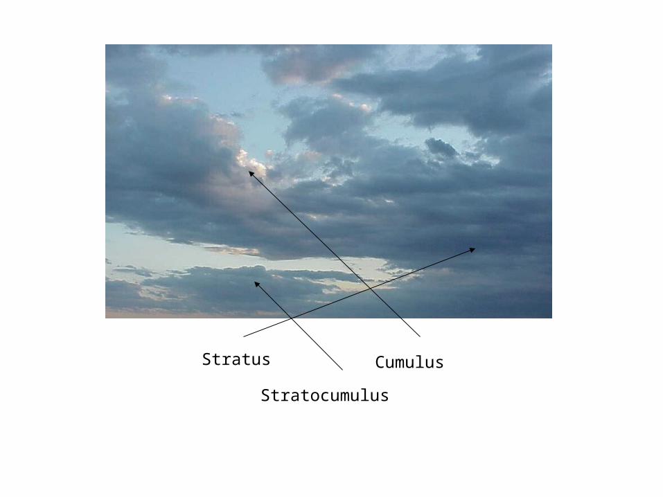
Stratus Cumulus
Stratocumulus
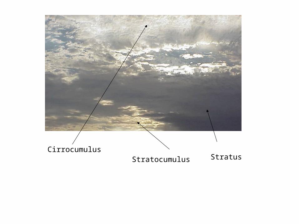
CirrocumulusStratocumulus Stratus
Stratocumulus
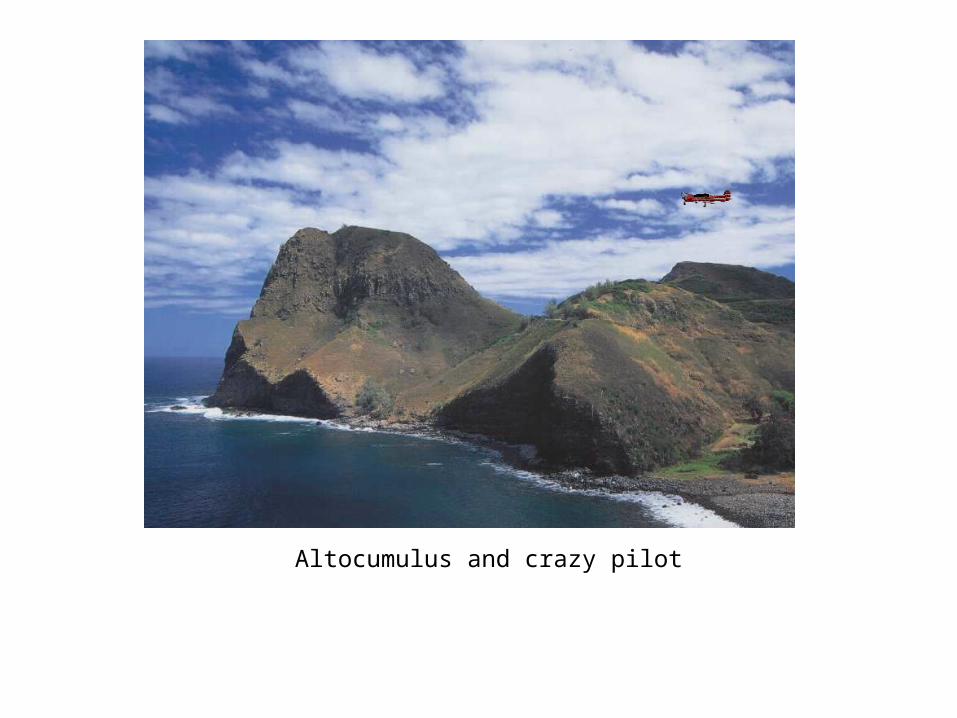
Altocumulus and crazy pilot
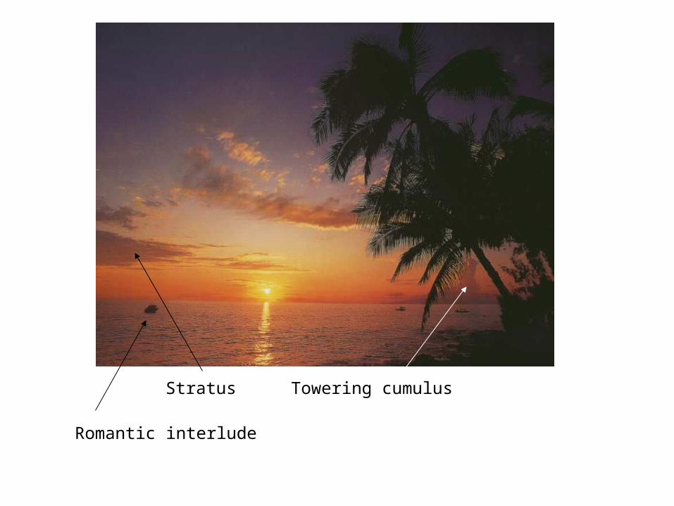
Stratus Towering cumulus
Romantic interlude
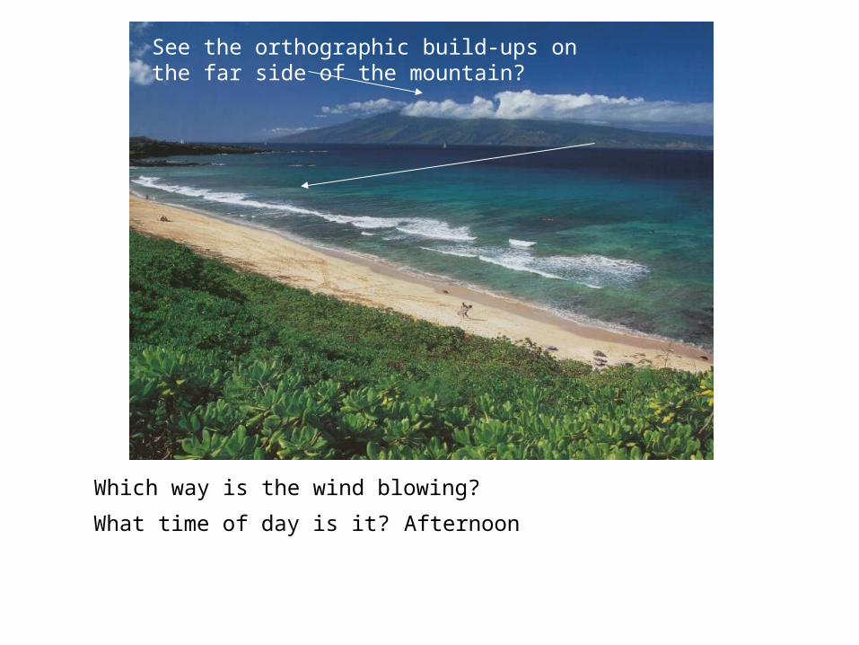
Which way is the wind blowing?
What time of day is it? Afternoon
See the orthographic build-ups on the far side of the mountain?
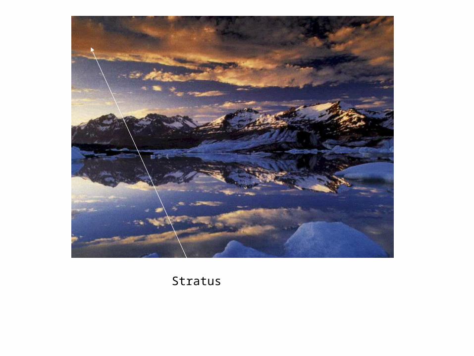
Stratus
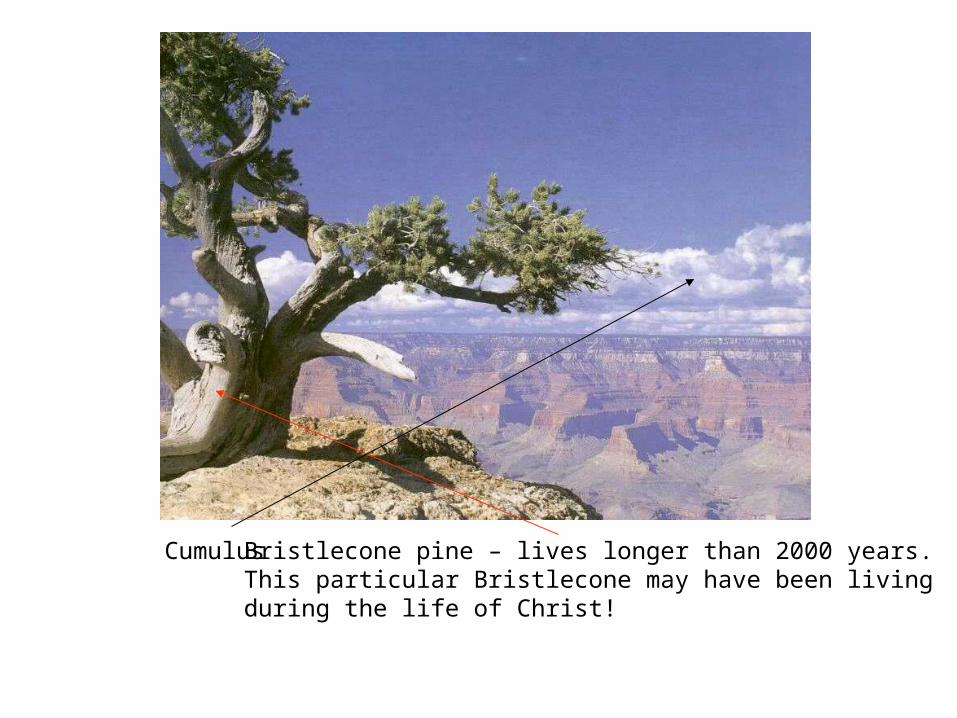
Cumulus Bristlecone pine – lives longer than 2000 years.This particular Bristlecone may have been livingduring the life of Christ!
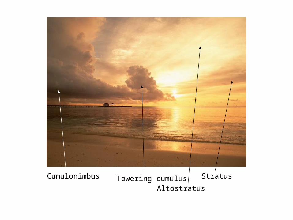
StratusCumulonimbus Towering cumulusAltostratus
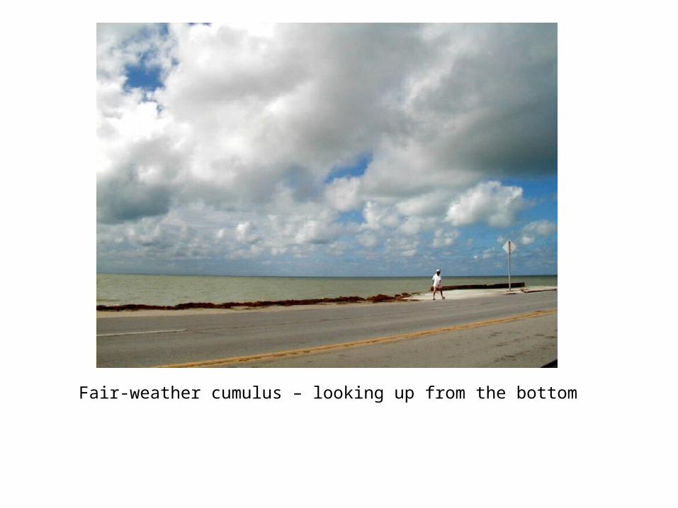
Fair-weather cumulus – looking up from the bottom
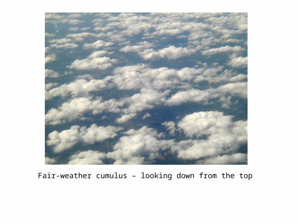
Fair-weather cumulus – looking down from the top
Cumulus
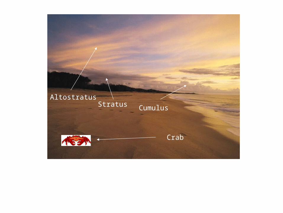
AltostratusStratus
Crab
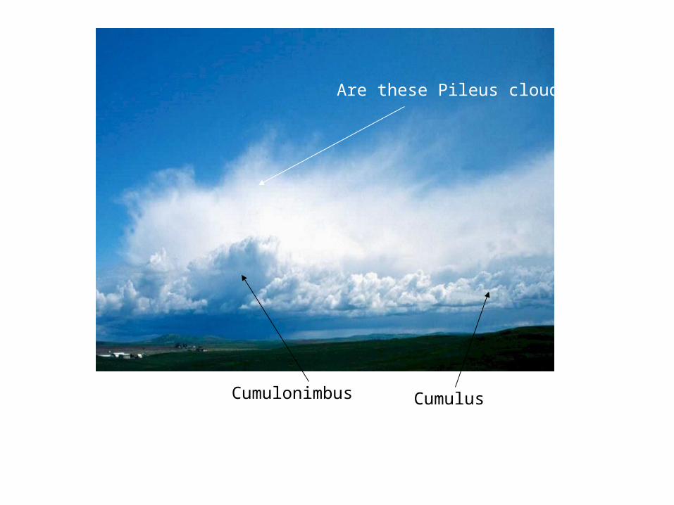
Cumulonimbus Cumulus
Are these Pileus clouds?
Cirrus
Cirrus
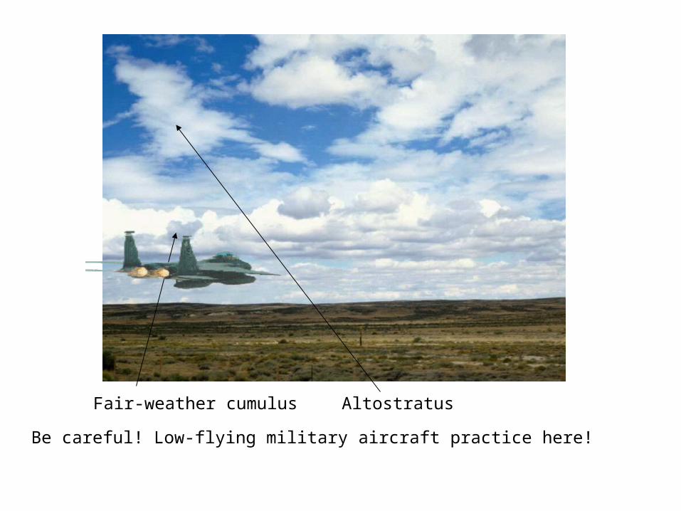
Fair-weather cumulus Altostratus
Be careful! Low-flying military aircraft practice here!
Fair-weather cumulus
Stratocumulus
CumulusAltostratus
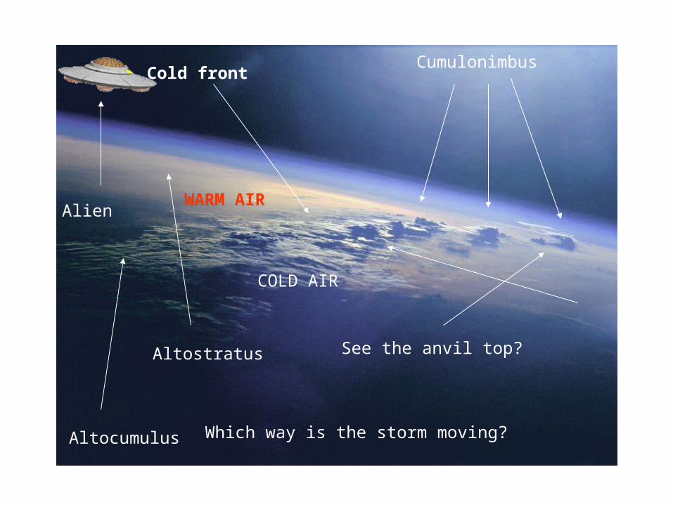
Cold frontCumulonimbus
Altocumulus Which way is the storm moving?
See the anvil top?Altostratus
Alien
COLD AIR
WARM AIR
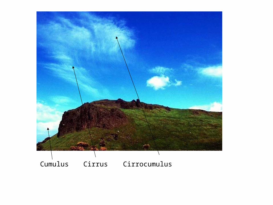
Cumulus Cirrus Cirrocumulus
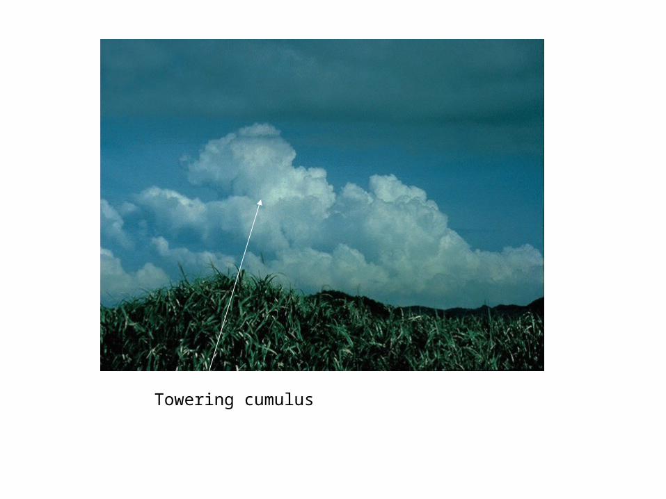
Towering cumulus
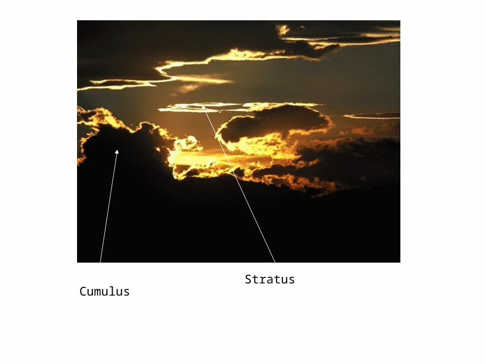
CumulusStratus
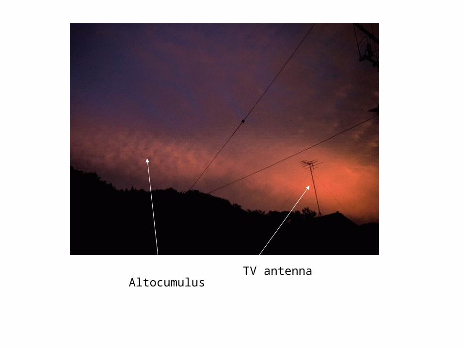
AltocumulusTV antenna
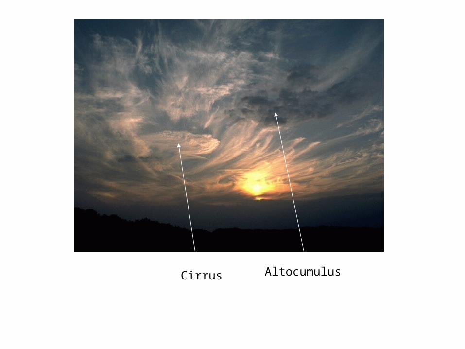
Cirrus Altocumulus
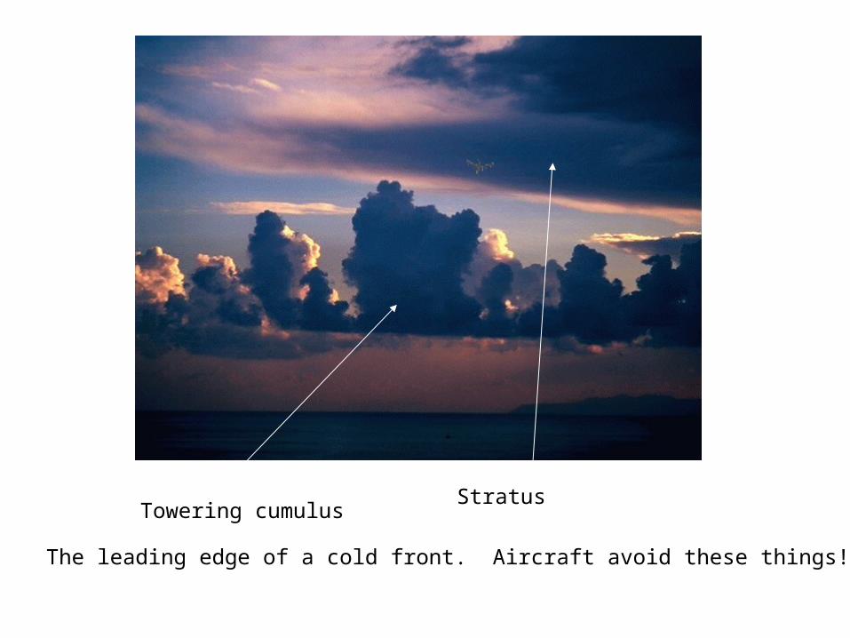
Towering cumulusStratus
The leading edge of a cold front. Aircraft avoid these things!
Cirrus
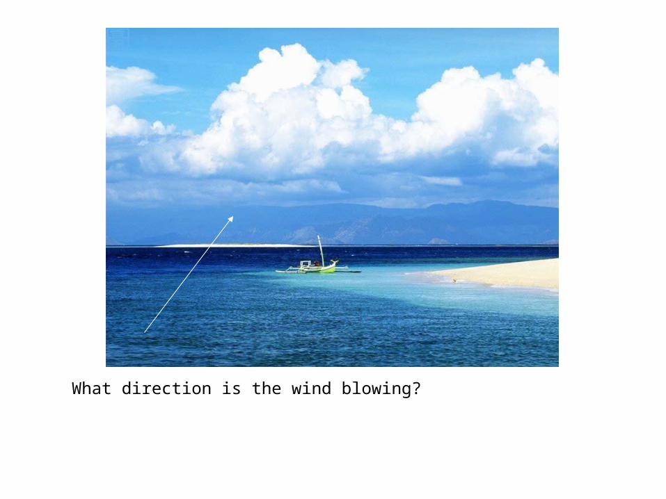
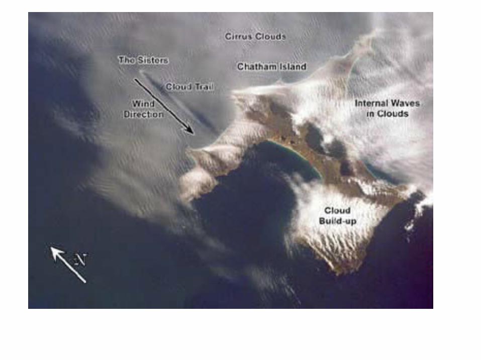
What direction is the wind blowing?