Embed Size (px)
Citation preview
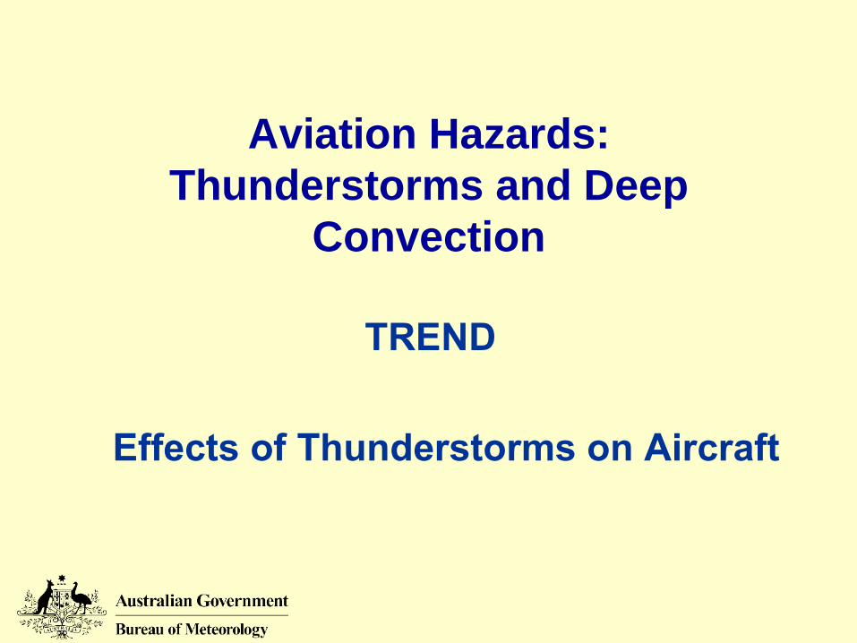
Aviation Hazards:Thunderstorms and Deep
Convection
TREND
Effects of Thunderstorms on Aircraft
© Copyright Commonwealth of Australia 2006, Bureau of Meteorology
2
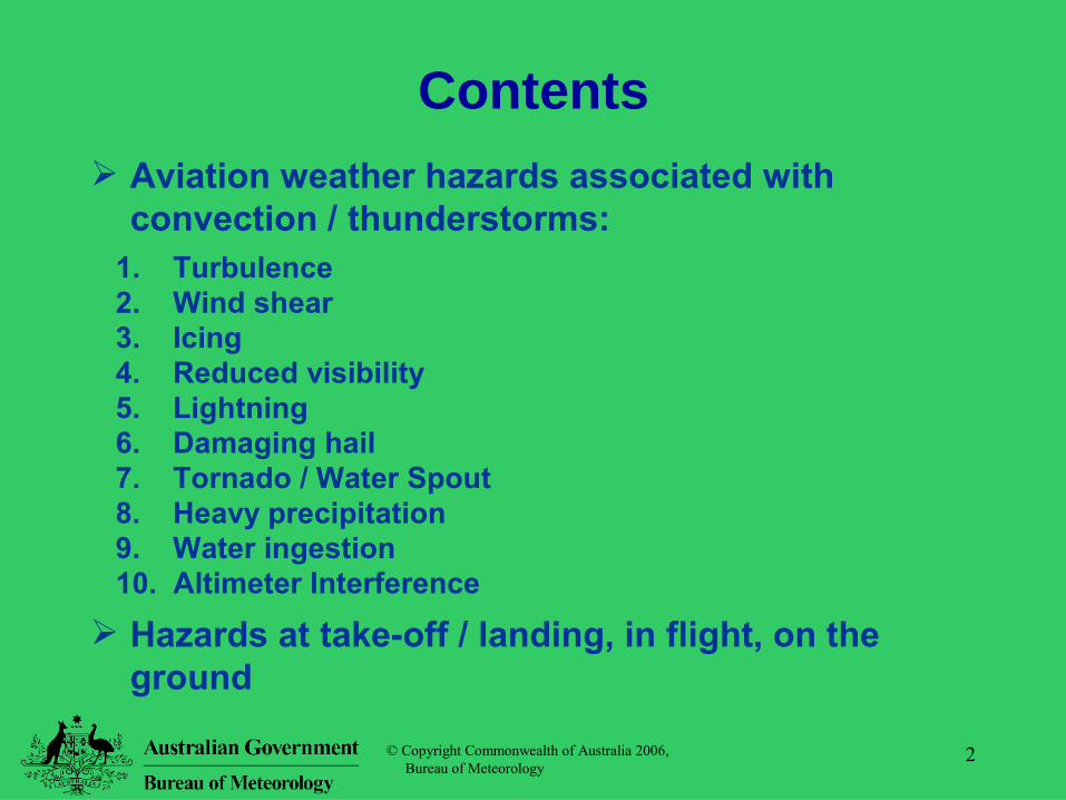
Contents Aviation weather hazards associated with
convection / thunderstorms:1. Turbulence2. Wind shear3. Icing4. Reduced visibility5. Lightning6. Damaging hail7. Tornado / Water Spout8. Heavy precipitation9. Water ingestion10. Altimeter Interference
Hazards at take-off / landing, in flight, on the ground
© Copyright Commonwealth of Australia 2006, Bureau of Meteorology
3
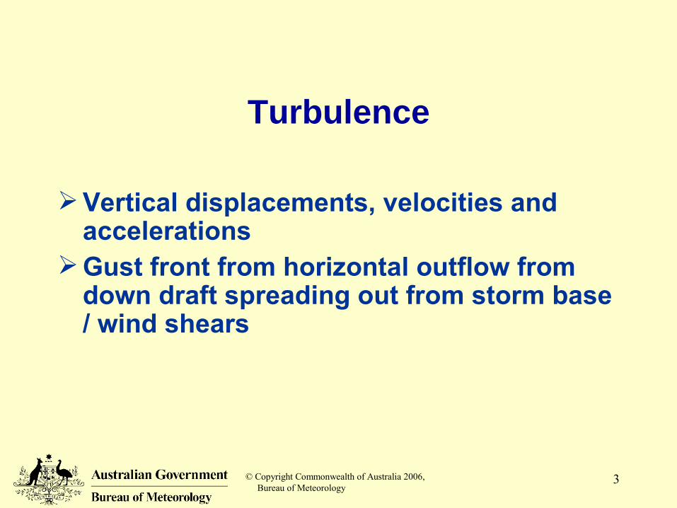
Turbulence
Vertical displacements, velocities and accelerations
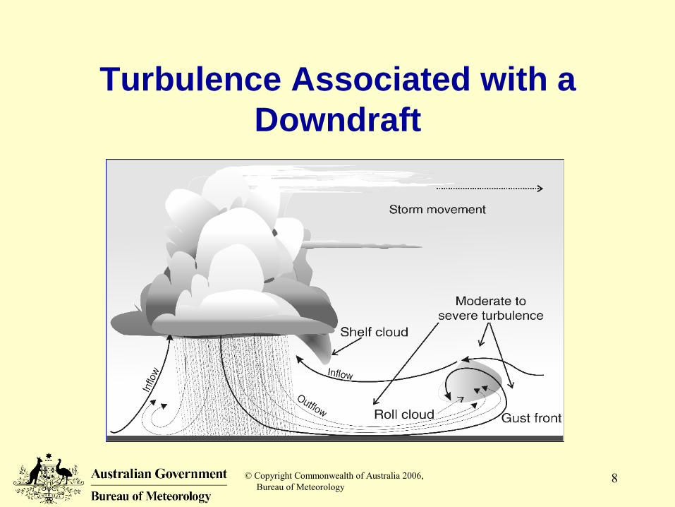
Gust front from horizontal outflow from down draft spreading out from storm base / wind shears
© Copyright Commonwealth of Australia 2006, Bureau of Meteorology
4
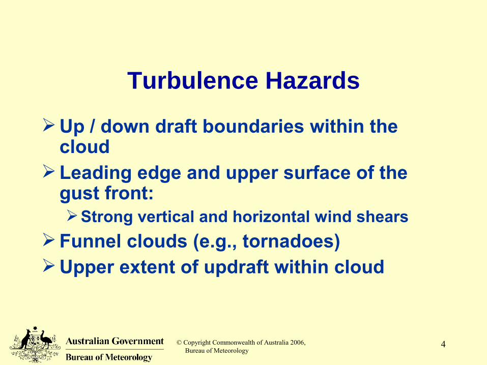
Turbulence Hazards
Up / down draft boundaries within the cloud
Leading edge and upper surface of the gust front:Strong vertical and horizontal wind shears
Funnel clouds (e.g., tornadoes)Upper extent of updraft within cloud
© Copyright Commonwealth of Australia 2006, Bureau of Meteorology
5
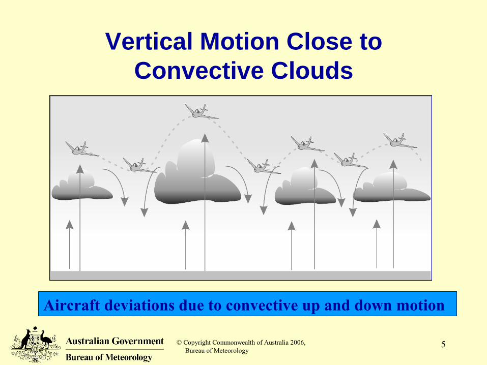
Vertical Motion Close to Convective Clouds
Aircraft deviations due to convective up and down motion

© Copyright Commonwealth of Australia 2006, Bureau of Meteorology
6
Cruising Above Cumulonimbus Tops
© Copyright Commonwealth of Australia 2006, Bureau of Meteorology
7
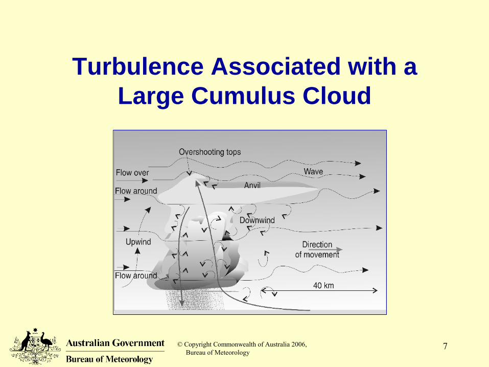
Turbulence Associated with a Large Cumulus Cloud
© Copyright Commonwealth of Australia 2006, Bureau of Meteorology
8
Turbulence Associated with a Downdraft
© Copyright Commonwealth of Australia 2006, Bureau of Meteorology
9
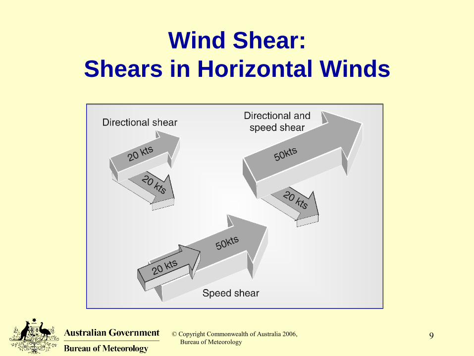
Wind Shear:Shears in Horizontal Winds
© Copyright Commonwealth of Australia 2006, Bureau of Meteorology
10
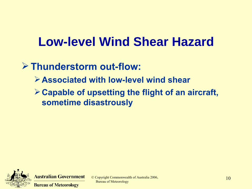
Low-level Wind Shear Hazard
Thunderstorm out-flow:Associated with low-level wind shearCapable of upsetting the flight of an aircraft,
sometime disastrously
© Copyright Commonwealth of Australia 2006, Bureau of Meteorology
11
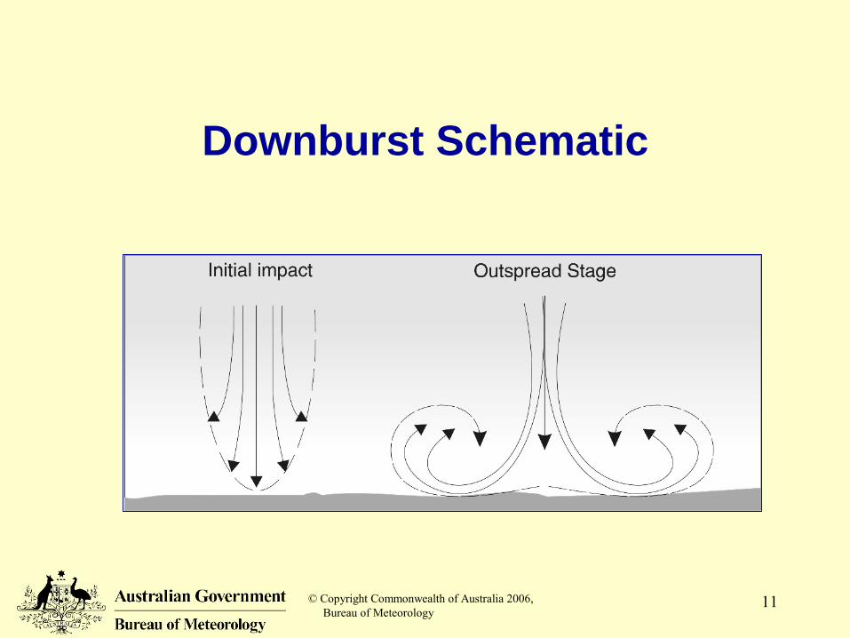
Downburst Schematic
© Copyright Commonwealth of Australia 2006, Bureau of Meteorology
12
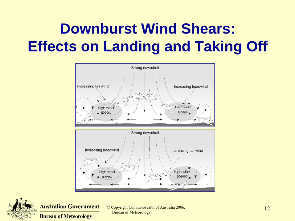
Downburst Wind Shears:Effects on Landing and Taking Off
© Copyright Commonwealth of Australia 2006, Bureau of Meteorology
13
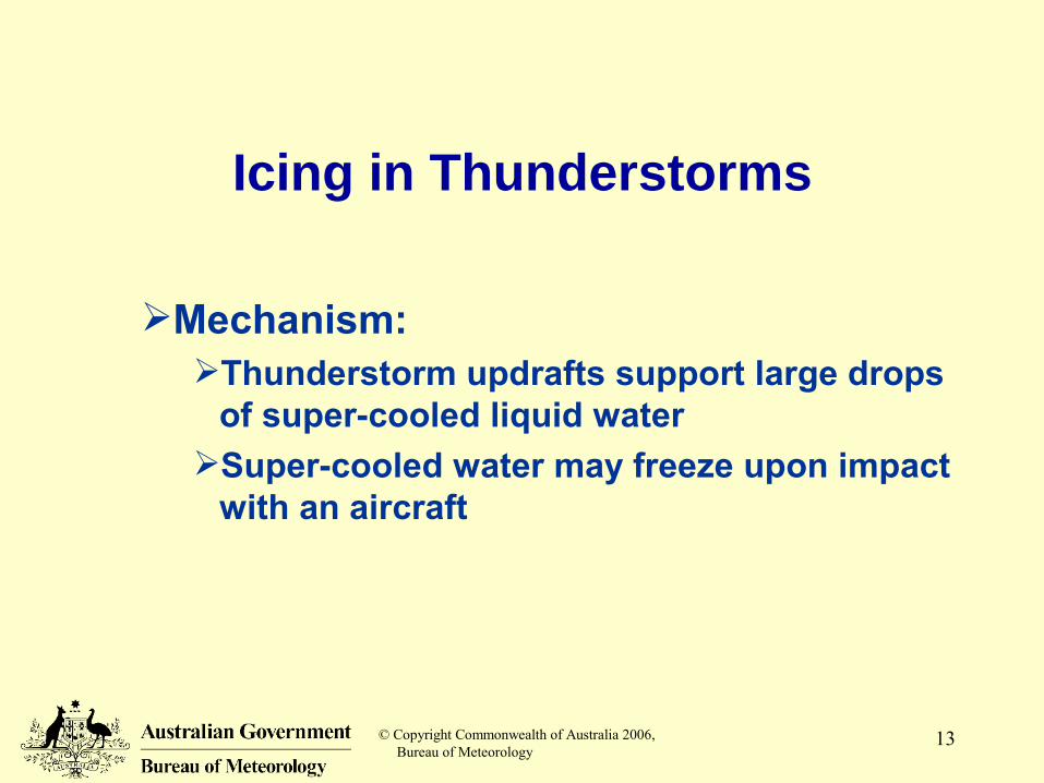
Icing in Thunderstorms
Mechanism:Thunderstorm updrafts support large drops
of super-cooled liquid waterSuper-cooled water may freeze upon impact
with an aircraft
© Copyright Commonwealth of Australia 2006, Bureau of Meteorology
14
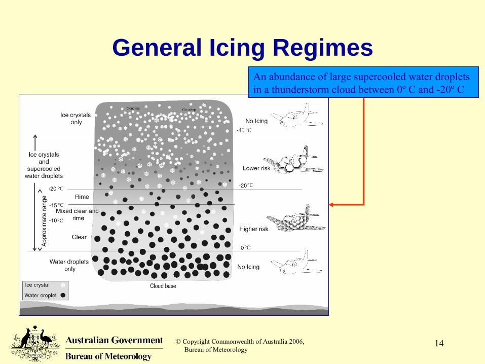
General Icing RegimesAn abundance of large supercooled water droplets in a thunderstorm cloud between 0º C and -20º C
© Copyright Commonwealth of Australia 2006, Bureau of Meteorology
15
Hazardous Effects of Aircraft Icing
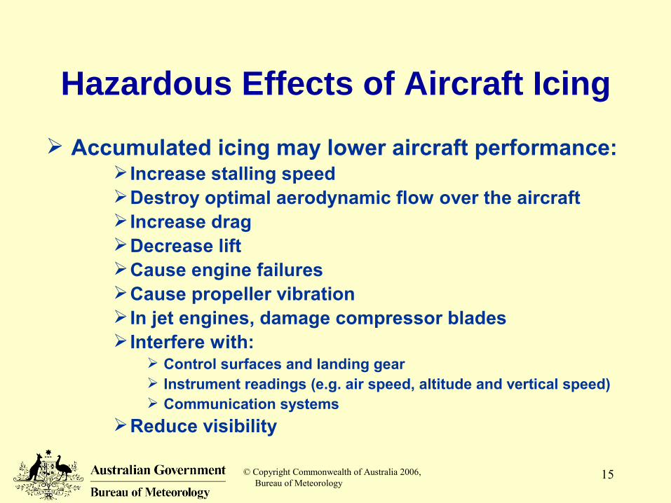
Accumulated icing may lower aircraft performance: Increase stalling speedDestroy optimal aerodynamic flow over the aircraft Increase dragDecrease liftCause engine failuresCause propeller vibration In jet engines, damage compressor blades Interfere with:
Control surfaces and landing gear Instrument readings (e.g. air speed, altitude and vertical speed) Communication systems
Reduce visibility
© Copyright Commonwealth of Australia 2006, Bureau of Meteorology
16
Icing Intensity
TraceIce is perceptible – not hazardous unless
exposure is for an extended periodLight
Accumulation rate may cause problems if flight is prolonged
ModerateShort periods of exposure become hazardous
SevereShort term exposures are hazardous and an
immediate diversion is necessary
© Copyright Commonwealth of Australia 2006, Bureau of Meteorology
17
Reduced Visibility
Mechanism:
Horizontal visibilityDue to precipitation
Showers of rain, snow and hail
Vertical visibilityDue to obscuring cloud
Cumulonimbus, Stratus, etc.
© Copyright Commonwealth of Australia 2006, Bureau of Meteorology
18
Lightning
A high-current electrical discharge caused by a thunderstorm …Cloud-to-cloudWithin-cloud (~ 50 % of all strikes)Cloud-to-ground – prime hazards to people
(risk of electrocution) or property on the ground
Generally, the higher the frequency of strikesThe more severe the thunderstorm
In precise location and timing, lightning strikes are difficult to predict
© Copyright Commonwealth of Australia 2006, Bureau of Meteorology
19
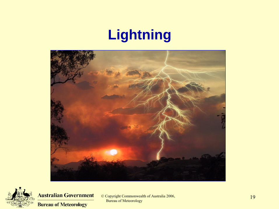
Lightning
© Copyright Commonwealth of Australia 2006, Bureau of Meteorology
20
Lightning: Aircraft Damage
Direct damagePuncturing the fuselageBurning, melting or distorting aircraft parts
Indirect damageTemporary or permanent damage to avionicsFire in the fuel systemTemporary blinding of the pilot
Visual or instruments
© Copyright Commonwealth of Australia 2006, Bureau of Meteorology
21
The Effects of Lightning on Aircraft
Flight Safety Australia Magazine article:“Bolt from the Blue” http://www.casa.gov.au/fsa/2005/aug/48-50.pdf
© Copyright Commonwealth of Australia 2006, Bureau of Meteorology
22
Damaging Hail
Hail can inflict severe damage to an aircraft in flight or on the ground
Hail is mostly a mid-latitude phenomenonAn intense thunderstorm allows:Storm updrafts are strong
Large hail is suspended and circulated up and down within the could until it falls from the storm cloud
Hail stones accumulate mass by sweeping through super-cooled water droplets and ice particles
© Copyright Commonwealth of Australia 2006, Bureau of Meteorology
23
Funnel Clouds:Tornado / Water Spout
Tornadoes / water spouts are usually identified by a funnel cloudTornadic winds are extremely destructive – the
most violent weather phenomenonCan cause structural damage to an aircraft
Tornado formation depends on the wind shear environment of the severe storm
© Copyright Commonwealth of Australia 2006, Bureau of Meteorology
24
Heavy Precipitation
Thunderstorms are capable of extreme rainfall intensities
Heavy precipitation can:Reduce visibility in flight and on the ground“St. Elmo's Fire”
Precipitation, especially in vicinity of a thunderstorm can build up static electric on the aircraft
Interferes with radio transmission Noisy disturbance at low radio frequencies
Wet runways – reduce stopping ability upon landing and decrease steering control on the ground
Flooding of airfield, boggy environs
© Copyright Commonwealth of Australia 2006, Bureau of Meteorology
25
Water Ingestion
If thunderstorm updraft suspends sufficient water droplets …Jet engine may ingest more water than design
specificationsCan lead to engine flame-outThere is no known successful operational recovery
procedure
© Copyright Commonwealth of Australia 2006, Bureau of Meteorology
26
Altimeter InterferenceAir pressure changes often respond to a
thunderstorm’s downdraft …Usually, the pressure changes are very rapidAs the storm approaches, often the pressure
falls steadilyAir pressure then rises rapidly
With the onset of gust front and arrival of the cold down draft (with heavy precipitation)
Air pressure falls back to ambient pressure when the storm moves away
Total cycle time = 10 to 15 minutes onlyWhence, the altimeter could be of the order of
100 feet in error
© Copyright Commonwealth of Australia 2006, Bureau of Meteorology
27
Statistically, the most hazardous phase of flight is take-off and /or landing Turbulence Wind shear Reduced Visibility:
Vertical visibility, due to Cloud (Cb, St, etc) Horizontal visibility, due to Precipitation (SHRA, SHGR,
SHSN) Lightning Damaging hail Tornado / Water Spout Heavy precipitation Water ingestion
Take-off / LandingThunderstorm Hazards
© Copyright Commonwealth of Australia 2006, Bureau of Meteorology
28
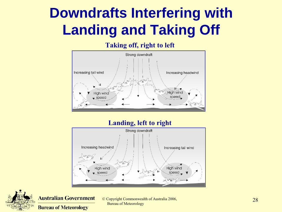
Downdrafts Interfering with Landing and Taking Off
Landing, left to right
Taking off, right to left
© Copyright Commonwealth of Australia 2006, Bureau of Meteorology
29
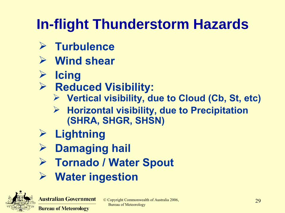
In-flight Thunderstorm Hazards Turbulence Wind shear Icing Reduced Visibility:
Vertical visibility, due to Cloud (Cb, St, etc) Horizontal visibility, due to Precipitation
(SHRA, SHGR, SHSN) Lightning Damaging hail Tornado / Water Spout Water ingestion
© Copyright Commonwealth of Australia 2006, Bureau of Meteorology
30
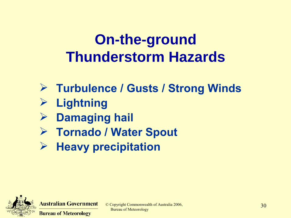
On-the-groundThunderstorm Hazards
Turbulence / Gusts / Strong Winds Lightning Damaging hail Tornado / Water Spout Heavy precipitation
© Copyright Commonwealth of Australia 2006, Bureau of Meteorology
31
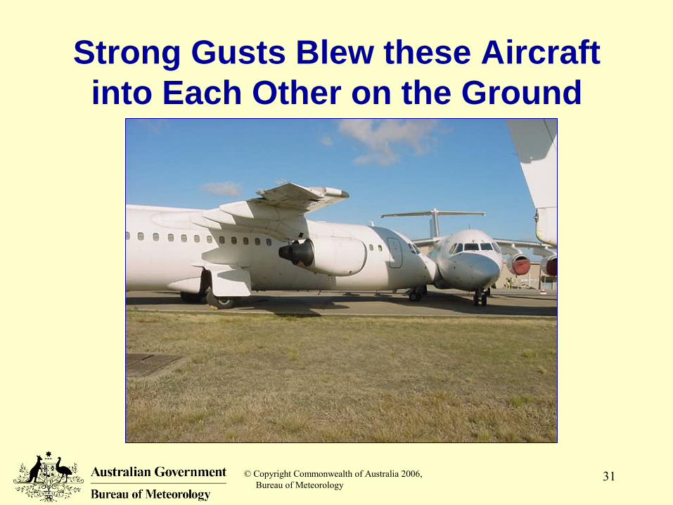
Strong Gusts Blew these Aircraft into Each Other on the Ground
© Copyright Commonwealth of Australia 2006, Bureau of Meteorology
32
Summary
Thunderstorms are extremely hazardous to flight
Pilots should avoid thunderstorms because of the number and severity of associated hazards
Forecasting thunderstorm activity in a timely and accurate way has great utility to the aviation Industry
© Copyright Commonwealth of Australia 2006, Bureau of Meteorology
33
Forward to
Satellite and radar observations of thunderstorms