Embed Size (px)
Citation preview
Norwegian Defence Research Establishment
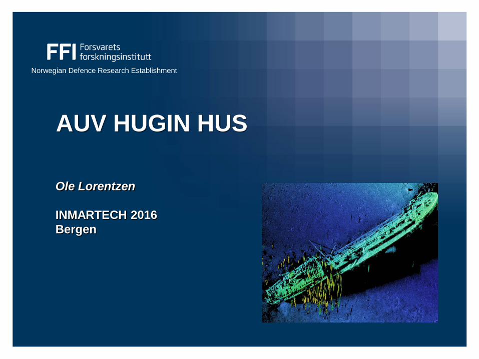
AUV HUGIN HUS
Ole Lorentzen INMARTECH 2016 Bergen
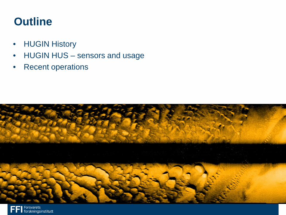
Outline
• HUGIN History • HUGIN HUS – sensors and usage • Recent operations
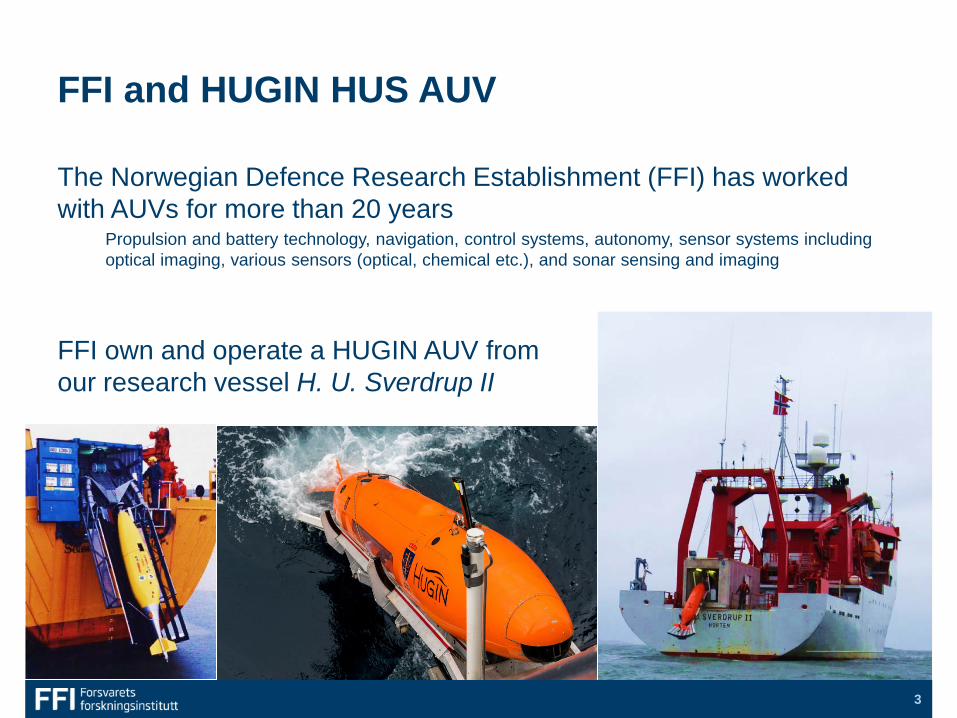
FFI and HUGIN HUS AUV
The Norwegian Defence Research Establishment (FFI) has worked with AUVs for more than 20 years
Propulsion and battery technology, navigation, control systems, autonomy, sensor systems including optical imaging, various sensors (optical, chemical etc.), and sonar sensing and imaging
FFI own and operate a HUGIN AUV from our research vessel H. U. Sverdrup II
3
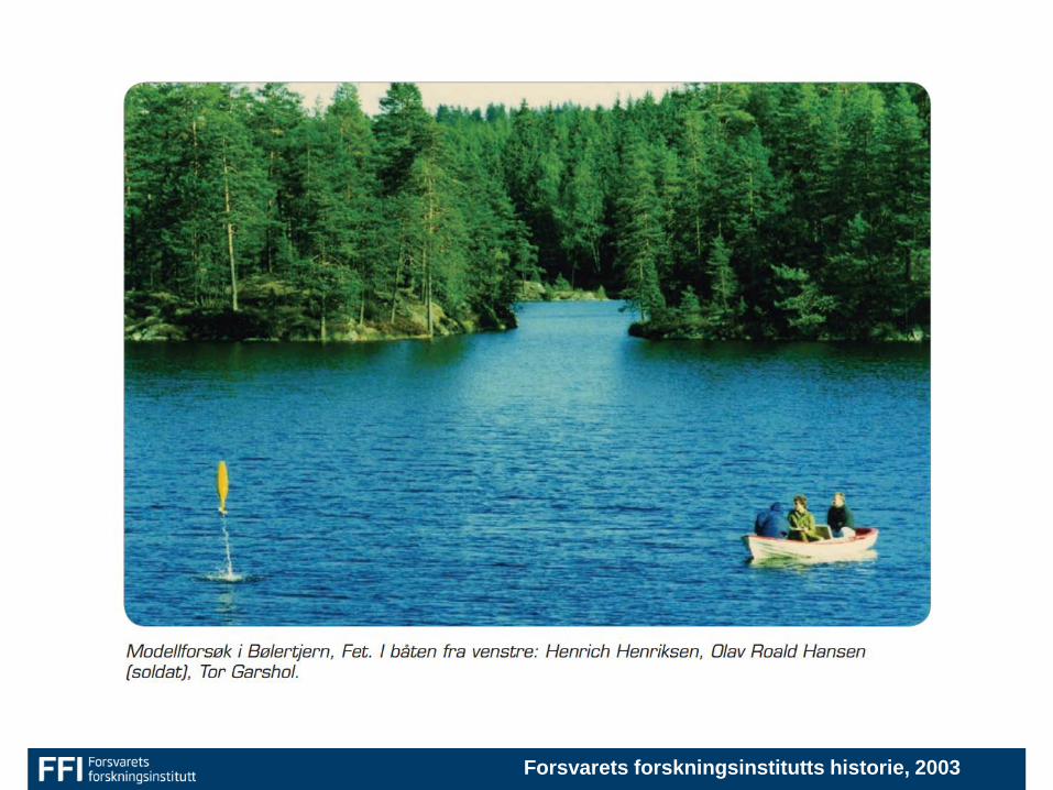
Forsvarets forskningsinstitutts historie, 2003
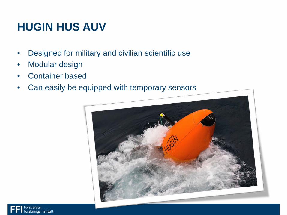
HUGIN HUS AUV
• Designed for military and civilian scientific use • Modular design • Container based • Can easily be equipped with temporary sensors
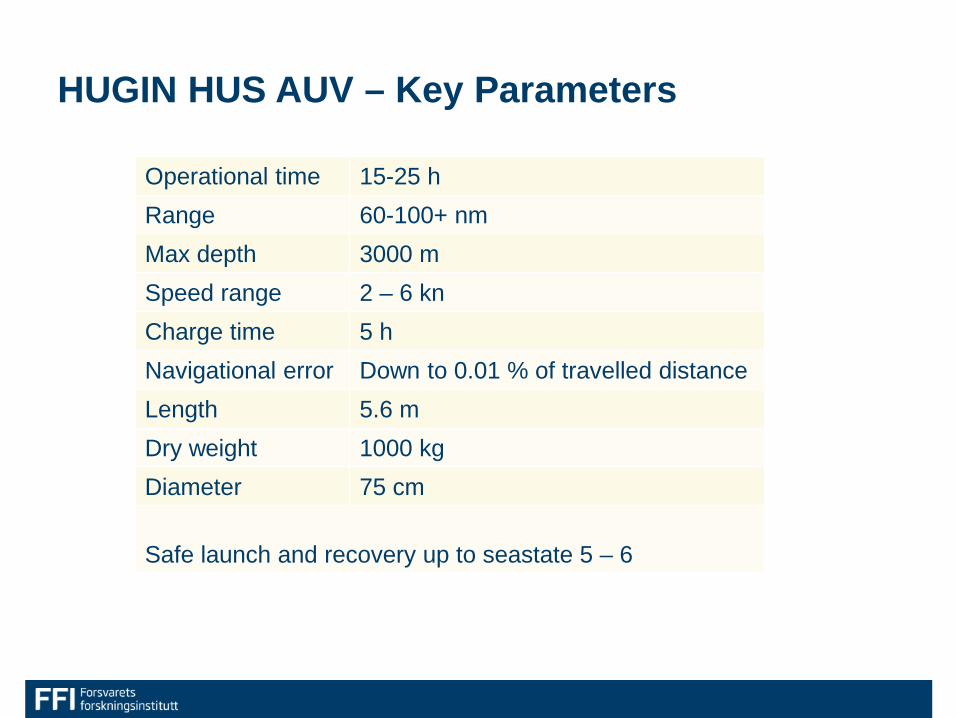
HUGIN HUS AUV – Key Parameters
Operational time 15-25 h Range 60-100+ nm Max depth 3000 m Speed range 2 – 6 kn Charge time 5 h Navigational error Down to 0.01 % of travelled distance Length 5.6 m Dry weight 1000 kg Diameter 75 cm Safe launch and recovery up to seastate 5 – 6
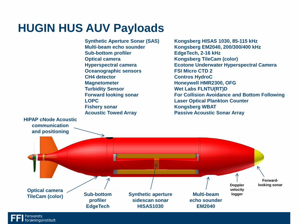
HUGIN HUS AUV Payloads
Sub-bottom profiler
EdgeTech
Synthetic aperture sidescan sonar
HISAS1030
Optical camera TileCam (color) Multi-beam
echo sounder EM2040
HIPAP cNode Acoustic communication and positioning
Forward-looking sonar
Synthetic Aperture Sonar (SAS) Kongsberg HISAS 1030, 85-115 kHz Multi-beam echo sounder Kongsberg EM2040, 200/300/400 kHz Sub-bottom profiler EdgeTech, 2-16 kHz Optical camera Kongsberg TileCam (color) Hyperspectral camera Ecotone Underwater Hyperspectral Camera Oceanographic sensors FSI Micro CTD 2 CH4 detector Contros HydroC Magnetometer Honeywell HMR2300, OFG Turbidity Sensor Wet Labs FLNTU(RT)D Forward looking sonar For Collision Avoidance and Bottom Following LOPC Laser Optical Plankton Counter Fishery sonar Kongsberg WBAT Acoustic Towed Array Passive Acoustic Sonar Array
Doppler velocity logger
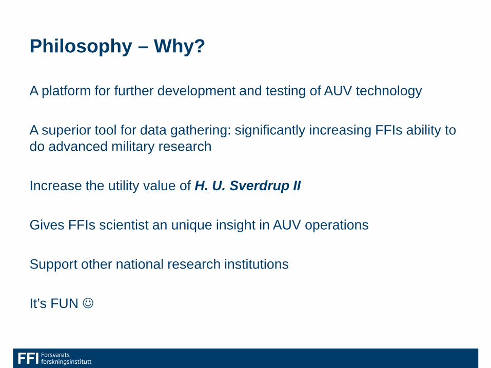
Philosophy – Why?
A platform for further development and testing of AUV technology A superior tool for data gathering: significantly increasing FFIs ability to do advanced military research Increase the utility value of H. U. Sverdrup II Gives FFIs scientist an unique insight in AUV operations Support other national research institutions It’s FUN
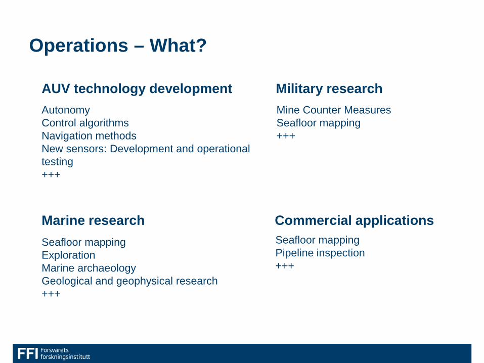
Operations – What?
Autonomy Control algorithms Navigation methods New sensors: Development and operational testing +++
Military research AUV technology development
Marine research
Mine Counter Measures Seafloor mapping +++
Commercial applications Seafloor mapping Exploration Marine archaeology Geological and geophysical research +++
Seafloor mapping Pipeline inspection +++
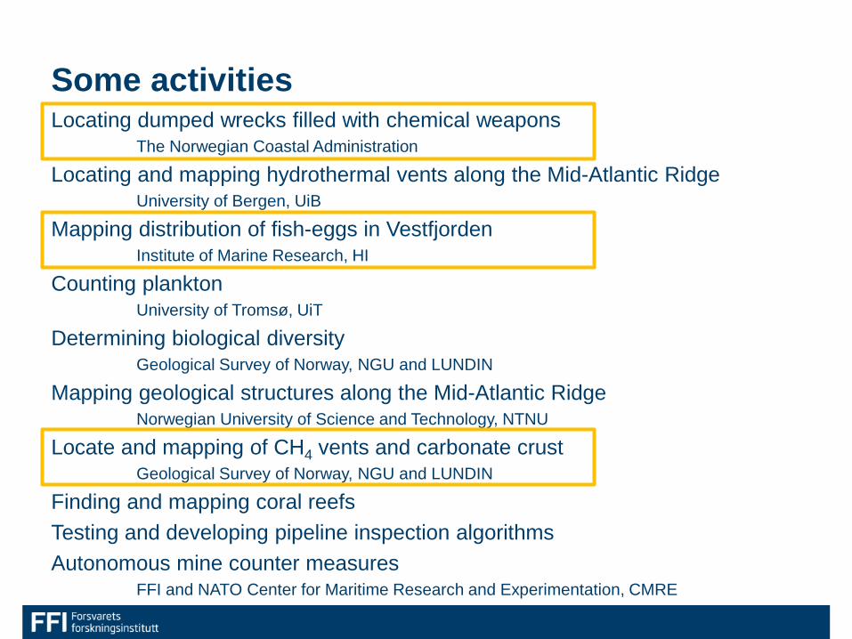
Some activities Locating dumped wrecks filled with chemical weapons The Norwegian Coastal Administration
Locating and mapping hydrothermal vents along the Mid-Atlantic Ridge University of Bergen, UiB
Mapping distribution of fish-eggs in Vestfjorden Institute of Marine Research, HI
Counting plankton University of Tromsø, UiT
Determining biological diversity Geological Survey of Norway, NGU and LUNDIN
Mapping geological structures along the Mid-Atlantic Ridge Norwegian University of Science and Technology, NTNU
Locate and mapping of CH4 vents and carbonate crust Geological Survey of Norway, NGU and LUNDIN
Finding and mapping coral reefs Testing and developing pipeline inspection algorithms Autonomous mine counter measures FFI and NATO Center for Maritime Research and Experimentation, CMRE
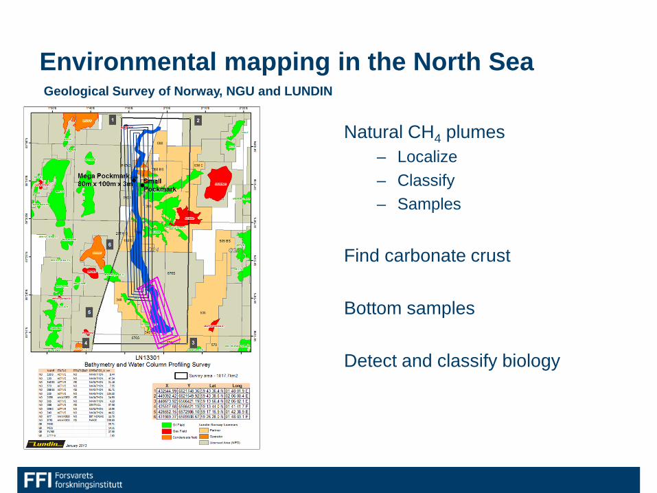
Natural CH4 plumes – Localize – Classify – Samples
Find carbonate crust
Bottom samples
Detect and classify biology
Environmental mapping in the North Sea Geological Survey of Norway, NGU and LUNDIN
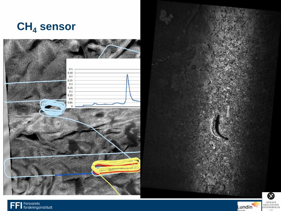
CH4 sensor
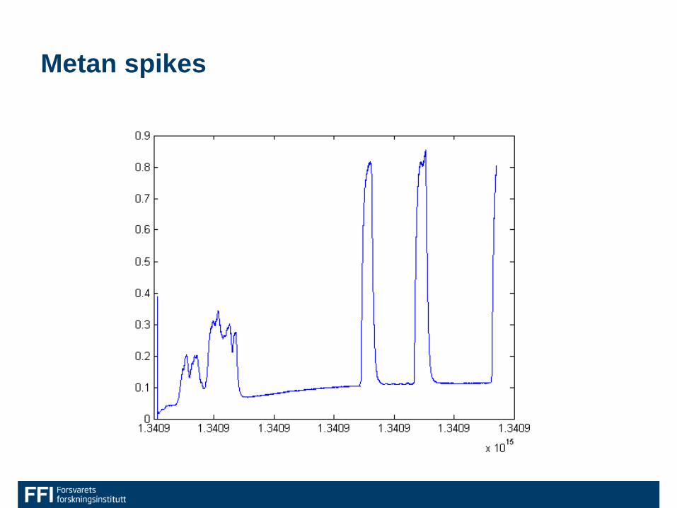
Metan spikes
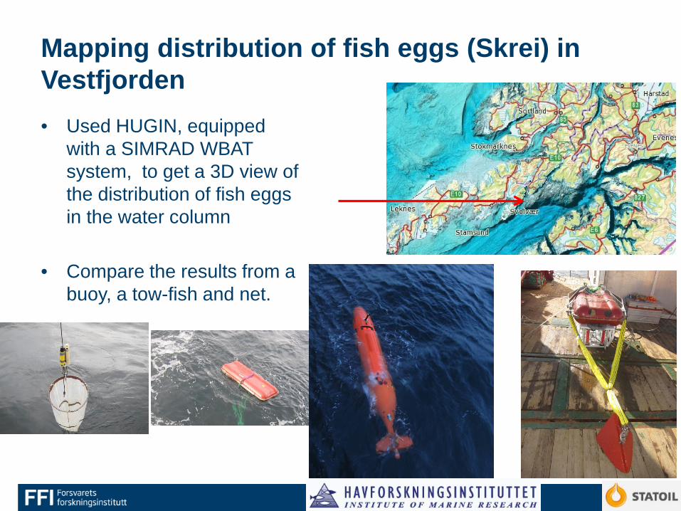
Mapping distribution of fish eggs (Skrei) in Vestfjorden • Used HUGIN, equipped
with a SIMRAD WBAT system, to get a 3D view of the distribution of fish eggs in the water column
• Compare the results from a buoy, a tow-fish and net.
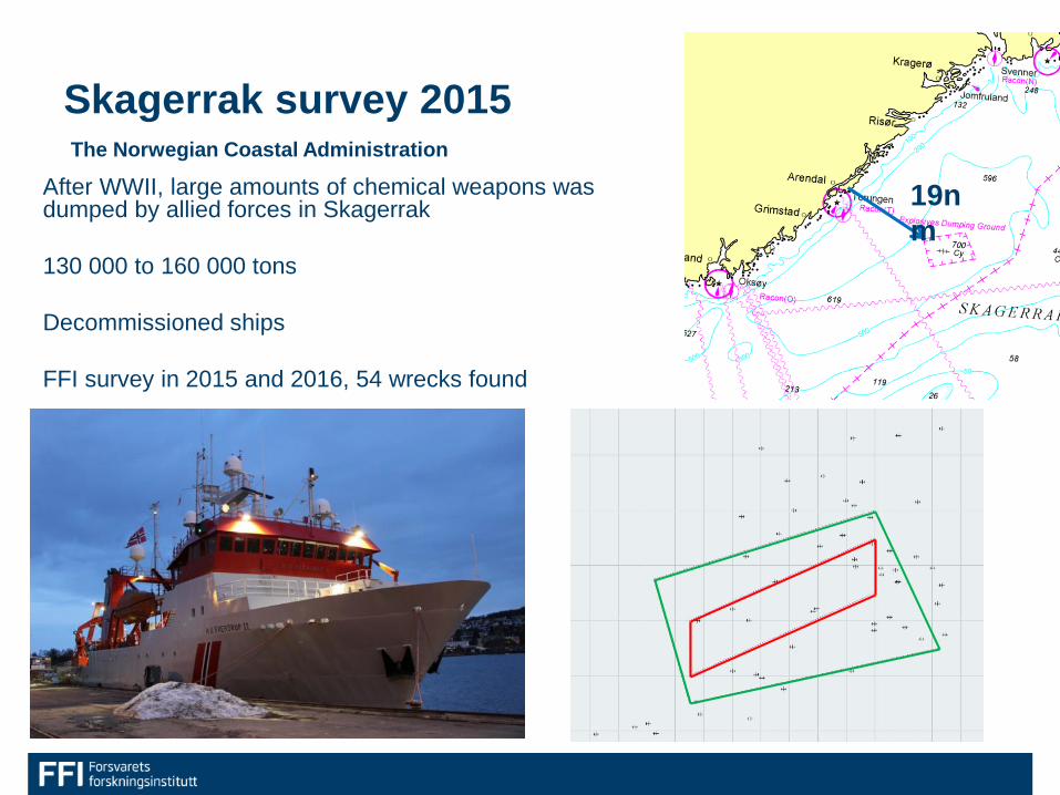
Skagerrak survey 2015
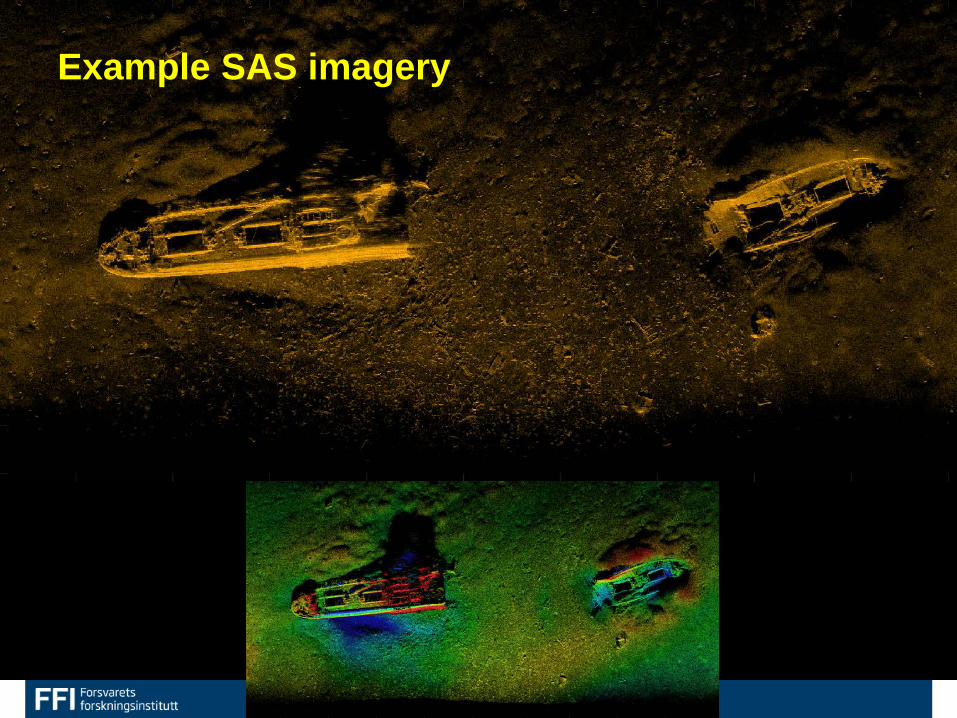
After WWII, large amounts of chemical weapons was dumped by allied forces in Skagerrak 130 000 to 160 000 tons Decommissioned ships FFI survey in 2015 and 2016, 54 wrecks found
19nm
The Norwegian Coastal Administration
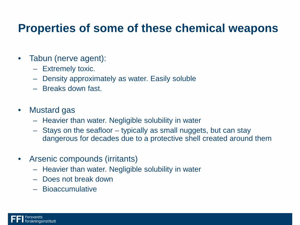
Properties of some of these chemical weapons
• Tabun (nerve agent): – Extremely toxic. – Density approximately as water. Easily soluble – Breaks down fast.
• Mustard gas
– Heavier than water. Negligible solubility in water – Stays on the seafloor – typically as small nuggets, but can stay
dangerous for decades due to a protective shell created around them
• Arsenic compounds (irritants) – Heavier than water. Negligible solubility in water – Does not break down – Bioaccumulative
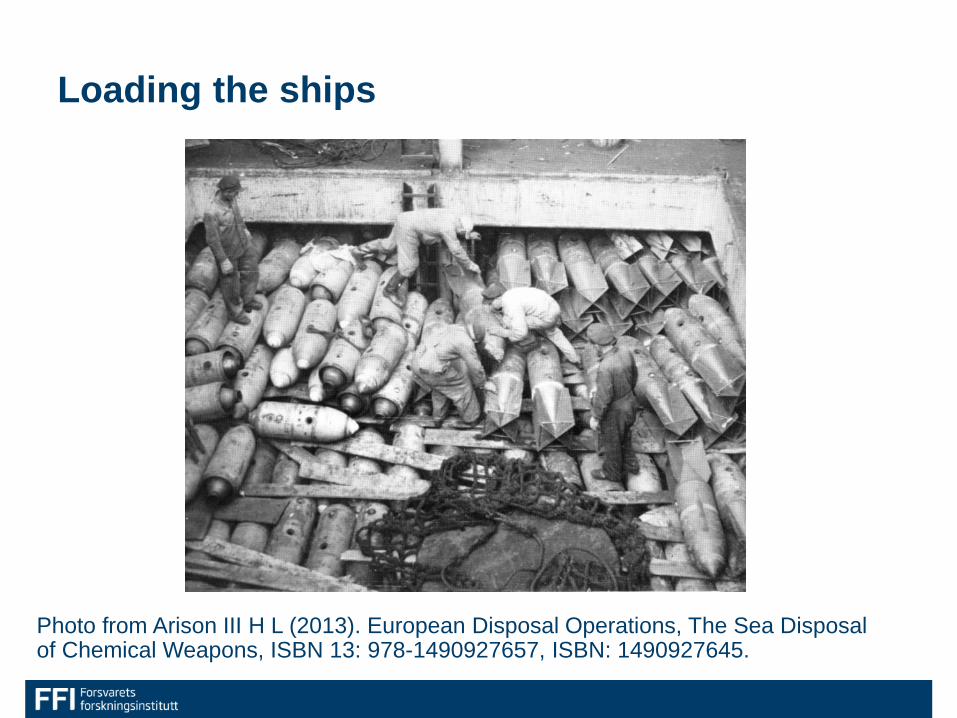
Loading the ships
Photo from Arison III H L (2013). European Disposal Operations, The Sea Disposal of Chemical Weapons, ISBN 13: 978-1490927657, ISBN: 1490927645.
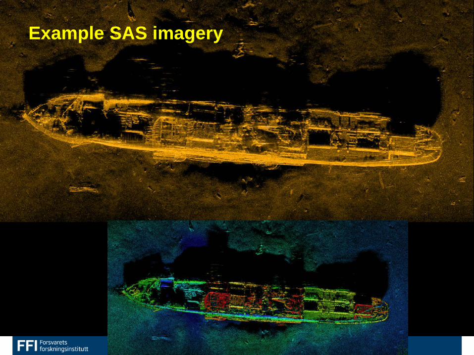
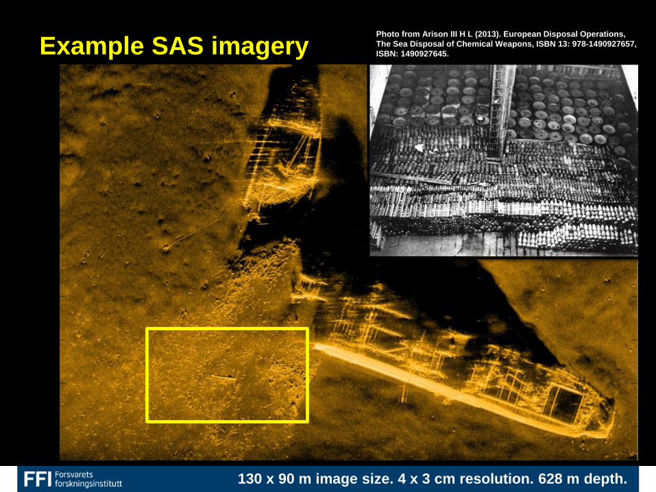
Example SAS imagery
Example SAS imagery
Example SAS imagery
130 x 90 m image size. 4 x 3 cm resolution. 628 m depth.
Photo from Arison III H L (2013). European Disposal Operations, The Sea Disposal of Chemical Weapons, ISBN 13: 978-1490927657, ISBN: 1490927645.
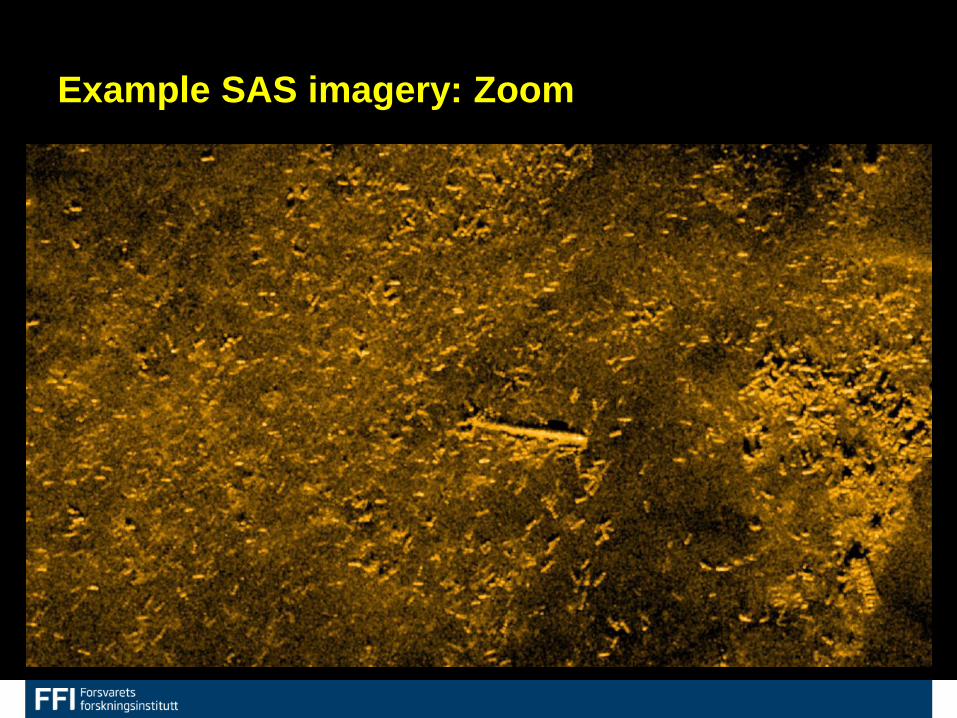
Example SAS imagery: Zoom
22