Embed Size (px)
Citation preview

Automatically Cleaning and Processing Bicycle GPS Traces
Will Tsay
May 17, 2015

Outline
• CyclePhilly Smartphone App• GPS Data Collection• GPS Data Processing• Processing Results• Limitations• Future

Smarter Phones
Source: Qualcomm Technologies, Inc Press Release April 24, 2014

Sensor Capabilities
Sensors• Motion
– Linear– Rotational
• Environmental– Photometer– Thermometer
• Positional– Magnetometers– Proximity– Navigational
Applications• A
– User activity– Screen orientation
• B– Screen brightness– Phone self-preservation
• C– Compass– RFID, NFC, Screen shutoff– GPS, GLONASS, Galileo
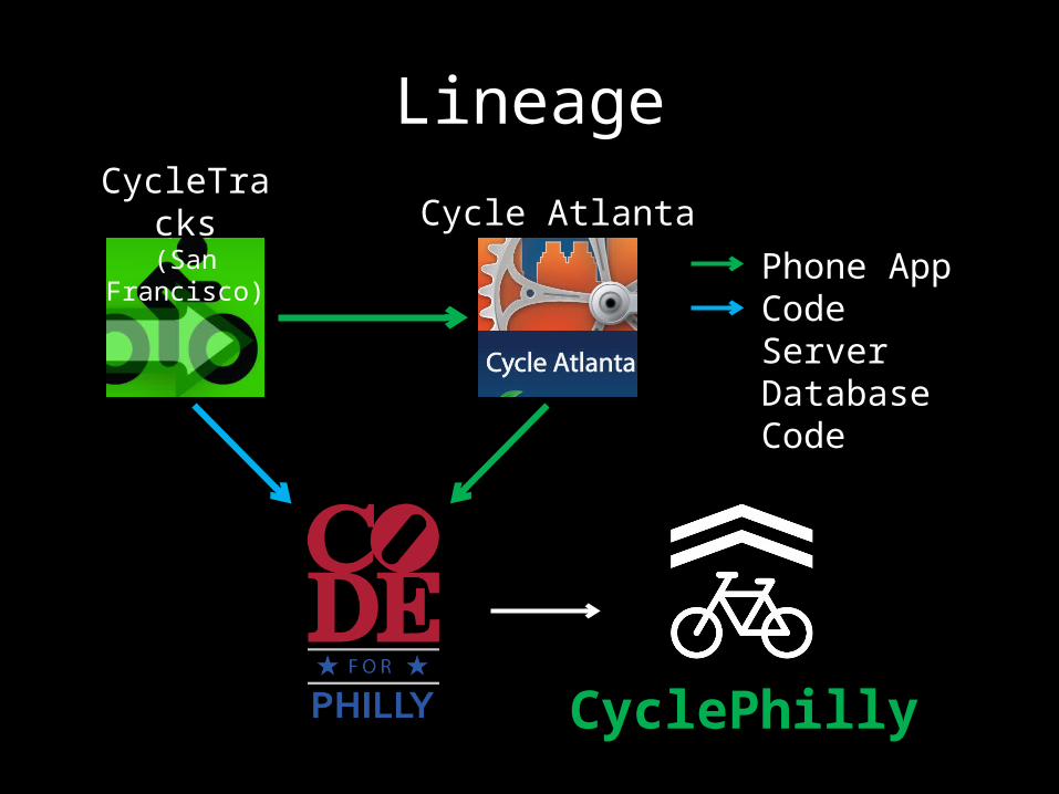
LineageCycleTracks(San Francisco) Cycle Atlanta
CyclePhilly
Phone App CodeServer Database Code


User Demographics
• User Characteristics– Age– Ethnicity– Gender– Income (Household)
• Cycling Frequency• Cyclist Classification• Cycling History

Data Collection Flow
Cycle Philly GPS Tracking Data UploadUser starts recording
their tripApp records time-
stamped geographic coordinates
Once the trip is completed, recorded
data is uploaded

Data Processing
• Written in Python 2.7 (64-bit)– SciPy (spatial)– NetworkX (path finding)– PyShp (Shapefile IO)
• Runs Multithreaded• Visualization– CartoDB, Leaflet
• Tools used are freely available

Data Processing Flow
GPS Traces
Open StreetMap
Data Processing
GPS traces related
to street network
DVRPC
Public Database

Data Sources
1. Open Street Map– Road Type– Directionality
2. CyclePhilly GPS Traces– Longitude, Latitude– GPS Accuracy– Speed
• OSM Data accuracy/completeness is critical

Handling Raw Data
• GPS accuracy variability– Urban (Street) Canyon– Obscured line of sight
• Anonymization concerns• Accidental multi-modal trips• … other unspecified strangeness
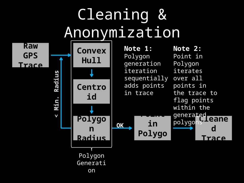
Cleaning & Anonymization
Raw GPS Trace
Convex Hull
Centroid
Polygon Radius
Point in Polygon
Cleaned Trace
OK
< M
in. R
adiu
sNote 2:Point in Polygon iterates over all points in the trace to flag points within the generated polygons
Note 1:Polygon generation iteration sequentially adds points in trace
Polygon Generation
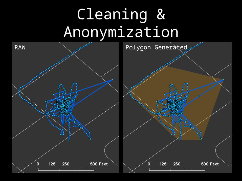
Cleaning & AnonymizationRAW Polygon Generated
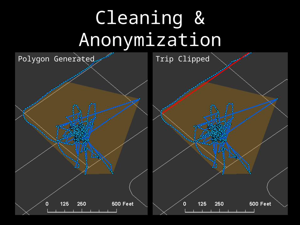
Cleaning & AnonymizationPolygon Generated Trip Clipped

Trip Snapping
Cleaned Trace
OSM Network
K-D TreeGPS Points
Link Hedge
Weighted SP Search
Snapped Trace
Note:K-D Tree: K-dimensional binary tree – enables efficient searching by splitting groups of data

Trip SnappingRaw Trace Raw Trace – Snapped Trace

Trip SnappingRaw Trace – Snapped Trace Snapped Trace

All Trips

Link Selection

Purpose: Errand
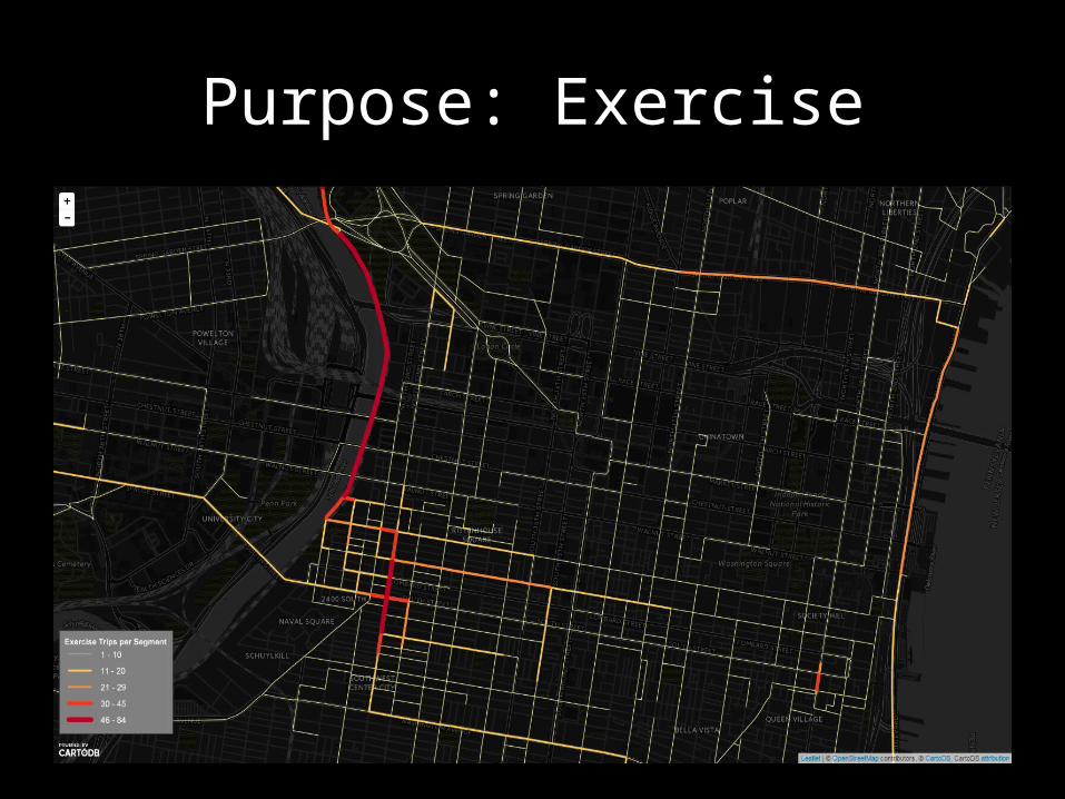
Purpose: Exercise

Purpose: Shopping

Purpose: Social

Final Data Overview
• May – October, 2014• 330 Users• 9200 Trips– 5600 Commute Purpose– 3500 Non-Commute
• ~18,000,000 rows (1.5 GB)

Rider Characteristics

Trips by Purpose

Trips by Purpose
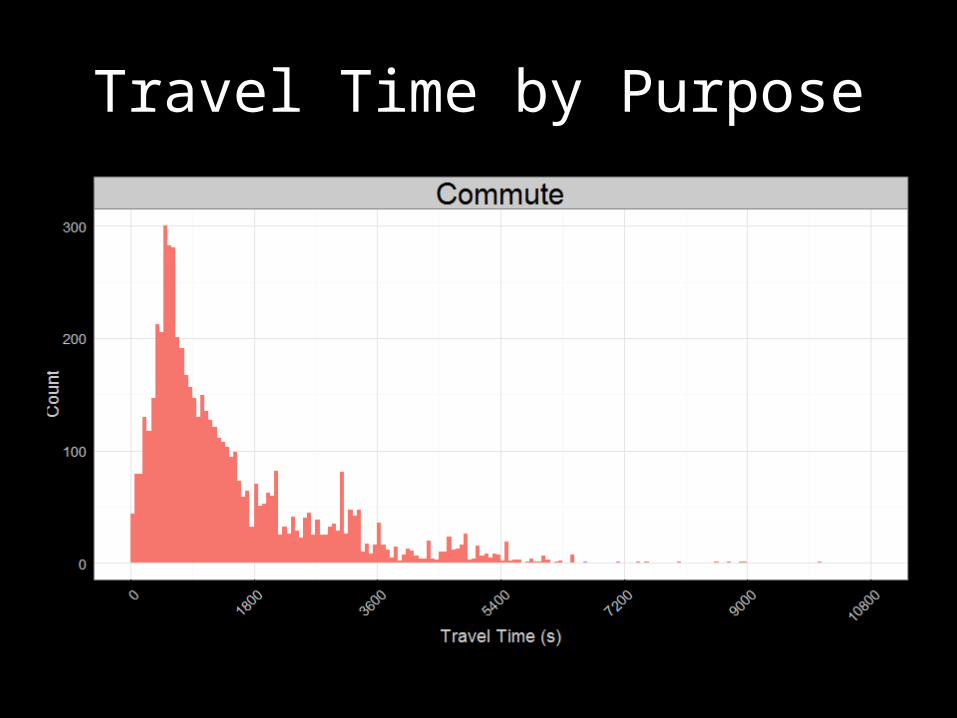
Travel Time by Purpose

Travel Time by Purpose
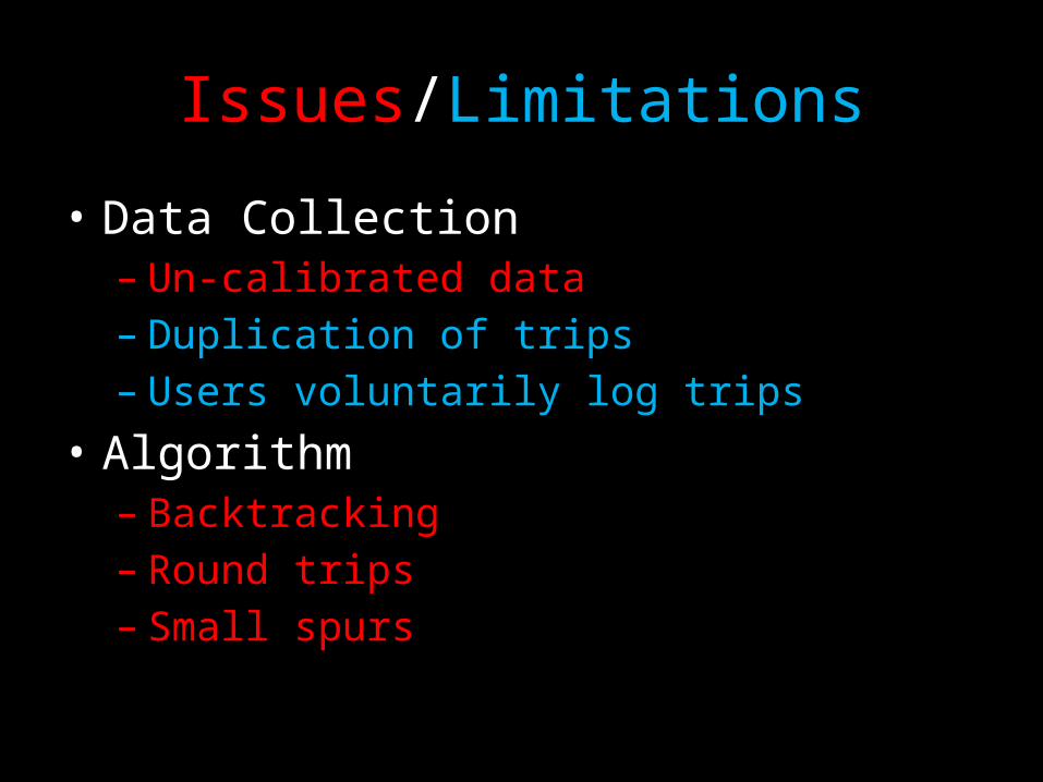
Issues/Limitations
• Data Collection– Un-calibrated data– Duplication of trips– Users voluntarily log trips
• Algorithm– Backtracking– Round trips– Small spurs

Future
• Improvements– Phone app re-write• Collect additional sensor data• Easier debugging
• Uses– Possible bike path choice model– Seasonal correction factor– Complement to permanent & mobile bike counts


![String Processing - (Based on [Manber 1989])im.ntu.edu.tw/~tsay/dokuwiki/lib/exe/fetch.php?... · String Processing (Based on [Manber 1989]) Yih-Kuen Tsay Department of Information](https://img.pdfslide.us/doc/110x75/60170be62bdec1361174d32b/string-processing-based-on-manber-1989imntuedutwtsaydokuwikilibexefetchphp.jpg)