Embed Size (px)
Citation preview
August 2017
https://ais-portal.usace.army.mil
Automatic Identification System Analysis Package
Contact: Dr. Ned Mitchell, Principal Investigator, [email protected] contact: Dr. Marin Kress, [email protected]
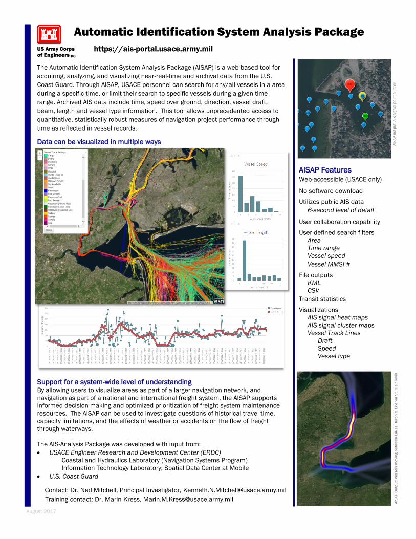
AISAP Features Web-accessible (USACE only)
No software download
Utilizes public AIS data
6-second level of detail
User collaboration capability
User-defined search filters
Area
Time range
Vessel speed
Vessel MMSI #
File outputs
KML
CSV
Transit statistics
Visualizations
AIS signal heat maps
AIS signal cluster maps
Vessel Track Lines
Draft
Speed
Vessel type
AIS
AP
Ou
tpu
t: V
esse
ls m
ovin
g b
etw
ee
n L
ak
es H
uro
n &
Eri
e v
ia S
t. C
lair
Riv
er
AIS
AP
ou
tpu
t: A
IS s
ign
al p
oin
t clu
ste
r.
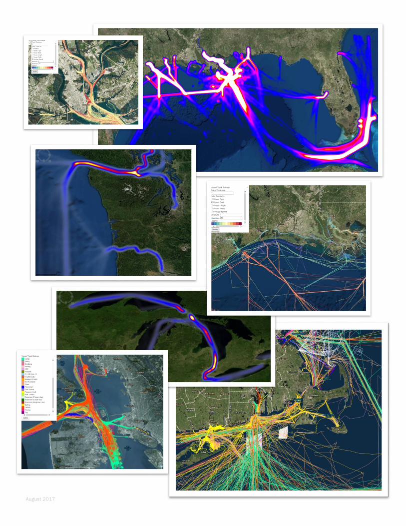
Support for a system-wide level of understanding By allowing users to visualize areas as part of a larger navigation network, and
navigation as part of a national and international freight system, the AISAP supports
informed decision making and optimized prioritization of freight system maintenance
resources. The AISAP can be used to investigate questions of historical travel time,
capacity limitations, and the effects of weather or accidents on the flow of freight
through waterways.
The AIS-Analysis Package was developed with input from:
USACE Engineer Research and Development Center (ERDC)
Coastal and Hydraulics Laboratory (Navigation Systems Program)
Information Technology Laboratory; Spatial Data Center at Mobile
U.S. Coast Guard
US Army Corps
of Engineers (R)
The Automatic Identification System Analysis Package (AISAP) is a web-based tool for
acquiring, analyzing, and visualizing near-real-time and archival data from the U.S.
Coast Guard. Through AISAP, USACE personnel can search for any/all vessels in a area
during a specific time, or limit their search to specific vessels during a given time
range. Archived AIS data include time, speed over ground, direction, vessel draft,
beam, length and vessel type information. This tool allows unprecedented access to
quantitative, statistically robust measures of navigation project performance through
time as reflected in vessel records.
Data can be visualized in multiple ways
August 2017