Embed Size (px)
Citation preview
G-AMPIS®
Integrated Sensing and Inspection of Highway Surface Distress
Howard Chung and Masanobu Shinozuka
Department of Civil and Environmental EngineeringUniversity of California, Irvine, CA 92697-2175
Workshop on Application of Remote Sensing Technologiesfor Disaster Response, Irvine, CA
September 12, 2003
2UC Irvine, Civil & Environmental Engineering
Contents
MotivationLiterature ReviewProposed ResearchPreliminary ResultSummaryFuture Plan
3UC Irvine, Civil & Environmental Engineering
MotivationDOT agencies spent huge efforts & money in inspection, planning,maintenance and repair of the highways’ pavement.
Traditional man-made inspection and documentation methods make this work cumbersome and inefficient.
Traditional documentation of surveyed records is hard to be retrieved, reviewed, and updated by DOT agencies and transportation engineers.
AMPIS* is built to systematically and automated carry out highway surface distress inspection and management in situ.
GIS and image technology-based AMPIS is developed for better implementation of Pavement Management System (PMS).
*AMPIS: Automated Management of Pavement Inspection System
4UC Irvine, Civil & Environmental Engineering
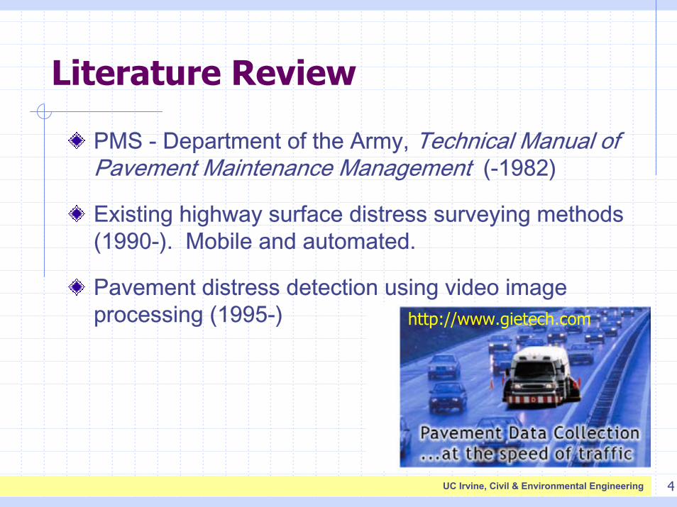
Literature Review
PMS - Department of the Army, Technical Manual of Pavement Maintenance Management (-1982)
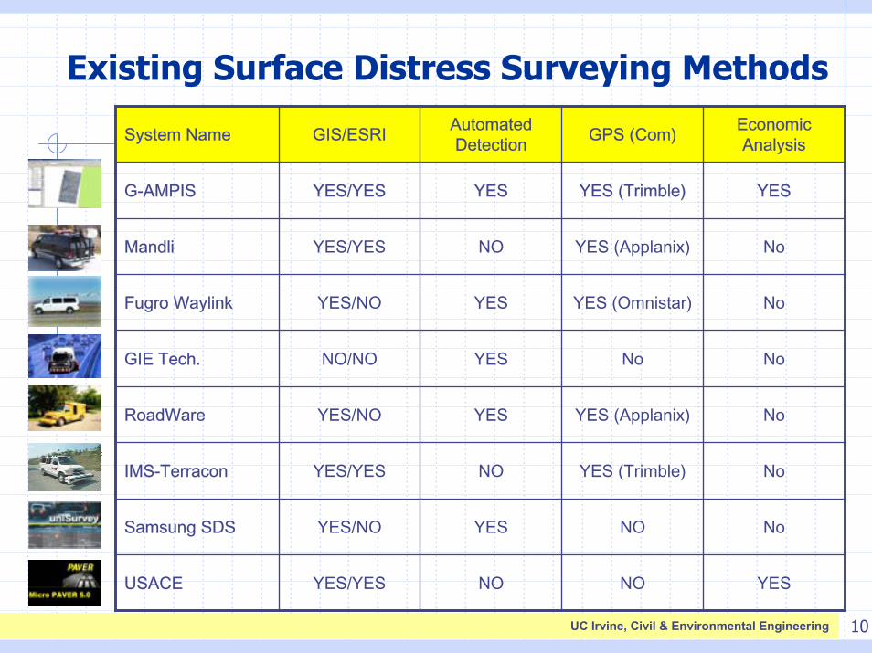
Existing highway surface distress surveying methods (1990-). Mobile and automated.
Pavement distress detection using video image processing (1995-) http://www.gietech.com
5UC Irvine, Civil & Environmental Engineering
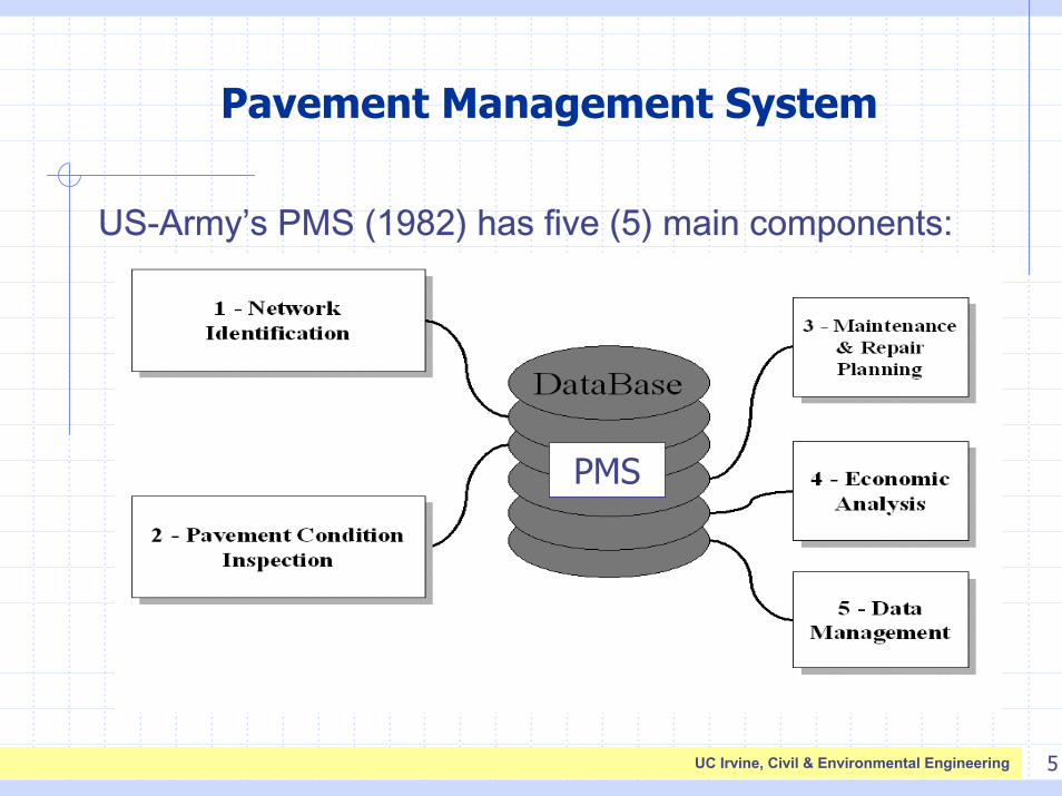
Pavement Management System
US-Army’s PMS (1982) has five (5) main components:
PMS
6UC Irvine, Civil & Environmental Engineering
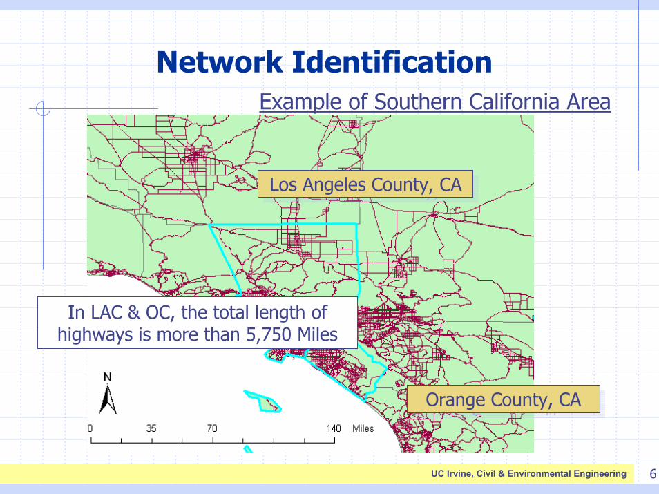
Network IdentificationExample of Southern California Area
Los Angeles County, CALos Angeles County, CA
Orange County, CAOrange County, CA
In LAC & OC, the total length of highways is more than 5,750 Miles
7UC Irvine, Civil & Environmental Engineering
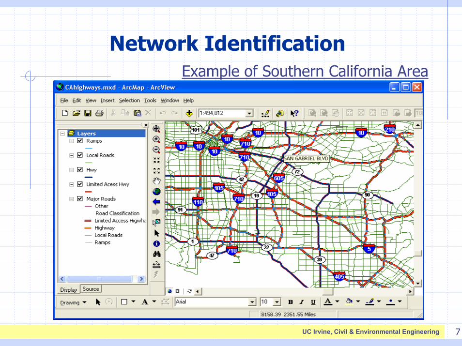
Network IdentificationExample of Southern California Area
8UC Irvine, Civil & Environmental Engineering
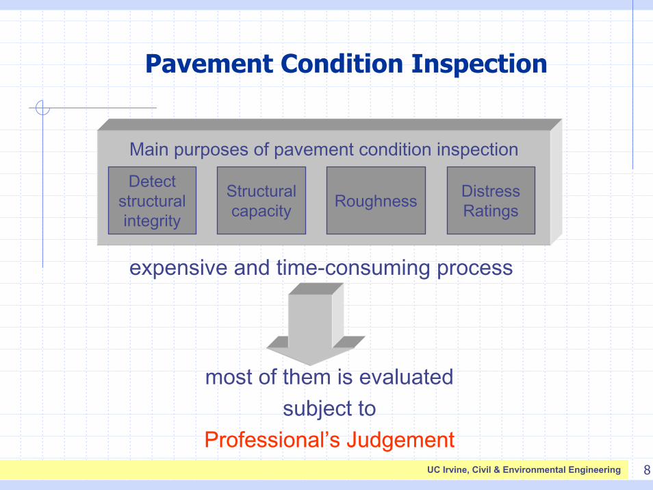
Pavement Condition Inspection
Detect structural integrity
Structural capacity Roughness Distress
Ratings
Main purposes of pavement condition inspection
expensive and time-consuming process
most of them is evaluated subject to
Professional’s Judgement
9UC Irvine, Civil & Environmental Engineering
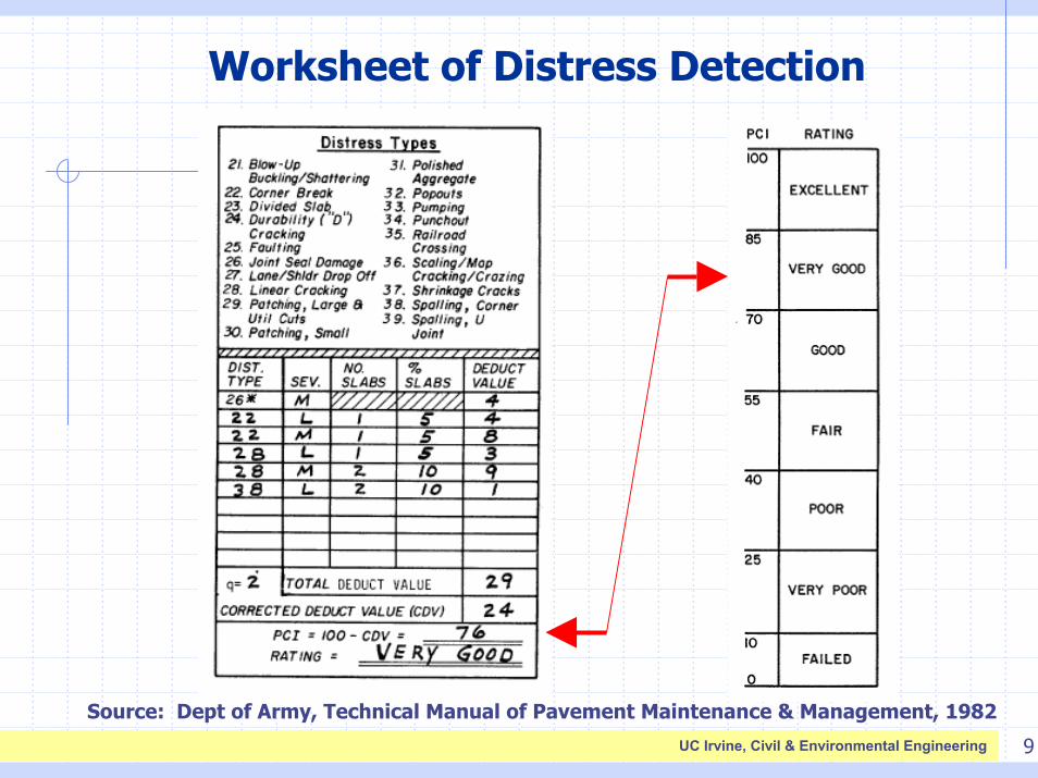
Worksheet of Distress Detection
Source: Dept of Army, Technical Manual of Pavement Maintenance & Management, 1982
10UC Irvine, Civil & Environmental Engineering
Existing Surface Distress Surveying MethodsEconomic AnalysisGPS (Com)Automated
DetectionGIS/ESRISystem Name
YESNONOYES/YESUSACE
NoNOYESYES/NOSamsung SDS
NoYES (Trimble)NOYES/YESIMS-Terracon
NoYES (Applanix)YESYES/NORoadWare
NoNoYESNO/NOGIE Tech.
NoYES (Omnistar)YESYES/NOFugro Waylink
NoYES (Applanix)NOYES/YESMandli
YESYES (Trimble)YESYES/YESG-AMPIS
11UC Irvine, Civil & Environmental Engineering
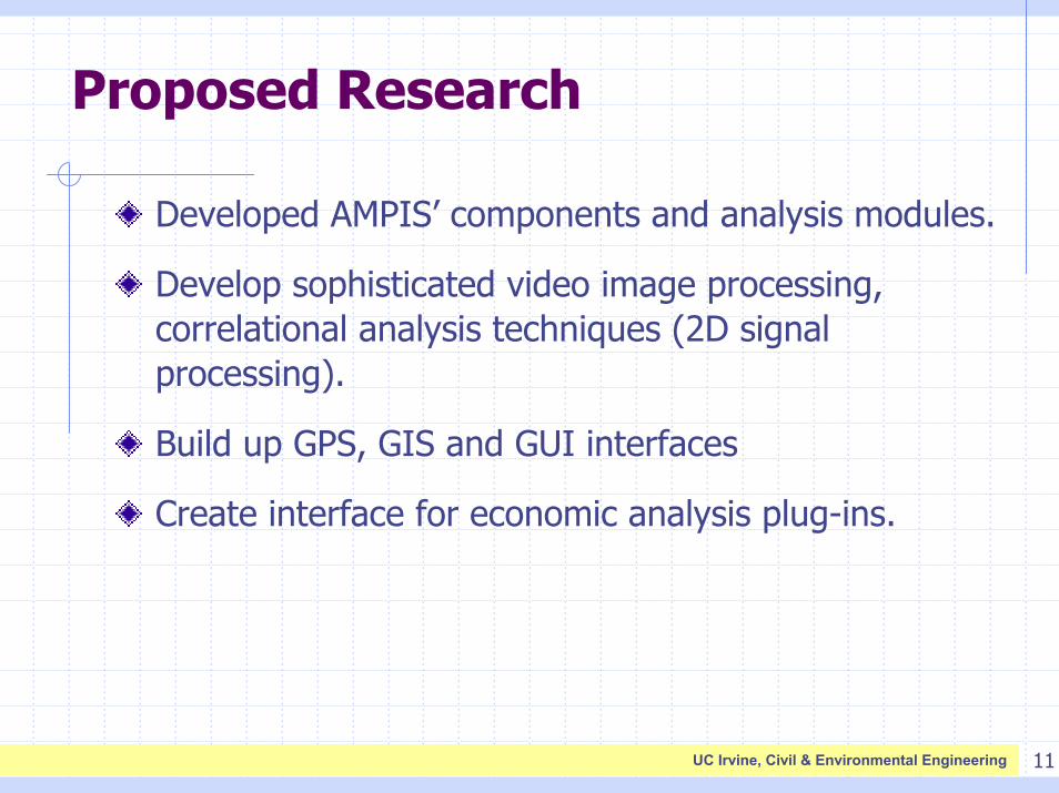
Proposed Research
Developed AMPIS’ components and analysis modules.
Develop sophisticated video image processing, correlational analysis techniques (2D signal processing).
Build up GPS, GIS and GUI interfaces
Create interface for economic analysis plug-ins.
12UC Irvine, Civil & Environmental Engineering
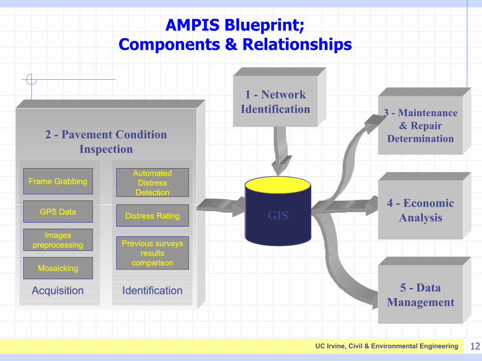
AMPIS Blueprint; Components & Relationships
Acquisition Identification
2 - Pavement Condition Inspection
AutomatedDistress
Detection
Distress Rating
Previous surveys results
comparisonMosaicking
Images preprocessing
GPS Data
Frame Grabbing
5 - Data Management
4 - Economic Analysis
1 - Network Identification 3 - Maintenance
& Repair Determination
GIS
13UC Irvine, Civil & Environmental Engineering
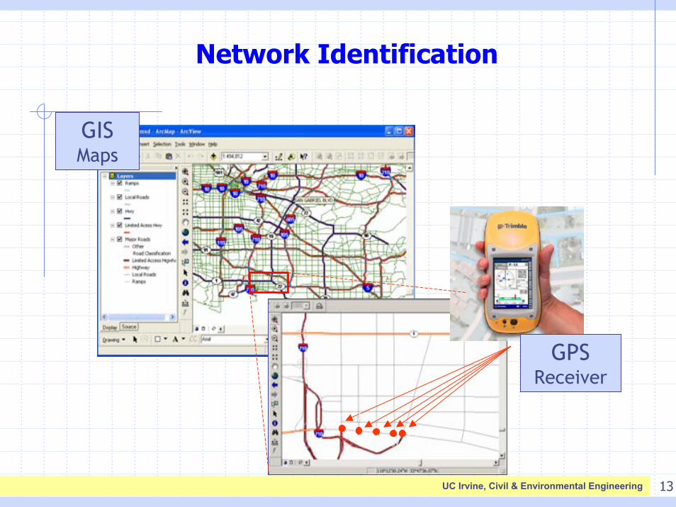
Network Identification
(x1,y1) (x2,y2)
(x3,y3) (x4,y4)(x5,y5)
GPS Receiver
GIS Maps
14UC Irvine, Civil & Environmental Engineering
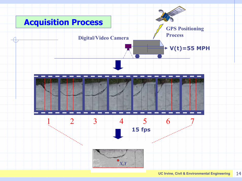
Acquisition ProcessGPS Positioning ProcessDigital/Video Camera
V(t)=55 MPH
1 2 6 7
X,Y
3 4 515 fps
15UC Irvine, Civil & Environmental Engineering
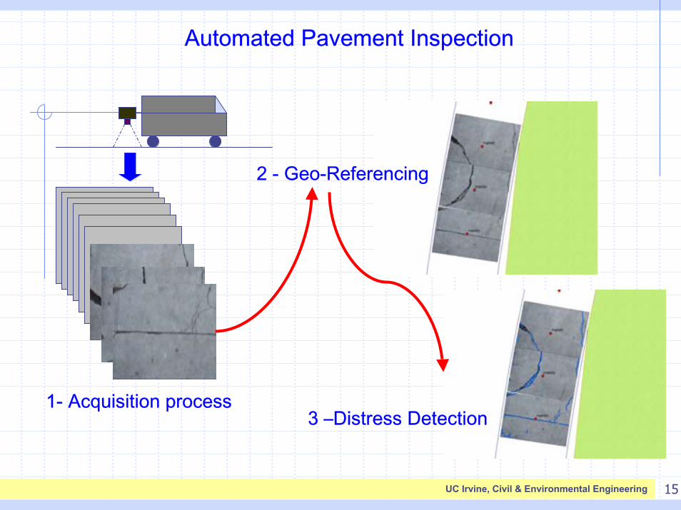
Automated Pavement Inspection
2 - Geo-Referencing
3 –Distress Detection1- Acquisition process
16UC Irvine, Civil & Environmental Engineering
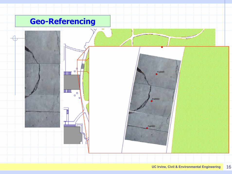
Geo-Referencing
17UC Irvine, Civil & Environmental Engineering
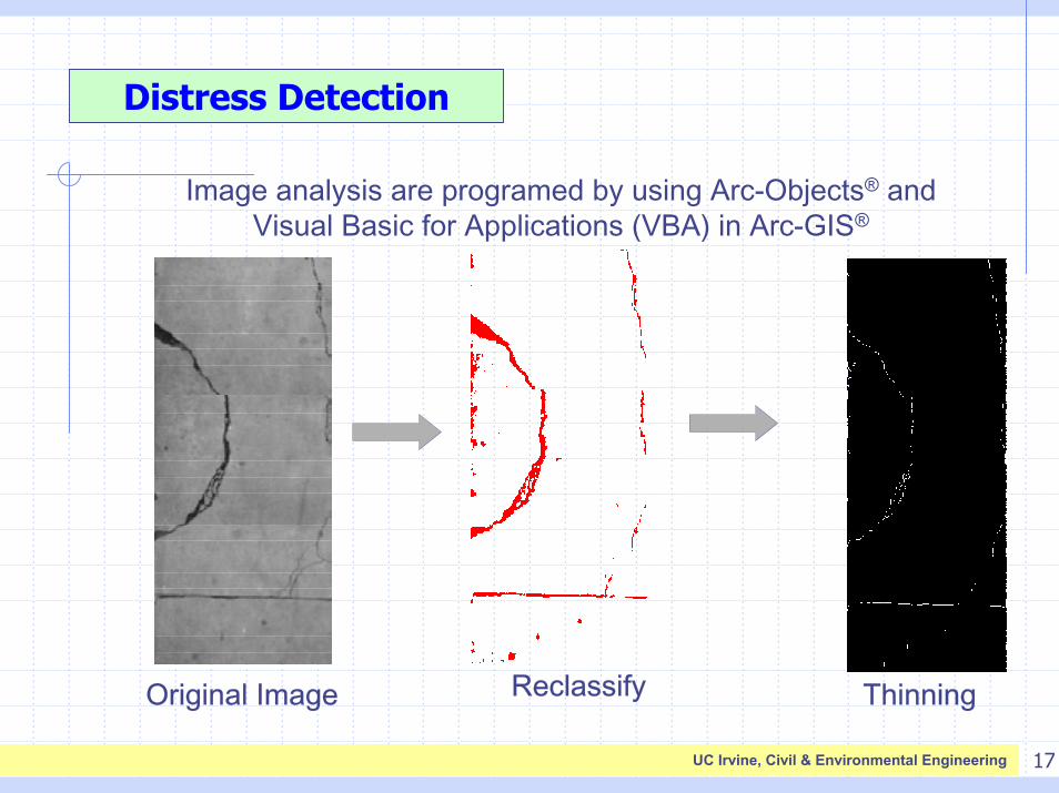
Distress Detection
Original Image Reclassify Thinning
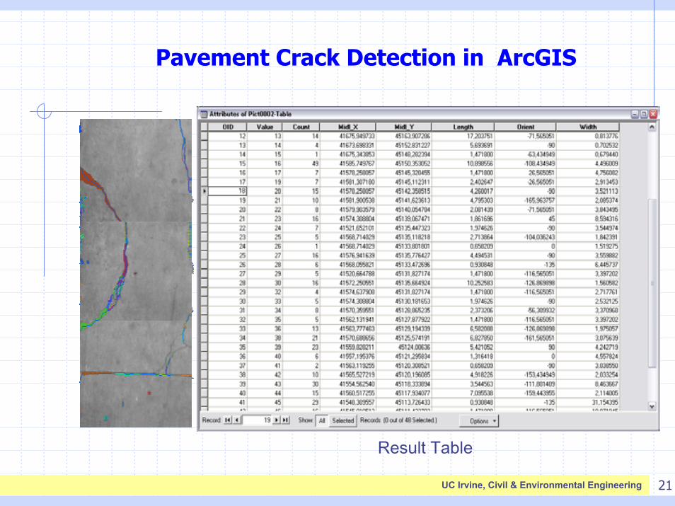
Image analysis are programed by using Arc-Objects® and Visual Basic for Applications (VBA) in Arc-GIS®
18UC Irvine, Civil & Environmental Engineering
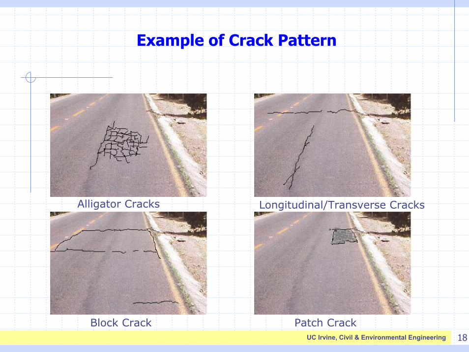
Example of Crack Pattern
Alligator Cracks Longitudinal/Transverse Cracks
Block Crack Patch Crack
19UC Irvine, Civil & Environmental Engineering
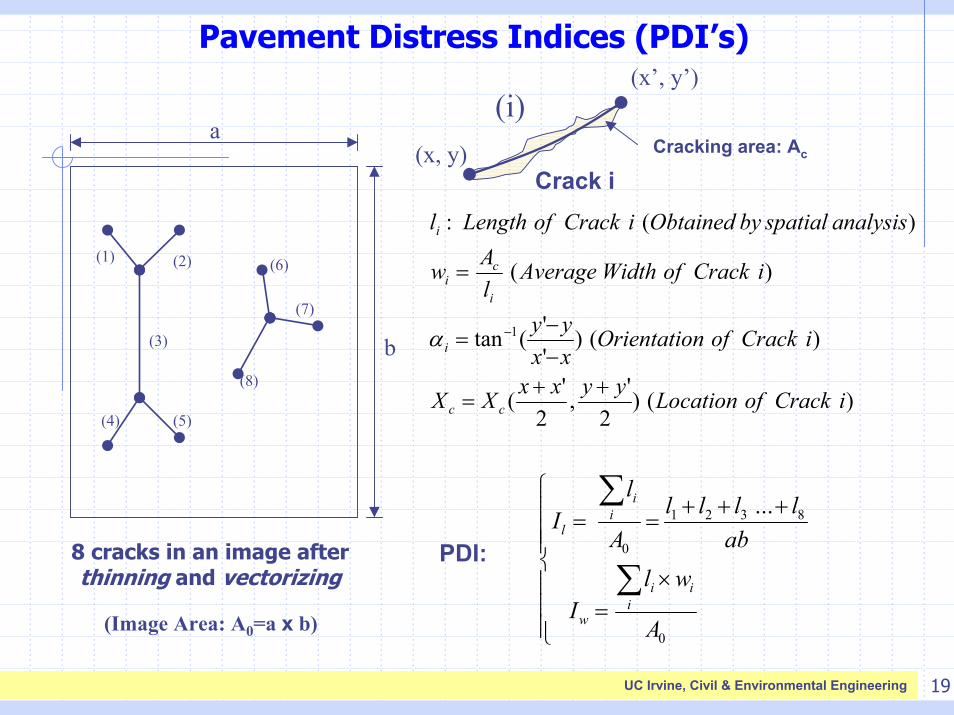
Pavement Distress Indices (PDI’s)
Crack i(x, y)
(i)(x’, y’)
(1) (2)
(3)
(4) (5)
(6)
(7)
(8)
aCracking area: Ac
)()2
',2
'(
)()''(tan
)(
)(:
1
iCrackofLocationyyxxXX
iCrackofnOrientatioxxyy
iCrackofWidthAveragelAw
analysisspatialbyObtainediCrackofLengthl
cc
i
i
ci
i
++=
−−
=
=
−αb
×=
+++==
∑
∑
0
8321
0
...
A
wlI
abllll
A
lI
ii
i
w
ii
l
8 cracks in an image after thinning and vectorizing
PDI:
(Image Area: A0=a x b)
20UC Irvine, Civil & Environmental Engineering
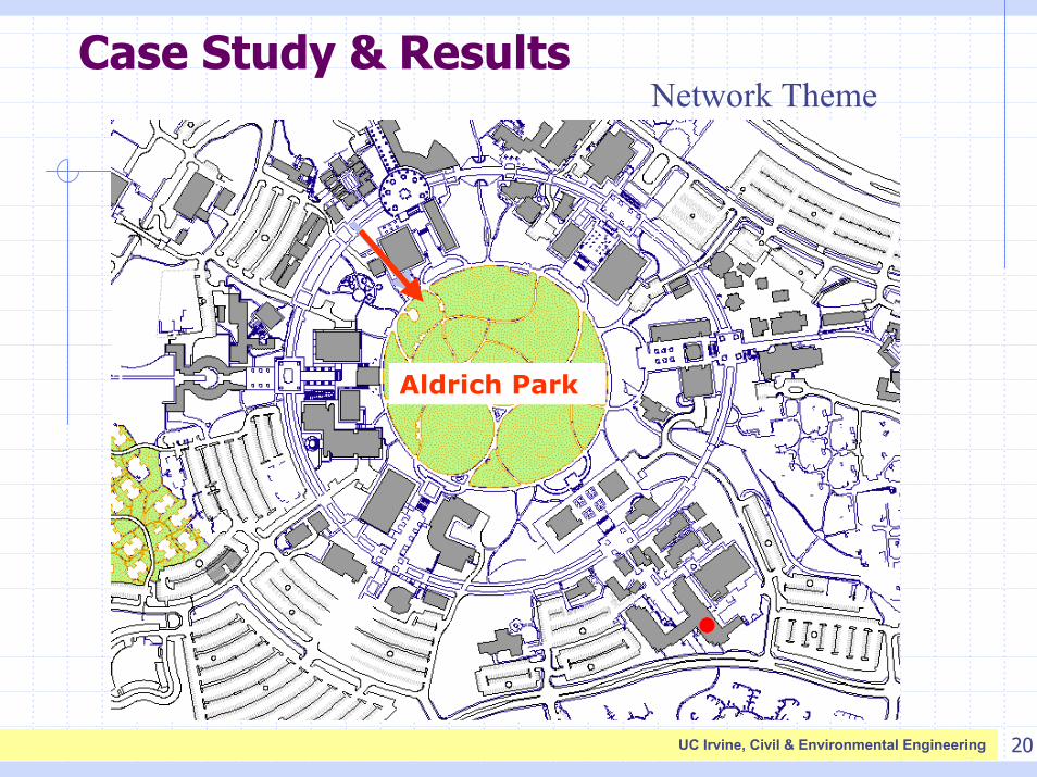
Case Study & ResultsNetwork Theme
Aldrich Park
21UC Irvine, Civil & Environmental Engineering
Pavement Crack Detection in ArcGIS
Base Layer
Crack Layer
Width Layer
Result Table
22UC Irvine, Civil & Environmental Engineering
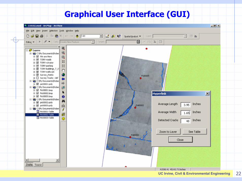
Graphical User Interface (GUI)
23UC Irvine, Civil & Environmental Engineering
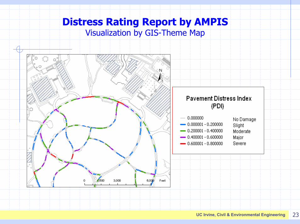
Distress Rating Report by AMPISVisualization by GIS-Theme Map
24UC Irvine, Civil & Environmental Engineering
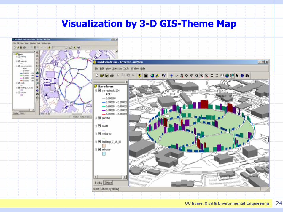
Visualization by 3-D GIS-Theme Map
25UC Irvine, Civil & Environmental Engineering
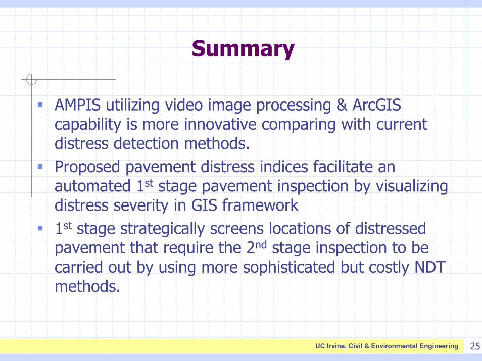
Summary
AMPIS utilizing video image processing & ArcGIS capability is more innovative comparing with current distress detection methods.Proposed pavement distress indices facilitate an automated 1st stage pavement inspection by visualizing distress severity in GIS framework1st stage strategically screens locations of distressed pavement that require the 2nd stage inspection to be carried out by using more sophisticated but costly NDT methods.
26UC Irvine, Civil & Environmental Engineering
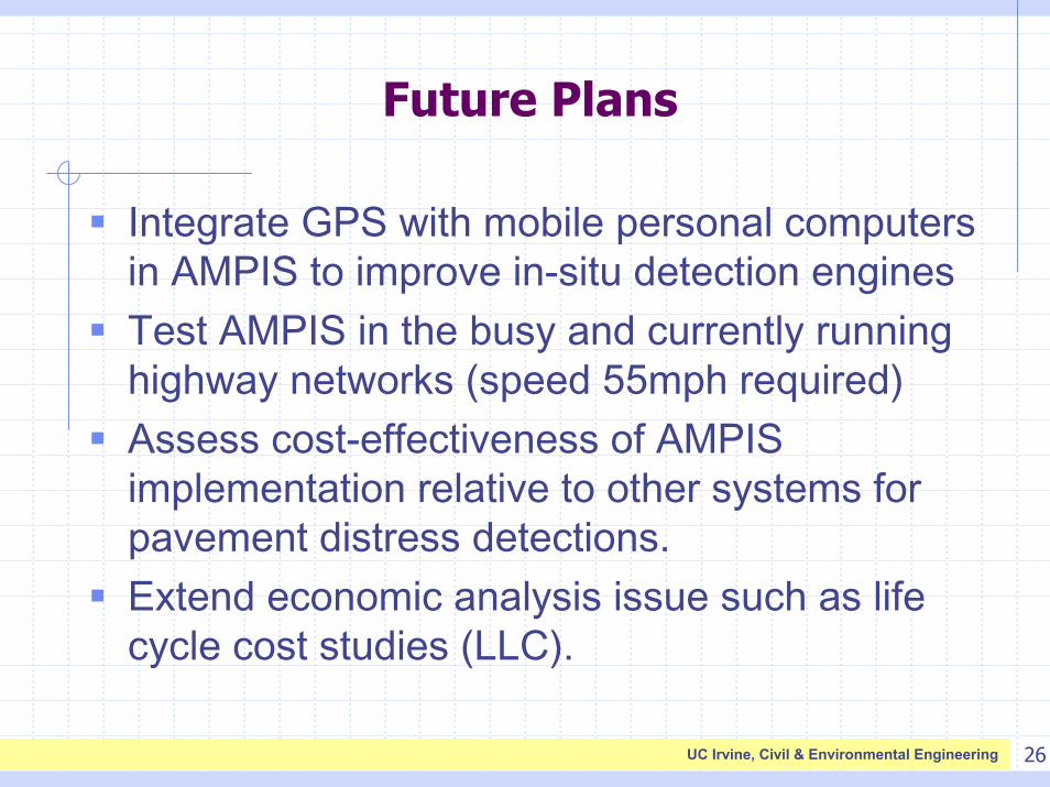
Future Plans
Integrate GPS with mobile personal computers in AMPIS to improve in-situ detection enginesTest AMPIS in the busy and currently running highway networks (speed 55mph required)Assess cost-effectiveness of AMPIS implementation relative to other systems for pavement distress detections. Extend economic analysis issue such as life cycle cost studies (LLC).
27UC Irvine, Civil & Environmental Engineering
Acknowledgement
This research is supported by the National Science Foundation (NSF) through the Multidisciplinary Center for Earthquake Engineering Research (MCEER), and also by California State Department of Transportation (Caltrans).
28UC Irvine, Civil & Environmental Engineering
References
M. Shinozuka, H. Chung, J. Liang, M. Ichitsubo, (2001), “System identification by Video Image Processing”, Proceedings of the 48th SPIE Symposium on Smart Structures and Materials, Newport Beach, March 4-8, 2001, CA.
M. Shinozuka, M. Ichitsubo, (2002), “A Study on Automation of Pavement Surface Distress Detection”, Technical Report, Kure National College of Technology, Printed in Japanese.
TM 5-623, Department of the Army, Technical Manual, Technical Maintenance Management, November, 1982.
K. C. Wang, (2000), “Design and Implementations of Automated Systems for Pavement Surface Distress Survey”, ASCE Journal of Infrastructure Systems, pp. 24-32.
Chung, H-C., Shinozuka, M., Soeller, T. and Girardello, R., (2003). “GIS-based AMPIS for Highway Surface Health Inspection and Management”, Submitted to ASCE Journal of Infrastructure Systems.

AMPIS Supplementary Slides
30UC Irvine, Civil & Environmental Engineering
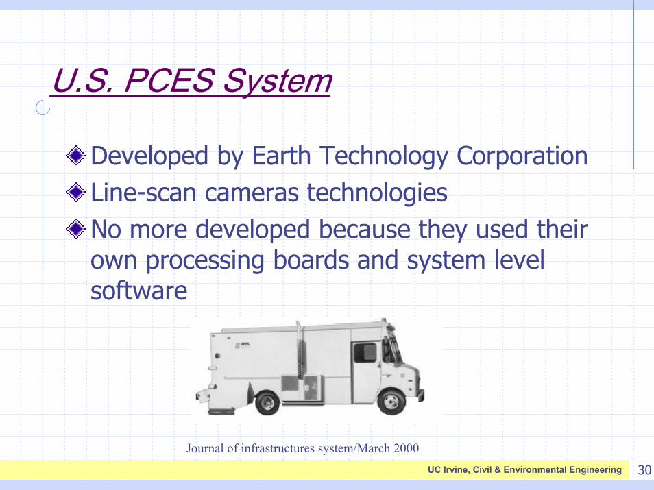
U.S. PCES System
Developed by Earth Technology CorporationLine-scan cameras technologiesNo more developed because they used their own processing boards and system level software
Journal of infrastructures system/March 2000
31UC Irvine, Civil & Environmental Engineering
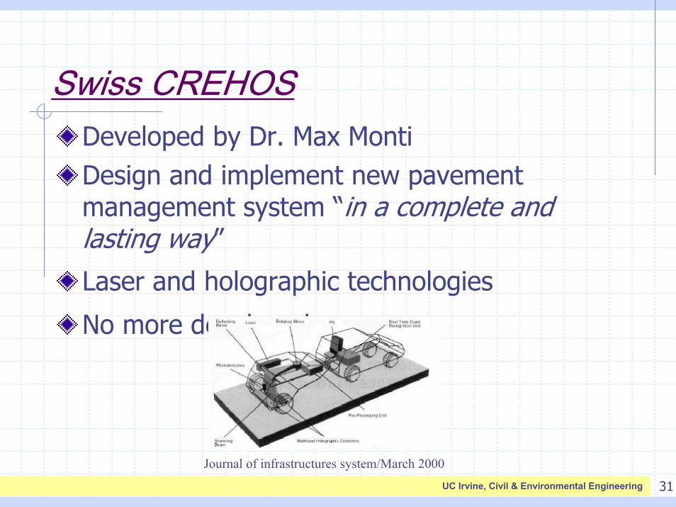
Swiss CREHOSDeveloped by Dr. Max MontiDesign and implement new pavement management system “in a complete and lasting way”
Laser and holographic technologies
No more developed
Journal of infrastructures system/March 2000
32UC Irvine, Civil & Environmental Engineering
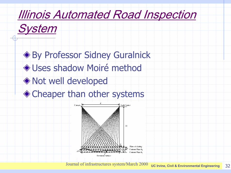
Illinois Automated Road Inspection System
By Professor Sidney GuralnickUses shadow Moiré methodNot well developedCheaper than other systems
Journal of infrastructures system/March 2000
33UC Irvine, Civil & Environmental Engineering
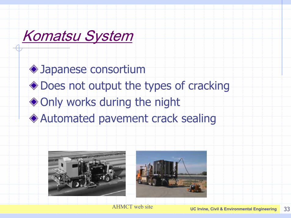
Komatsu System
Japanese consortiumDoes not output the types of crackingOnly works during the nightAutomated pavement crack sealing
AHMCT web site
34UC Irvine, Civil & Environmental Engineering
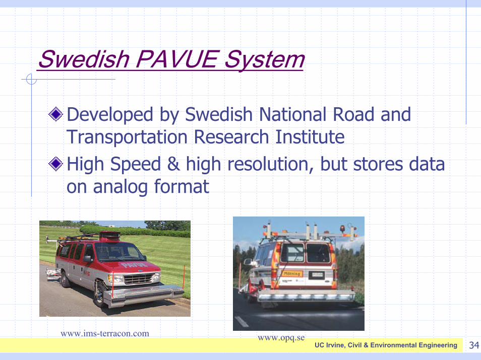
Swedish PAVUE System
Developed by Swedish National Road and Transportation Research InstituteHigh Speed & high resolution, but stores data on analog format
www.opq.sewww.ims-terracon.com
35UC Irvine, Civil & Environmental Engineering
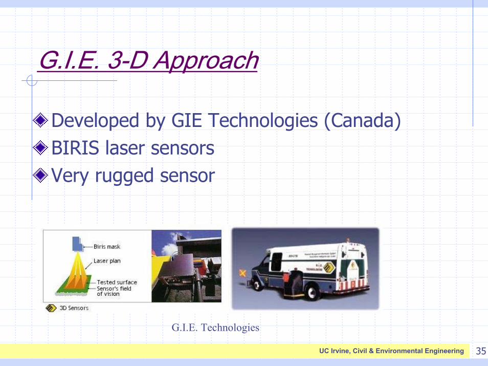
G.I.E. 3-D Approach
Developed by GIE Technologies (Canada)BIRIS laser sensorsVery rugged sensor
G.I.E. Technologies
36UC Irvine, Civil & Environmental Engineering
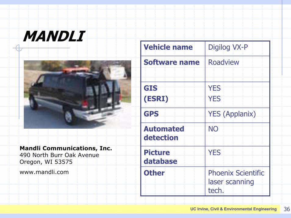
MANDLI
Phoenix Scientific laser scanning tech.
Other
YESPicture database
NOAutomated detection
YES (Applanix)GPS
YESYES
GIS (ESRI)
RoadviewSoftware name
Digilog VX-PVehicle name
Mandli Communications, Inc.490 North Burr Oak AvenueOregon, WI 53575
www.mandli.com
37UC Irvine, Civil & Environmental Engineering
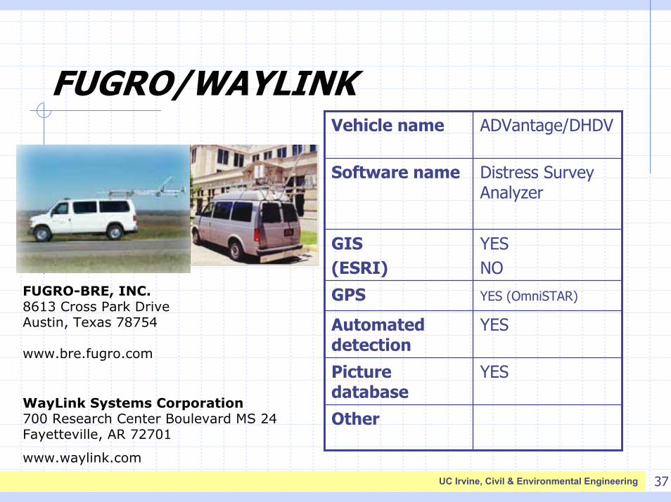
FUGRO/WAYLINK
Other
YESPicture database
YES Automated detection
YES (OmniSTAR)GPS
YESNO
GIS (ESRI)
Distress Survey Analyzer
Software name
ADVantage/DHDVVehicle name
FUGRO-BRE, INC.8613 Cross Park DriveAustin, Texas 78754
www.bre.fugro.com
WayLink Systems Corporation700 Research Center Boulevard MS 24Fayetteville, AR 72701
www.waylink.com
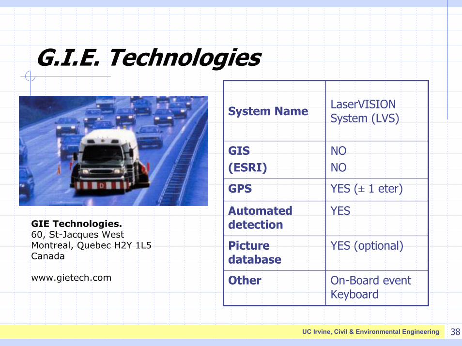
38UC Irvine, Civil & Environmental Engineering
G.I.E. Technologies
On-Board event Keyboard
Other
YES (optional)Picture database
YES Automated detection
YES (± 1 eter)GPS
NONO
GIS (ESRI)
LaserVISIONSystem (LVS)System Name
GIE Technologies.60, St-Jacques West Montreal, Quebec H2Y 1L5 Canada
www.gietech.com
39UC Irvine, Civil & Environmental Engineering
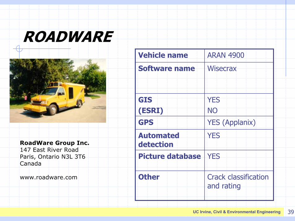
ROADWARE
Crack classification and rating
Other
YESPicture database
YES Automated detection
YES (Applanix)GPS
YESNO
GIS (ESRI)
WisecraxSoftware name
ARAN 4900Vehicle name
RoadWare Group Inc.147 East River RoadParis, Ontario N3L 3T6 Canada
www.roadware.com
40UC Irvine, Civil & Environmental Engineering
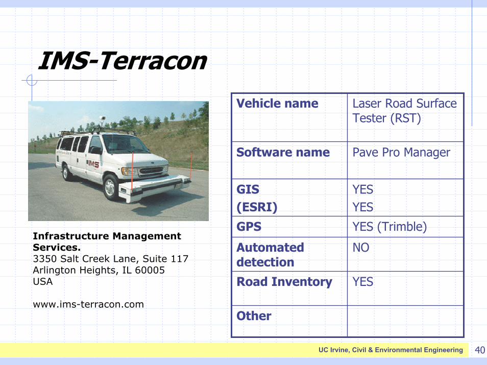
IMS-Terracon
Other
YESRoad Inventory
NO Automated detection
YES (Trimble)GPS
YESYES
GIS (ESRI)
Pave Pro ManagerSoftware name
Laser Road Surface Tester (RST)
Vehicle name
Infrastructure Management Services.3350 Salt Creek Lane, Suite 117 Arlington Heights, IL 60005 USA
www.ims-terracon.com
41UC Irvine, Civil & Environmental Engineering
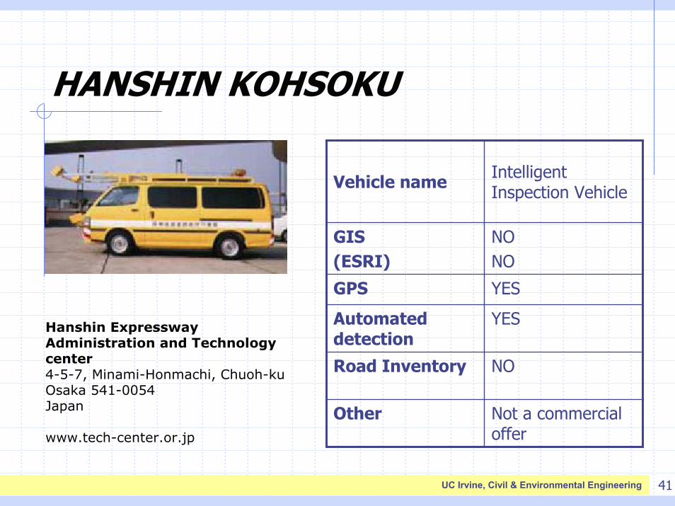
HANSHIN KOHSOKU
Hanshin Expressway Administration and Technology center4-5-7, Minami-Honmachi, Chuoh-kuOsaka 541-0054 Japan
www.tech-center.or.jp
Not a commercial offer
Other
NORoad Inventory
YES Automated detection
YES GPS
NONO
GIS (ESRI)
Intelligent Inspection VehicleVehicle name
42UC Irvine, Civil & Environmental Engineering
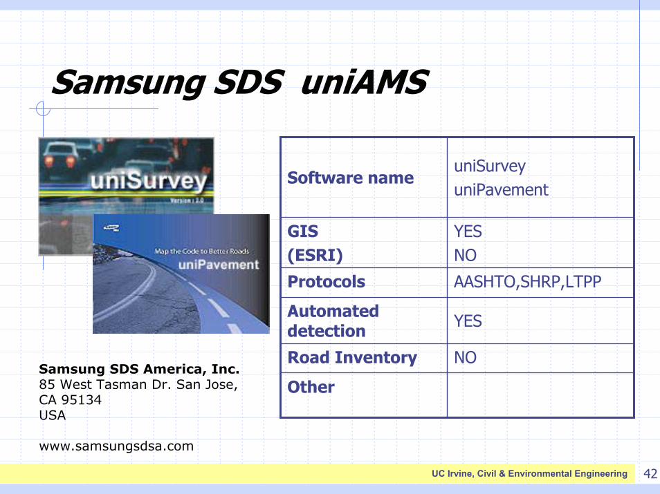
Samsung SDS uniAMS
Samsung SDS America, Inc.85 West Tasman Dr. San Jose, CA 95134 USA
www.samsungsdsa.com
Other
NORoad Inventory
YES Automated detection
AASHTO,SHRP,LTPPProtocols
YESNO
GIS (ESRI)
uniSurveyuniPavement
Software name
43UC Irvine, Civil & Environmental Engineering
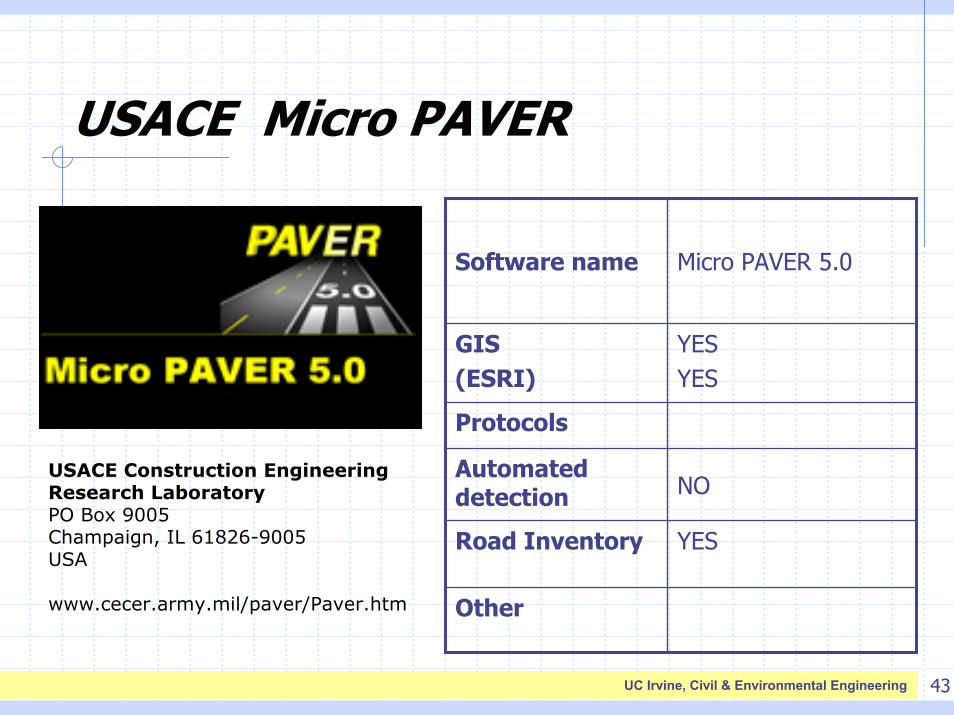
USACE Micro PAVER
USACE Construction Engineering Research LaboratoryPO Box 9005 Champaign, IL 61826-9005 USA
www.cecer.army.mil/paver/Paver.htm
Other
YESRoad Inventory
NO Automated detection
Protocols
YESYES
GIS (ESRI)
Micro PAVER 5.0Software name