Embed Size (px)
Citation preview
Autodesk® Topobase™
See the big picture.
Make Better Decisions
By providing an integrated view of CAD, asset, GIS, and customer information, Autodesk® Topobase™ software helps improve inefficient processes and data quality, while enabling you to share up-to-date spatial information throughout your organization.
Infrastructure Design and ManagementAutodesk Topobase infrastructure model management software helps to provide more accurate information about the location and status of your assets throughout your organization. Built on AutoCAD® Map 3D software, Autodesk MapGuide® Enterprise software, and Oracle® software, Topobase helps you improve efficiency by consolidating isolated stores of computer-aided design (CAD) and geographical information system (GIS) data into a central spatial information database.
As a result, Topobase helps free you from time-consuming manual steps and conversion processes that often introduce mistakes and reduce precision.
Topobase is an integrated system that helps manage events that take place during the entire lifecycle of your assets. For example, when your organization needs to replace an aging section of water utility pipe, with help from Topobase, engineers are able to create construction plans
for the project, determine which residents must be notified, and schedule the work. Field staff replace the pipe and engineers add relevant as-built information and register the project as complete—all within a single software environment.
More Flexible, Open ArchitectureAutodesk Topobase is an open framework that adheres to the specifications set forth by the Open Geospatial Consortium (OGC) and is designed for easier customization. As a result, Topobase supports specific data requirements and business processes—data fields, workflows, business rules, dialog boxes, and user access permissions—without software programming or database expertise.
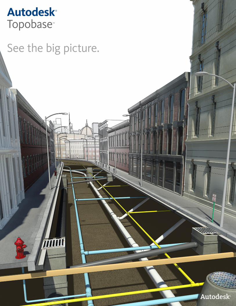
The spatial information managed by Topobase can be integrated with most existing business systems using standard IT tools, without the need for expensive proprietary tools or middleware. Topobase helps make it easier to consolidate spatial information with data from customer relationship management (CRM), GIS, or other enterprise systems, providing a more comprehensive view of your infrastructure.
Used Around the World
Australia:MidCoast Water
Canada:Innisfil Hydro
Germany:ÜZ LülsfeldHenkelStadtwerke GmbH and Stadtische BetriebeFulda Gas and Water Supply
Hungary:Bácsvíz Zrt.Budapest District Land Office
Sweden:Tekis
Switzerland:City of ChurIndustrielle Werke BaselRomande EnergieRhaetian Railway
United States:Las Vegas Valley Water DistrictKansas City Board of Public UtilitiesSt. Paul Department of Public Works
Improve Responsiveness
Provide field forces with the information they need to help resolve service requests quickly.
Quicker Return on InvestmentAutodesk Topobase provides industry-specific modules for managing infrastructure assets, helping enable more rapid implementation and a quick return on investment.
Each module—water, wastewater, gas, electric and land—includes a detailed data model that can be configured to better capture the exact information you need regarding your infrastructure assets. Workflows help reduce steps when designing new infrastructure, and business rules provide more security and consistency as users in separate departments update the database. And the multiple display models enable each user to view the information with the scale, symbols, and formatting most relevant to them.
Improve Processes and Data AccessPurchased by utilities, municipalities, and government agencies that manage electricity, gas, water, sewer, land, road, and rail infrastructure assets, Autodesk Topobase is used in more than 500 companies worldwide.
With help from Topobase, organizations can integrate CAD and GIS information into an infrastructure model for a more comprehensive view of their assets; improve efficiency and data quality by minimizing manual data input and standardizing data capture processes; and use Autodesk® design information throughout the infrastructure asset life cycle. In addition, the software provides secure access to CAD, GIS, and asset information to departments that may not have had access before, such as field operations, customer service, and finance.
Consulting Services from the ExpertsTo help you get more from your investment, Autodesk offers consulting and partner services to help implement Topobase more quickly and successfully. Autodesk Consulting and partner services can assist you with data migration, configuration, implementation of local standards, and interfacing with existing systems.
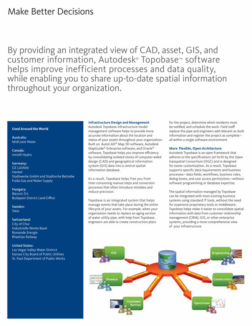
Autodesk Topobase infrastructure model management software provides visibility into valuable design, GIS, and asset data. A single source of information helps reduce operational roadblocks by enabling users to access the data they need, when they need it.

With network data integrated into one system, we’ve got the information we need to quickly approve new solar and wind hookups all in one easy-to-use location. What used to take several days up or up to two weeks can now be accomplished for our customers in a few hours. — Artur Brei GIS & Documentation Manager ÜZ Lülsfeld
Learn More or PurchaseAccess specialists worldwide who can provide product expertise, a deepunderstanding of your industry, and value that extends beyond your softwarepurchase. To purchase Autodesk Topobase software, contact an AutodeskPremier Solutions Provider or Autodesk Authorized Reseller. Locate a resellernear you at www.autodesk.com/reseller.
Autodesk Learning and EducationFrom instructor-led or self-paced classes to online training or educationresources, Autodesk offers learning solutions to fit your needs. Get expertguidance at an Autodesk Authorized Training Center (ATC®) site, access learning tools online or at your local bookstore, and validate your experience with Autodesk certifications. Learn more at www.autodesk.com/learning.
Autodesk Services and SupportHelp accelerate return on investment and optimize productivity with companion products, consulting services, and support from Autodesk and Autodesk authorized partners. Designed to get you up to speed and keep you ahead of the competition, these tools help you make the most of your software—no matter what industry you are in. Learn more www.autodesk.com/servicesandsupport.
Autodesk SubscriptionAutodesk® Subscription gives you immediate access to software upgrades and exclusive access to service and support benefits designed to help you get the most out of your Autodesk software. Learn more www.autodesk.com/subscription.
This brochure is printed on 100 percent postconsumer waste recycled paper.
Autodesk, AutoCAD, ATC, Autodesk MapGuide, and Topobase are registered trademarks or trademarks of Autodesk, Inc., and/or its subsidiaries and/or affiliates in the USA and/or other countries. All other brand names, product names, or trademarks belong to their respective holders. Autodesk reserves the right to alter product and services offerings, and specifications and pricing at any time without notice, and is not responsible for typographical or graphical errors that may appear in this document. © 2010 Autodesk, Inc. All rights reserved. BR0C1-000000-MZ41