Embed Size (px)
Citation preview
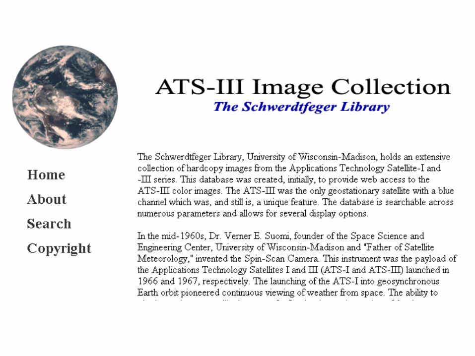
ATS-III: Making the Images Available
Jean PhillipsSchwerdtfeger Library, Space Science and Engineering Center
University of Wisconsin-Madison
ASLI Conference, 12-13 January 2005, San Diego, CA
Discussion Threads
• The Spin-Scan Camera Idea
• Spin-Scan Camera on ATS-I
• Spin-Scan Camera on ATS-III
• Database, ATS Image Classification
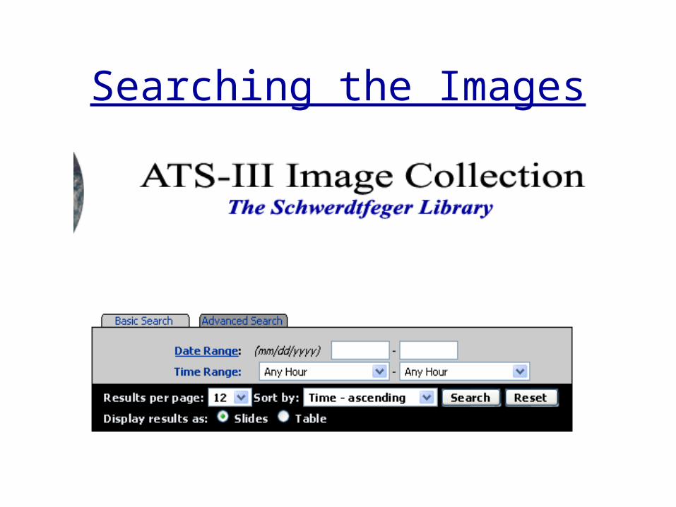
• Searching the Images
• Conclusion
The Spin-Scan Camera Idea
• Verner Suomi, Father of Satellite Meteorology
• Payload of ATS-I, 1966
• Payload of ATS-III, 1967
• Pioneered continuous viewing of weather from space
Camera Idea, cont.
• Suomi understood benefits of observing single weather events at frequent intervals
• These observations not possible with polar orbiting satellites
• NASA’s new geostationary satellite, Applications Technology Satellite (ATS)
Camera Idea, cont.
• “The weather moves, not the satellite” (Suomi)• Suomi used the spin of the satellite to scan the
earth – 2400 satellite revolutions needed to produce one Earth image
• The camera scanned a small strip of the Earth with each rotation, tilting slightly for the next rotation (or line of the picture)
• Image of Earth created in about 20 minutes
Camera Idea, cont.
• Spin-Scan Camera allowed scientists to observe weather systems as they developed
• A concept that revolutionized satellite meteorology
• Weather satellite images and “movies” of weather in motion were seen on the news as a result of Suomi’s invention
• The technology soon became operational – it was now possible to track air motion, cloud heights, rainfall, natural disasters and other weather events
Spin-Scan Cloud Camera on ATS-I
• Dr. Suomi was the PI for the ATS-I Spin-Scan Cloudcover Camera (SSCC) Experiment
• Launched on 7 December 1966 and among other things, was designed to collect and relay cloudcover pictures
• ATS-I spacecraft was a cylinder 54” long and 57.6” in diameter
• Experiment successful through 16 October 1972 (From: The Applications Technology Satellite Meteorological Data Catalog: Volume I)
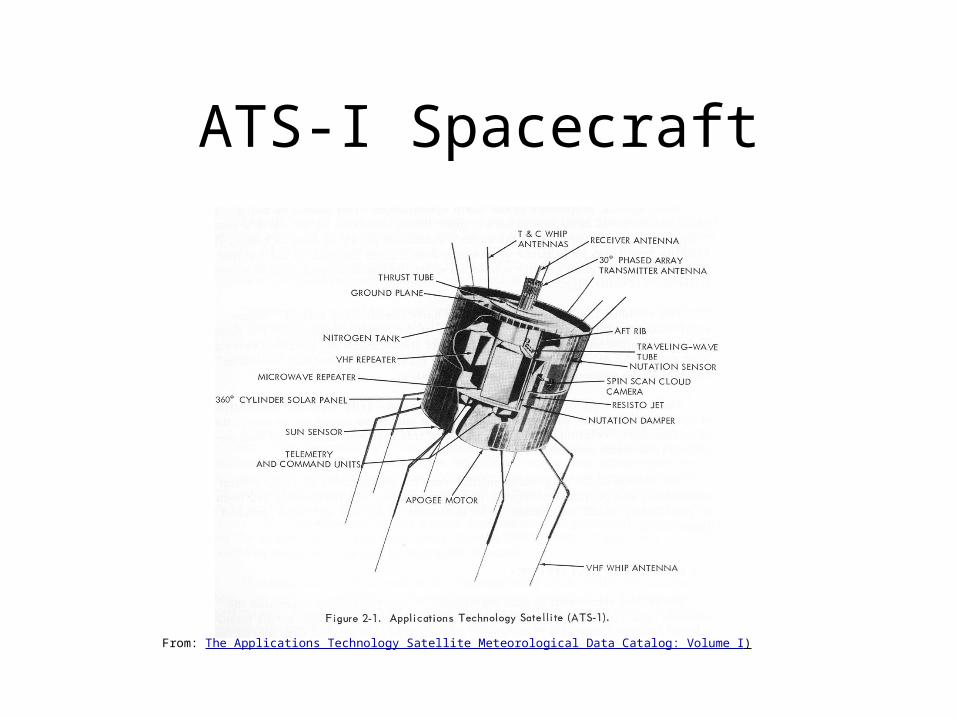
ATS-I Spacecraft
From: The Applications Technology Satellite Meteorological Data Catalog: Volume I)
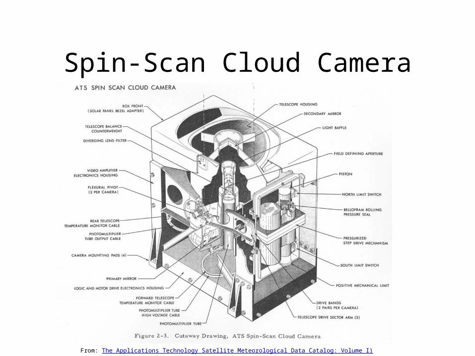
Spin-Scan Cloud Camera
From: The Applications Technology Satellite Meteorological Data Catalog: Volume I)
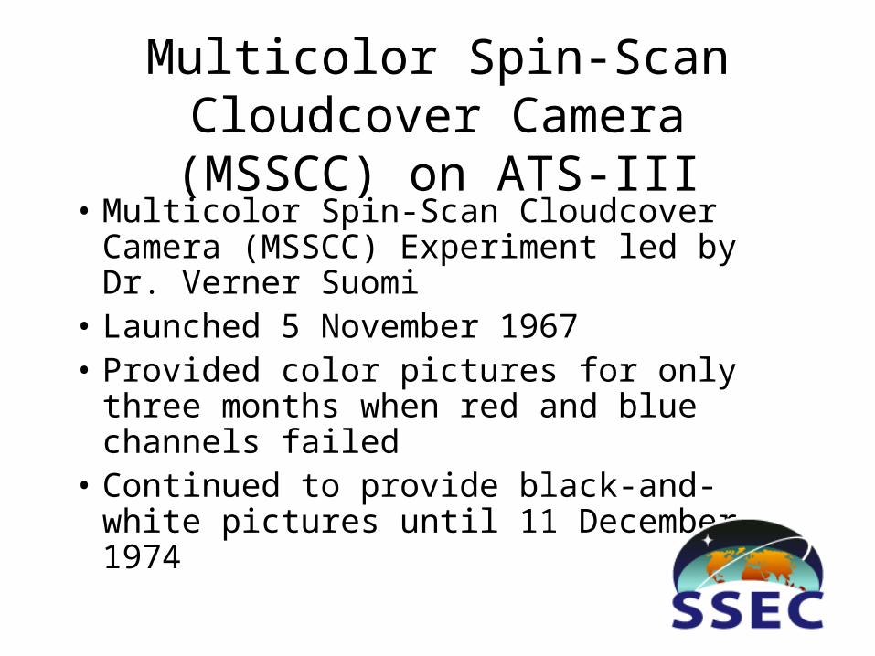
Multicolor Spin-Scan Cloudcover Camera (MSSCC) on ATS-III
• Multicolor Spin-Scan Cloudcover Camera (MSSCC) Experiment led by Dr. Verner Suomi
• Launched 5 November 1967• Provided color pictures for only three
months when red and blue channels failed• Continued to provide black-and-white
pictures until 11 December 1974
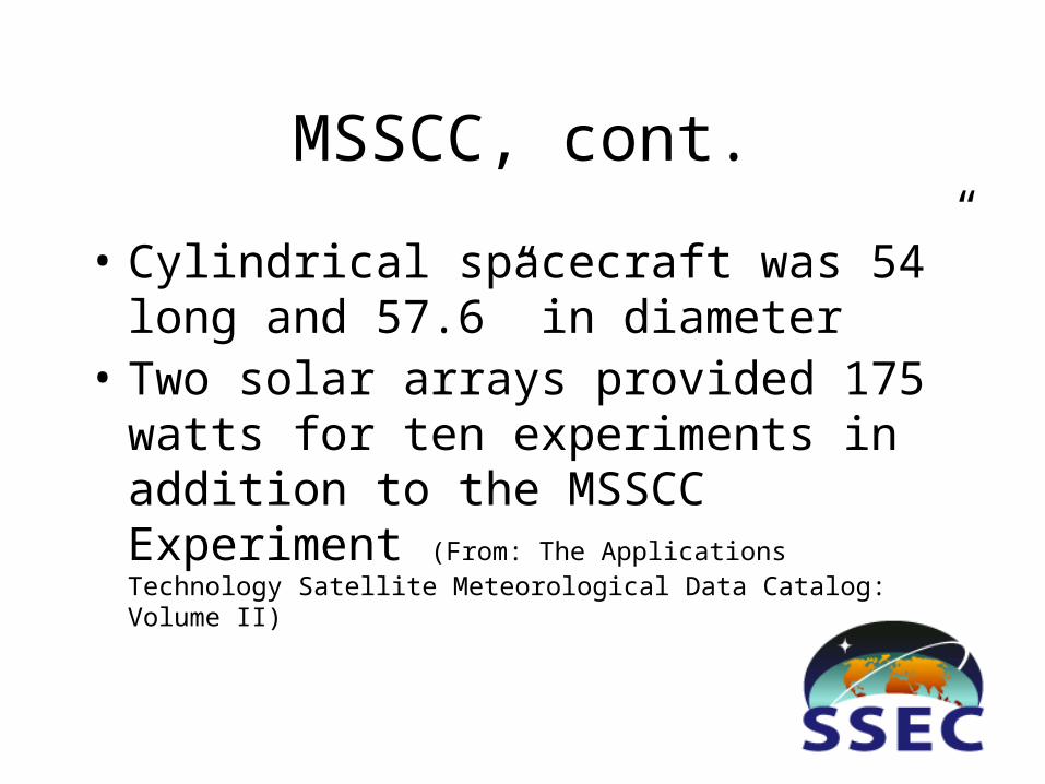
MSSCC, cont.
• Cylindrical spacecraft was 54” long and 57.6” in diameter
• Two solar arrays provided 175 watts for ten experiments in addition to the MSSCC Experiment (From: The Applications Technology Satellite Meteorological Data Catalog: Volume II)
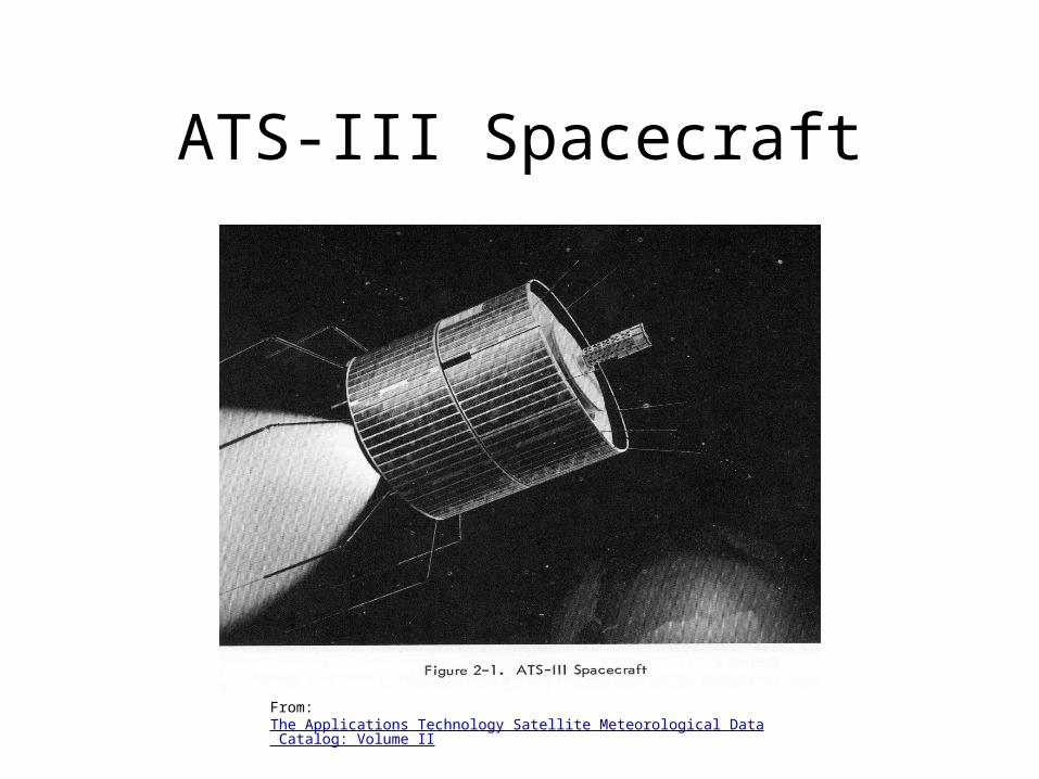
ATS-III Spacecraft
From: The Applications Technology Satellite Meteorological Data Catalog: Volume II
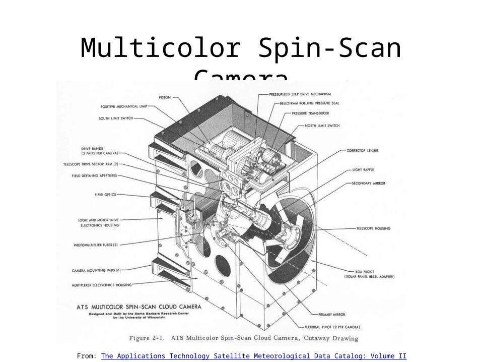
Multicolor Spin-Scan Camera
From: The Applications Technology Satellite Meteorological Data Catalog: Volume II
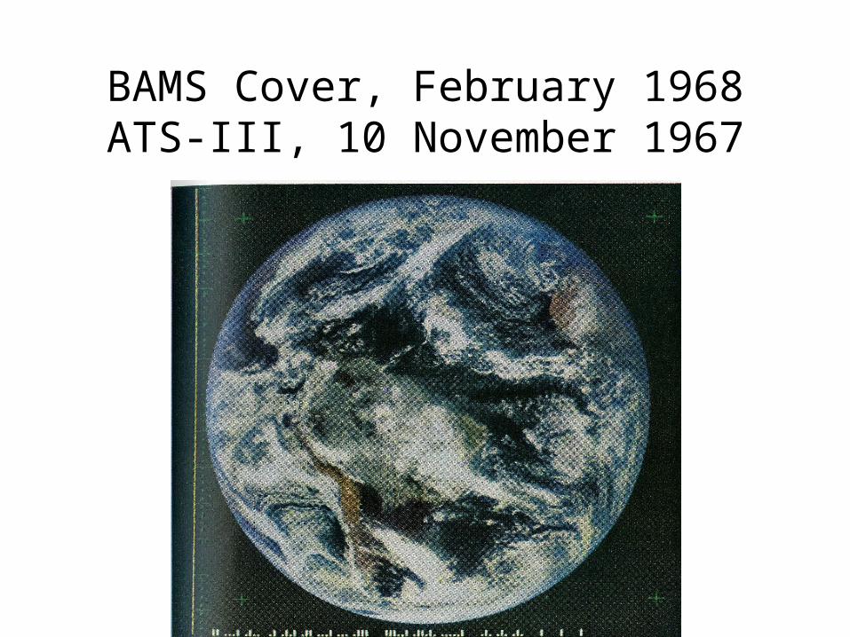
BAMS Cover, February 1968ATS-III, 10 November 1967
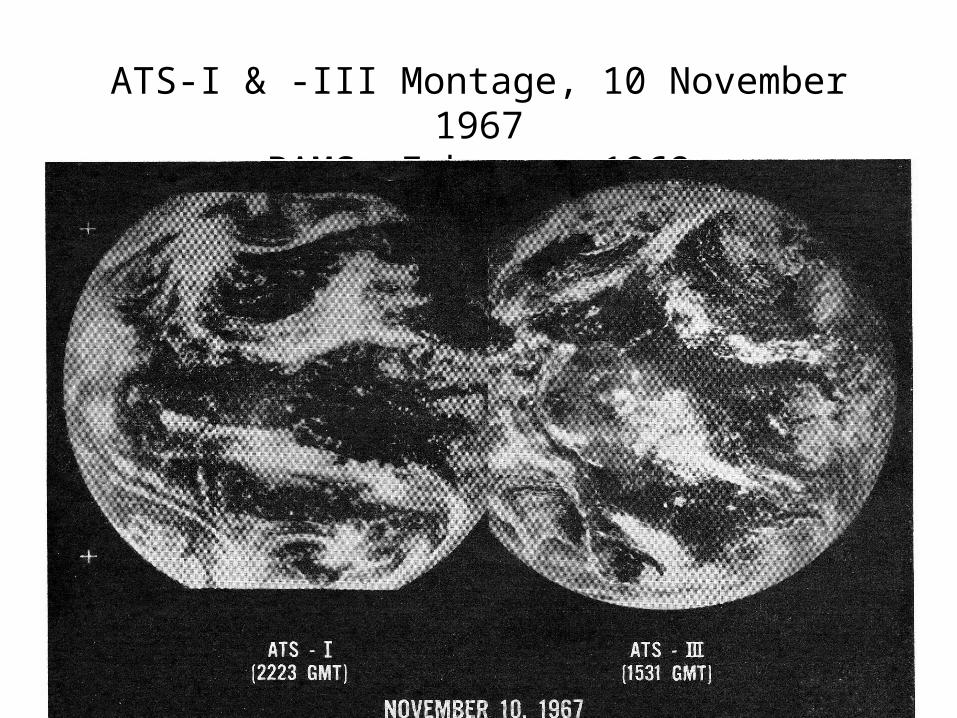
ATS-I & -III Montage, 10 November 1967BAMS, February 1968
MSSCC, cont.
• Purpose of adding color was to help estimate the altitudes of cloud tops
• The red/blue channel ratio along with zenith angle is used to calculate cloud altitude
• Color gives better contrast between clouds and background
• ATS-III camera capable of full disk Earth images which is aesthetically more pleasing
• ATS-III provided first useful color photography from this altitude (From: BAMS, v.49, no.2, February 1968, pp74-83)
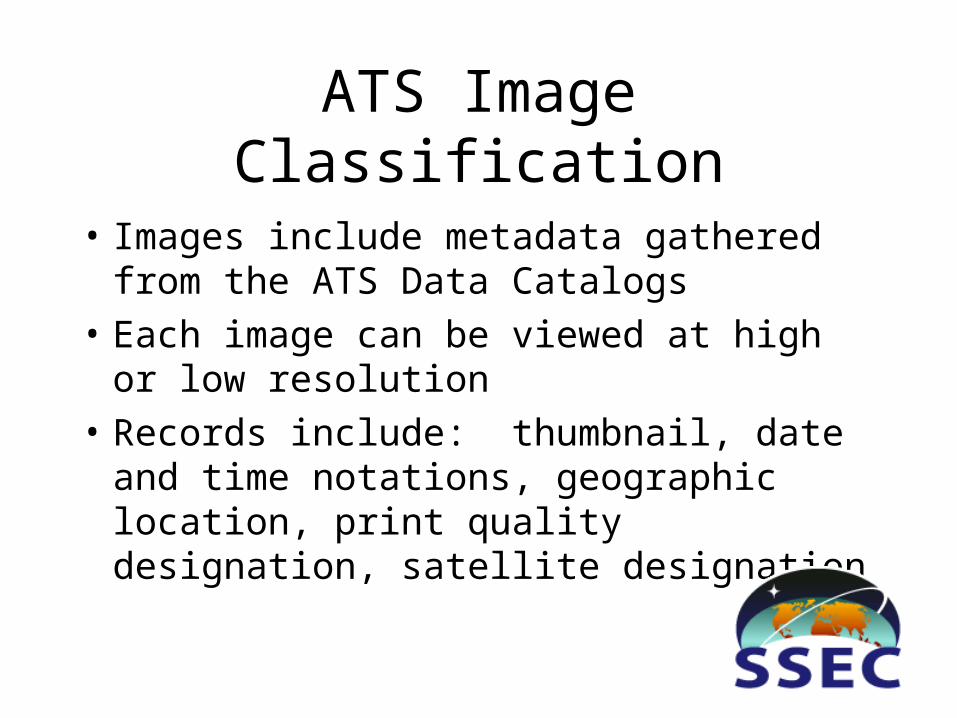
ATS Image Classification
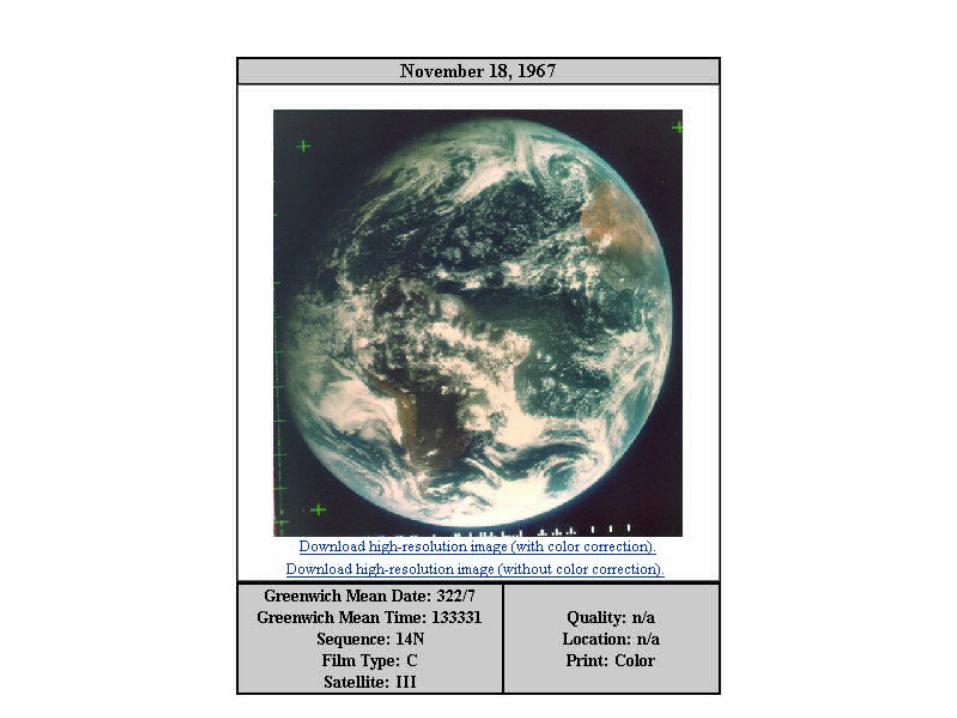
• Images include metadata gathered from the ATS Data Catalogs
• Each image can be viewed at high or low resolution
• Records include: thumbnail, date and time notations, geographic location, print quality designation, satellite designation
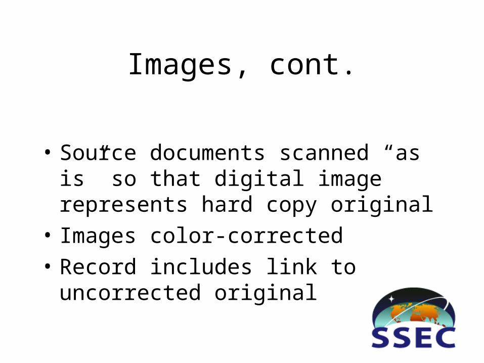
Images, cont.
• Source documents scanned “as is” so that digital image represents hard copy original
• Images color-corrected
• Record includes link to uncorrected original
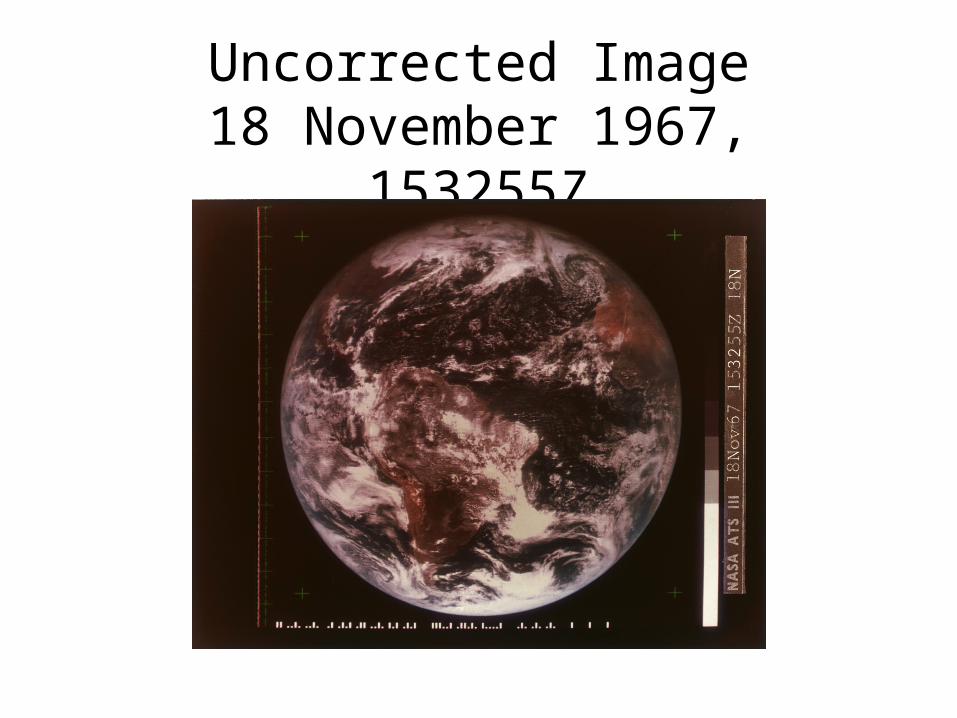
Uncorrected Image18 November 1967, 153255Z
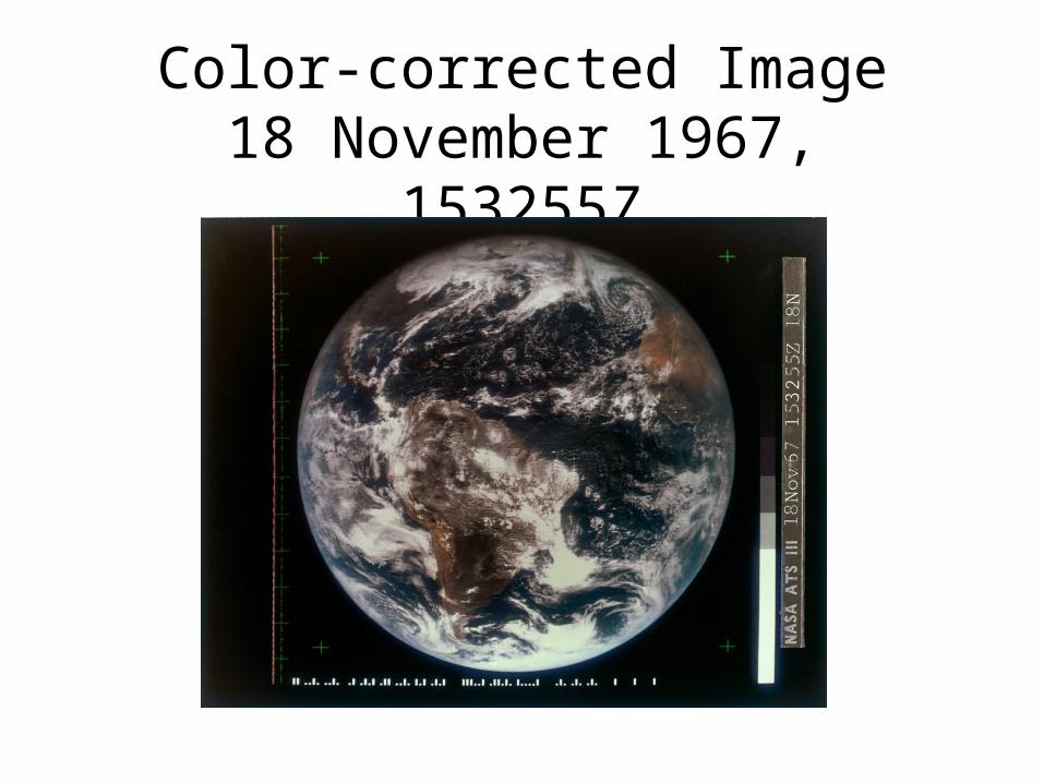
Color-corrected Image18 November 1967, 153255Z
Searching, cont.
• Search parameters: date and time range, image quality, and geographic locations
• http://library.ssec.wisc.edu/spinscan
Why Bother?
• First true color images from a geostationary satellite, capturing frequent weather observations over large fraction of Earth’s surface
• After it became operational, the technology improved the accuracy of forecasting
• Adopted for many satellites built for NASA, NOAA, ESA, Japanese Meteorological Agency, Chinese National Satellite Meteorological Center
• Physical collection is degrading, needs preservation, and is difficult to use
• Electronic files no longer available• Extends available climate data set to pre-SMS,
allowing scientists to study weather history over a longer baseline
• Legacy of Dr. Verner E. Suomi