Embed Size (px)
Citation preview
ATIS Wireless Location Services (LS) Update
DOCUMENT #: GSC13-GRSC6-20r1
FOR: Presentation
SOURCE: ATIS
AGENDA ITEM: GRSC; Location Services; 4.1
CONTACT(S): Don Zelmer ([email protected])
Submission Date:July 16, 2008
2
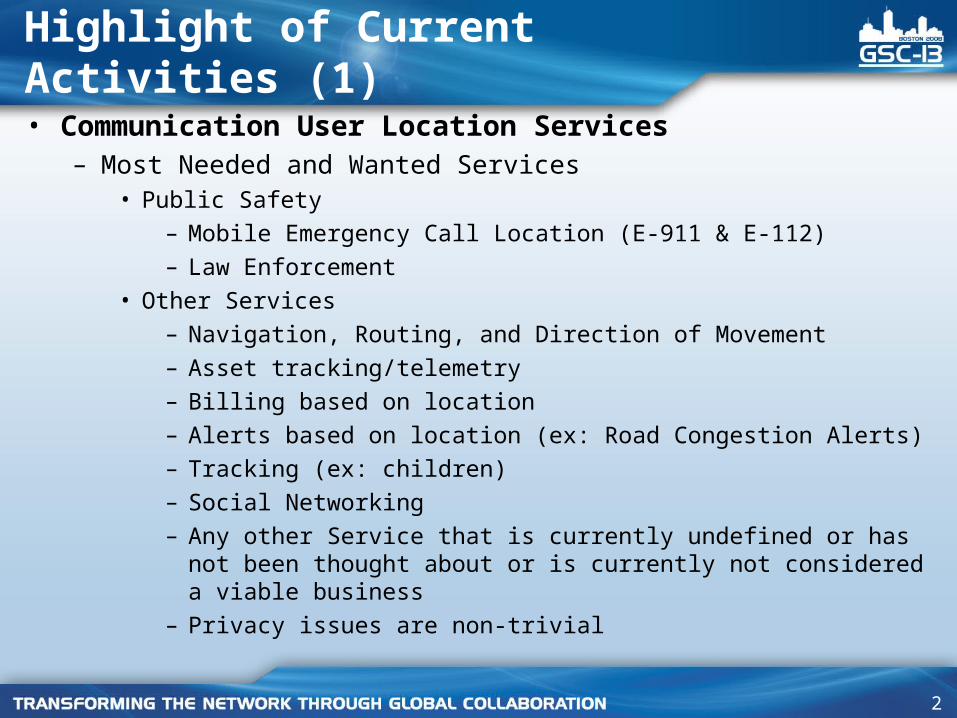
• Communication User Location Services – Most Needed and Wanted Services
• Public Safety
– Mobile Emergency Call Location (E-911 & E-112)
– Law Enforcement
• Other Services
– Navigation, Routing, and Direction of Movement
– Asset tracking/telemetry
– Billing based on location
– Alerts based on location (ex: Road Congestion Alerts)
– Tracking (ex: children)
– Social Networking
– Any other Service that is currently undefined or has not been thought about or is currently not considered a viable business
– Privacy issues are non-trivial
Highlight of Current Activities (1)
3
Highlight of Current Activities (2)
• A new SIM card was introduced in February 2008 which has an embedded AGPS receiver– Generally works with legacy phones without any modifications– Apparently complies with 3GPP & OMA Specifications– Supports, to some degree, backward compatible with legacy UE’s– Supports LBS on SIM for most wireless UE and Network applications
• EU - Galileo GPS Satellite System will be operational by 2013– Approved in November 2007 by 27 EU members– Will increase the TTFF when used in combination with US based
GPS system
• Current Wireless location topics being developed by the industry:– Home Node B– VoIP– Data
4
Strategic Direction
• As time goes on, Location Services will become more important for all users of wireless communications
• Technology is generally moving forward; however, location accuracy requirements are becoming tougher to achieve
• Altitude will become more important• Combinations of technologies that cover in-building, rural,
and urban canyon applications will become more important• Tremendous resources are currently, and will in the future be
required to achieve better accuracy based on regulatory requirements
5
Challenges
• Continue to develop Location Services that achieve both better accuracy along with reasonable complexity in hardware, software, transport, and I/O of the devices that does not severely impact capacity and complexity in the wireless network.
6
Next Steps/Actions
• Continue to work with the regulatory bodies that mandate accuracy requirements
• Work to achieve robust specifications/standards for implementations that will handle the anticipated increase in demand for Location Services
7
Proposed Resolution
• N/A
8
Supplemental Slides
9
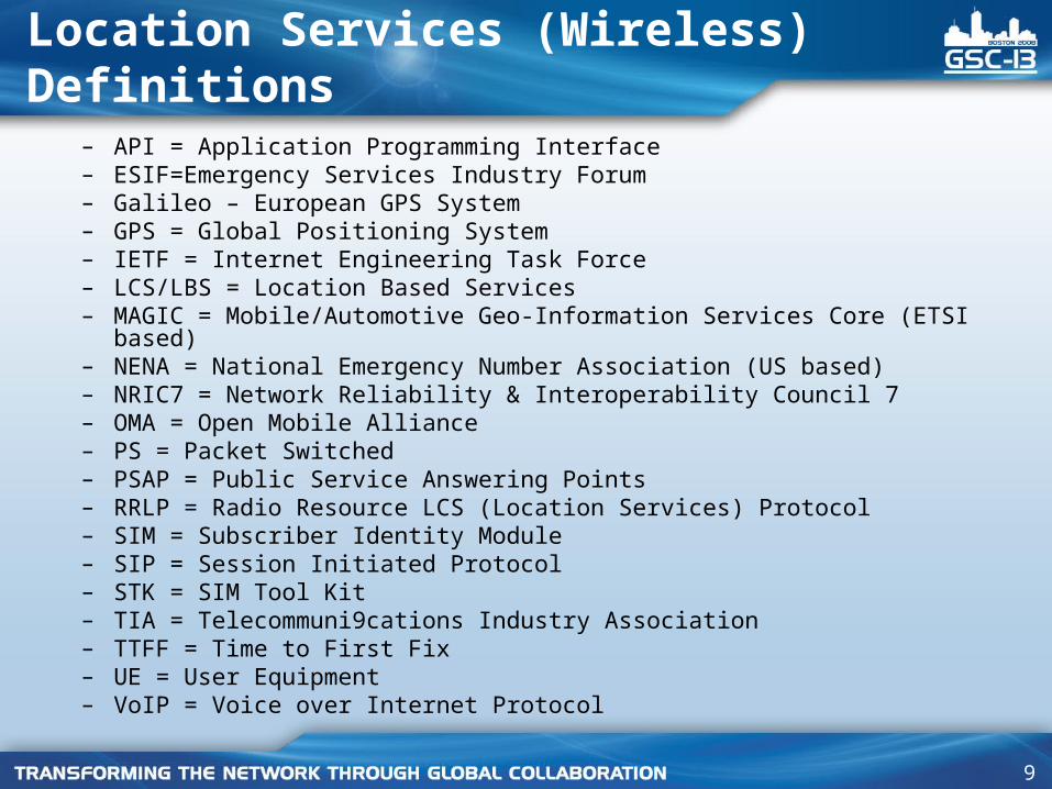
Location Services (Wireless) Definitions
– API = Application Programming Interface – ESIF=Emergency Services Industry Forum– Galileo – European GPS System– GPS = Global Positioning System– IETF = Internet Engineering Task Force– LCS/LBS = Location Based Services– MAGIC = Mobile/Automotive Geo-Information Services Core (ETSI based)– NENA = National Emergency Number Association (US based)– NRIC7 = Network Reliability & Interoperability Council 7– OMA = Open Mobile Alliance– PS = Packet Switched– PSAP = Public Service Answering Points– RRLP = Radio Resource LCS (Location Services) Protocol– SIM = Subscriber Identity Module– SIP = Session Initiated Protocol– STK = SIM Tool Kit– TIA = Telecommuni9cations Industry Association– TTFF = Time to First Fix– UE = User Equipment– VoIP = Voice over Internet Protocol
10
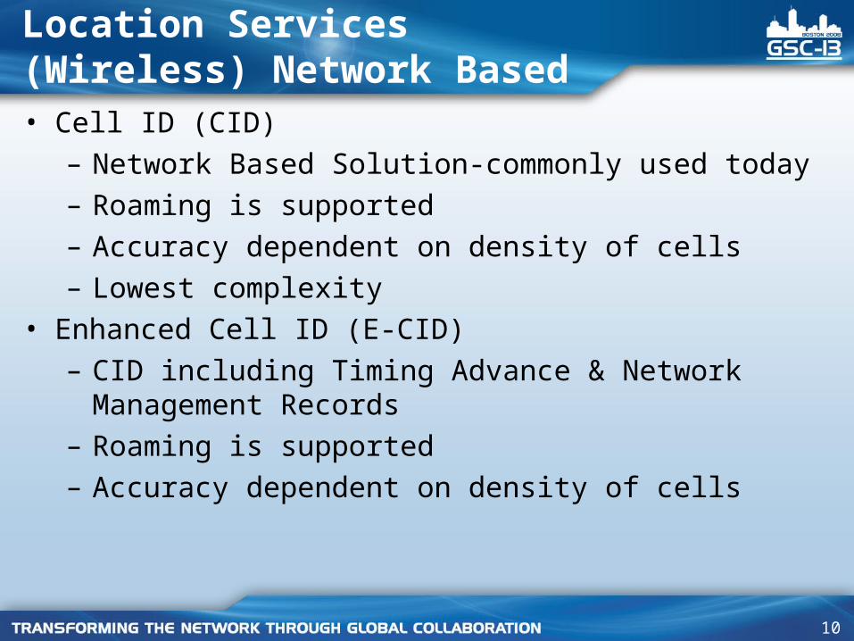
Location Services (Wireless) Network Based• Cell ID (CID)
– Network Based Solution-commonly used today– Roaming is supported– Accuracy dependent on density of cells– Lowest complexity
• Enhanced Cell ID (E-CID)– CID including Timing Advance & Network Management
Records– Roaming is supported– Accuracy dependent on density of cells
11
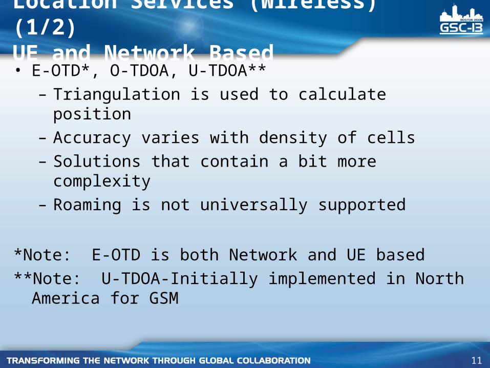
Location Services (Wireless) (1/2) UE and Network Based• E-OTD*, O-TDOA, U-TDOA**
– Triangulation is used to calculate position– Accuracy varies with density of cells– Solutions that contain a bit more complexity– Roaming is not universally supported
*Note: E-OTD is both Network and UE based
**Note: U-TDOA-Initially implemented in North America for GSM
12
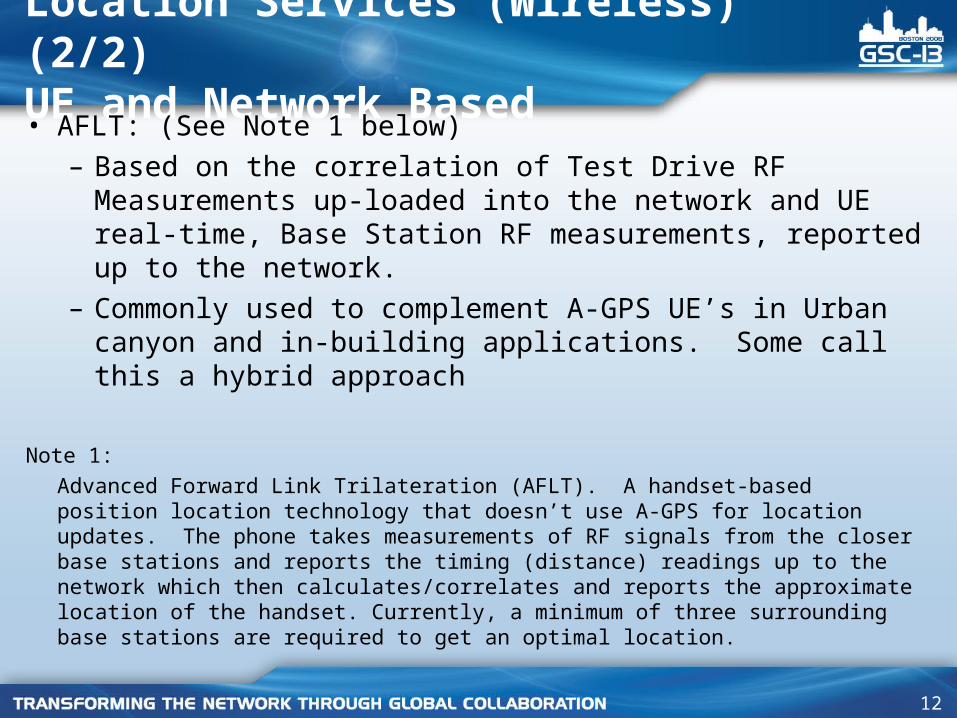
Location Services (Wireless) (2/2) UE and Network Based • AFLT: (See Note 1 below)
– Based on the correlation of Test Drive RF Measurements up-loaded into the network and UE real-time, Base Station RF measurements, reported up to the network.
– Commonly used to complement A-GPS UE’s in Urban canyon and in-building applications. Some call this a hybrid approach
Note 1:
Advanced Forward Link Trilateration (AFLT). A handset-based position location technology that doesn’t use A-GPS for location updates. The phone takes measurements of RF signals from the closer base stations and reports the timing (distance) readings up to the network which then calculates/correlates and reports the approximate location of the handset. Currently, a minimum of three surrounding base stations are required to get an optimal location.
13
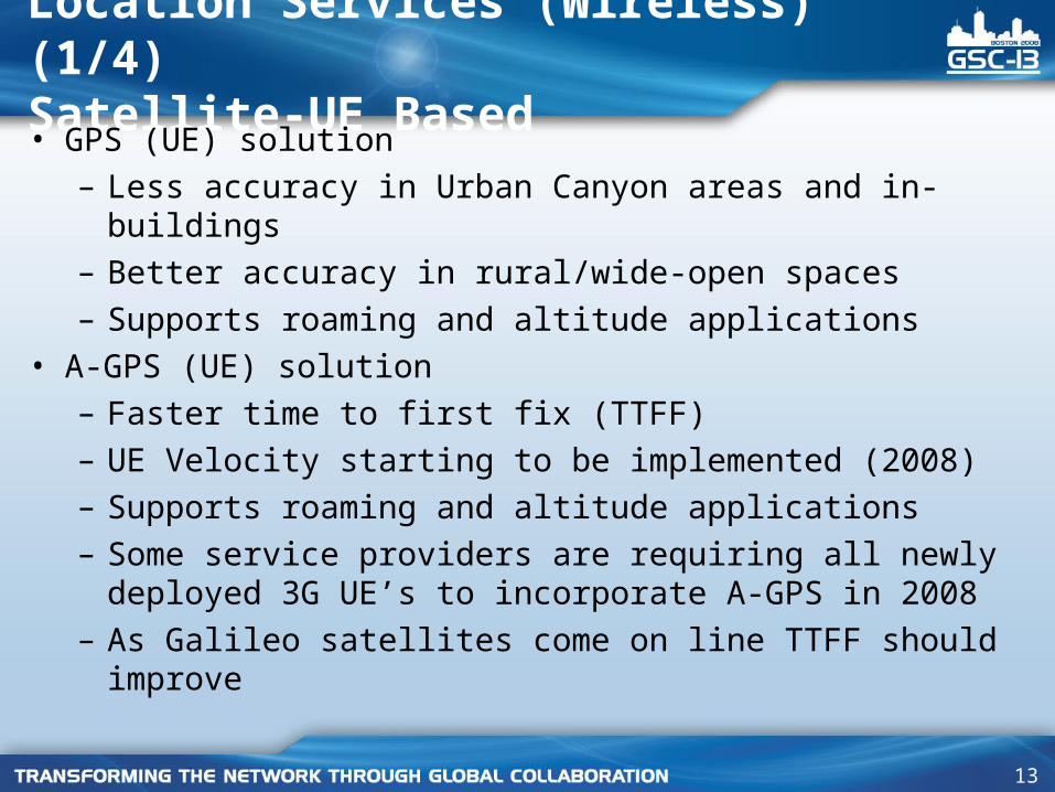
Location Services (Wireless) (1/4) Satellite-UE Based• GPS (UE) solution
– Less accuracy in Urban Canyon areas and in-buildings – Better accuracy in rural/wide-open spaces– Supports roaming and altitude applications
• A-GPS (UE) solution – Faster time to first fix (TTFF)– UE Velocity starting to be implemented (2008)– Supports roaming and altitude applications– Some service providers are requiring all newly deployed
3G UE’s to incorporate A-GPS in 2008– As Galileo satellites come on line TTFF should improve
14
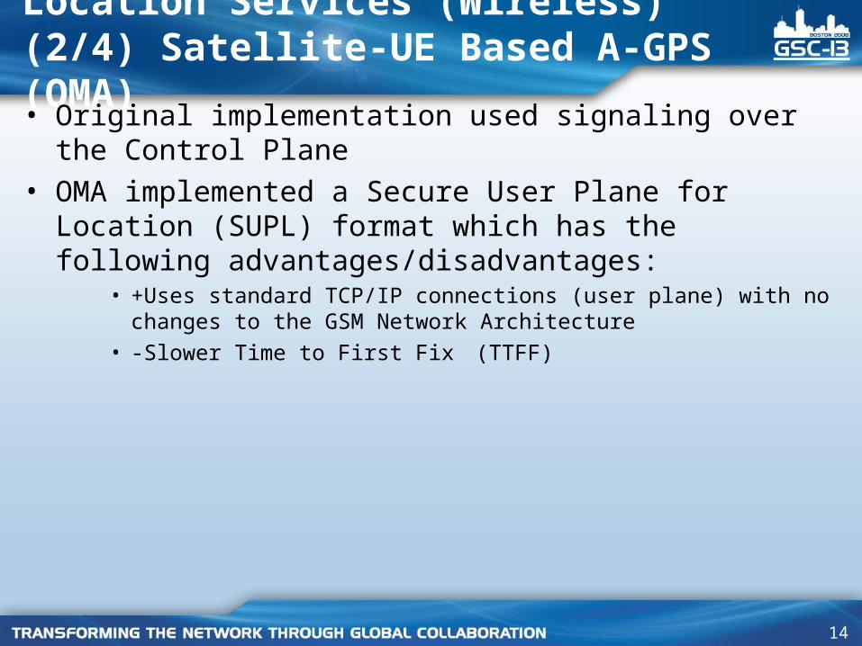
Location Services (Wireless) (2/4) Satellite-UE Based A-GPS (OMA)• Original implementation used signaling over the Control
Plane• OMA implemented a Secure User Plane for Location (SUPL)
format which has the following advantages/disadvantages:• +Uses standard TCP/IP connections (user plane) with no changes to the
GSM Network Architecture
• -Slower Time to First Fix (TTFF)
15
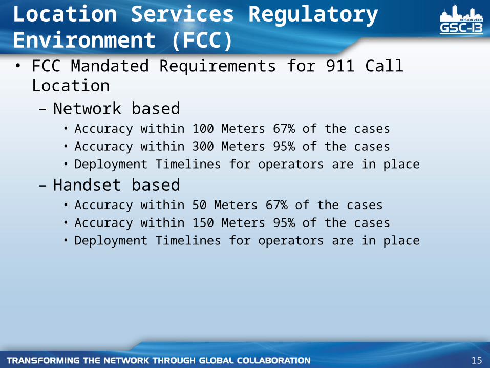
Location Services Regulatory Environment (FCC)• FCC Mandated Requirements for 911 Call Location
– Network based • Accuracy within 100 Meters 67% of the cases
• Accuracy within 300 Meters 95% of the cases
• Deployment Timelines for operators are in place
– Handset based • Accuracy within 50 Meters 67% of the cases
• Accuracy within 150 Meters 95% of the cases
• Deployment Timelines for operators are in place
16
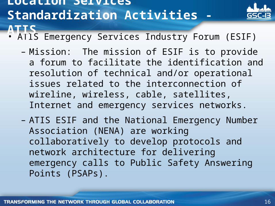
• ATIS Emergency Services Industry Forum (ESIF)
– Mission: The mission of ESIF is to provide a forum to facilitate the identification and resolution of technical and/or operational issues related to the interconnection of wireline, wireless, cable, satellites, Internet and emergency services networks.
– ATIS ESIF and the National Emergency Number Association (NENA) are working collaboratively to develop protocols and network architecture for delivering emergency calls to Public Safety Answering Points (PSAPs).
Location Services Standardization Activities - ATIS
17
Location Services Standardization Activities - ATIS
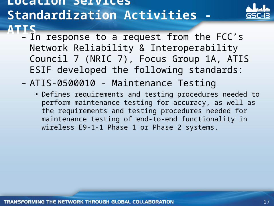
– In response to a request from the FCC’s Network Reliability & Interoperability Council 7 (NRIC 7), Focus Group 1A, ATIS ESIF developed the following standards:
– ATIS-0500010 - Maintenance Testing• Defines requirements and testing procedures needed to perform
maintenance testing for accuracy, as well as the requirements and testing procedures needed for maintenance testing of end-to-end functionality in wireless E9-1-1 Phase 1 or Phase 2 systems.
18
Location Services Standardization Activities - ATIS
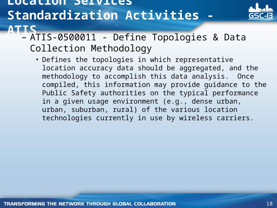
– ATIS-0500011 - Define Topologies & Data Collection Methodology
• Defines the topologies in which representative location accuracy data should be aggregated, and the methodology to accomplish this data analysis. Once compiled, this information may provide guidance to the Public Safety authorities on the typical performance in a given usage environment (e.g., dense urban, urban, suburban, rural) of the various location technologies currently in use by wireless carriers.
19
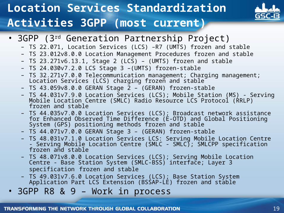
Location Services Standardization Activities 3GPP (most current)
• 3GPP (3rd Generation Partnership Project)– TS 22.071, Location Services (LCS) –R7 (UMTS) frozen and stable – TS 23.012v8.0.0 Location Management Procedures frozen and stable – TS 23.271v6.13.1, Stage 2 (LCS) – (UMTS) frozen and stable – TS 24.030v7.2.0 LCS Stage 3 –(UMTS) frozen-stable– TS 32.271v7.0.0 Telecommunication management; Charging management; Location
Services (LCS) charging frozen and stable – TS 43.059v8.0.0 GERAN Stage 2 – (GERAN) frozen-stable – TS 44.031v7.9.0 Location Services (LCS); Mobile Station (MS) - Serving Mobile
Location Centre (SMLC) Radio Resource LCS Protocol (RRLP) frozen and stable – TS 44.035v7.0.0 Location Services (LCS); Broadcast network assistance for Enhanced
Observed Time Difference (E-OTD) and Global Positioning System (GPS) positioning methods frozen and stable
– TS 44.071v7.0.0 GERAN Stage 3 – (GERAN) frozen-stable – TS 48.031v7.1.0 Location Services LCS: Serving Mobile Location Centre - Serving
Mobile Location Centre (SMLC - SMLC); SMLCPP specification frozen and stable – TS 48.071v8.0.0 Location Services (LCS); Serving Mobile Location Centre - Base
Station System (SMLC-BSS) interface; Layer 3 specification frozen and stable – TS 49.031v7.6.0 Location Services (LCS); Base Station System Application Part LCS
Extension (BSSAP-LE) frozen and stable
• 3GPP R8 & 9 – Work in process
20
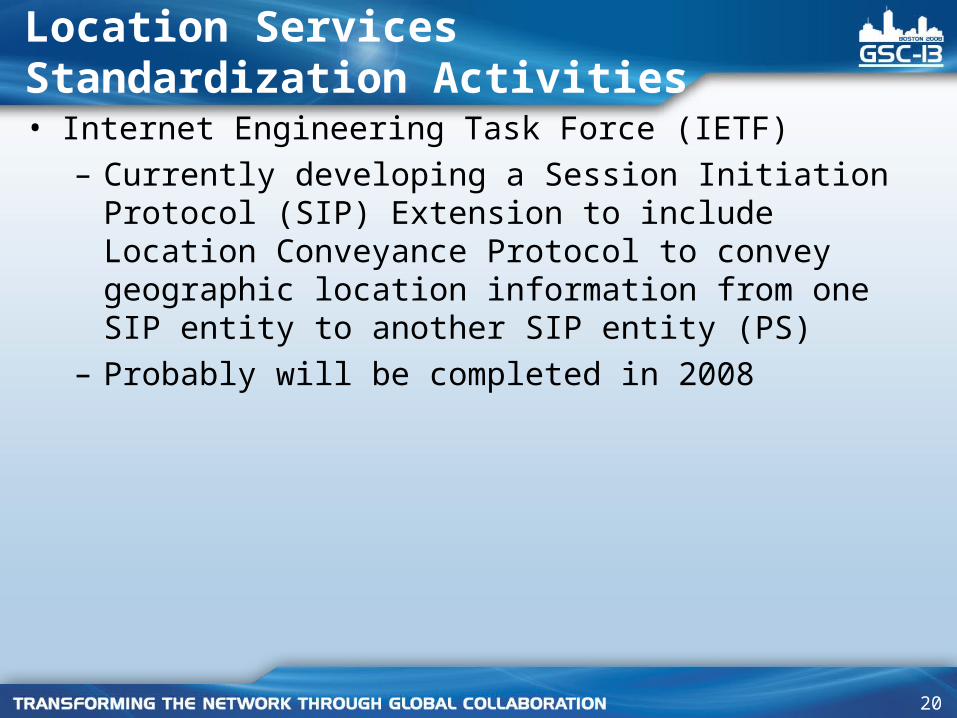
Location Services Standardization Activities• Internet Engineering Task Force (IETF)
– Currently developing a Session Initiation Protocol (SIP) Extension to include Location Conveyance Protocol to convey geographic location information from one SIP entity to another SIP entity (PS)
– Probably will be completed in 2008
21
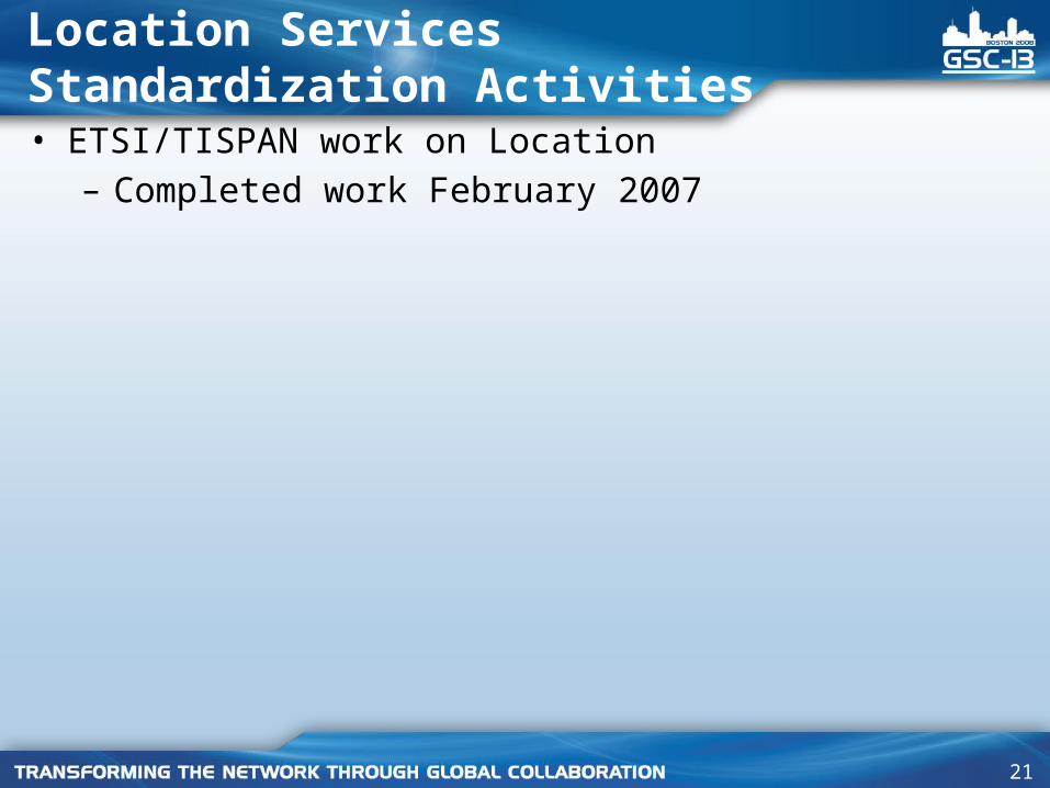
Location Services Standardization Activities• ETSI/TISPAN work on Location
– Completed work February 2007
22
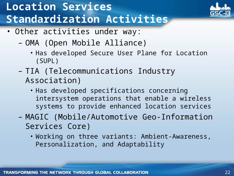
Location Services Standardization Activities• Other activities under way:
– OMA (Open Mobile Alliance) • Has developed Secure User Plane for Location (SUPL)
– TIA (Telecommunications Industry Association)
• Has developed specifications concerning intersystem operations that enable a wireless systems to provide enhanced location services
– MAGIC (Mobile/Automotive Geo-Information Services Core)
• Working on three variants: Ambient-Awareness, Personalization, and Adaptability