Embed Size (px)
DESCRIPTION
Assistive Technology Webinar. Brought to you by Michigan’s Assistive Technology Program at MDRC. About the Webinar. Use the chat function on the right hand side. Questions and comments are encouraged and expected! The session is being recorded. We will start recording now. 2. - PowerPoint PPT Presentation
Citation preview

1
Assistive Technology Webinar
Brought to you by Michigan’s Assistive Technology Program at MDRC.

22
About the Webinar
Use the chat function on the right hand side.
Questions and comments are encouraged and expected!
The session is being recorded. We will start recording now.
3
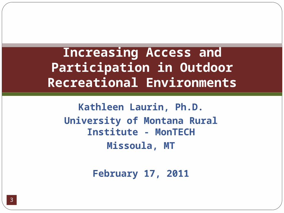
Kathleen Laurin, Ph.D.University of Montana Rural Institute -
MonTECHMissoula, MT
February 17, 2011
Increasing Access and Participation in Outdoor
Recreational Environments
4
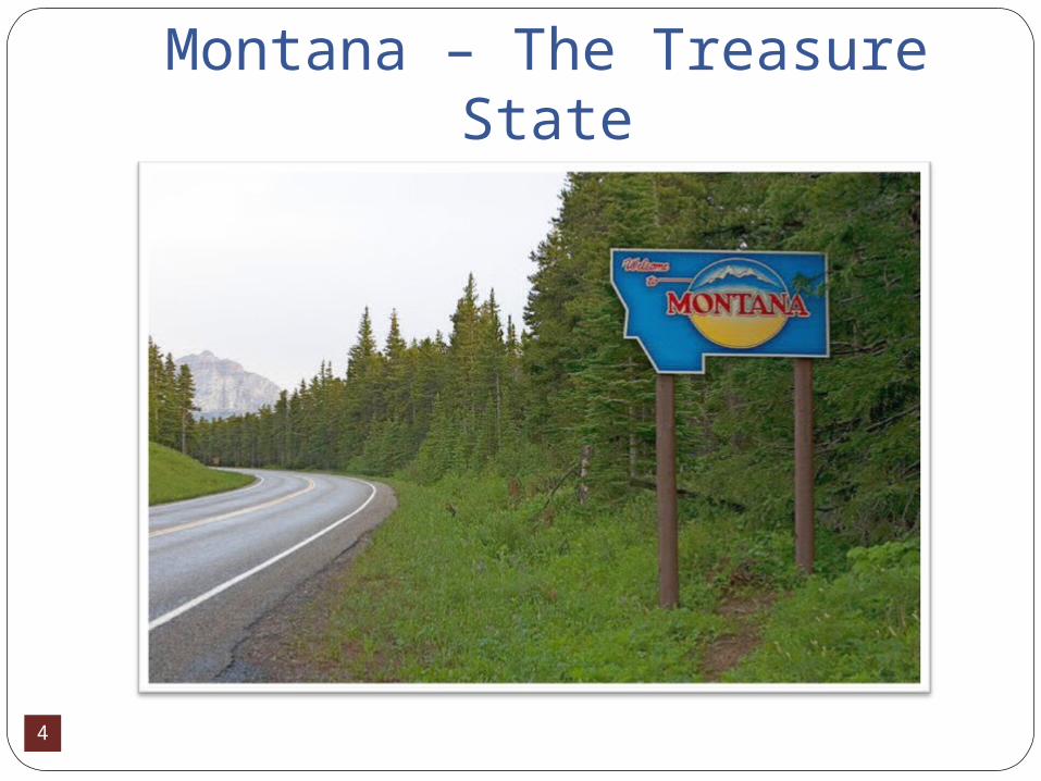
Montana – The Treasure State
5
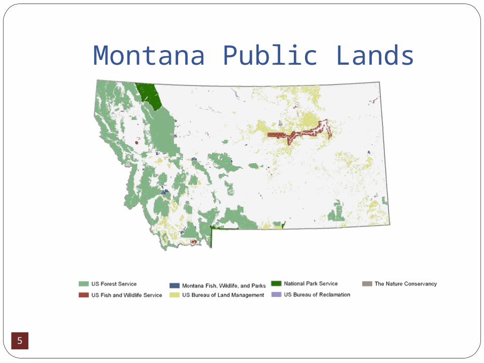
Montana Public Lands

6
Montana has extraordinary natural assets that include:320 state fishing access sites50 State Parks6 National Parks and MonumentsLewis & Clark and Nez Perce National Historic
Trails9 National Forests13 National Wildlife Refuges18 designated Wilderness Areas (3.3 million
acres)24 Bureau of Land Management (BLM)
Recreation sites953,574 acres of lakes, reservoirs, rivers and
streams
7
No one resource that provides accessibility
information
8
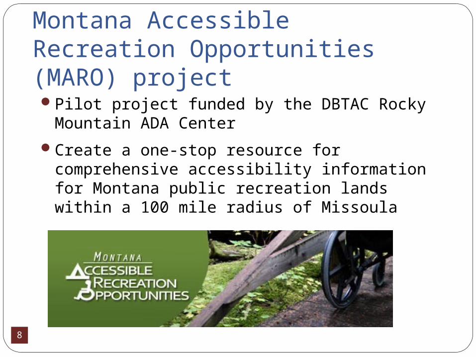
Montana Accessible Recreation Opportunities (MARO) project Pilot project funded by the DBTAC Rocky
Mountain ADA Center
Create a one-stop resource for comprehensive accessibility information for Montana public recreation lands within a 100 mile radius of Missoula

9
Montana Accessible Recreation Opportunities (MARO) project
This included approximately one hundred recreation areas that are managed by state parks, national forest, and/or BLM
We have expanded beyond the initial identified area and have currently completed assessments of 164 sites
10
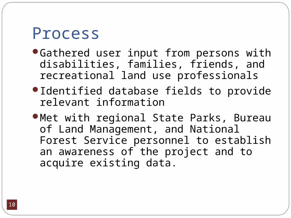
ProcessGathered user input from persons with
disabilities, families, friends, and recreational land use professionals
Identified database fields to provide relevant information
Met with regional State Parks, Bureau of Land Management, and National Forest Service personnel to establish an awareness of the project and to acquire existing data.
11
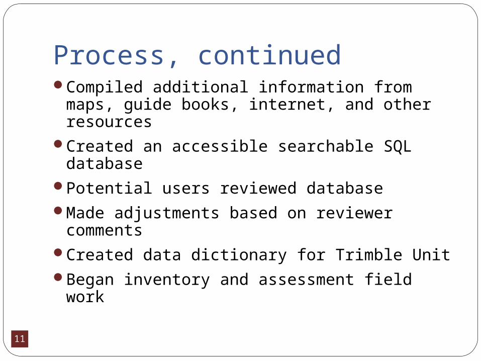
Process, continuedCompiled additional information from
maps, guide books, internet, and other resources
Created an accessible searchable SQL database
Potential users reviewed database Made adjustments based on reviewer
commentsCreated data dictionary for Trimble UnitBegan inventory and assessment field work
12
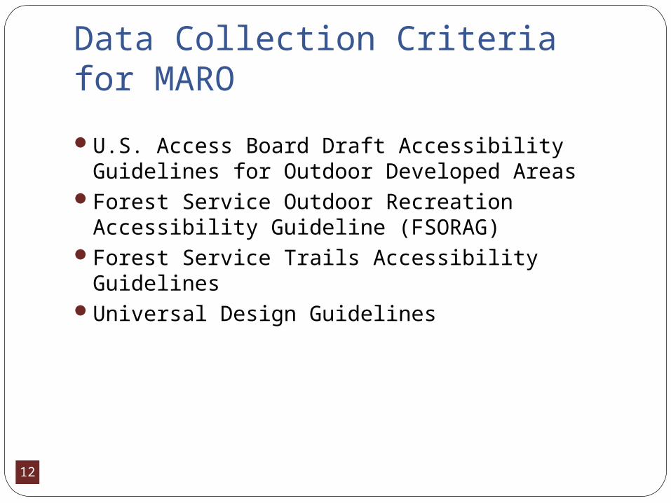
Data Collection Criteria for MARO
U.S. Access Board Draft Accessibility Guidelines for Outdoor Developed Areas
Forest Service Outdoor Recreation Accessibility Guideline (FSORAG)
Forest Service Trails Accessibility GuidelinesUniversal Design Guidelines
13
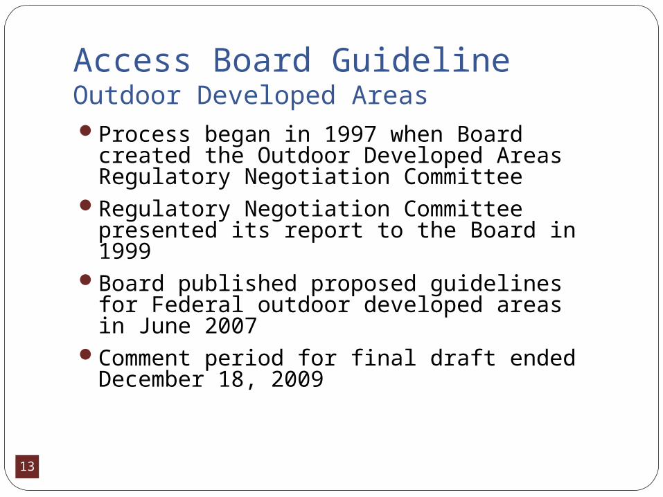
Access Board GuidelineOutdoor Developed AreasProcess began in 1997 when Board created
the Outdoor Developed Areas Regulatory Negotiation Committee
Regulatory Negotiation Committee presented its report to the Board in 1999
Board published proposed guidelines for Federal outdoor developed areas in June 2007
Comment period for final draft ended December 18, 2009
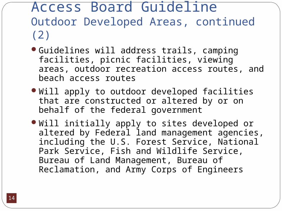
14
Access Board GuidelineOutdoor Developed Areas, continued (2)Guidelines will address trails, camping
facilities, picnic facilities, viewing areas, outdoor recreation access routes, and beach access routes
Will apply to outdoor developed facilities that are constructed or altered by or on behalf of the federal government
Will initially apply to sites developed or altered by Federal land management agencies, including the U.S. Forest Service, National Park Service, Fish and Wildlife Service, Bureau of Land Management, Bureau of Reclamation, and Army Corps of Engineers
15
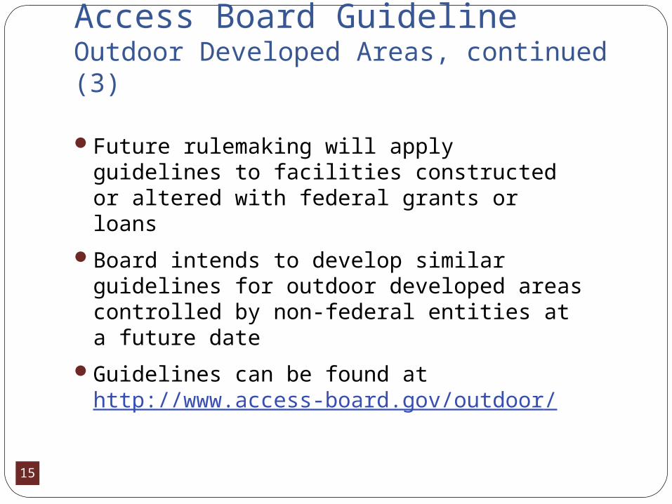
Access Board GuidelineOutdoor Developed Areas, continued (3)
Future rulemaking will apply guidelines to facilities constructed or altered with federal grants or loans
Board intends to develop similar guidelines for outdoor developed areas controlled by non-federal entities at a future date
Guidelines can be found at http://www.access-board.gov/outdoor/
16
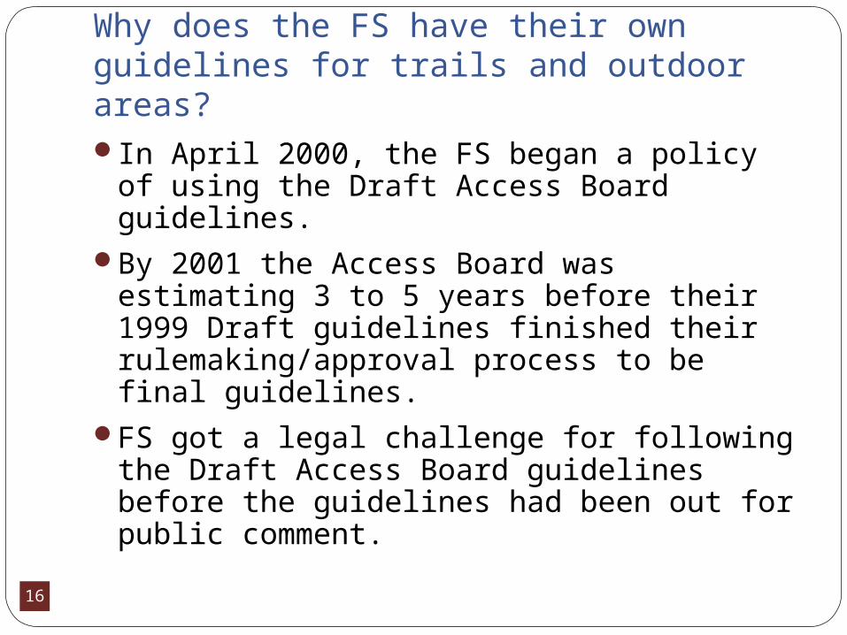
Why does the FS have their own guidelines for trails and outdoor areas?In April 2000, the FS began a policy of
using the Draft Access Board guidelines.By 2001 the Access Board was estimating 3
to 5 years before their 1999 Draft guidelines finished their rulemaking/approval process to be final guidelines.
FS got a legal challenge for following the Draft Access Board guidelines before the guidelines had been out for public comment.
17
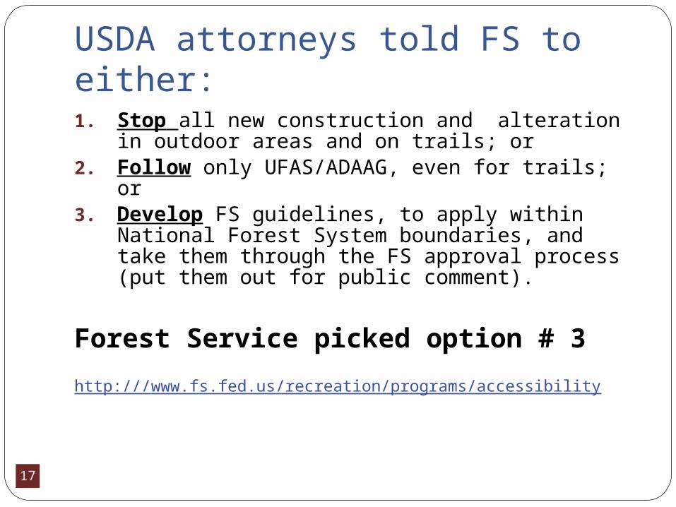
USDA attorneys told FS to either:1. Stop all new construction and alteration in
outdoor areas and on trails; or2. Follow only UFAS/ADAAG, even for trails;
or3. Develop FS guidelines, to apply within
National Forest System boundaries, and take them through the FS approval process (put them out for public comment).
Forest Service picked option # 3
http:///www.fs.fed.us/recreation/programs/accessibility
18
Universal DesignDesign of products and environments
usable by the broadest public to the greatest extent possible
Intent of universal design is to simplify life for everyone by making products, communications, and the built environment usable by as many people as possible
Universal design means taking into consideration the needs of as many people as possible without the need of adaptation or specialized design for specific groups
19
Universal Design, continued.Benefits of universal design are safer and
more welcoming parks and trails for allUniversal design guidelines permit
flexibility, if equal or greater accessibility can be provided by a different or more creative design solution
In the best of all possible worlds, the concept of universal design would guide the creation of all facilities and programs

20
Principles of Universal Design as Applied to Parks 1. Equitable use: parks are accessible to all users, provide
the same means for all users, identical where possible, equivalent when not;
2. Flexibility in use: parks accommodate a wide range of individual preferences and abilities, provide choice for all;
3. Simple and intuitive: understanding the park and context should be easy, regardless of the user’s experience, knowledge, language, or skill;
4. Perceptible information: information is communicated effectively to the user regardless of ambient conditions or the user’s sensory abilities;
21
Principles of Universal Design as Applied to Parks, continued5. Tolerance for error: hazards and the adverse
consequences of accidents are minimized (most used elements are the most accessible, hazardous elements are isolated or eliminated, provide warnings);
6. Low physical effort: the design can be used efficiently and comfortably with a minimum of fatigue; and
7. Size and space for approach and use: appropriate size and space is provided for approach, reach, manipulation, regardless of user’s body size, posture, or mobility.
(Adapted from North Carolina University: The Center for Universal Design http://www.design.ncsu.edu/cud/)
22
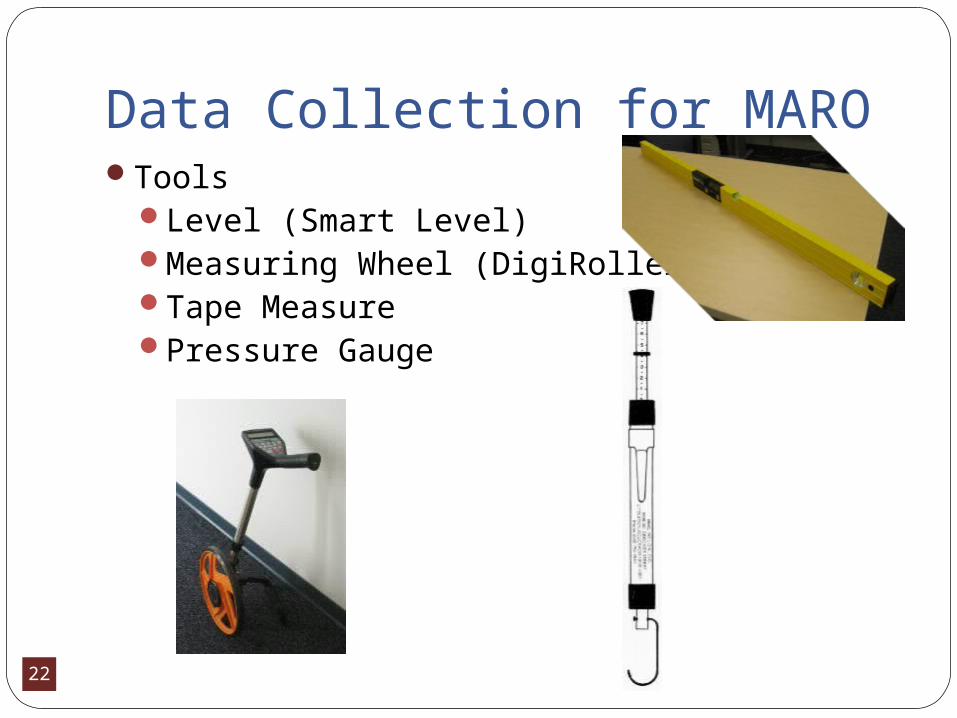
Data Collection for MAROTools
Level (Smart Level)Measuring Wheel (DigiRoller)Tape MeasurePressure Gauge
23
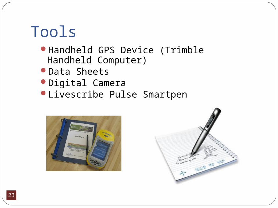
ToolsHandheld GPS Device (Trimble Handheld
Computer)Data Sheets Digital CameraLivescribe Pulse Smartpen
24
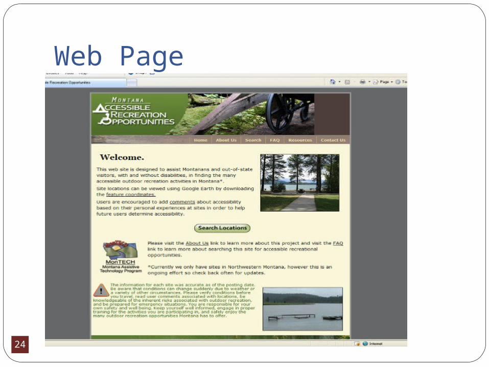
Web Page

25
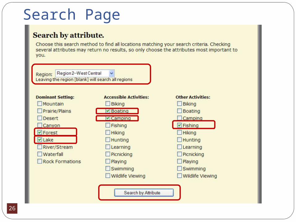
Database and Website-Search Page
26
Search Page
27
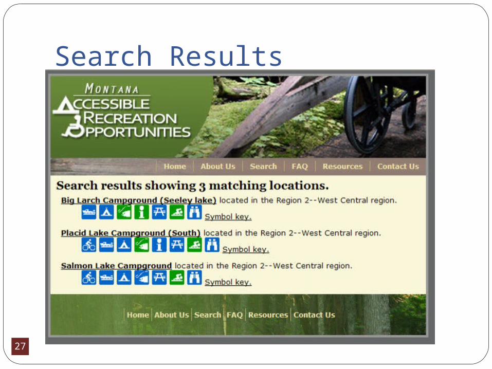
Search Results
28
Database and WebsiteGeneral information gathered:
Contact information for land managerLand manager’s Internet siteDirections to the siteInformation about the settingInformation about other (non-
accessible) recreation opportunities at the site
29
DatabaseAccessibility information gathered:
Accessible activities available at each site.We defined 12 broadly categorized accessible
recreation activities that may be available at a siteProvide detailed information (such as
maximum slope, minimum trail width, and surface type) for each accessible activity available at the different sites to help users determine if the activity is accessible and desirable to them.
30
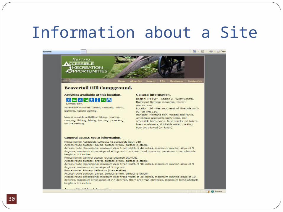
Information about a Site
31
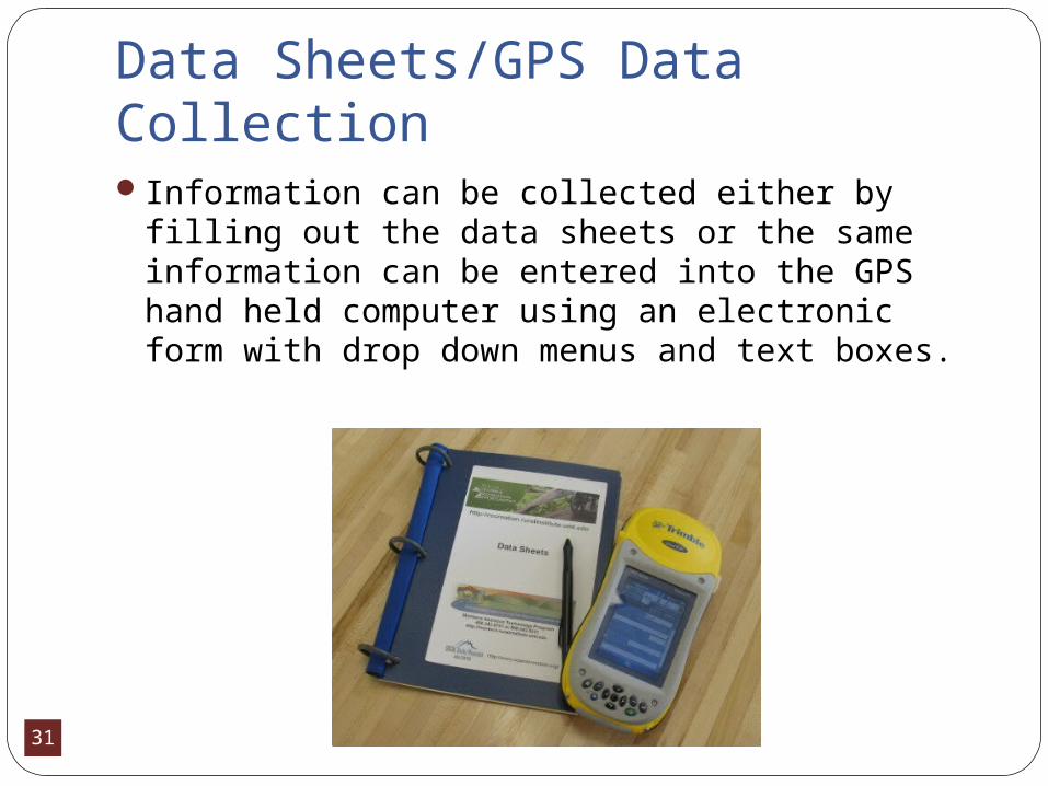
Data Sheets/GPS Data CollectionInformation can be collected either by filling
out the data sheets or the same information can be entered into the GPS hand held computer using an electronic form with drop down menus and text boxes.

32
Recreation Activities Camping Hiking (Trails) Biking (Trails) Fishing (Access) Boating (Launches) Playing (Playgrounds) Scenic/Wildlife
Viewing
Picnic/Day Use Sites Swimming/Water
Access Hunting Visitors’ Center Learning Opportunities

33
Data Collected – All ActivitiesParking
Marked Accessible (type and number of stalls) Parking Space Dimensions SlopeSurface Type (firm and stable)
Access Routes from Parking to Activities or Facilities Running Slope and Cross SlopeWidth Tread ObstaclesSurface Type
New website design will allow for comments by the assessor to be entered for each activity
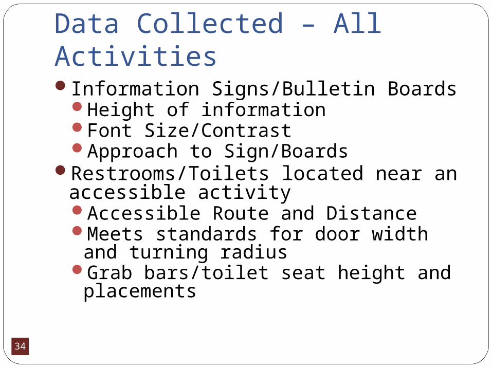
34
Data Collected – All ActivitiesInformation Signs/Bulletin Boards
Height of informationFont Size/ContrastApproach to Sign/Boards
Restrooms/Toilets located near an accessible activityAccessible Route and DistanceMeets standards for door width and
turning radiusGrab bars/toilet seat height and
placements
35
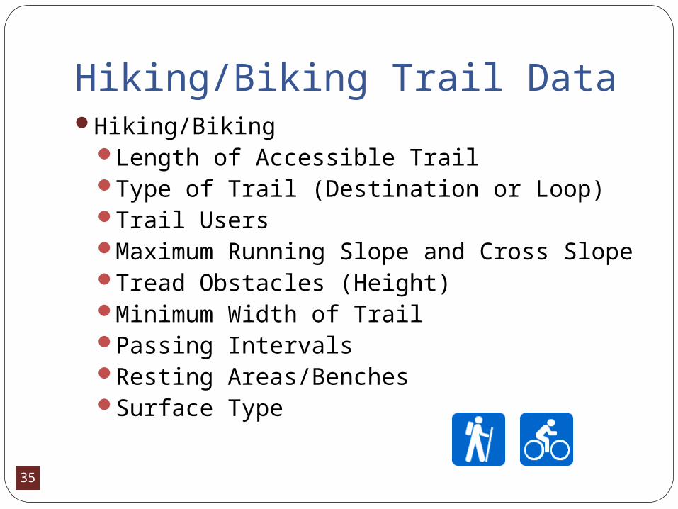
Hiking/Biking Trail DataHiking/Biking
Length of Accessible TrailType of Trail (Destination or Loop)Trail UsersMaximum Running Slope and Cross SlopeTread Obstacles (Height)Minimum Width of TrailPassing IntervalsResting Areas/BenchesSurface Type
36
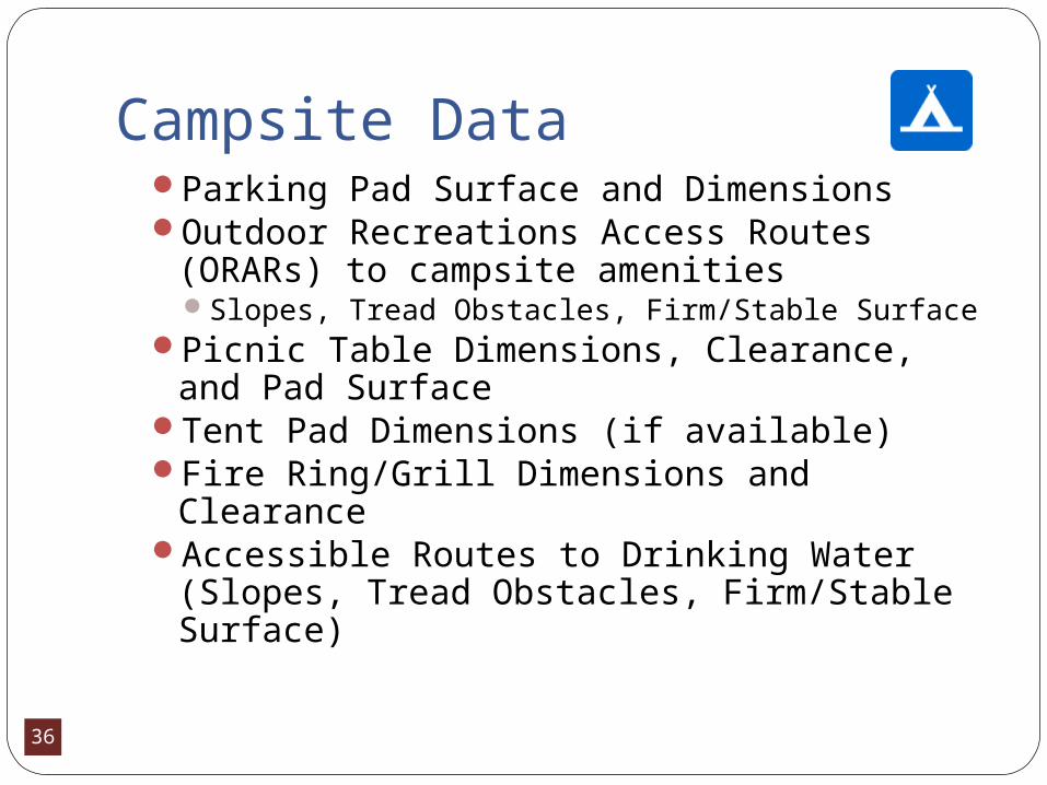
Campsite DataParking Pad Surface and DimensionsOutdoor Recreations Access Routes (ORARs)
to campsite amenitiesSlopes, Tread Obstacles, Firm/Stable Surface
Picnic Table Dimensions, Clearance, and Pad Surface
Tent Pad Dimensions (if available) Fire Ring/Grill Dimensions and ClearanceAccessible Routes to Drinking Water (Slopes,
Tread Obstacles, Firm/Stable Surface)
37
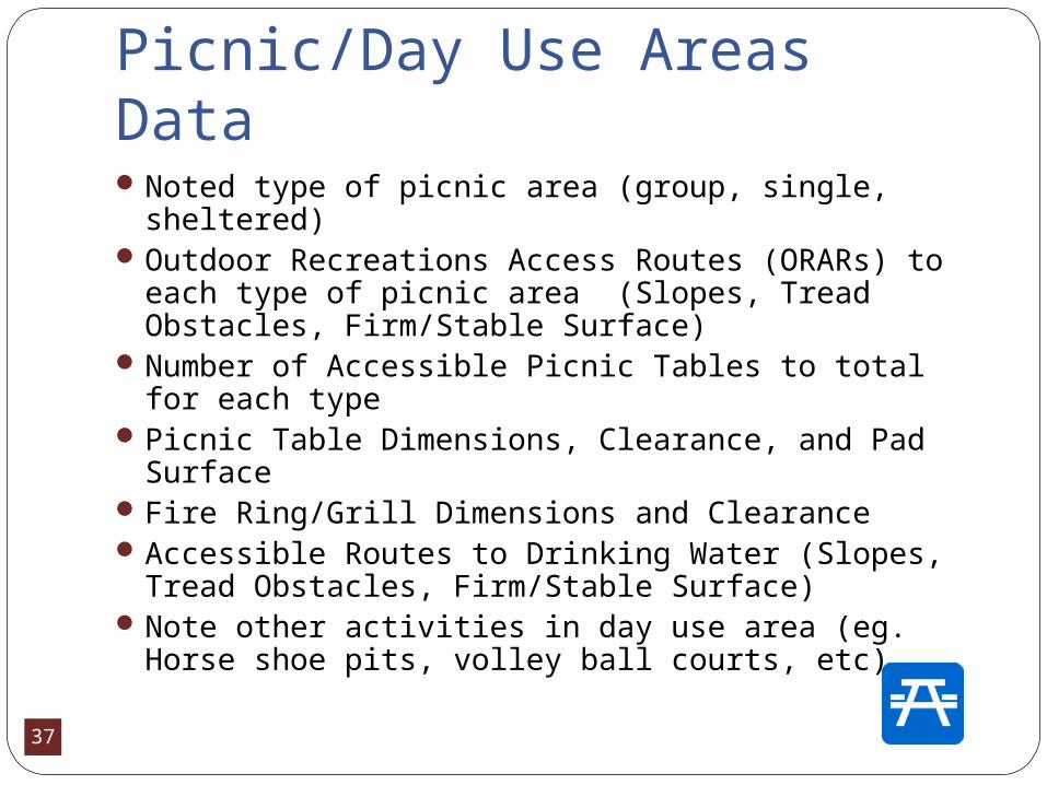
Picnic/Day Use Areas DataNoted type of picnic area (group, single, sheltered)Outdoor Recreations Access Routes (ORARs) to
each type of picnic area (Slopes, Tread Obstacles, Firm/Stable Surface)
Number of Accessible Picnic Tables to total for each type
Picnic Table Dimensions, Clearance, and Pad Surface
Fire Ring/Grill Dimensions and ClearanceAccessible Routes to Drinking Water (Slopes, Tread
Obstacles, Firm/Stable Surface) Note other activities in day use area (eg. Horse
shoe pits, volley ball courts, etc)
38
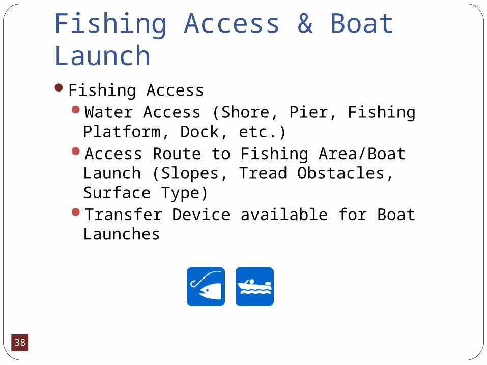
Fishing Access & Boat LaunchFishing Access
Water Access (Shore, Pier, Fishing Platform, Dock, etc.)
Access Route to Fishing Area/Boat Launch (Slopes, Tread Obstacles, Surface Type)
Transfer Device available for Boat Launches

39
Playing and SwimmingPlay Areas
Surface typeAccessible play equipment availableAccess into play area (width, tread obstacles)
Swimming Areas Water Access (Shore, Beach, Dock, etc.)Access Route to swimming area (Slopes,
Tread Obstacles, Surface Type)
40
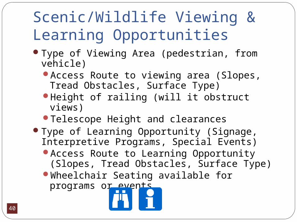
Scenic/Wildlife Viewing & Learning OpportunitiesType of Viewing Area (pedestrian, from vehicle)
Access Route to viewing area (Slopes, Tread Obstacles, Surface Type)
Height of railing (will it obstruct views)Telescope Height and clearances
Type of Learning Opportunity (Signage, Interpretive Programs, Special Events)Access Route to Learning Opportunity
(Slopes, Tread Obstacles, Surface Type)Wheelchair Seating available for programs or
events

41
Visitor Centers Parking (marked spaces, dimensions and number of spaces) Access Route to Entrance (curb cuts/slopes) Entrance Dimensions (tread obstacle, width, pressure to
open door, door handle type and height) Exhibits and Displays
Location of displays, display height, and clearancePaths of travel between displaysFont Size and Contrast of Text with backgroundDisplay Controls Operable with a closed fistClosed Captioning for video displays
42
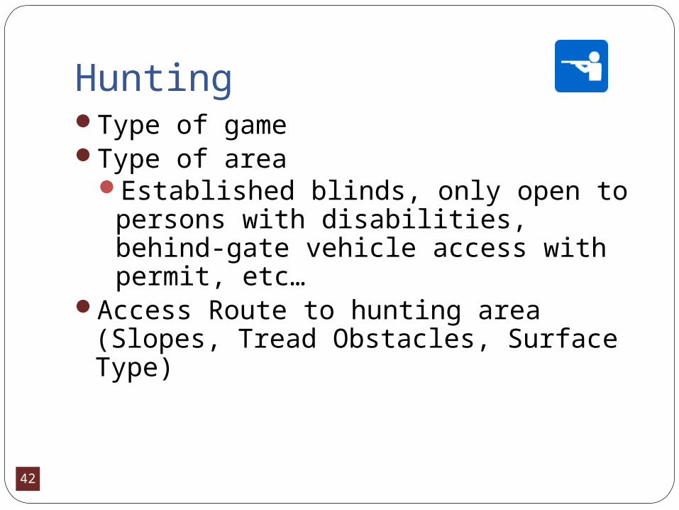
HuntingType of gameType of area
Established blinds, only open to persons with disabilities, behind-gate vehicle access with permit, etc…
Access Route to hunting area (Slopes, Tread Obstacles, Surface Type)
43
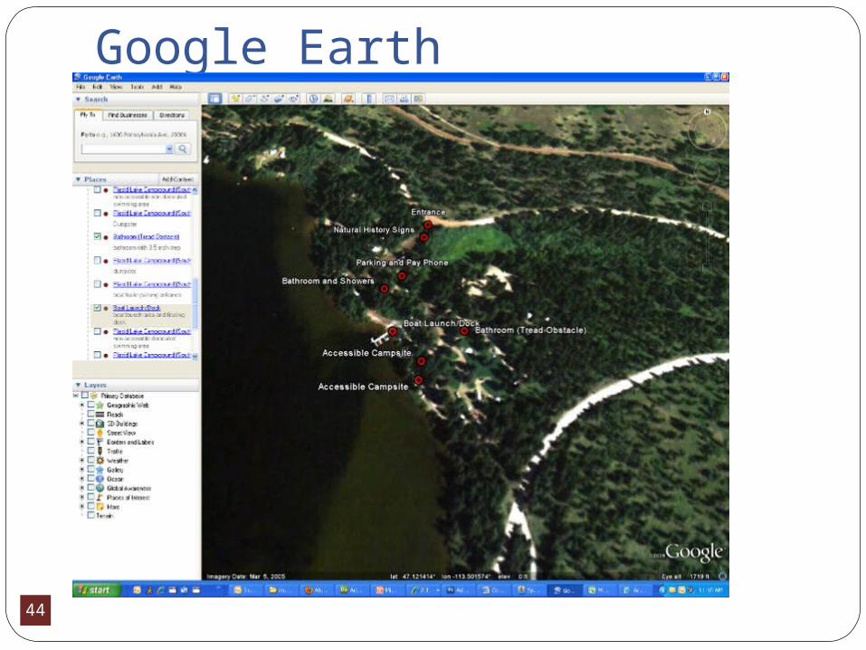
Database - GPSGPS coordinates of sites to allow users
to preview sites within Google Earth and/or enter the coordinates into their own personal navigation systems to assist with trip planning and navigation.
44
Google Earth
45
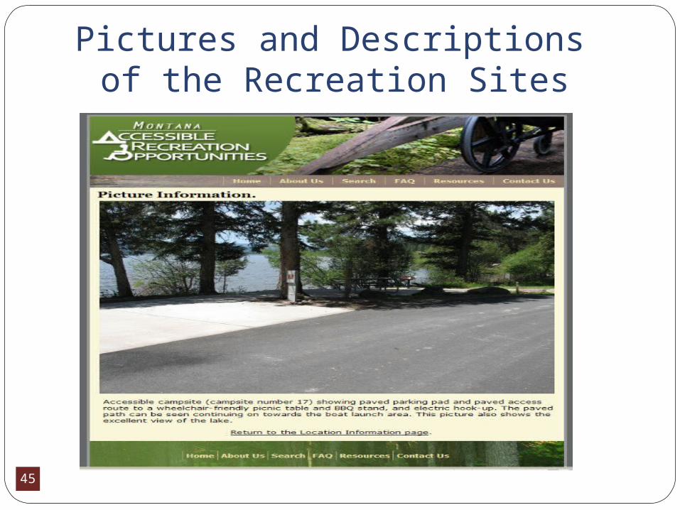
Pictures and Descriptions of the Recreation Sites
46
Database – User CommentsAccessibility information gathered:
Comment feature that provides opportunity for users to share their experiences at a site or with an activity so that future users may be better aware of unique or changing conditions
Users may voluntarily provide their email contact information so that they can directly contact each other for additional information
47
Future Plans/ImprovementsDifferent icons to denote accessible
featuresDynamic web map with the MARO
websiteBetter feature identification in Google
MapImprovements in website general design
and navigation
48
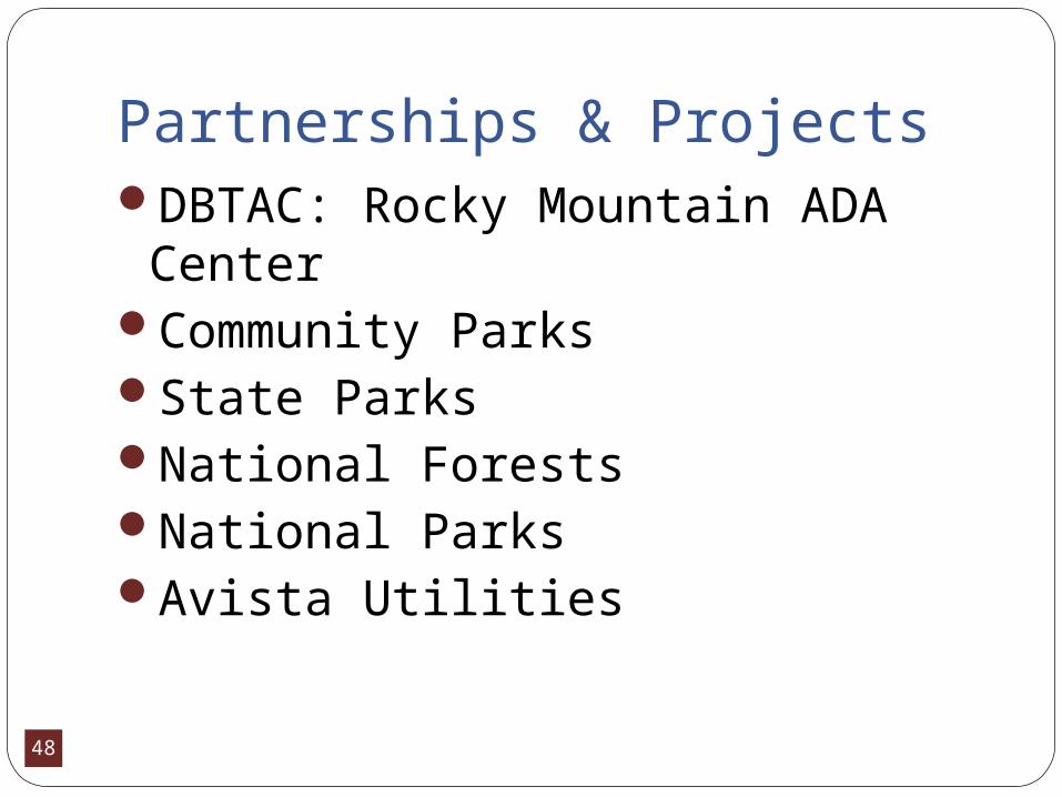
Partnerships & ProjectsDBTAC: Rocky Mountain ADA
CenterCommunity ParksState ParksNational ForestsNational ParksAvista Utilities
49
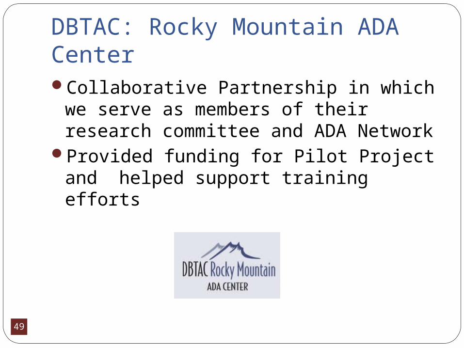
DBTAC: Rocky Mountain ADA CenterCollaborative Partnership in which we
serve as members of their research committee and ADA Network
Provided funding for Pilot Project and helped support training efforts
50
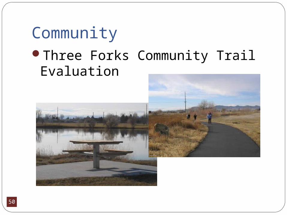
CommunityThree Forks Community Trail
Evaluation
51
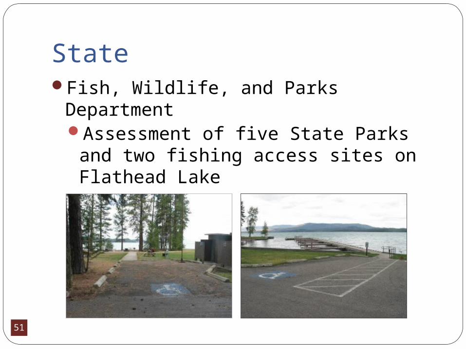
StateFish, Wildlife, and Parks Department
Assessment of five State Parks and two fishing access sites on Flathead Lake

52
U.S. Forest ServiceWorking with Northern Regional Office
and Individual National Forests on multiple efforts regarding assessments, trainings, and inventories

53
FederalNational Parks
Glacier National Park - Two-day field trip looking at Glacier’s accessible opportunities and discussion of future plans.
Yellowstone National Park – Utah Youth Conservation Corps

54
Avista UtilitiesHelp maintain and improve
multiple recreation sites in areas that they use for energy production

55
Montana Access To Outdoor Recreation (MATOR)
A project which promotes participation in wildlife-associated recreation through the use of Assistive Technology and other supports.
56
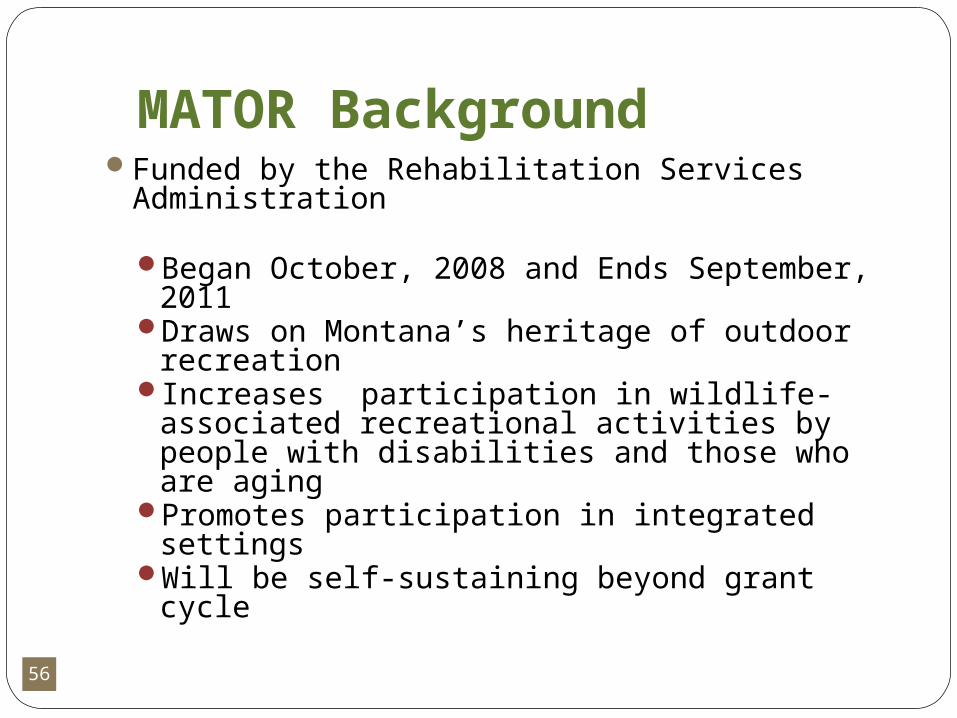
MATOR BackgroundFunded by the Rehabilitation Services
Administration
Began October, 2008 and Ends September, 2011
Draws on Montana’s heritage of outdoor recreation
Increases participation in wildlife-associated recreational activities by people with disabilities and those who are aging
Promotes participation in integrated settingsWill be self-sustaining beyond grant cycle
57
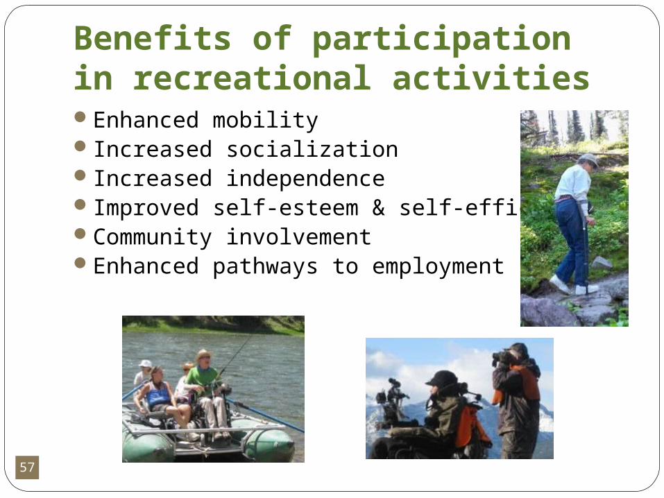
Benefits of participation in recreational activitiesEnhanced mobilityIncreased socializationIncreased independenceImproved self-esteem & self-efficacyCommunity involvementEnhanced pathways to employment

58
MATOR PartnersMonTECH/Montana Assistive Technology
ProgramMontana FWP (Wildlife & Parks divisions)Montana Vocational RehabilitationMontana Independent Living CentersUS Forest ServiceIndividual volunteers & sporting groupsPrivate businesses and corporationsEquipment developers & vendors
59
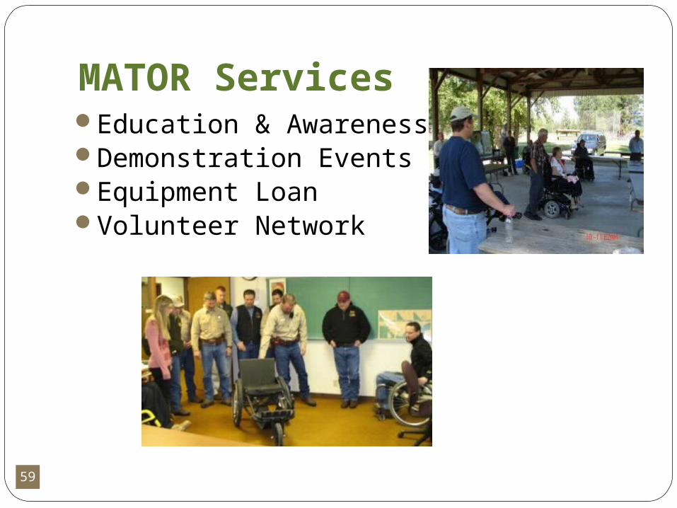
MATOR ServicesEducation & AwarenessDemonstration EventsEquipment LoanVolunteer Network

60
Education and AwarenessProvide awareness through outreach
Literature, website, activities, trainingshttp://recreation.ruralinstitute.umt.edu/mator
Integrate information into FWP modulesFWP online & other education materials
Dissemination through other entities
61
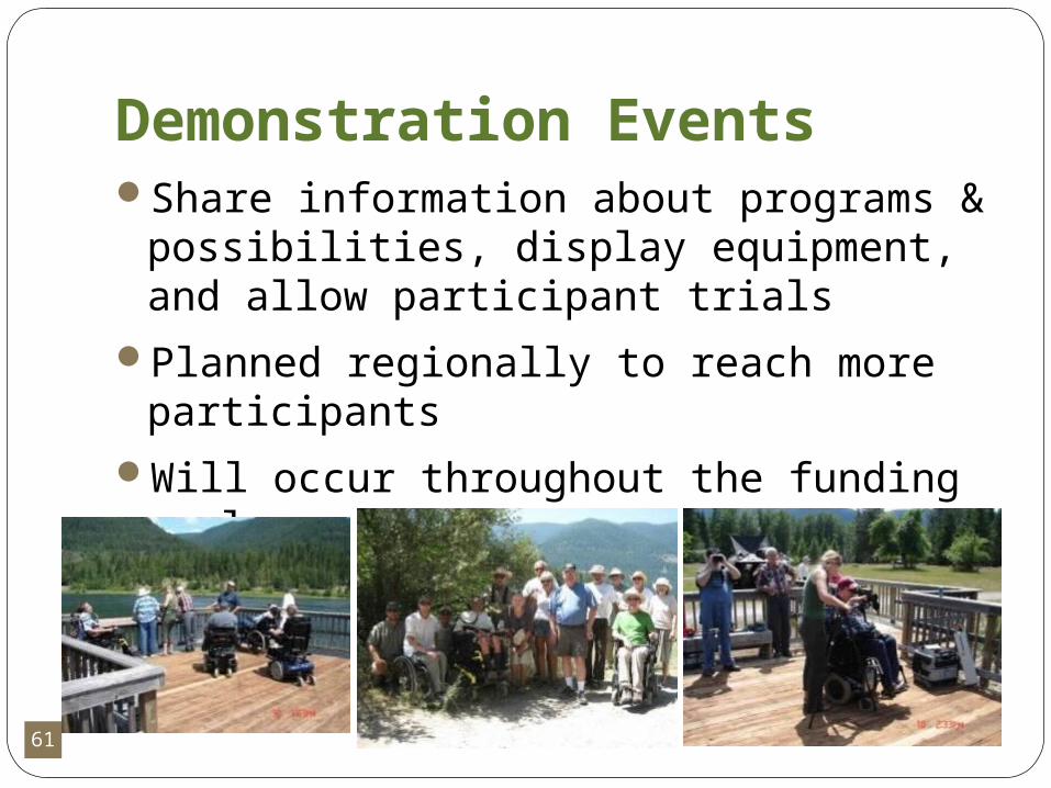
Demonstration EventsShare information about programs &
possibilities, display equipment, and allow participant trials
Planned regionally to reach more participants
Will occur throughout the funding cycle
62
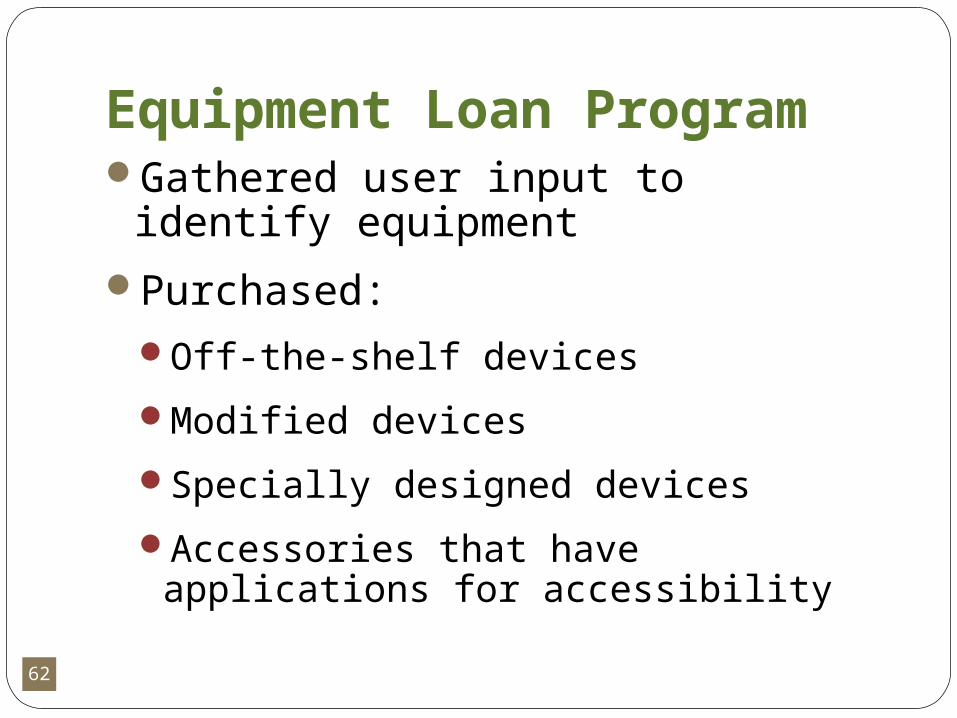
Equipment Loan ProgramGathered user input to identify
equipment
Purchased:Off-the-shelf devices
Modified devices
Specially designed devices
Accessories that have applications for accessibility
63
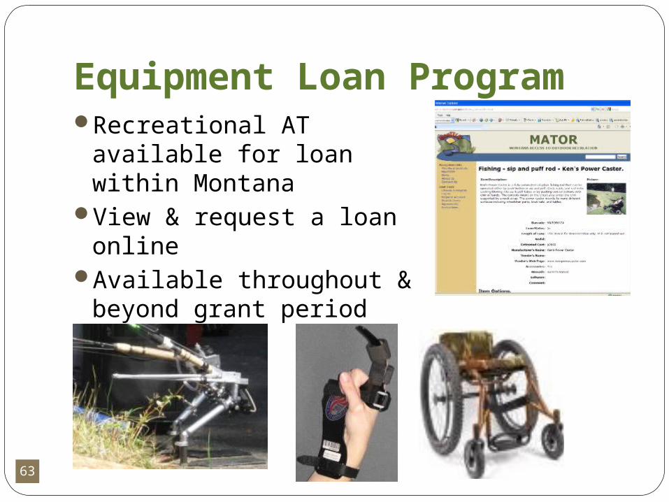
Equipment Loan ProgramRecreational AT available
for loan within MontanaView & request a loan
onlineAvailable throughout &
beyond grant period
64
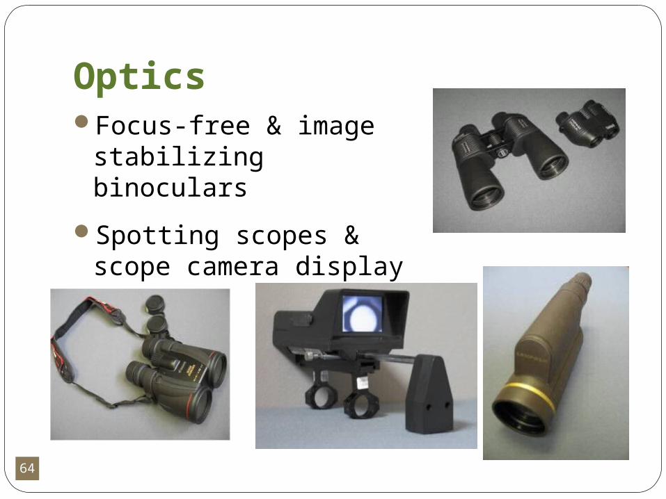
OpticsFocus-free & image
stabilizing binoculars
Spotting scopes & scope camera display
65
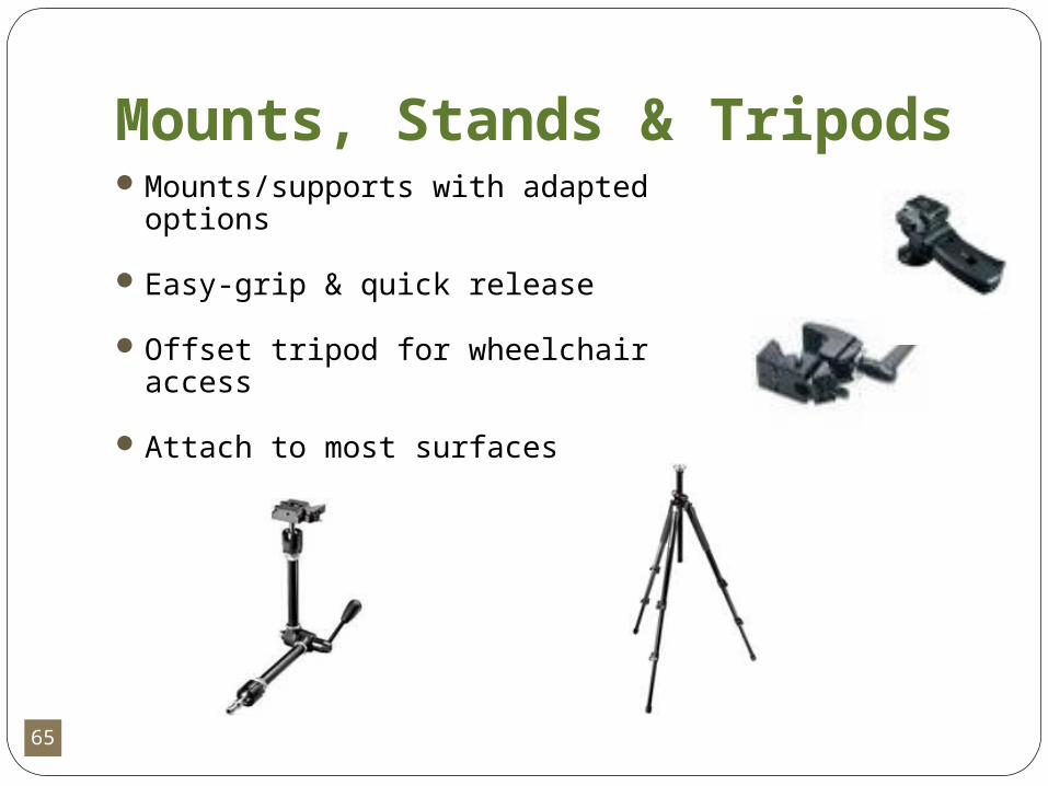
Mounts, Stands & TripodsMounts/supports with adapted
options
Easy-grip & quick release
Offset tripod for wheelchair access
Attach to most surfaces

66
Mount’n Mover by BlueSky DesignsUniversally adaptableMounts to mobility devicesSupports many types of
devices, including recreational equipment
67
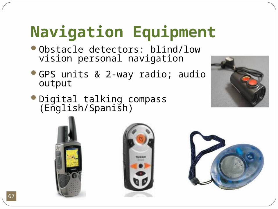
Navigation EquipmentObstacle detectors: blind/low vision
personal navigation
GPS units & 2-way radio; audio output
Digital talking compass (English/Spanish)
68
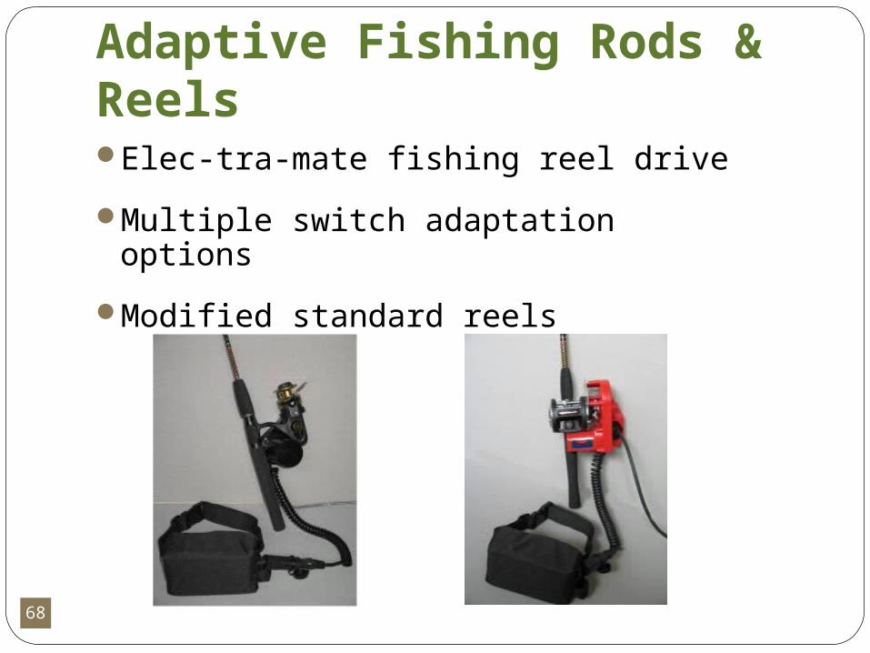
Adaptive Fishing Rods & ReelsElec-tra-mate fishing reel drive
Multiple switch adaptation options
Modified standard reels
69
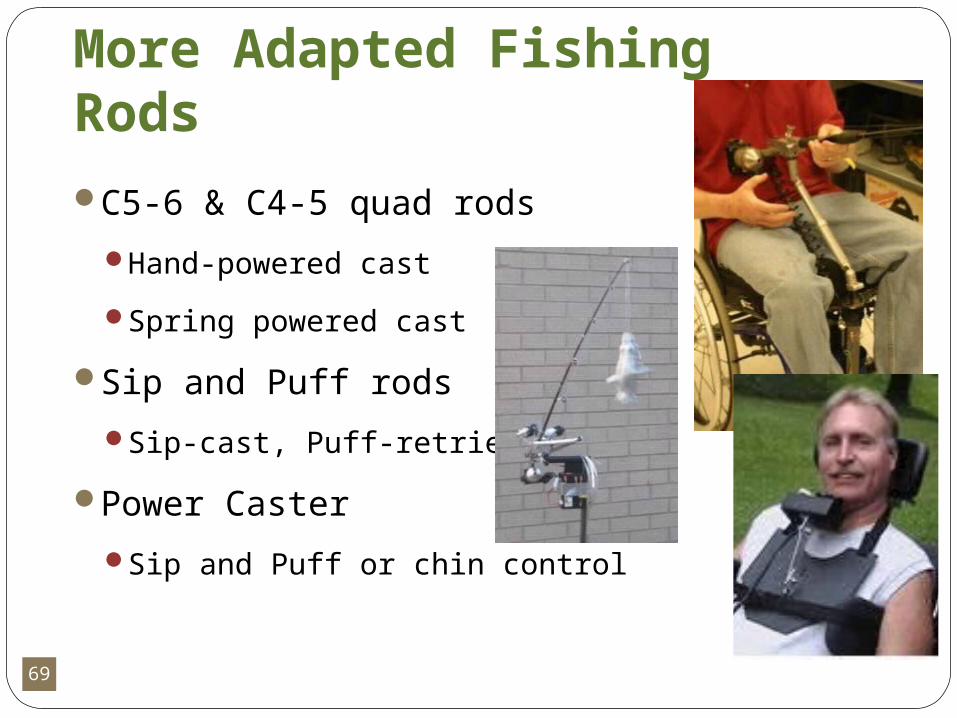
More Adapted Fishing Rods
C5-6 & C4-5 quad rods
Hand-powered cast
Spring powered cast
Sip and Puff rods
Sip-cast, Puff-retrieve
Power Caster
Sip and Puff or chin control
70
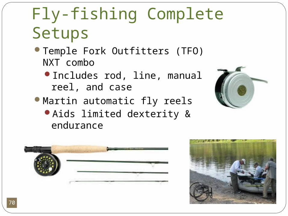
Fly-fishing Complete SetupsTemple Fork Outfitters (TFO) NXT
comboIncludes rod, line, manual reel,
and caseMartin automatic fly reels
Aids limited dexterity & endurance
71
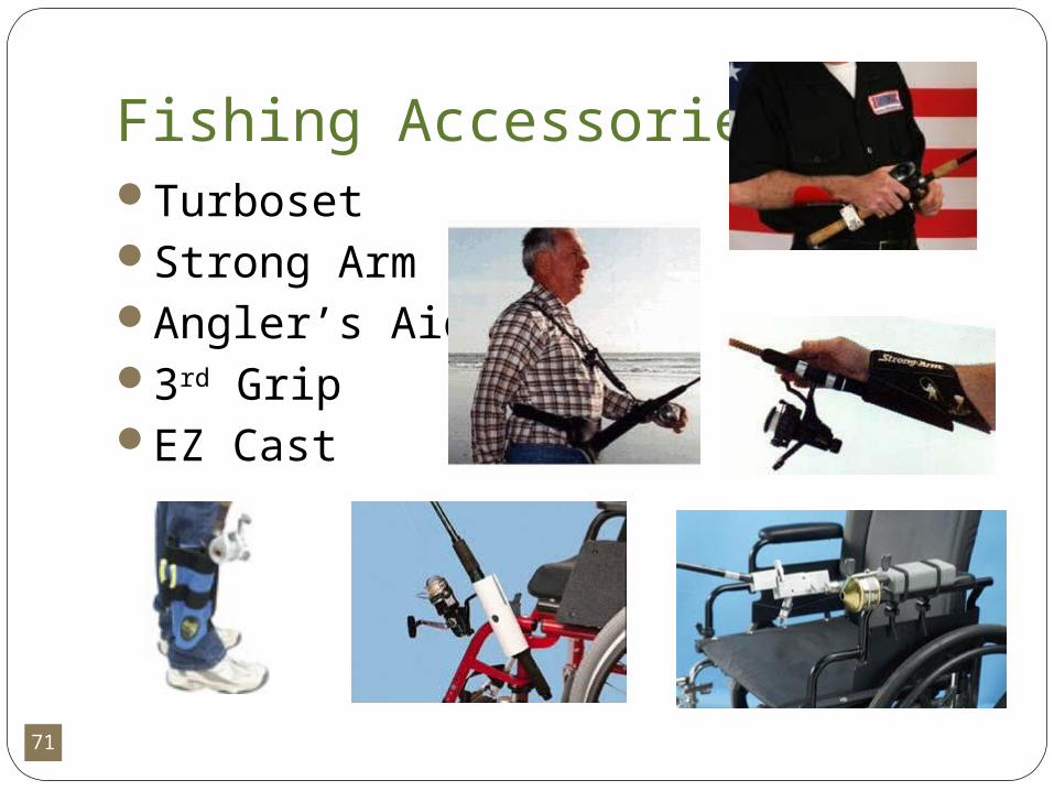
Fishing AccessoriesTurbosetStrong ArmAngler’s Aid3rd GripEZ Cast
72
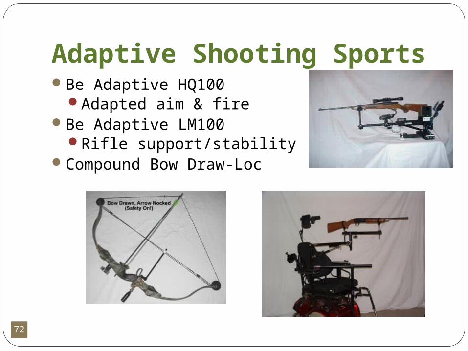
Adaptive Shooting SportsBe Adaptive HQ100
Adapted aim & fireBe Adaptive LM100
Rifle support/stabilityCompound Bow Draw-Loc
73
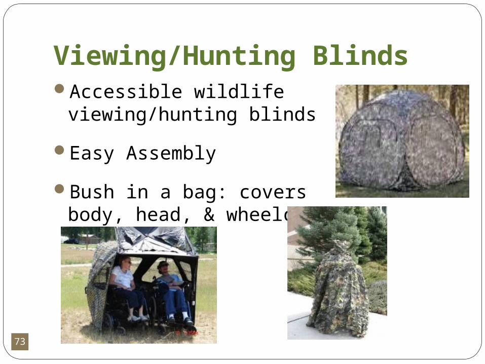
Viewing/Hunting BlindsAccessible wildlife
viewing/hunting blinds
Easy Assembly
Bush in a bag: covers body, head, & wheelchair
74
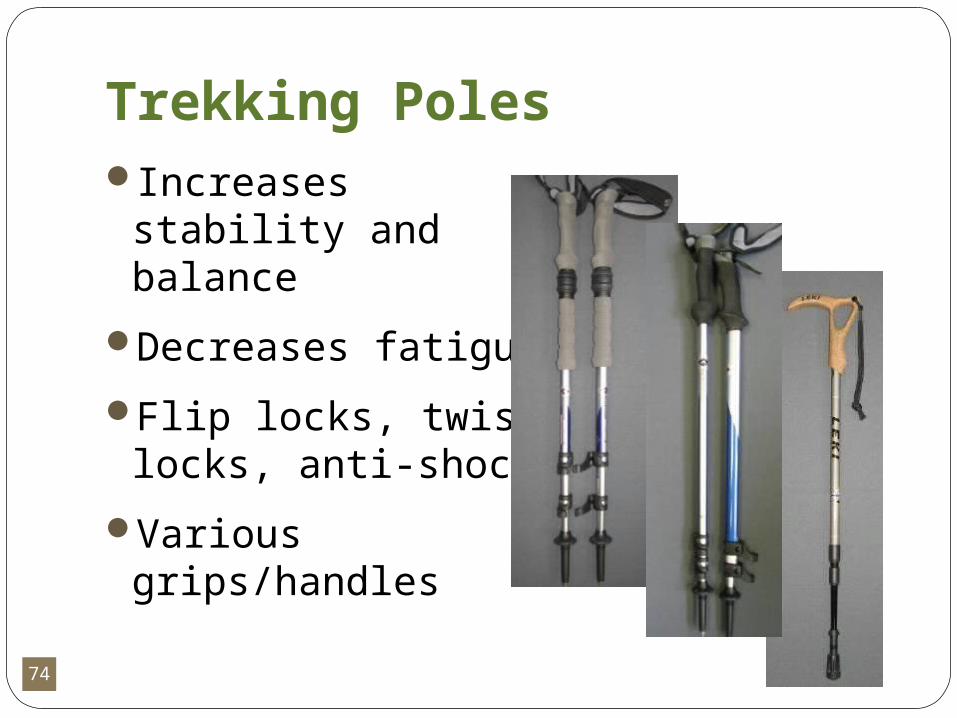
Trekking PolesIncreases stability
and balance
Decreases fatigue
Flip locks, twist locks, anti-shock
Various grips/handles

75
RipPod Trekking/Shooting stickLightweight trekking
pole for balance & endurance
Becomes shooting stick with magnetic attachment
Attachment accessories for firearms & archery
Planning to produce camera attachments
76
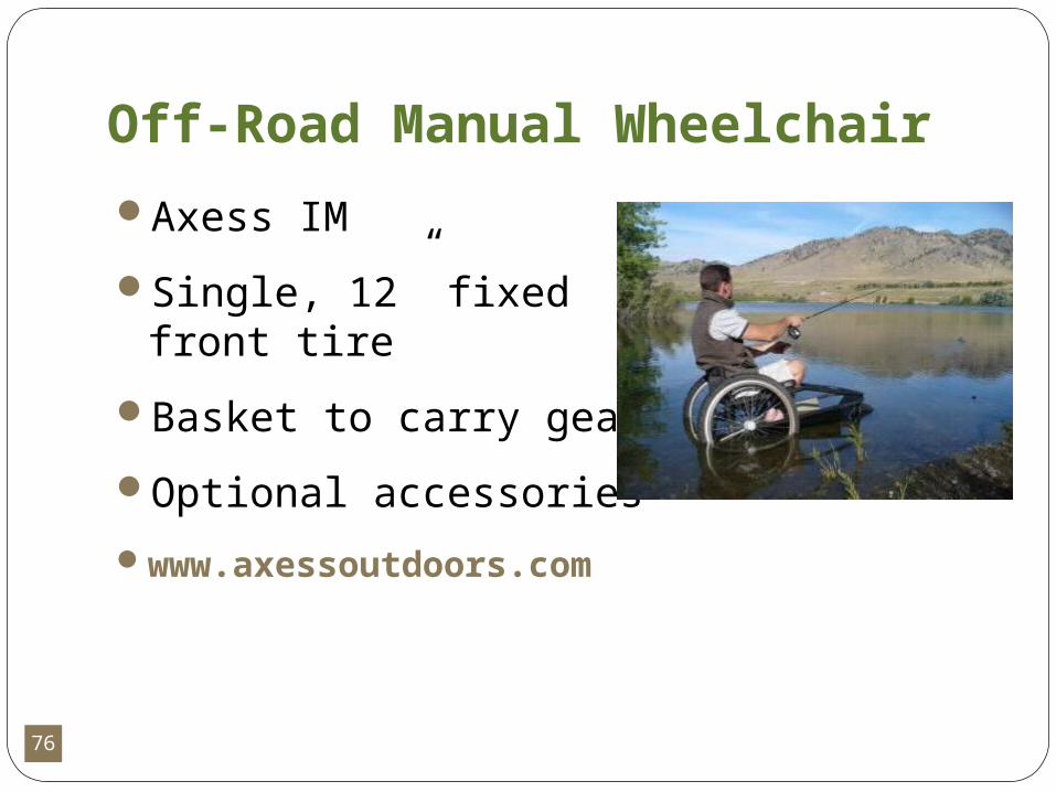
Off-Road Manual Wheelchair
Axess IM
Single, 12” fixed front tire
Basket to carry gear
Optional accessories
www.axessoutdoors.com

77
Other Wheelchairs for Off-roadQuickie 2 manual folding &
rigid frames Invacare CrossfireOutdoor tires and impact
guardsCommon child & adult
widths
78
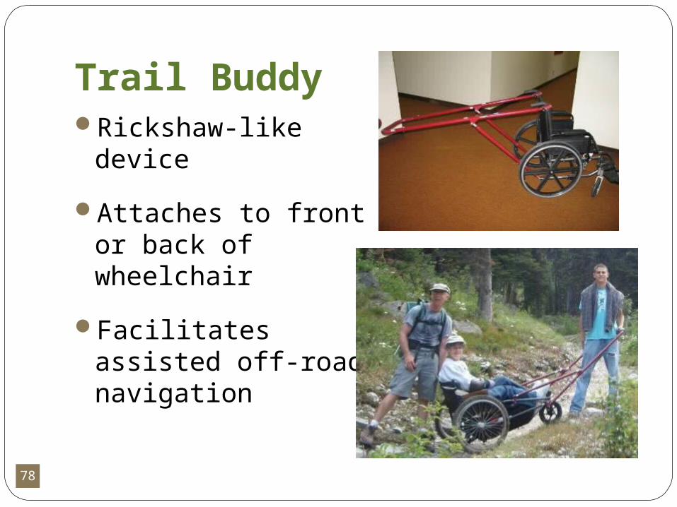
Trail BuddyRickshaw-like device
Attaches to front or back of wheelchair
Facilitates assisted off-road navigation
79
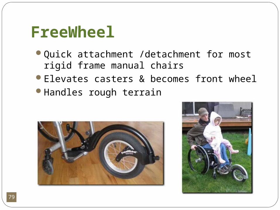
FreeWheel Quick attachment /detachment for most rigid
frame manual chairsElevates casters & becomes front wheelHandles rough terrain

80
Accessible CampingEureka Freedom Tent
Sliding door; no threshold
Wall Tent with frame
Most accessible
Accessories:
Raised cot, remote lantern, accessible cook station
81
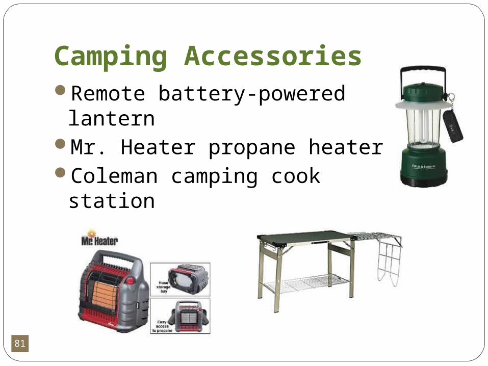
Camping AccessoriesRemote battery-powered
lantern Mr. Heater propane heaterColeman camping cook
station
82
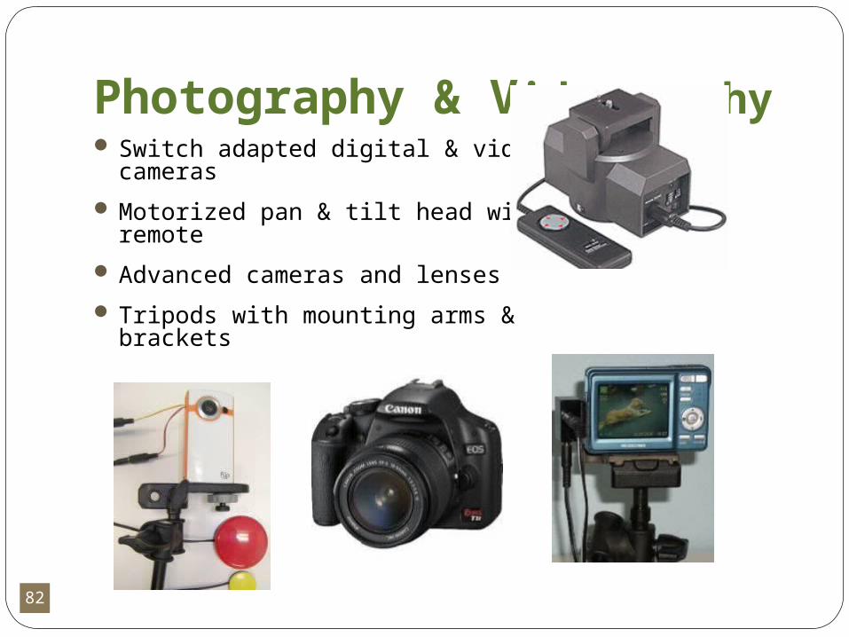
Photography & Videography Switch adapted digital & video
cameras
Motorized pan & tilt head with remote
Advanced cameras and lenses
Tripods with mounting arms & brackets
83
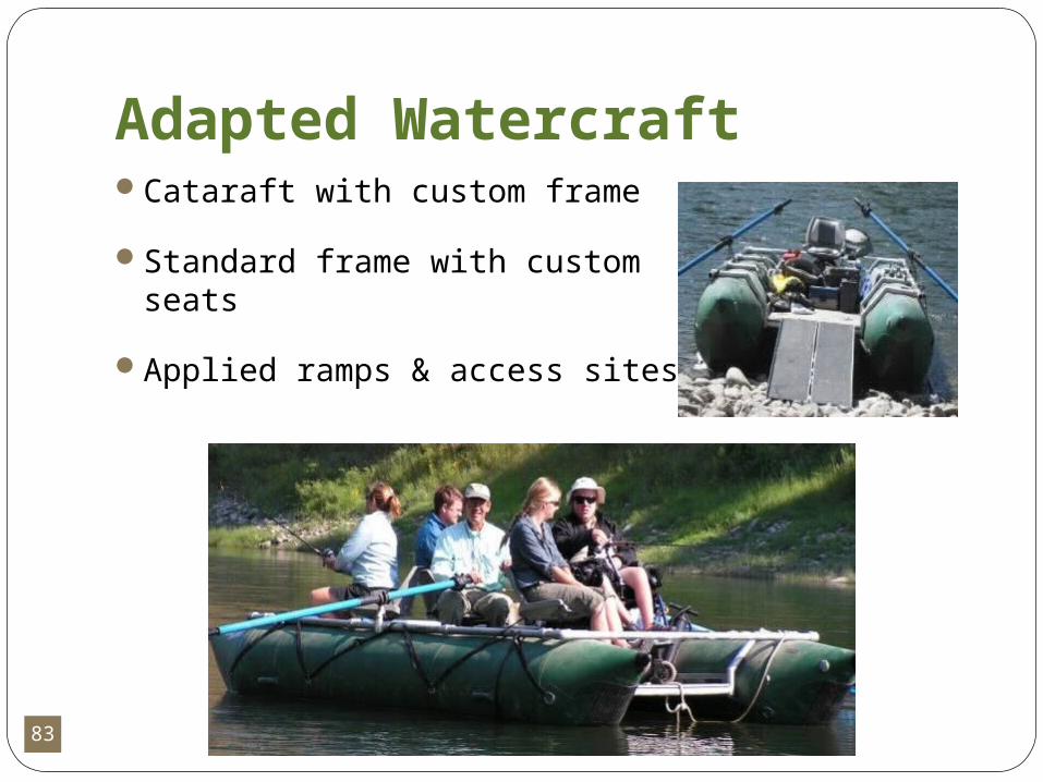
Adapted WatercraftCataraft with custom frame
Standard frame with custom seats
Applied ramps & access sites
84
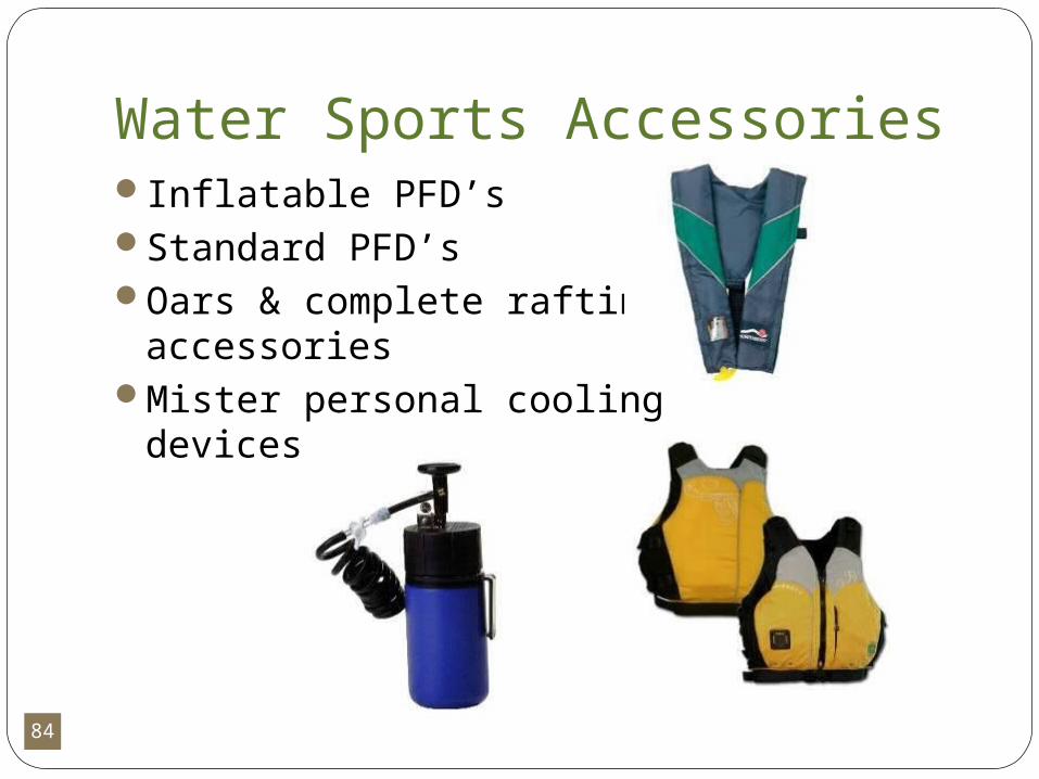
Water Sports AccessoriesInflatable PFD’sStandard PFD’sOars & complete rafting
accessoriesMister personal cooling
devices
85
Much, much more equipment…All equipment is available via the
website for use in MontanaView & search equipment; request a
loanCall for assistance
Additional equipment to be purchased through September 2011
* Users asked to suggest equipment they like & will use
86
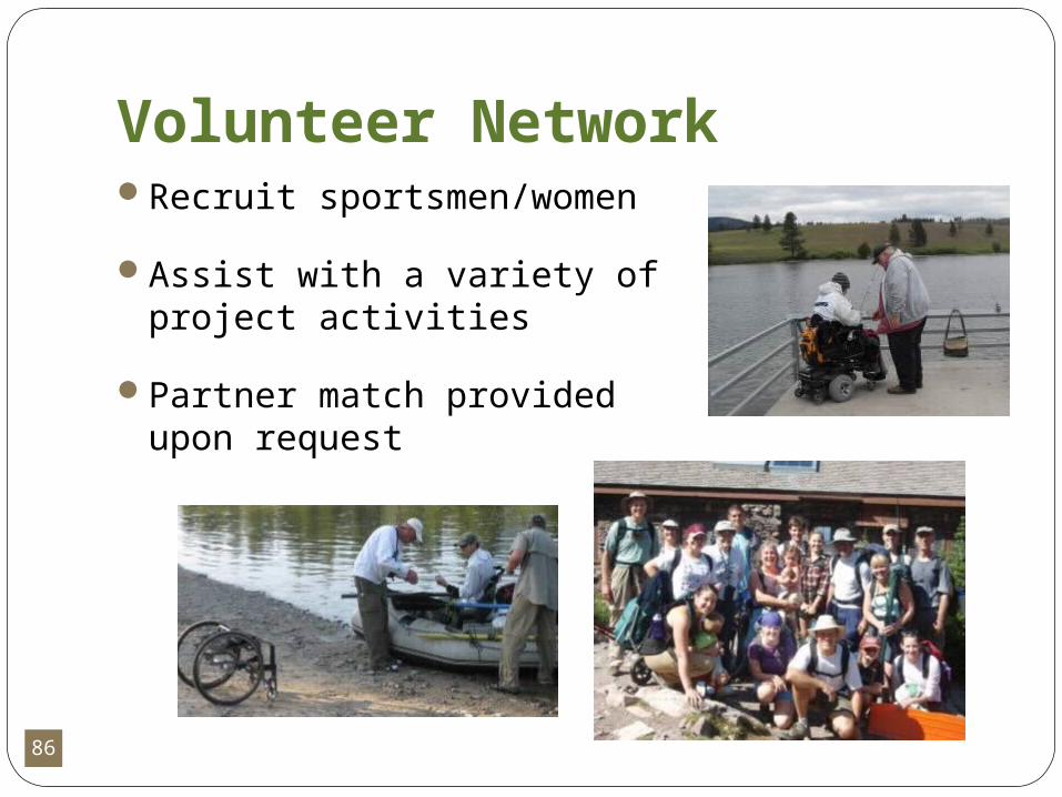
Volunteer NetworkRecruit sportsmen/women
Assist with a variety of project activities
Partner match provided upon request
87
MonTECH ServicesConsultingTraining (on-site and distance)PresentationsCustomized Assessments and ReportsCollecting GPS DataMapping

88
Contact InformationMonTECHhttp://montech.ruralinstitute.umt.edu/[email protected]
For questions relating to the recreation database and data sheets email:
Jillian Jurica at [email protected]
89
Questions?
90
Thank you!