Embed Size (px)
Citation preview
113
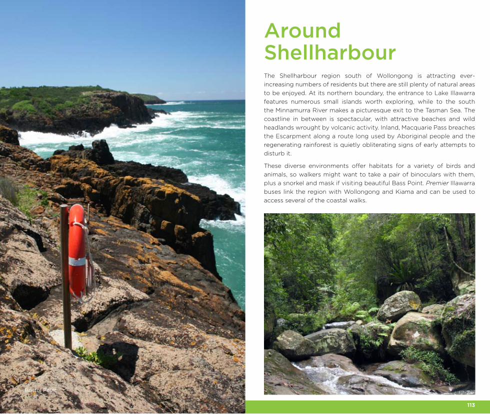
The Shellharbour region south of Wollongong is attracting ever-
increasing numbers of residents but there are still plenty of natural areas
to be enjoyed. At its northern boundary, the entrance to Lake Illawarra
features numerous small islands worth exploring, while to the south
the Minnamurra River makes a picturesque exit to the Tasman Sea. The
coastline in between is spectacular, with attractive beaches and wild
headlands wrought by volcanic activity. Inland, Macquarie Pass breaches
the Escarpment along a route long used by Aboriginal people and the
regenerating rainforest is quietly obliterating signs of early attempts to
disturb it.
These diverse environments offer habitats for a variety of birds and
animals, so walkers might want to take a pair of binoculars with them,
plus a snorkel and mask if visiting beautiful Bass Point. Premier Illawarra
buses link the region with Wollongong and Kiama and can be used to
access several of the coastal walks.
Around Shellharbour
Bristol Point
114 115
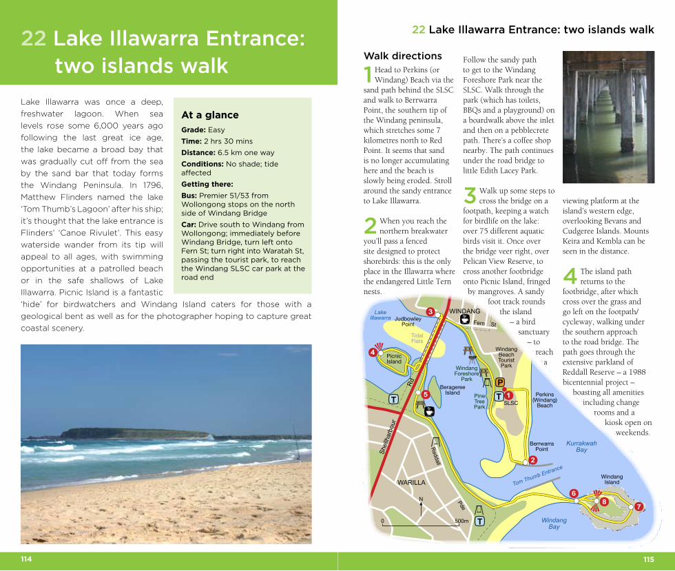
22 Lake Illawarra Entrance: two islands walk
Walk directions
1 Head to Perkins (or Windang) Beach via the
sand path behind the SLSC and walk to Berrwarra Point, the southern tip of the Windang peninsula, which stretches some 7 kilometres north to Red Point. It seems that sand is no longer accumulating here and the beach is slowly being eroded. Stroll around the sandy entrance to Lake Illawarra.
2 When you reach the northern breakwater
you’ll pass a fenced site designed to protect shorebirds: this is the only place in the Illawarra where the endangered Little Tern nests.
Follow the sandy path to get to the Windang Foreshore Park near the SLSC. Walk through the park (which has toilets, BBQs and a playground) on a boardwalk above the inlet and then on a pebblecrete path. There’s a coffee shop nearby. The path continues under the road bridge to little Edith Lacey Park.
3 Walk up some steps to cross the bridge on a
footpath, keeping a watch for birdlife on the lake: over 75 different aquatic birds visit it. Once over the bridge veer right, over Pelican View Reserve, to cross another footbridge onto Picnic Island, fringed
by mangroves. A sandy foot track rounds
the island – a bird
sanctuary – to
reach a
viewing platform at the island’s western edge, overlooking Bevans and Cudgeree Islands. Mounts Keira and Kembla can be seen in the distance.
4 The island path returns to the
footbridge, after which cross over the grass and go left on the footpath/cycleway, walking under the southern approach to the road bridge. The path goes through the extensive parkland of Reddall Reserve – a 1988 bicentennial project –
boasting all amenities including change
rooms and a kiosk open on
weekends.
Lake Illawarra was once a deep,
freshwater lagoon. When sea
levels rose some 6,000 years ago
following the last great ice age,
the lake became a broad bay that
was gradually cut off from the sea
by the sand bar that today forms
the Windang Peninsula. In 1796,
Matthew Flinders named the lake
‘Tom Thumb’s Lagoon’ after his ship;
it’s thought that the lake entrance is
Flinders’ ‘Canoe Rivulet’. This easy
waterside wander from its tip will
appeal to all ages, with swimming
opportunities at a patrolled beach
or in the safe shallows of Lake
Illawarra. Picnic Island is a fantastic
‘hide’ for birdwatchers and Windang Island caters for those with a
geological bent as well as for the photographer hoping to capture great
coastal scenery.
22 Lake Illawarra Entrance: two islands walk
At a glance
Grade: Easy
Time: 2 hrs 30 mins
Distance: 6.5 km one way
Conditions: No shade; tide affected
Getting there:
Bus: Premier 51/53 from Wollongong stops on the north side of Windang Bridge
Car: Drive south to Windang from Wollongong; immediately before Windang Bridge, turn left onto Fern St; turn right into Waratah St, passing the tourist park, to reach the Windang SLSC car park at the road end
0 500m
N
TP
3
4
15
2
6
78
T
T
Shel
lhar
bour
Reddall
Rd
Pde
Fern St
WINDANG
WindangForeshore
Park
SLSC
KurrakwahBay
PicnicIsland
Tom Thumb Entrance
LakeIllawarra
Perkins(Windang)
Beach
BerrwarraPoint
WindangIsland
WindangBay
BeragereeIsland
TidalFlats
JudbowleyPoint
WARILLA
PineTreePark
WindangBeachTouristPark
116 117
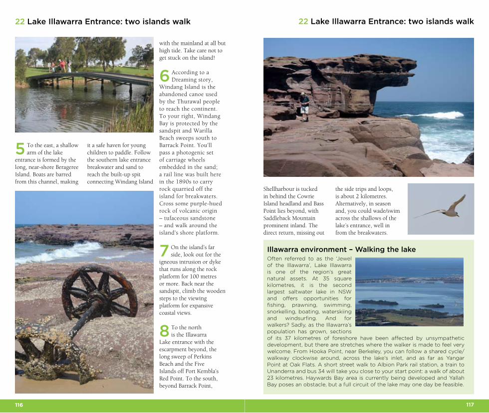
5 To the east, a shallow arm of the lake
entrance is formed by the long, near-shore Berageree Island. Boats are barred from this channel, making
it a safe haven for young children to paddle. Follow the southern lake entrance breakwater and sand to reach the built-up spit connecting Windang Island
with the mainland at all but high tide. Take care not to get stuck on the island!
6 According to a Dreaming story,
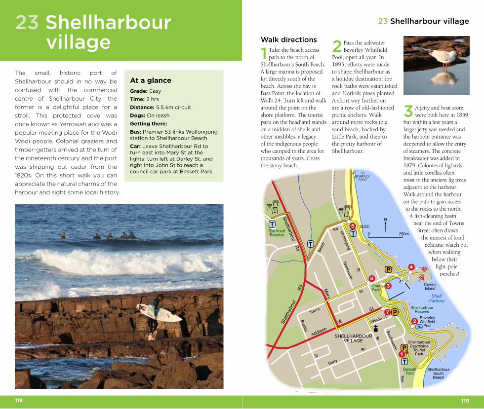
Windang Island is the abandoned canoe used by the Thurawal people to reach the continent. To your right, Windang Bay is protected by the sandspit and Warilla Beach sweeps south to Barrack Point. You’ll pass a photogenic set of carriage wheels embedded in the sand; a rail line was built here in the 1890s to carry rock quarried off the island for breakwaters. Cross some purple-hued rock of volcanic origin – tufaceous sandstone – and walk around the island’s shore platform.
7 On the island’s far side, look out for the
igneous intrusion or dyke that runs along the rock platform for 100 metres or more. Back near the sandspit, climb the wooden steps to the viewing platform for expansive coastal views.
8 To the north is the Illawarra
Lake entrance with the escarpment beyond, the long sweep of Perkins Beach and the Five Islands off Port Kembla’s Red Point. To the south, beyond Barrack Point,
22 Lake Illawarra Entrance: two islands walk22 Lake Illawarra Entrance: two islands walk
Illawarra environment – Walking the lakeOften referred to as the ‘Jewel of the Illawarra’, Lake Illawarra is one of the region’s great natural assets. At 35 square kilometres, it is the second largest saltwater lake in NSW and offers opportunities for fishing, prawning, swimming, snorkelling, boating, waterskiing and windsurfing. And for walkers? Sadly, as the Illawarra’s population has grown, sections of its 37 kilometres of foreshore have been affected by unsympathetic development, but there are stretches where the walker is made to feel very welcome. From Hooka Point, near Berkeley, you can follow a shared cycle/walkway clockwise around, across the lake’s inlet, and as far as Yangar Point at Oak Flats. A short street walk to Albion Park rail station, a train to Unanderra and bus 34 will take you close to your start point: a walk of about 23 kilometres. Haywards Bay area is currently being developed and Yallah Bay poses an obstacle, but a full circuit of the lake may one day be feasible.
the side trips and loops, is about 2 kilometres. Alternatively, in season and, you could wade/swim across the shallows of the lake’s entrance, well in from the breakwaters.
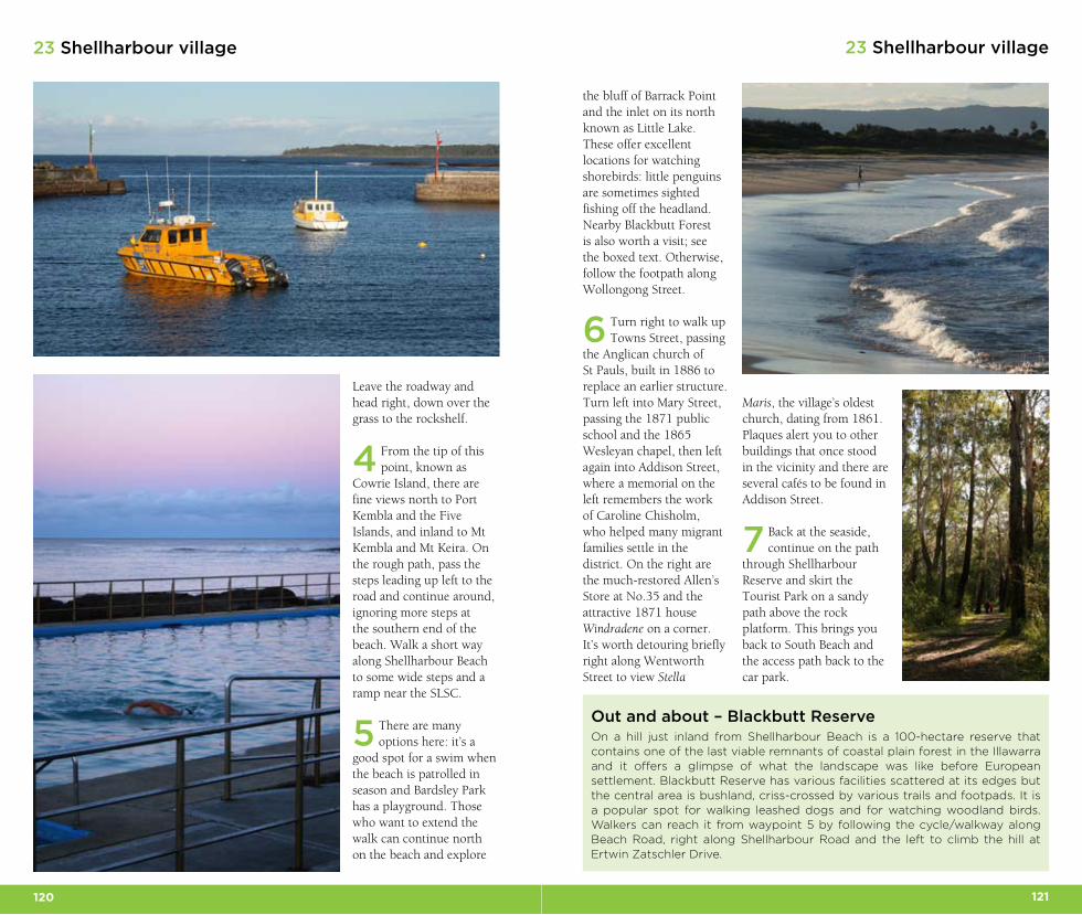
Shellharbour is tucked in behind the Cowrie Island headland and Bass Point lies beyond, with Saddleback Mountain prominent inland. The direct return, missing out
118 119
23 Shellharbour village
The small, historic port of
Shellharbour should in no way be
confused with the commercial
centre of Shellharbour City: the
former is a delightful place for a
stroll. This protected cove was
once known as Yerrowah and was a
popular meeting place for the Wodi
Wodi people. Colonial graziers and
timber-getters arrived at the turn of
the nineteenth century and the port
was shipping out cedar from the
1820s. On this short walk you can
appreciate the natural charms of the
harbour and sight some local history.
23 Shellharbour village
At a glance
Grade: Easy
Time: 2 hrs
Distance: 5.5 km circuit
Dogs: On leash
Getting there:
Bus: Premier 53 links Wollongong station to Shellharbour Beach
Car: Leave Shellharbour Rd to turn east into Mary St at the lights; turn left at Darley St, and right into John St to reach a council car park at Bassett Park
Walk directions
1 Take the beach access path to the north of
Shellharbour’s South Beach. A large marina is proposed for directly south of the beach. Across the bay is Bass Point, the location of Walk 24. Turn left and walk around the point on the shore platform. The tourist park on the headland stands on a midden of shells and other inedibles, a legacy of the indigenous people who camped in the area for thousands of years. Cross the stony beach.
2 Pass the saltwater Beverley Whitfield
Pool, open all year. In 1895, efforts were made to shape Shellharbour as a holiday destination: the rock baths were established and Norfolk pines planted. A short way further on are a row of old-fashioned picnic shelters. Walk around more rocks to a sand beach, backed by Little Park, and then to the pretty harbour of Shellharbour.
3 A jetty and boat store were built here in 1859
but within a few years a larger jetty was needed and the harbour entrance was deepened to allow the entry of steamers. The concrete breakwater was added in 1879. Colonies of figbirds and little corellas often roost in the ancient fig trees adjacent to the harbour. Walk around the harbour on the path to gain access to the rocks to the north.
A fish-cleaning basin near the end of Towns
Street often draws the interest of local
pelicans: watch out when walking
below their light-pole
perches!
0 250m
N
TOBARRACK
POINT
T
P
3
4
1
5
2
6
7 P
P
T
T
T
Addison
Towns
S
t
St
Mary
StShel
lhar
bour
Rd
Shellharbour Rd
Wollongong St
Beac
h
Rd
Wilson St
BoollwarrooPde
Darly
St
Sophia St
Wentworth
StSHELLHARBOURVILLAGE
BassettPark
ShellharbourBeachside
TouristPark
ShellHarbour
SLSC
ShellharbourSouthBeach
BeverleyWhitfield
Pool
ShellharbourReserve
GreyPark
BlackbuttReserve
CowrieIsland
120 121
23 Shellharbour village23 Shellharbour village
the bluff of Barrack Point and the inlet on its north known as Little Lake. These offer excellent locations for watching shorebirds: little penguins are sometimes sighted fishing off the headland. Nearby Blackbutt Forest is also worth a visit; see the boxed text. Otherwise, follow the footpath along Wollongong Street.
6 Turn right to walk up Towns Street, passing
the Anglican church of St Pauls, built in 1886 to replace an earlier structure. Turn left into Mary Street, passing the 1871 public school and the 1865 Wesleyan chapel, then left again into Addison Street, where a memorial on the left remembers the work of Caroline Chisholm, who helped many migrant families settle in the district. On the right are the much-restored Allen’s Store at No.35 and the attractive 1871 house Windradene on a corner. It’s worth detouring briefly right along Wentworth Street to view Stella
Out and about – Blackbutt ReserveOn a hill just inland from Shellharbour Beach is a 100-hectare reserve that contains one of the last viable remnants of coastal plain forest in the Illawarra and it offers a glimpse of what the landscape was like before European settlement. Blackbutt Reserve has various facilities scattered at its edges but the central area is bushland, criss-crossed by various trails and footpads. It is a popular spot for walking leashed dogs and for watching woodland birds. Walkers can reach it from waypoint 5 by following the cycle/walkway along Beach Road, right along Shellharbour Road and the left to climb the hill at Ertwin Zatschler Drive.
Leave the roadway and head right, down over the grass to the rockshelf.
4 From the tip of this point, known as
Cowrie Island, there are fine views north to Port Kembla and the Five Islands, and inland to Mt Kembla and Mt Keira. On the rough path, pass the steps leading up left to the road and continue around, ignoring more steps at the southern end of the beach. Walk a short way along Shellharbour Beach to some wide steps and a ramp near the SLSC.
5 There are many options here: it’s a
good spot for a swim when the beach is patrolled in season and Bardsley Park has a playground. Those who want to extend the walk can continue north on the beach and explore
Maris, the village’s oldest church, dating from 1861. Plaques alert you to other buildings that once stood in the vicinity and there are several cafés to be found in Addison Street.
7 Back at the seaside, continue on the path
through Shellharbour Reserve and skirt the Tourist Park on a sandy path above the rock platform. This brings you back to South Beach and the access path back to the car park.
122 123
24 Bass Point Reserve
Finding the trackNear Shellharbour village, leave Shellharbour Road at the lights to head east down Addison Street and follow signs for Bass Point; on Bass Point Tourist Road, pass the long quarry jetty and turn left to park in a large lay-by down by a boat ramp.
Walk directions
1 A sign marks the start of the Bass Point Coastal
Walk. The grassy path wanders past volcanic latite rock to soon reach Red Sands Beach, presumably named after the iron-oxide intrusions in the nearby rocks. From here, there are sweeping views of the Illawarra Escarpment and the coast from Shellharbour to Port Kembla. Behind the beach is a thicket of lantana, backed by tall coastal banksias. Around from the beach, head past a set of steps coming down from the right, then continue around onto the
sand and rock-hop around to the next small cove.
2 This beach of large grey pebbles is known
as The Middy. Continue on to soon pick up the main walking track to reach another tiny sand beach at Beaky Cove, backed by banksias that are frequented by honeyeaters and introduced red-whiskered bulbuls. Rejoin the path briefly and walk through stone barriers to reach the main picnic area, fringed by casuarinas.
3 There’s an indigenous cultural path around
this clearing. Middens on Bass Point indicate Aboriginal activity here from at least 17,000 years ago, when this area was well inland; one yielded the earliest edge-ground axe found outside of tropical Australia. At the eastern edge of the clearing, take time to inspect the Gutter: a dramatic, 40-metre-long volcanic dyke, formed when molten magma was forced into a fissure of existing rock and then
Just south of Shellharbour, one
rocky little headland resisted
encroaching settlement and
quarrying. The combined values
of Bass Point – its natural beauty,
cultural and archaeological fea-
tures – have warranted a listing
in the Register of the Australian
Heritage Commission and it is indeed a special place to visit,
especially if you’re prepared to leave the level path. When the
water temperature permits, you’ll want to leave dry land altogether,
but bring a snorkel and mask with you! With its diverse habitats,
this is also a great location for watching birdlife.
24 Bass Point Reserve
At a glance
Grade: Medium
Time: 3 hrs
Distance: 5 km circuit
Conditions: Easy rock-hopping, one short difficult section
0 500m
N
TOSHELLHARBOUR
▲
▲TP
34
1
5
2
6
7
8
PP
T
PP
Bass PointTourist
Rd
Bass PointReserve
Red SandsBeach
BeakyCove
Memorial
MaloneysBay
TheMiddy
The Gutter
BostonPoint
BassPoint
BushrangersBay
ViewingPlatform
Dyke
ViewingPlatform
124 125
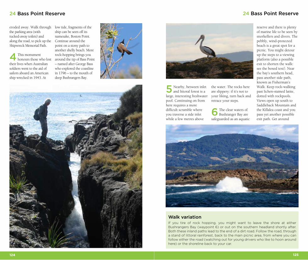
low tide, fragments of the ship can be seen off its namesake, Boston Point. Continue around the point on a stony path to another shelly beach. More rock-hopping brings you around the tip of Bass Point – named after George Bass who explored the coastline in 1796 – to the mouth of deep Bushrangers Bay.
5 Nearby, between inlet and littoral forest is a
large, interesting freshwater pool. Continuing on from here requires a more difficult scramble where you traverse a side inlet while a few metres above
eroded away. Walk through the parking area (with tucked-away toilets) and along the road, to pick up the Shipwreck Memorial Path.
4 This monument honours those who lost
their lives when Australian soldiers went to the aid of sailors aboard an American ship wrecked in 1943. At
24 Bass Point Reserve24 Bass Point Reserve
Walk variationIf you tire of rock hopping, you might want to leave the shore at either Bushrangers Bay (waypoint 6) or out on the southern headland shortly after. Both these inland paths lead to the end of a dirt road. Follow the road, through a stand of littoral rainforest, back to the main picnic area, from where you can follow either the road (watching out for young drivers who like to hoon around here) or the shoreline back to your car.
the water. The rocks here are slippery: if it’s not to your liking, turn back and retrace your steps.
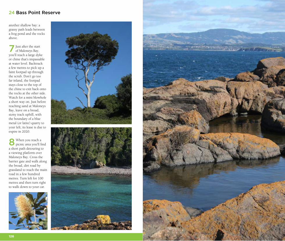
6 The clear waters of Bushranger Bay are
safeguarded as an aquatic
reserve and there is plenty of marine life to be seen by snorkellers and divers. The pebbly, wind-protected beach is a great spot for a picnic. You might detour up the steps to a viewing platform (also a possible exit to shorten the walk: see the boxed text). Near the bay’s southern head, pass another side path, known as Fisherman’s Walk. Keep rock-walking past lichen-stained latite, dotted with rockpools. Views open up south to Saddleback Mountain and the Killalea coast and you pass yet another possible exit path. Get around
126 127
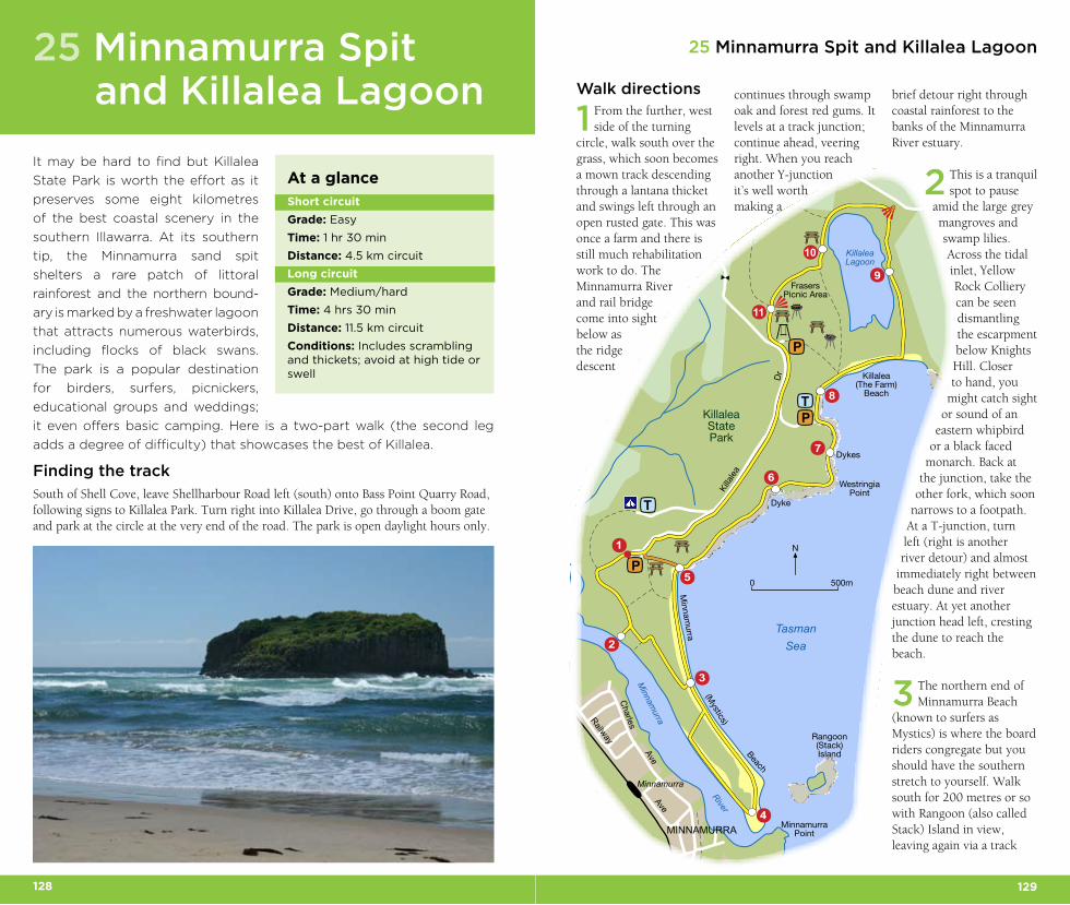
another shallow bay: a grassy path leads between a frog pond and the rocks above.
7 Just after the start of Maloneys Bay,
you’ll reach a large dyke or chine that’s impassable at water level. Backtrack a few metres to pick up a faint footpad up through the scrub. Don’t go too far inland, the footpad stays close to the top of the chine to exit back onto the rocks at the other side. Watch for a mini blowhole a short way on. Just before reaching sand at Maloneys Bay, leave on a broad, stony track uphill, with the boundary of a blue metal (or latite) quarry to your left; its lease is due to expire in 2020.
8 When you reach a picnic area you’ll find
a short path detouring to a viewing platform over Maloneys Bay. Cross the barrier gate and walk along the broad, dirt road by grassland to reach the main road in a few hundred metres. Turn left for 100 metres and then turn right to walk down to your car.
24 Bass Point Reserve
128 129
0 500m
N
▲
▲
T
P
3
4
1
5
2
6
7
8
9
TP
10
11
P
Charles
Minnamurra
Ave
Railway
Ave
Killa
lea
Dr
MINNAMURRA MinnamurraPoint
KillaleaLagoon
TasmanSea
Killalea(The Farm)
Beach
Minnam
urraKillaleaStatePark
Dykes
Dyke
WestringiaPoint
FrasersPicnic Area
Minnam
urra
(Mystics)
Beach
Rangoon(Stack)Island
River
25 Minnamurra Spit and Killalea Lagoon
Walk directions
1 From the further, west side of the turning
circle, walk south over the grass, which soon becomes a mown track descending through a lantana thicket and swings left through an open rusted gate. This was once a farm and there is still much rehabilitation work to do. The Minnamurra River and rail bridge come into sight below as the ridge descent
continues through swamp oak and forest red gums. It levels at a track junction; continue ahead, veering right. When you reach another Y-junction it’s well worth making a
brief detour right through coastal rainforest to the banks of the Minnamurra River estuary.
2 This is a tranquil spot to pause
amid the large grey mangroves and swamp lilies. Across the tidal inlet, Yellow Rock Colliery can be seen dismantling the escarpment below Knights Hill. Closer to hand, you
might catch sight or sound of an
eastern whipbird or a black faced
monarch. Back at the junction, take the
other fork, which soon narrows to a footpath.
At a T-junction, turn left (right is another river detour) and almost
immediately right between beach dune and river estuary. At yet another junction head left, cresting the dune to reach the beach.
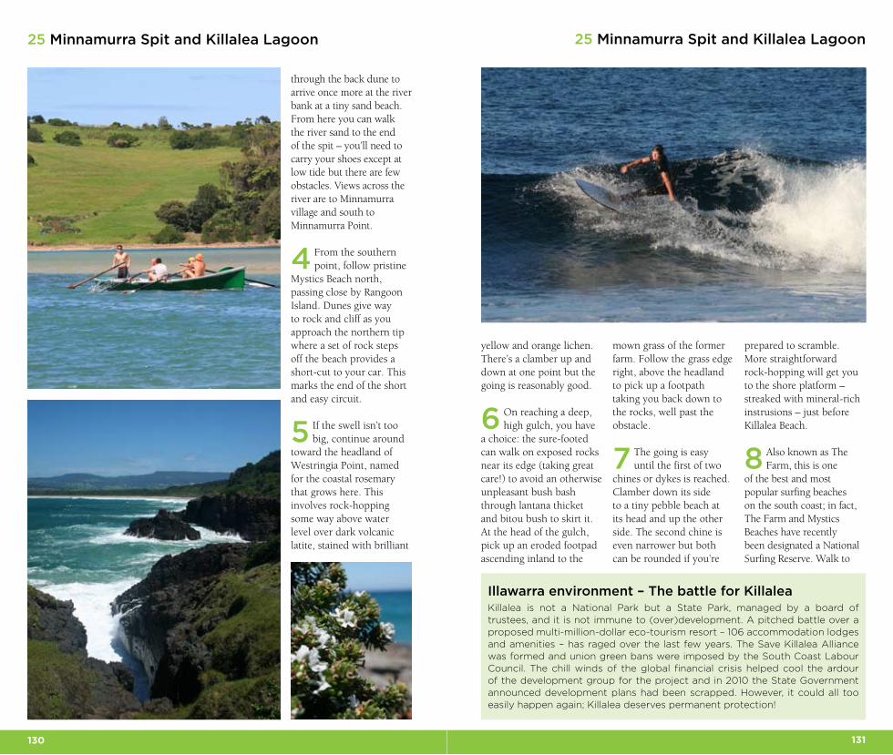
3 The northern end of Minnamurra Beach
(known to surfers as Mystics) is where the board riders congregate but you should have the southern stretch to yourself. Walk south for 200 metres or so with Rangoon (also called Stack) Island in view, leaving again via a track
It may be hard to find but Killalea
State Park is worth the effort as it
preserves some eight kilometres
of the best coastal scenery in the
southern Illawarra. At its southern
tip, the Minnamurra sand spit
shelters a rare patch of littoral
rainforest and the northern bound-
ary is marked by a freshwater lagoon
that attracts numerous waterbirds,
including flocks of black swans.
The park is a popular destination
for birders, surfers, picnickers,
educational groups and weddings;
it even offers basic camping. Here is a two-part walk (the second leg
adds a degree of difficulty) that showcases the best of Killalea.
Finding the track
South of Shell Cove, leave Shellharbour Road left (south) onto Bass Point Quarry Road, following signs to Killalea Park. Turn right into Killalea Drive, go through a boom gate and park at the circle at the very end of the road. The park is open daylight hours only.
25 Minnamurra Spit and Killalea Lagoon
At a glance
Short circuit
Grade: Easy
Time: 1 hr 30 min
Distance: 4.5 km circuit
Long circuit
Grade: Medium/hard
Time: 4 hrs 30 min
Distance: 11.5 km circuit
Conditions: Includes scrambling and thickets; avoid at high tide or swell
130 131
25 Minnamurra Spit and Killalea Lagoon25 Minnamurra Spit and Killalea Lagoon
yellow and orange lichen. There’s a clamber up and down at one point but the going is reasonably good.
6 On reaching a deep, high gulch, you have
a choice: the sure-footed can walk on exposed rocks near its edge (taking great care!) to avoid an otherwise unpleasant bush bash through lantana thicket and bitou bush to skirt it. At the head of the gulch, pick up an eroded footpad ascending inland to the
mown grass of the former farm. Follow the grass edge right, above the headland to pick up a footpath taking you back down to the rocks, well past the obstacle.
7 The going is easy until the first of two
chines or dykes is reached. Clamber down its side to a tiny pebble beach at its head and up the other side. The second chine is even narrower but both can be rounded if you’re
prepared to scramble. More straightforward rock-hopping will get you to the shore platform – streaked with mineral-rich instrusions – just before Killalea Beach.
8 Also known as The Farm, this is one
of the best and most popular surfing beaches on the south coast; in fact, The Farm and Mystics Beaches have recently been designated a National Surfing Reserve. Walk to
through the back dune to arrive once more at the river bank at a tiny sand beach. From here you can walk the river sand to the end of the spit – you’ll need to carry your shoes except at low tide but there are few obstacles. Views across the river are to Minnamurra village and south to Minnamurra Point.
4 From the southern point, follow pristine
Mystics Beach north, passing close by Rangoon Island. Dunes give way to rock and cliff as you approach the northern tip where a set of rock steps off the beach provides a short-cut to your car. This marks the end of the short and easy circuit.
5 If the swell isn’t too big, continue around
toward the headland of Westringia Point, named for the coastal rosemary that grows here. This involves rock-hopping some way above water level over dark volcanic latite, stained with brilliant
Illawarra environment – The battle for KillaleaKillalea is not a National Park but a State Park, managed by a board of trustees, and it is not immune to (over)development. A pitched battle over a proposed multi-million-dollar eco-tourism resort – 106 accommodation lodges and amenities – has raged over the last few years. The Save Killalea Alliance was formed and union green bans were imposed by the South Coast Labour Council. The chill winds of the global financial crisis helped cool the ardour of the development group for the project and in 2010 the State Government announced development plans had been scrapped. However, it could all too easily happen again; Killalea deserves permanent protection!
132 133
25 Minnamurra Spit and Killalea Lagoon
the eastern end of the beach and head inland on a track through the back dune to skirt above Killalea Lagoon’s eastern banks. The sand dunes separating the sea and lagoon were once the site of a short-lived gold mining business in 1872 owned by Edward Killalea.
9 The track veers close to the lagoon’s
reed-lined bank allowing a short detour to a good
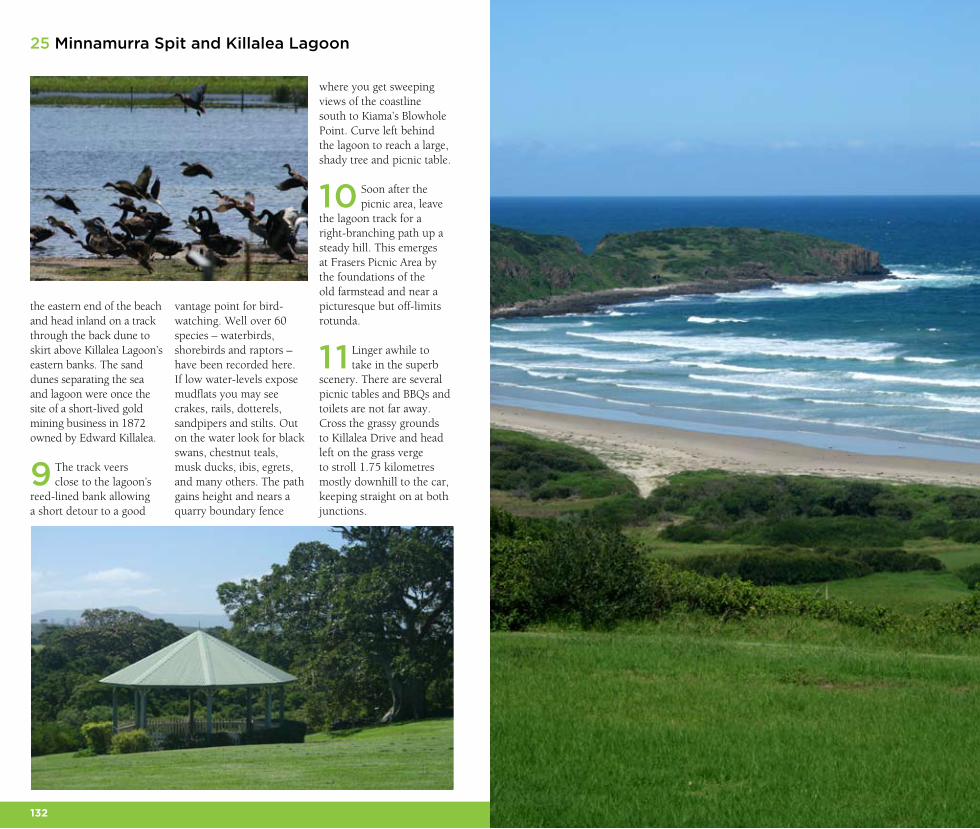
vantage point for bird-watching. Well over 60 species – waterbirds, shorebirds and raptors – have been recorded here. If low water-levels expose mudflats you may see crakes, rails, dotterels, sandpipers and stilts. Out on the water look for black swans, chestnut teals, musk ducks, ibis, egrets, and many others. The path gains height and nears a quarry boundary fence
where you get sweeping views of the coastline south to Kiama’s Blowhole Point. Curve left behind the lagoon to reach a large, shady tree and picnic table.
10 Soon after the picnic area, leave
the lagoon track for a right-branching path up a steady hill. This emerges at Frasers Picnic Area by the foundations of the old farmstead and near a picturesque but off-limits rotunda.
11 Linger awhile to take in the superb
scenery. There are several picnic tables and BBQs and toilets are not far away. Cross the grassy grounds to Killalea Drive and head left on the grass verge to stroll 1.75 kilometres mostly downhill to the car, keeping straight on at both junctions.
25 Minnamurra Spit and Killalea Lagoon
134 135
26 Macquarie Pass Cascade Rainforest
Walk directions
1 Cross the grass-mown picnic area to a metal
signboard at the far right corner, marking the head of the Cascade Rainforest Walk. This is the first of several interpretive signs along a mostly well-graded path that makes use of an old cedar-getting trail.
2 The path soon leaves the Cascades Stream,
a tributary of Macquarie Rivulet, climbing log steps to meet another track joining from the left. Descend once more to the creek and
soon pass on your left a huge strangler fig in a small clearing.
3 Continue upstream – there are several places
you can easily detour to the stream where maidenhair ferns grow along the bank. Most of the red cedars have long since been logged but rainforest species such as cabbage tree palm, tree-fern, liana vine, giant stinging tree, lilly pilly, coachwood and sassafras abound. In cooler seasons,
the fungi can be spectacular
after rain.
4 You’ll next reach the base of a railed ramp
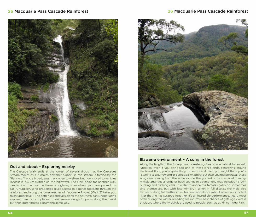
which rises up and then descends to creek level at the confluence with a smaller tributary creek. Trees around here bear axe marks, reminders of the selective logging in the area. Steps deposit you on flat rock at the base of the Cascade.
5 Pause here awhile and admire the
scene. If you look up into the lush forest canopy you’ll see elkhorns and birds nest ferns; these large epiphytes are associated more with subtropical than temperate rainforests. Retrace your steps to return to your car.
The rugged escarpment amphi-
theatre of Macquarie Pass National
Park is a remarkable sight to the
west as you travel through the
southern Illawarra. The park protects
some of Australia’s most southern
subtropical rainforest and is named
after a historic route taken from
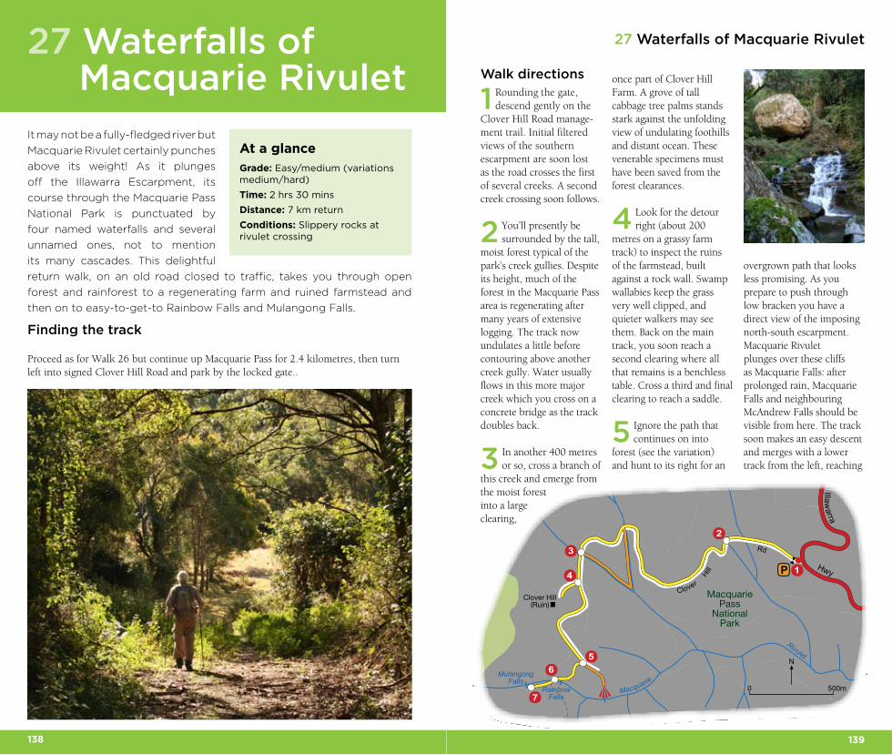
coastal plain to the highlands. This creek-side rainforest walk to a waterfall
in the foothills of the park is the only officially designated walking track in
the park. It’s a short but beautiful stroll, especially after rain.
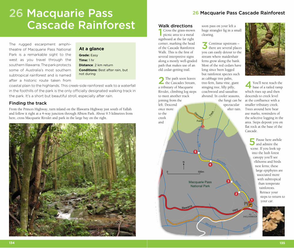
Finding the trackFrom the Princes Highway, turn inland on the Illawarra Highway just south of Yallah and follow it right at a 4-way junction through Albion Park. About 9.5 kilmetres from here, cross Macquarie Rivulet and park in the large bay on the right.
26 Macquarie Pass Cascade Rainforest
At a glance
Grade: Easy
Time: 1 hr
Distance: 2 km return
Conditions: Best after rain, but not during
0 500m
N
TOSHELLHARBOUR
P
3
4
1
5
2
HwyIllawarra
Glenview
Trac
k
Ford
Stream
Macquarie PassNational Park
RivuletMacquarie
Cascades
The
136 137
26 Macquarie Pass Cascade Rainforest26 Macquarie Pass Cascade Rainforest
Out and about – Exploring nearbyThe Cascade Walk ends at the lowest of several drops that the Cascades Stream makes as it tumbles downhill; higher up, the stream is forded by the Glenview Track, a broad, easy track open to walkers but now closed to vehicles (access is 3.3 km further up the highway). The start point for another walk can be found across the Illawarra Highway from where you have parked the car. A road servicing properties gives access to a minor footpath through the rainforest and along the lower reaches of Macquarie Rivulet (Walk 27 takes you to an upper level). The path rises and falls along the northern bank, negotiating exposed tree roots in places, to visit several delightful pools along the rivulet but then deteriorates. Return the same way.
Illawarra environment – A song in the forestAlong the length of the Escarpment, forested gullies offer a habitat for superb lyrebirds. Even if you don’t see one of these large birds, scratching around the forest floor, you’re quite likely to hear one. At first, you might think you’re listening to a currawong or perhaps a whipbird, but then you realise that all these songs are coming from the same source: the lyrebird is the master of mimicry. A male arranges a range of bush sounds in a symphony that includes his own buzzing and clicking calls, in order to entice the females (who do sometimes sing themselves, but with less mimicry). When in full display, the male also throws his long tail feathers over his head and dances about on a mound of leaf litter that he has scraped together. It’s an incredible performance, heard most often during the winter breeding season. Your best chance of getting tickets is at places where the lyrebirds are used to people, such as at Minnamurra Falls.
White Sands Walk
138 139
27 Waterfalls of Macquarie Rivulet
Walk directions
1 Rounding the gate, descend gently on the
Clover Hill Road manage-ment trail. Initial filtered views of the southern escarpment are soon lost as the road crosses the first of several creeks. A second creek crossing soon follows.
2 You’ll presently be surrounded by the tall,
moist forest typical of the park’s creek gullies. Despite its height, much of the forest in the Macquarie Pass area is regenerating after many years of extensive logging. The track now undulates a little before contouring above another creek gully. Water usually flows in this more major creek which you cross on a concrete bridge as the track doubles back.
3 In another 400 metres or so, cross a branch of
this creek and emerge from the moist forest into a large clearing,
once part of Clover Hill Farm. A grove of tall cabbage tree palms stands stark against the unfolding view of undulating foothills and distant ocean. These venerable specimens must have been saved from the forest clearances.
4 Look for the detour right (about 200
metres on a grassy farm track) to inspect the ruins of the farmstead, built against a rock wall. Swamp wallabies keep the grass very well clipped, and quieter walkers may see them. Back on the main track, you soon reach a second clearing where all that remains is a benchless table. Cross a third and final clearing to reach a saddle.
5 Ignore the path that continues on into
forest (see the variation) and hunt to its right for an
It may not be a fully-fledged river but
Macquarie Rivulet certainly punches
above its weight! As it plunges
off the Illawarra Escarpment, its
course through the Macquarie Pass
National Park is punctuated by
four named waterfalls and several
unnamed ones, not to mention
its many cascades. This delightful
return walk, on an old road closed to traffic, takes you through open
forest and rainforest to a regenerating farm and ruined farmstead and
then on to easy-to-get-to Rainbow Falls and Mulangong Falls.
Finding the track
Proceed as for Walk 26 but continue up Macquarie Pass for 2.4 kilometres, then turn left into signed Clover Hill Road and park by the locked gate..
27 Waterfalls of Macquarie Rivulet
At a glance
Grade: Easy/medium (variations medium/hard)
Time: 2 hrs 30 mins
Distance: 7 km return
Conditions: Slippery rocks at rivulet crossing
overgrown path that looks less promising. As you prepare to push through low bracken you have a direct view of the imposing north-south escarpment. Macquarie Rivulet plunges over these cliffs as Macquarie Falls: after prolonged rain, Macquarie Falls and neighbouring McAndrew Falls should be visible from here. The track soon makes an easy descent and merges with a lower track from the left, reaching
0 500m
N
▲
▲
P
3
4 1
5
2
6
7
Hwy
Rd
Illawarra
Clover H
ill
MacquariePass
NationalPark
Clover Hill(Ruin)
Rivulet
MulangongFalls
RainbowFalls
Macquarie
140 141
27 Waterfalls of Macquarie Rivulet27 Waterfalls of Macquarie Rivulet
the bank of Macquarie Rivulet. Take care, as the smooth rock can be slippery.
6 A few metres down-stream, Rainbow Falls
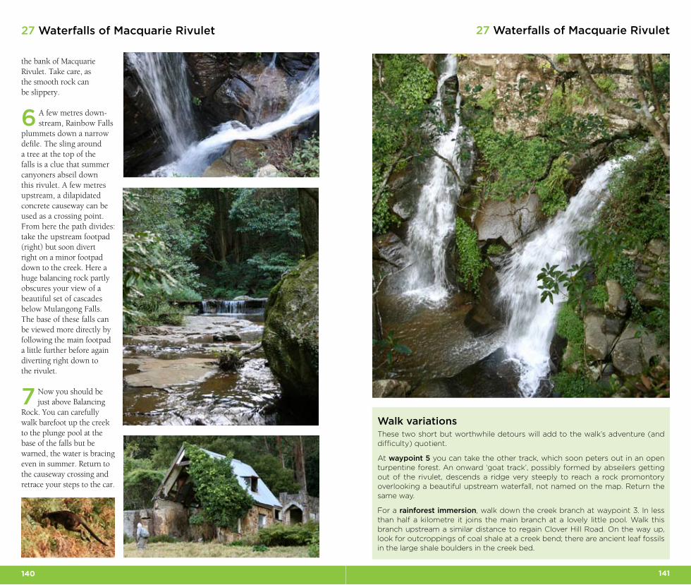
plummets down a narrow defile. The sling around a tree at the top of the falls is a clue that summer canyoners abseil down this rivulet. A few metres upstream, a dilapidated concrete causeway can be used as a crossing point. From here the path divides: take the upstream footpad (right) but soon divert right on a minor footpad down to the creek. Here a huge balancing rock partly obscures your view of a beautiful set of cascades below Mulangong Falls. The base of these falls can be viewed more directly by following the main footpad a little further before again diverting right down to the rivulet.
7 Now you should be just above Balancing
Rock. You can carefully walk barefoot up the creek to the plunge pool at the base of the falls but be warned, the water is bracing even in summer. Return to the causeway crossing and retrace your steps to the car.
Walk variationsThese two short but worthwhile detours will add to the walk’s adventure (and difficulty) quotient.
At waypoint 5 you can take the other track, which soon peters out in an open turpentine forest. An onward ‘goat track’, possibly formed by abseilers getting out of the rivulet, descends a ridge very steeply to reach a rock promontory overlooking a beautiful upstream waterfall, not named on the map. Return the same way.
For a rainforest immersion, walk down the creek branch at waypoint 3. In less than half a kilometre it joins the main branch at a lovely little pool. Walk this branch upstream a similar distance to regain Clover Hill Road. On the way up, look for outcroppings of coal shale at a creek bend; there are ancient leaf fossils in the large shale boulders in the creek bed.