Embed Size (px)
Citation preview
Argentina and Brazil A possible site to host
the SKA
M. Arnal, G. Dubner, E. Giacani, J. Lepine, H. Levato, R. Morras, E. Reynoso
AAA, 2005, La Plata
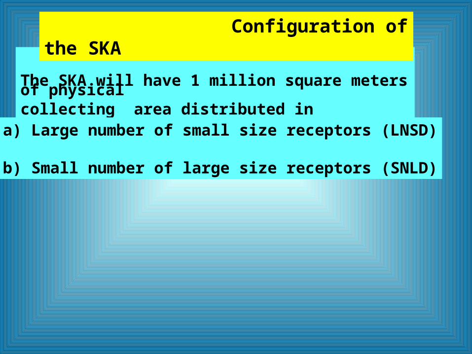
The SKA will have 1 million square meters of physical collecting area distributed in
Configuration of the SKA
a) Large number of small size receptors (LNSD)
b) Small number of large size receptors (SNLD)
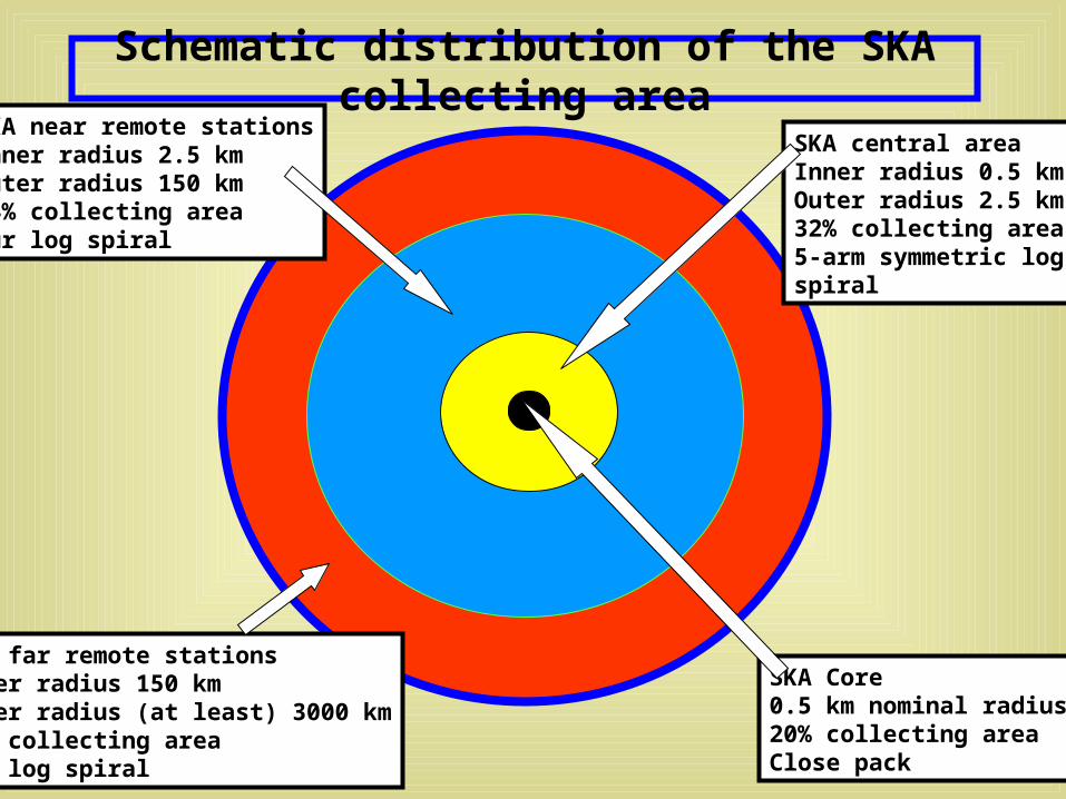
Schematic distribution of the SKA collecting area
SKA Core0.5 km nominal radius20% collecting areaClose pack
SKA far remote stationsInner radius 150 kmOuter radius (at least) 3000 km24% collecting areaOur log spiral
SKA near remote stationsInner radius 2.5 kmOuter radius 150 km24% collecting areaOur log spiral
SKA central areaInner radius 0.5 kmOuter radius 2.5 km32% collecting area5-arm symmetric logspiral

• Radioquietness of potencial sites
• Technical and scientific resources of the country
• Physical characteristic of the site
• Tropospheric and ionospheric conditions
• Capital and operating costs
• Political and economic situation of the region
Initial Site Analysis Document
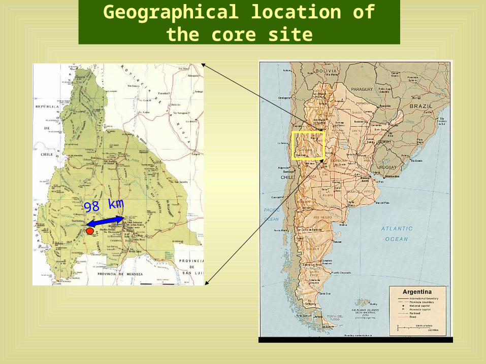
Geographical location of the core site
98 km
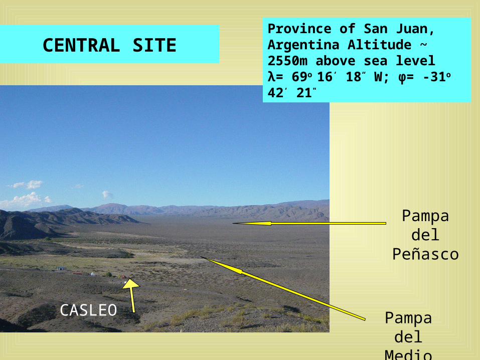
CENTRAL SITE
CASLEO Pampa del Medio
Pampa del Peñasco
Province of San Juan, Argentina Altitude ~ 2550m above sea level λ= 69o 16‘ 18“ W; φ= -31o 42‘ 21"
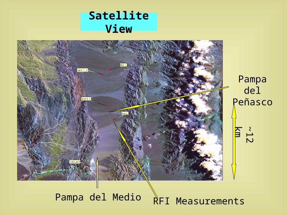
Satellite View
Pampa del Medio
Pampa del Peñasco
~12 km
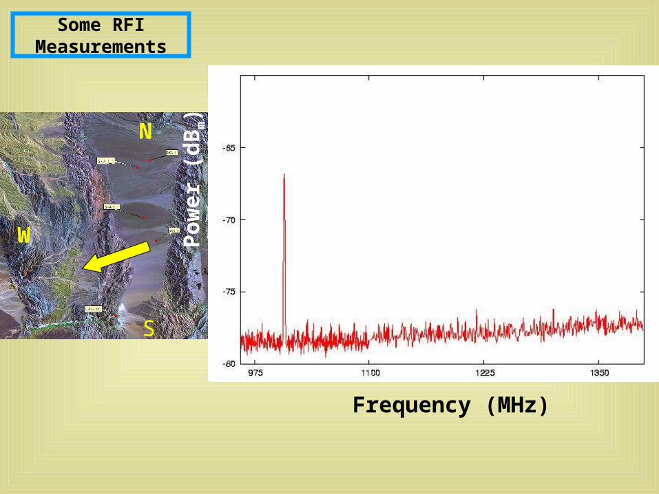
RFI Measurements
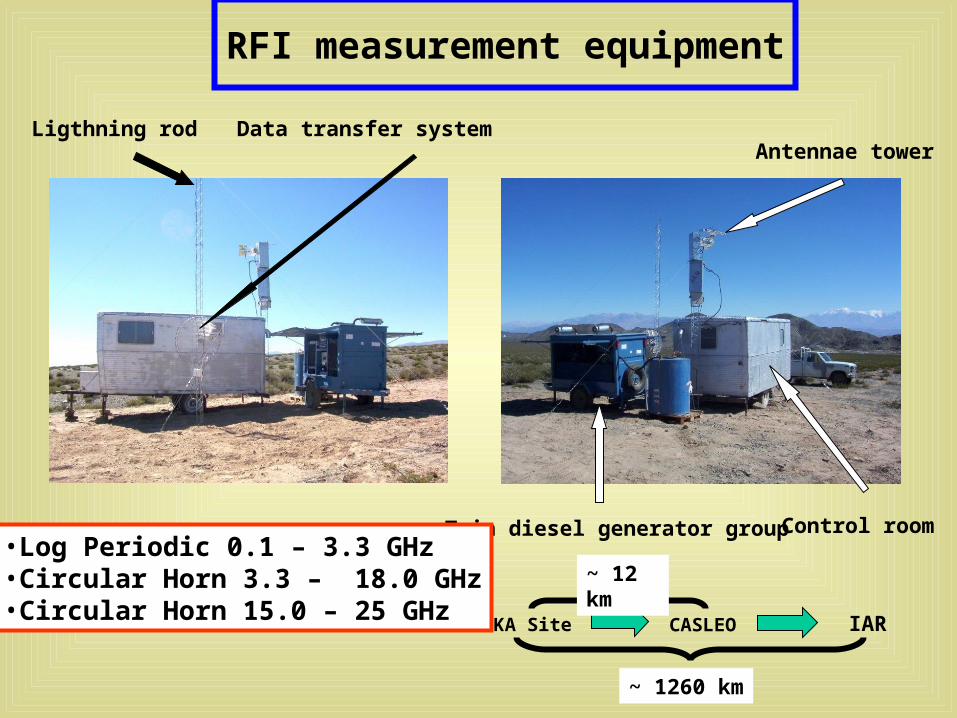
RFI measurement equipment
Twin diesel generator group
Antennae towerData transfer systemLigthning rod
Control room
SKA Site CASLEO IAR
~ 1260 km
~ 12 km•Log Periodic 0.1 – 3.3 GHz•Circular Horn 3.3 – 18.0 GHz•Circular Horn 15.0 – 25 GHz
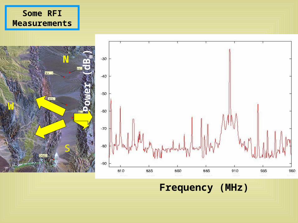
Some RFI Measurements
S
W
N
Frequency (MHz)
Pow
er (
dB
m)
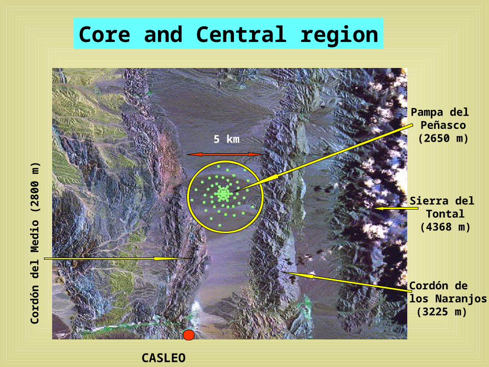
Core and Central region
CASLEO (2550m)
Cordón de los Naranjos (3225 m)
Sierra del Tontal
(4368 m)
Pampa del Peñasco(2650 m)5 km
Cor
dón
del
Med
io (
2800
m)
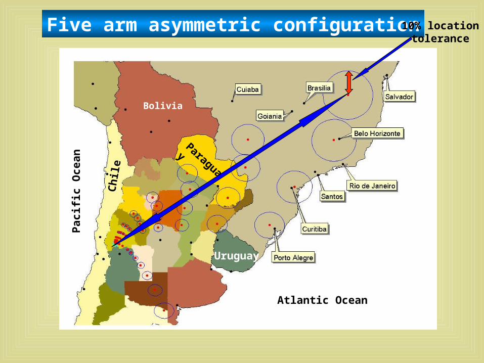
Five arm asymmetric configuration
Paraguay
BoliviaC
hile
Uruguay
10% locationtolerance
Atlantic Ocean
Pac
ific
Oce
an
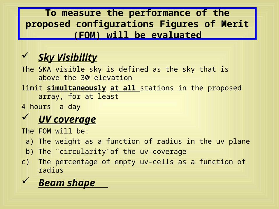
To measure the performance of the proposed configurations Figures of Merit (FOM) will be evaluated
Sky VisibilityThe SKA visible sky is defined as the sky that is above the 30o elevation
limit simultaneously at all stations in the proposed array, for at least
4 hours a day
UV coverageThe FOM will be:
a) The weight as a function of radius in the uv plane
b) The ¨circularity¨of the uv-coverage
c) The percentage of empty uv-cells as a function of radius
Beam shape
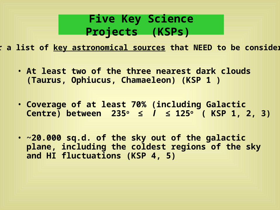
Five Key Science Projects (KSPs)
• At least two of the three nearest dark clouds (Taurus, Ophiucus, Chamaeleon) (KSP 1 )
• Coverage of at least 70% (including Galactic Centre) between 235o ≤ l ≤ 125o ( KSP 1, 2, 3)
• ~20.000 sq.d. of the sky out of the galactic plane, including the coldest regions of the sky and HI fluctuations (KSP 4, 5)
(or a list of key astronomical sources that NEED to be considered)
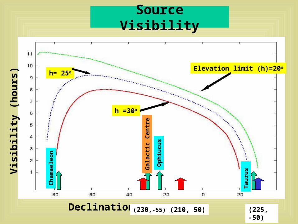
Source Visibility
Declination
Vis
ibil
ity
(hou
rs)
h =30o
h= 25oElevation limit (h)=20o
Tau
rus
Op
hiu
cus
Ch
amae
leon
Gal
acti
c C
entr
e
(210, 50)(230,-55) (225, -50)
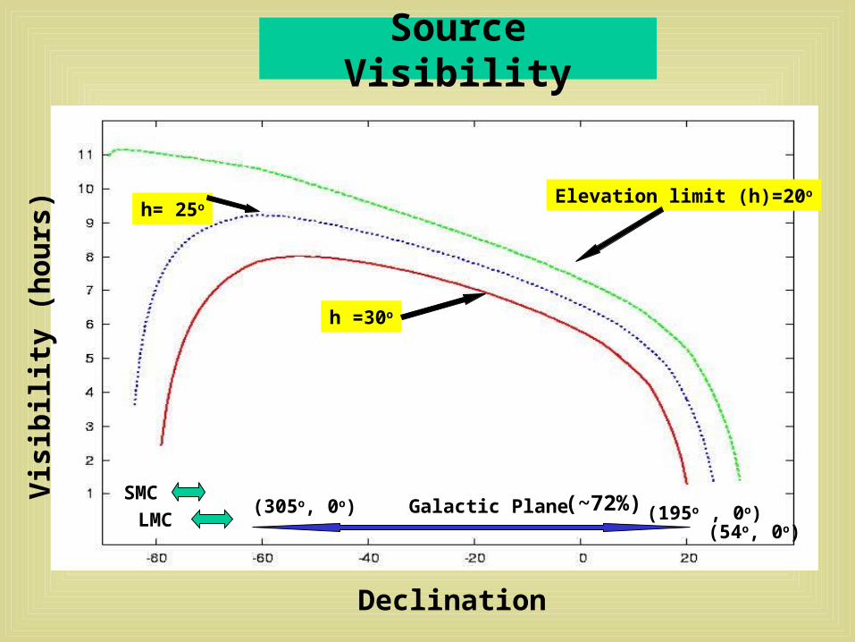
Source Visibility
Declination
Vis
ibil
ity
(hou
rs)
h =30o
h= 25oElevation limit (h)=20o
SMC
LMCGalactic Plane(305o, 0o) (195o , 0o)(~72%)
(54o, 0o)
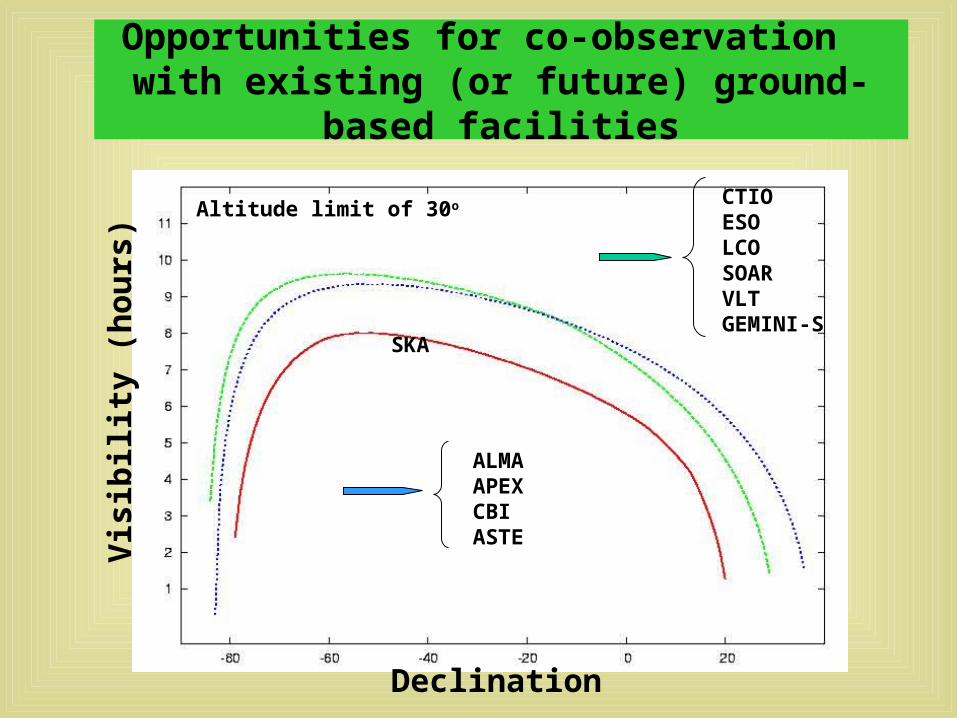
Opportunities for co-observation with existing (or future) ground-based facilities
Vis
ibil
ity
(hou
rs)
Declination
CTIOESOLCOSOARVLTGEMINI-S
ALMAAPEXCBIASTE
SKA
Altitude limit of 30o
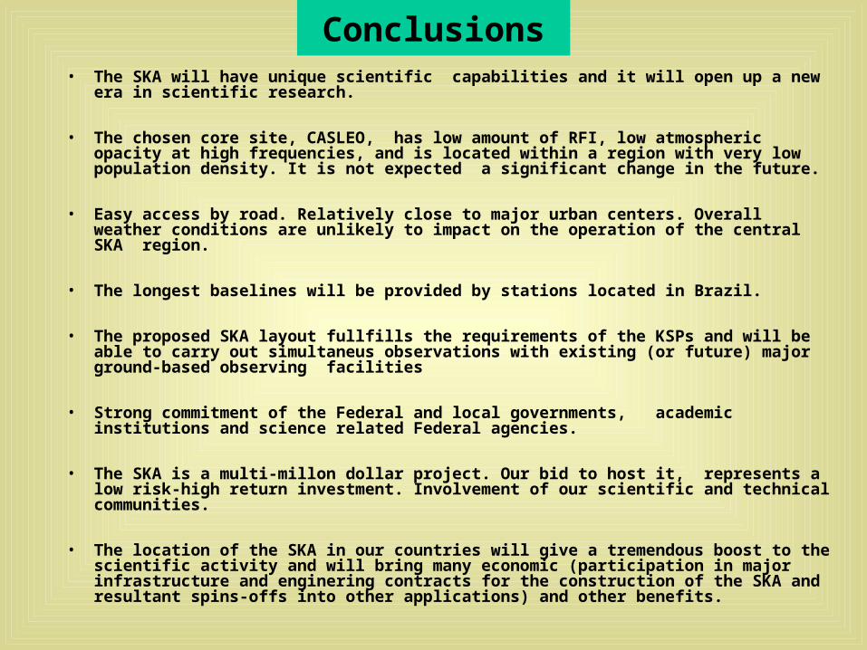
Conclusions• The SKA will have unique scientific capabilities and it will open up a new era in scientific
research.
• The chosen core site, CASLEO, has low amount of RFI, low atmospheric opacity at high frequencies, and is located within a region with very low population density. It is not expected a significant change in the future.
• Easy access by road. Relatively close to major urban centers. Overall weather conditions are unlikely to impact on the operation of the central SKA region.
• The longest baselines will be provided by stations located in Brazil.
• The proposed SKA layout fullfills the requirements of the KSPs and will be able to carry out simultaneus observations with existing (or future) major ground-based observing facilities
• Strong commitment of the Federal and local governments, academic institutions and science related Federal agencies.
• The SKA is a multi-millon dollar project. Our bid to host it, represents a low risk-high return investment. Involvement of our scientific and technical communities.
• The location of the SKA in our countries will give a tremendous boost to the scientific activity and will bring many economic (participation in major infrastructure and enginering contracts for the construction of the SKA and resultant spins-offs into other applications) and other benefits.
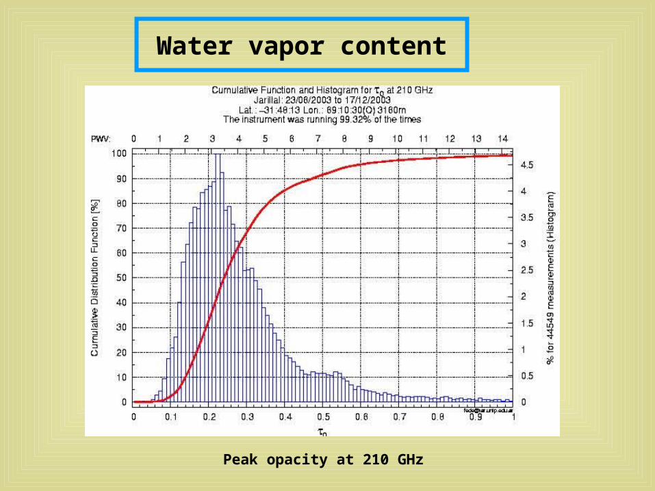
Water vapor content
Peak opacity at 210 GHz
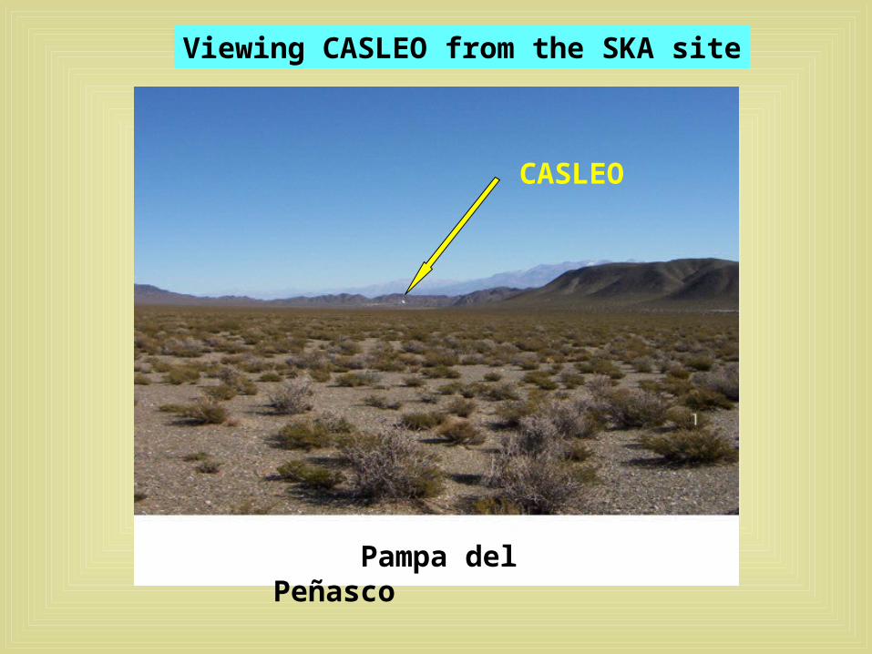
Pampa del Peñasco
Viewing CASLEO from the SKA site
CASLEO
Some RFI Measurements
S
W
N
Frequency (MHz)
Pow
er (
dB
m)
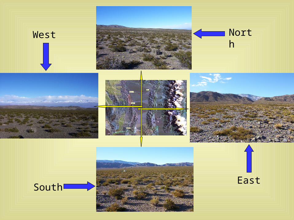
North
EastSouth
West
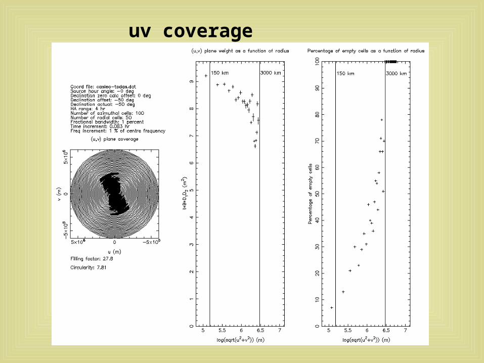
uv coverage
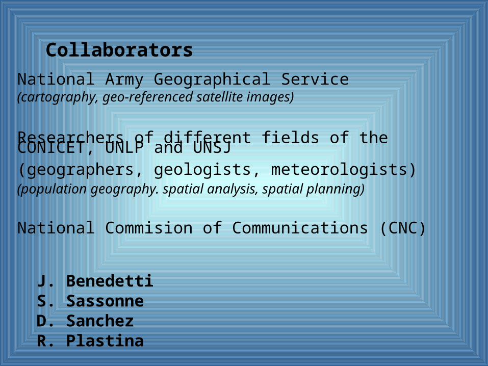
National Army Geographical Service(cartography, geo-referenced satellite images)
Researchers of different fields of the CONICET, UNLP and UNSJ(geographers, geologists, meteorologists)(population geography. spatial analysis, spatial planning)
National Commision of Communications (CNC)
J. Benedetti S. Sassonne D. Sanchez R. Plastina
Collaborators

•The National House of Representatives
• The National Secretary of Science and Technology
• The Board of Directors of the National Research Council of Science and Technology
• The Government of the Province of San Juan
• “Consejo Académico” of the Faculty of Astronomy of the UNLP
• “Consejo Superior” of the National University of La Plata
The Argentinean candidacy has the endorsement of:
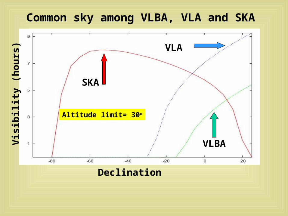
Common sky among VLBA, VLA and SKA V
isib
ilit
y (h
ours
)
Declination
SKA
VLA
VLBA
Altitude limit= 30o
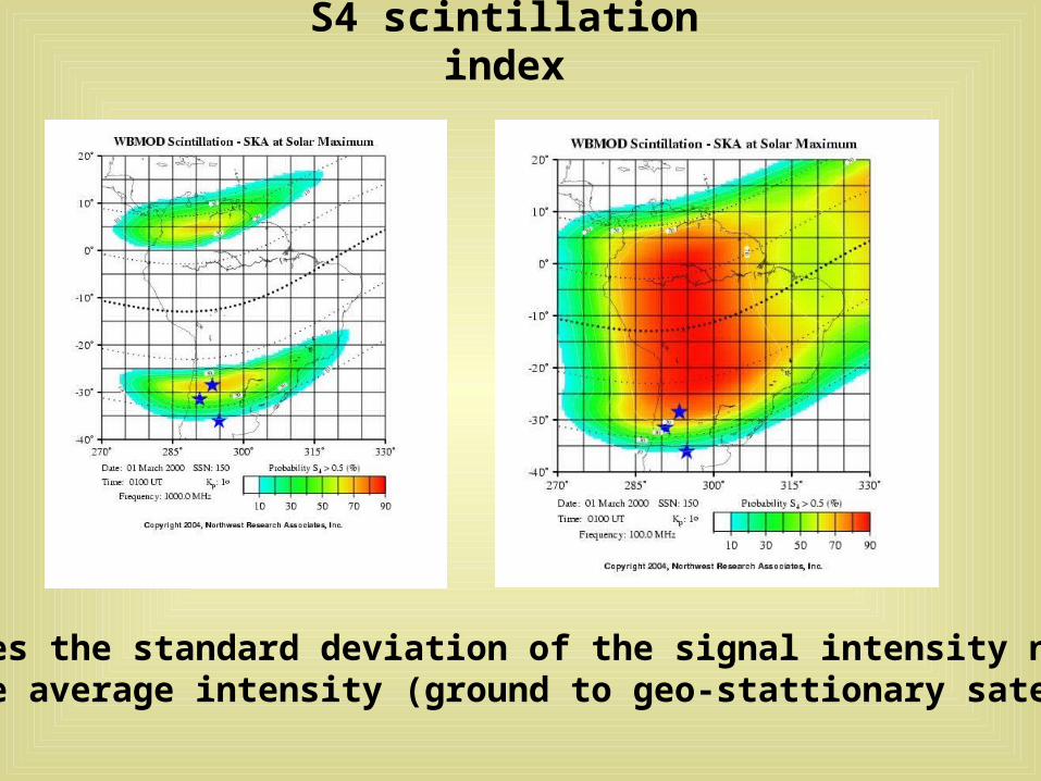
S4 scintillation index
S4 measures the standard deviation of the signal intensity normalized by the average intensity (ground to geo-stattionary satellite)