Embed Size (px)
Citation preview
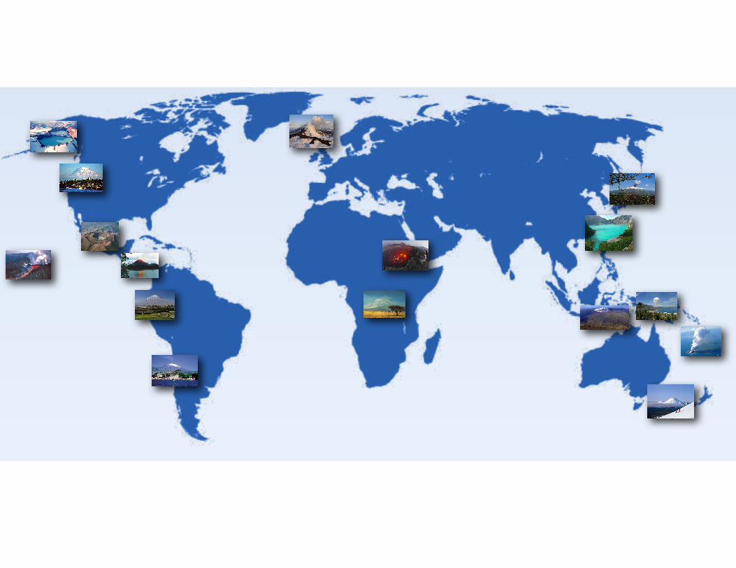
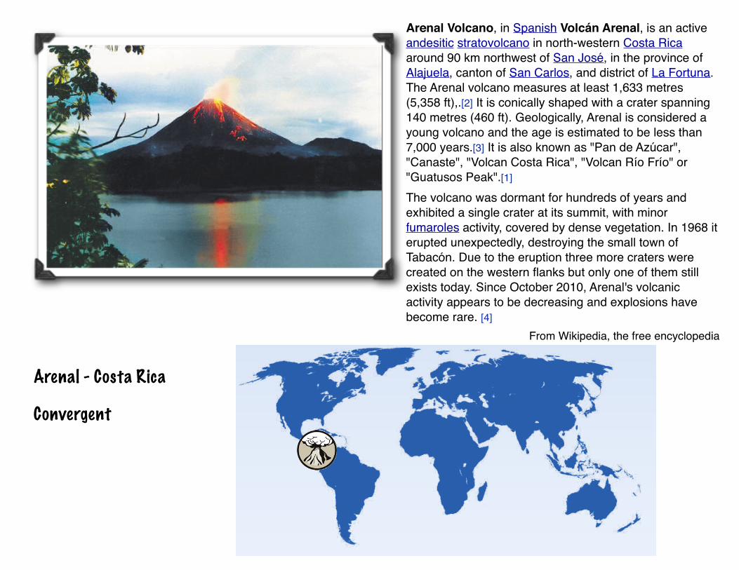
Arenal - Costa Rica
Convergent
Arenal Volcano, in Spanish Volcán Arenal, is an active andesitic stratovolcano in north-western Costa Rica around 90 km northwest of San José, in the province of Alajuela, canton of San Carlos, and district of La Fortuna. The Arenal volcano measures at least 1,633 metres (5,358 ft),.[2] It is conically shaped with a crater spanning 140 metres (460 ft). Geologically, Arenal is considered a young volcano and the age is estimated to be less than 7,000 years.[3] It is also known as "Pan de Azúcar", "Canaste", "Volcan Costa Rica", "Volcan Río Frío" or "Guatusos Peak".[1]
The volcano was dormant for hundreds of years and exhibited a single crater at its summit, with minor fumaroles activity, covered by dense vegetation. In 1968 it erupted unexpectedly, destroying the small town of Tabacón. Due to the eruption three more craters were created on the western flanks but only one of them still exists today. Since October 2010, Arenal's volcanic activity appears to be decreasing and explosions have become rare. [4]
From Wikipedia, the free encyclopedia
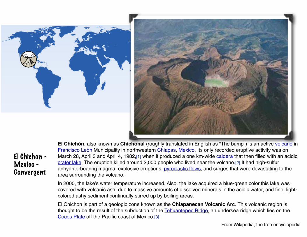
El Chichon - Mexico - Convergent
El Chichón, also known as Chichonal (roughly translated in English as "The bump") is an active volcano in Francisco León Municipality in northwestern Chiapas, Mexico. Its only recorded eruptive activity was on March 28, April 3 and April 4, 1982,[1] when it produced a one km-wide caldera that then filled with an acidic crater lake. The eruption killed around 2,000 people who lived near the volcano.[2] It had high-sulfur anhydrite-bearing magma, explosive eruptions, pyroclastic flows, and surges that were devastating to the area surrounding the volcano.In 2000, the lake's water temperature increased. Also, the lake acquired a blue-green color,this lake was covered with volcanic ash, due to massive amounts of dissolved minerals in the acidic water, and fine, light-colored ashy sediment continually stirred up by boiling areas.El Chichon is part of a geologic zone known as the Chiapanecan Volcanic Arc. This volcanic region is thought to be the result of the subduction of the Tehuantepec Ridge, an undersea ridge which lies on the Cocos Plate off the Pacific coast of Mexico.[3]
From Wikipedia, the free encyclopedia
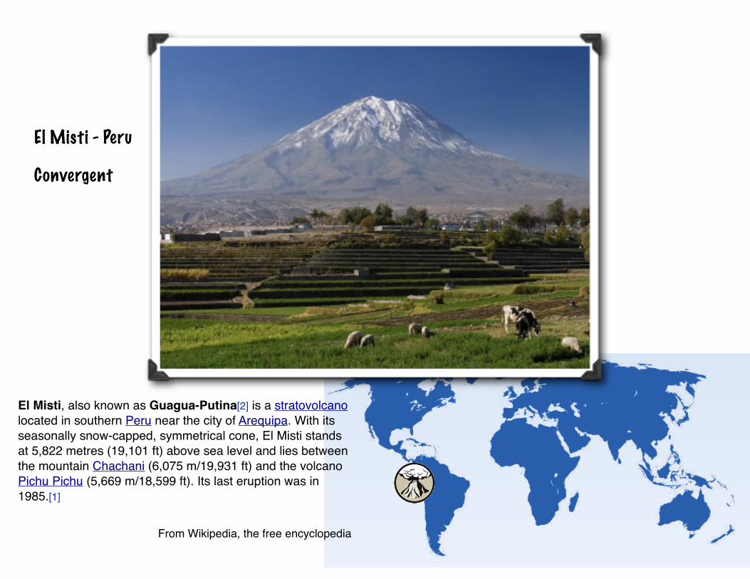
El Misti - Peru
Convergent
El Misti, also known as Guagua-Putina[2] is a stratovolcano located in southern Peru near the city of Arequipa. With its seasonally snow-capped, symmetrical cone, El Misti stands at 5,822 metres (19,101 ft) above sea level and lies between the mountain Chachani (6,075 m/19,931 ft) and the volcano Pichu Pichu (5,669 m/18,599 ft). Its last eruption was in 1985.[1]
From Wikipedia, the free encyclopedia
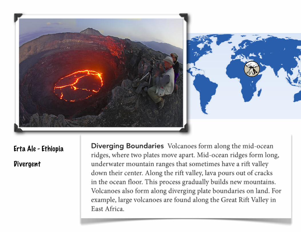
Erta Ale - Ethiopia
Divergent
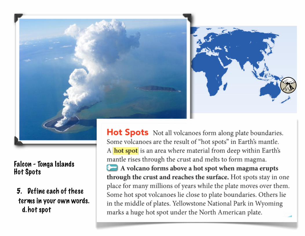
Falcon - Tonga Islands Hot Spots
5. Define each of these terms in your own words.
d. hot spot
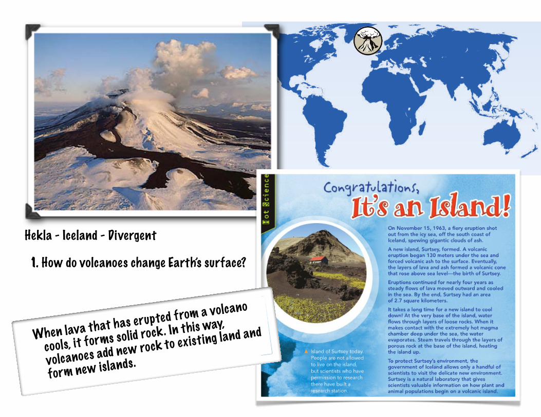
Hekla - Iceland - Divergent
1. How do volcanoes change Earth’s surface?
When lava that has erupted from a volcano
cools, it forms solid rock. In this way,
volcanoes add new rock to existing land and
form new islands.
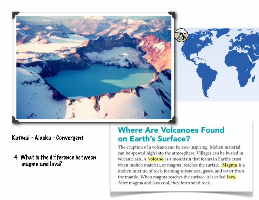
Katmai - Alaska - Convergent
4. What is the difference between magma and lava?
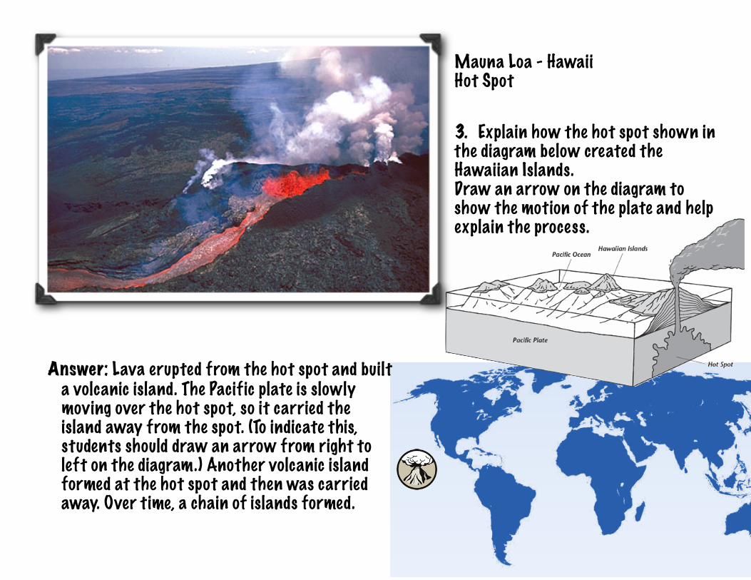
Mauna Loa - Hawaii Hot Spot
3. Explain how the hot spot shown in the diagram below created the Hawaiian Islands.Draw an arrow on the diagram to show the motion of the plate and help explain the process.
Answer: Lava erupted from the hot spot and builta volcanic island. The Pacific plate is slowlymoving over the hot spot, so it carried theisland away from the spot. (To indicate this,students should draw an arrow from right toleft on the diagram.) Another volcanic islandformed at the hot spot and then was carriedaway. Over time, a chain of islands formed.
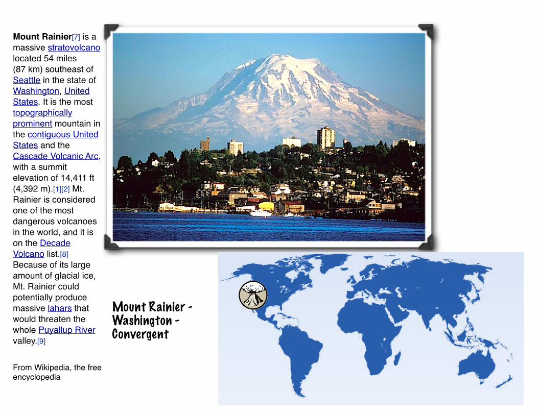
Mount Rainier - Washington - Convergent
Mount Rainier[7] is a massive stratovolcano located 54 miles (87 km) southeast of Seattle in the state of Washington, United States. It is the most topographically prominent mountain in the contiguous United States and the Cascade Volcanic Arc, with a summit elevation of 14,411 ft (4,392 m).[1][2] Mt. Rainier is considered one of the most dangerous volcanoes in the world, and it is on the Decade Volcano list.[8] Because of its large amount of glacial ice, Mt. Rainier could potentially produce massive lahars that would threaten the whole Puyallup River valley.[9]
From Wikipedia, the free encyclopedia
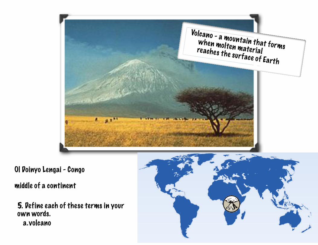
Ol Doinyo Lengai - Congo
middle of a continent
5. Define each of these terms in your own words.
a. volcano
Volcano - a mountain that forms when molten materialreaches the surface of Earth
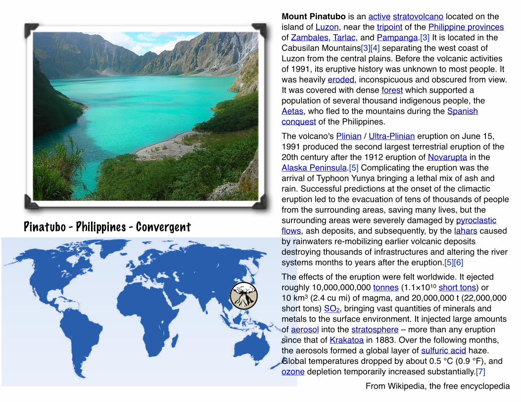
Pinatubo - Philippines - Convergent
Mount Pinatubo is an active stratovolcano located on the island of Luzon, near the tripoint of the Philippine provinces of Zambales, Tarlac, and Pampanga.[3] It is located in the Cabusilan Mountains[3][4] separating the west coast of Luzon from the central plains. Before the volcanic activities of 1991, its eruptive history was unknown to most people. It was heavily eroded, inconspicuous and obscured from view. It was covered with dense forest which supported a population of several thousand indigenous people, the Aetas, who fled to the mountains during the Spanish conquest of the Philippines.The volcano's Plinian / Ultra-Plinian eruption on June 15, 1991 produced the second largest terrestrial eruption of the 20th century after the 1912 eruption of Novarupta in the Alaska Peninsula.[5] Complicating the eruption was the arrival of Typhoon Yunya bringing a lethal mix of ash and rain. Successful predictions at the onset of the climactic eruption led to the evacuation of tens of thousands of people from the surrounding areas, saving many lives, but the surrounding areas were severely damaged by pyroclastic flows, ash deposits, and subsequently, by the lahars caused by rainwaters re-mobilizing earlier volcanic deposits destroying thousands of infrastructures and altering the river systems months to years after the eruption.[5][6]The effects of the eruption were felt worldwide. It ejected roughly 10,000,000,000 tonnes (1.1×10¹⁰ short tons) or 10 km3 (2.4 cu mi) of magma, and 20,000,000 t (22,000,000 short tons) SO2, bringing vast quantities of minerals and metals to the surface environment. It injected large amounts of aerosol into the stratosphere – more than any eruption since that of Krakatoa in 1883. Over the following months, the aerosols formed a global layer of sulfuric acid haze. Global temperatures dropped by about 0.5 °C (0.9 °F), and ozone depletion temporarily increased substantially.[7]
From Wikipedia, the free encyclopedia
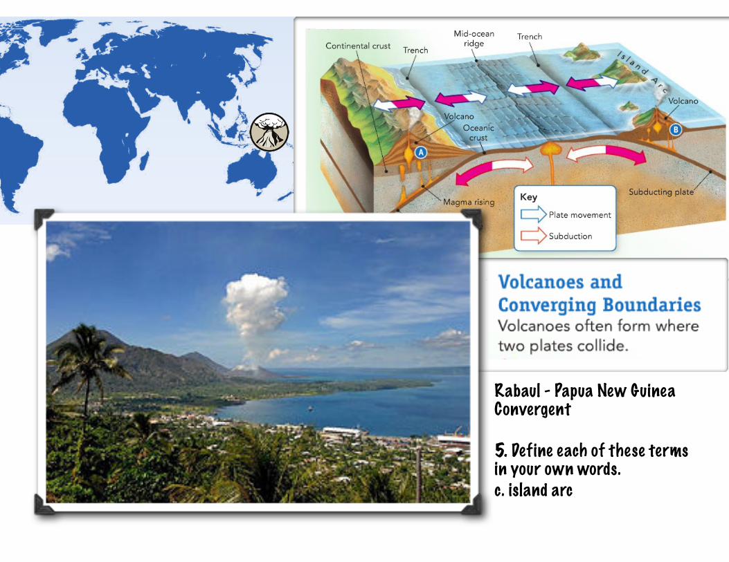
Rabaul - Papua New Guinea Convergent
5. Define each of these terms in your own words.c. island arc
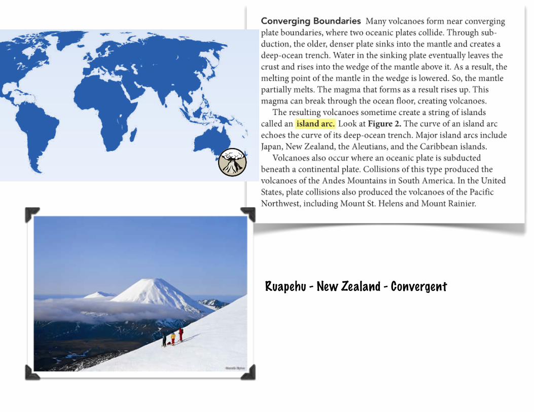
Ruapehu - New Zealand - Convergent
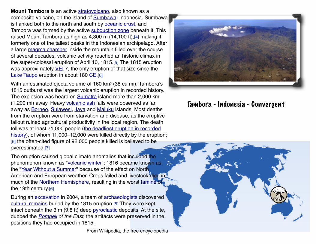
Tambora - Indonesia - Convergent
Mount Tambora is an active stratovolcano, also known as a composite volcano, on the island of Sumbawa, Indonesia. Sumbawa is flanked both to the north and south by oceanic crust, and Tambora was formed by the active subduction zone beneath it. This raised Mount Tambora as high as 4,300 m (14,100 ft),[4] making it formerly one of the tallest peaks in the Indonesian archipelago. After a large magma chamber inside the mountain filled over the course of several decades, volcanic activity reached an historic climax in the super-colossal eruption of April 10, 1815.[5] The 1815 eruption was approximately VEI 7, the only eruption of that size since the Lake Taupo eruption in about 180 CE.[6]
With an estimated ejecta volume of 160 km3 (38 cu mi), Tambora's 1815 outburst was the largest volcanic eruption in recorded history. The explosion was heard on Sumatra island more than 2,000 km (1,200 mi) away. Heavy volcanic ash falls were observed as far away as Borneo, Sulawesi, Java and Maluku islands. Most deaths from the eruption were from starvation and disease, as the eruptive fallout ruined agricultural productivity in the local region. The death toll was at least 71,000 people (the deadliest eruption in recorded history), of whom 11,000–12,000 were killed directly by the eruption;[6] the often-cited figure of 92,000 people killed is believed to be overestimated.[7]
The eruption caused global climate anomalies that included the phenomenon known as "volcanic winter": 1816 became known as the "Year Without a Summer" because of the effect on North American and European weather. Crops failed and livestock died in much of the Northern Hemisphere, resulting in the worst famine of the 19th century.[6]
During an excavation in 2004, a team of archaeologists discovered cultural remains buried by the 1815 eruption.[8] They were kept intact beneath the 3 m (9.8 ft) deep pyroclastic deposits. At the site, dubbed the Pompeii of the East, the artifacts were preserved in the positions they had occupied in 1815.
From Wikipedia, the free encyclopedia
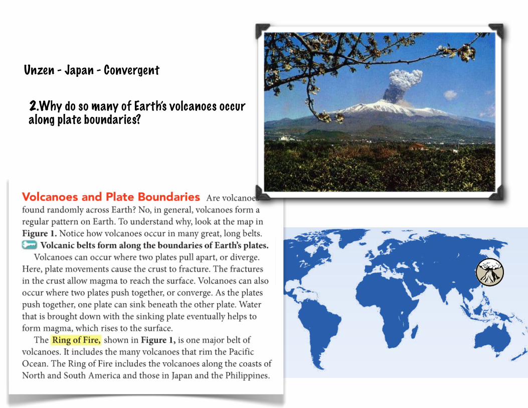
Unzen - Japan - Convergent
2.Why do so many of Earth’s volcanoes occur along plate boundaries?
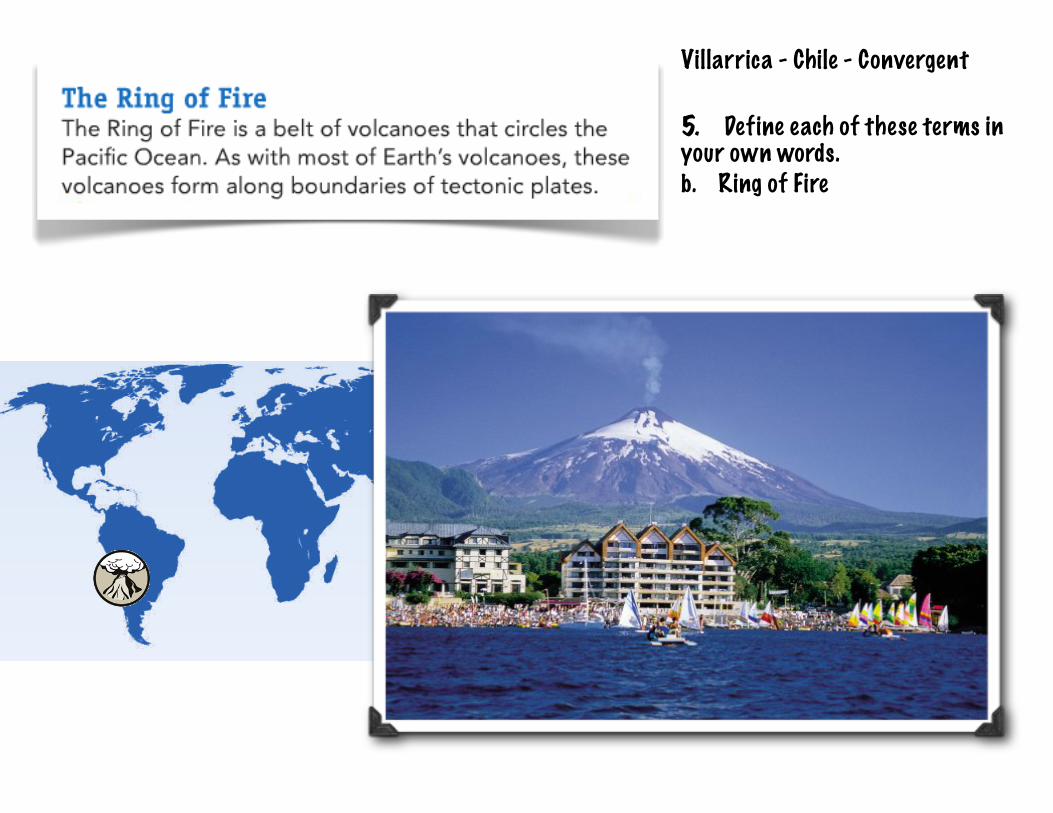
Villarrica - Chile - Convergent
5. Define each of these terms in your own words.b. Ring of Fire