Embed Size (px)
Citation preview
Qls
Qls
Qls
Qls
Qls
Qls
Qls
Qls
Qls
Qls
QlsQls
Qls
Qls
Qls
Qls
Qls
Qls
Qls
Qls
Qls
Qls
QlsQls
Qls
Qls
Qls
Qls
Qls
Qls
Qls
Qls
(/2
(/2
Cartographic Compilat ion: E. L. Kadrmas & S.S. Kran ich
102o 45' 00"
48o 22' 30"
102o 37' 30"
102o 37' 30"102o 45' 00"48o 15' 00" 48o 15' 00"
48o 22' 30"
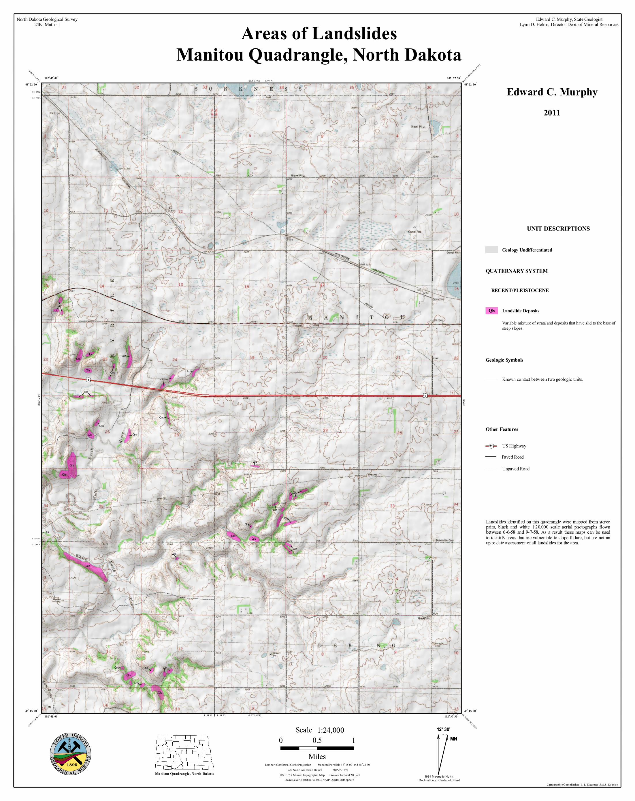
Areas of LandslidesManitou Quadrangle, North Dakota
(ROSS NW) (COTTONWOOD LAKE)(WHITE EARTH)
(CHARLSON NE) (ROB INSON LAKE)
(TIOG
A SE
)
(RAT LAKE)
(ROS
S)
North Dakota Geological Survey24K: Mntu - l
Edward C. Murphy, State GeologistLynn D. Helms, Director Dept. of Mineral Resources
Geologic Symbols
Known contact between two geologic units.
UNIT DESCRIPTIONS
QUATERNARY SYSTEM
RECENT/PLEISTOCENE
Geology Undifferentiated
T. 156 N.
T. 155 N.
T. 1 57 N.
T. 1 56 N.
R. 93 W.
Other Features
Unpaved Road
Paved RoadUS Highway(/2
MN
1981 Magnetic North Declinat ion at Center of Sheet
12o 30'
0 0.5 1Miles
1:24,000Scale
Stand ard Paral lels 4 8o 15' 00" an d 48o 22' 30"
USGS 7.5 Min ute Topo graph ic Map Co ntour Interval 2 0 Feet
Lambert Conformal Conic Projection1927 No rth American Datum NGVD 1929
Road Layer Rectified to 2 003 NAIP Digi tal Orth ophoto
R. 93 W.R. 94 W.
Manitou Quadrangle, North Dakota
Edward C. Murphy2011
Variable mixture of strata and deposits that have slid to the base ofsteep slopes.
Landslide DepositsQls
Landslides identified on this quadrangle were mapped from stereopairs, black and white 1:20,000 scale aerial photographs flownbetween 6-6-58 and 9-7-58. As a result these maps can be usedto identify areas that are vulnerable to slope failure, but are not anup to date assessment of all landslides for the area.