Embed Size (px)
Citation preview
Archaeological Excavations in Sherburn, Vale of Pickering, North Yorkshire. September 2011
The village of Sherburn, situated on the southern side of the eastern end of the Vale of Pickering and
overlooked by the Yorkshire Wolds to the south, is the largest of the villages that occupy the sandy
margin between the foot of the Yorkshire Wolds and the former wetlands that characterise the
eastern end of the Vale. A royal vill with two churches, identified in Domesday, the village sits astride
the Wykeham-Sherburn moraine which survives as a slight ridge projecting into the former wetlands
which in antiquity served as a route across the Vale. The surviving church, which was almost
completely rebuilt between 1909 and 1912, incorporates a number of fragments of Late
Saxon/Viking Age sculptural stone in the present fabric. The church sits in a dominant position at the
northern end of the present village. Archaeological research by the Landscape Research Centre over
the last three decades has included extensive air-photographic survey and, more recently, large
scale geophysical survey around the present village. The geophysical survey in particular reveals that
Sherburn has a settlement history that extends back into later prehistory, and that during the Anglo-
Saxon period the settlement extended over more than 25ha, larger than the excavated village at
West Heslerton, but with a considerably larger number and greater density of Grubenhäuser, the
distinctive cavity floor buildings that characterise settlements of the Early and Middle Anglo-Saxon
periods.
Two discoveries, one made through regular aerial survey over the last 30 years and another made
during the mid 19th century, are the subject of a small research programme designed to try and
understand Sherburn’s role during the Anglo-Saxon period.
Crop-Marks and Geophysical evidence
To the east of the present village a crop-mark of a ‘D-Shaped’ enclosure measuring nearly 100m
across, seen from the air after the field was first ploughed in modern times in 1981, has produced
increasingly clear crop-marks, reflecting ongoing plough damage during the last few years. This
enclosure, and what appears to be a rectangular structure aligned east-west just outside it to the
north, appear with great clarity in the crop-mark record; geophysical survey has shown that the field
in which it is situated contains a vast amount of archaeological evidence. The enclosure is unusual
and internal details, visible in the crop-mark, geomagnetic and electronic resistance surveys, indicate
that it is exceptional. Very strong magnetic anomalies, possibly indicative of burnt structures, are
situated just inside the ditch that defines the enclosure in a situation that is not dissimilar to the
distribution of industrial structures in early Irish Monastic enclosures.
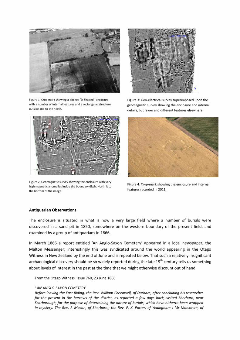
Figure 1: Crop mark showing a ditched 'D-Shaped' enclosure,
with a number of internal features and a rectangular structure
outside and to the north.
Figure 2: Geomagnetic survey showing the enclosure with very
high magnetic anomalies inside the boundary ditch. North is to
the bottom of the image.
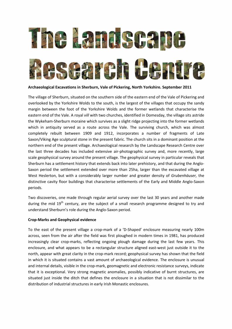
Figure 3: Geo-electrical survey superimposed upon the
geomagnetic survey showing the enclosure and internal
details, but fewer and different features elsewhere.
Figure 4: Crop-mark showing the enclosure and internal
features recorded in 2011.
Antiquarian Observations
The enclosure is situated in what is now a very large field where a number of burials were
discovered in a sand pit in 1850, somewhere on the western boundary of the present field, and
examined by a group of antiquarians in 1866.
In March 1866 a report entitled ‘An Anglo-Saxon Cemetery’ appeared in a local newspaper, the
Malton Messenger; interestingly this was syndicated around the world appearing in the Otago
Witness in New Zealand by the end of June and is repeated below. That such a relatively insignificant
archaeological discovery should be so widely reported during the late 19th century tells us something
about levels of interest in the past at the time that we might otherwise discount out of hand.
From the Otago Witness. Issue 760, 23 June 1866 ‘ AN ANGLO-SAXON CEMETERY. Before leaving the East Riding, the Rev. William Greenwell, of Durham, after concluding his researches for the present in the barrows of the district, as reported a few days back, visited Sherburn, near Scarborough, for the purpose of determining the nature of burials, which have hitherto been wrapped in mystery. The Rev. J. Mason, of Sherburn,; the Rev. F. K. Porter, of Yedingham ; Mr Monkman, of
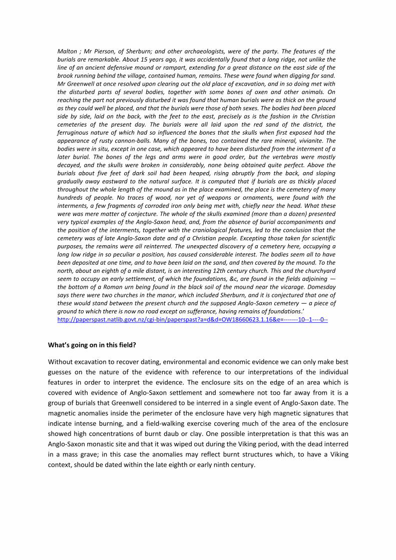
Malton ; Mr Pierson, of Sherburn; and other archaeologists, were of the party. The features of the burials are remarkable. About 15 years ago, it was accidentally found that a long ridge, not unlike the line of an ancient defensive mound or rampart, extending for a great distance on the east side of the brook running behind the village, contained human, remains. These were found when digging for sand. Mr Greenwell at once resolved upon clearing out the old place of excavation, and in so doing met with the disturbed parts of several bodies, together with some bones of oxen and other animals. On reaching the part not previously disturbed it was found that human burials were as thick on the ground as they could well be placed, and that the burials were those of both sexes. The bodies had been placed side by side, laid on the back, with the feet to the east, precisely as is the fashion in the Christian cemeteries of the present day. The burials were all laid upon the red sand of the district, the ferruginous nature of which had so influenced the bones that the skulls when first exposed had the appearance of rusty cannon-balls. Many of the bones, too contained the rare mineral, vivianite. The bodies were in situ, except in one case, which appeared to have been disturbed from the interment of a later burial. The bones of the legs and arms were in good order, but the vertebras were mostly decayed, and the skulls were broken in considerably, none being obtained quite perfect. Above the burials about five feet of dark soil had been heaped, rising abruptly from the back, and sloping gradually away eastward to the natural surface. It is computed that if burials are as thickly placed throughout the whole length of the mound as in the place examined, the place is the cemetery of many hundreds of people. No traces of wood, nor yet of weapons or ornaments, were found with the interments, a few fragments of corroded iron only being met with, chiefly near the head. What these were was mere matter of conjecture. The whole of the skulls examined (more than a dozen) presented very typical examples of the Anglo-Saxon head, and, from the absence of burial accompaniments and the position of the interments, together with the craniological features, led to the conclusion that the cemetery was of late Anglo-Saxon date and of a Christian people. Excepting those taken for scientific purposes, the remains were all reinterred. The unexpected discovery of a cemetery here, occupying a long low ridge in so peculiar a position, has caused considerable interest. The bodies seem all to have been deposited at one time, and to have been laid on the sand, and then covered by the mound. To the north, about an eighth of a mile distant, is an interesting 12th century church. This and the churchyard seem to occupy an early settlement, of which the foundations, &c, are found in the fields adjoining — the bottom of a Roman urn being found in the black soil of the mound near the vicarage. Domesday says there were two churches in the manor, which included Sherburn, and it is conjectured that one of these would stand between the present church and the supposed Anglo-Saxon cemetery — a piece of ground to which there is now no road except on sufferance, having remains of foundations.’ http://paperspast.natlib.govt.nz/cgi-bin/paperspast?a=d&d=OW18660623.1.16&e=-------10--1----0--
What’s going on in this field?
Without excavation to recover dating, environmental and economic evidence we can only make best
guesses on the nature of the evidence with reference to our interpretations of the individual
features in order to interpret the evidence. The enclosure sits on the edge of an area which is
covered with evidence of Anglo-Saxon settlement and somewhere not too far away from it is a
group of burials that Greenwell considered to be interred in a single event of Anglo-Saxon date. The
magnetic anomalies inside the perimeter of the enclosure have very high magnetic signatures that
indicate intense burning, and a field-walking exercise covering much of the area of the enclosure
showed high concentrations of burnt daub or clay. One possible interpretation is that this was an
Anglo-Saxon monastic site and that it was wiped out during the Viking period, with the dead interred
in a mass grave; in this case the anomalies may reflect burnt structures which, to have a Viking
context, should be dated within the late eighth or early ninth century.
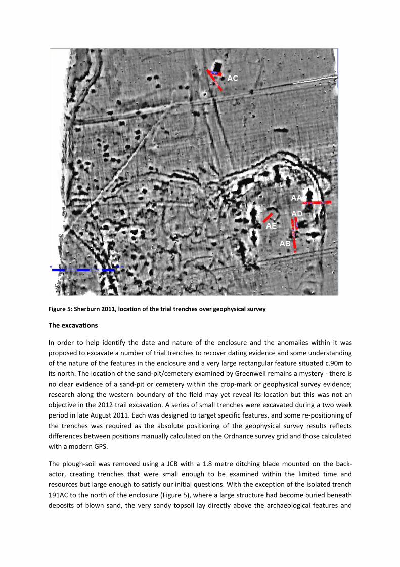
Figure 5: Sherburn 2011, location of the trial trenches over geophysical survey
The excavations
In order to help identify the date and nature of the enclosure and the anomalies within it was
proposed to excavate a number of trial trenches to recover dating evidence and some understanding
of the nature of the features in the enclosure and a very large rectangular feature situated c.90m to
its north. The location of the sand-pit/cemetery examined by Greenwell remains a mystery - there is
no clear evidence of a sand-pit or cemetery within the crop-mark or geophysical survey evidence;
research along the western boundary of the field may yet reveal its location but this was not an
objective in the 2012 trail excavation. A series of small trenches were excavated during a two week
period in late August 2011. Each was designed to target specific features, and some re-positioning of
the trenches was required as the absolute positioning of the geophysical survey results reflects
differences between positions manually calculated on the Ordnance survey grid and those calculated
with a modern GPS.
The plough-soil was removed using a JCB with a 1.8 metre ditching blade mounted on the back-
actor, creating trenches that were small enough to be examined within the limited time and
resources but large enough to satisfy our initial questions. With the exception of the isolated trench
191AC to the north of the enclosure (Figure 5), where a large structure had become buried beneath
deposits of blown sand, the very sandy topsoil lay directly above the archaeological features and
natural subsoil, without the protective layer of blown-sand that is a characteristic of areas both to
the east and west of Sherburn. In the area of the enclosure (trenches 191AA,AB,AD and AE - Figure
6, Figure 7)) there was extensive evidence of the use of sub-soiling ploughs and damage from deep
ploughing which had truncated the buried deposits.
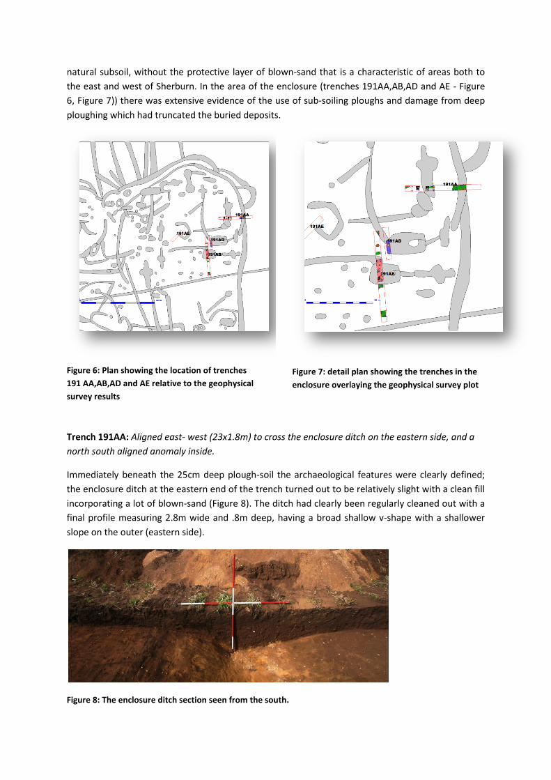
Figure 6: Plan showing the location of trenches
191 AA,AB,AD and AE relative to the geophysical
survey results
Figure 7: detail plan showing the trenches in the
enclosure overlaying the geophysical survey plot
Trench 191AA: Aligned east- west (23x1.8m) to cross the enclosure ditch on the eastern side, and a
north south aligned anomaly inside.
Immediately beneath the 25cm deep plough-soil the archaeological features were clearly defined;
the enclosure ditch at the eastern end of the trench turned out to be relatively slight with a clean fill
incorporating a lot of blown-sand (Figure 8). The ditch had clearly been regularly cleaned out with a
final profile measuring 2.8m wide and .8m deep, having a broad shallow v-shape with a shallower
slope on the outer (eastern side).
Figure 8: The enclosure ditch section seen from the south.
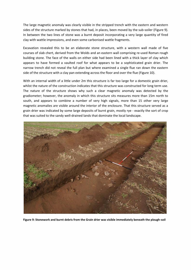
The large magnetic anomaly was clearly visible in the stripped trench with the eastern and western
sides of the structure marked by stones that had, in places, been moved by the sub-soiler (Figure 9).
In between the two lines of stone was a burnt deposit incorporating a very large quantity of fired
clay with wattle impressions, and even some carbonised wattle fragments.
Excavation revealed this to be an elaborate stone structure, with a western wall made of five
courses of slab chert, derived from the Wolds and an eastern wall comprising re-used Roman rough
building stone. The face of the walls on either side had been lined with a thick layer of clay which
appears to have formed a vaulted roof for what appears to be a sophisticated grain drier. The
narrow trench did not reveal the full plan but where examined a single flue ran down the eastern
side of the structure with a clay pan extending across the floor and over the flue (Figure 10).
With an internal width of a little under 2m this structure is far too large for a domestic grain drier,
whilst the nature of the construction indicates that this structure was constructed for long term use.
The nature of the structure shows why such a clear magnetic anomaly was detected by the
gradiometer; however, the anomaly in which this structure sits measures more than 15m north to
south, and appears to combine a number of very high signals, more than 15 other very large
magnetic anomalies are visible around the interior of the enclosure. That this structure served as a
grain drier was indicated by some large deposits of burnt grain, mostly rye - exactly the sort of crop
that was suited to the sandy well-drained lands that dominate the local landscape.
Figure 9: Stonework and burnt debris from the Grain drier was visible immediately beneath the plough-soil
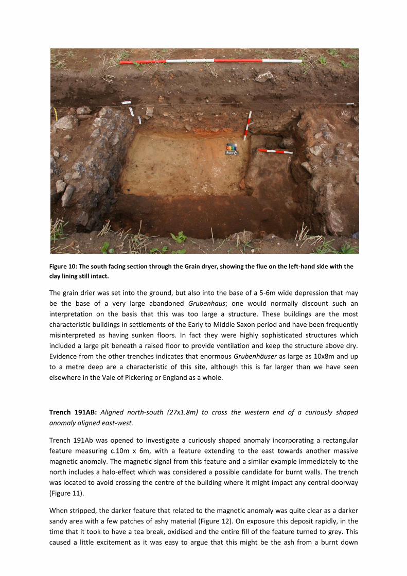
Figure 10: The south facing section through the Grain dryer, showing the flue on the left-hand side with the
clay lining still intact.
The grain drier was set into the ground, but also into the base of a 5-6m wide depression that may
be the base of a very large abandoned Grubenhaus; one would normally discount such an
interpretation on the basis that this was too large a structure. These buildings are the most
characteristic buildings in settlements of the Early to Middle Saxon period and have been frequently
misinterpreted as having sunken floors. In fact they were highly sophisticated structures which
included a large pit beneath a raised floor to provide ventilation and keep the structure above dry.
Evidence from the other trenches indicates that enormous Grubenhäuser as large as 10x8m and up
to a metre deep are a characteristic of this site, although this is far larger than we have seen
elsewhere in the Vale of Pickering or England as a whole.
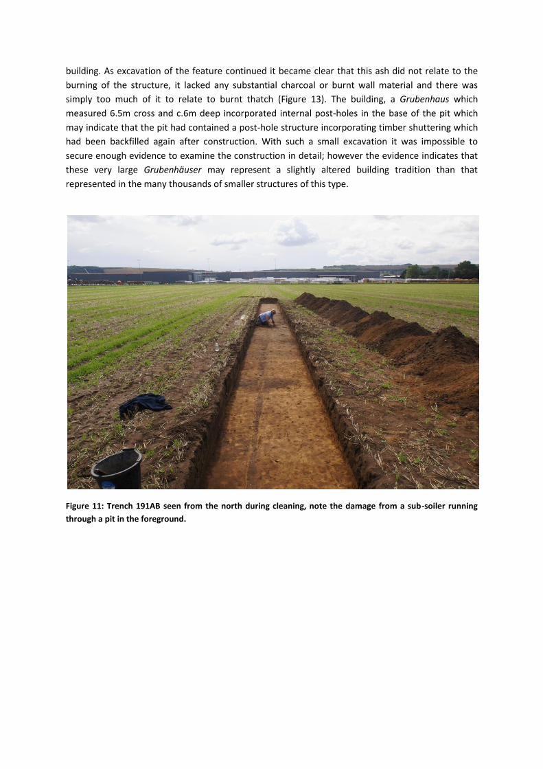
Trench 191AB: Aligned north-south (27x1.8m) to cross the western end of a curiously shaped
anomaly aligned east-west.
Trench 191Ab was opened to investigate a curiously shaped anomaly incorporating a rectangular
feature measuring c.10m x 6m, with a feature extending to the east towards another massive
magnetic anomaly. The magnetic signal from this feature and a similar example immediately to the
north includes a halo-effect which was considered a possible candidate for burnt walls. The trench
was located to avoid crossing the centre of the building where it might impact any central doorway
(Figure 11).
When stripped, the darker feature that related to the magnetic anomaly was quite clear as a darker
sandy area with a few patches of ashy material (Figure 12). On exposure this deposit rapidly, in the
time that it took to have a tea break, oxidised and the entire fill of the feature turned to grey. This
caused a little excitement as it was easy to argue that this might be the ash from a burnt down
building. As excavation of the feature continued it became clear that this ash did not relate to the
burning of the structure, it lacked any substantial charcoal or burnt wall material and there was
simply too much of it to relate to burnt thatch (Figure 13). The building, a Grubenhaus which
measured 6.5m cross and c.6m deep incorporated internal post-holes in the base of the pit which
may indicate that the pit had contained a post-hole structure incorporating timber shuttering which
had been backfilled again after construction. With such a small excavation it was impossible to
secure enough evidence to examine the construction in detail; however the evidence indicates that
these very large Grubenhäuser may represent a slightly altered building tradition than that
represented in the many thousands of smaller structures of this type.
Figure 11: Trench 191AB seen from the north during cleaning, note the damage from a sub-soiler running
through a pit in the foreground.
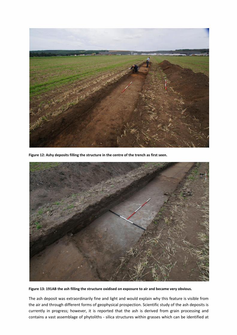
Figure 12: Ashy deposits filling the structure in the centre of the trench as first seen.
Figure 13: 191AB the ash filling the structure oxidised on exposure to air and became very obvious.
The ash deposit was extraordinarily fine and light and would explain why this feature is visible from
the air and through different forms of geophysical prospection. Scientific study of the ash deposits is
currently in progress; however, it is reported that the ash is derived from grain processing and
contains a vast assemblage of phytoliths - silica structures within grasses which can be identified at
the species level. Assuming that the rest of this large feature contains a similar body of material this
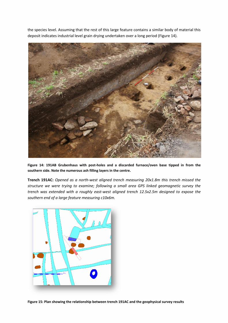
deposit indicates industrial level grain drying undertaken over a long period (Figure 14).
Figure 14: 191AB Grubenhaus with post-holes and a discarded furnace/oven base tipped in from the
southern side. Note the numerous ash filling layers in the centre.
Trench 191AC: Opened as a north-west aligned trench measuring 20x1.8m this trench missed the
structure we were trying to examine; following a small area GPS linked geomagnetic survey the
trench was extended with a roughly east-west aligned trench 12.5x2.5m designed to expose the
southern end of a large feature measuring c10x6m.
Figure 15: Plan showing the relationship between trench 191AC and the geophysical survey results
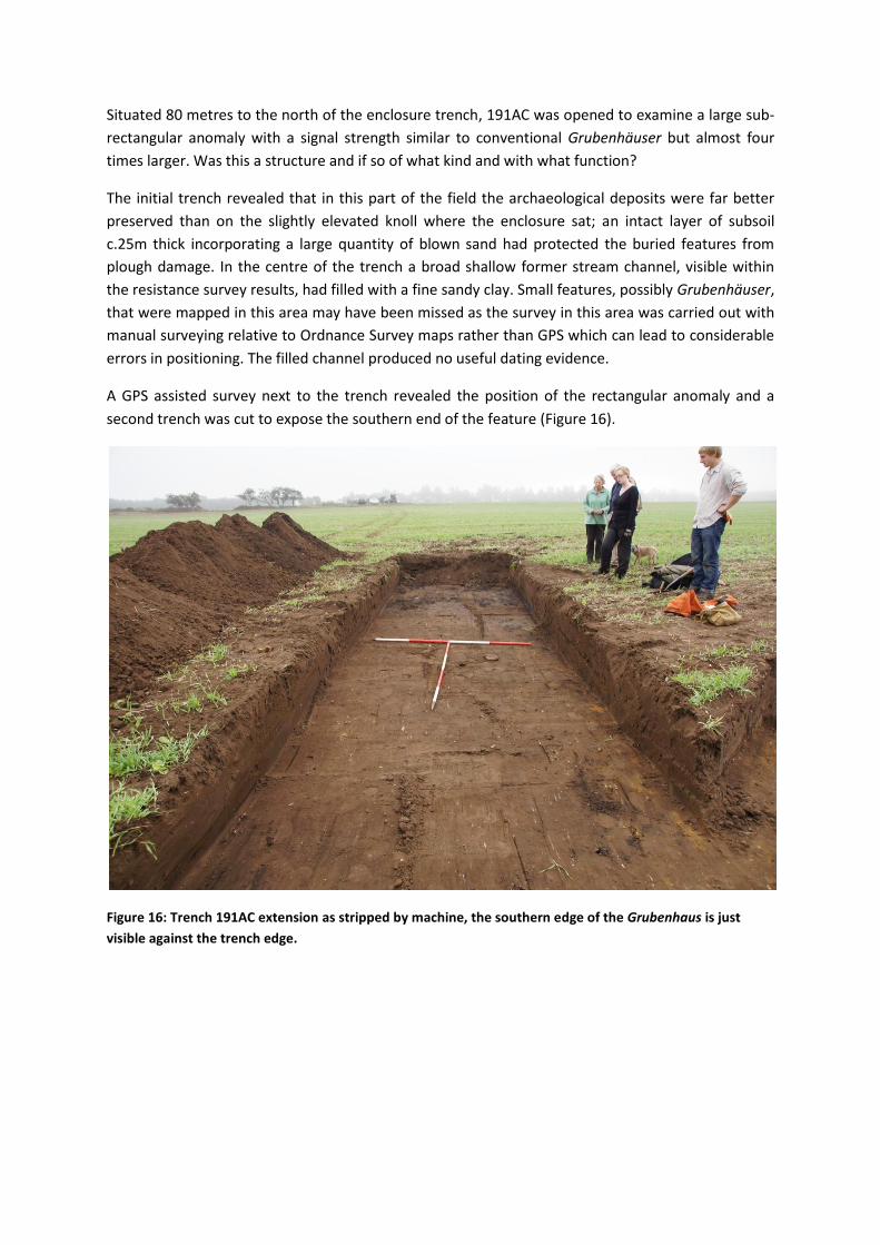
Situated 80 metres to the north of the enclosure trench, 191AC was opened to examine a large sub-
rectangular anomaly with a signal strength similar to conventional Grubenhäuser but almost four
times larger. Was this a structure and if so of what kind and with what function?
The initial trench revealed that in this part of the field the archaeological deposits were far better
preserved than on the slightly elevated knoll where the enclosure sat; an intact layer of subsoil
c.25m thick incorporating a large quantity of blown sand had protected the buried features from
plough damage. In the centre of the trench a broad shallow former stream channel, visible within
the resistance survey results, had filled with a fine sandy clay. Small features, possibly Grubenhäuser,
that were mapped in this area may have been missed as the survey in this area was carried out with
manual surveying relative to Ordnance Survey maps rather than GPS which can lead to considerable
errors in positioning. The filled channel produced no useful dating evidence.
A GPS assisted survey next to the trench revealed the position of the rectangular anomaly and a
second trench was cut to expose the southern end of the feature (Figure 16).
Figure 16: Trench 191AC extension as stripped by machine, the southern edge of the Grubenhaus is just
visible against the trench edge.
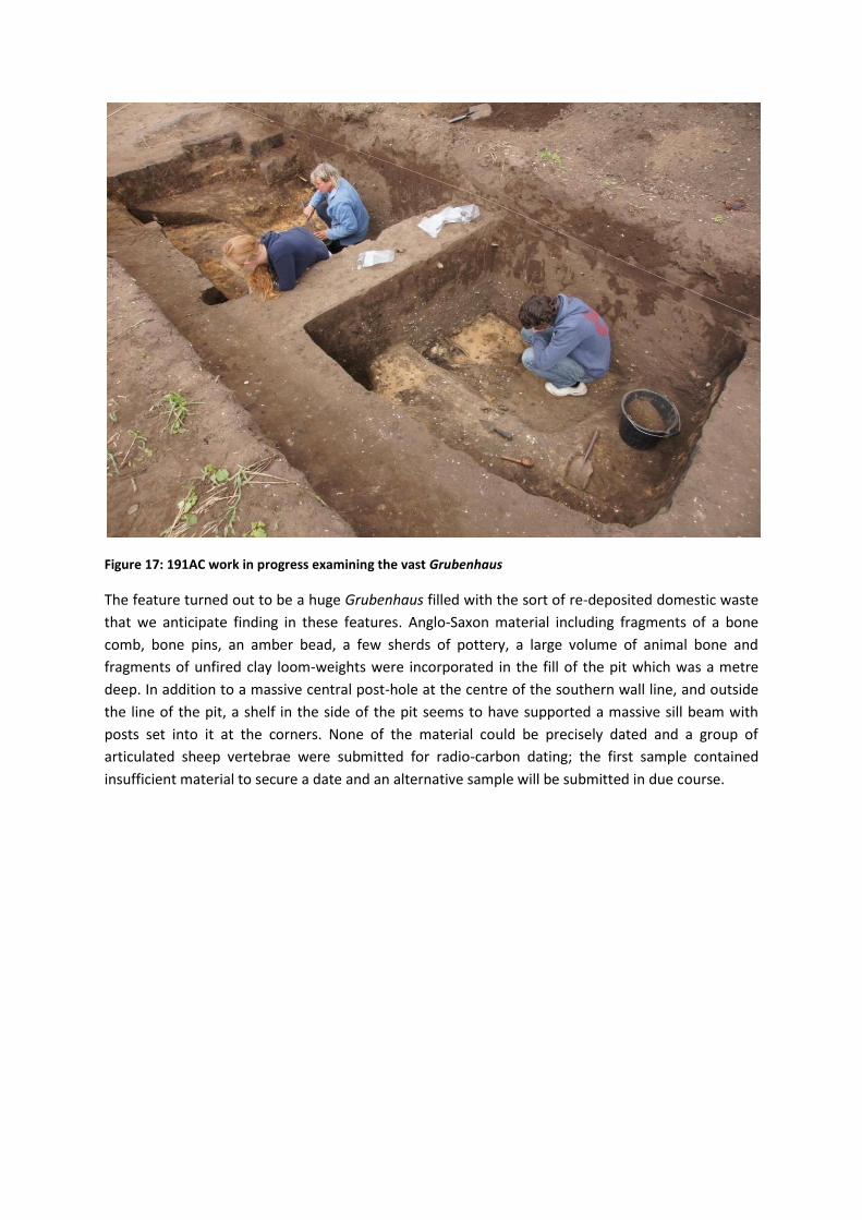
Figure 17: 191AC work in progress examining the vast Grubenhaus
The feature turned out to be a huge Grubenhaus filled with the sort of re-deposited domestic waste
that we anticipate finding in these features. Anglo-Saxon material including fragments of a bone
comb, bone pins, an amber bead, a few sherds of pottery, a large volume of animal bone and
fragments of unfired clay loom-weights were incorporated in the fill of the pit which was a metre
deep. In addition to a massive central post-hole at the centre of the southern wall line, and outside
the line of the pit, a shelf in the side of the pit seems to have supported a massive sill beam with
posts set into it at the corners. None of the material could be precisely dated and a group of
articulated sheep vertebrae were submitted for radio-carbon dating; the first sample contained
insufficient material to secure a date and an alternative sample will be submitted in due course.
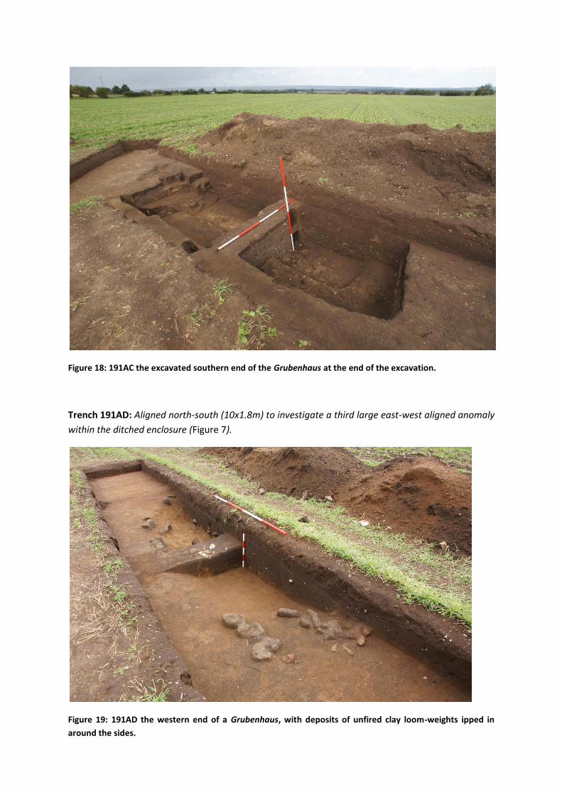
Figure 18: 191AC the excavated southern end of the Grubenhaus at the end of the excavation.
Trench 191AD: Aligned north-south (10x1.8m) to investigate a third large east-west aligned anomaly
within the ditched enclosure (Figure 7).
Figure 19: 191AD the western end of a Grubenhaus, with deposits of unfired clay loom-weights ipped in
around the sides.
Trench 191AD, measuring 9x1.8m and aligned north-south to the east and north of the ash filled
building examined in 191AB, ran across the western end of a Grubenhaus aligned east-west and
appearing on the geophysical survey as an anomaly measuring 9x6m.
The small segment of this structure examined confirmed the interpretation of the feature as a
Grubenhaus, its excavated width was just 5m with a central post in the western gable end. No post
holes could be identified in the corners and relative to the other structures examined it was very
shallow with a depth no greater than .35m. In contrast to the adjacent structure, which was
probably too close to have been actively used at the same time, the fill of this feature contained no
ash. It contained very few finds in a sandy matrix incorporating a large amount of blown sand, and
had a large number of clay loom-weight fragments tipped in around the edges, with a particular
concentration in the south-west corner.
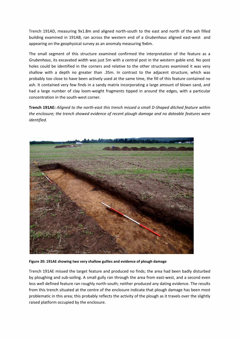
Trench 191AE: Aligned to the north-east this trench missed a small D-Shaped ditched feature within
the enclosure; the trench showed evidence of recent plough damage and no dateable features were
identified.
Figure 20: 191AE showing two very shallow gullies and evidence of plough damage
Trench 191AE missed the target feature and produced no finds; the area had been badly disturbed
by ploughing and sub-soiling. A small gully ran through the area from east-west, and a second even
less well defined feature ran roughly north-south; neither produced any dating evidence. The results
from this trench situated at the centre of the enclosure indicate that plough damage has been most
problematic in this area; this probably reflects the activity of the plough as it travels over the slightly
raised platform occupied by the enclosure.
Conclusions
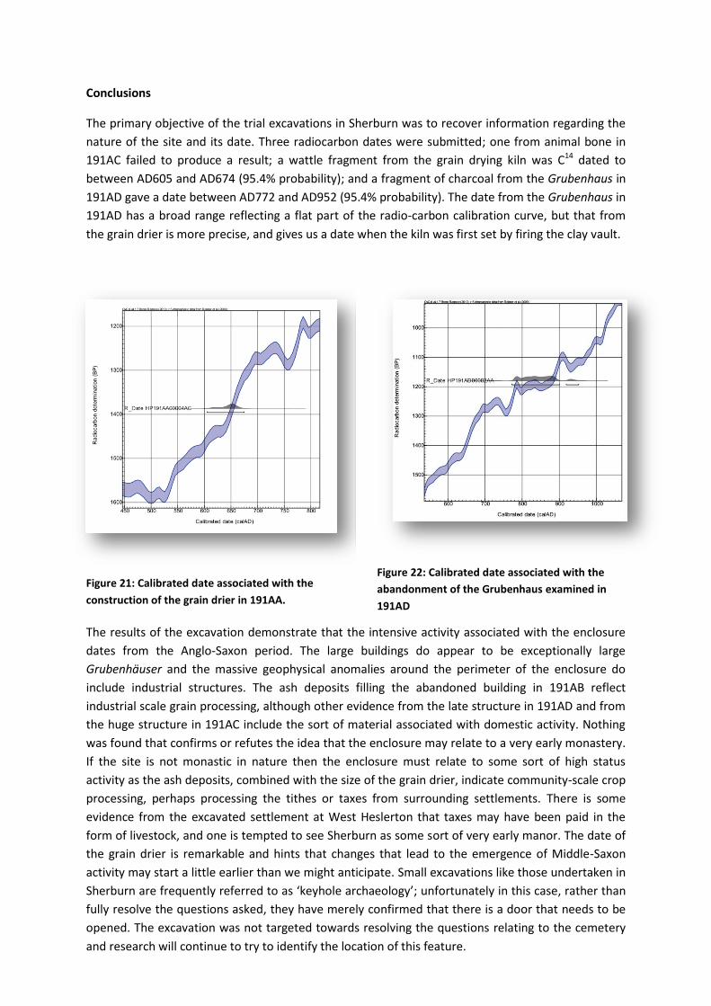
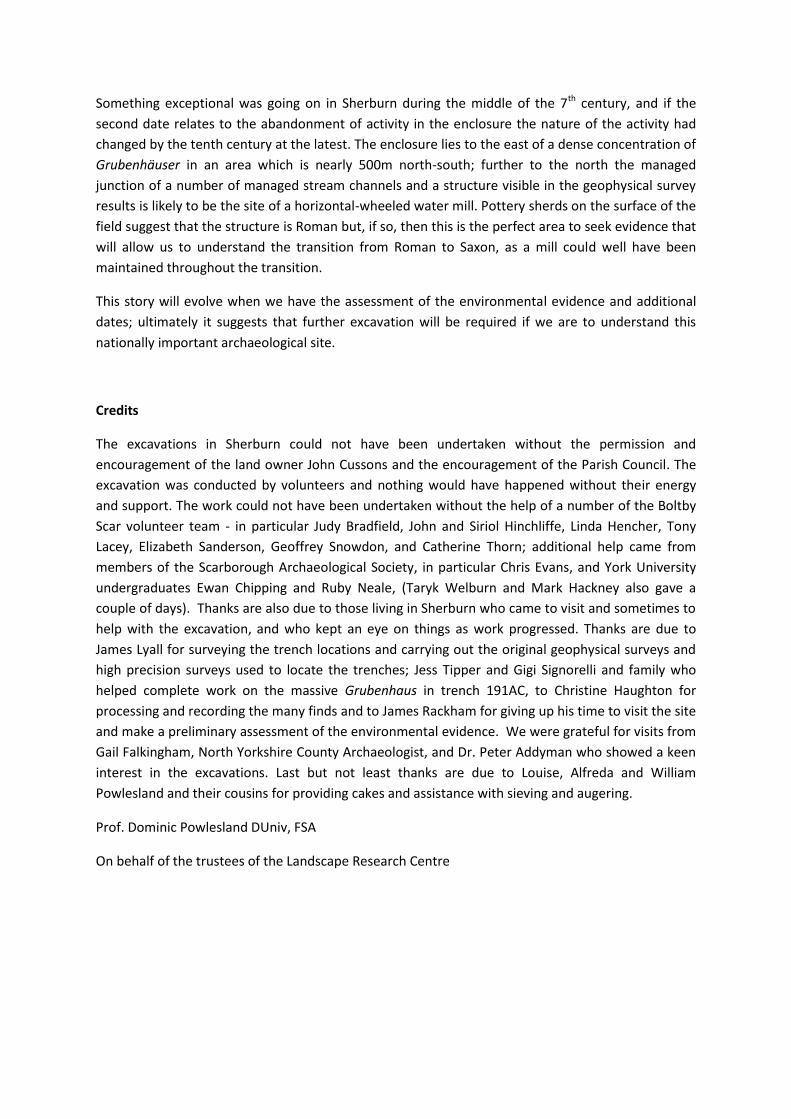
The primary objective of the trial excavations in Sherburn was to recover information regarding the
nature of the site and its date. Three radiocarbon dates were submitted; one from animal bone in
191AC failed to produce a result; a wattle fragment from the grain drying kiln was C14 dated to
between AD605 and AD674 (95.4% probability); and a fragment of charcoal from the Grubenhaus in
191AD gave a date between AD772 and AD952 (95.4% probability). The date from the Grubenhaus in
191AD has a broad range reflecting a flat part of the radio-carbon calibration curve, but that from
the grain drier is more precise, and gives us a date when the kiln was first set by firing the clay vault.
Figure 21: Calibrated date associated with the
construction of the grain drier in 191AA.
Figure 22: Calibrated date associated with the
abandonment of the Grubenhaus examined in
191AD
The results of the excavation demonstrate that the intensive activity associated with the enclosure
dates from the Anglo-Saxon period. The large buildings do appear to be exceptionally large
Grubenhäuser and the massive geophysical anomalies around the perimeter of the enclosure do
include industrial structures. The ash deposits filling the abandoned building in 191AB reflect
industrial scale grain processing, although other evidence from the late structure in 191AD and from
the huge structure in 191AC include the sort of material associated with domestic activity. Nothing
was found that confirms or refutes the idea that the enclosure may relate to a very early monastery.
If the site is not monastic in nature then the enclosure must relate to some sort of high status
activity as the ash deposits, combined with the size of the grain drier, indicate community-scale crop
processing, perhaps processing the tithes or taxes from surrounding settlements. There is some
evidence from the excavated settlement at West Heslerton that taxes may have been paid in the
form of livestock, and one is tempted to see Sherburn as some sort of very early manor. The date of
the grain drier is remarkable and hints that changes that lead to the emergence of Middle-Saxon
activity may start a little earlier than we might anticipate. Small excavations like those undertaken in
Sherburn are frequently referred to as ‘keyhole archaeology’; unfortunately in this case, rather than
fully resolve the questions asked, they have merely confirmed that there is a door that needs to be
opened. The excavation was not targeted towards resolving the questions relating to the cemetery
and research will continue to try to identify the location of this feature.
Something exceptional was going on in Sherburn during the middle of the 7th century, and if the
second date relates to the abandonment of activity in the enclosure the nature of the activity had
changed by the tenth century at the latest. The enclosure lies to the east of a dense concentration of
Grubenhäuser in an area which is nearly 500m north-south; further to the north the managed
junction of a number of managed stream channels and a structure visible in the geophysical survey
results is likely to be the site of a horizontal-wheeled water mill. Pottery sherds on the surface of the
field suggest that the structure is Roman but, if so, then this is the perfect area to seek evidence that
will allow us to understand the transition from Roman to Saxon, as a mill could well have been
maintained throughout the transition.
This story will evolve when we have the assessment of the environmental evidence and additional
dates; ultimately it suggests that further excavation will be required if we are to understand this
nationally important archaeological site.
Credits
The excavations in Sherburn could not have been undertaken without the permission and
encouragement of the land owner John Cussons and the encouragement of the Parish Council. The
excavation was conducted by volunteers and nothing would have happened without their energy
and support. The work could not have been undertaken without the help of a number of the Boltby
Scar volunteer team - in particular Judy Bradfield, John and Siriol Hinchliffe, Linda Hencher, Tony
Lacey, Elizabeth Sanderson, Geoffrey Snowdon, and Catherine Thorn; additional help came from
members of the Scarborough Archaeological Society, in particular Chris Evans, and York University
undergraduates Ewan Chipping and Ruby Neale, (Taryk Welburn and Mark Hackney also gave a
couple of days). Thanks are also due to those living in Sherburn who came to visit and sometimes to
help with the excavation, and who kept an eye on things as work progressed. Thanks are due to
James Lyall for surveying the trench locations and carrying out the original geophysical surveys and
high precision surveys used to locate the trenches; Jess Tipper and Gigi Signorelli and family who
helped complete work on the massive Grubenhaus in trench 191AC, to Christine Haughton for
processing and recording the many finds and to James Rackham for giving up his time to visit the site
and make a preliminary assessment of the environmental evidence. We were grateful for visits from
Gail Falkingham, North Yorkshire County Archaeologist, and Dr. Peter Addyman who showed a keen
interest in the excavations. Last but not least thanks are due to Louise, Alfreda and William
Powlesland and their cousins for providing cakes and assistance with sieving and augering.
Prof. Dominic Powlesland DUniv, FSA
On behalf of the trustees of the Landscape Research Centre