Embed Size (px)
Citation preview

A GIS S f S d PlA GIS S f S d PlArcGIS Software Status and PlansArcGIS Software Status and Plans
Plus Remarks About Implementing Plus Remarks About Implementing GIS on the WebGIS on the Webp gp g
Clint BrownClint BrownDirector of Software Engineering, ESRIDirector of Software Engineering, ESRI
11
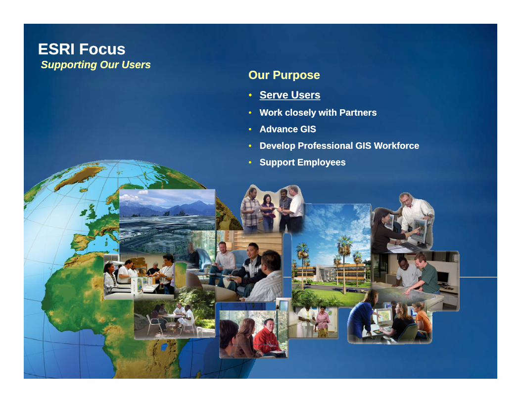
ESRI FocusESRI FocusSupporting Our UsersSupporting Our Users
Our PurposeOur PurposeOur PurposeOur Purpose•• Serve UsersServe Users•• Work closely with PartnersWork closely with Partners
•• Advance GIS Advance GIS
•• Develop Professional GIS WorkforceDevelop Professional GIS Workforce
•• Support EmployeesSupport Employees
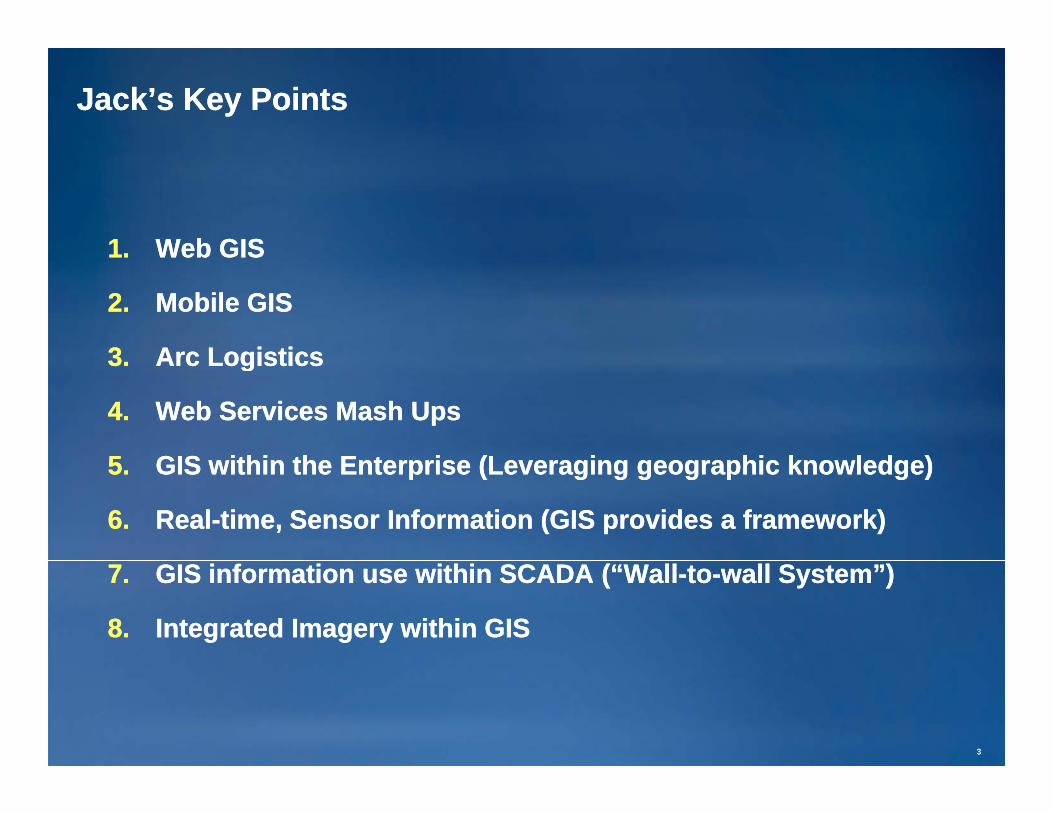
Jack’s Key PointsJack’s Key Points
11 Web GISWeb GIS1.1. Web GISWeb GIS
2.2. Mobile GISMobile GIS
33 Arc LogisticsArc Logistics3.3. Arc LogisticsArc Logistics
4.4. Web Services Mash UpsWeb Services Mash Ups
55 GIS ithi th E t i (L i hi k l d )GIS ithi th E t i (L i hi k l d )5.5. GIS within the Enterprise (Leveraging geographic knowledge)GIS within the Enterprise (Leveraging geographic knowledge)
6.6. RealReal--time, Sensor Information (GIS provides a framework)time, Sensor Information (GIS provides a framework)
7.7. GIS information use within SCADA (“WallGIS information use within SCADA (“Wall--toto--wall System”)wall System”)
8.8. Integrated Imagery within GISIntegrated Imagery within GIS
33

Your Are Part of a Global GIS CommunityYour Are Part of a Global GIS Community•• 1.5 M GIS Professionals1.5 M GIS Professionals
•• 400 000 Organizations400 000 Organizations•• 400,000 Organizations400,000 Organizations
•• All NationsAll Nations
•• Many Disciplines & InterestsMany Disciplines & Interests
. . . Improving How We Organize & Manage Critical Facilities. . . Improving How We Organize & Manage Critical Facilities

Key GIS applications in Utilities ManagementKey GIS applications in Utilities Management
1.1. Asset managementAsset management
–– Facilities networksFacilities networks
Resource accountingResource accounting–– Resource accountingResource accounting
2.2. Situational awarenessSituational awareness
–– RoleRole--base dashboardbase dashboard
–– Status reviewStatus review
–– VisualizationVisualization
–– More sensors on the networkMore sensors on the network
3.3. Outage and Disaster ManagementOutage and Disaster Management
–– Deployment and stagingDeployment and staging
4.4. Mobile Workforce ManagementMobile Workforce Management
5.5. Facilities PlanningFacilities Planning
By characterizing and representing the earth’s physical and human’s cultural By characterizing and representing the earth’s physical and human’s cultural
patterns and processespatterns and processes

GIS is Strategic Information TechnologyGIS is Strategic Information TechnologyThree partsThree parts
Based on geographyBased on geography

Common GIS Dataset TypesCommon GIS Dataset Types
RastersRastersFeature collectionsFeature collections
AttributesAttributesAttributesAttributes
GIS Data Strategy GIS Data Strategy ---- Simple geometry storage plus rich spatial relationshipsSimple geometry storage plus rich spatial relationships

The Foundation of ArcGIS Is the GeodatabaseThe Foundation of ArcGIS Is the GeodatabaseOrganizing & Managing Geospatial DataOrganizing & Managing Geospatial Data
Comprehensive Information ModelComprehensive Information Model(Any Type of Data)(Any Type of Data)
NetworksNetworks3D Objects3D Objects AttributesAttributes
ArcGISArcGIS
•• Many DBMS’sMany DBMS’s
VectorsVectors
jj
TopologyTopology
CartographyCartography
Geodatabase
•• FilesFiles
SurveysSurveys
AnnotationAnnotation
DimensionsDimensions
TerrainTerrain
CadastralCadastral
SchematicsSchematics
Scalable Storage EnvironmentsScalable Storage Environments
AddressesAddressesImagesImages
gg
88
. . . Essential for Leveraging the Full Capabilities of ArcGIS. . . Essential for Leveraging the Full Capabilities of ArcGIS

Geographic information is viewed in Maps and 3D Geographic information is viewed in Maps and 3D ViewsViewsWindows into the geodatabase. Access to Tasks and Tools.Windows into the geodatabase. Access to Tasks and Tools.
2D Maps2D Maps 3D Maps3D Maps
VisualizationVisualization

Geoprocessing and AnalysisGeoprocessing and AnalysisExample: Facilities ManagementExample: Facilities Management Electrical OutageElectrical Outage
WatershedWatershedCaliforniaCalifornia
ect ca Outageect ca OutageAnalysisAnalysisColoradoColorado
Drive Time Drive Time AnalysisAnalysisKansasKansas
Wireless Network PlanningWireless Network PlanningggLithuaniaLithuania

The fundamental nature of our users’ work remains The fundamental nature of our users’ work remains constantconstant
•• Resource and landscape inventoryResource and landscape inventory
•• Facility managementFacility management
•• PlanningPlanning•• PlanningPlanning
•• Government operationsGovernment operations
•• ScienceScienceScienceScience
•• Land information and managementLand information and management
•• Public access to informationPublic access to information
•• . . . . . .
Changes in technology bring opportunities for newChanges in technology bring opportunities for newChanges in technology bring opportunities for new Changes in technology bring opportunities for new
approaches andapproaches and competition . . .competition . . .

The nature of the computing landscape continues to The nature of the computing landscape continues to changechangegg
•• Mainframe computingMainframe computingMainframe computingMainframe computing
•• Departmental and scientific computingDepartmental and scientific computing
Workstations and networksWorkstations and networks•• Workstations and networksWorkstations and networks
•• Personal computersPersonal computers
•• Database and enterprise serversDatabase and enterprise servers
•• The web connecting individual systemsThe web connecting individual systems
•• Devices and networksDevices and networks
•• The Web is the systemThe Web is the system
•• . . .. . .

ESRI Focus: Serving our users with real systemsESRI Focus: Serving our users with real systems
Working together to build Working together to build ––RealReal things forthings forRealReal things for things for
RealReal people doing people doing
RealReal workwork
What works?What works?Simple things scale. Complex things fail.Simple things scale. Complex things fail.
Understanding geographic content and how it is presented is Understanding geographic content and how it is presented is
critical critical ––“It’s what’s in the groove that counts.”“It’s what’s in the groove that counts.”
GIS users are in a unique position to leverage this.GIS users are in a unique position to leverage this.

Today GIS Implementations Follow Three Common PatternsToday GIS Implementations Follow Three Common Patterns
. . . These Are the Foundation. . . These Are the Foundation
f N P ttf N P ttD ktD kt SS F d t dF d t d
GIS UsersGIS UsersMobile UsersMobile Users
WebWeb
for an New Patternfor an New PatternWebWeb--Based IntegrationBased Integration
DesktopDesktop ServerServer FederatedFederated
ProfessionalProfessional•• Ad Hoc ProjectsAd Hoc Projects
WorkgroupsWorkgroups•• Shared DatabaseShared Database
OrganizationsOrganizations•• Shared ServicesShared Services GIS UsersGIS Users UsersUsers•• Ad Hoc ProjectsAd Hoc Projects
•• Analysis/ModelingAnalysis/Modeling•• MappingMapping
•• Shared DatabaseShared Database•• Fixed ApplicationsFixed Applications•• TransactionsTransactions
•• Shared ServicesShared Services•• IntegrationIntegration•• CollaborationCollaboration
GISGISServersServers
AuthorsAuthors Web GISWeb GIS
1414
. . . Providing New Opportunities for Leveraging Your Work. . . Providing New Opportunities for Leveraging Your Work

The web will be at the center of everything we doThe web will be at the center of everything we do
•• The Web means:The Web means:F d t d t k hit tF d t d t k hit t–– Federated network architectureFederated network architecture
–– Simple and fast user experienceSimple and fast user experience
–– Content is keyContent is keyyy
•• RichRich
•• AuthoritativeAuthoritative
–– Web programming modelsWeb programming models
–– Participation in a larger “ecosystem” Participation in a larger “ecosystem”
Power to aggregatorsPower to aggregators–– Power to aggregatorsPower to aggregators
–– “Cloud computing” paradigm“Cloud computing” paradigm
We will continue to integrate the web into ArcGISWe will continue to integrate the web into ArcGIS

GIS Professionals Will Implement Web GISGIS Professionals Will Implement Web GISDeliver geographic information to a wide range of usersDeliver geographic information to a wide range of users
Author & Serve Geographic KnowledgeAuthor & Serve Geographic Knowledge
Many Many applicationsapplications
Author & Serve Geographic KnowledgeAuthor & Serve Geographic Knowledge
•• High Quality MapsHigh Quality Maps
•• 3D Visualizations3D Visualizations
CitizensCitizens
ConsumersConsumersCasual UsersCasual Users
Knowledge WorkersKnowledge Workers
•• Analysis & ModelsAnalysis & Models
•• Data Management WorkflowsData Management Workflows
Mobile WorkersMobile Workers
GIS WorkersGIS WorkersDistributedWeb Services
•• Authoritative ContentAuthoritative Content
•• Rich Web ApplicationsRich Web ApplicationsEnterprise SystemsEnterprise Systems
GISProfessionals
. . . Shared GIS Services. . . Shared GIS Services
1616
Reaching New Communities of Users . . . Reaching New Communities of Users . . .
. . . Dramatically Leveraging Our Collective Knowledge. . . Dramatically Leveraging Our Collective Knowledge

Google and Microsoft provide good implementation examplesGoogle and Microsoft provide good implementation examples
•• Easy, outEasy, out--ofof--the box applications the box applications
•• ReadyReady--toto--use, use, multimulti--scalescale basemaps (Streets, Imagery)basemaps (Streets, Imagery)
•• Easy to add layers (e.g., via KML)Easy to add layers (e.g., via KML)
•• Helps to address a focused set of questionsHelps to address a focused set of questions
–– What’s around here? “Exploration”What’s around here? “Exploration”
Where is it? (Find locations)Where is it? (Find locations)–– Where is it? (Find locations)Where is it? (Find locations)
–– How do I get there? (Routing)How do I get there? (Routing)
–– What does my information look like in this context? (Mashups viaWhat does my information look like in this context? (Mashups viaWhat does my information look like in this context? (Mashups via What does my information look like in this context? (Mashups via KML, etc.)KML, etc.)
As GIS users, we can learn a lot from these web sitesAs GIS users, we can learn a lot from these web sites
We must demonstrate what else is possibleWe must demonstrate what else is possible

The ArcGIS RoadmapThe ArcGIS RoadmapWhat is 9.3? What is 9.3?
D ktD kt SS M bilM bil O liO li
A Complete Integrated SystemA Complete Integrated System
DesktopDesktop ServerServer MobileMobile OnlineOnline
•• ArcReaderArcReader•• ArcViewArcView
•• Work GroupWork Group•• EnterpriseEnterprise
•• ArcGIS Mobile ArcGIS Mobile ArcPadArcPad
•• ContentContentResourceResource DESKTOPDESKTOP
MOBILEMOBILE
EXPLOREREXPLORER
•• ArcViewArcView•• ArcEditorArcEditor•• ArcInfoArcInfo•• EngineEngine
•• EnterpriseEnterprise •• ArcPadArcPad •• ResourceResourceCentersCenters
DESKTOPDESKTOP
WEBWEB
SERVERSERVERONLINEONLINE
1818
. . . For Authoring, Serving & Using Geographic Knowledge. . . For Authoring, Serving & Using Geographic Knowledge

9.3 Makes ArcGIS Better9.3 Makes ArcGIS BetterImproving Quality & Extending FunctionalityImproving Quality & Extending Functionality
EnhancementsEnhancements•• MappingMapping
S ti l A l iS ti l A l i•• Spatial AnalysisSpatial Analysis•• Data ManagementData Management•• Mobile UseMobile Use•• InteroperabilityInteroperability•• Enterprise IntegrationEnterprise Integrationp gp g•• Web ServicesWeb Services•• Online Resources & ContentOnline Resources & Content
1919
. . . Helping Users Be More Successful. . . Helping Users Be More Successful
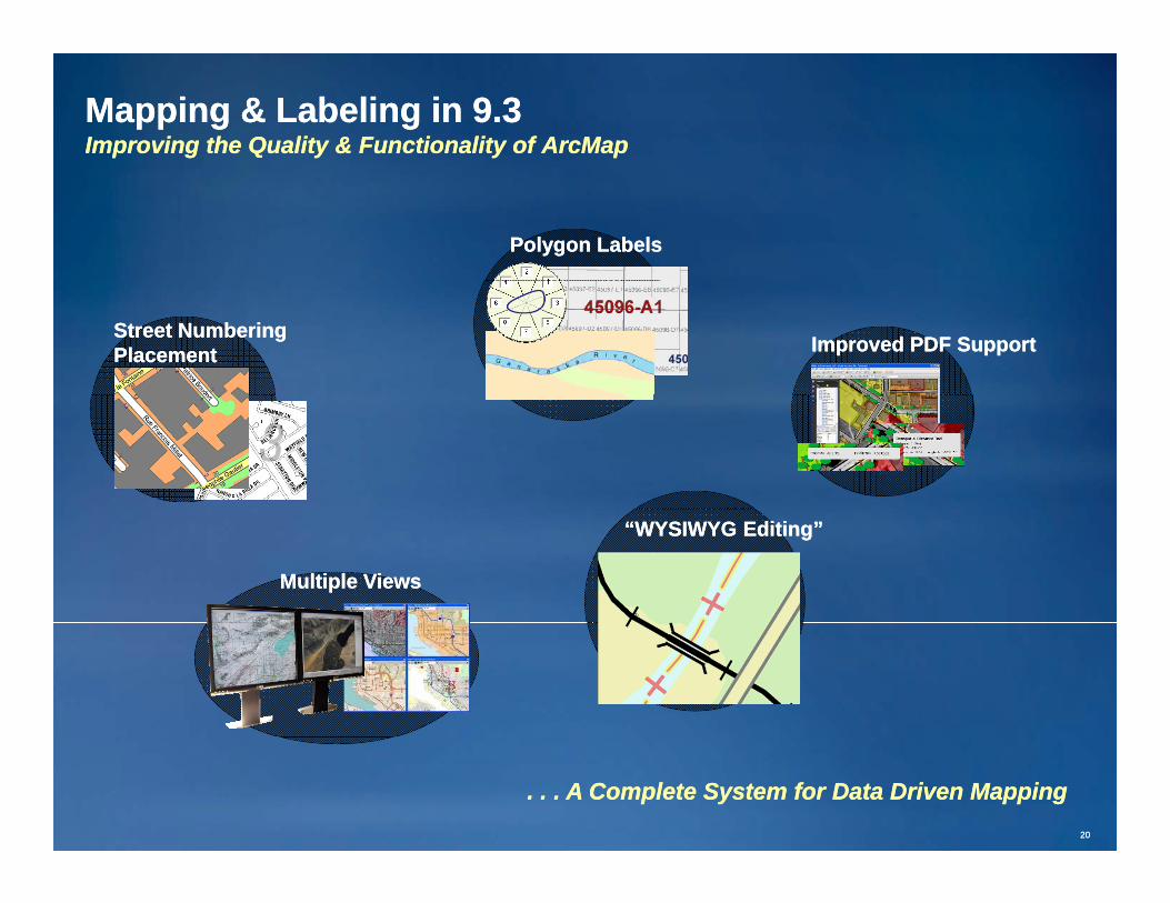
Mapping & Labeling in 9.3Mapping & Labeling in 9.3Improving the Quality & Functionality of ArcMapImproving the Quality & Functionality of ArcMap
Polygon LabelsPolygon Labels
Street NumberingStreet NumberingPlacementPlacement Improved PDF SupportImproved PDF Support
“WYSIWYG Editing”“WYSIWYG Editing”
Multiple ViewsMultiple Views
2020
. . . A Complete System for Data Driven Mapping. . . A Complete System for Data Driven Mapping

KML Tools in 9.3KML Tools in 9.3Using & Sharing Data on the WebUsing & Sharing Data on the Web
Virtual Earth in ArcGISVirtual Earth in ArcGIS
KML / KMZKML / KMZ
Geo PDF Geo PDF Support with Support with
AdobeAdobe

Improving Geographic Modeling in 9.3Improving Geographic Modeling in 9.3Providing Answers to Difficult QuestionsProviding Answers to Difficult Questions
Scatter Plot GraphicsScatter Plot Graphics
ImprovedImprovedProximity AnalysisProximity Analysis
Gaussian GeostatisticalGaussian GeostatisticalSimulationsSimulations
Analysis & ModelingAnalysis & Modeling
Vehicle RoutingVehicle Routingwith Time Windowswith Time Windows
Contouring with BarriersContouring with Barriers GeographicallyGeographicallyWeighted RegressionWeighted Regression
2222
. . . Improves Scripting, Performance & Quality. . . Improves Scripting, Performance & Quality

ArcLogistics 9.3ArcLogistics 9.3Easy to use your own networksEasy to use your own networks
NavigatorNavigator
ArcLogisticsOptimizes RoutesOptimizes Routes
ArcLogistics
Provides NavigationProvides Navigation
Schedules VehiclesSchedules Vehicles
2323
Fast return on investment . . . Fast return on investment . . .
. . . Reduces Fuel Consumption, Saves 15. . . Reduces Fuel Consumption, Saves 15--30% of Costs, & Improves Services30% of Costs, & Improves Services

SERVERArcGIS 9.3ArcGIS 9.3SERVERBasicBasic StandardStandard AdvancedAdvanced
Open & Scalable GIS ServerOpen & Scalable GIS Server
•• Data Data ManagementManagement
•• MappingMapping•• 3D Visualization3D Visualization
D tD t
•• AnalysisAnalysis•• MobileMobile
M iM iUseUse
Web MapWeb MapDesktopDesktop ExplorerExplorer MobileMobile EnterpriseEnterpriseIntegrationIntegration
OpenOpenStandardsStandards
•• Data Data ManagementManagement
•• MappingMapping•• 3D Visualization3D Visualization•• Data Data
ManagementManagement
ServeServe
AuthorAuthor
2424
. . . Making GIS Knowledge Available to Anyone. . . Making GIS Knowledge Available to Anyone

ArcGIS Server allows ArcGIS Server allows you to publish GIS services and you to publish GIS services and taskstasks
New at New at 9.39.3

ArcGIS Server supports many applicationsArcGIS Server supports many applications
UseUse
Web MapWeb MapDesktopDesktop ExplorerExplorer MobileMobile EnterpriseEnterpriseIntegrationIntegration
OpenOpenStandardsStandards
UseUse
ServeServeServeServe
AuthorAuthor
UC 2008 PlenaryUC 2008 Plenary 2626

ArcGIS Server supports enterprise geodatabase managementArcGIS Server supports enterprise geodatabase management
Open: SQL XMLOpen: SQL XMLTransactions and web Transactions and web
servicesservices
Open: SQL, XML, Open: SQL, XML, WCS, WFS, SOAP, WCS, WFS, SOAP,
REST, . . .REST, . . .
NetworksNetworks3D Objects3D Objects AttributesAttributes
ArcGISArcGISScalable Storage EnvironmentsScalable Storage Environments
VectorsVectors
jj
TopologyTopology
CartographyCartography
Geodatabase
SurveysSurveys
AnnotationAnnotation
DimensionsDimensions
TerrainTerrain
CadastralCadastral
SchematicsSchematics•• Personal geodatabasePersonal geodatabase
•• File geodatabaseFile geodatabase
•• DBMS supportDBMS support
AddressesAddressesImagesImages
pppp
•• OracleOracle
•• SQL ServerSQL Server
•• PostGreSQLPostGreSQL
2727
. . . Essential for Leveraging the Full Capabilities of ArcGIS. . . Essential for Leveraging the Full Capabilities of ArcGIS
•• PostGreSQLPostGreSQL
•• IBM DB 2 IBM DB 2
•• Informix Informix

ArcGIS Server Advancements in 9.3ArcGIS Server Advancements in 9.3Improving Quality, Performance & ScalabilityImproving Quality, Performance & Scalability Easier WebEasier Web
DevelopmentDevelopment
Better CachingBetter Caching
DevelopmentDevelopment
JavaScript
Flex WebWeb 2.02.0SilverLight
9.3 Client
BackwardsBackwardsCompatibilityCompatibility
Improved WebImproved WebMap & ADFMap & ADF
MetadataMetadataServicesServices
REST
Image Service
DynamicDynamic
ImageImageIntegrationIntegration
9.39.2
9.1
9.0
•• PrintingPrinting•• Map NavigationMap Navigation•• Map TipsMap Tips
GeoPortalToolkit
Security & Security & LoggingLogging
StandardsStandardsSupportSupport
DynamicDynamicProcessingProcessing 9.2 Client
Mobile AppMobile App
•• SQL Server 2008SQL Server 2008 LoggingLogging
Any Client/Any Client/Any SystemAny System
WMSWMS
GMLGMLWCSWCS
WFSWFS--TT
CSWCSW
KMLKML
SOAPSOAP
SQLSQL
RESTREST CADCAD
More DBMS’sMore DBMS’s
•• PostGreSQLPostGreSQL•• DB2 ZOSDB2 ZOS
2828
. . . Strengthening Enterprise Readiness. . . Strengthening Enterprise Readiness

ArcGIS Server 9.3 Supports New Web ClientsArcGIS Server 9.3 Supports New Web ClientsRich Internet Applications. New at 9.3.Rich Internet Applications. New at 9.3.
Web Map AppWeb Map AppWeb Map AppWeb Map App
FlexFlexJavaScriptJavaScript
Web 2.0Web 2.0RESTWeb ADF(.net/Java)
ArcGISArcGISServerServerServerServer
2929
. . . Fast, Flexible, & Agile. . . Fast, Flexible, & Agile

ArcGIS 9.3 Security for Web GISArcGIS 9.3 Security for Web GISSecure individual services and web applicationsSecure individual services and web applications
R l B d S itRole Based SecurityFor Services and Applications
Can use Windows users and groups,LDAP, database, or a custom provider
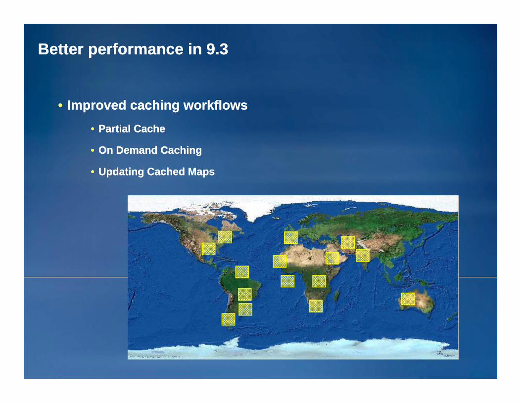
Better performance in 9.3Better performance in 9.3
•• Improved caching workflowsImproved caching workflowsP ti l C hP ti l C h•• Partial CachePartial Cache
•• On Demand CachingOn Demand Caching
•• Updating Cached MapsUpdating Cached Mapsp g pp g p

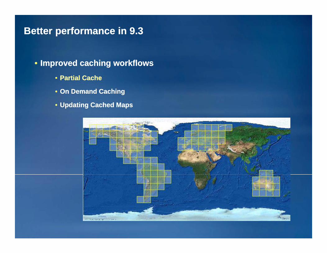
Better performance in 9.3Better performance in 9.3
•• Improved caching workflowsImproved caching workflowsP ti l C hP ti l C h•• Partial CachePartial Cache
•• On Demand CachingOn Demand Caching
•• Updating Cached MapsUpdating Cached Mapsp g pp g p
Better performance in 9.3Better performance in 9.3
•• Improved caching workflowsImproved caching workflows•• Partial CachePartial CachePartial CachePartial Cache
•• On Demand CachingOn Demand Caching
•• Updating Cached MapsUpdating Cached Maps

Better performance in 9.3Better performance in 9.3
•• Improved caching workflowsImproved caching workflows•• Partial CachePartial CachePartial CachePartial Cache
•• On Demand CachingOn Demand Caching
•• Updating Cached MapsUpdating Cached Maps

Better performance in 9.3Better performance in 9.3
•• Improved caching workflowsImproved caching workflows•• Partial CachePartial CachePartial CachePartial Cache
•• On Demand CachingOn Demand Caching
•• Updating Cached MapsUpdating Cached Maps

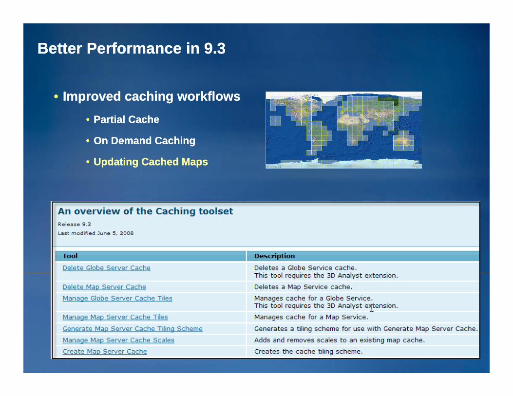
Better Performance in 9.3Better Performance in 9.3
•• Improved caching workflowsImproved caching workflows•• Partial CachePartial CachePartial CachePartial Cache
•• On Demand CachingOn Demand Caching
•• Updating Cached MapsUpdating Cached Maps

Better Performance in 9.3Better Performance in 9.3
•• Improved caching workflowsImproved caching workflows•• Partial CachePartial Cache
•• On Demand CachingOn Demand Caching
•• Updating Cached MapsUpdating Cached Maps
Better Performance in 9.3Better Performance in 9.3
•• Improved caching workflowsImproved caching workflows•• Partial CachePartial Cache
•• On Demand CachingOn Demand Caching
•• Updating Cached MapsUpdating Cached Maps

ArcGIS 9.3 Server Manages ImageryArcGIS 9.3 Server Manages ImageryProvides a System for Managing, Analyzing, and Visualizing ImageryProvides a System for Managing, Analyzing, and Visualizing Imagery
O hO h R ifi iR ifi i
On Display ProcessingOn Display Processing
OrthoOrtho--RectificationRectification
Pan SharpeningPan SharpeningImage Processing
Mosaicing /Mosaicing /
Browser
Image Processing
Color BalanceColor Balance
GIS Desktop
ArcGISArcGISServerServer
Red cingRed cing RawRaw
ImageImageServerServer
EnterpriseData SSReducingReducing
TimeTimeFilesFiles Data Serve Imagery as a basemapServe Imagery as a basemap
Or perform advanced image processingOr perform advanced image processing

New Image Service at 9.3New Image Service at 9.3

ArcGIS Supports Mobile ApplicationsArcGIS Supports Mobile ApplicationsMultiple Solutions for Working in the FieldMultiple Solutions for Working in the Field ArcPadArcPad
•• MappingMapping•• EditingEditing
ArcGIS DesktopArcGIS Desktop& Engine& Engine
•• QueryQuery•• GPSGPS
General Purpose General Purpose
SynchronizedSynchronizedwith Geodatabasewith Geodatabase
ArcGIS MobileArcGIS Mobile
Full FeatureFull Feature
MobileMobileDesktopDesktop
ArcPadArcPad
MobileMobile
Server BasedServer Based
4141
. . . Connecting & Integrating the Mobile Work Force. . . Connecting & Integrating the Mobile Work Force

ArcGIS Explorer Is Expanding GIS for EveryoneArcGIS Explorer Is Expanding GIS for EveryoneIntegrating, Visualizing & Analyzing Geographic InformationIntegrating, Visualizing & Analyzing Geographic Information
•• FastFast•• IntuitiveIntuitive•• Web CentricWeb Centric Accessing Maps,Accessing Maps,
Models & Globe ServicesModels & Globe Services
ArcGIS OnlineArcGIS Online ArcGIS ServerArcGIS Server
4242
. . . Creating a New Community of Users. . . Creating a New Community of Users

ArcGIS Online ArcGIS Online Resource CenterResource CenterA New Portal for Online ResourcesA New Portal for Online Resources
Code samples
Online Maps & Online Maps & Globe ServicesGlobe Services
CommunityCommunity
. . . Supporting & Building the . . . Supporting & Building the A GIS C itA GIS C it
NowNow•• Online HelpOnline Help•• Developer SDK’sDeveloper SDK’s
ResourcesResources
ArcGIS CommunityArcGIS Community Developer SDK sDeveloper SDK s•• Blogs & ForumsBlogs & Forums•• Code GalleriesCode Galleries•• Knowledge BaseKnowledge Base•• Software UpdatesSoftware Updates•• VideosVideosESRIESRI •• VideosVideos
FutureFuture•• Metadata Catalog of GIS ServicesMetadata Catalog of GIS Services
ESRIESRI
4343
http://resources.esri.comhttp://resources.esri.com

GIS Content Is an Integral Part of ArcGISGIS Content Is an Integral Part of ArcGISNow Delivered as Online ServicesNow Delivered as Online Services
I & El tiI & El tiImagery & ElevationImagery & Elevation
AsiaAsiaU.S.U.S.
EE
Street MapsStreet Maps
Basemaps & GlobesBasemaps & GlobesEuropeEurope
Demographics Demographics & Market Data& Market Data
GeologyGeologyThematic MapsThematic Maps
HydroHydroGeologyGeology
4444
Providing Consistent & Accurate Basemaps, Imagery & Data . . .Providing Consistent & Accurate Basemaps, Imagery & Data . . .
. . . Helping GIS Professionals be Immediately Productive. . . Helping GIS Professionals be Immediately Productive

Thinking about patterns for deploying Web GISThinking about patterns for deploying Web GIS

GIS Practitioner's RoleGIS Practitioner's RoleBuild and share authoritative geographic informationBuild and share authoritative geographic information
•• Make it useableMake it useable•• As GIS users, you build and maintain comprehensive data about your facilities As GIS users, you build and maintain comprehensive data about your facilities
operations and territoriesoperations and territories
–– Integrated “spatial fabrics” of spatially related datasetsIntegrated “spatial fabrics” of spatially related datasets
•• Land BaseLand Base
•• UtilitiesUtilities
•• Business unitsBusiness unitsBusiness unitsBusiness units
•• Customers and demographicsCustomers and demographics
•• Incidents, Disaster Response,Incidents, Disaster Response,
•• Etc.Etc.
•• We are learning how to make this information consumable and easy to useWe are learning how to make this information consumable and easy to use
•• Use a simple pattern for deploying geographic information using Web GISUse a simple pattern for deploying geographic information using Web GISp p p y g g g p gp p p y g g g p g
How can you use Web GIS to deploy this?How can you use Web GIS to deploy this?

A framework for Web GIS applicationsA framework for Web GIS applicationsMaking your geographic information consumable on the webMaking your geographic information consumable on the web
4GIS map applicationGIS map application1
41
GIS base mapGIS base map
Operational layers and Operational layers and resultsresults
3 2
3
Tasks and tools Tasks and tools (“Workflows” for applying (“Workflows” for applying the information)the information)
2 4
the information) the information)
GIS database(s)GIS database(s)5
5

Your Actions are ContributingYour Actions are Contributing
•• Raising AwarenessRaising Awareness
•• Saving ResourcesSaving ResourcesSaving ResourcesSaving Resources
•• Increasing EfficiencyIncreasing Efficiency
•• Supporting Economic DevelopmentSupporting Economic Development
•• Improving Human HealthImproving Human Health
•• Mitigating ConflictsMitigating Conflicts
Pl i d D iPl i d D i•• Planning and DesignPlanning and Design
4848
. . . Improving How We Manage Our Businesses. . . Improving How We Manage Our Businesses