Embed Size (px)
Citation preview
Max Ozenberger & Steve Heidelberg
ArcGIS Pro: 3D Tips and Tricks

Why go 3D?
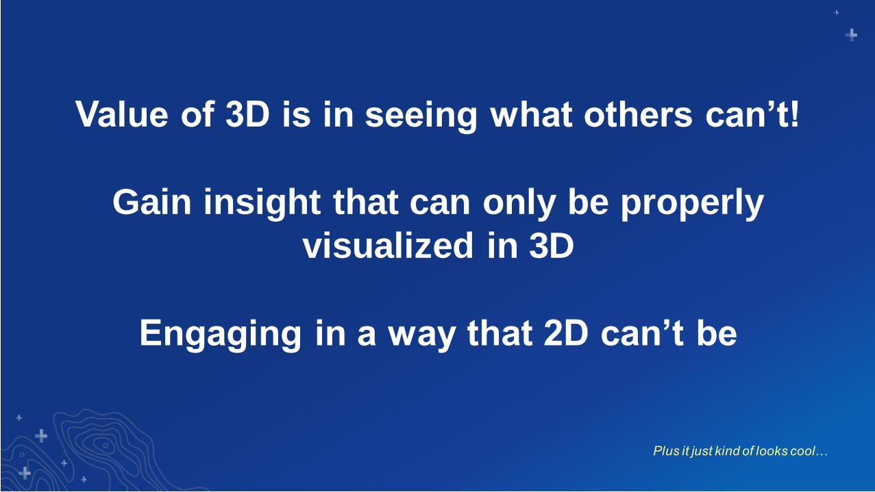
Value of 3D is in seeing what others can’t!
Gain insight that can only be properly
visualized in 3D
Engaging in a way that 2D can’t be
Plus it just kind of looks cool…
Common 3D Types supported by ArcGIS Pro
3D Types
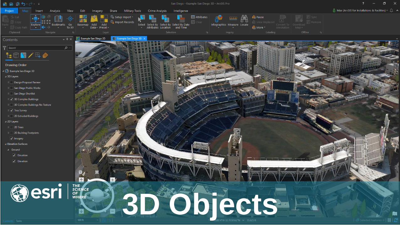
3D Objects
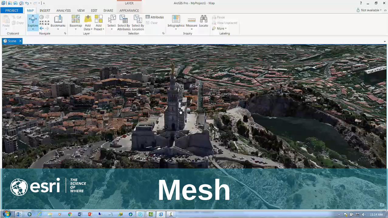
Mesh
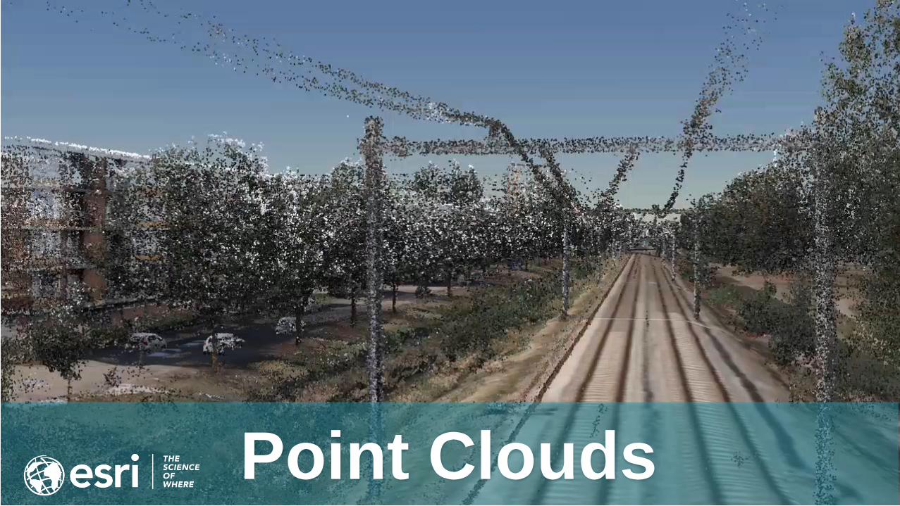
Point Clouds
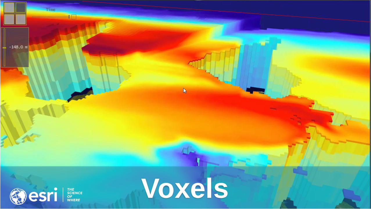
Voxels
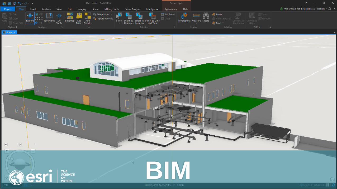
BIM
Use your existing data in a 3D Scene
2D into 3D
“I don’t have 3D data…”
Then make it out of your 2D data!
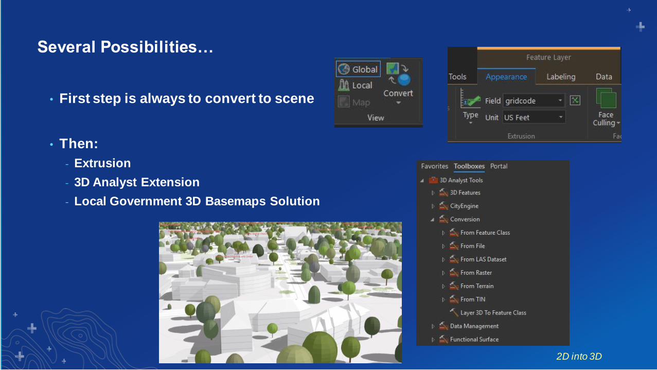
Several Possibilities…
• First step is always to convert to scene
• Then:
- Extrusion
- 3D Analyst Extension
- Local Government 3D Basemaps Solution
2D into 3D

This isn’t just about visualization!
3D Analysis
Living in a 3D world means there are spatial
questions that can only be answered in 3D
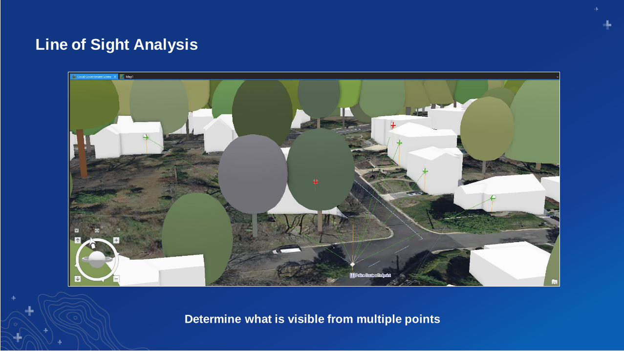
Line of Sight Analysis
Determine what is visible from multiple points
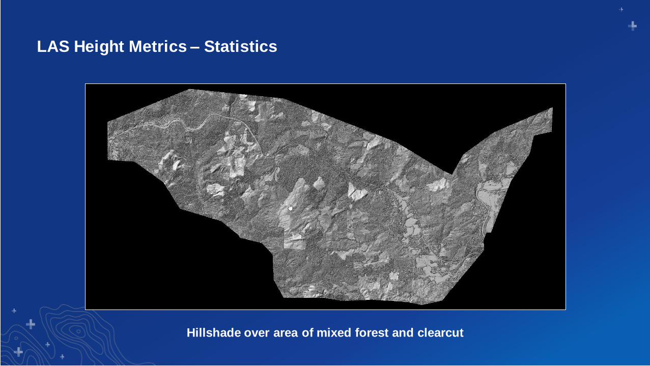
LAS Height Metrics – Statistics
Hillshade over area of mixed forest and clearcut
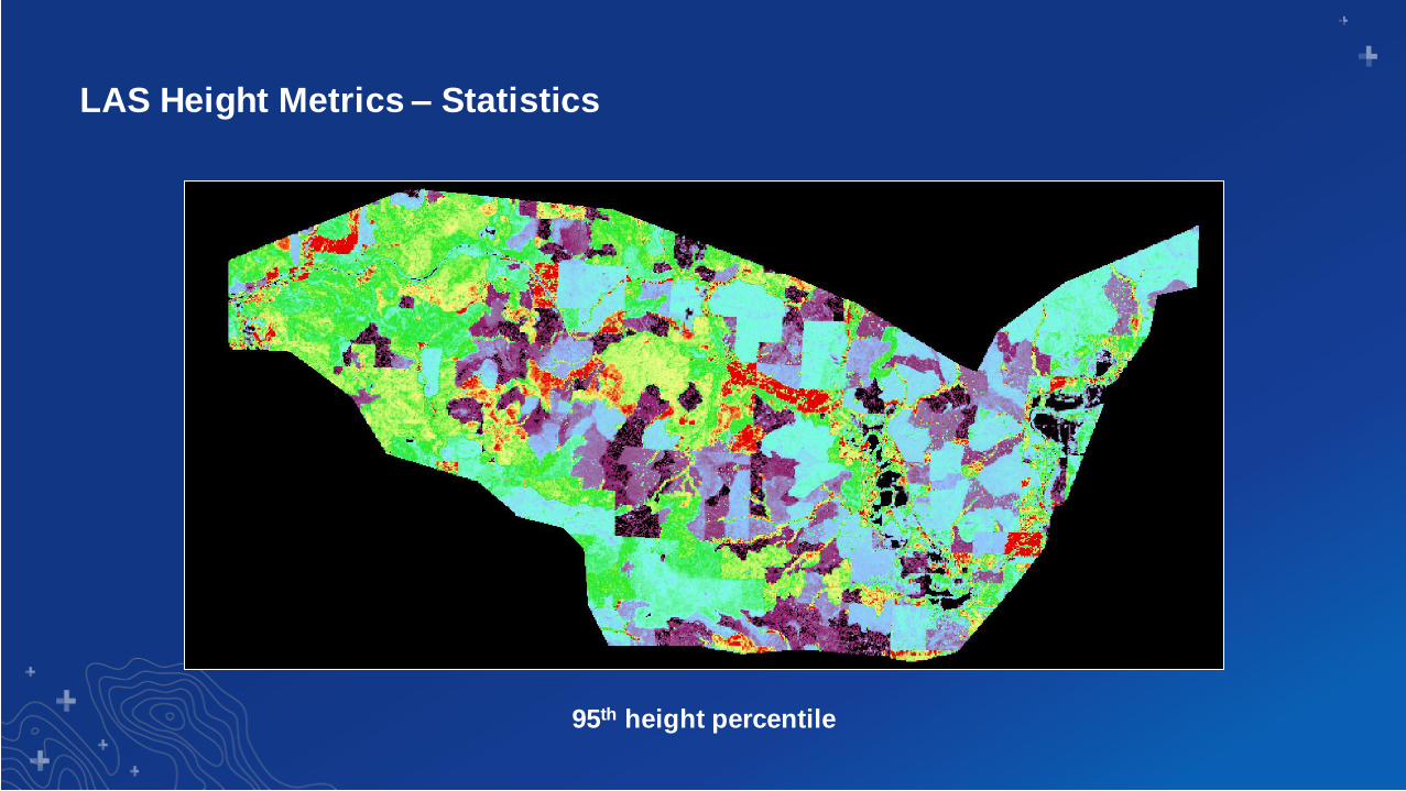
LAS Height Metrics – Statistics
95th height percentile
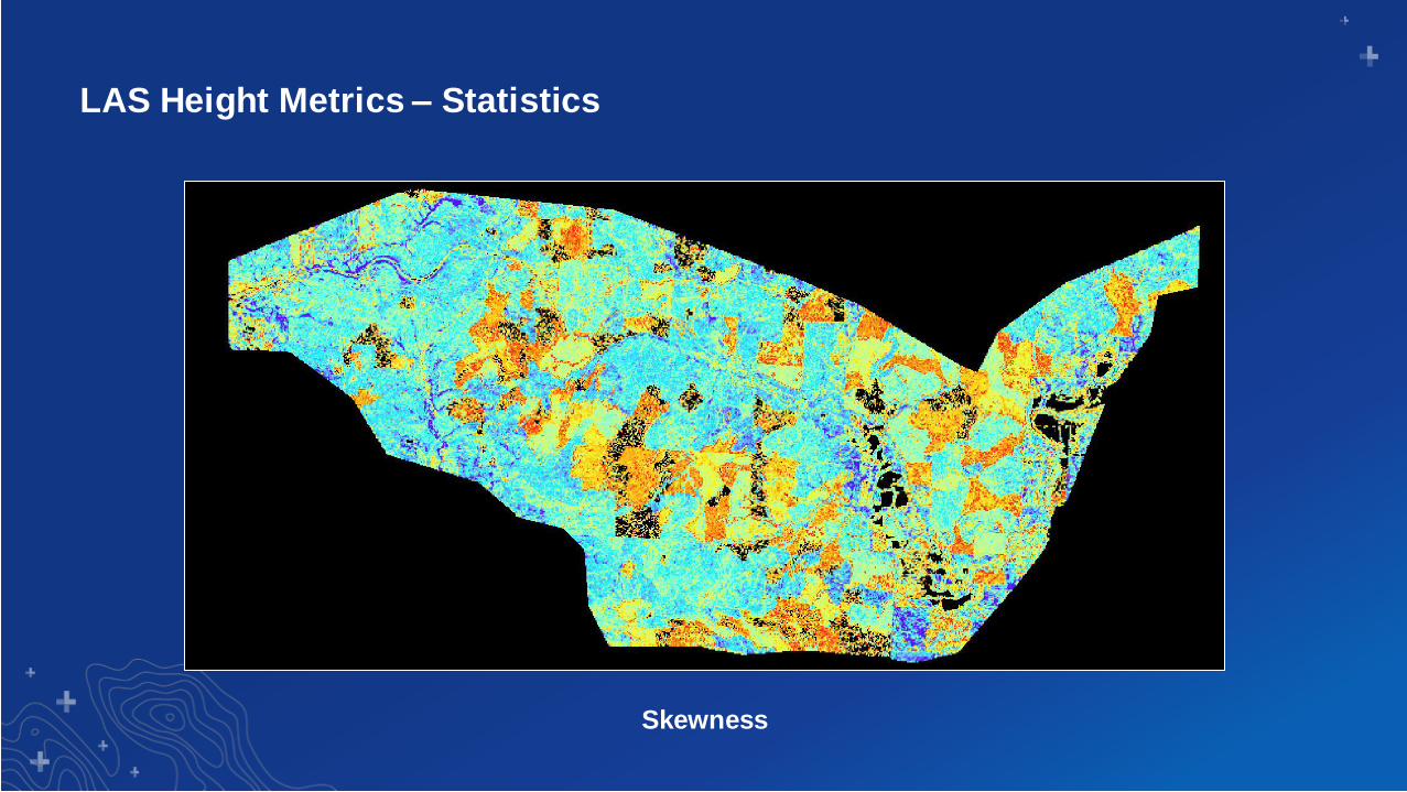
LAS Height Metrics – Statistics
Skewness
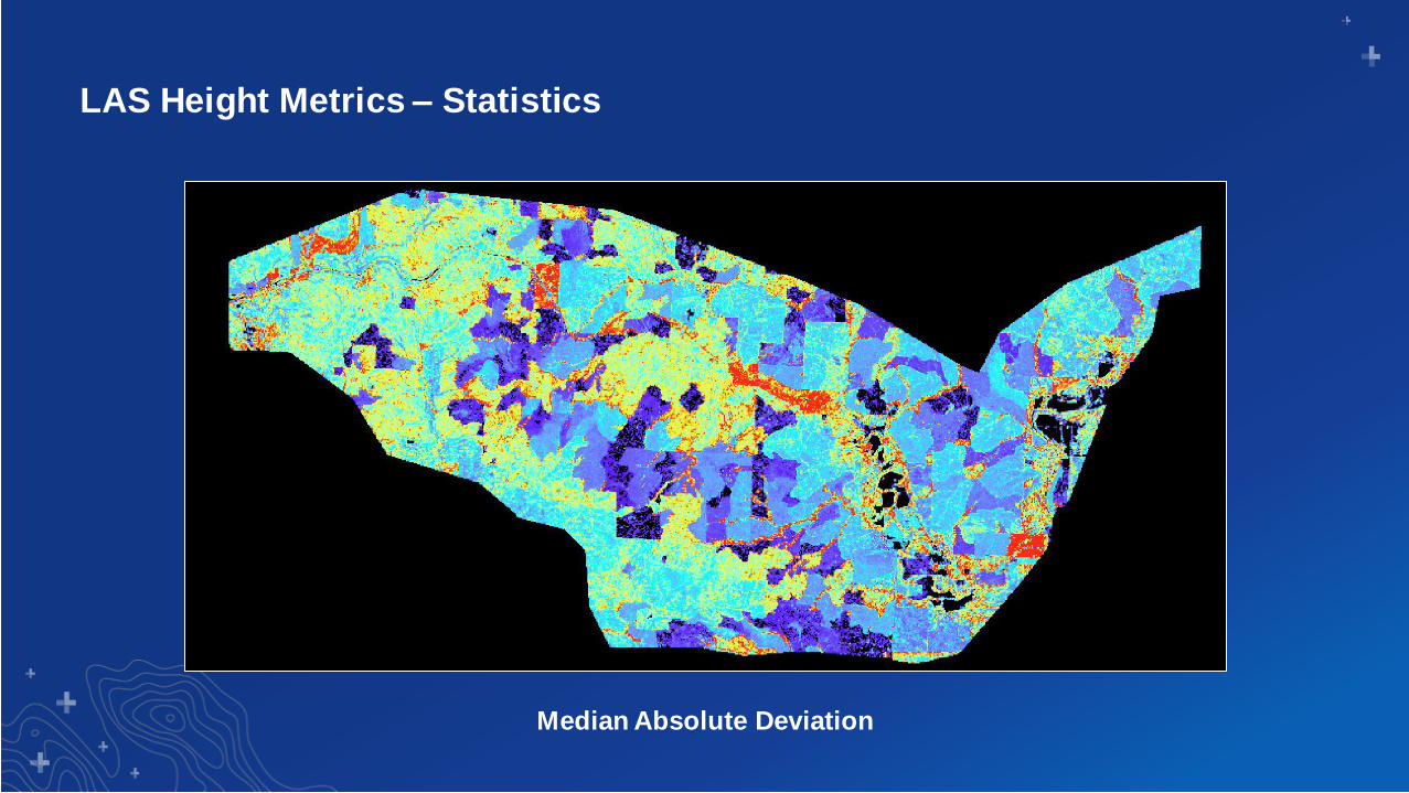
LAS Height Metrics – Statistics
Median Absolute Deviation
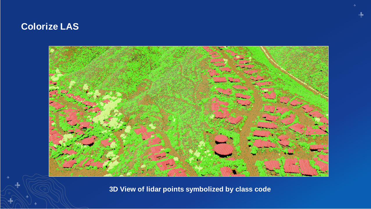
Colorize LAS
3D View of lidar points symbolized by class code
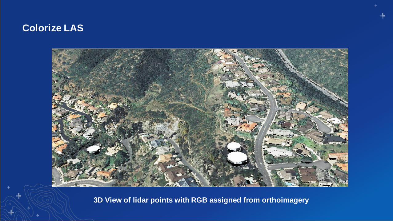
Colorize LAS
3D View of lidar points with RGB assigned from orthoimagery
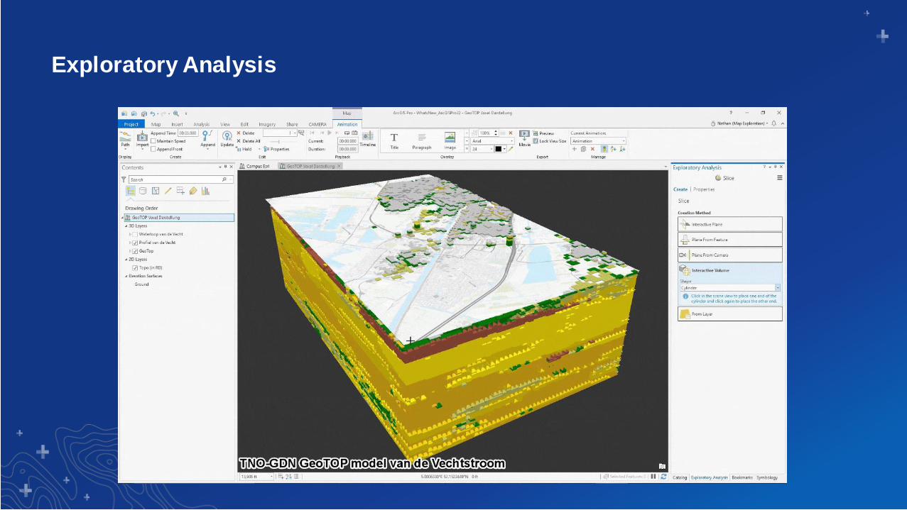
Exploratory Analysis
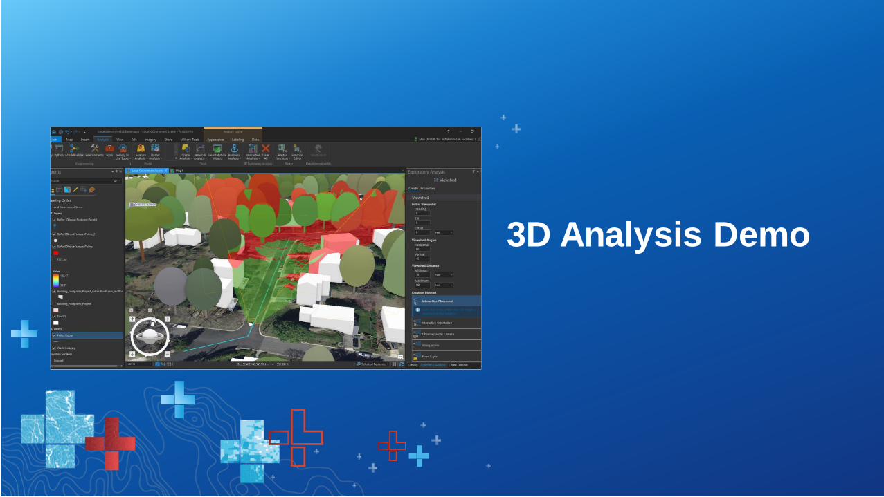
3D Analysis Demo
Bookmarks, Time Slider, Range Slider, and Animation
Location & Temporal Capture
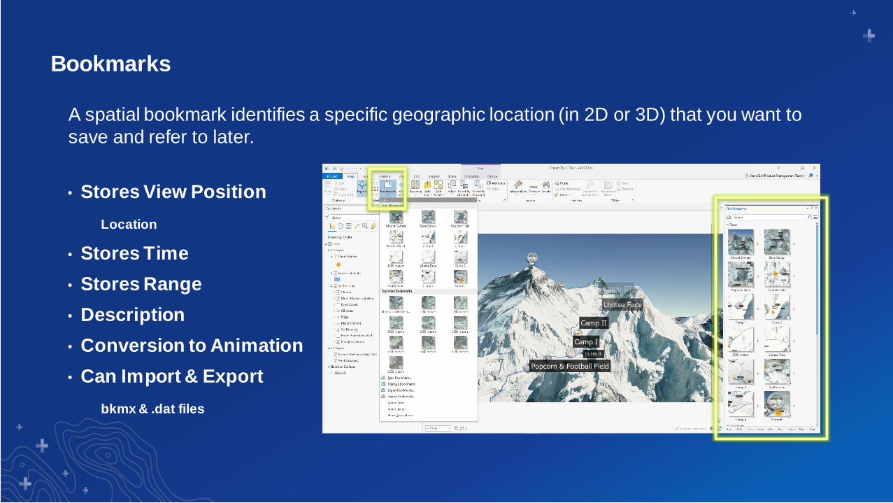
Bookmarks
• Stores View Position
Location
• Stores Time
• Stores Range
• Description
• Conversion to Animation
• Can Import & Export
bkmx & .dat files
A spatial bookmark identifies a specific geographic location (in 2D or 3D) that you want to
save and refer to later.
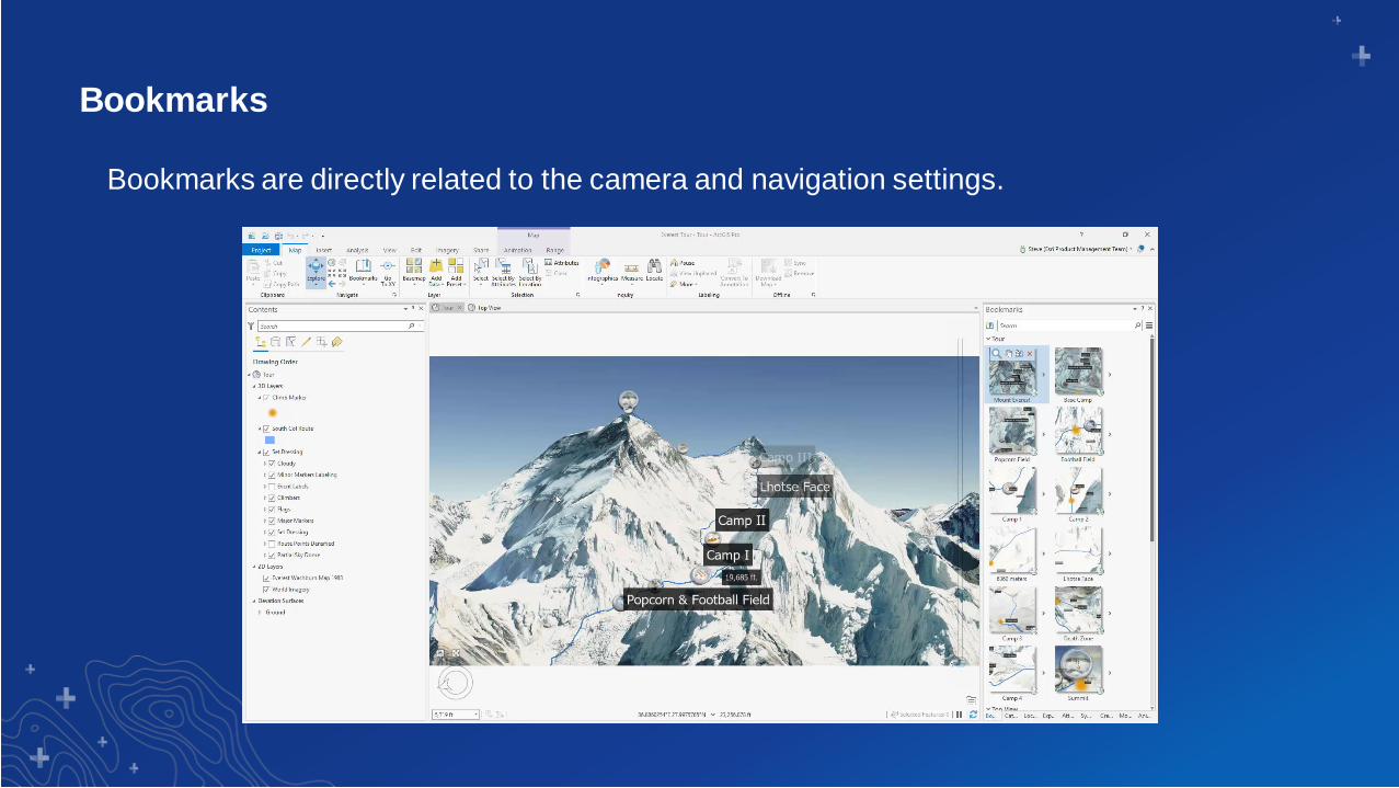
Bookmarks
Bookmarks are directly related to the camera and navigation settings.
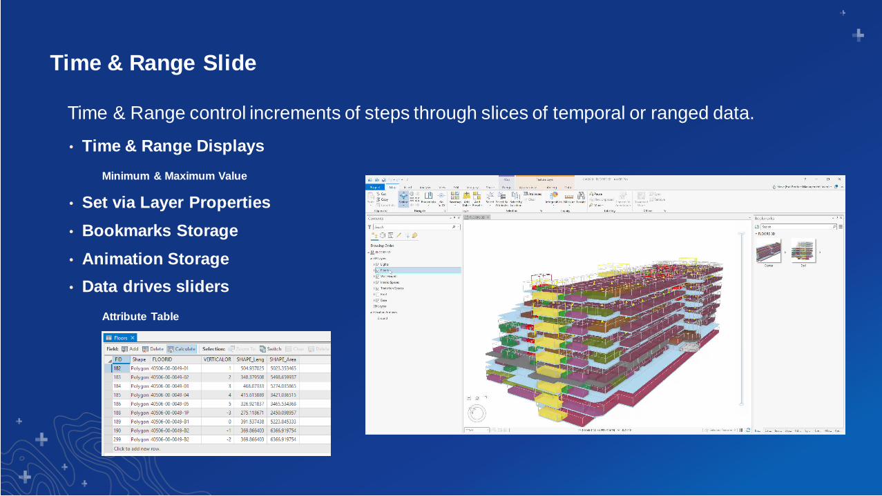
Time & Range Slide
• Time & Range Displays
Minimum & Maximum Value
• Set via Layer Properties
• Bookmarks Storage
• Animation Storage
• Data drives sliders
Attribute Table
Time & Range control increments of steps through slices of temporal or ranged data.
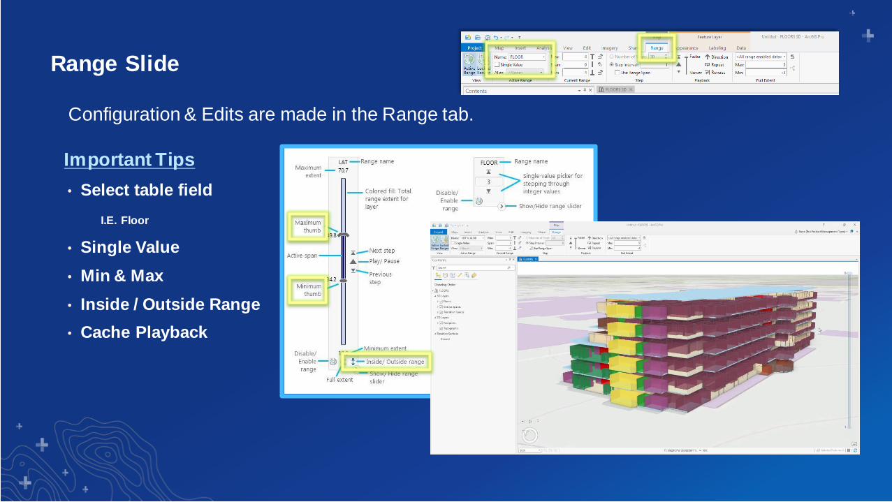
Range Slide
• Select table field
I.E. Floor
• Single Value
• Min & Max
• Inside / Outside Range
• Cache Playback
Configuration & Edits are made in the Range tab.
Important Tips
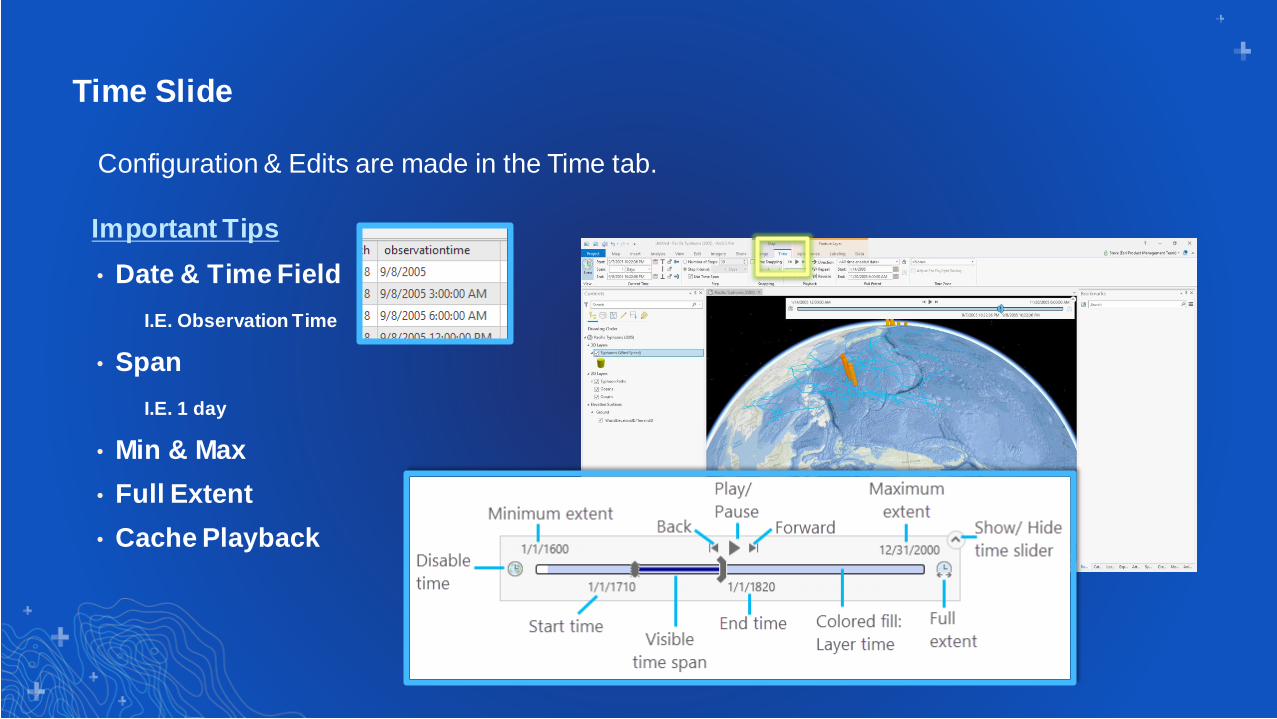
Time Slide
• Date & Time Field
I.E. Observation Time
• Span
I.E. 1 day
• Min & Max
• Full Extent
• Cache Playback
Configuration & Edits are made in the Time tab.
Important Tips
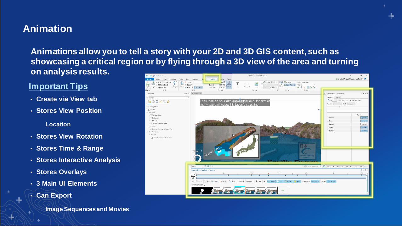
Animation
• Create via View tab
• Stores View Position
Location
• Stores View Rotation
• Stores Time & Range
• Stores Interactive Analysis
• Stores Overlays
• 3 Main UI Elements
• Can Export
Image Sequences and Movies
Animations allow you to tell a story with your 2D and 3D GIS content, such as
showcasing a critical region or by flying through a 3D view of the area and turning
on analysis results.
Important Tips
Animation
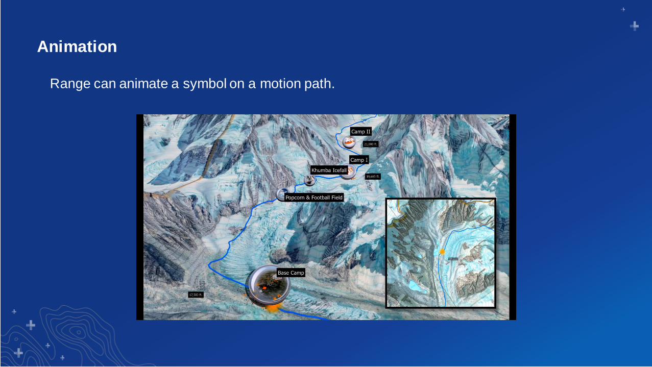
Range can animate a symbol on a motion path.
Animation
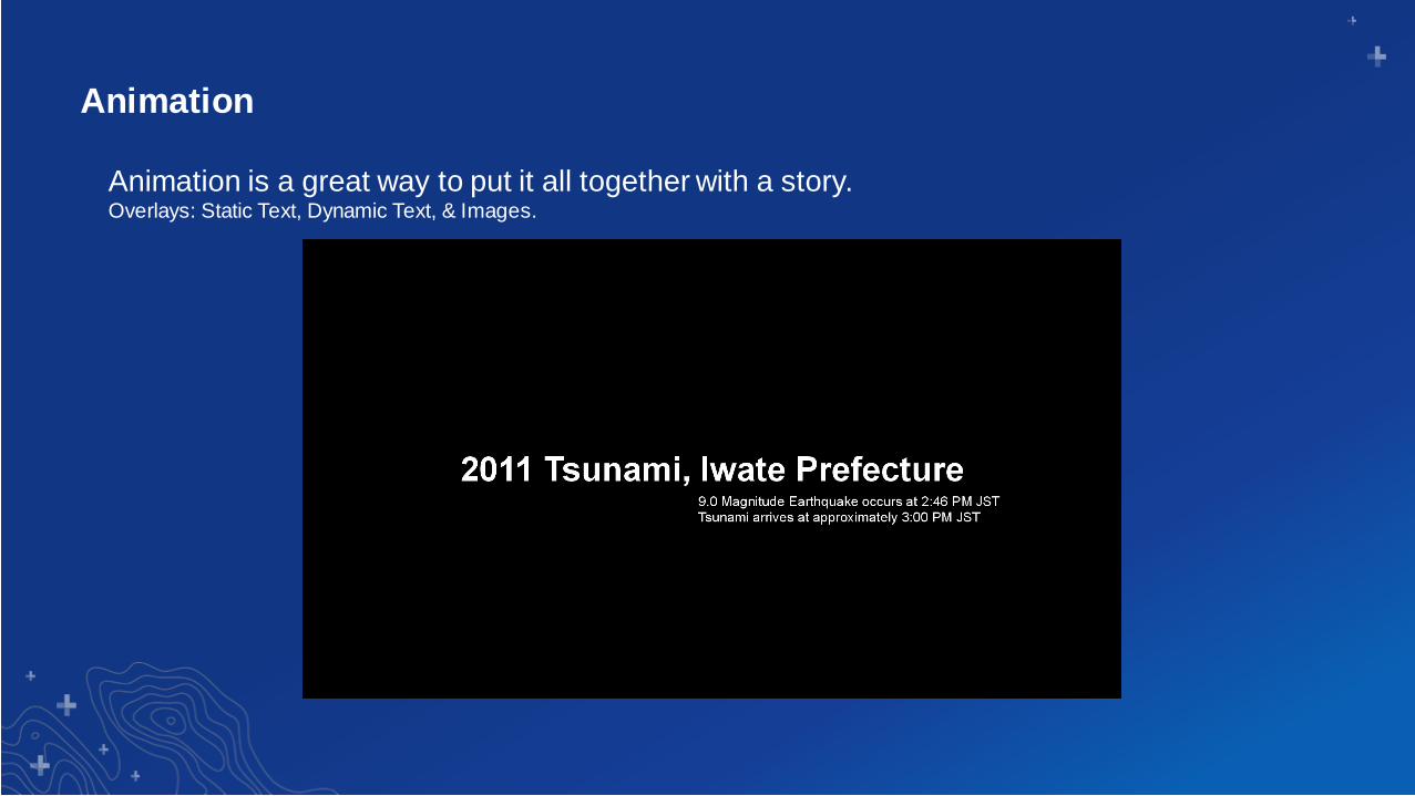
Animation is a great way to put it all together with a story. Overlays: Static Text, Dynamic Text, & Images.
Animation
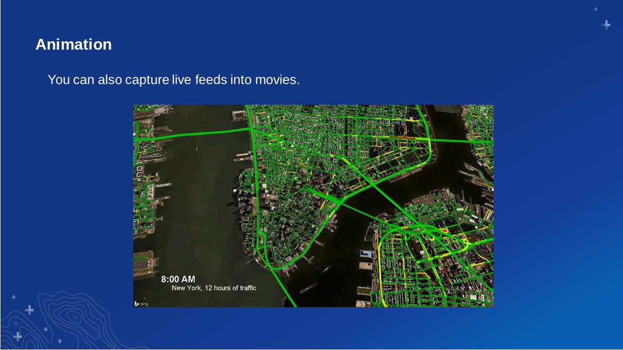
You can also capture live feeds into movies.
What to do once you’ve got your 3D perfect
Next steps
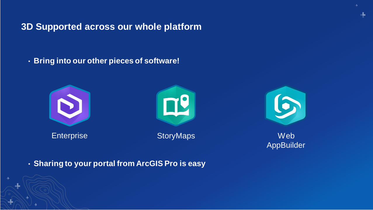
3D Supported across our whole platform
• Bring into our other pieces of software!
• Sharing to your portal from ArcGIS Pro is easy
Enterprise StoryMaps Web
AppBuilder
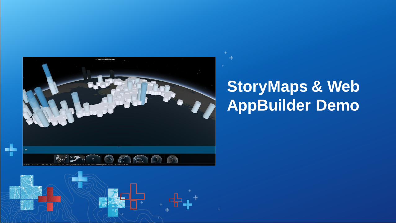
StoryMaps & Web
AppBuilder Demo
Don’t be afraid of 3D!
3D GIS is a natural evolution to our
solutions
ArcGIS Pro is a great way to get started with
3D GIS
Print Your Certificate of Attendance
Print Stations Located in 150 Concourse Lobby
Tuesday12:30 pm – 6:30 pm
Expo
Hall B
5:15 pm – 6:30 pm
Expo Social
Hall B
Wednesday10:45 am – 5:15 pm
Expo
Hall B
6:30 pm – 9:30 pm
Networking Reception
Smithsonian National Museum
of Natural History
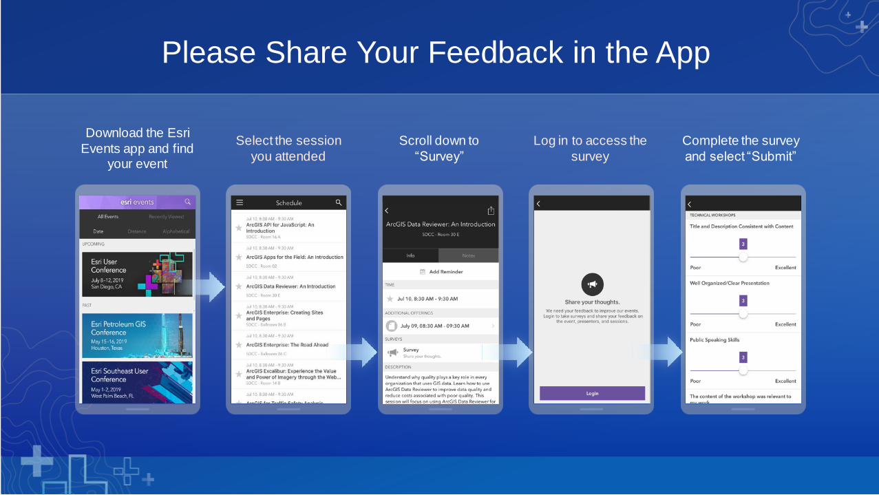
Download the Esri
Events app and find your event
Select the session
you attended
Scroll down to
“Survey”
Log in to access the
survey
Complete the survey
and select “Submit”
Please Share Your Feedback in the App

Presenter Names
Presentation Title


Section Subhead
Section Header

Presenter(s)
Demo Title