Embed Size (px)
Citation preview

ArcGIS Online vs. ArcMap:
Comparing the
Geoprocessing from Three
Mini Case Studies
Keith Darby
City of Wheaton
October 18, 2016

http://resources.arcgis.com/es/help/getting-
started/articles/GUID-B6763213-57F3-49FD-9183-
D4DEE1115E54-web.png

http://image.slidesharecdn.com/arcgisonline-120316123335-
phpapp01/95/hawaii-pacific-gis-conference-2012-esri-arcgis-online-arcgis-
online-61-728.jpg?cb=1331902295

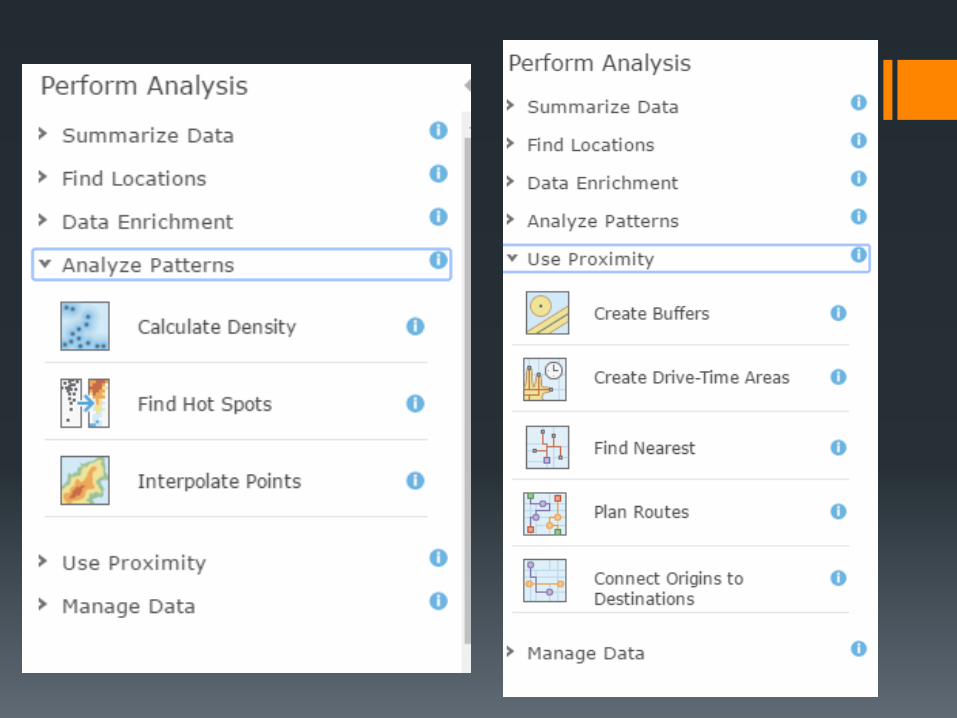
ArcGIS Online Processing Tools
With every new version, ESRI will either
release or enhanced existing geoprocessing
tools.
Some of these tools can already be found in
ArcMap (e.g. buffer, dissolve, etc).
Even with the release of these tools, or even
storing data, ESRI will not let ArcGIS Online be
used for its full extent for free.
With an ArcGIS Online license, users will have
to pay service credits depending on the tool
and the amount of data that will be processed.

Currently at the City of Wheaton
On occasion, there will be a request to
use a sophisticated geospatial tool to
complete a project.
No formal license extension purchases
(Network Analyst, Spatial Analyst, etc).
Review the existing geoprocessing tools
in ArcGIS Online.
Contact ESRI to activate a 60 day trial on
any extension as needed.

Research Study Questions
Can you get similar results if you are
using ArcGIS Online than an ArcMap
extension?
What are the limitations of the ArcGIS
Online tools?
Is it more cost efficient to use ArcGIS
Online than purchasing an extension?

Case #1: Customized Routing
The Forestry Division is continuing to
replant trees from the emerald ash borer.
Working with a consultant, their goal is to
replace trees on a seasonal basis while
maintaining a diverse tree species in the
affected areas.
After classifying which trees will be planted,
then its time to create a planting tree route
that is simple and easy to navigate.

FALL 2016
PLANTING:
439 TREES

AGOL Limitations
The AGOL tool has a maximum limit of 200 “stops” that can be used per analysis.
Overall, AGOL has failed do this restriction.
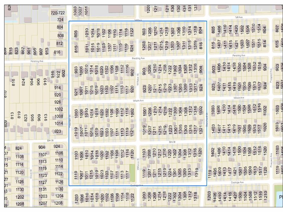
In order to show the two comparisons; the amount of trees for this analysis was reduced to 75 trees. Focusing on the southeast side of the city.
Use 1 service credit per analysis.


Case #1 Conclusions
There is a difference in results between AGOL and Network Analyst.
Spend less time configuring in AGOL than with the Network Analyst.
Creating and using network analyst can be a significant learning curve.
AGOL uses 1 service credit per each revision while Network Analyst is “free.”
Would like to see if added barriers and time settings to determine if the results would be similar or different.

Case #2: Geocoding
Postal addresses will change for certain
residential, commercial, and industrial properties.
Important to have accurate address databases for
historical purposes and requests from government
agencies (county, state, federal, etc.)
City of Wheaton has 23,050 active mailing
addresses
ESRI World Geocoding Service
One of the most expensive to use for service credits:
40 credits per 1,000 addresses.
City of Wheaton Service Credits Used: 922

Geocoding Settings
Used 3 geocoders for this study: World Geocoding Service,
In House, and DUCOMM.
Used the default settings in the advanced options:
Spelling sensitivity: 80
Minimum candidate score: 75
Minimum match score: 85
Took multiple attempts for the World Geocoding Service to
work properly: login and subscription issues


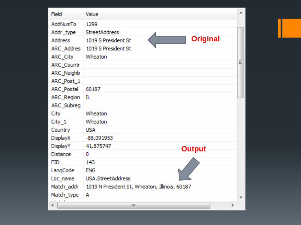
Original
Output


Case #2 Conclusions There are major differences when comparing the three
selected geocoders.
AGOL service costs 8 service credits (187 addresses.)
10 addresses were classified as the wrong street
direction.
Can be useful for studying outside your local jurisdiction.
Good idea to compare in house and other sources for
quality control purposes.
Be very cautious on the service credits!
40 credits per 1,000 addresses

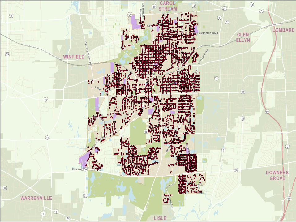
Case #3: Density Analysis
The City of Wheaton currently has 17,765 active trees.
The most common tree species is maple (8,214).
Maple Tree Species Breakdown:
Amur: 33
Autumn Blaze: 346
Crimson King: 28
Mamo Freeman’s: 94
Norway: 3,335
Pacific Sunset: 9
Red: 861
Silver: 2,519
Sugar: 989
Other popular tree species: Oak, Flowering Crabapple, Callery
Pear, and Honeylocust.

Why is this Important? The Forestry Department is actively replacing ash trees.
Main objective is to have a diverse tree species throughout
the city.
Factors: Location/Environment, Cost, and Resident
Preference
Tree City USA
City of Wheaton has been receiving this award for 30
consecutive years.
Requirements: Tree Department, Tree Care Ordinance,
Invest at least $2 per capita, and Arbor Day Observance.
Modify any existing tree planting schedules, restructured
budgets for tree caring, and informing the residents the
benefits of a diverse tree species.


All Maple
Trees
8.3
Credits


All Maple
Trees
In ArcMap
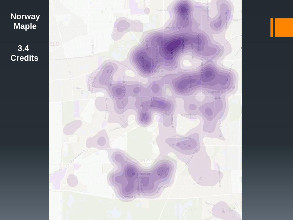
Norway
Maple
3.4
Credits

Norway
Maple
In ArcMap

Silver
Maple
2.5
Credits

Silver
Maple
In ArcMap

Case #3 Conclusions
When using AGOL and ArcMap, both of the
results are very similar to each other.
It takes 1 service credit per 1,000 records.
You may have to adjust the symbology and
classification settings in ArcMap.
AGOL has a better quality output than in
ArcMap.
Recommendation: Use AGOL if you are not
willing to purchase the Spatial Analyst extension.
Future: Add additional data to see if similar
results will occur.

Overall Summary
There are major differences between AGOL and the
extensions in ArcMap.
Depending on the analysis that will be performed,
recommend using AGOL first then try using the
extensions in ArcMap.
If using AGOL, beware of the service credits.
Creating services, hosting data or using any of the
analysis tools will use credits.
The cost of an ArcMap extension is $2,500.
Continue to be updated on new product
developments and enhancements from ESRI.