Embed Size (px)
Citation preview

ArcGIS for the Military – Domestic Operations Professional Development Workshop
Andrew Smialek, Bill Raymond and Joe Bayles
February 10–11, 2014 | Washington DC
Federal GIS Conference 2014
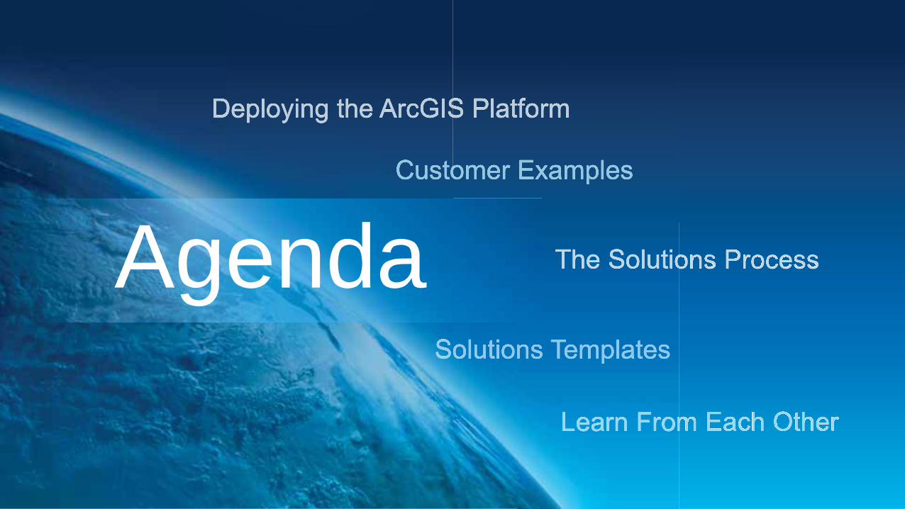
Agenda

Business Solution Architecture
Command
Planning Logistics Operations Interagency - Public Affairs
… Protect life, property, and infrastructure …Restore order …Manage resources

ArcGIS for Domestic Operations Solution Design
GIS Professionals ArcGIS Platform
Logistics Interagency and
Public Affairs Operations Command Planning

Vision Esri’s Platform for Domestic Operations

GIS Is Being Transformed Into A Cloud / Web GIS
Making GIS Easier, and Always Available
Common Geospatial Platform
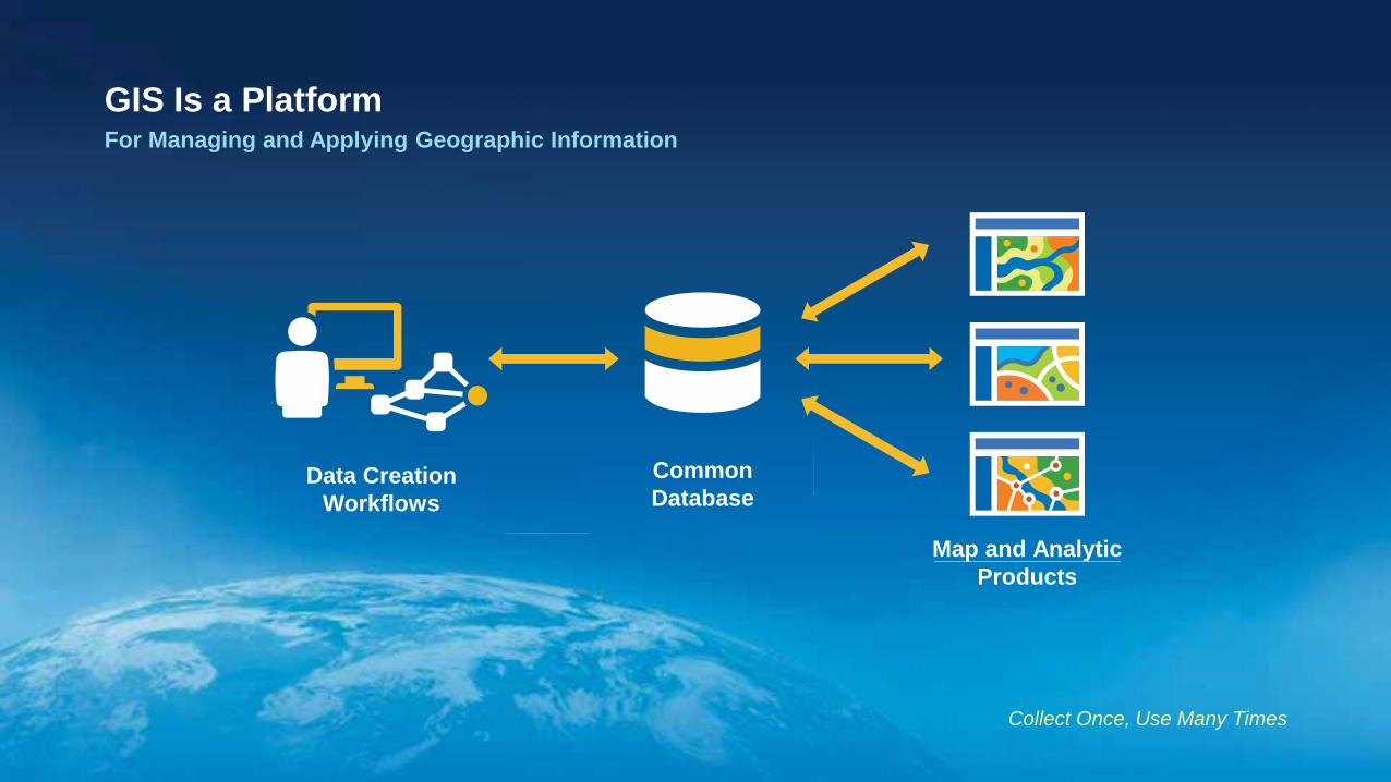
GIS Is a Platform For Managing and Applying Geographic Information
Common Database
Map and Analytic Products
Data Creation Workflows
Map and AnalyticProducts
Collect Once, Use Many Times
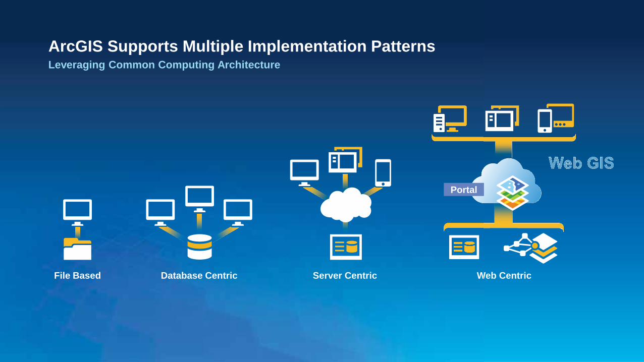
Web Centric W
ArcGIS Supports Multiple Implementation Patterns Leveraging Common Computing Architecture
File Based Server Centric Database Centric
Portal
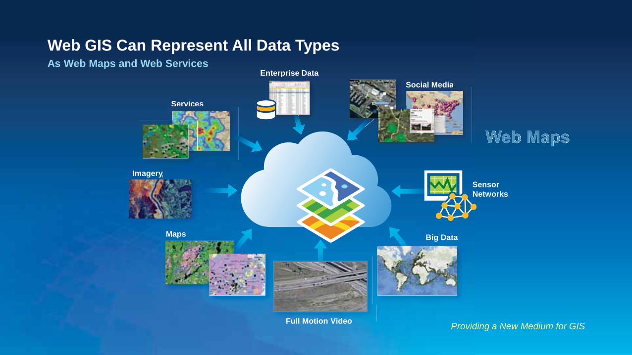
Web GIS Can Represent All Data Types As Web Maps and Web Services
Providing a New Medium for GIS
Imagery Imagery
Social Media Social Media
Big Data
Services
Sensor Networks
Maps
Enterprise Data p
Full Motion Video
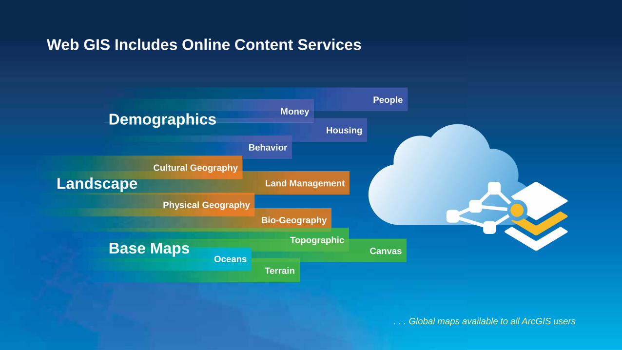
Web GIS Includes Online Content Services
. . . Global maps available to all ArcGIS users
Housing
Behavior
People Money Demographics
Bio-Geography
Land Management Cultural Geography
Physical Geography
Landscape
Canvas Topographic
Terrain Oceans
Base Maps
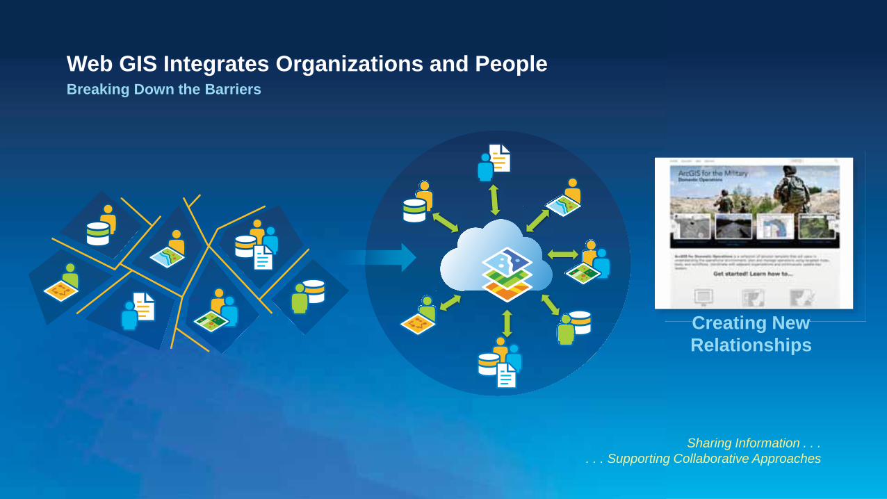
Web GIS Integrates Organizations and People Breaking Down the Barriers
Sharing Information . . . . . . Supporting Collaborative Approaches
Creating New Relationships Creating New

Solutions delivered to
User
The Template Development Process
Our motto is to deliver early and often
Customer Involved Through the Entire Process
Gather Requirements
Users • NGB • State JOCs
ESRI • Sales • Services • Solutions
Prototype
Solutions Team • Mock-up • Select technology • Define plan
Review
Site Visit & Webinars • Demonstration • User feedback • Define
Adjustments
Refine
Solutions Team • Re-define
adjustments (technical)
• Develop modifications
Test
Solutions Team • Test mod’s to
templates • Load to Amazon • Customer
Assessment Feedback
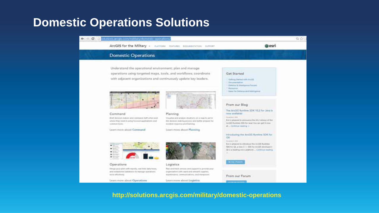
Domestic Operations Solutions
http://solutions.arcgis.com/military/domestic-operations
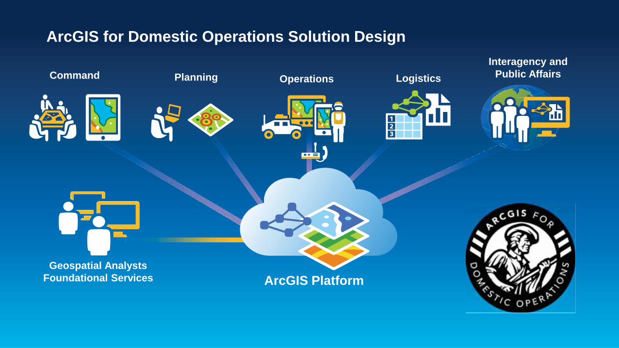
ArcGIS for Domestic Operations Solution Design
Geospatial Analysts Foundational Services ArcGIS Platform
Logistics Interagency and
Public Affairs Operations Command Planning

What’s Next in Development
More dedicated templates
Operations Dashboards
Briefing Books
Organizational Template
Adaptation between disciplines
Expansion of the Solutions Website
Administration
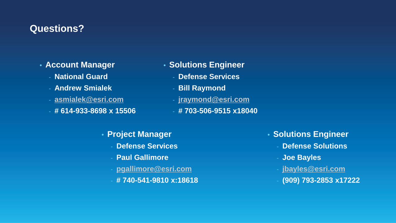
Questions?
• Account Manager - National Guard - Andrew Smialek - [email protected] - # 614-933-8698 x 15506
• Solutions Engineer - Defense Services - Bill Raymond - [email protected] - # 703-506-9515 x18040
• Solutions Engineer - Defense Solutions - Joe Bayles - [email protected] - (909) 793-2853 x17222
• Project Manager - Defense Services - Paul Gallimore - [email protected] - # 740-541-9810 x:18618
Don’t forget to complete a session evaluation form!
February 10–11, 2014 | Washington DC
Federal GIS Conference 2014
Smithsonian National Museum of Natural History Tuesday, 6:30 PM–9:30 PM Bus Pickup located on L Street
February 10–11, 2014 | Washington DC
Federal GIS Conference 2014
Networking Reception

Print your customized Certificate of Attendance! Printing stations located in Hall B and the 140/150 Room Concourse.
February 10–11, 2014 | Washington DC
Federal GIS Conference 2014

GIS Solutions EXPO, Hall B Monday, 12:30 PM–6:30 PM Tuesday, 10:45 AM–4:00 PM • Exhibitors • Hands-On Learning Lab • Technical & Extended Support • Demo Theater • Esri Showcase
February 10–11, 2014 | Washington DC
Federal GIS Conference 2014
Interested in diving deeper into Esri technology? Add a day to your Fed GIS experience and register to attend the Esri DevSummit Washington DC. Stop by the registration counter to sign up.
February 10–11, 2014 | Washington DC
Federal GIS Conference 2014


![Kinetic and mechanistic studies on the oxidation of D ...nopr.niscair.res.in/bitstream/123456789/15506/1... · Bangalore, 560 00 I, India and H C Sindhu Veerendra ... [substrate])](https://img.pdfslide.us/doc/110x75/60296bddc793a8016908bd7b/kinetic-and-mechanistic-studies-on-the-oxidation-of-d-nopr-bangalore-560-00.jpg)

![Hurst, Bernadette J. Puleo€¦ · G57, 40.00 mg CMAS SiO Wellman -Aygun Smialek Braue 0 49 mole%; such as NASA’s CMAS (with NiO DSC:020 OES Measured by EDS [#] Type Date/time :](https://img.pdfslide.us/doc/110x75/5f04cb127e708231d40fbc15/hurst-bernadette-j-puleo-g57-4000-mg-cmas-sio-wellman-aygun-smialek-braue-0.jpg)