Embed Size (px)
Citation preview
1
11111 IntroducingArcGIS Desktop
development
The ESRI® ArcGIS® Desktop Developer Guide is an introduction for
anyone who wants to customize or extend ArcGIS Desktop applications, such
as ArcMap™ or ArcCatalog™.
This chapter introduces the ArcGIS Desktop development environment in the
context of the ArcGIS product family.
Topics covered in this chapter include an ArcGIS 9 developer overview, an
ArcGIS Desktop developer overview, using this guide, and ArcGIS developer
resources.
Ch01-Intro.pmd 8/25/2004, 9:13 AM1
2 • ArcGIS Desktop Developer Guide
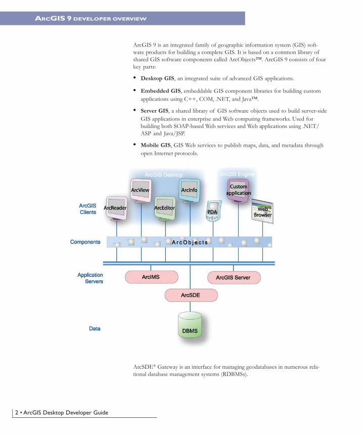
ArcGIS 9 is an integrated family of geographic information system (GIS) soft-ware products for building a complete GIS. It is based on a common library ofshared GIS software components called ArcObjects™. ArcGIS 9 consists of fourkey parts:
• Desktop GIS, an integrated suite of advanced GIS applications.
• Embedded GIS, embeddable GIS component libraries for building customapplications using C++, COM, .NET, and Java™.
• Server GIS, a shared library of GIS software objects used to build server-sideGIS applications in enterprise and Web computing frameworks. Used forbuilding both SOAP-based Web services and Web applications using .NET/ASP and Java/JSP.
• Mobile GIS, GIS Web services to publish maps, data, and metadata throughopen Internet protocols.
ArcSDE® Gateway is an interface for managing geodatabases in numerous rela-tional database management systems (RDBMSs).
ARCGIS 9 DEVELOPER OVERVIEW
Ch01-Intro.pmd 8/25/2004, 9:13 AM2
Chapter 1 • Introducing ArcGIS Desktop development • 3
ArcGIS provides a scalable framework for implementing GIS for a single user orfor many users on desktops and servers. This book will be of greatest use todevelopers who want to use the ArcGIS Desktop Developer Kit to customizeand extend the ArcView®, ArcEditor™, or ArcInfo® desktop products. This bookprovides a general explanation of the options and opportunities available todevelopers with ArcGIS Desktop. Several scenarios will illustrate with codeexamples the different types of customization that can be developed with theArcGIS Desktop Developer Kit.
ArcGIS is a platform for building geographic information systems. ArcGIS 9 willextend the system with major new capabilities in the areas of geoprocessing, 3Dvisualization, and developer tools. Two new products, ArcGIS Engine andArcGIS Server, are introduced at this release, making ArcGIS a complete systemfor application and server development.
There is a wide range of possibilities when developing with ArcGIS, includingthe following:
• Configure/Customize ArcGIS applications, such as ArcMap and ArcCatalog.
• Extend the ArcGIS architecture and data model.
• Embed maps and GIS functionality in other applications with ArcGIS Engine.
• Build and deploy custom desktop applications with ArcGIS Engine.
• Build Web services and applications with ArcGIS Server.
ArcGIS 9 has a common developer experience across all ArcGIS products(Engine, Server, and Desktop). This book focuses on customizing and extendingthe ArcGIS Desktop applications. Developers wanting to build customstandalone applications or work with ArcGIS Server should refer to the ArcGISEngine Developer Guide and the ArcGIS Server Administration and Development Guide,respectively.
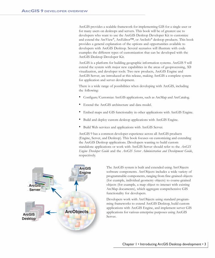
The ArcGIS system is built and extended using ArcObjectssoftware components. ArcObjects includes a wide variety ofprogrammable components, ranging from fine-grained objects(for example, individual geometry objects) to coarse-grainedobjects (for example, a map object to interact with existingArcMap documents), which aggregate comprehensive GISfunctionality for developers.
Developers work with ArcObjects using standard program-ming frameworks to extend ArcGIS Desktop, build customapplications with ArcGIS Engine, and implement server GISapplications for various enterprise purposes using ArcGISServer.
ARCGIS 9 DEVELOPER OVERVIEW
ArcObjectsArcGIS
Desktop
ArcGISServer
ArcGISEngine
Ch01-Intro.pmd 8/25/2004, 9:13 AM3
4 • ArcGIS Desktop Developer Guide
ARCGIS 9 DEVELOPER OVERVIEW
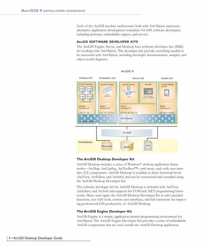
Each of the ArcGIS product architectures built with ArcObjects representsalternative application development containers for GIS software developers,including desktops, embeddable engines, and servers.
ARCGIS SOFTWARE DEVELOPER KITS
The ArcGIS Engine, Server, and Desktop have software developer kits (SDK)for working with ArcObjects. The developer kits provide everything needed tobe successful with ArcObjects, including developer documentation, samples, andobject model diagrams.
The ArcGIS Desktop Developer KitArcGIS Desktop includes a series of Windows® desktop application frame-works—ArcMap, ArcCatalog, ArcToolbox™—and more, each with user inter-face (UI) components. ArcGIS Desktop is available at three functional levels(ArcView, ArcEditor, and ArcInfo) and can be customized and extended usingthe ArcGIS Desktop Developer Kit.
The software developer kit for ArcGIS Desktop is included with ArcView,ArcEditor, and ArcInfo and supports the COM and .NET programming frame-works. Many users apply the ArcGIS Desktop Developer Kit to add extendedfunctions, new GIS tools, custom user interfaces, and full extensions for improv-ing professional GIS productivity of ArcGIS Desktop.
The ArcGIS Engine Developer KitArcGIS Engine is a simple, application-neutral programming environment forArcObjects. The ArcGIS Engine Developer Kit provides a series of embeddableArcGIS components that are used outside the ArcGIS Desktop application
ArcGIS 9
DBMS
Desktop GIS Embedded GIS Server GIS
ArcGIS Desktop
Geodatabase
ArcSDE
Mobile GIS
ArcGIS Server ArcIMS ArcGIS MobileArcPad
DesktopDeveloper Kit
EngineDeveloper Kit
ServerDeveloper Kit
.NET C++ VB .NET C++ VB JAVA JAVA ADF NET ADF C++
ArcView ArcEditor
ArcReaderArcInfo
+ ArcGIS Extensions
File-based XML
PEI Compact Framework
Component Building Blocks
Desktop
Server
Web
CustomApplications
ArcGIS Engine
Web TemplatesCustom Templates
ArcObjects
MobileDeveloper Kit
Ch01-Intro.pmd 8/25/2004, 9:13 AM4
Chapter 1 • Introducing ArcGIS Desktop development • 5
ARCGIS 9 DEVELOPER OVERVIEW
framework (for example, mapping objects are managed as part of ArcGISEngine, rather than in ArcMap). Using the ArcGIS Engine Developer Kit, devel-opers build focused GIS solutions with simple interfaces to access any set of GISfunctions or can embed GIS logic in existing user applications to deploy GIS tobroad groups of users. ArcGIS Engine has a COM, .NET, Java, and C++ applica-tion programming interface (API) for developers.
The ArcGIS Server Developer KitArcGIS Server defines and implements a set of standard GIS Web services (forexample, mapping, data access, and geocoding), as well as supports enterprise-level application development based on ArcObjects for the server.
The ArcGIS Server Developer Kit enables developers to build central GIS serversto host GIS functions that are accessed by many users, perform back office pro-cessing on large central GIS databases, build and deliver GIS Web applications,and perform distributed GIS computing.
Ch01-Intro.pmd 8/25/2004, 9:13 AM5
6 • ArcGIS Desktop Developer Guide
ArcGIS Desktop includes a suite of integrated applications, including ArcMap,ArcCatalog, and ArcToolbox. By using these applications and interfaces in unison,you can perform any GIS task, simple to advanced, including mapping, geographicanalysis, data editing and compilation, data management, visualization, andgeoprocessing.
WHAT ARE ARCVIEW, ARCEDITOR, AND ARCINFO?
ArcGIS Desktop is the information authoring and usage tool for GIS profession-als. It is scalable as three separate software products to meet the needs of manytypes of users.
ArcView provides comprehensive mapping and analysis tools along with simpleediting and geoprocessing.
ArcEditor includes advanced editing capabilities for shapefiles and geodatabasesin addition to the full functionality of ArcView.
ArcInfo is the flagship ArcGIS Desktop product. It builds on the functionalityof ArcEditor with advanced geoprocessing. It also includes the legacy applica-tions for ArcInfo Workstation.
Because ArcView, ArcEditor, and ArcInfo all share a common architecture, usersworking with any of these GIS desktops can share their work with other users.Maps, data, symbology, map layers, custom tools and interfaces, reports,metadata, and so on, can be accessed interchangeably in all three products. Thismeans that you benefit from using a single architecture, minimizing the need tolearn and deploy several different architectures.
New capabilities can be added to all seats through a series of ArcGIS Desktopextensions from ESRI and other organizations. Users can also develop their owncustom extensions to ArcGIS Desktop by working with ArcObjects, the ArcGISsoftware component library. Users develop extensions and custom tools usingstandard Windows programming interfaces, such as COM and .NET.
ArcObjects is a framework that lets you create domain-specific components fromother components. The ArcObjects components collaborate to serve every datamanagement and map presentation function common to most GIS applications.ArcObjects provides an infrastructure for application customization that lets youconcentrate on serving the specific needs of your clients.
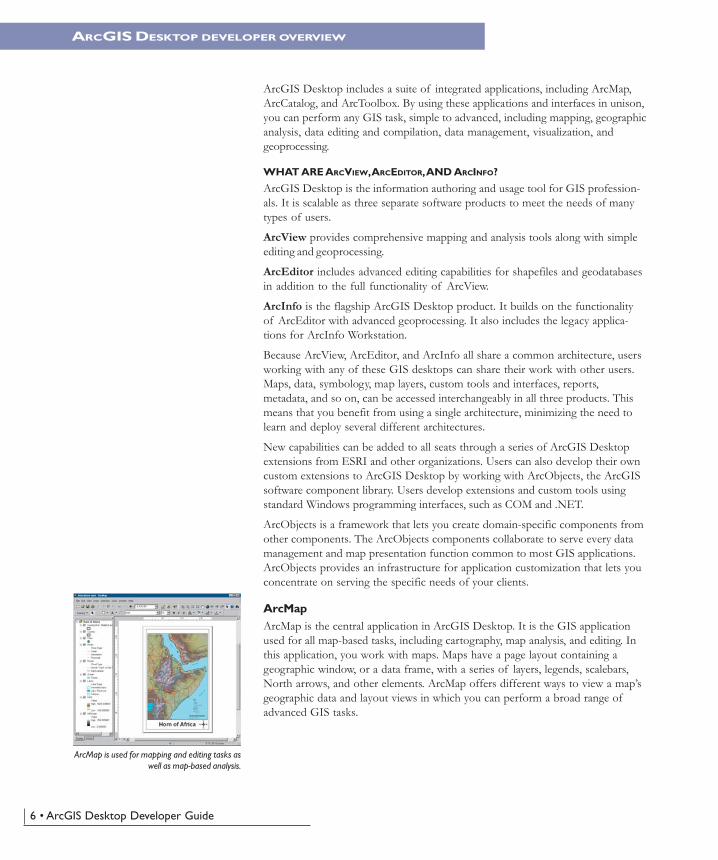
ArcMapArcMap is the central application in ArcGIS Desktop. It is the GIS applicationused for all map-based tasks, including cartography, map analysis, and editing. Inthis application, you work with maps. Maps have a page layout containing ageographic window, or a data frame, with a series of layers, legends, scalebars,North arrows, and other elements. ArcMap offers different ways to view a map’sgeographic data and layout views in which you can perform a broad range ofadvanced GIS tasks.
ARCGIS DESKTOP DEVELOPER OVERVIEW
ArcMap is used for mapping and editing tasks aswell as map-based analysis.
Ch01-Intro.pmd 8/25/2004, 9:13 AM6
Chapter 1 • Introducing ArcGIS Desktop development • 7
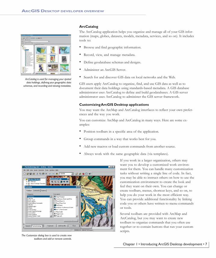
ArcCatalogThe ArcCatalog application helps you organize and manage all of your GIS infor-mation (maps, globes, datasets, models, metadata, services, and so on). It includestools to:
• Browse and find geographic information.
• Record, view, and manage metadata.
• Define geodatabase schemas and designs.
• Administer an ArcGIS Server.
• Search for and discover GIS data on local networks and the Web.
GIS users apply ArcCatalog to organize, find, and use GIS data as well as todocument their data holdings using standards-based metadata. A GIS databaseadministrator uses ArcCatalog to define and build geodatabases. A GIS serveradministrator uses ArcCatalog to administer the GIS server framework.
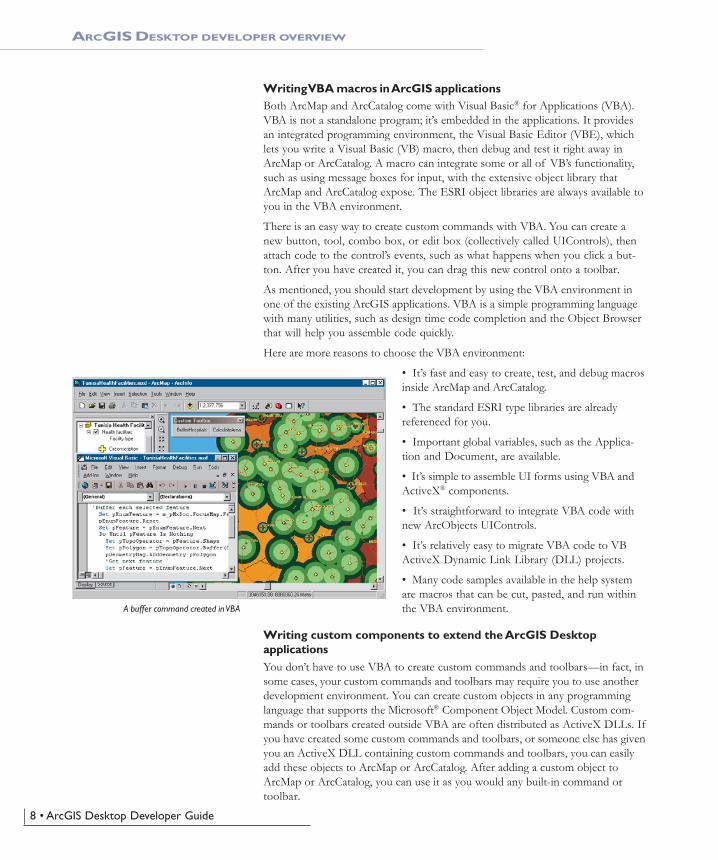
Customizing ArcGIS Desktop applicationsYou may want the ArcMap and ArcCatalog interfaces to reflect your own prefer-ences and the way you work.
You can customize ArcMap and ArcCatalog in many ways. Here are some ex-amples:
• Position toolbars in a specific area of the application.
• Group commands in a way that works best for you.
• Add new macros or load custom commands from another source.
• Always work with the same geographic data (via templates).
If you work in a larger organization, others maywant you to develop a customized work environ-ment for them. You can handle many customizationtasks without writing a single line of code. In fact,you may be able to instruct others on how to use thecustomization environment to create the look andfeel they want on their own. You can change orcreate toolbars, menus, shortcut keys, and so on, tohelp you do your work in the most efficient way.You can provide additional functionality by linkingcode you or others have written to menu commandsor tools.
Several toolbars are provided with ArcMap andArcCatalog, but you may want to create newtoolbars to organize commands that you often usetogether or to contain buttons that run your customscripts.
ARCGIS DESKTOP DEVELOPER OVERVIEW
ArcCatalog is used for managing your spatialdata holdings, defining your geographic data
schemas, and recording and viewing metadata.
The Customize dialog box is used to create newtoolbars and add or remove controls.
Ch01-Intro.pmd 8/25/2004, 9:13 AM7
8 • ArcGIS Desktop Developer Guide
Writing VBA macros in ArcGIS applicationsBoth ArcMap and ArcCatalog come with Visual Basic® for Applications (VBA).VBA is not a standalone program; it’s embedded in the applications. It providesan integrated programming environment, the Visual Basic Editor (VBE), whichlets you write a Visual Basic (VB) macro, then debug and test it right away inArcMap or ArcCatalog. A macro can integrate some or all of VB’s functionality,such as using message boxes for input, with the extensive object library thatArcMap and ArcCatalog expose. The ESRI object libraries are always available toyou in the VBA environment.
There is an easy way to create custom commands with VBA. You can create anew button, tool, combo box, or edit box (collectively called UIControls), thenattach code to the control’s events, such as what happens when you click a but-ton. After you have created it, you can drag this new control onto a toolbar.
As mentioned, you should start development by using the VBA environment inone of the existing ArcGIS applications. VBA is a simple programming languagewith many utilities, such as design time code completion and the Object Browserthat will help you assemble code quickly.
Here are more reasons to choose the VBA environment:
• It’s fast and easy to create, test, and debug macrosinside ArcMap and ArcCatalog.
• The standard ESRI type libraries are alreadyreferenced for you.
• Important global variables, such as the Applica-tion and Document, are available.
• It’s simple to assemble UI forms using VBA andActiveX® components.
• It’s straightforward to integrate VBA code withnew ArcObjects UIControls.
• It’s relatively easy to migrate VBA code to VBActiveX Dynamic Link Library (DLL) projects.
• Many code samples available in the help systemare macros that can be cut, pasted, and run withinthe VBA environment.
Writing custom components to extend the ArcGIS DesktopapplicationsYou don’t have to use VBA to create custom commands and toolbars—in fact, insome cases, your custom commands and toolbars may require you to use anotherdevelopment environment. You can create custom objects in any programminglanguage that supports the Microsoft® Component Object Model. Custom com-mands or toolbars created outside VBA are often distributed as ActiveX DLLs. Ifyou have created some custom commands and toolbars, or someone else has givenyou an ActiveX DLL containing custom commands and toolbars, you can easilyadd these objects to ArcMap or ArcCatalog. After adding a custom object toArcMap or ArcCatalog, you can use it as you would any built-in command ortoolbar.
ARCGIS DESKTOP DEVELOPER OVERVIEW
A buffer command created in VBA
Ch01-Intro.pmd 8/25/2004, 9:13 AM8
Chapter 1 • Introducing ArcGIS Desktop development • 9
If you want to use a programming language other than VBA, or if you want topackage ArcObjects functionality into a COM DLL, EXE, OCX, or .NET assem-bly, you will have to work outside the VBA development environment. Thisapproach generally requires creating a project, referencing the ArcObjects typelibraries required, implementing ArcObjects interfaces, adding code, then compil-ing the source into a binary file.
Following are some advantages of building custom components:
• They can be easily delivered to end users via custom setup programs.
• You can hide your code and logic in a binary file.
• You can extend and customize virtually every aspect of the ArcGIS technol-ogy.
Components can be broadly categorized into two areas of customization: thosethat reside at the application level, such as custom buttons, toolbars, windows,and extensions, and those that reside at the geodatabase level, such as customfeature class extensions and features. Some of these more advancedcustomizations cannot be accomplished through the VBA environment.
ARCGIS DESKTOP DEVELOPER OVERVIEW
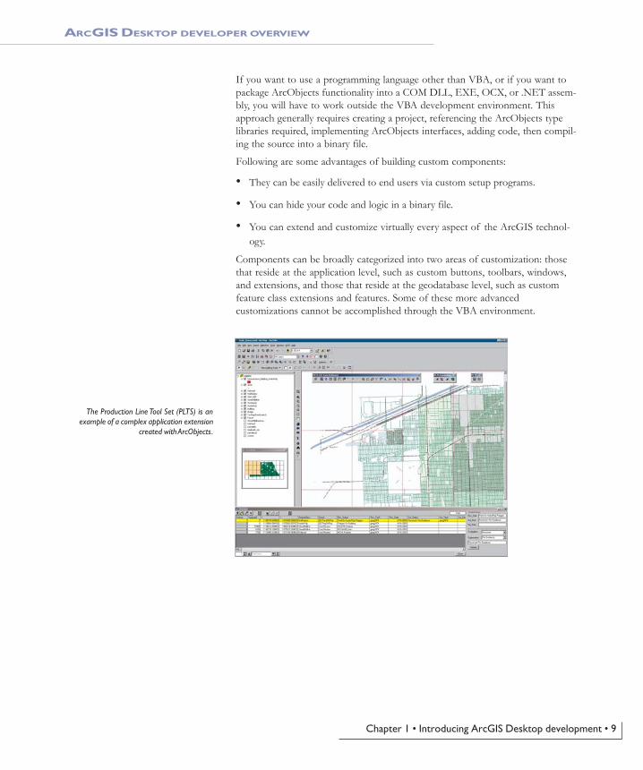
The Production Line Tool Set (PLTS) is anexample of a complex application extension
created with ArcObjects.
Ch01-Intro.pmd 8/25/2004, 9:13 AM9
10 • ArcGIS Desktop Developer Guide
The ArcGIS Desktop Developer Guide is an introduction for anyone who wants tocustomize or extend the ArcGIS Desktop applications, such as ArcMap orArcCatalog.
This guide will help you become a desktop developer by walking you throughnumerous VBA code samples and providing a problem-solving guide and devel-oper scenarios. Although the samples documented in this guide may not solveyour immediate problem, they will serve as a framework or template on whichyou can build a more specific or complex solution.
To serve the greatest base of developers, most of the code samples in this guideare written in VBA. As necessary, some code samples are written in MicrosoftVisual Basic, VB .NET, or Visual C++®.
CHAPTER GUIDE
Chapter 1, ‘Introducing ArcGIS Desktop development’, gives you an overview ofthe ArcGIS 9 product family, the desktop developer framework, the types ofcustomizations that can be made, and additional resources.
Chapter 2, ‘ArcGIS software architecture’, describes the underlying technologyused to create the ArcGIS Desktop products, ArcObjects, and the softwarearchitecture common to the ArcGIS product family.
Chapter 3, ‘Developing for ArcGIS Desktop applications’, guides you through thebasics of ArcGIS Desktop development. The chapter begins with some desktopapplication framework theory, then walks you through some small tutorials fortoolbar customization and VBA macro writing. The chapter concludes with thetheory and steps in creating custom components that extend the ArcGIS Desktopframework.
Chapter 4, ‘Licensing and deployment’, discusses license considerations whendeveloping your customizations and how to package and deploy yourcustomizations, including VBA macros and components, to other users.
Chapter 5, ‘Developer scenarios’, guides you through the creation of several typesof components that can plug into the ArcGIS Desktop applications.
Appendix A, ‘Developer environments’, describes in more detail the MicrosoftComponent Object Model, the foundation for ArcObjects, and continues with alanguage reference guide for each API supported by ArcGIS. These guides discussissues and considerations while developing ArcGIS with a particular API.
Appendix B, ‘Reading the object model diagrams’, discusses how to read andinterpret the ArcGIS object model diagrams. Understanding the structure andrelationships of ArcObjects represented in these diagrams is essential in ArcGISdevelopment.
Appendix C, ‘Illustrated code samples’, shows numerous VBA code snippets forsome common desktop applications. These are illustrated with components fromthe ArcGIS object model to help you understand the structure and relationships.
Appendix D, ‘ArcObjects problem-solving guide,’ presents a methodology to helpyou solve real-world ArcObjects programming tasks that customize or extend theArcGIS Desktop applications.
USING THIS GUIDE
Ch01-Intro.pmd 8/25/2004, 9:13 AM10
Chapter 1 • Introducing ArcGIS Desktop development • 11
Appendix E, ‘UIControls’, shows class and interface diagrams for UIControls,which are VBA-based commands with interfaces available only in VBA.
Appendix F, ‘Bibliography’, is not intended as a complete resource, but it doescontain many of the everyday references that ESRI developers use when devel-oping Visual Basic, Visual C++, Visual Studio .NET code, and ArcObjects.
USING THIS GUIDE
Ch01-Intro.pmd 8/25/2004, 9:13 AM11
12 • ArcGIS Desktop Developer Guide
The following topics describe some of the additional resources available to you asa developer. These include books and guides and various help systems.
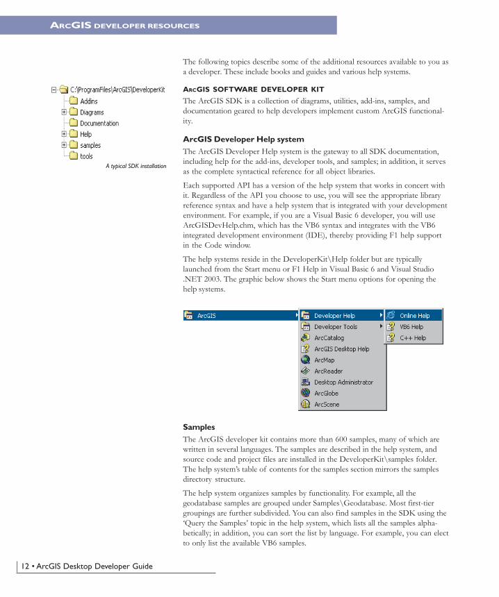
ARCGIS SOFTWARE DEVELOPER KIT
The ArcGIS SDK is a collection of diagrams, utilities, add-ins, samples, anddocumentation geared to help developers implement custom ArcGIS functional-ity.
ArcGIS Developer Help systemThe ArcGIS Developer Help system is the gateway to all SDK documentation,including help for the add-ins, developer tools, and samples; in addition, it servesas the complete syntactical reference for all object libraries.
Each supported API has a version of the help system that works in concert withit. Regardless of the API you choose to use, you will see the appropriate libraryreference syntax and have a help system that is integrated with your developmentenvironment. For example, if you are a Visual Basic 6 developer, you will useArcGISDevHelp.chm, which has the VB6 syntax and integrates with the VB6integrated development environment (IDE), thereby providing F1 help supportin the Code window.
The help systems reside in the DeveloperKit\Help folder but are typicallylaunched from the Start menu or F1 Help in Visual Basic 6 and Visual Studio.NET 2003. The graphic below shows the Start menu options for opening thehelp systems.
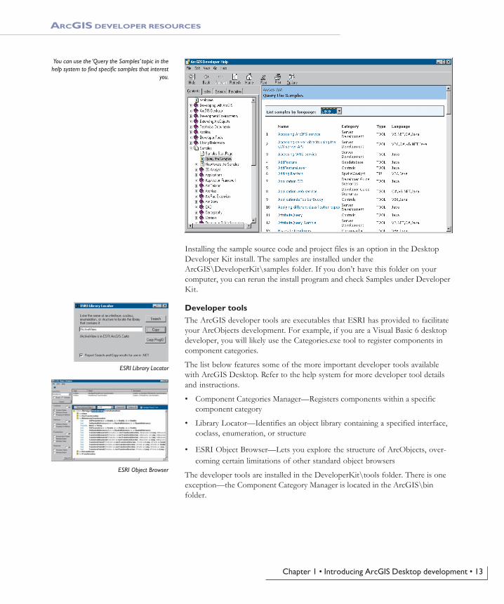
SamplesThe ArcGIS developer kit contains more than 600 samples, many of which arewritten in several languages. The samples are described in the help system, andsource code and project files are installed in the DeveloperKit\samples folder.The help system’s table of contents for the samples section mirrors the samplesdirectory structure.
The help system organizes samples by functionality. For example, all thegeodatabase samples are grouped under Samples\Geodatabase. Most first-tiergroupings are further subdivided. You can also find samples in the SDK using the‘Query the Samples’ topic in the help system, which lists all the samples alpha-betically; in addition, you can sort the list by language. For example, you can electto only list the available VB6 samples.
A typical SDK installation
ARCGIS DEVELOPER RESOURCES
Ch01-Intro.pmd 8/25/2004, 9:13 AM12
Chapter 1 • Introducing ArcGIS Desktop development • 13
Installing the sample source code and project files is an option in the DesktopDeveloper Kit install. The samples are installed under theArcGIS\DeveloperKit\samples folder. If you don’t have this folder on yourcomputer, you can rerun the install program and check Samples under DeveloperKit.
Developer toolsThe ArcGIS developer tools are executables that ESRI has provided to facilitateyour ArcObjects development. For example, if you are a Visual Basic 6 desktopdeveloper, you will likely use the Categories.exe tool to register components incomponent categories.
The list below features some of the more important developer tools availablewith ArcGIS Desktop. Refer to the help system for more developer tool detailsand instructions.
• Component Categories Manager—Registers components within a specificcomponent category
• Library Locator—Identifies an object library containing a specified interface,coclass, enumeration, or structure
• ESRI Object Browser—Lets you explore the structure of ArcObjects, over-coming certain limitations of other standard object browsers
The developer tools are installed in the DeveloperKit\tools folder. There is oneexception—the Component Category Manager is located in the ArcGIS\binfolder.
ARCGIS DEVELOPER RESOURCES
You can use the ‘Query the Samples’ topic in thehelp system to find specific samples that interest
you.
ESRI Library Locator
ESRI Object Browser
Ch01-Intro.pmd 8/25/2004, 9:13 AM13
14 • ArcGIS Desktop Developer Guide
Add-insThe ESRI add-ins automate some of the tasks performed by the software engi-neer when developing with ArcObjects, as well as provide tools that make debug-ging code easier. ESRI provides add-ins for the Visual Basic 6 IDE and the VisualStudio .NET IDE. Listed below are the add-ins available for these developmentenvironments.
Visual Basic 6• ESRI Align Controls With Tab Index—Ensures control creation order
matches tab index
• ESRI Automatic References—Automatically adds ArcGIS library references
• ESRI Code Converter—Converts projects from ArcGIS 8.x to ArcGIS 9.x
• ESRI Command Creation Wizard—Facilitates the creation of commands andtools
• ESRI Compile and Register—Aids in compiling components and registeringthese in desired component categories
• ESRI ErrorHandler Generator—Automates the generation of error handlingcode
• ESRI ErrorHandler Remover—Removes the error handlers from the sourcefiles
• ESRI Interface Implementer—Automatically stubs out implemented inter-faces
Visual Studio .NET• ESRI Component Category Registrar—Stubs out registration functions to
enable self-component category registration
• ESRI .NET Code Converter—Converts projects from ArcGIS 8.x toArcGIS 9.x
• ESRI GUID Generator—Inserts a Global Unique Identifier (GUID) attribute
The .NET add-ins are automatically installed during setup if a version of VisualStudio .NET 2003 is detected; the Visual Basic 6 add-ins are only installed if youselect them on the install. Once installed the add-ins have to be registered manu-ally using the .bat files in the Addins directory.
THE ARCGIS DEVELOPER DOCUMENTATION SERIES
This guide is part of the ArcGIS Developer documentation series.
The ArcGIS Engine Developer Guide provides information for developers whowant to create applications based on ArcGIS Engine. ArcGIS Engine allows youto embed GIS functionality within other applications and create desktop-likeapplications using the supplied ArcGIS controls, such as MapControl, Toolbar,and PageLayout controls. ArcGIS Engine is also based on ArcObjects compo-nents and may be programmed through a number of APIs.
Visual Basic 6 add-ins are only installed if youselect them on the install.
ARCGIS DEVELOPER RESOURCES
Ch01-Intro.pmd 8/25/2004, 9:13 AM14
Chapter 1 • Introducing ArcGIS Desktop development • 15
The ArcGIS Server Administrator and Developer Guide is for developers who willcreate ArcGIS Server applications and customizations. At the core of ArcGISServer is a rich ArcObjects object library that can be consumed in Web applica-tions and Web services to deliver advanced GIS functionality to a wide range ofusers who interact with the server through Web browsers and other thin clientapplications. ArcGIS Server may also be programmed through a number of APIs.
ARCGIS DEVELOPER ONLINE WEB SITE
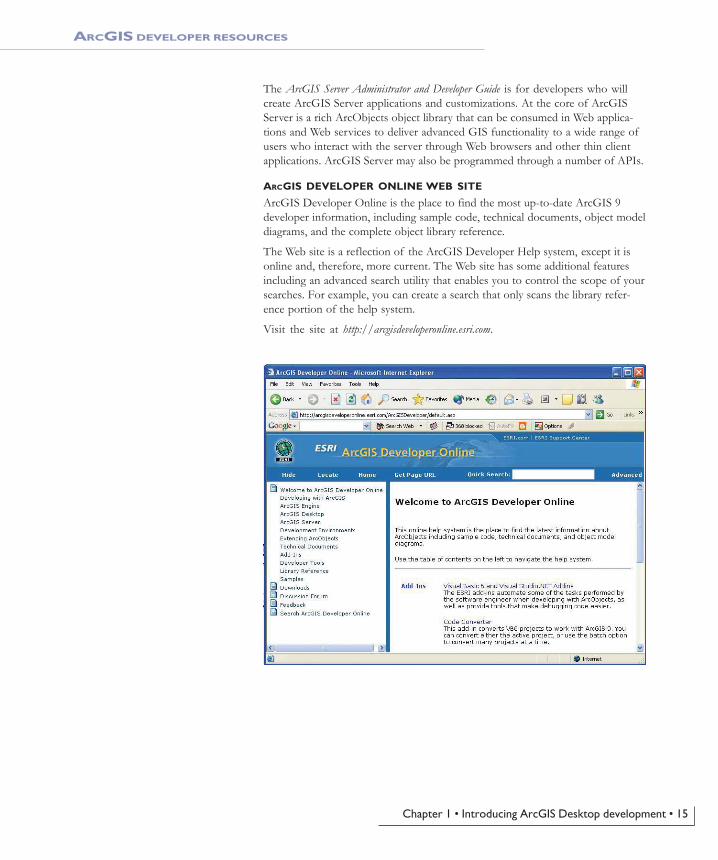
ArcGIS Developer Online is the place to find the most up-to-date ArcGIS 9developer information, including sample code, technical documents, object modeldiagrams, and the complete object library reference.
The Web site is a reflection of the ArcGIS Developer Help system, except it isonline and, therefore, more current. The Web site has some additional featuresincluding an advanced search utility that enables you to control the scope of yoursearches. For example, you can create a search that only scans the library refer-ence portion of the help system.
Visit the site at http://arcgisdeveloperonline.esri.com.
ARCGIS DEVELOPER RESOURCES
Ch01-Intro.pmd 8/25/2004, 9:13 AM15
16 • ArcGIS Desktop Developer Guide
ESRI SUPPORT CENTER
The ESRI Support Center at http://support.esri.com contains software information,technical documents, samples, forums, and a knowledge base for all ArcGISproducts.
ArcGIS developers can take advantage of the forums, knowledge base, andsamples sections in particular to aid in development of their ArcGIS applications.
TRAINING
ESRI offers a number of instructor-led and Web-based training courses for theArcGIS Desktop developer. These courses range from the introductory level forVBA to more advanced courses in component development with specific APIs.
For more information visit http://www.esri.com and click the Training and Eventstab.
The ESRI Virtual Campus can also be found directly at http://campus.esri.com/.
ARCGIS DEVELOPER RESOURCES
Ch01-Intro.pmd 8/25/2004, 9:13 AM16