Embed Size (px)
Citation preview
Arab-Israeli Conflict Map Analysis Activity
Look at the maps of Israel and Palestine from 1517 to 2003. What can we learn about history from looking at these maps? What questions do you have as a result of these maps? Your assignment is to:
examine all of the maps closely, and using complete sentences, answer the questions below.
Each group member is responsible for his/her own answers and timeline.
1. Who ruled the region of Palestine before World War I? 2. How did the Treaty of Versailles affect the region?
3. What happened to the region soon after (and as a result of) World War II? Explain why.
4. How long did the UN Partition Plan last? What happened between the years 1947 and
1949? Why?
5. In 1949, who controlled (a) Gaza and (b) the West Bank?
6. What new land was acquired in 1967? Who acquired it? From whom did they acquire it, and how?
7. How long did they keep this new land?
8. When did Israel first become “Israel”? Who opposed this plan? Why do you think they
opposed it?
9. What are the Palestinian territories today called?
10. What is an Israeli settlement? Where are the settlements located? Why are they located there?
11. What is an Israeli checkpoint? Where are they located? Why are they located there?
12. How have the West Bank and Gaza Strip changed over time? Why? What effect do you
think this has on the Palestinian and Israeli people?
13. What questions do YOU have about this region?
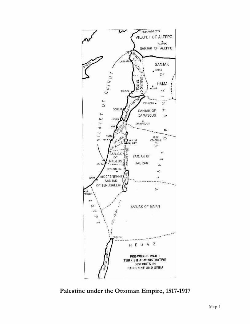
Map 1
Palestine under the Ottoman Empire, 1517-1917
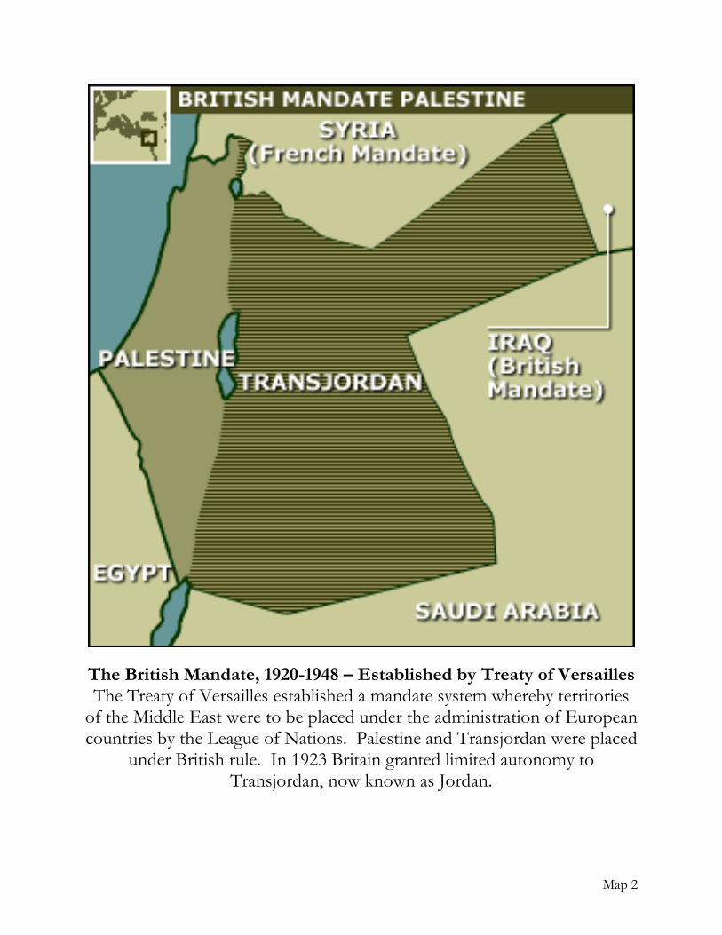
Map 2
The British Mandate, 1920-1948 – Established by Treaty of Versailles The Treaty of Versailles established a mandate system whereby territories
of the Middle East were to be placed under the administration of European countries by the League of Nations. Palestine and Transjordan were placed
under British rule. In 1923 Britain granted limited autonomy to Transjordan, now known as Jordan.
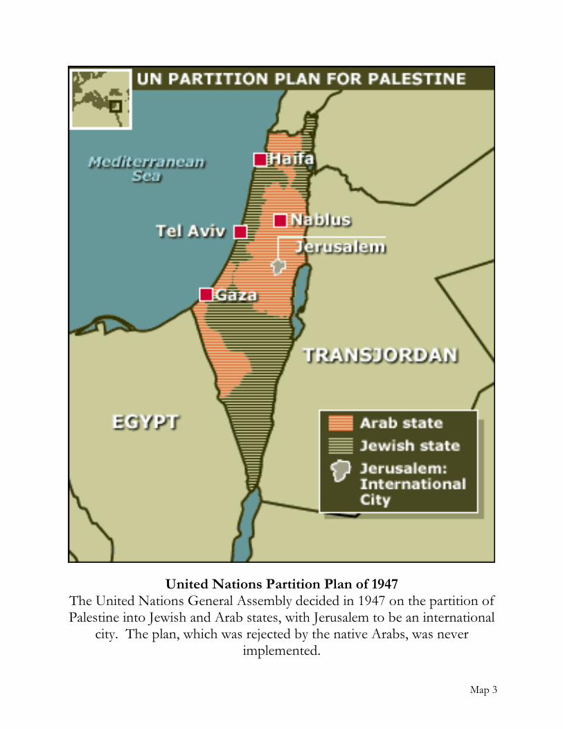
Map 3
United Nations Partition Plan of 1947 The United Nations General Assembly decided in 1947 on the partition of Palestine into Jewish and Arab states, with Jerusalem to be an international
city. The plan, which was rejected by the native Arabs, was never implemented.
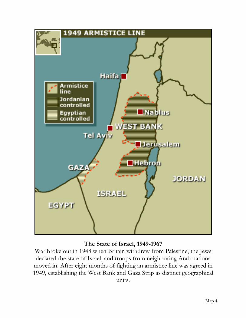
Map 4
The State of Israel, 1949-1967 War broke out in 1948 when Britain withdrew from Palestine, the Jews declared the state of Israel, and troops from neighboring Arab nations
moved in. After eight months of fighting an armistice line was agreed in 1949, establishing the West Bank and Gaza Strip as distinct geographical
units.

Map 5
Israeli Conquests in Six Day War, 1967 In a pre-emptive attack on Egypt that drew Syria and Jordan into a regional
war in 1967, Israel made massive territorial gains.

Map 6
Peace Treaty with Egypt and Sinai Redeployment, 1980-1982 The Israel-Egypt Peace Treaty was signed on March 26, 1979, following the
Camp David Accords of September 18, 1978, which determined a framework for a peace treaty between Israel and Egypt. The framework also set a timetable
for establishing diplomatic relations and normalization between Israel and Egypt, as well as a timetable for the withdrawal of the Israeli army from lands
previously occupied. The peace treaty "tied up loose threads" and included further Israeli withdrawal to the international border between the two states.
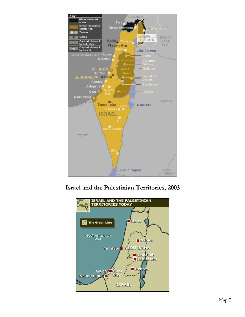
Map 7
Israel and the Palestinian Territories, 2003
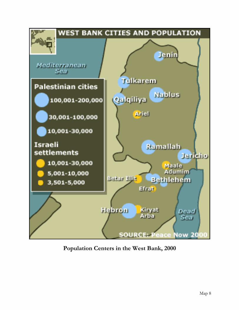
Map 8
Population Centers in the West Bank, 2000
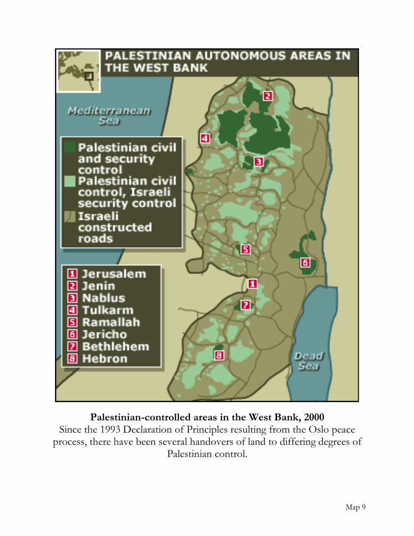
Map 9
Palestinian-controlled areas in the West Bank, 2000 Since the 1993 Declaration of Principles resulting from the Oslo peace
process, there have been several handovers of land to differing degrees of Palestinian control.
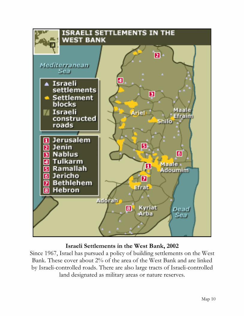
Map 10
Israeli Settlements in the West Bank, 2002 Since 1967, Israel has pursued a policy of building settlements on the West Bank. These cover about 2% of the area of the West Bank and are linked by Israeli-controlled roads. There are also large tracts of Israeli-controlled
land designated as military areas or nature reserves.
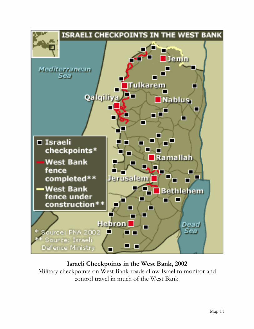
Map 11
Israeli Checkpoints in the West Bank, 2002 Military checkpoints on West Bank roads allow Israel to monitor and
control travel in much of the West Bank.
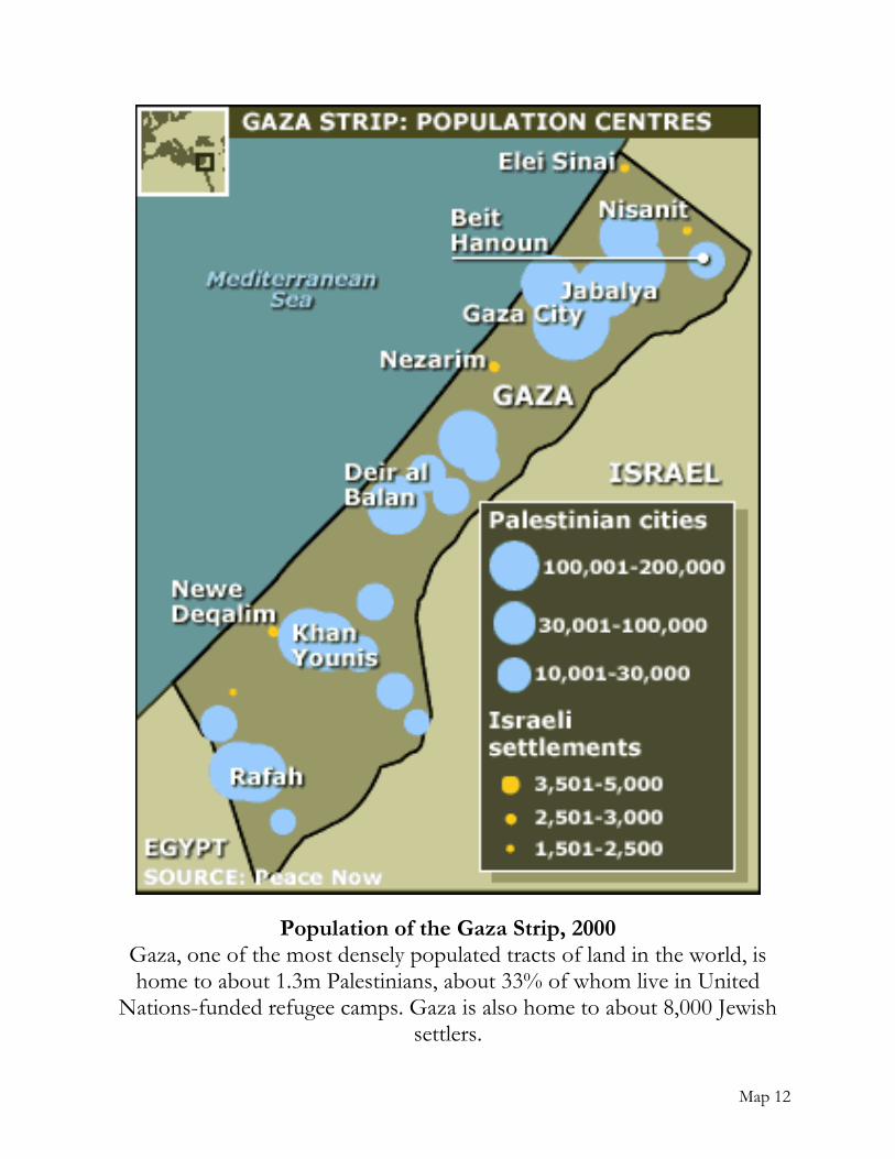
Map 12
Population of the Gaza Strip, 2000 Gaza, one of the most densely populated tracts of land in the world, is home to about 1.3m Palestinians, about 33% of whom live in United
Nations-funded refugee camps. Gaza is also home to about 8,000 Jewish settlers.
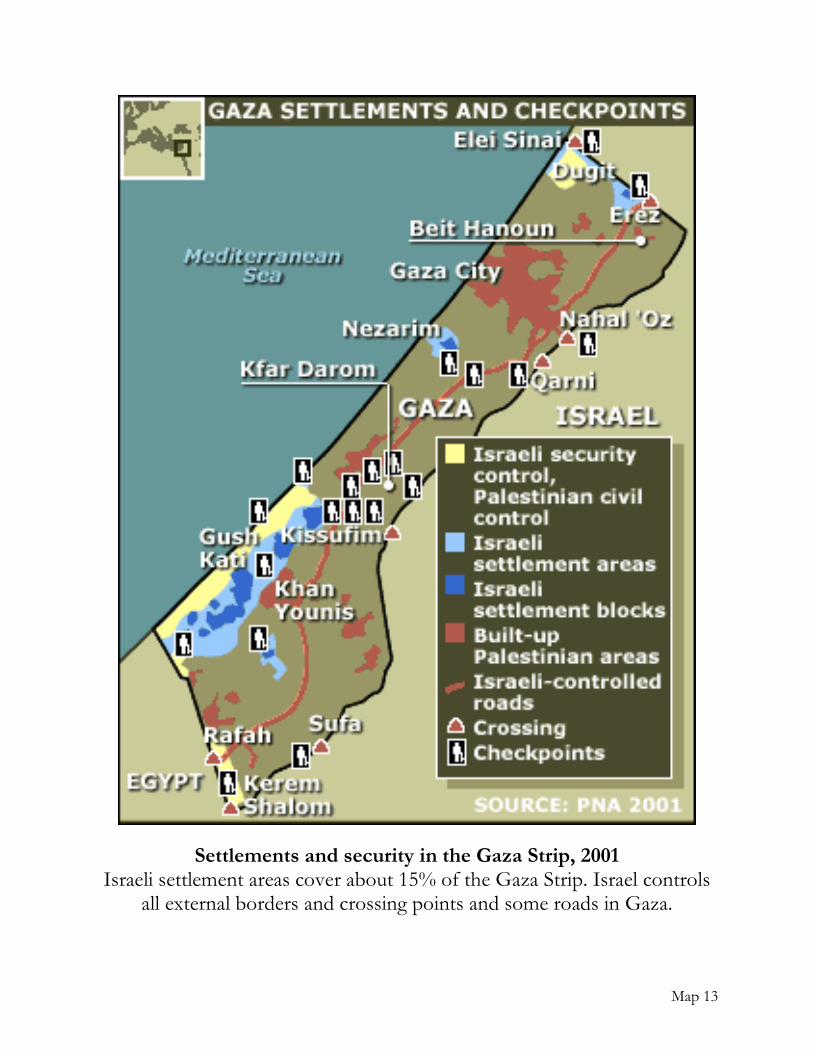
Map 13
Settlements and security in the Gaza Strip, 2001 Israeli settlement areas cover about 15% of the Gaza Strip. Israel controls
all external borders and crossing points and some roads in Gaza.